Sun spots
Much is made of the appearance of shadows in Apollo photographs, but not much mention is made of the object making those shadows and the appearances the sun can make in Apollo images.
One of the features of photographs of Earth taken from space is the glint of the
sun on the Earth’s oceans. The original focus of this page was the sub-
It soon became clear that this wasn’t what was being seen, and the reason for this is precisely because of the position of the photographer. I’ll illustrate this with a couple of simple props later.
Thanks to the records available from weather satellites (see here) and mission transcripts we know when Apollo photographs were taken, so we ought to be able to tell where the sun’s reflection should be, and see whether this is in fact the case. We have enough records from Summer missions (eg Apollo 11, 14 and 15) and Winter ones (Apollo 8 and 17) to provide a good contrast, as well as Spring missions from Apollo 10, 13 and 16 and Apollo 12’s Autumn mission.
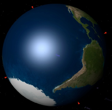
The first question to address is how we’re going to identify where the sun should be shining. We could go through all kinds of mathematical hoops to check, but there’s a much simpler one. Celestia (a freely available astronomy software package) allows the user to set both time and viewpoint, and it also shows the sun’s glint quite beautifully. We also have Stellarium (another free package), with which we can set the viewing point as the sun. Our question is then very simple: do Stellarium and Celestia’s predictions coincide with the reality of the Apollo image?
Let’s start with Apollo 8.
The first photograph with a clearly identifiable sun spot is AS08-
It’s worth pointing out the difference between the view taken directly above the
Earth and that of Apollo 8, which differs because Apollo is on a lunar trajectory
(but not yet at the moon!) and not in a geostationary Earth orbit. Anyone who thinks
the photos were taken from Earth orbit should have a go at replicating the views
in something like Google Earth -
After that aside, hopefully it should not be too difficult to point out that the location of the sun’s glint, bearing in mind the difference in viewing angle thanks to Apollo 8’s trajectory, is entirely consistent with where it should be.
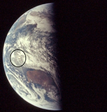
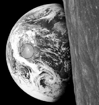
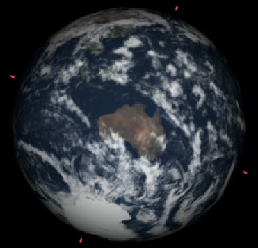
Let’s skip on in time a bit now and look at AS08-

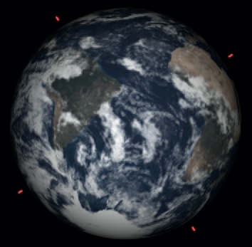
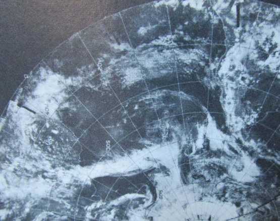
At first glance the glint seems too close to the African coast (certainly if we were assuming it should be directly beneath the sun), but again I believe we are victim of perspective. The Celestia prediction puts the glint pretty much in the middle of the South Atlantic. If we look at the Apollo suns spot in relation to the weather patterns on view, then we can confirm that this is pretty much where it is, give or take a few hundred miles. This image on the right is from my own personal copy of the ESSA 7 data catalogue dated 22/12/68.
By following the longitude lines up from the distinctive ‘L’ shaped cloud system
to wards the centre of the image, we can see that the position of the SSP is not
far off where it should be -
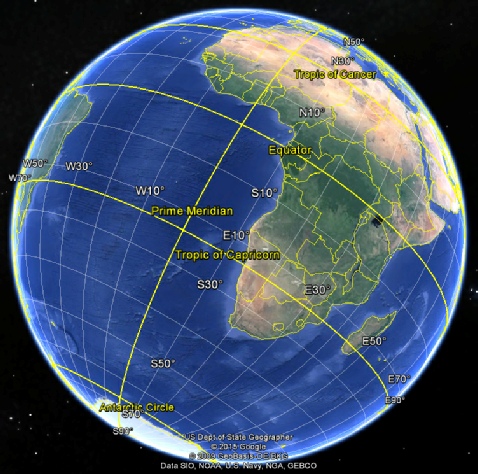
Speaking of the south Atlantic, as this image was taken just after the winter solstice, we would expect the sun’s reflection to fall pretty much on the tropic of Capricorn. If we examine Google Earth to see where that is, we find that this is exactly the case.
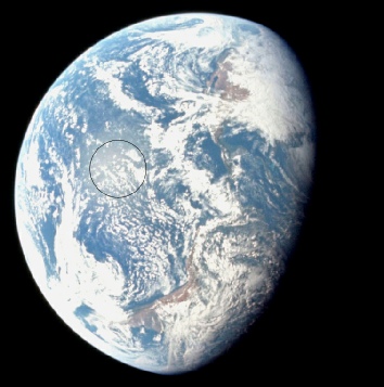
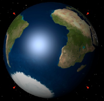
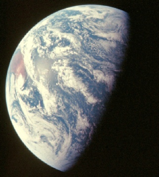
Let’s move on a day or two and skip to one of the most famous photographs every taken,
the Apollo 8 Earthrise, which does show a very clear reflection of sunlight. AS08-
Once again we have confirmation that the reflection is exactly where it should be.
Notice that now we are looking at a view taken from the moon the Celestia viewpoint
is consistent with the Apollo one. You might notice that the view from the sun’s
perspective seems to show that the sub-
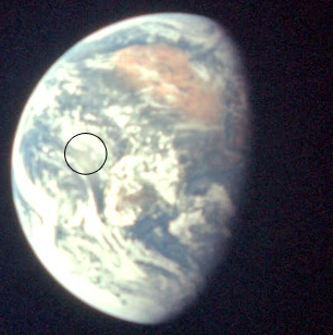
The next image provides perspective we haven’t examined before, and again illustrates
that the Apollo 8 view is in cislunar space (between Earth and Moon). AS08-
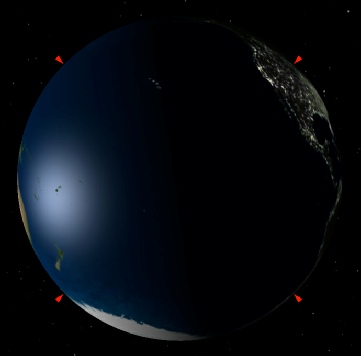
Sharp-
So why the discrepancy? The answer lies in the fact that the sun is shining into a reflective surface, and like any view into a mirror what we are seeing is the reflected location of the original light source, not what the light source is actually shining on.
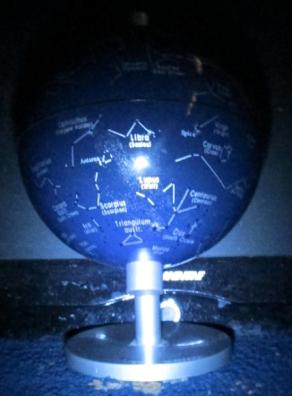
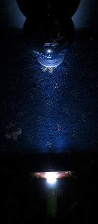
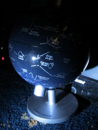
Let’s illustrate this with a couple of simple props. In the photographs below the set up is the same: A torch is pointing at my little celestial globe. The photo on the left shows the set up. The centre image is taken from behind the torch, while the one on the right is taken from the side. The point on the globe directly beneath the torch is exactly the same, the only thing that has changed is the viewpoint of the camera. When looking from the ‘sun’ (our torch), the reflected light is shining from Libra. When viewed from the side, it now appears almost in Virgo.
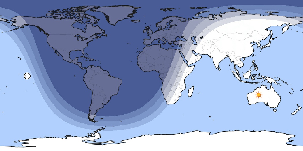
Celestia’s view is therefore the most reliable indicator of what the viewer would see from space in terms of a bright spot on the Earth’s surface, particular as the photographs taken by Apollo get further away from the Earth. The progressively large deviation of where the subsolar point should be and the location of the sun’s reflection in the ocean is yet more evidence that the photographs were taken not from above the Earth but from a moving spaceship.
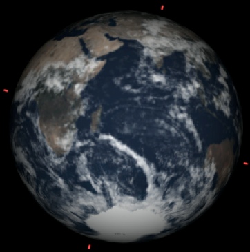
We can verify this further by going backwards in Apollo 8’s timeline to TLI, the
Trans-
This view is shown on the left below, and the SSP should fall around the tropic of Capricorn in the centre of South America. Apollo’s 16mm stills on the other hand show the reflected sun to fall on the the continent’s northern coast. On the right of this set of images is the view from above my celestial globe, taken with the same set up as the previous ones.
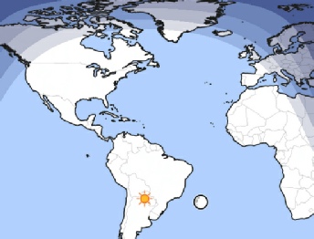
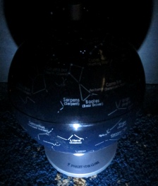
Our little experimental set up shows that the when viewed from a position above the globe reflected light is now north of Libra, just as the reflected light on the Earth is north of the true SSP. It’s almost as if Apollo 8 was well above the equator when it carried out TLI, and well above the northern hemisphere when this was filmed! The TLI burn occurred at 15:47 GMT, after which it moved outwards from the Earth while the Earth continued to move beneath it. TLI occurred at a position somewhere east of Hawaii (21.48N 143.02W to be precise) and the trajectory carried the departing Apollo 8 over the Caribbean, just as shown above.
For one last look at Apollo 8 let’s fast forward to the final image taken of Earth,timed
at 08:00 on the 27th AS08-