Artemis over tit
NASA’s Artemis 2 mission has completed (so far) an historic lunar flyby with a human crew for the first time in over 50 years.
Some people aren’t convinced. They are so unconvinced they are incapable of being convinced.
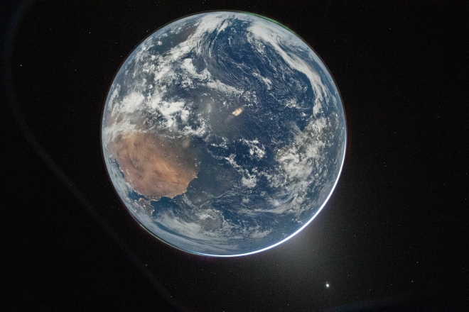
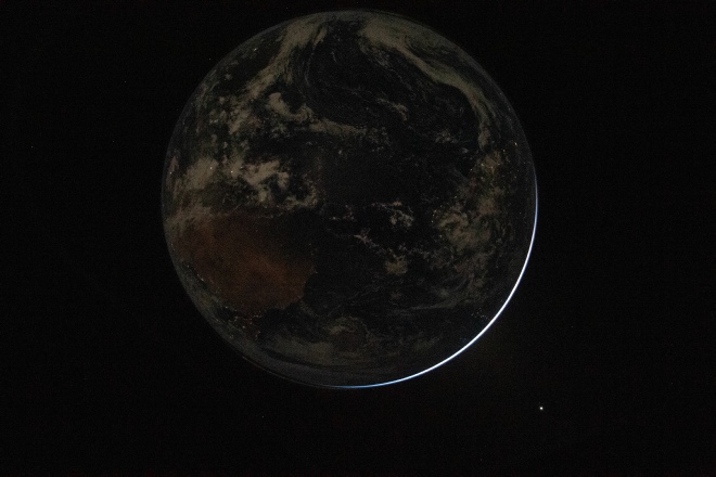
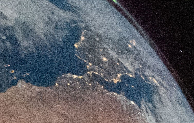
This pair of images was posted by NASA. They were taken about 19 seconds apart, and have different settings to allow for the fact that it was taken at night, with the sun directly behind Earth, so that the only light on the scene is that reflected from the moon..
The photos were taken about 19 seconds apart on April 3rd, at 00:27
The image that shows detail has many stars in it, Venus, and aurorae at the north and south polar regions.
Stray decided he didn’t like it, and asked Grok and ChatGPT to tell him what to think:
“The Earth itself shows realistic geography (Australia’s coastline and red desert interior), natural cloud patterns with realistic turbulence and shadowing, and a proper atmospheric limb glow (thin blue halo caused by Rayleigh scattering).
The viewing geometry — Australia in the lower-
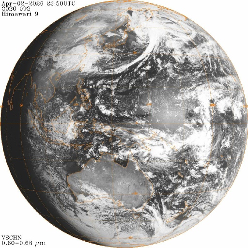
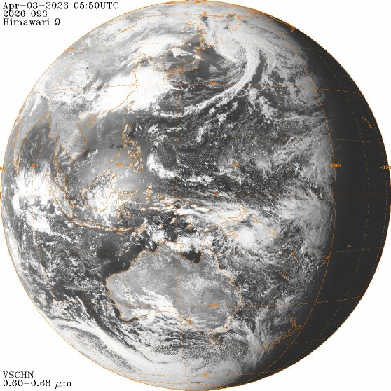
This geometry is characteristic of the Himawari-
OK then, let’s see how Himawari looked at that time.
Hmm.
Seems to be a whole bunch of stuff missing here, particularly that tropical cyclone off Australia’s north east coast.
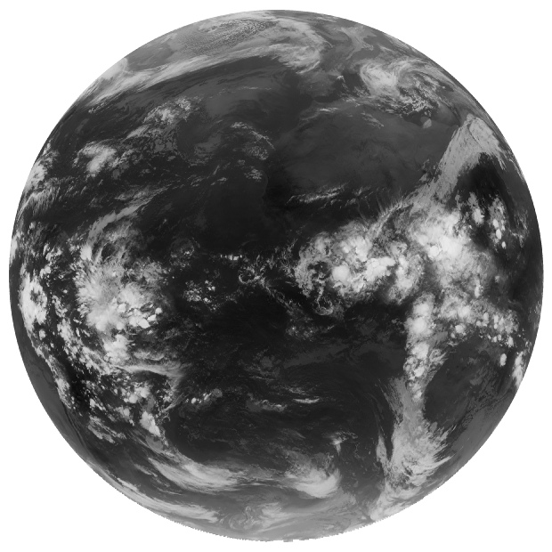
Maybe, just maybe, it’s because Australia isn’t visible from their vantage point at the time it was taken. Maybe, just maybe, it’s because the image is upside down, in terms of our convention for having north at the top of an image. Let’s help him out
Well now that seems to put a whole new perspective on things doesn’t it.
Maybe there are some other satellites in operation at the time that could help?
Turns out ESA’s METEOSAT and Russia’s Elektra L-
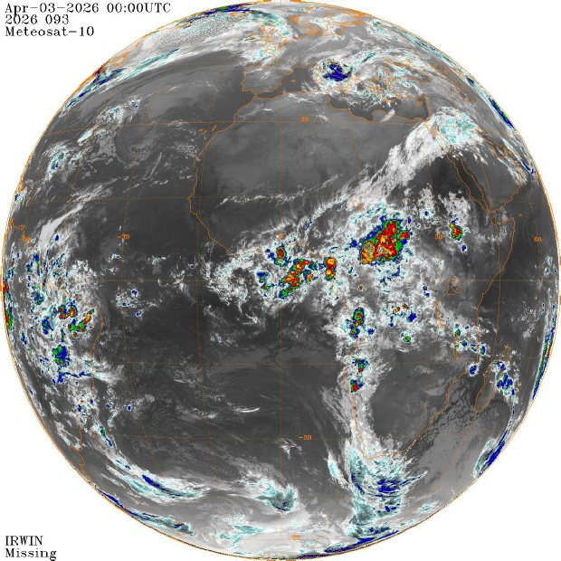
It’s worth pointing out here that the Artemis photo is taken at night, with extreme ISO levels and a relatively long exposure to allow all available light to be used. These two satellite images are using infrared, so the could patterns won’t be identical. There are, however, many exact matches in both views that confirm we are looking at the right place at the right time.
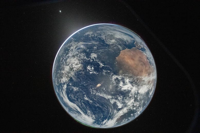
Anything else he posts is just clutching at straws. The only proof you really need is this, a shot of Spain and north Africa.
AI makes a whole bunch of claims about what you should be able to see, and specifically claims that a bright spot on the image matches exactly what you can see in a Himawari image taken at 05:00 UTC.
Here’s that image.
It’s in black and white, but it doesn’t tale too much effort to notice that the bright spot it refers to is way off centre, north west of Australia, compared with the almost dead centre spot in the Artemis view. Which is ironic because AI says:
“Reality: Wide-
In fact, that bright spot definitely is internal lighting.
Here’s what will happen: Stray will get evidence shown to him that he is looking at Africa. He will have it pointed out to him that the satellite evidence supports that. He will double down and ignore it completely, and retreat to ever more ridiculous postures to defend it.
It’s hugely ironic that in other parts of the site dedicated to him he’s insisting our observations don’t match reference frames, he is completely ignoring the idea that north is up -
Update: he has now finally conceded that it shows Africa. Was it because he checked for himself, or because he got AI to confirm it once he’d rotated the photo.
Take a wild stab in the dark there.
Despite now knowing what he’s looking at, however, he is very much reverting to type and denying the evidence of his eyes to try and convince himself that it isn’t a genuine image. He’s even made this excuse as to why AI couldn’t do his homework for him:
“All of the NASA images of the earth are composites that show the earth with the continents in the same position as we see them on maps.. This Artemis II earth image is the first one to show the planet upside down, ie; flipped.”
Which is categorically untrue. Any Earthrise photo, just for one example, will usually be shown with the lunar horizon at the bottom, meaning Earth is rotated 90 degrees, I can give numerous examples where Earth has been shown flipped horizontally by mistake. You can still work out what’s where. Not all images of Earth are composites -