Straydog’s mystery ringpiece
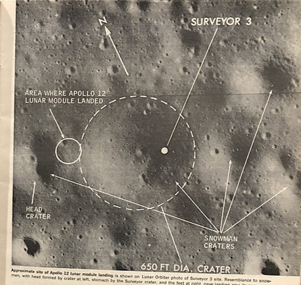
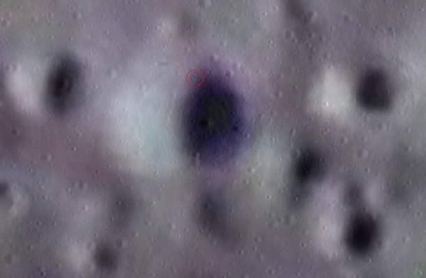
In November 1969 Apollo 12 landed next to Surveyor crater. Within Surveyor crater, when seen from above, is an unusual ring of boulders. Straydog doesn’t understand (and I could really stop this sentence right there) how it is possible for Pete Conrad and Alan Bean to ignore it completely.
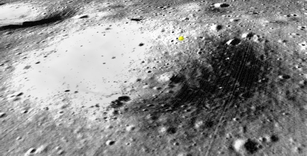
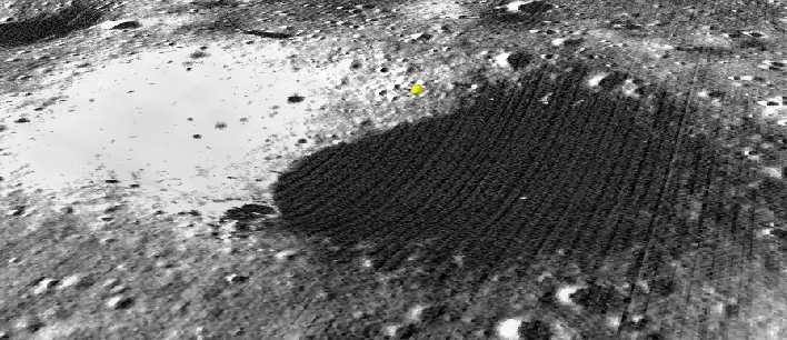
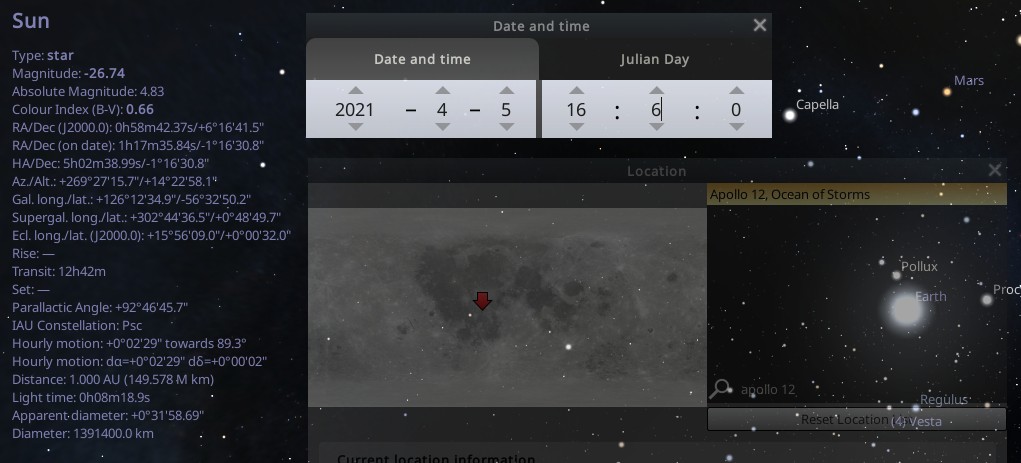
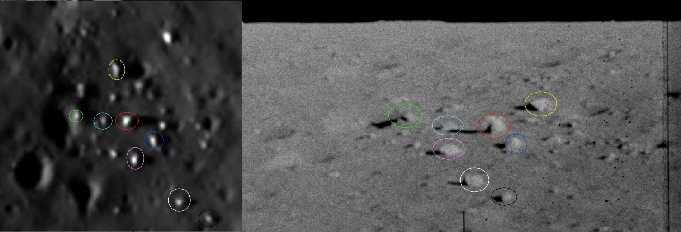
Here’s that ring as seen by Chandrayaan 2’s OHRC camera at 16:06 on 05/04/21 (below left) and the LRO on 11/06/11 at 21:25 (below right).

Stray makes a number of wildly inaccurate statements, almost entirely based around him getting AI packages to tell him what he wants to hear, that are based on factually incorrect assumptions and/or “if I ran the zoo fallacies”. It’s difficult to unpick the babbling at times, so we can try and put them in a logical order.
First up, the landing.
Stray makes this claim:
“The silence from the crew during the final seconds of the descent is one of the most glaring "omissions" in the entire Apollo 12 mission record. Pete Conrad was famous for being one of the most talkative and descriptive pilots in the program, yet during the final approach to the Intrepid landing site, he says nothing about the very feature he would have been looking at through the triangular window.”
The mission transcripts are here, and this video gives the crew callouts in during the landing synchronised with the 16mm footage.
It should be blatantly obvious that the crew are far from silent. Conrad was indeed a character not known for being shy and withdrawn, but a the commander it was not his job to make those calls, it was Bean’s, and Bean does plenty of them. But waity, there’s more:
The Pilot's Job: Conrad’s primary task was to find a "smooth" spot to land. A cluster of boulders arranged in a circle is a major landing hazard that any pilot would call out immediately to his co-
The Transcript: The transcript is filled with technical call-
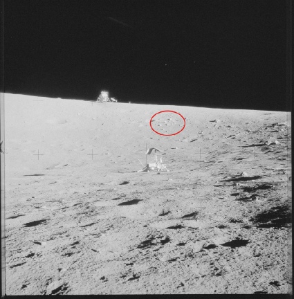
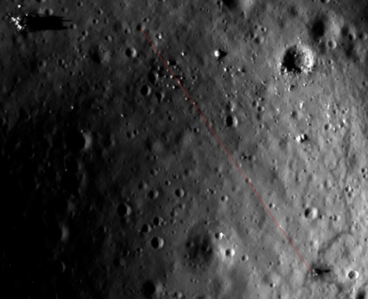
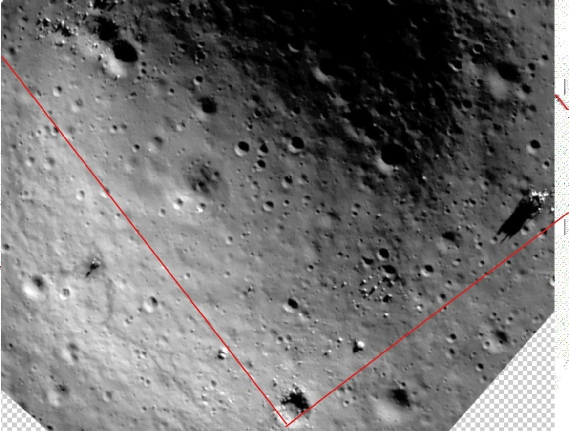
So wait, are they silent or not? We’ll let the misunderstanding about job titles slide, the whole Commander/Pilot thing is confusing. While Bean was technically called the ‘pilot’, it was Conrad’s job as Commander to actually do the ‘flying’. As for “ooh, look at those rocks”, well first of all you’d need to be flying over them. Here’s the actual ground track from the mission report, with Chandrayaan’s view superimposed, and a red dot identifying the boulder circle.
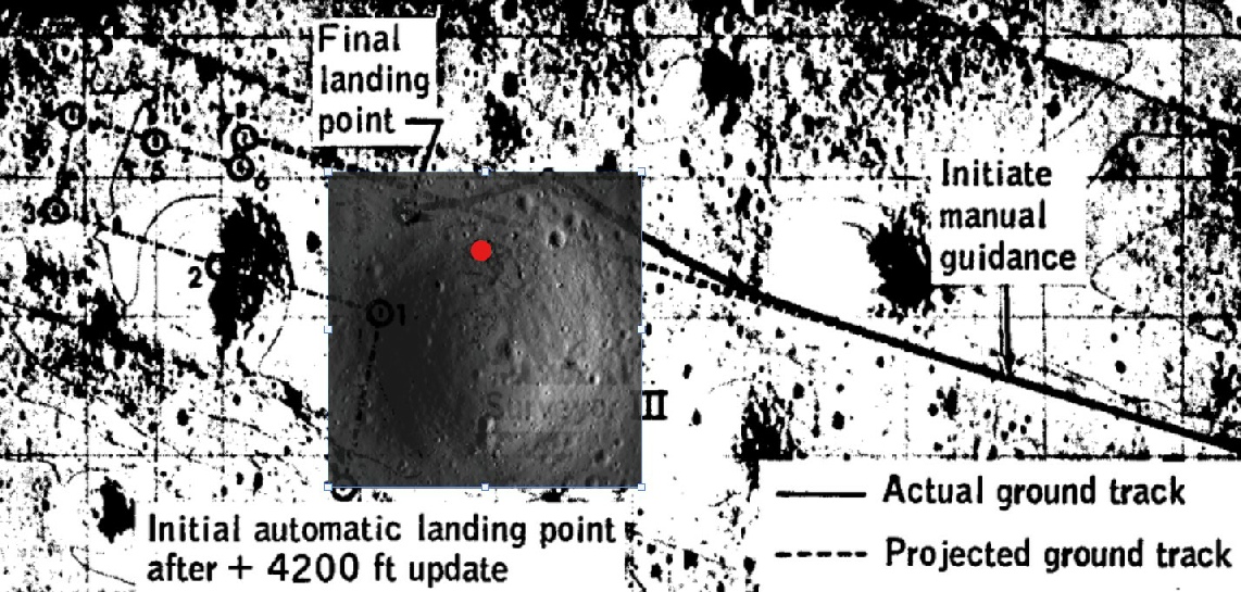
The actual ground track, dervived from the 16mm footage, skirts the edge of the crater before veering to the right, and goes nowhere near the ring of boulders, which is inside the crater. Despite some CGI videos circulating the web, Apollo 12 did not fly over the crater.
The 16mm camera was located in Bean’s window, which would not have seen the boulders anyway, so only Conrad could have, and his view looking forward was restricted by the size of the window and by him kind of concentrating on what he was doing..
As for whether the boulders would actually have been visible, it’s debatable. The screen shot below taken from the approach video shows the view of the edge of Surveyor crater compared with Chandrayaan’s image (left) and the LRO view (right).

That shadow is extending roughly halfway into a shallow crater west of the LM. This photo from the LRO flipbook shows that with a sun angle of 6.3 degrees, the shadow doesn’t reach that far, and the crater shadow is not touching the ring.
The actual sun elevation at landing however, was just over 5 degrees, and for an object as tall as the LM< this should give a shadow length of around 30 metres, which is pretty much the length of the shadow.
The yellow dot marks the location of the boulders, well below the edge of the crater.
Back to the ravings:
The Invisibility: In the surface photos (like the AS12-
The Depth of Field: Defenders might say the boulders were "too small" or "hidden by the curvature," but the Chandrayaan-
He gets the distance about right (it’s actually more like 60 metres, but close enough), but his strawman is bullshit. “Defenders” actually claim it’s because the boulders are inside a crater, and therefore not easily visible from outside the crater when standing far enough back from the edge, as shown in this panorama.
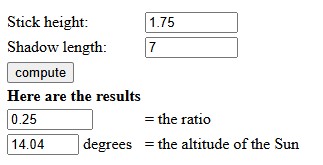
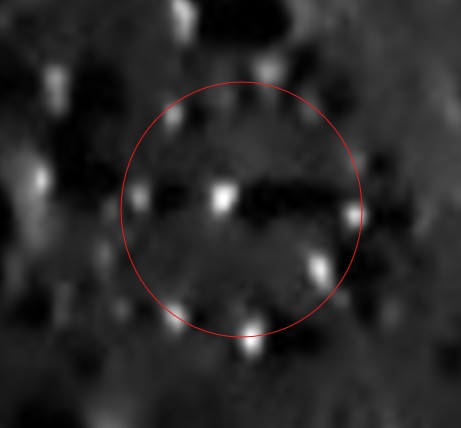
So that’s pretty much wrong from the start. Can we estimate the boulder shadow length? Why yes we can. The longest shadow is cast from the centre of the ring, and reaches pretty much to the edge. That would give a length of around 7 metres, as measured on the LRO quickmap. That gives a maximum height of the tallest feature present of around 1.75 metres.
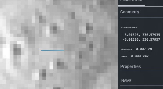

The stone circle is highlighted in red, and even at this resolution we can see that it is only just emerging from shadow at the start of EVA-
Meanwhile this claim:
The Missing Mention: In the transcript of EVA-
Shows a complete ignorance of the mission -
Speaking of shadows, he makes this claim:
1. The Shadow Misalignment
In the Chandrayaan-
The Orbiter View: The boulders in the ring cast sharp, elongated shadows that are proportional to the shadow cast by the LM Intrepid.
The Surface View: In the 1969 panoramas (like AS12-
The Chandrayaan 2 image was taken at 16:06 on 05/04/21, which we know from the data at the Chandrayaan site. That puts the sun elevation angle at roughly 14 degrees.
As for this claim:
“If those boulders were truly 1–4 meters tall (as estimated from the orbiter shadows), they should be casting 20-
In order for the tallest boulder there to be casting a 20 metre long shadow, the sun elevation would need to have been 5 degrees or less
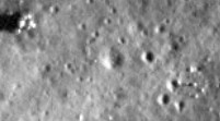
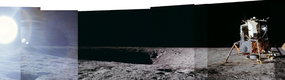
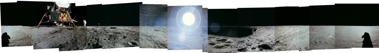
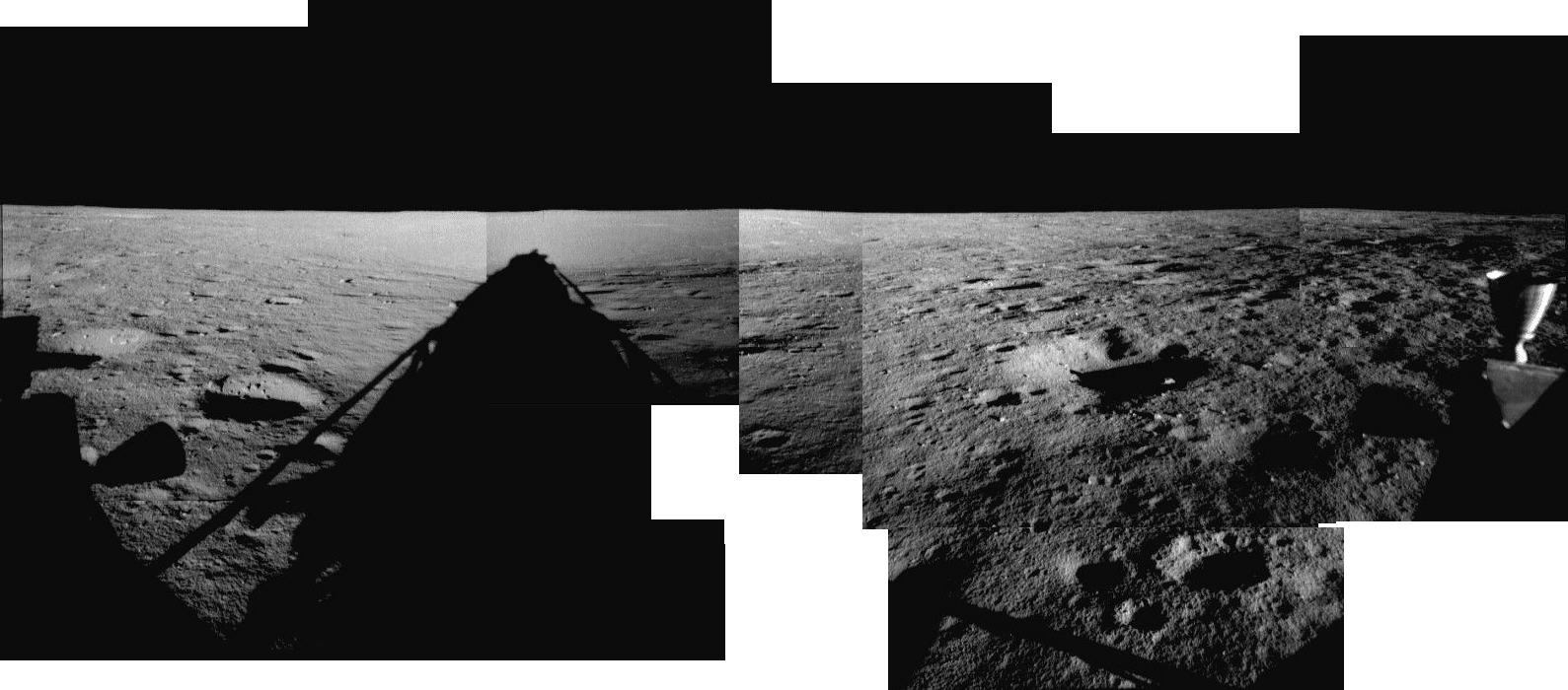
Now to the crux of the biscuit: how come they didn’t visit it, or even acknowledge its existence in any way? Well, to do that we need to see what the astronauts could see from their vantage point. Here are three photographs taken during their expedition into the crater:

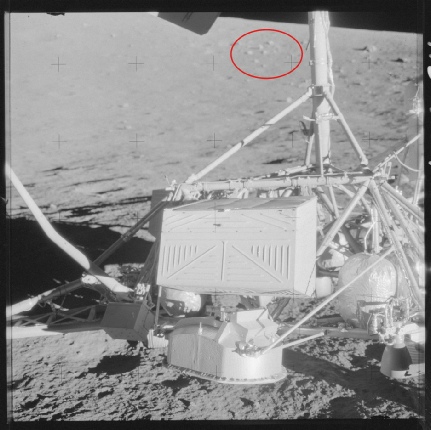
Let’s zoom in.
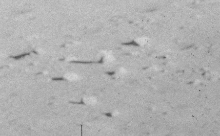
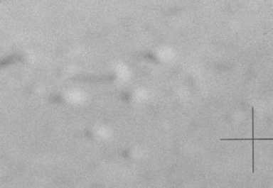
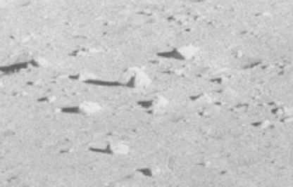
Doesn’t look very stonehenge like does it? Are we sure we have the right ones? I’ve zoomed in on the clearest view, and adjusted the brightness levels so that they’re easier to see.
It should be obvious that the reason the circle of rocks weren’t mentioned is that from the vantage point of the astronauts it was just a collection of rocks. It’s only apparent as an approximate circle when viewed from above..
I say “approximate” deliberately.
The arrangement pf rocks is roughly circular, but it’s in no way a perfect circle. The line passes through the centre of some rocks, others are inside, others outside the perimeter, and the largest rock in the centre is not perfectly in the centre. Our brain’s desire to make a pattern is doing the rest. It certainly isn’t the perfectly symmetrical circle he’s claiming it is.
Yet again, the features are identifiable, just not as a any kind o megalithic henge.
So no, they didn’t “ignore a deliberate-
“NASA defenders often claim the boulder ring is "lost in the sun glare" in surface photos.”
I’ve not seen anyone claim that. The truth is the circle isn’t apparent as a circle at ground level.
It also becomes pretty obvious that he’s just copying and pasting AI arguments, because one his claims is this:
If the tracks are darker because the astronauts "packed down" the soil (making it less reflective), then the Lunar Rover tracks should be the darkest of all because of the weight and the tread. However, in many images, the rover tracks and the footpaths have completely different "shades" of dark.
What rover would that be stray? The argument about why the trails is also false -
After initially implying that the Chandrayaan images were faked, saying:
“The AI/CGI Fingerprint: Many analysts have pointed out that modern "reconstructions" of these sites (like the LRO or Chandrayaan images) often contain features that weren't in the original 1960s "studio" shots. It's as if the modern CGI team added "geological interest" to the high-
Effectively saying that the images were altered for fun by someone, which is just bullshit, before later saying:
“There is a strong possibility that the "Boulder Ring" is a feature of the real lunar surface that the modern orbiters (like Chandrayaan-
This would explain why it's missing from the 1969 panoramas but present in the 2021 orbital data.”
So the orbital images are genuine, apart from:
“It would also explain why the "boot prints" never go near it—the CGI artists who drew the tracks for the orbital release simply didn't want to complicate the "narrative" by having the actors interact with an unexplained megalith.”
What explains it much better is that the trails recorded by modern orbital probes are genuine, just like the rocks. If he’s happy that the rocks are genuinely there, then there’s a problem for him: they did not know they were there before they visited them. You also can’t simultaneoulsy claim that the tracks are drawn in and use those tracks “avoiding” the ring as proof that.
Here’s a couple of examples, one from a digitally restored lunar orbiter image, another published at the time (see here).
They also weren’t captured by the Surveyor’s own TV cameras -
How, then, did they know to include them in Apollo photos?
In a nutshell, there’s no contradiction between there being an apparent circle of boulders in aerial shots of Surveyor crater and none in the surface ones. They just aren’t recognisable as a surface feature, and as a result there was no reason for astronauts to go over and look at them. They didn’t mention them because they didn’t see them as a feature.
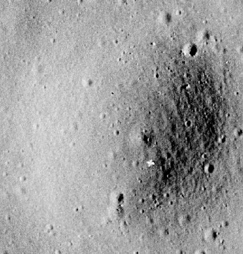
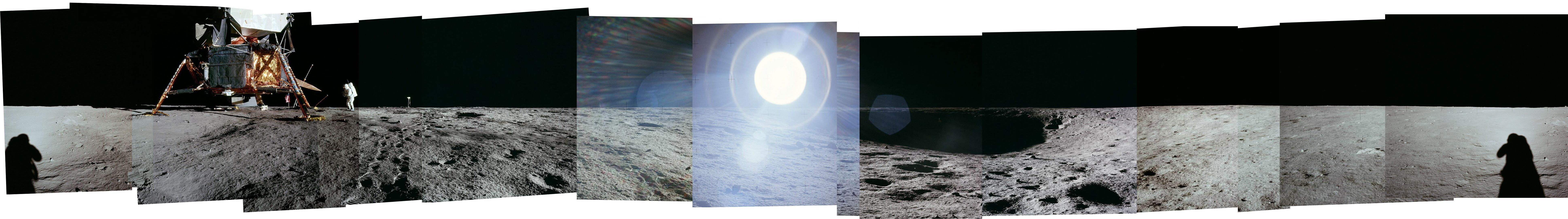
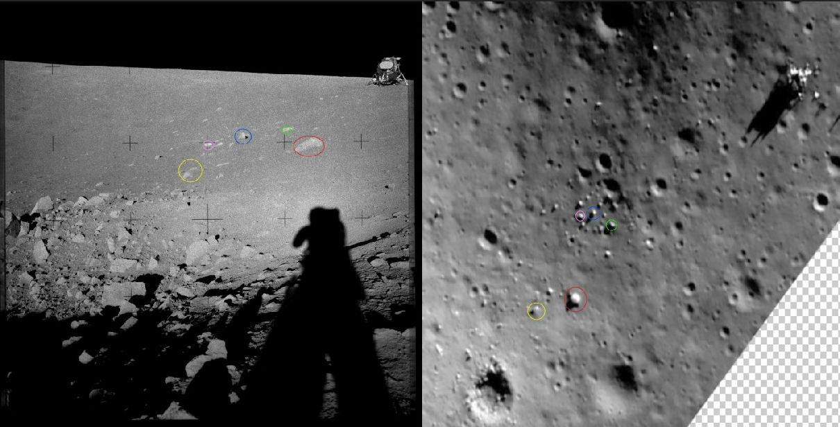
We can also return to a panorama taken from a position just below the lip of Surveyor crater.
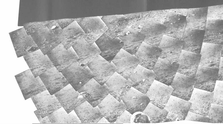
Close examination of one of the component images (AS12-
It’s not too difficult to identify features nearer the camera, but (as suggested earlier) the rocks we’re really interested in are hiding in, or on the edge of the shadows and difficult to see thanks to the glare of the sun. If we can’t see it, neither could they.
This panorama was taken at 12:45 on 19/11/69. The sun angle was at 8 degrees.

We have another panorama taken at what was called ‘blocky crater’, for obvious reasons. Alan Bean took two, and one of them has the LM in view, so we should be able to identify the stone circle.
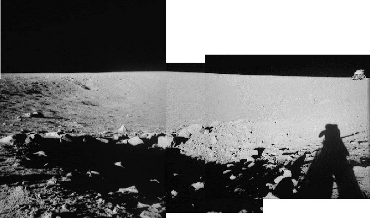
Let’s see if we can identify them in the image where they should sit: AS12-
The nearest large boulder visible above the shadow is outlined in green, and its shadow can be seen extended over the edge of the crater shadow. At least some of the boulder circle looks likely to have been in shadow.
We can estimate shadow lengths by looking at this panorama taken shortly after landing:

Another panorama is available, but it makes more sense to discuss that later.
At around the time of the start of EVA-
Based on those calculations, it’s more than likely that some or all of the ring would have been in shadow, and at best only the tops of the tallest boulders would be visible -
He goes to complain that the boulder ring isn’t visible in any photos taken from the LM or next to the crater
“When you look at the official panoramas taken by Pete Conrad from the window of the LM Intrepid (and later on the surface), the area to the west of the LM—where the ring should be—is generally depicted as a flat, featureless plain of gray dust.
Stray seems to be getting a little confused there -
“The boulder ring is not inside a crater”
It’s a shame, then, that when you make 3D models of the surface using freely available data, they show that it’s exactly where it is: below the crater edge.