Apollo 14
Apollo 14’s Fra Mauro landing site is well covered by Kaguya and Chandrayaan as well as LRO data, so we have three probes from which to generate 3D views.
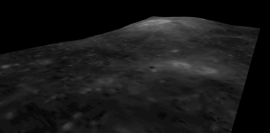
Starting with India, the DEM and Orthographic images generate quite a brightly lit scene, which is a shame as it obscures the detail of Cone crater (the main relief feature of the area). Here’s their overview of the landing site.
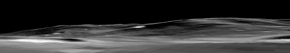
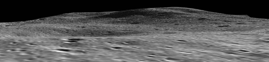
Compare that with Japan’s view of the same area from as near an approximation of ground level as is possible with the 3D plugin used:
Now to answer a question surrounding the second EVA to Cone crater -
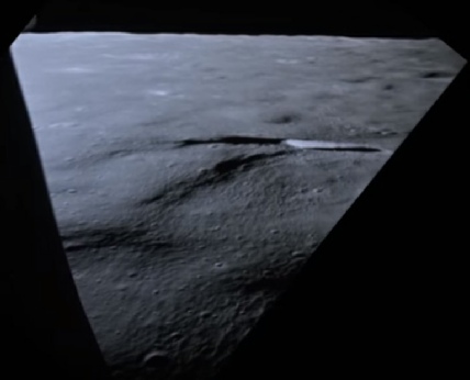
At least part of the problem lies with lighting conditions on the day. Examination of the surface panorama at the top of the page shows that, while the crater edge would have been visible in better lighting conditions, the western edge was completely in shadow. As the eastern side of the crater was in darkness (as seen in the landing footage) even though the crater is angled slightly towards them it was effectively invisible.
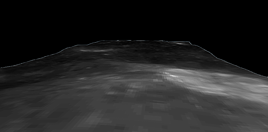
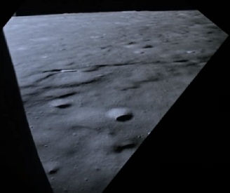
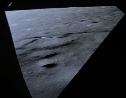
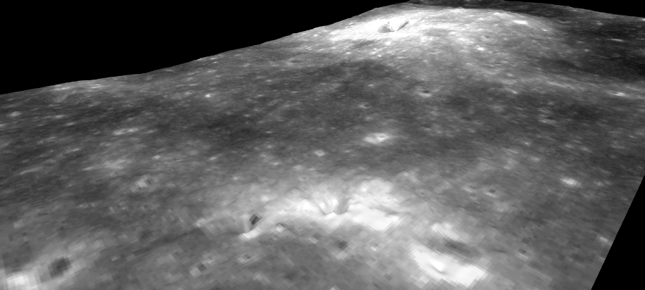
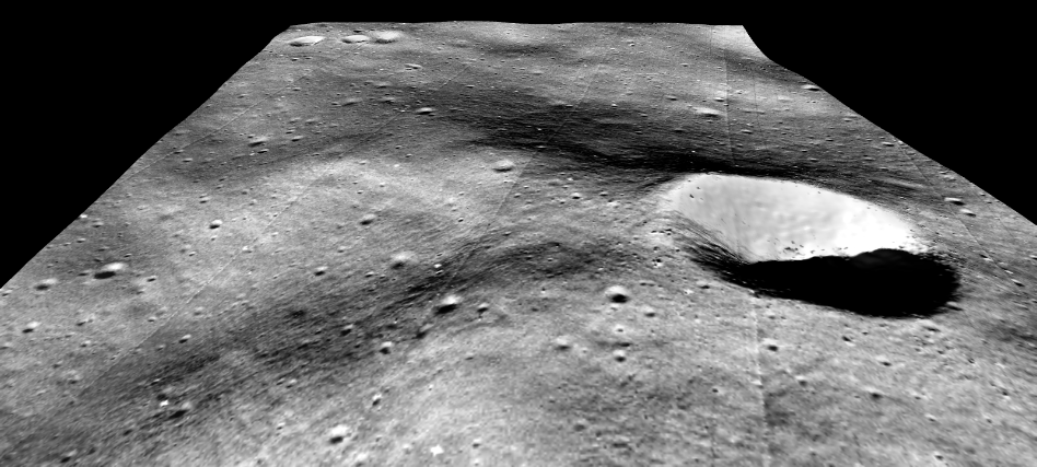
The other reason becomes clear when you take a view from the edge of cone crater, as close as possible to the position they reached. Here’s the view as seen in the LRO 3D version.
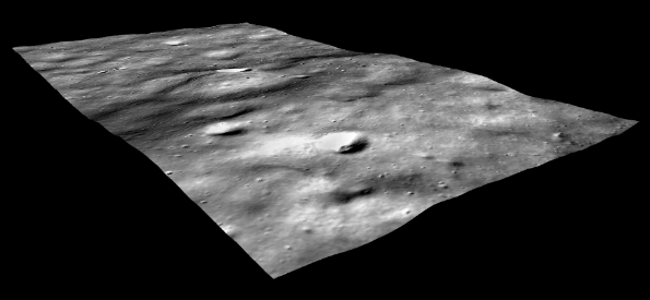
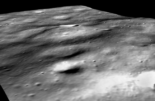
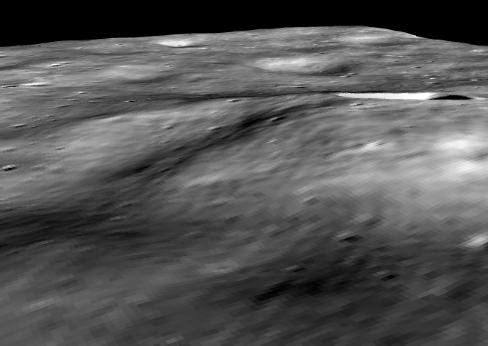
Japan’s DTM, coverage is more detailed and here is their perspective from above.
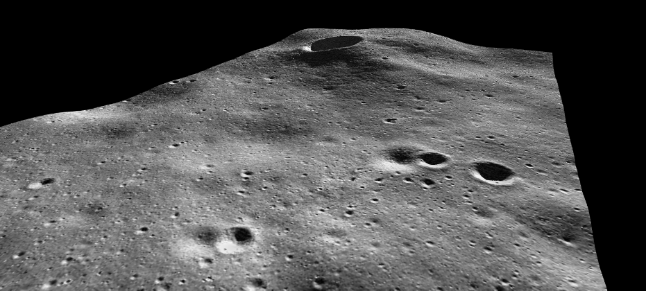
And the LRO’s is more detailed still:
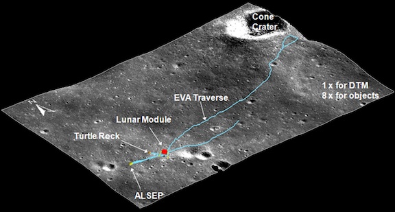
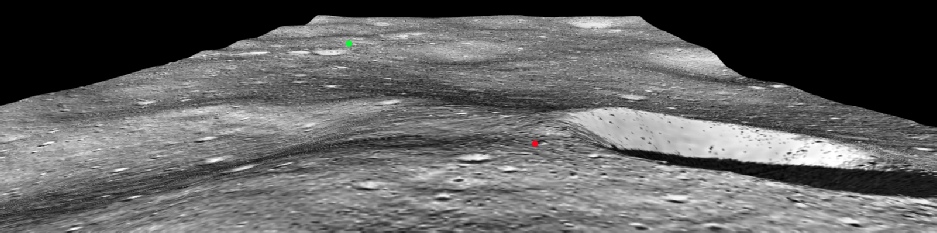
Because the Japanese map covers a larger area than the strips given by the LRO map we can follow the terrain as the LM approaches the landing site. The 16mm footage taken during the landing (see here) passes over Cone crater on its way to its eventual landing site. Below are three views comparing what can be seen in the footage with what can be observed using Japan’s data.
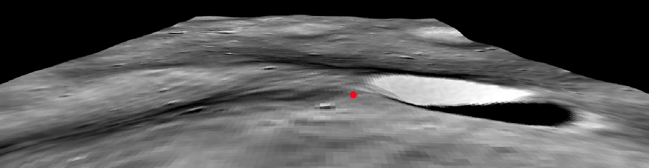
The green spot on the image shows the approximate location of the LM, and the red one the highest spot that they reached -
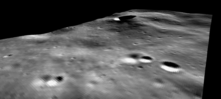
This is a close up view from above. From this perspective it looks as though Saddle Rock is right on the crater rim and they should have been able to peer over into Cone, but what the 3D view shows is that from their vantage point they would not have been able to see that the crater was there.
The image below shows what would seem to be the edge of the crater, but it would have been very difficult for them to know that given that the far wall would not have been visible to them.
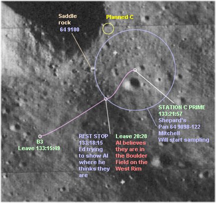
On an already stretched mission timeline, they did not have any more resources available to go and see for themselves and reluctantly called it a day after visiting another crater at Station C Prime.
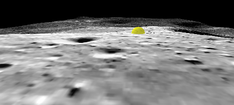
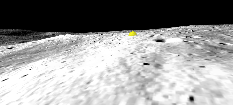
Here are another two perspectives from the LRO DEM, on the left looking up towards Saddle Rock (the yellow marker), and on the right looking westwards to it:
I can strongly recommend downloading the 3D models at the end of this page to check for yourself -
We can see from this that it picks out the same landscape configuration as the LRO model, and again suggests that the view from Saddle Rock (red marker) would not have allowed them to see that the crater was just a short walk to the horizon.
And just for completeness, here’s the pre-
 Apollo Overview
3D Overview
Apollo Overview
3D Overview
Just for completeness, here is China’s latest version of the site:
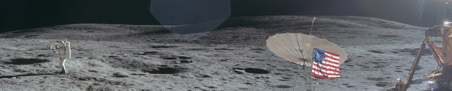
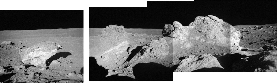
That’s the view on the way in, how about comparing the view on the ground Here’s a panorama taken from the landing site looking towards Cone crater.
And to complete the set, here’s China’s view.