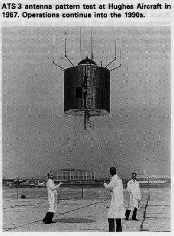
Figure 2.1.1: The ATS-
Analogue signals were digitised so that different levels of brightness were assigned numerical values and these values were stored on tape. According to this document, one ATS image could use an entire tape reel when digitised (4 reels for colour). Ultimately, seven track 18 inch reels were used, and these could store 70 images (roughly a day and a half's worth of data). It took an estimated 4 hours between image transmission from the satellite to being visible on a terminal on the ground.
Just for fun, here’s where ATS got in on the Apollo missions by being used in a Christmas card from the crew (figure 2.1.6).
2.1 ATS Satellites
ATS stands for Application Technology Satellite, and the satellite used in this research is predominantly the ATS-
ATS-
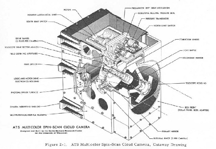
The camera used to image the earth was developed by Dr Verner Suomi of the University of Wisconsin-
While in orbit it span at around 120 rpm, and with each spin it scanned a small line of the Earth's surface, each line representing 3.2 km of latitude. On the next spin it scanned a slightly lower latitude, and over 2400 revolutions it would achieve full coverage. It would take roughly 20 minutes to compose an entire image, after which the camera would reset itself and the process would start again. Most of the archives show a single image for each day, but in reality there was a very good record. As will be in seen in a later chapter this can be used to pinpoint the timing of Apollo images very precisely.
The colour image comprised a blue, green and red channel. These three channels worked for just 3 months, after which the red and blue channels ceased to function. Black & white images were still produced until the mid-
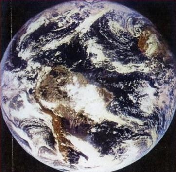
The satellite became the first to photograph the full Earth from space in high quality colour (see figure 2.1.3), and this led to the first colour time lapse film of the Earth from space (see below).
The first US sourced high quality full Earth black and white images (and the first satellite images to feature Earth and moon together, although arguably this distinction belongs to Lunar Orbiter 1) were done by ATS-
The image shown above in figure 2.1.3 has often been mis-
Interestingly, the satellite does have a direct link with Apollo.
This NASA page reports that it provided television relay for the live Apollo 11 TV broadcasts to Radio Television Caracas, a Venezuelan broadcaster. It is important to note that it served purely as a relay for the TV signal. It took approximately half an hour for the satellites own camera to create a single image and reset itself, it did not have the capacity to broadcast its own images live. It would also not have been possible for Apollo 11 to send a signal direct to the satellite as it would not have been visible. The main TV signal for Apollo 11's moon walk (Extra-
ATS-
This document describes early techniques where each strip would be printed, with characters such as '*','/' and ')' in order used to simulate a grey scale, involving a huge amount of paper. Kinescope assemblies (A technique for recording TV images directly on still or moving film) were also used to photograph the TV images.
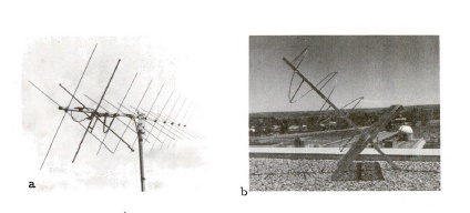
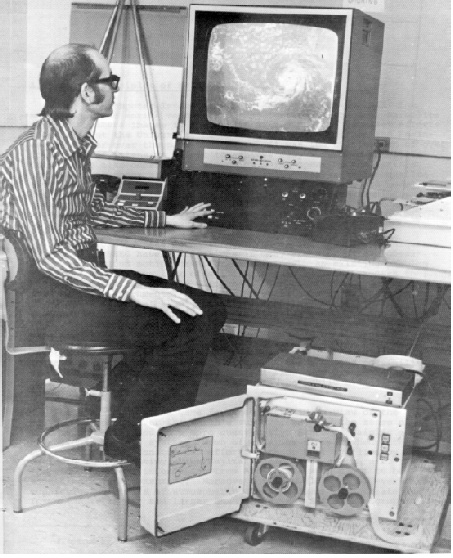
Information could be recorded on tape and analysed later, but the systems were bulky and slow (figure 2.1.5).
Figure 2.1.2 – The ATS-
Figure 2.1.3: Earth from space, November 1967 (Example source)
Figure 2.1.4: VHF antennae used to receive ATS-
Figure 2.1.5: A WINDCO terminal, developed between 1971-
Observant readers will notice it’s upside down!
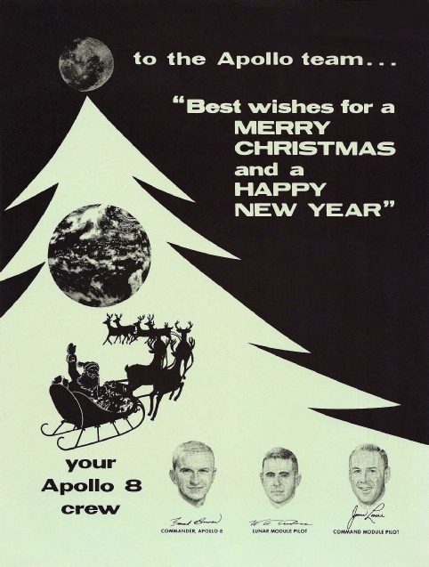
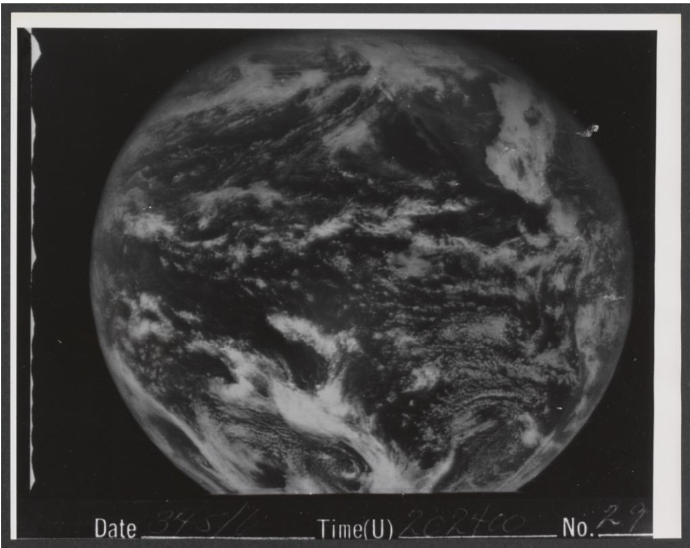
Figure 2.1.6: Apollo 8 Christmas card featuring an ATS-