2.2 ESSA
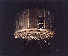
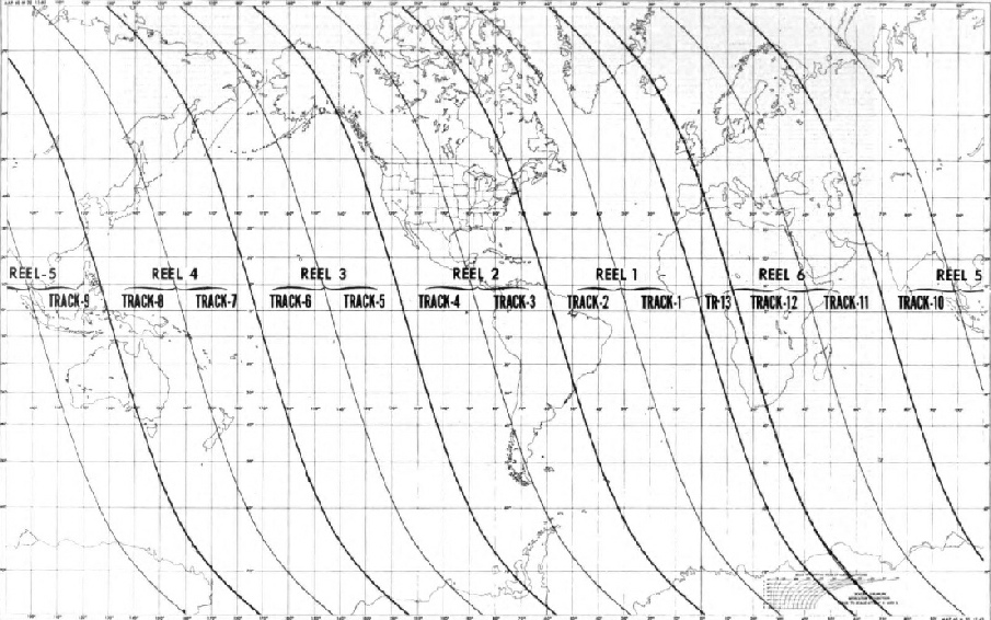
Figure 2.2.3: ESSA Satellite tracks (this diagram can be seen in most of the ESSA data catalogues catalogues, and is the same for each satellite)
Figure 2.2.1: An ESSA Satellite (http://history.nasa.gov/SP-
The Environmental Science Services Administration launched a series of 2nd generation TIROS (Television Infrared Observation Satellites) probes through the 1960s. The satellites tended to be much shorter lived (between 1 and 3 years).
These probes were geosynchronous polar orbital satellites operating at a much lower orbital altitude of between 400 and 900 miles (it varied by satellite), taking roughly two hours to complete a single orbit, covering the entire earth's surface in 24 hours. The satellites used on of two types of camera system, both consisting of a camera on opposite sides of the craft, and as it cartwheeled in orbit the camera facing the ground would take an image.
Advanced Vidicon Camera Systems (AVCS) recorded images on tape & transmitted them at pre-
Eventually there were around 300 APT receiving stations located around the world, and the images were therefore immediately available to anyone capable of building a receiver. This article in Radio Science, for example, describes data collected in Peru from the ATS. Amateurs could also collect images. This website for Douai Abbey describes how Benedictine monks at an English Abbey produced satellite images by recording their signals using radio receivers, although it is not clear which satellite they specifically listened to. This article describes the activities of amateur satellite trackers in the US, and some of them even made recordings, as shown here.
This Pathe News report shows a British firm manufacturing the receiver stations.
On a personal note, as a student I spent some time in the late 1980s in an environmental study centre in south Wales (Ty’r Morwydd in Abergavenny, now sadly closed). Whilst I was there the centre acquired a satellite dish and the software needed to receive images from NOAA and METEOSAT satellites. I can therefore speak from personal experience and state that such images can be acquired relatively easily – as can many modern amateur trackers of satellites worldwide.
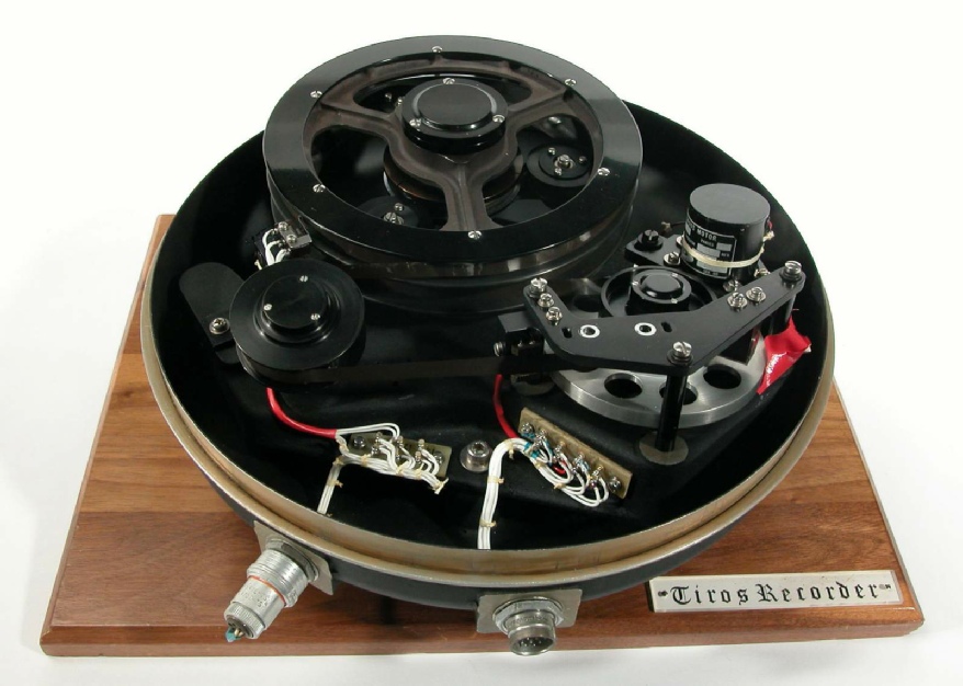
The exact coverage of each image would vary depending on the orbital height, but each image covered roughly 400000 square miles, with each line of TV transmission equalling roughly 2 nautical miles. The orbital periods are designed so that the images are recorded in daylight, effectively meaning that photographs are taken during 1 hour of each orbit. One image was taken roughly every 260 seconds, with an exposure time of around 8 seconds. It was transmitted to earth either automatically or on demand from ground stations. Images were capable of being stored on board on magnetic tape should the satellite be either out of range of a receiver station, or transmitting images whilst taking another. Figure 2.2.2 shows an example of the tape mechanism from this site.
Figure 2.2.2: TIROS magnetic tape recording mechansim.
The images were recorded on photographic film using kinescopes, and also transferred to magnetic tape, with numerical values used to represent different levels of brightness. These tapes were used in “high powered computers” (sic) to be displayed on a cathode ray computer monitor (eg, as shown here). Like APT images, they could be transmitted by fax to other agencies throughout the world.
A diagram showing the orbital paths for ESSA satellites is shown below in figure 2.2.3. These paths were the same for each ESSA satellite.
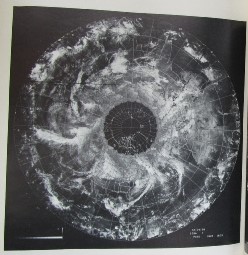
The image data from these satellites were often compiled into circular hemisphere plots, but occasionally are shown in strips (figure 2.2.4).
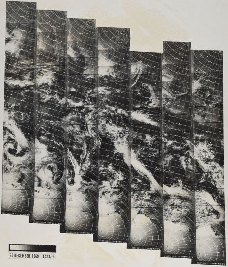
Figure 2.2.4: ESSA satellite data presentation.
