The PAO has already confirmed that they are receiving TV through Honeysuckle Creek, and Australia is just visible. They have only just emerged from behind the moon, and SkySafari confirms they are where they should be.
The next image featuring a recognisable Earth is on magazine 15, and the first image on there, AS08-
Figure 4.1.5.2: AS08-
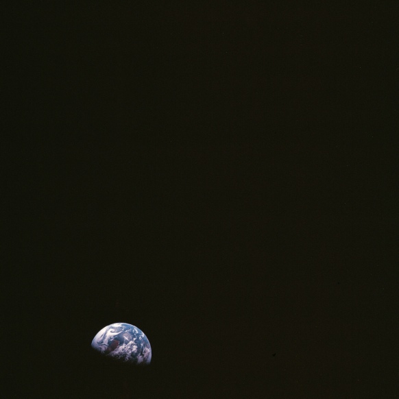
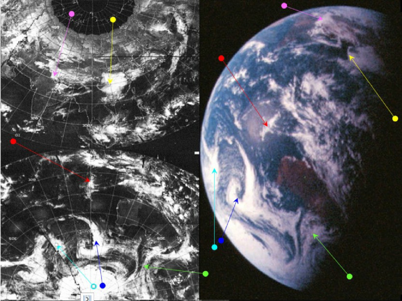
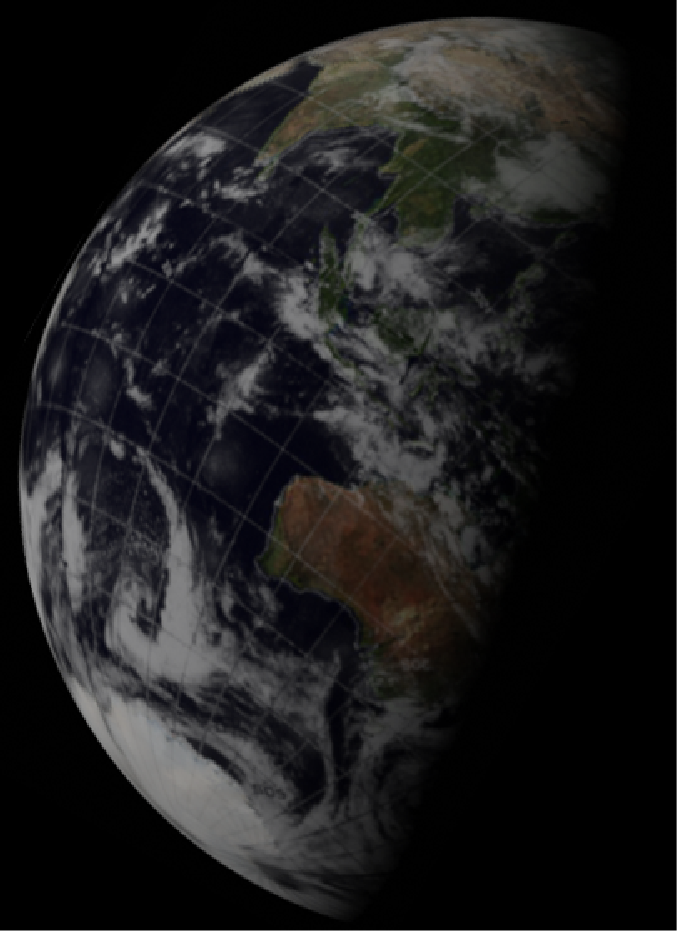
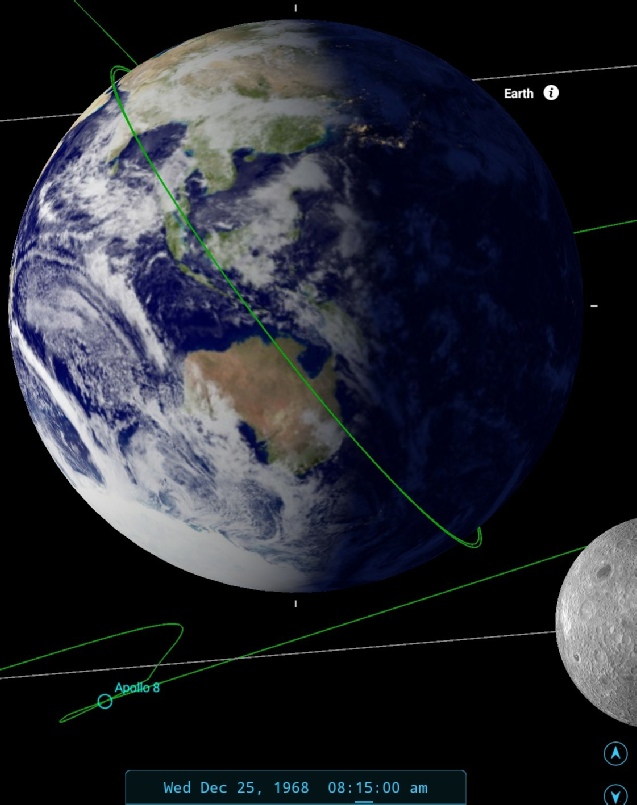
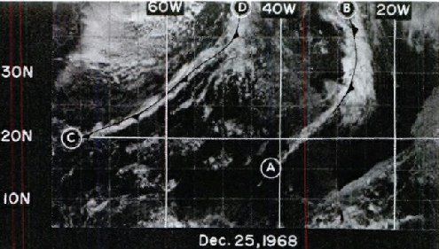
Figure 4.1.5.3: ESSA-
This view of Australia is repeated several times over the next 48 hours, and the cloud systems in it undergo subtle changes in that time, so it is worth describing what we can see.
The system to the west of Australia is like an inverted bass clef symbol (blue arrow), connected by a west-
If the reader cares to return to figure 4.1.2.6, the plume of cloud extending to Australia from Antarctica is also visible there (yellow arrow),as is a 'bass clef' pattern in what could be seen as an early stage of development, identified by the cyan arrow. If the weather patterns are followed through the satellite images, it becomes evident that what is visible in figure 4.1.5.2 as a plume actually started out in figure 4.1.2.6 as a curl of cloud off the west coast, and the cloud systems visible in the images are part of a progression of weather patterns typical for the region.
The position of Australia at the terminator in the photo allows SkySafari to determine a time of 08:15 on the 25th. Note that Skyfari confirms that they are no longer in lunar orbit. ESSA's image dated the 24th still applies here, and orbit number 1637 (track 8), which commenced at 05:00 on the 25th.
It’s worth going back in time a few hours and mentioning that as the crew disappear behind the moon for the TEI burn, they make the following observations:
088:49:51 Anders (onboard): You can really see Australia or something down there on the Earth. ... I get Earth set here in just a second.
…
088:51:00 Anders (onboard): Look at the Earth.
088:51:03 Borman (onboard): Yes.
088:51:04 Lovell (onboard): Setting?
088:51:05 Borman (onboard): Yes.
088:51:06 Anders (onboard): Yes, we're down in Carnarvon.
088:51:10 Lovell (onboard): Huh?
088:51:11 Anders (onboard): Yes, we're down in Honeysuckle; that was Australia.
Figure 4.1.5.4 shows that Australia very much was in full view as Earth set behind them, and as they re-
After this first set of three images in magazine 15, there are a further 4 that were taken some time later. These photographs are represented here by AS08-
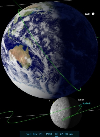
Figure 4.1.5.4: SkySafari view of Earth prior to TEI
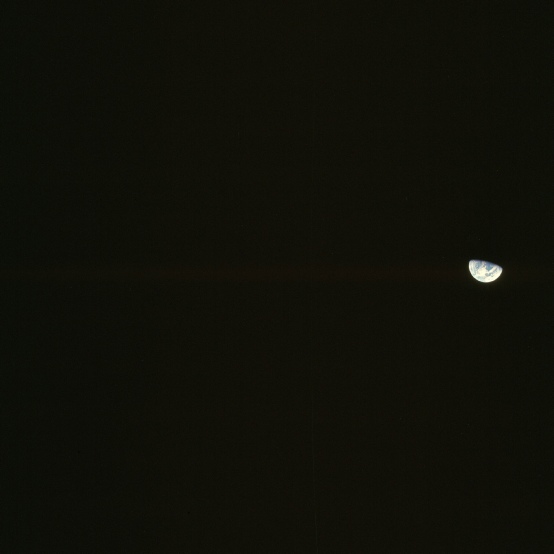
Figure 4.1.5.5: AS08-
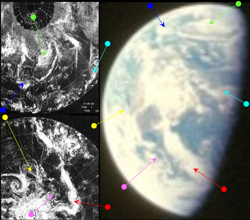

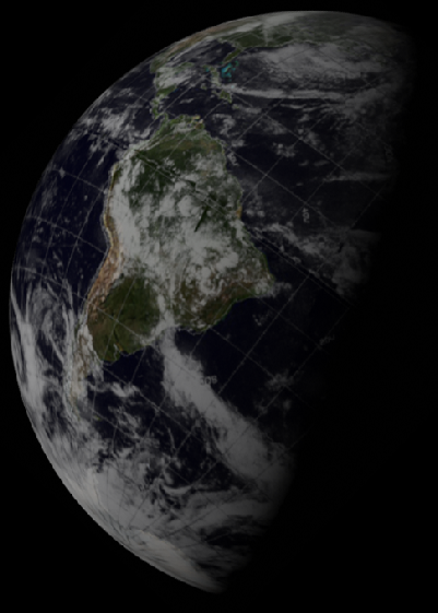
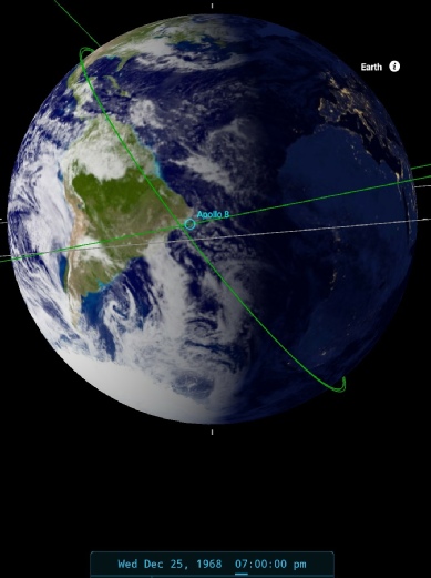
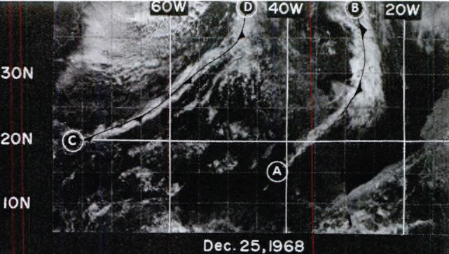
Figure 4.1.5.6: ESSA-
The view we have in this image is also one that has been featured before, and the reader is referred back to earlier figures over the preceding days for similar views that show the evolution of weather patterns on Earth over several days, and not (as some conspiracy followers claim) some form of painting.
The same broad features seen in previous photographs of south America are still visible, from the long thin band of cloud across the north Atlantic from the Gulf of Mexico (blue arrow) to the large 'dog leg' of cloud extending across from south America towards southern Africa (red arrow). The arrangement of those weather systems is, however unique to the 25th of December 1968.
SkySafari's estimate puts the time of the image at 19:00 on the 25th, and this compares with a time for the ATS-
A little while later there is another pair of photographs, probably taken to coincide with a TV broadcast. While these show only a small rotation, they do allow the use of all 3 satellites in comparing the weather, as for once they are all available.
Figure 4.1.5.7 shows AS08-
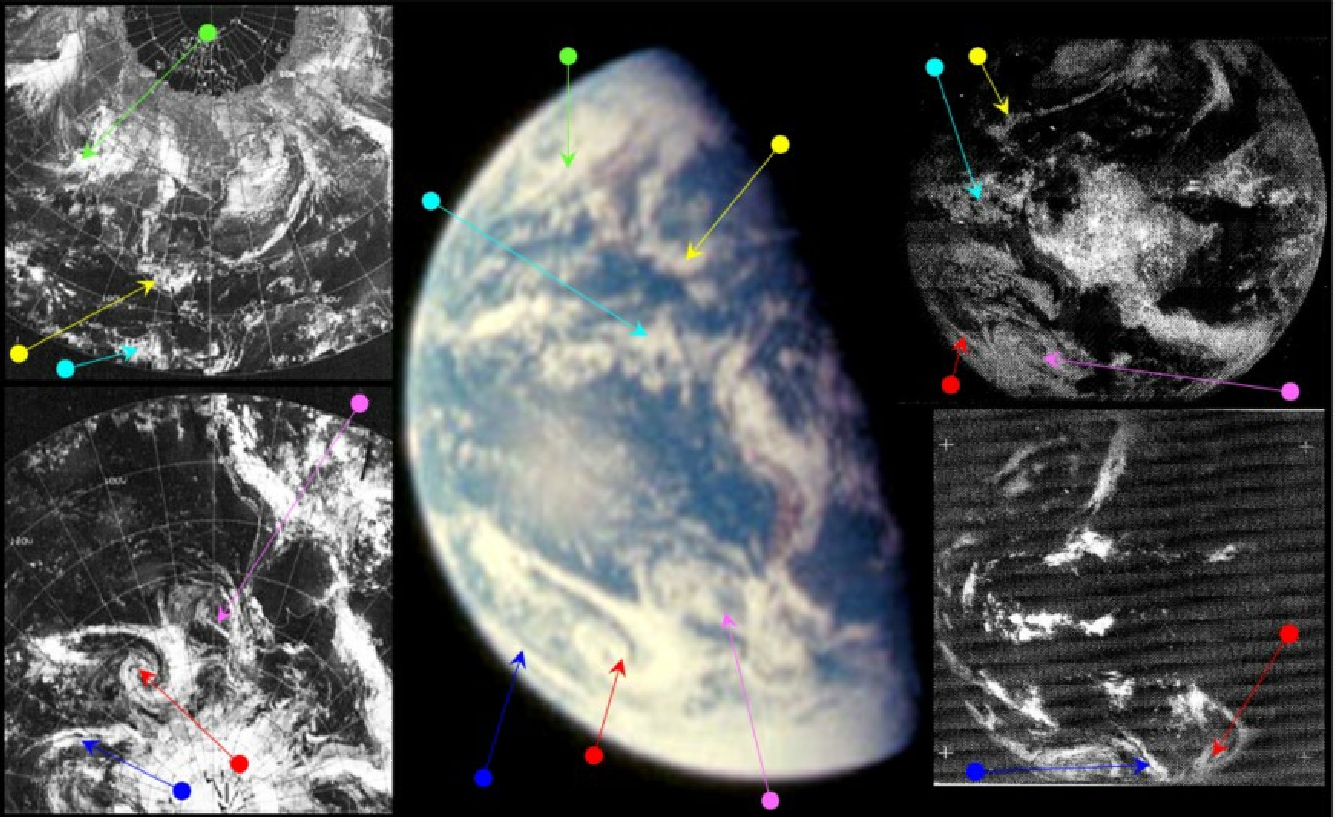

Figure 4.1.5.7: AS08-
In the preceding photograph we have lost sight of most of the weather systems visible in the previous image, but the magenta arrow does pick out the complex cloud patterns off the south American coast that have been a consistent feature throughout photographs of the region. The most striking feature now is a long curl of cloud tightly coiled off southern Chile, a system that is common to all the satellite images in one form or another.
The smaller weather patterns are less striking thanks to the picture being slightly out of focus, but it is still easy to make them out. The clouds over central America stretching down from the USA are very obvious (yellow arrow), and once the ESSA image's green arrowed cloud is noticed, its configuration on the actual image is readily identifiable.
As far as timings are concerned, the terminator cutting across Brazil puts the time at around 19:00 on the 25th. ATS-
A gap of several hours ensues before any more photographs are taken of Earth in magazine 15, with the next appearing on December 26th. Click the links below to move on.
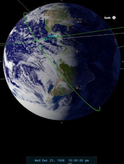
Figure 4.1.5.8: ESSA-
4.1.5 -
Christmas day saw a momentous broadcast from lunar orbit, complete with a reading from Genesis. Before that reading, and the view of the lunar surface that accompanied it, we re treated to a view of Earth. Here’s the crew’s description:
085:44:00 Anders: Houston, you're seeing a view of the Earth taken below the lunar horizon. We're going to follow the track until the terminator, where we will turn the spacecraft and give you a view of the long shadowed terrain at the terminator, which should come in quite well in the TV.
The view isn’t up to much -
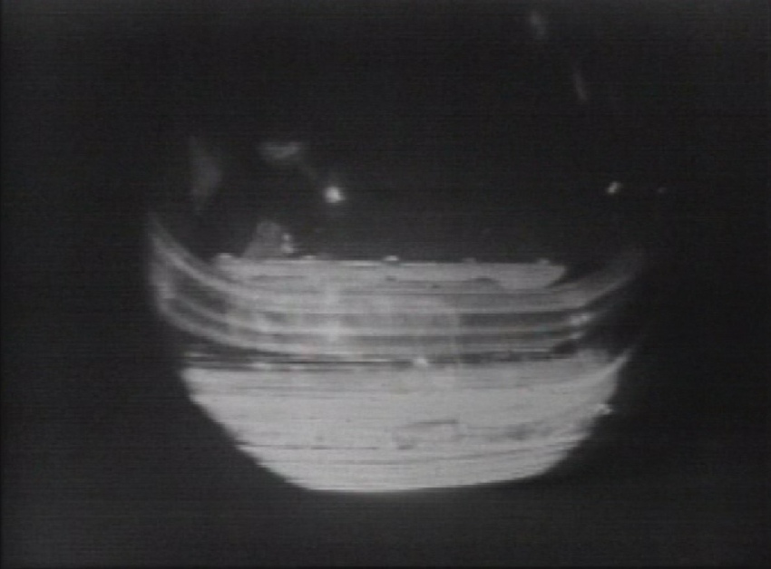
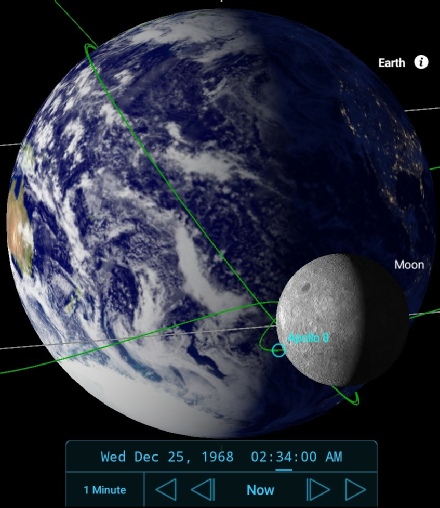
Figure 4.1.5.1: View from the start of TV transmission taken from the ‘Leaving the Cradle’ box set, but also available here, and SkySafari depiction.