4.7.1 - Apollo 15 Day 1 - Launch
The first image of Earth taken by Apollo 15 turns out to be one from its parking orbit, taken using the ultra-violet film. The transcript records the moment:
001:30:56 Scott: Getting a little UV here.
Which translates to around 15:04 GMT.
Figure 4.7.1.1 shows the flight path in this early part of the mission.
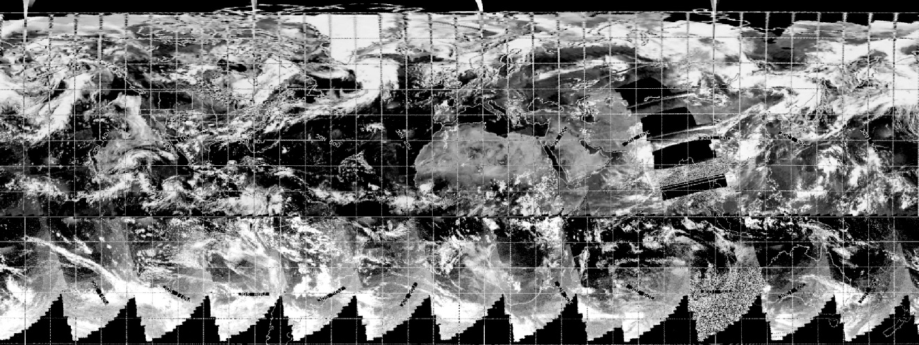
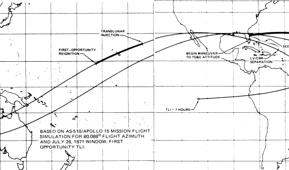
Figure 4.7.1.1: Earth Parking Orbit paths (modified from the AFJ)
We also know at this point that communications were being routed through Goldstone in California. We should, therefore, be able to see the weather patterns in the satellite images off the coast of California. Let’s have a look at the best of these first UV images (figure 4.7.1.2).
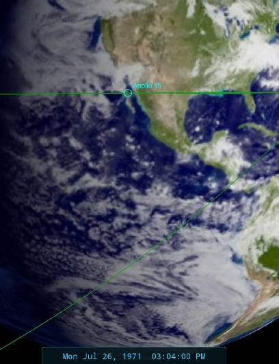
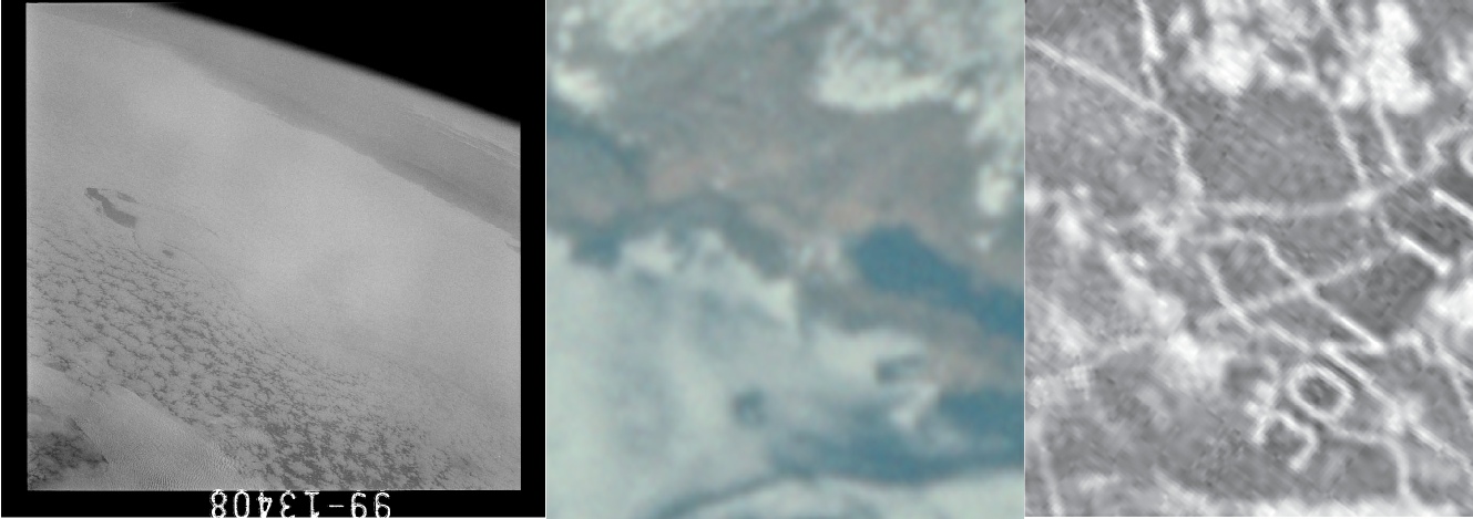
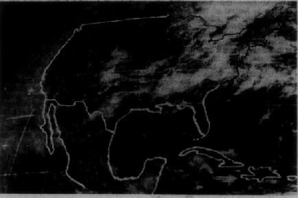
Figure 4.7.1.2: AS15-99-13408 compared with a section of AS15-91-12344 and a section of the ESSA view of the same area.
I’ve added a crop from a photograph taken later in the mission by way of comparison, but we do have here a shot of the California coast in the distance, and a beautiful island wake forming around Guadalupe, something also visible in the colour photograph.
The first full image of Earth (part of a short sequence of Earth photographs) taken during Apollo 15 was taken using magazine 91. It occurs after a sequence of photographs showing the docking sequence of the CSM and LM and a discarded SIV-B, which immediately places those images after 17:52 on the 26th (see here for the mission timeline).
AS15-91-12342 (see figure 4.7.1.3) is focused on the Atlantic, with south America the dominant land mass visible. There is a curl of cloud stretching from the Gulf to the mid-north Atlantic, and above the thin line of cloud marking the inter-tropical convergence zone is an unusual system that should be obvious on the satellite image. South America is marked by long banks of cloud along its western coast, and a number of bands of cloud run across it. These weather patterns will now be identified in figure 4.7.1.4.
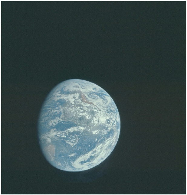
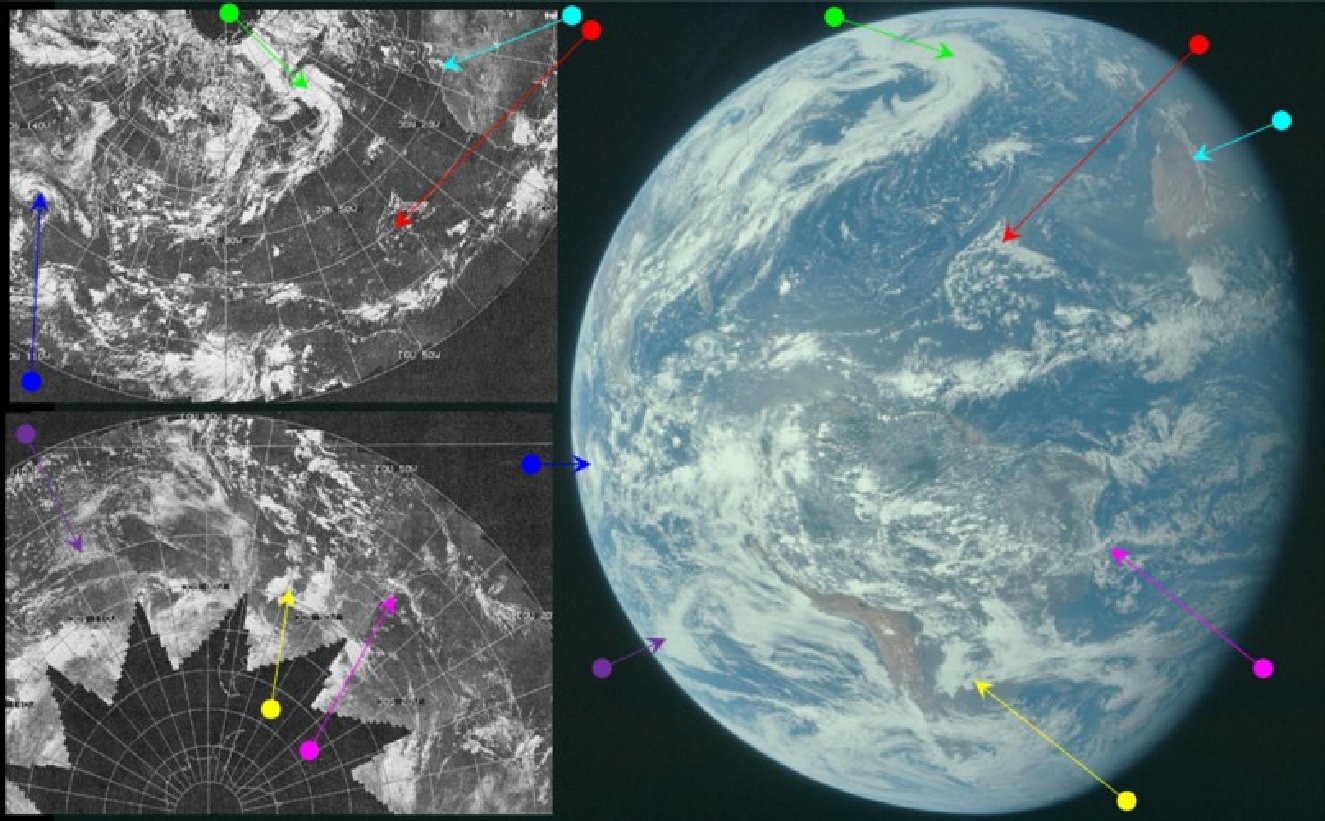
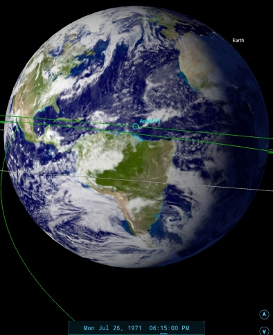
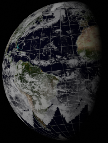
Figure 4.7.1.3: AS15-91-12342 compared with ESSA 8 images from July 26th. SkySafari insert shows time at terminator. Right is a 3D reconstruction of digitally restored ESSA data. Above is the ESSA satellite view from the 26th published in the Sarasota Herald Tribune on the 27th.
There’s no reference to the photography in the transcript, but the Earth view occurs after images of LM extraction from the SIV-B and the jettison of the now spent stage, which means the timing of the photo at around 18:15. As we can see, this is an exact match with what we should be seeing.
As is usual with the first Earth images in a mission, there is no difficulty picking out the weather systems shown on the photograph. They are clearly contemporaneous, and as is the way with weather features the patterns visible on the satellite image are different on the following day. The ESSA track covering the centre of the Apollo image would be track number 2, which corresponds to orbit number 996, commenced at 16:01 on the 26th.
After a duplicate image of AS15-91-12342, another Earth image shows a different surface configuration of clouds. Figure 4.7.1.5 shows AS15-91-12344.
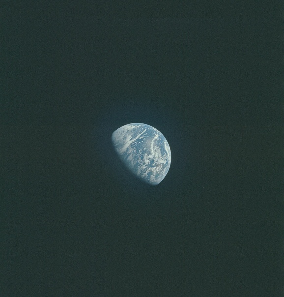
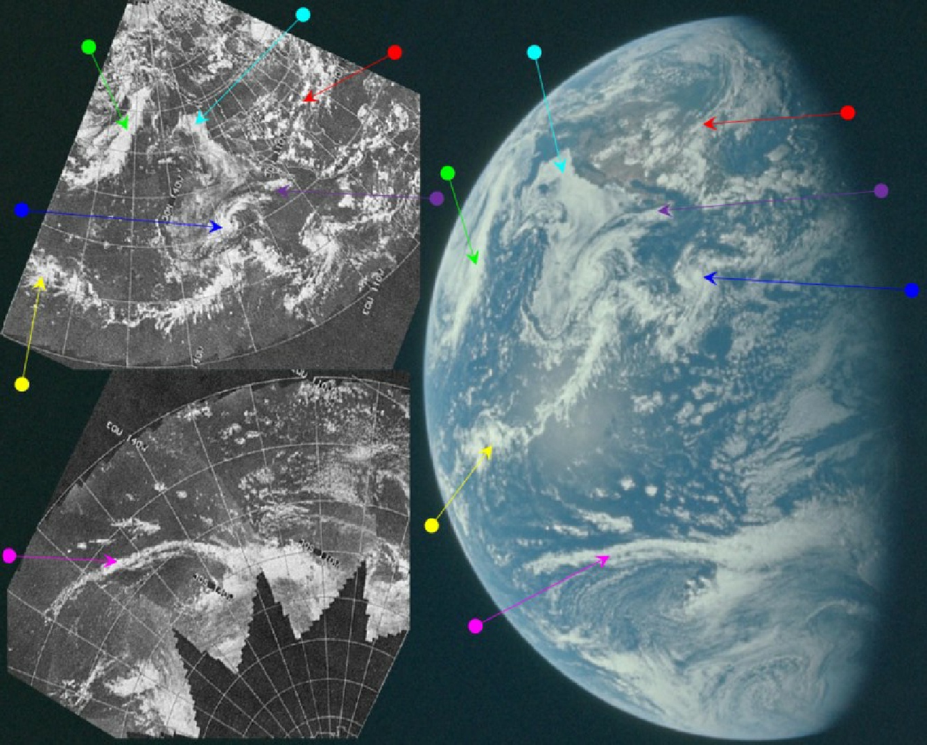
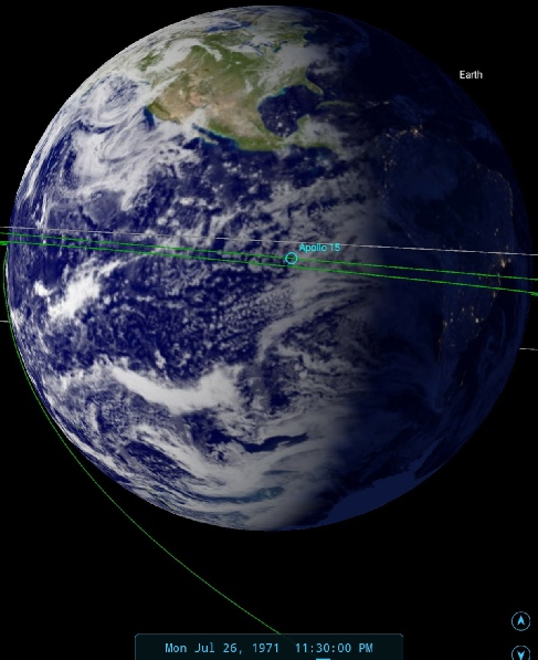
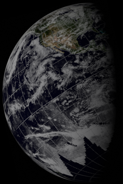
Figure 4.7.1.6: AS15-91-12344 compared with ESSA satellite. Also shown left are 3D reconstruction using ESSA data and SkySafari depiction. Above is the ESSA satellite view from the 26th published in the Sarasota Herald Tribune on the 27th.
The blue arrowed system in figure 4.7.1.6 is the same one as identified in figure 4.7.1.4, and this system will be discussed in more detail momentarily. The system picked out by the cyan arrow is also visible in 4.7.1.2, west of the system identified by the green arrow in that figure. As for the other systems, it should again be obvious even without the arrows that those visible in the Apollo image are also present on the ESSA mosaic.
SkySafari suggests a time for the image of 23:30. ESSA's most representative track covering this part of the Pacific is number 5, which corresponds to orbit 999. This orbit started at 22:07, giving a good correspondence with the Apollo timing.
While this photograph is not specifically mentioned in the transcript, we do have a reference to its companion UV image (figure 4.7.1.7)
In order to get the photo, the crew needed to stop the Passive Thermal Control ‘Barbecue roll’, and that’s what we have referenced here:
009:49:17 Scott (onboard): Okay, let's go to UV then.
The time there equates to around 23:23. We also know that 40 minutes later they re-orient themselves to take the next sequence of images in the UV magazine, the moon.
010:30:16 Irwin: Rog, Karl. Would you go back and recheck the attitude - the attitude for the UV pictures of the Moon?
So these images of Earth have to have been taken before then.
Back to the blue arrow. The significance of this system can be identified in the weather records of the time, and in the documents mentioned in the preamble to this section (section 4.7.0). The reason it has been singled out here is because it is identifiable as Hurricane Hilary. The ESSA 8 image recorded in the MWR can be matched with the ESSA 9 images in figure 4.7.1.4 and 4.7.1.6, as shown in figure 4.7.8.
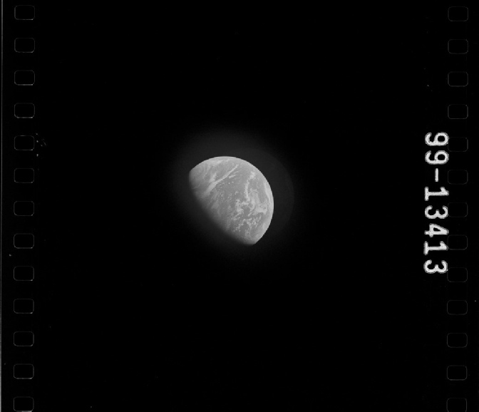
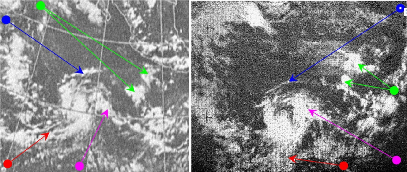
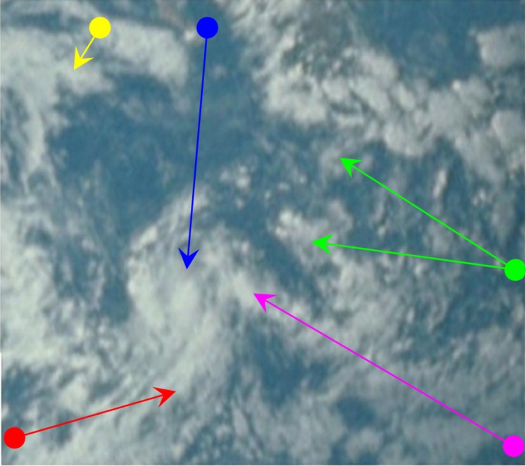
Figure 4.7.1.8: ESSA 9 (bottom left), ESSA 8 (bottom right), AS15-91-12342 (top left) and AS15-91-12344 (top right) images of Hurricane Hilary, 26/07/71.
Hilary formed on the 26th (or at least the system was officially designated as a tropical storm on the 26th) and lasted just over a week before declining in strength. It succeeded Hurricane Georgette, and overlapped with Hurricane Ilsa, the remnants of the former still being just visible in the above figure, marked by the yellow arrow, and more clearly in figure 4.7.4 (purple arrow). ESSA 8's image of Georgette from July 24th in the MWL on page 332 (Source) is shown in figure 4.7.1.9.
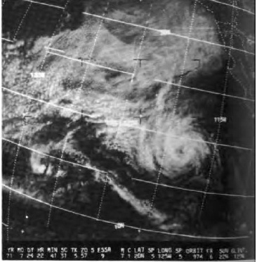
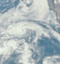
Figure 4.7.1.9: ESSA 9 image of Hurricane Georgette on 24/07/71. (Source given in text), compared with the same weather system in AS15-91-12344. The Apollo image has been rotated to match the ESSA viewpoint.
As with other examples in this research, it is worth noting that while all 4 images show the same features, they are not identical. The cloud immediately to the north of the eye (blue arrow) is thicker in the later Apollo image, and in the ESSA 9 version. The two adjacent small patches of cloud (green arrow) change their overall shape and position in relation to Mexico. Every component of the Hurricane is slightly different in each of the 4 images, showing that each image was taken at a different time and not, as some conspiracists would argue, merely reproductions of the same image.
The next in this short series of receding Earth pictures was taken on the next calendar day. Click the link below to see it.