4.7.2 - Apollo 15 Day 2 - Coast
The next in this short series of receding Earth pictures is AS15-91-12345 (see figure 4.7.2.1 – Source).
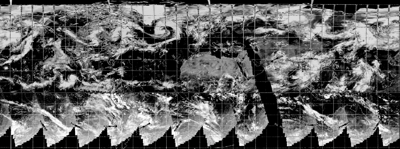
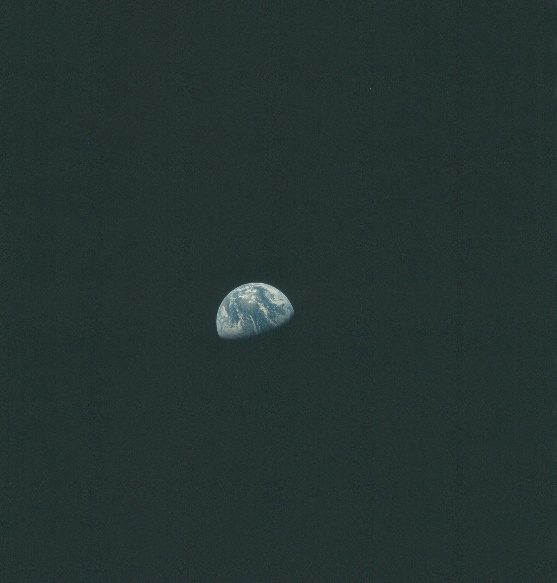
Figure 4.7.2.1: AS15-91-12345
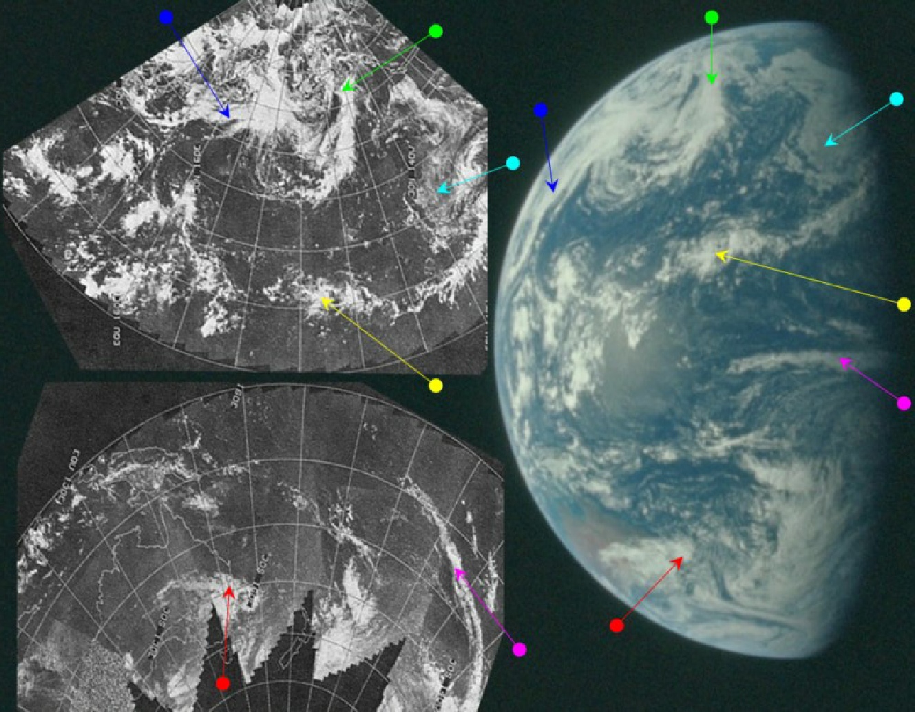

Figure 4.7.2.2: AS15-91-12345 compared with ESSA 9 satellite image and SkySafari depiction. Right is a 3D reconstruction using digitally restored ESSA data. Green, cyan, magenta and yellow arrows are as figure 4.7.1.6.
SkySafari’s depiction suggests a time for the Apollo image of around 02:30 on the 27th, and the 3 hour time gap between this image and the previous one is amply demonstrated by the appearance of Australia and by differences that are evident in the cloud patterns that are visible in the earlier image. The system identified by the yellow arrow, for example, has clouds that are different to the north and south of it when they are examined closely – see figure 4.7.2.3.

Figure 4.7.2.3: Zoomed section of AS15-91-12344 and AS15-91-12345 showing the same weather system several hours apart. No two clouds are the same, but the overall features are.
Again, there’s no direct reference to the photograph, but the SkySafari and satellite corroboration is undeniable.
The next image in this sequence of photographs is AS12-91-12347 (see figure 4.7.2.4, Source), which is analysed in figure 4.7.2.5..
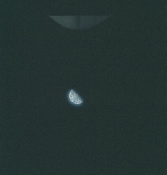
Figure 4.2.7.4: AS15-91-12347
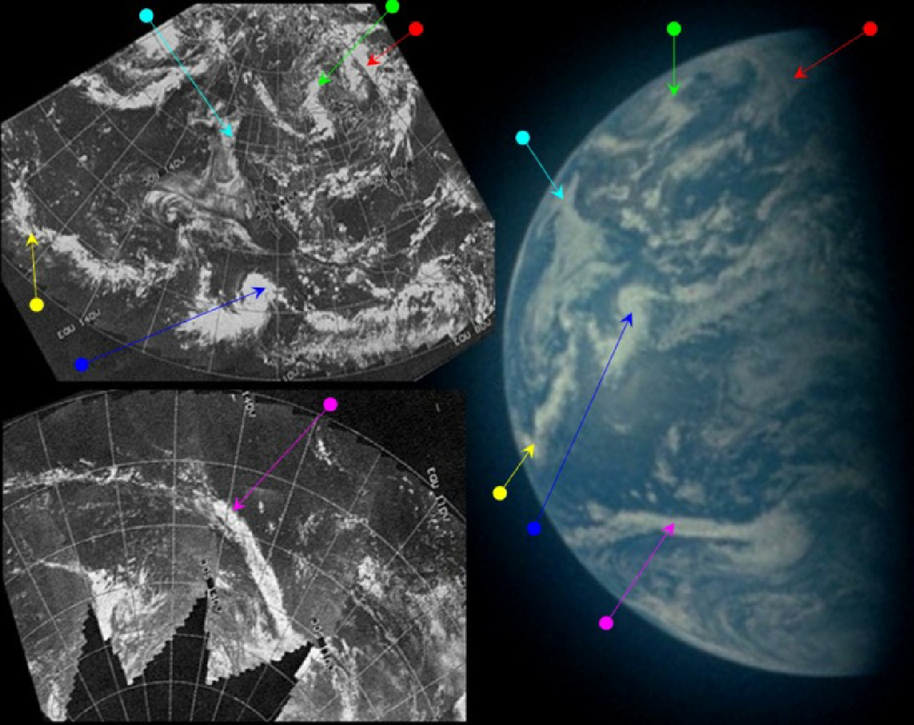

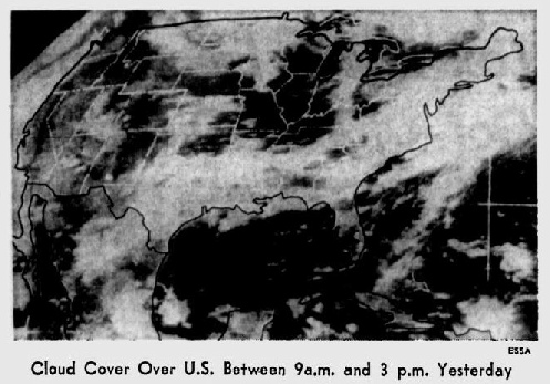
Figure 4.7.2.5: AS15-91-12347 compared with ESSA 9 image and SkySafari depiction. Right is a 3D reconstruction using digitally restored ESSA data. Above is ESSA satellite image from 27/07/71, published in the Sarasota Herald Tribune on the 28th, and one from the St Petersburg Times from the same publication date.
For this latest photograph, north America is back in focus, which means it was taken some time later than the previous photograph. Despite this time gap, some weather features persist from the previous one. Hurricane Hilary is still making progress across the Pacific (blue arrow), and while they have become less coherent systems, the sub-equatorial bands of clouds (magenta and yellow) are still there. Fog also persists along the west coast of north America. It’s worth comparing a close-up view of the Apollo image with one from the NOAA-1 satellite (see introduction for source), specifically the cloud system identified by the green arrow (figure 4.7.2.6).

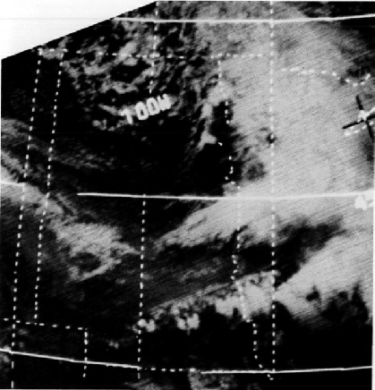
Figure 4.7.2.6: Cropped area of AS15-91-12347 compared with NOAA-1 satellite view (above) and section of 3D reconstruction.
The area covered by the NOAA satellite is given in the source document as North & South Dakota, which corresponds with the line of longitude shown. There is definitely a good match between the Apollo image, viewing the area obliquely, and the view from above taken by the satellite.
Stellarium estimates that this image was taken at 22:30, and the size of the disk is consistent with the suggested date of the 27th – as are the clouds featured on the ESSA mosaics, which are different in the following day's image. ESSA's best fit orbit for this image is number 1011 (track 4), which commenced at 21:01. As usual, the ESSA image and the Apollo image are taken with a short time of each other, which explains their similarity. The NOAA-1 image time is given as 14:00 MDT, which equates to 20:00 GMT.
A further confirmation of timing is given by the two photographs immediately after AS15-91-12347 (eg AS15-91-12349). They are labelled simply as 'Spacecraft interior' on the AIA and in the photographic index (Source), but comparison of them with other photographs available on the internet (eg LM interior) clearly identify them as belonging to the lunar module. The LM was inspected at 23:30 on the 27th, and the mission transcript (ALSJ) mentions the camera equipment (the crew were preparing for a TV broadcast). It does seem likely that these two photographs were taken as part of the LM inspection, and this acts as a later limit for image 12347.
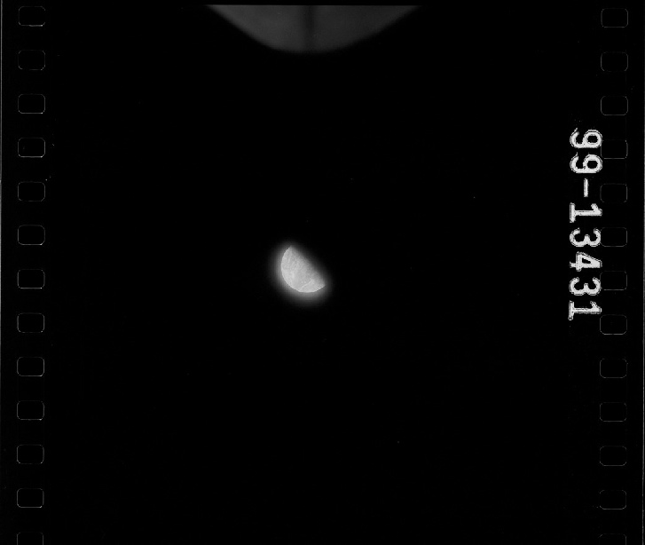
We also have another series of UV images that correspond with this colour photograph, with AS15-99-13431 a representative example (figure 4.7.2.7).
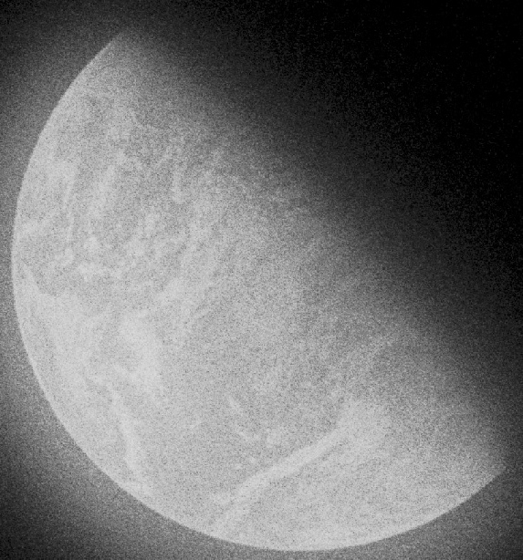
Figure 4.7.2.7: AS15-99-13431, with a close up of Earth from it.
A perfect match with the colour photo! The UV sequence is recorded in the AFJ as being at 33:00 GET, or 22:34, just after they had completed using the sextant for photography. As usual, everything ties in together perfectly.
The next photo of Earth occurs on day 3. Click the link below.