4.8.1 -
Once Apollo 16’s protective shroud was removed the crew wasted little time in checking out their cameras, taking several photographs in Earth Parking Orbit (EPO).
They started off with three taken over the Pacific ocean, shown in figure 4.8.1.1.
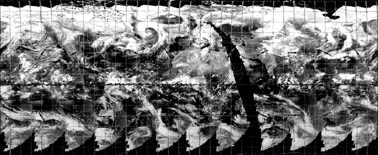
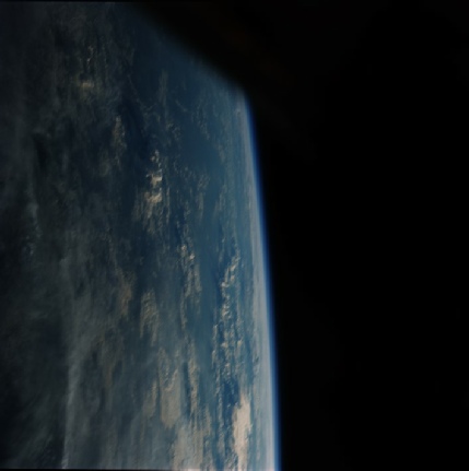
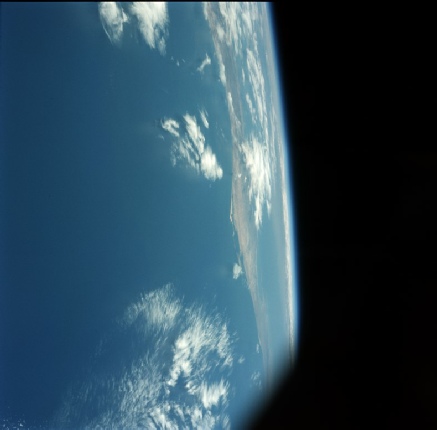
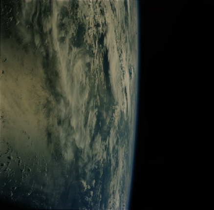
Figure 4.8.1.1: left to right -
The location and timing of the final image in this trio is easy enough, it’s Baja California around the San Carlos area. We can also be pretty precise as to when it was taken.
001:28:40 Young (onboard): [Garble] I wouldn't even think about it anymore. Okay, there's the coast of -
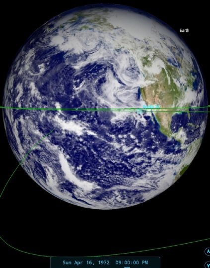
That time equates to around 19:23 GMT, and figure 4.8.1.2 shows us where that would put the craft in its EPO.
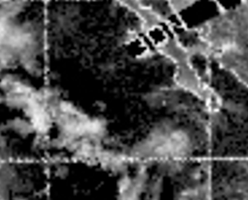
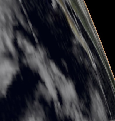
Figure 4.8.1.2: SkySafari depiction of the transcript time, ESSA satellite view from the 16th and a 3D reconstruction.
SkySafari shows us that the time of Young’s comment puts them in exactly the right spot, and while the satellite view isn’t really intended to go down that low, there’s nothing inconsistent about the view there either.
That leaves us with working out where the other two were taken. We get another clue in the transcript for 18857:
001:22:28 Young (onboard): That's 10,000 pictures of horizons and sunrises. I got a picture of the Moon out there [garble] coming up.
Moon you say? Well, buried in a small part of 18858 is just that (figure 4.8.1.3)

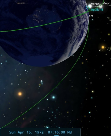
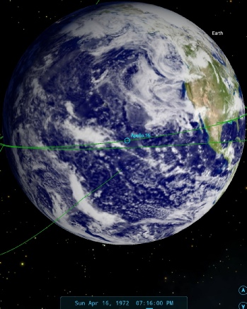
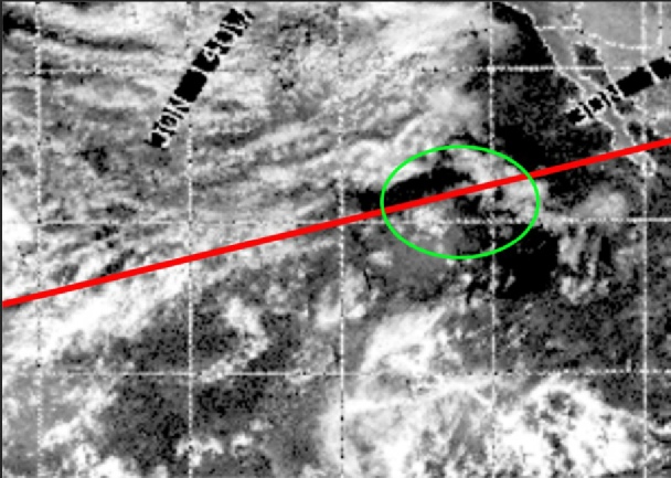
Figure 4.8.1.3: Top row -
The spacecraft position is much further west than when Baja’s coast is photographed, but because Young is looming Eastward he’s seeing much further. My opinion is that the storm cell he’s photographed is the one inside the green ellipse.
The location for the first in the sequence is more difficult, bu the length and orientation of the shadows suggests that Young is looking slightly more to the north and slightly earlier in the orbit (as opposed to ‘at the same time’). My view is that they were taken much earlier than is presented in the AFJ.
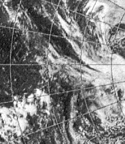
The next two photos show the ground as they pass over the Gulf of Mexico (figure 4.8.1.4).
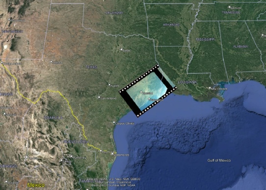
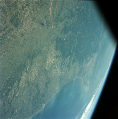
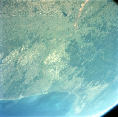
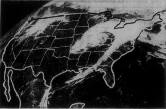
Figure 4.8.1.4: AS16-
The satellite photograph clearly shows the arm of a swirling storm system extending into the Gulf that is visible in the distance in the second photograph. The location of the photographs suggets a time of around 19:28, shortly before which Young says:
001:31:25 Young: Okay. You're 5 by. The coastline is under us. It's beautiful, and we're standing by for some words.
That storm system becomes much more prominent once they leave orbit. Shortly after these photographs were taken they start their second orbit, and the next section of photographs see them back over the Pacific. Individually the photographs aren’t helpful, but combined into photomontages they’re much more useful.
The first set of images consists of AS16-


Figure 4.8.1.5: Photomontage of AS16-
We’ll look to get more confirmation of this when we get out of orbit.
The next set consists of images AS16-
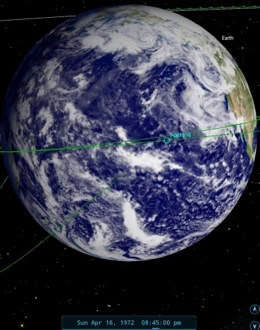
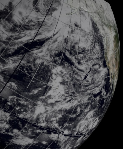
Figure 4.8.1.6: Photomontage of AS16-
It’s worth noting how small an area was covered by the first photograph of Baja California examined earlier!
While the view above is looking to the east, the next couple of photographs are taken looking towards the north. Figure 4.8.1.7 is a montage of two photographs, AS16-
Figure 4.8.1.7: Photomontage of AS16-

The land mass at the top of the second photograph is part of Mexico, and the two images can be merged into a single one, which is what we’ll do for the satellite comparison in figure 4.8.1.8.
The next images to be examined occur after TLI, and consist of two still photographs taken shortly before TV broadcast. The still images are shown in figure 4.8.1.8.
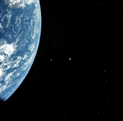
Figure 4.8.1.8: AS16-
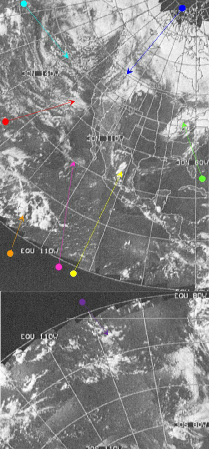
Figure 4.8.1.10: TV broadcast stills from youtube and photographs taken by a TV viewers during the broadcast (Source, source) and an image taken in Mission Control (source). SkySafari time depictions from the end of the TV broadcast. Arrow colours match those used in figure 4.8.1.9.
As for when they were taken, we have the advantage of a TV broadcast timed to coincide with the LM extraction process. Careful examination of the photographs above shows a considerable amount of debris, so they must have been taken shortly after separation from the SIV-
The TV broadcast started at 21:04, and at the end of the transmission we have the following:
003:25:26 Duke: Houston, before we turn the TV off, we gon -
Capcom confirm they are receiving the image
003:26:40 Fullerton: Very nice picture, Charlie. We can see Southwestern United States, Lower California. Very nice.
003:26:50 Duke: Good. Ken's doing all that good work for you. It's out his window.
003:27:10 Mattingly: Gordon, is that color okay for you?
003:27:13 Fullerton: Very nice, Ken. Beautiful color.
003:27:17 Mattingly: I bet it's good, but you just can't believe how beautiful it is. See the reds in the desert down there and the Southern United States and northern part of Mexico. And from here, you see the Great Lakes and the State of Florida out there. And it's just absolutely something. We're going to go back to work, but thought you'd enjoy that.
At 21:22 GMT, the TV pictures finished.
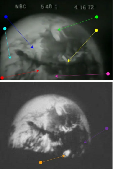
These TV images were used a short while later in a NBC news broadcast, available here.
Amusingly, the TV broadcaster's voice, commenting on the pictures says that:
“if my calculations are correct, the North Pole is to the right.. the Earth is tipped on its side”
He's correct about the Earth being viewed sideways on, but has got the location of the North Pole entirely wrong!
The time is clearly shown on the news broadcast as 5:48 on April 16th. The timestamp itself is actually added as part of the Vanderbilt Television News Archive, which recorded all news transmissions at the time, and did not feature in the actual broadcast. The broadcast time relates to the Central Daylight Time zone of the NBC nightly news broadcast, which started at 17:30 CDT.
The Vanderbilt archive has this link about the transmission. Interestingly, for all that Apollo deniers claim the missions were aimed at diverting interest from Vietnam, the war dominated the news program before the Apollo segment.
The shot was taken at the end of the Apollo TV transmission after docking, and the much reduced size of the Earth shows the speed at which they were travelling, and the news broadcast records that they are already 7000 miles out. The Apollo transmission ended at 21:22 GMT, or 16:22 EDT, with a second short 10 minute broadcast starting at 22:04 GMT (17:04 CDT), still in time for the TV news broadcast. While the label ‘Live from space’ is true in terms of it being broadcast from space, it is not strictly true for the news broadcast itself.
As for what is in the image, the most obvious feature is the large 'speech bubble' shape (green arrow) off the east coast of north America, and all of the other cloud features match perfectly between the TV, Apollo and satellite images. In terms of when the image was taken, we already have a definite match for the video screenshots, and therefore the Apollo image. Another interesting feature is that although the TV image was taken later, the ‘speech bubble is further from the edge of the globe. As the Earth can’t have gone backwards, the spacecraft must have changed its viewing perspective, as inidicated by the SkySafari depictions.
The ESSA track covering the east coast of the USA would have been orbit 4308 (track number 3), which started at 20:06. So, at the time of the Apollo images there was actually no satellite mosaic of the region photographed, and ESSA 9 could not, therefore, have been used as the basis for some sort of fake of the Apollo photograph. In order to demonstrate that ESSA 8, or ATS-
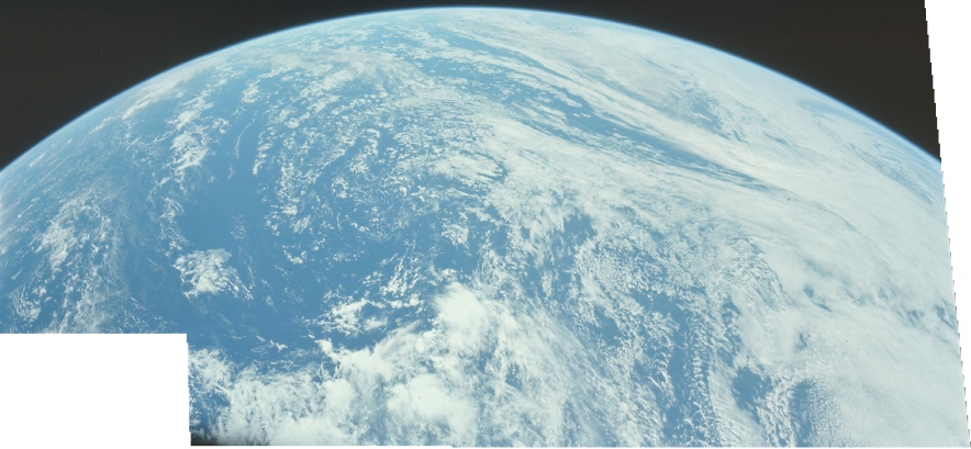
We next have a a shot showing just a small portion of the Earth (figure 4.8.1.11), which is shown for completeness.
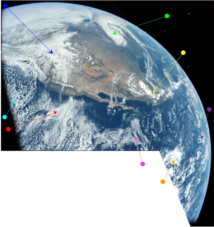
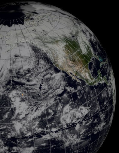

Figure 4.8.1.9: Photomontage of AS16-
Now that we’re further out some of the weather systems we could see at lower altitudes become easier to make out, but we can’t see them all yet. It should also be pretty
Looking closely at the two photographs it’s possible to make out lots of debris from the TV broadcast, which only turned its gaze Earthwards at 21:19, so a time of 21:00 seems reasonable here.
To get confirmation of that being reasonable, we now need to look at the TV broadcast, stills from which (from a variety of sources) are given in figure 4.8.1.10.
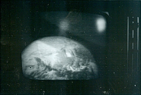
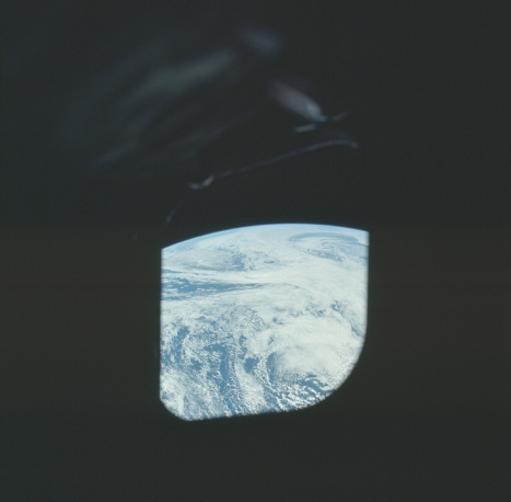
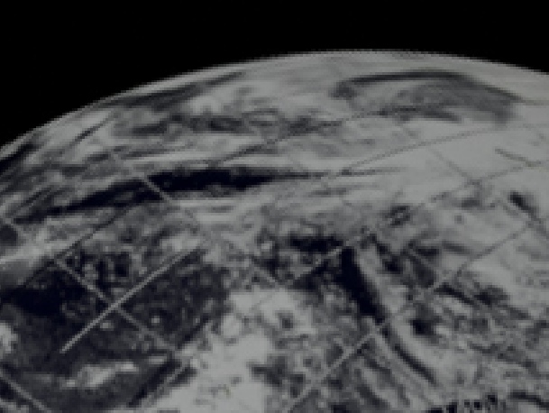
Figure 4.8.1.11: AS16-
The next set of three Earth images were obviously taken at the same time as the TV broadcast, as the orientation of the USA and the position of the large storm system has moved to match the live image (see figure 4.8.1.12).
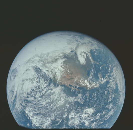
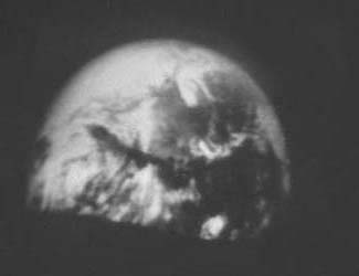
Figure 4.8.1.12: AS16-
The viewing angle is a perfect match, as is what’s on view. This particular photograph is the final one of a set of three, each one gradually showing more Earth, but they were obviously all taken at the same time. The also occur immediately after a dark shot showing the LM still encased inside the SIV-
The next photograph of Earth shows it as an entire globe, and appears after several photos of a now empty and distant SIV-
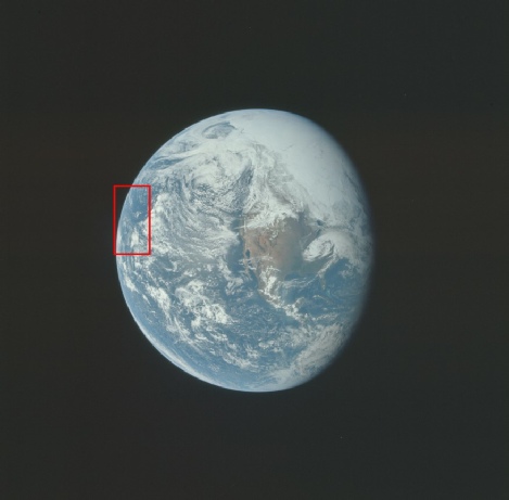
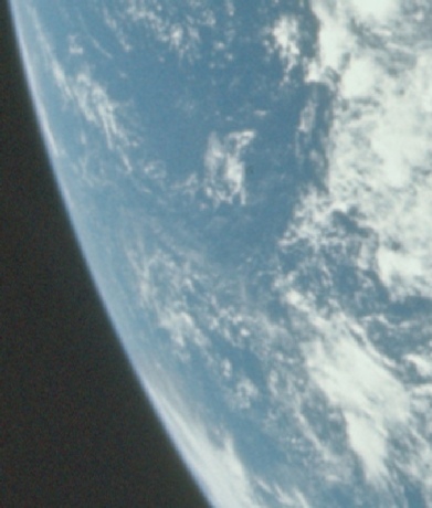
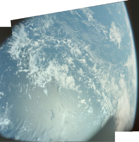
Figure 4.8.1.13: AS16-
The sharp eyed amongst you will have noticed that there I’ve added an extra bit of information, taking this opportunity to identify the location of the clouds photographed while still in Earth orbit. They are very obviously the same weather systems, but subtly different thanks to the passage of a few hours of time.
Speaking of weather systems, lets see how it compares with the satellite record -
It is unsurprising, given that the image was taken not long after the preceding Apollo photograph analysed, that the same broad weather patterns are visible. Even with the poor quality of the video screenshot, it is still possible to work out that the globe has rotated somewhat, as much more of the Pacific is visible, and the polar cloud mass has moved much further eastwards.
Also coming into view is a large hole in the Arctic cloud (yellow arrow), previously shown in figure 4.8.1.11. This feature is interesting because other conspiracy theorists suggest it shows the polar opening to a hollow earth, for example here and here. The tone of some of the articles makes it clear that they don't like using Apollo evidence, because they are forced to admit that the Apollo missions took place! It should be obvious that hole is at neither the magnetic nor geographic pole, and the sea can be seen, not a hole!
The ESSA timings have already been given in the previous image, and the timing of the East coast of the US part of the image would have been around 20:06. The terminator in the image is suggested to be at 22:15, just after the CSM had extracted the LM from the SIV-
004:16:59 Mattingly: Okay, Gordy, thank you. We got another spectacular view of the Earth down here. The polar ice cap. We can see the whole sphere, and the United States is absolutely spectacular.
004:17:22 Mattingly: In fact, you can see Lake Mead, Gordy; very clearly.
004:21:03 Young: Gordy, up off -
004:26:02 Mattingly: Gordy, the -
004:26:12 Fullerton: We're kind of getting the idea that you're impressed.
004:26:16 Young: Man, the thing about it, Gordy, is that the whole Southern United States, Mexico, and that -
004:26:32 Fullerton: Did you take some good pictures?
004:26:36 Young: Got some.
004:26:38 Mattingly: The way we're going, we may have to get a reload before we get to the Moon.
004:26:41 Young: As a matter of fact, you can see as far north as Lake Michigan and Lake Superior.
So, we have confirmation of their photography, and know that just before this conversation the crew had broadcast images of a departing SIV-
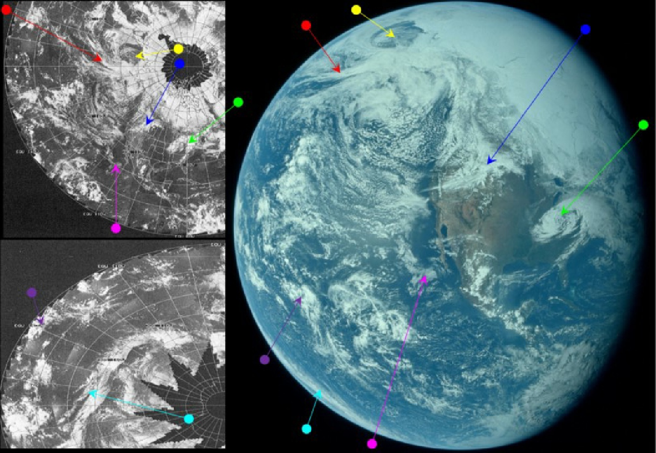
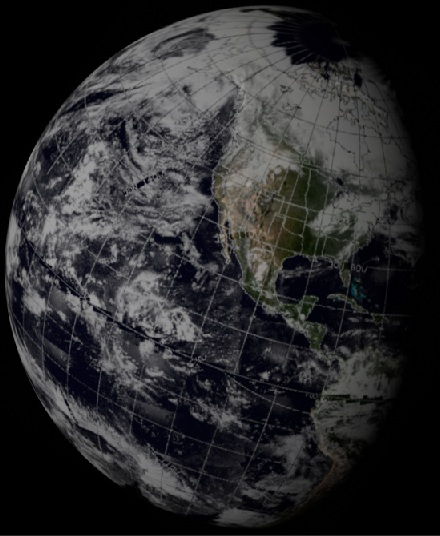

Figure 4.8.1.14: AS16-
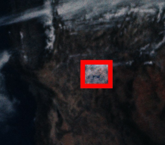
Figure 4.8.1.15: Lake Mead, as shown in the brightness adjusted area of AS16-
Just like every other astronaut observation from space -
That’s it for the 16th, click the link below to see the next day’s photographs.