4.8.2 -
Moving on a few hours we have the next image of Earth, and as with Apollo 15 this one looks to be a companion image to a sequence of UV photographs. Figure 4.8.2.1 shows the two full size images.
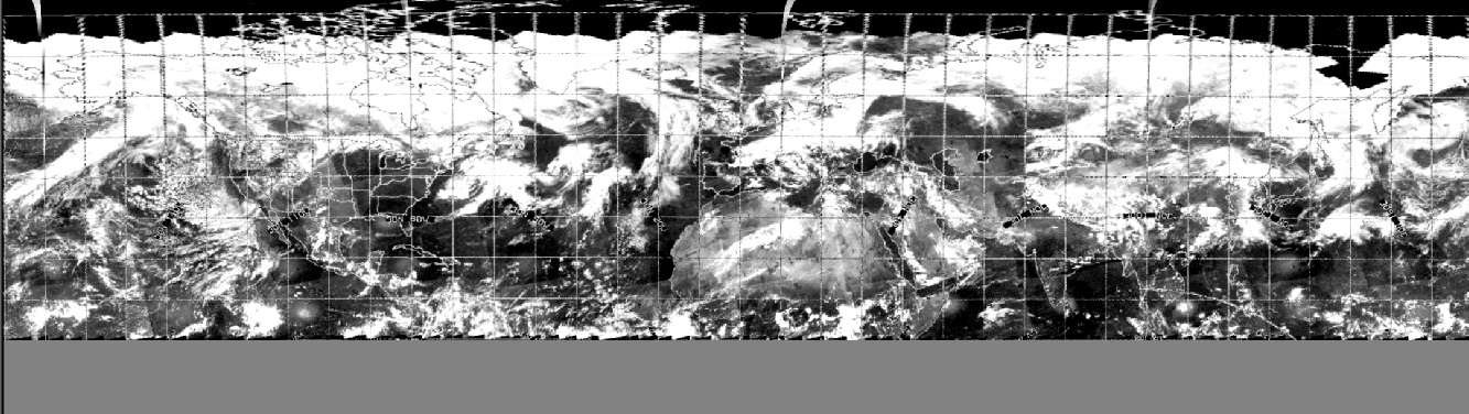
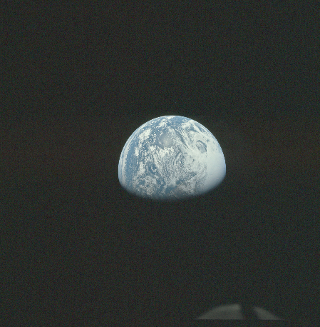
Figure 4.8.2.1: AS16-
The fact that there is a UV sequence, with the timing known, does help us a lot, but let’s have a look at the satellite comparison for more detail (figure 4.8.2.2)
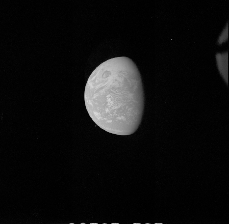
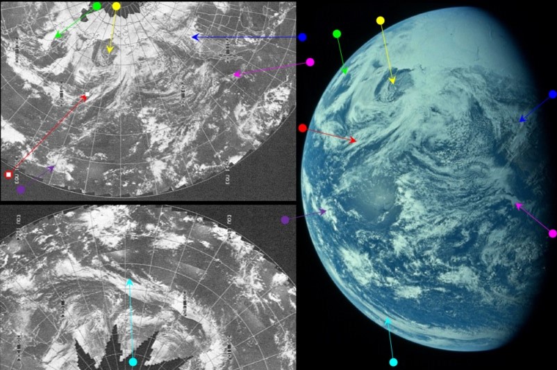
The Apollo image shows that the Earth has rotated by some distance since the previous photograph, with more of the Pacific visible, and more than half of the northern USA now in darkness. Australia is about to come into view, and the long band of cloud extending from the Arctic towards it is now more prominent, thanks to a change in viewpoint. The entrance to Earth's hollow interior [sic] is also much more in focus, and it should be even more obvious that it is just a gap in the clouds, with other, lower altitude clouds inside it. We can even demonstrate that it’s a dynamic system, changing over even just the few hours covering a small number of Apollo images. Figure 4.8.2.3 shows the development of the storm over time.
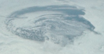
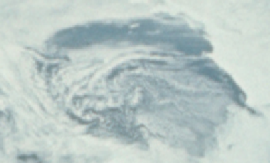
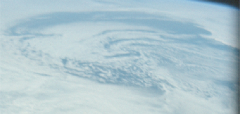
Figure 4.8.2.3: Close ups of Alaskan storm in AS16-
There is a relatively short gap between 18876 and 18885 (about 45 minutes) so there is very little difference between them (though they can be detected on close examination). The 3 hours or so between 18885 and 18887 produces a much more obvious change.
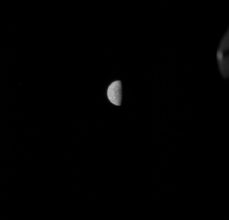
Returning to the analysis, the terminator position gives an estimated time of about 01:15 on the 17th of April, as determined by its location through California and Mexico. ESSA's orbits mean that track 4 would be closest to the terminator visible here, which equates to orbit number 4309, which was commenced at 23:01.
The Preliminary Science Report confirms the time of the photograph as being circa 8 hours in to the mission (page 17-
The satellite images show the same weather patterns in the UV image as the visible spectrum one, so the conclusion that they were taken at roughly the same time seems entirely reasonable. At 6 hours 40 minutes, the crew get a reminder about settings for the UV camera, and at 07:19 hours in they discuss a checklist they will attend to after the photographs. Five minutes later they appear to discuss that checklist, so everything ties in there.
Next up we have three images that are all very similar, but where close analysis demonstrates that at least one of them was taken slightly later than the other. The images are shown in figure 4.8.2.4.
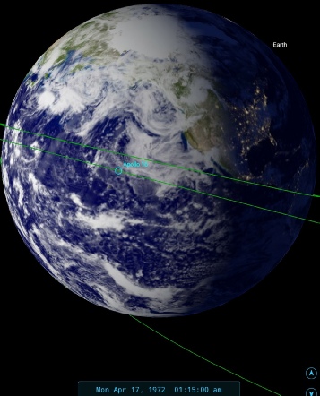
Figure 4.8.2.4: AS16-
The Earth has shrunk considerably (though as will be seen below, this isn’t always a product of increasing distance), and once the image is zoomed in there is again evidence of a rotating globe, not a static image in repeated use. Australia is now in full view, and south east Asia is visible beneath the clouds. The ‘entrance to inner Earth’ has now almost disappeared from view completely. Figure 4.8.2.5 examines the weather patterns visible in ESSA's mosaic in comparison with the first of the photographs shown above.
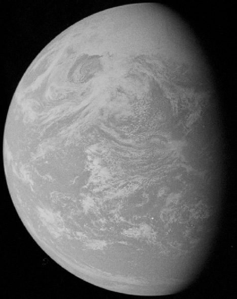
Figure 4.8.2.2: AS16-
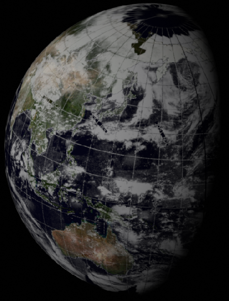
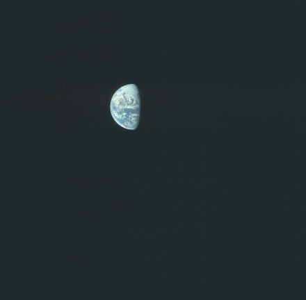
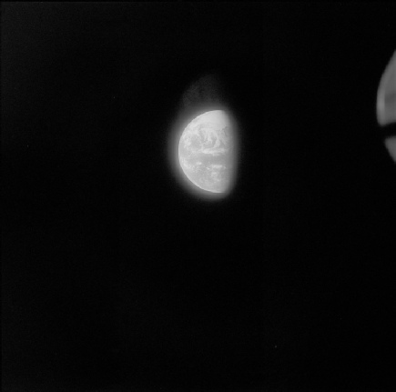
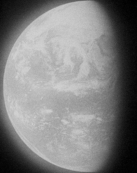
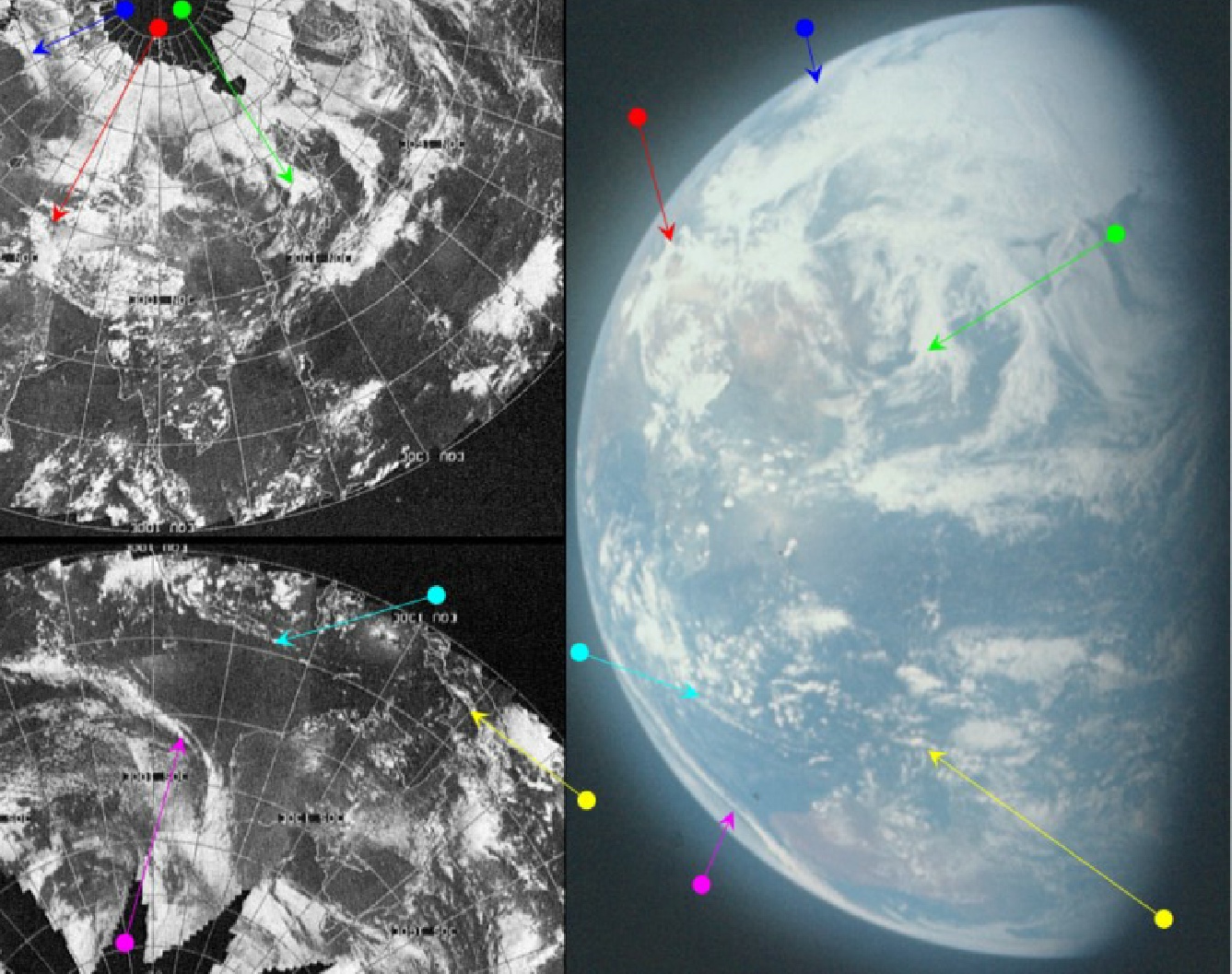
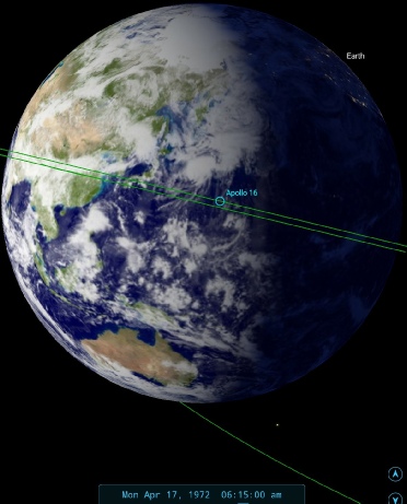
Figure 4.8.2.5: AS16-
I’ve included the UV image in this the above comparison, and with good reason -
012:22:13 Peterson: 16, when you finish the UV photos, we'd like you to go on and start the PTC right away, if you concur with it.
The position of the terminator close to Australia also suggests a time somewhere around 06:15.
What about the second colour photograph? Comparison of the terminator position shows that some of the weather patterns have moved into darkness, and we can also use India as a guide (figure 4.8.2.6).
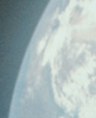
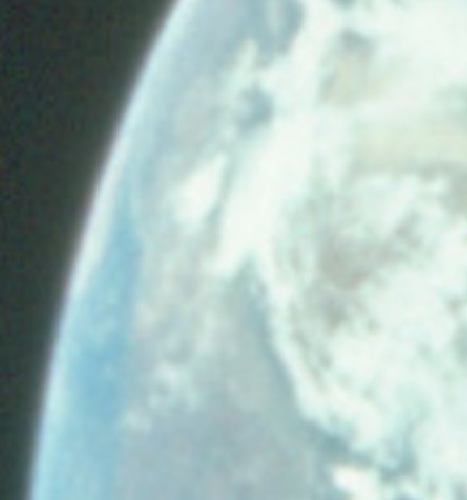
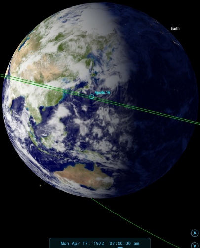
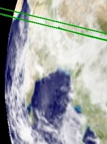
Figure 4.8.2.7: Comparison of the same area of AS16-
SkySafari allows is to make an estimate of around 07:00 GMT for the time of the second photograph, or 13:06 GET. We do have this in the transcript:
013:11:03 Mattingly: You would really love this sight. We're -
…
013:11:36 Young: You can see all of Australia, too. It's really something else.
As usual, the crew observations are entirely consistent with what we see in the photographs. Contrary to Mattingley’s comment, the photograph describes it perfectly.
Hopefully it’s obvious from the above that the position of India, or at least the weather systems above it, is more consistent with the first of the colour photographs. The more observant reader will also have spotted the same hardware in the UV and colour photographs not evident in the second colour image -
On that subject, one hoaxnut believes he has identified a discrepancy in the two Apollo colour images above, believing that the change in size between the two photos (AS16-
The photography index identifies all the colour photos in this sequence as taken with the 105mm. The process (as described in the Preliminary Science Report) involved using one camera with the 105mm UV lens, then swapping between colour and UV sensitive film magazines. The logical conclusion here is that the colour magazine was used on a different camera between UV sessions to take AS16-
Many contributors to Dave’s video have correctly identified that the looping elliptical orbit of the Apollo craft on its way to the moon will have changed the appearance of Earth, affecting the Aulis article’s estimate of 45 minutes (oddly similar to my rough and rounded up estimation!). They’re correct, but I believe my estimation based on movement of clouds towards the terminator of 8 to 10 degrees of longitude suggests that actual time gap is very close to that calculated by Dave McKeegan of 35 minutes. The use of different lenses and film also puts to the sword claims that a remote camera took the photographs -
We’ve already shown the change in weather features over time in figure 4.8.2.3, but it’s worth having another look in light of comments made on Dave’s video by one contributor:
“those cloud formations in both photos look exactly the same. Unfortunately, I am addicted to storm chasing and watch weather radars anytime there is a tornado outbreak as I'm doing right now so yes, I can agree with what you are saying about cloud formations changing slowly but they do change, some clouds grow larger while others disappear. If you can look at those two photos and see a notable difference in the cloud formations as well as where they are located over the land, please point it out”
Point them out? Sure thing -
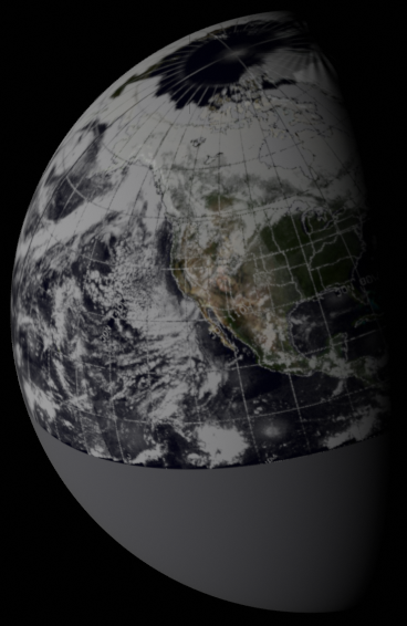
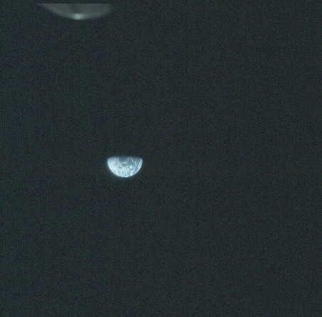
Figure 4.8.2.10: AS16-
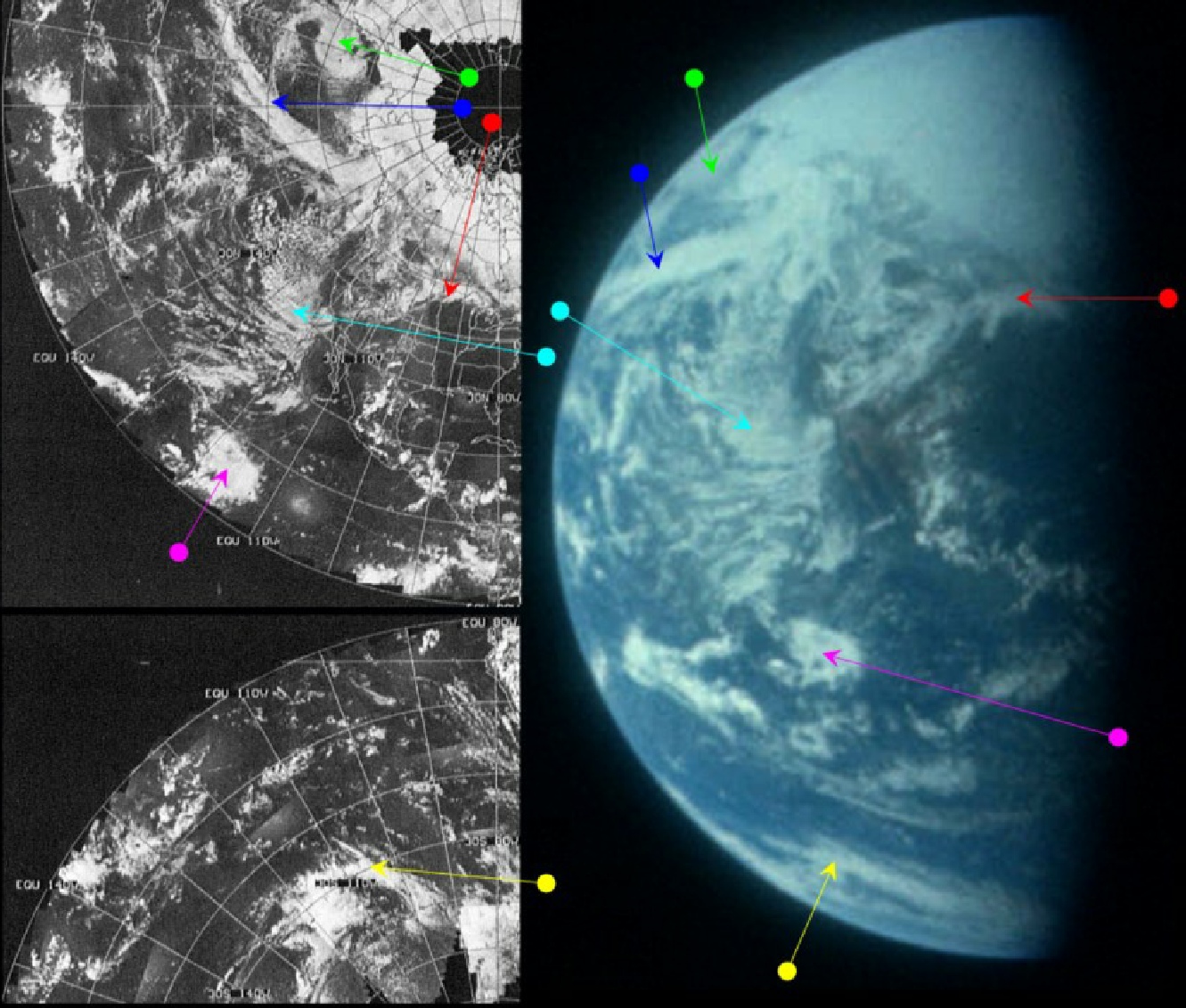
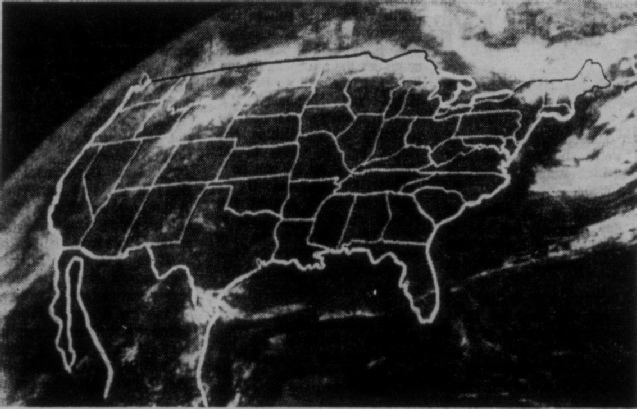
Figure 4.8.2.11: AS16-
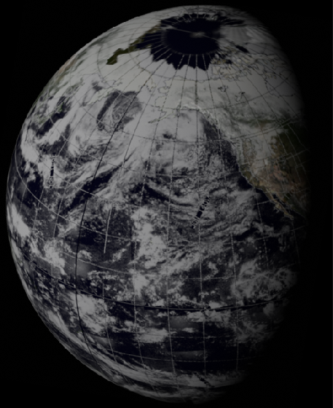
As north America is now visible on the image, it is obviously a photograph taken much later than the previous one, and the terminator estimate puts the time at around 23:15. The weather patterns are a clear and obvious match for those on the ESSA image dated the 17th. ESSA's most representative orbit for this area is orbit number 4320 (track 3), commenced at 19:09 on the 17th. Even with only half the digitally restored data to play with the match is excellent. The 3D reconstruction is missing the southern hemisphere, but the original records do still exist in the published volume.
The entrance to inner earth (green arrow) has now completely broken up, showing once and for all that it was never anything other than a weather system, and the clouds that made up its eastern wall has moved onwards to become a clearly defined weather front (blue arrow).
A couple of hours before this photograph was taken at about 20:30 on the 17th, there is a conversation between Capcom and Apollo, where the command module pilot says:
026:35:08 Duke: I think one of the most impressive sights, Tony, is the cloud formations you can see and the polar icecap.
and then the lunar module pilot says that:
026:35:33 Duke: There was that awful big storm up off the coast of Alaska in the Bering Sea, I guess it was yesterday. I can't see that now, though. I think you all are in the dark.
026:35:54 England: I guess our weather chart doesn't go up that high. I was going to see what we've got there now, but it only includes your recovery areas.
The storm to which he refers is the one forming the 'entrance to the hollow Earth' jokingly referred to here. Interestingly, Capcom report that their weather charts don't extend that far, as they only cover the landing area for splashdown. Obviously they don’t have a weather satellite image that shows them what is being described.
We also have confirmation that the UV images are about to be taken:
029:11:41 Mattingly: Okay, we're exiting PTC and going to the far-
At the time the image was actually taken, we have the following exchange:
029:22:48 Peterson: And, Charlie, you're right over the Gulf of Mexico.
…
029:23:08 Duke: What did you say about the Gulf, Pete?
029:23:11 Peterson: Yeah, you should be right directly over the Gulf of Mexico. [Long pause.]
029:23:28 Duke: Yeah, I was thinking the same thing -
So while earlier they couldn’t see the weather system that has now emerged back into view, they now confirm they are over the Gulf of Mexico, which is exactly where they should be.
That’s it for the 17th. Click the link below for the 18th.
The next in the sequence of Apollo images is AS16-
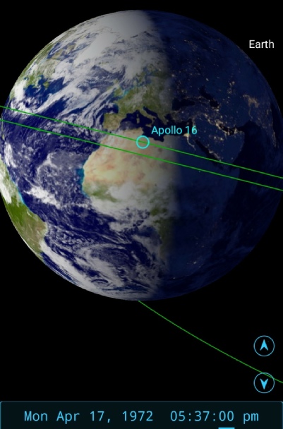
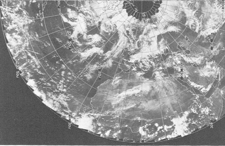
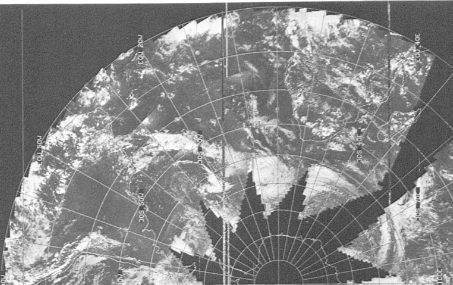
Figure 4.8.2.9: The view estimated in Skysafari at the time of Young’s comment, and ESSA satellite image.
The differences are subtle (as you’d expect at this scale), but definitely there. A notable one is the area inside the green box, where the clouds start to have a pronounced shadow when they are nearer the terminator.
Meanwhile, back in the CSM. there’s a brief discussion of the view homewards at 23:42 GET, or around 17:37 GMT:
023:42:54 Young: Okay. We can see the Earth out there, and it's getting a good deal smaller. It's about the same size as the Moon almost, out the other window. And Africa is clear this morning -
And a little while later:
023:45:17 Young: From our point of view, you only got a little more than half Earth.
Figure 4.8.2.9 shows that he’s absolutely correct.
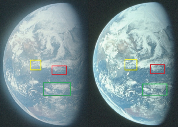
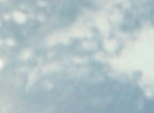

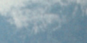

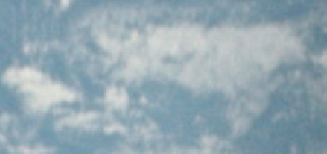
Figure 4.8.2.8: AS16-
