4.8.3 - Apollo 16 Day 3 - TLC continued
We have quite a gap now before the next photograph of Earth as the crew have a rest period after checking out the lunar module.
That’s not to say that they weren’t still looking homewards. At around 18:05 on the 18th we have the following:
048:00:32 Duke: Okay, Pete. We got you - Finally had time to look out the window and you're just coming into view again and just as pretty as ever.
048:00:43 Peterson: Very nice. What you looking at right now?
048:00:53 Peterson: Can you tell what part of the Earth?
048:00:54 Duke: We've got a half-Earth. Say again?
048:00:58 Peterson: Can you yell what part of the Earth you're looking at?
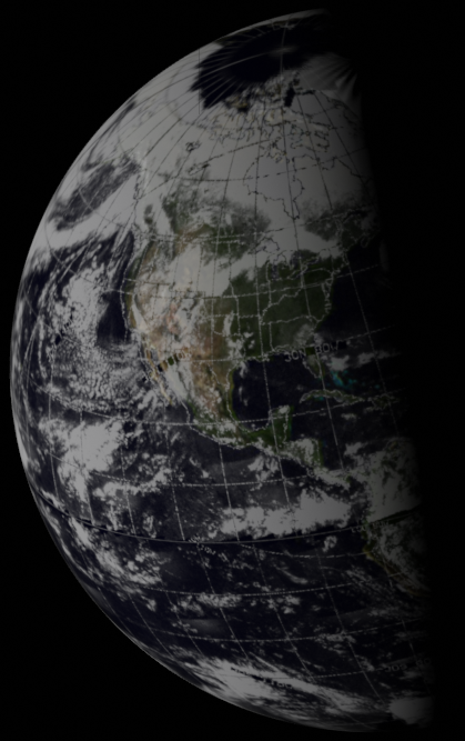
048:01:03 Duke: Well, we got half-Earth, and we see a land mass - see the North Pole - the north polar cap with two big swirls coming out off of it to the southwest. I can see the subsolar point very distinctly. It's a big white dot in the center towards the LM, away from the terminator. And there's a big land mass that's visible in the center. And - can't really make out exactly what it is. It's clear of clouds, though. It's the only place that's fairly clear.
048:01:44 Peterson: Okay, we show you directly over North Africa. And that's just about the terminator.
048:02:00 Duke: Okay, you got North Africa at the terminator?
048:02:04 Peterson: Just about.
048:02:06 Duke: Okay, that's what it is, then, looking at it, yeah. It's - it's Africa. Looks like a good storm system up in the Atlantic Ocean and above the subsolar point.
048:02:18 Peterson: Roger.
048:02:45 Duke: The blue coloring - the white of the clouds and the blue of the ocean, Dick. Things just stayed pretty constant as we move out - still really a spectacular sight.
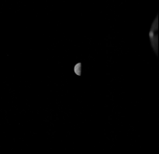
We may not have a photo, but we do have a satellite image we can look at, so we can at least see if his description matches what should be visible - see figure 4.8.3.1
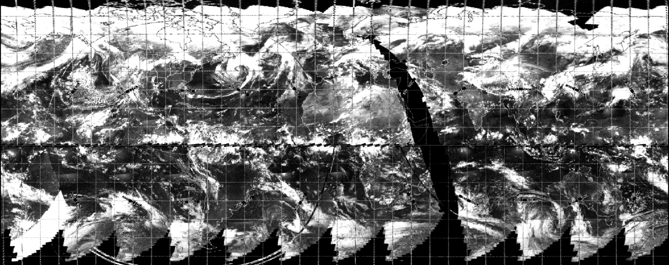
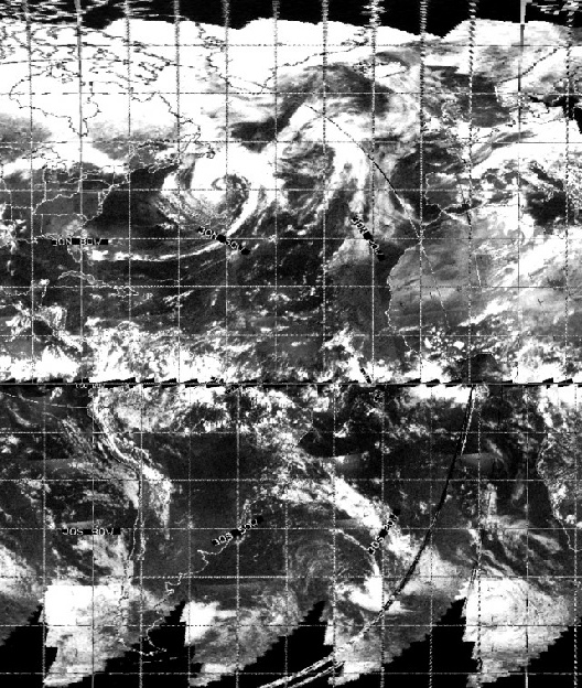
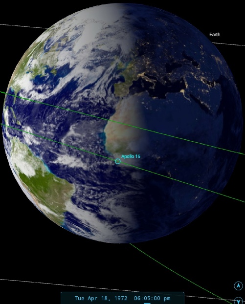
Figure 4.8.3.1: SkySafari depiction of Earth at the time of the comments recorded above and ESSA image from the 18th.
The view is indeed of a half Earth, and the north pole is definitely visible.The big swirls are the two large prongs extending to the west of Europe, and the Atlantic weather system is west of that. The big central landmass is Saharan Africa, a fact confirmed by their capcom, and it is indeed clear of clouds.
We also get some indirect evidence that they crew are looking at Spain from an interruption by a Spanish telephone engineer at 49:25:10, who had managed to patch in to the ground circuits by mistake - see this news report! Spain would definitely have been in shot at the time.
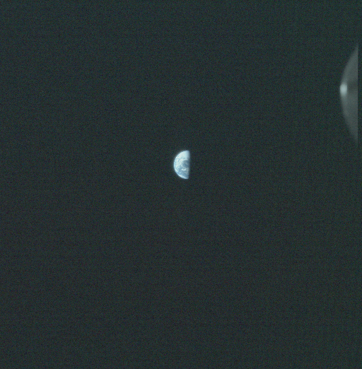
A few hours after this was taken we have another set of UV images and the usual companion Earth image - see figure 4.8.3.2.
We get a rough idea of the time of the UV photographs as the crew stop their barbecue roll and get ready to start photography:
052:08:21 Mattingly: And, if you're ready, Houston, we'll go ahead and stop PTC and go over to the UV attitude.
Then later:
052:31:41 Young: Let's get our UV. Give us a rough on that time and I'll come back with you.
A time that equates to 22:23 GMT. Let’s see how the satellite evidence matches up in figure 4.8.3.3
This image of Earth is only slightly more rotated than the previous one in the magazine, but the weather patterns are very obviously different and the Earth is much smaller in the image. That increasing distance from home has obviously had an impact on the clarity of the UV image, but it is still recognisably showing weather systems that match the colour photograph and the satellite record.
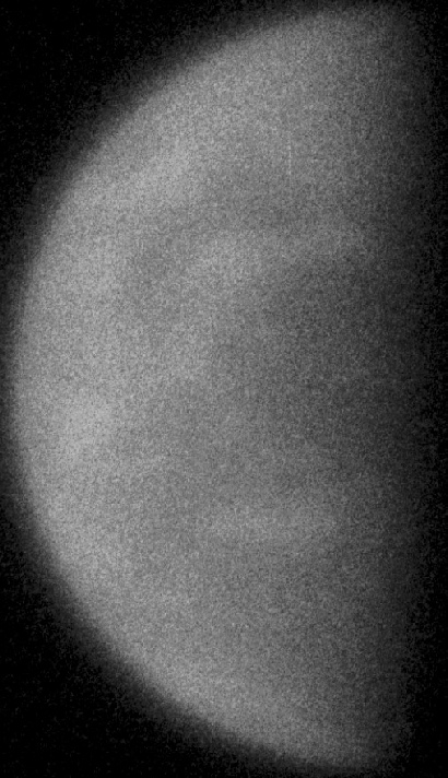
It’s also worth pointing out here that the crew seem to have forgotten to replace the 105mm UV lens when taking the colour photo - the small arc of circle in the upper right appears on all the UV photos. Dave McKeegan has some excellent analysis on this photo here.
There are two possible explanations: either NASA got sloppy and forgot to consult their continuity people before using this one, or it is just over 24 hours since the preceding image was taken.
We also have some discussion of the view in the transcript:
052:37:56 Young: Okay. On your plat board, Pete, what do you show over now?
052:38:02 Peterson: Just about over Florida. Kind of down over the tip of ...
…
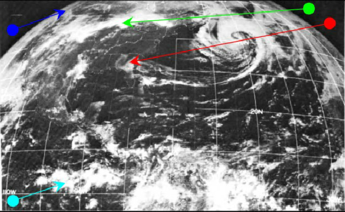
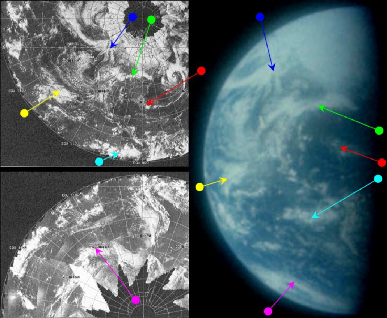
052:42:57 Duke: Houston, with the binocs out looking at the Earth, we can see Florida and the - the real blue water around the Bahamas. On around the Gulf of Mexico, looks like you might have some clouds near Houston and on down in New Mexico and the Great Lakes up in the North, where there's lots of clouds on up north of that.
052:43:20 Peterson: Roger. It is overcast here, Charlie.
052:43:22 Duke: [Garble] and up in the polar icecap, there is a big broken line; it looks like a river or something running down off to the southwest. Wonder what that feature might be?
052:43:43 Peterson: Does it look like - Is it a feature on the ground or a feature in the clouds?
052:43:55 Duke: I - I thought the whole thing was just snow and ice up there; maybe it is the clouds up in - it looked like to me it's - it's just up at the North Pole in the icecap area.
052:44:08 Peterson: Roger; understand. I don't ...
052:44:10 Duke: And it's been there since we laun - it's been there ever since we launched.
052:44:15 Peterson: Roger.
052:44:17 Duke: What it appeared to me to be was some places thawed out up there, but - and I was looking at water, but that might be the clouds actually.
052:44:26 Peterson: Okay. Tony is sitting here. I'll see if he knows anything about it.
052:44:36 Duke: Okay, and that storm system that was out west of Alaska or thereabouts appears to be still there.
The line running from the polar ice cap is the system identified by the green arrow, while the blue arrow picks out the Alaskan storm that is still persisting.
The satellite images act to confirm that the image is actually taken 24 hours later than the previous one in the magazine, although the act that more of south America is visible is also a clue - the Earth can’t rotate backwards!
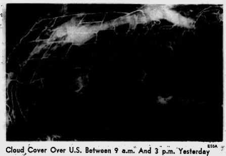
The ATS-3 image was featured in the MWL as part of their summary of the month's weather, and is part of a discussion of the large storm close to northern Europe. The tail end of this storm is picked out in red on the photographs. The ATS-3 image was taken at 17:05 on the 18th. On the 17th, this storm can be seen in ESSA images in a different place, and is not as cohesive as in this photograph.
The ESSA track best matching the terminator area is number 3, which corresponds to orbit number 4333 commenced at 20:08.
All of the weather systems are different to the previous day’s photographs, and they will be different again the following day, as you’ll see by clicking the link below.
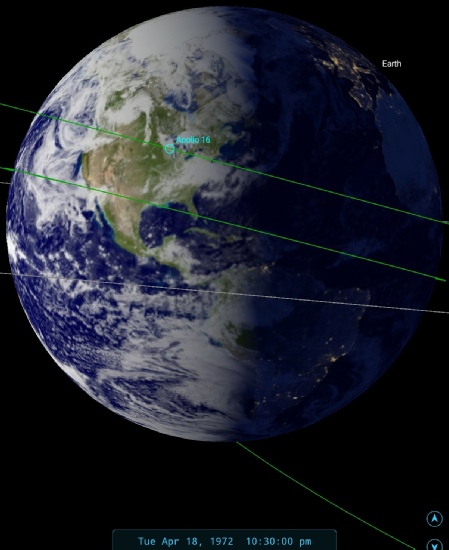
Figure 4.8.3.3: AS16-118-18891 compared with ESSA satellite imagery. Also shown is the ESSA image from the 18th printed in the Sarasota Herald Tribune on the 19th, an ATS-3 image, 3D reconstruction using ESSA data, close-up of the UV image and SkySafari depiction of the time. Bottom right is the same satellite image used in the Herald-Tribune from the St Petersburg Times.