4.8.12 - Apollo 16 Day 12 - UV photography and splashdown
The final view of Earth comes from the last session of UV photography, this time taken on the way home and in fact almost there. The session occurred at 16:44 on April 27th, and figure 4.8.12.1 shows where Apollo 16 was at that time, together with a Fourmilab projection of the Earth’s sunlit area.


Figure 4.8.12.1: SkySafari time depiction and fourmilab view of Earth at the time of the last UV photography session.
The models above indicate that the terminator is running down the centre of Africa, and only a thin sliver of daylight would have been visible. Here’s the crew commendinbg the session:
262:51:06 Mattingly: Houston, we've got the UV camera all set up. And it looks like we're pointing at the Earth. How about if we go ahead and take this - UV sequence now, instead of waiting until 55.
Shortly after the photography, Young confirms what they could see:
263:15:46 Young: Hank, we got the Earth out of Window 5. It's a very thin crescent and the subsolar point is - spectacularly bright.
Figure 4.8.12.2 shows the view of Earth taken by Apollo during that session together with satellite views.

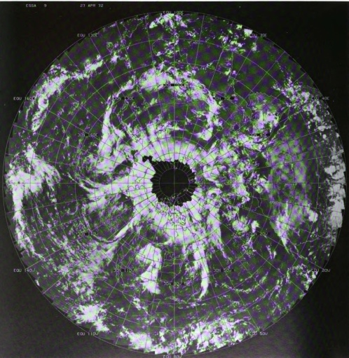
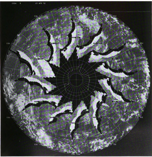
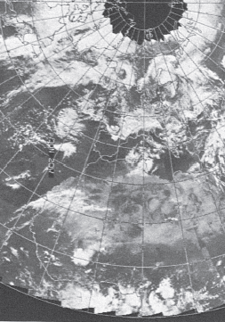
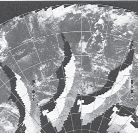
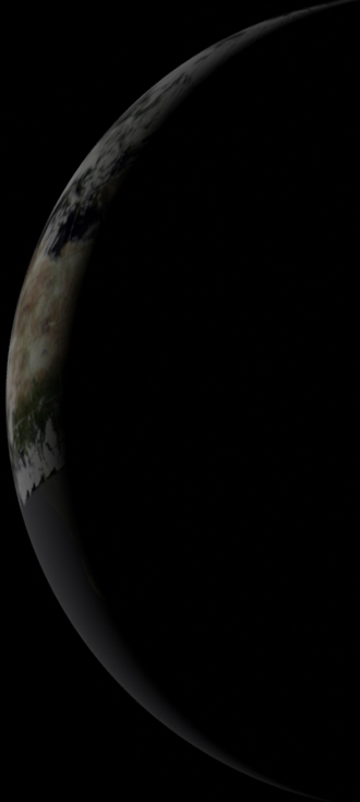
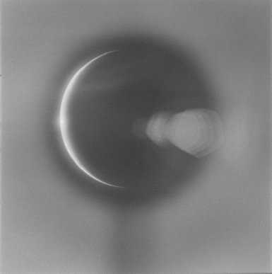
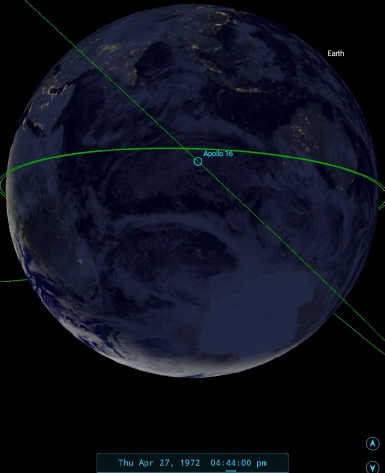
Figure 4.8.12.2: AS16-131-20182 compared with ESSA satellite data, 3D reconstruction, and SkySafari time depiction
As the Apollo image shows what appears to be a bright cloudy area in the centre line of the image, it’s tempting to interpret this is the ITCZ line along the equator. The bright sub-solar point reported by Young could well be light reflecting back off those clouds.
The UV images are therefore consistent with both the colour photographs that were evidently taken at the same time, and with the ESSA satellite images taken on Earth some time later.
As with other Apollo missions, we have one final element to the story that we can examine: views of Earth taken during re-entry, as visible on the 16mm magazine GG, available here.
The reference book Apollo by the numbers gives the re-entry location as -162.13, -19.87, with the eventual splashdown occurring at -156.22, -0.7, and we can see where that puts the returning CM using SkySafari (figure 4.8.12.3.
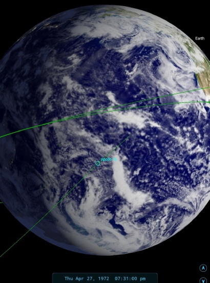
Figure 4.8.12.3: SkySafari depiction of the re-entry corridor.
The re-entry process is recorded as starting at 19:31 GMT on the 27th, which puts the nearest available satellite image as one commenced on the 27th, but with the relevant pass (number 6) starting at around 01:00 on the 28th. Figure 4.8.12.4 shows the ESSA image concerned.
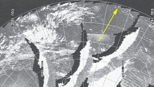
Figure 4.8.12.4: ESSA satellite image dated 27/04/72 with the re-entry trajectory superimposed.
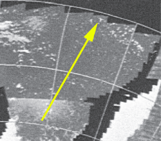
Figure 4.8.12.5 shows selected screenshots from the re-entry sequence.
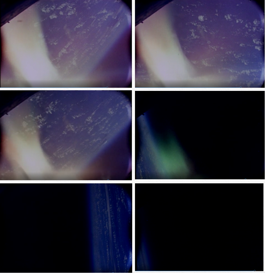
As with other Earth re-entry footage, there isn’t much in the way of wider context views to be absolutely certain, but what we again have is a view that is not at all inconsistent with the satellite view, despite the 5 hour time gap.
The final section will deal with any available synoptic charts and compare those with the Apollo photographs.
Figure 4.8.12.5: Selected re-entry screenshots.