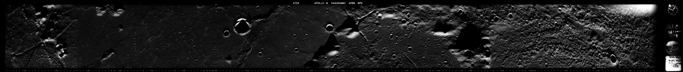
Apollo Panoramic Cameras
After briefly discussing Apollo Panoramic images here and here when discussing features observed on the lunar surface and the length of lunar shadows, I decided that this needed looking at in more detail and to give a little more information on the camera. As it turned out many of the photographs discussed below had already been identified by contributors to the Apollo Lunar Surface Journal, but not using the highest quality scans now available.
Much of the information for this comes from this page, and it is worth pointing out that articles from the Photogrammetic Engineering journal are available online here, such as these articles here and here. It’s worth pointing that out because it shows that the information about the cameras, and also some of the results from them, were publicly available. The book ‘Apollo over the moon’ also contains information about the camera, and I own an original copy -
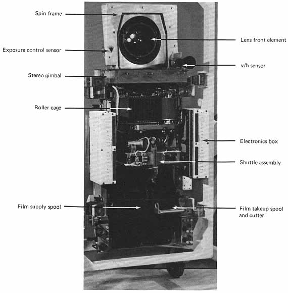
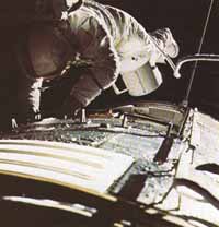
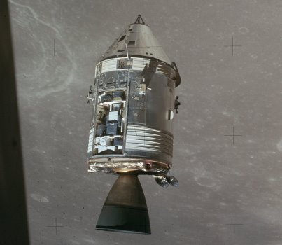
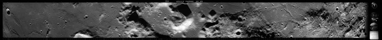
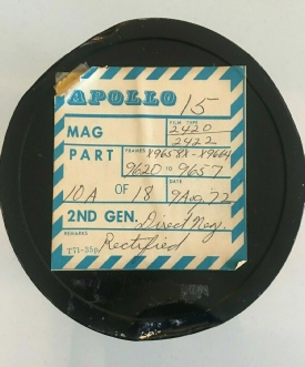
The Apollo Panoramic Camera (APC), a direct descendant of spy satellites used in the cold war, was made by Itek and mounted in the Scientific Instrumentation Module of Apollos 15, 16 and 17. The film magazines were collected in an EVA performed by the Command Module Pilot once the crew were heading back to Earth.
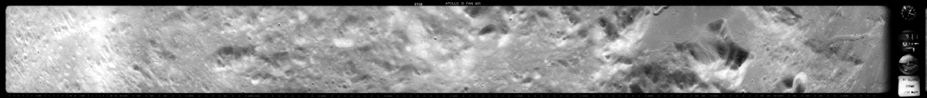
For the purposes of this analysis, I will be using photographs downloaded from this website. The Apollo Image Atlas also has a complete list of images, but in a much lower resolution format. The central portion of each image has been scanned as a PNG file, and also a large TIF image divided into 8 1.9 Gb tiles. I will use these large tiles covering the area of interest. I’ll use the low resolution files to give the overall picture, and the 2Gb tile for the detail. I will do whatever sharpening and level adjustment I deem necessary to show the images in their best light. Anyone who has a problem with that can, frankly, do one. The images are there, do your own analysis if you think I’ve made anything up.
So, let’s have a look at what we can find in these orbital photos. Ideally it would have been nice to see shots of every mission from Apollo, but sadly the surface coverage does fall short of Apollo 11 and 12’s landing site.
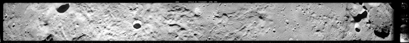
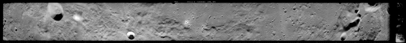
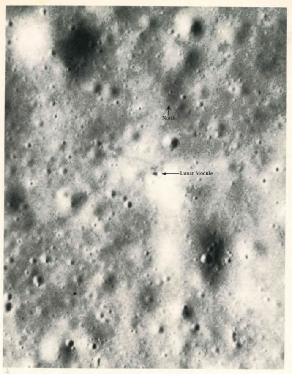
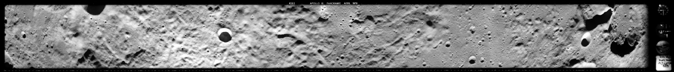
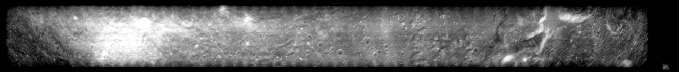
Apollo 14’s landing site at Fra Mauro was covered -
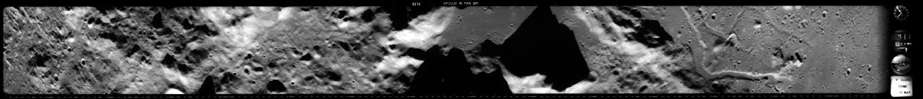
The picture is oriented with the north at the right hand edge, and the tile covering that part of the image is shown here with the approximate area of the landing zone highlighted in red.
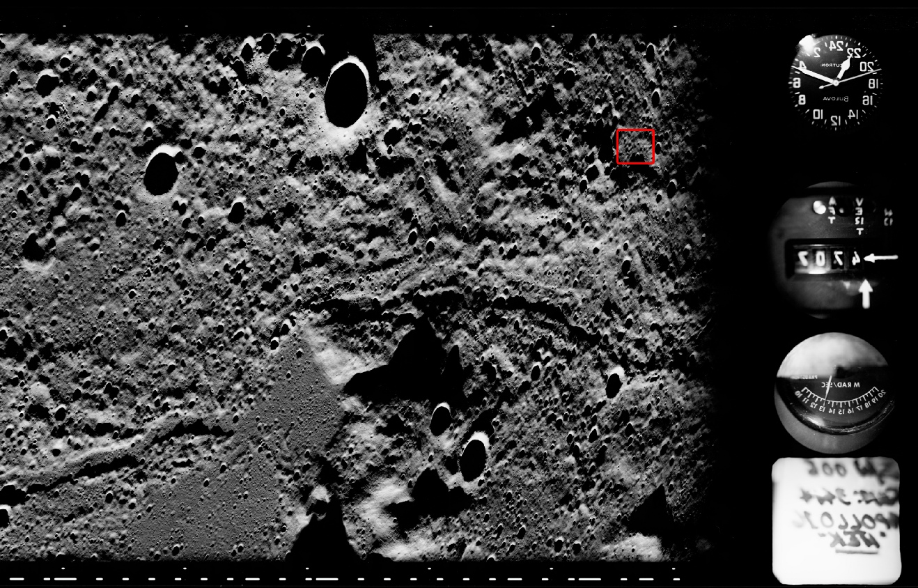
It’s worth pointing out that while the centre of the image is viewed from above, the distances involved mean that the far right and left hand sides of the image are viewed obliquely as the moon’s curvature comes into effect.
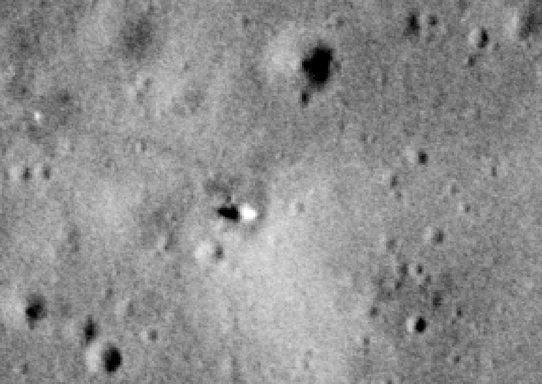
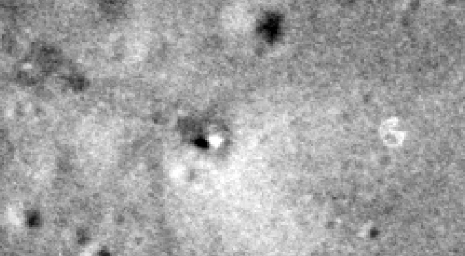
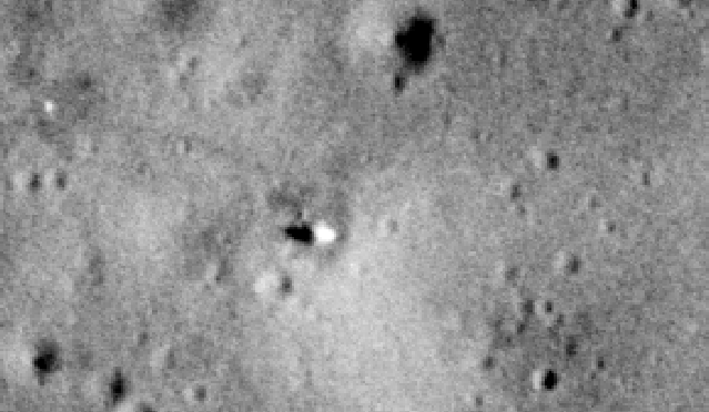
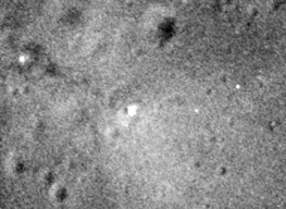
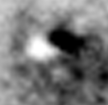
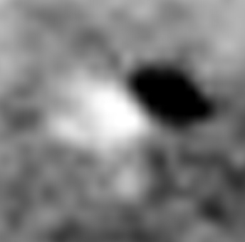
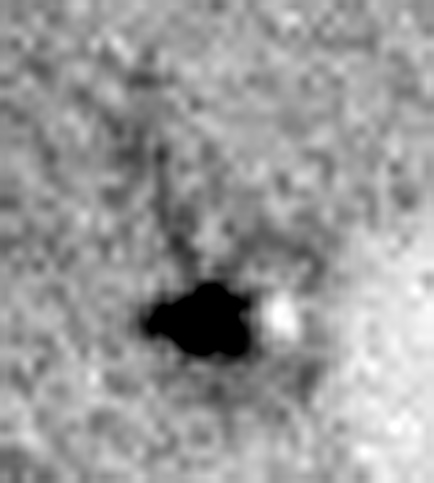
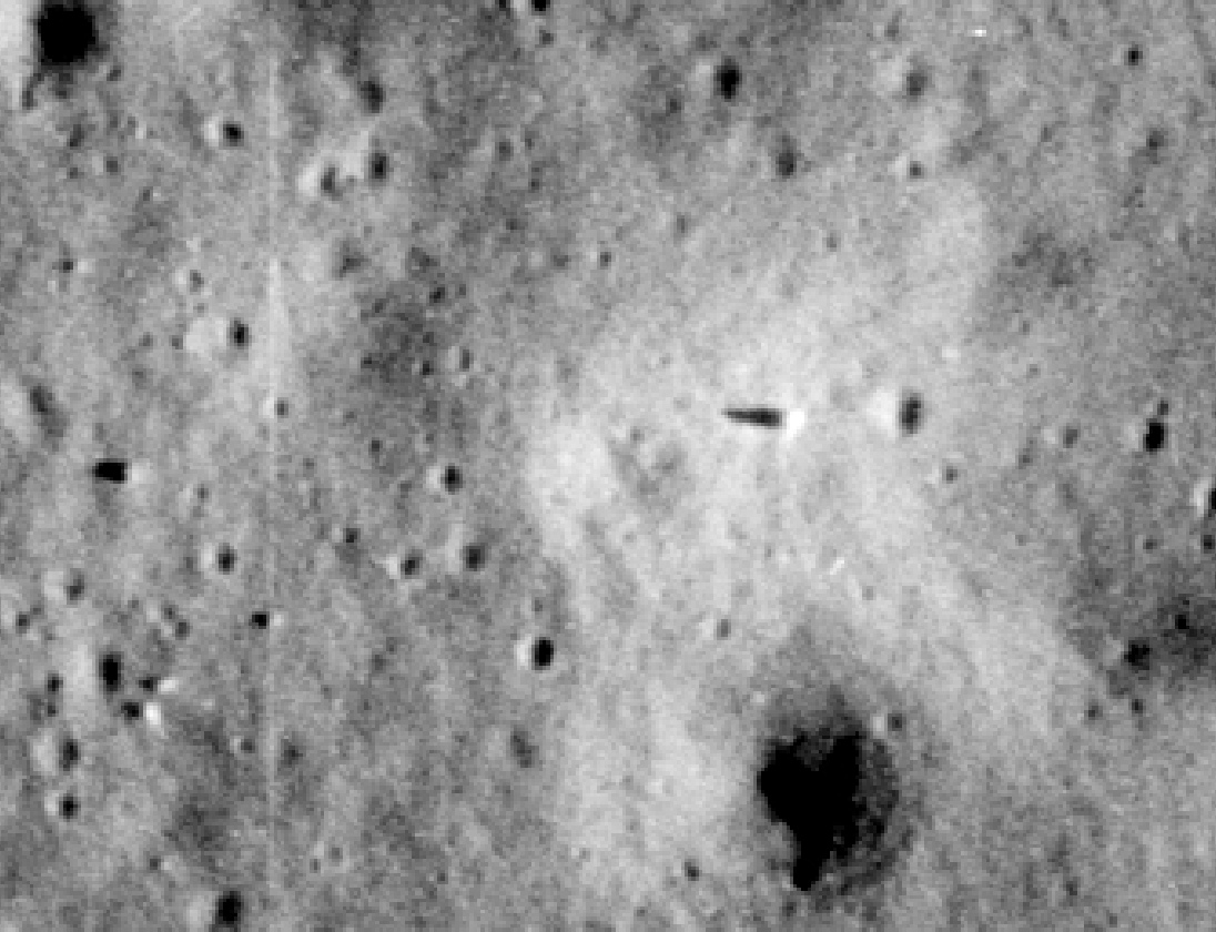
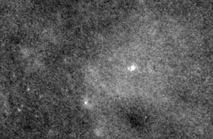
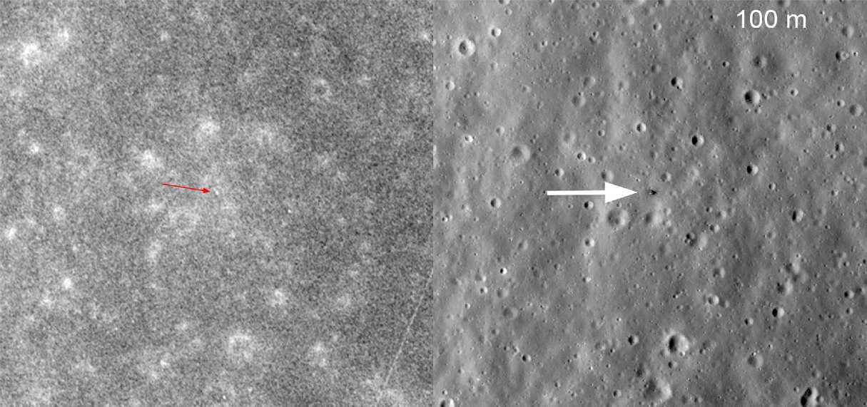
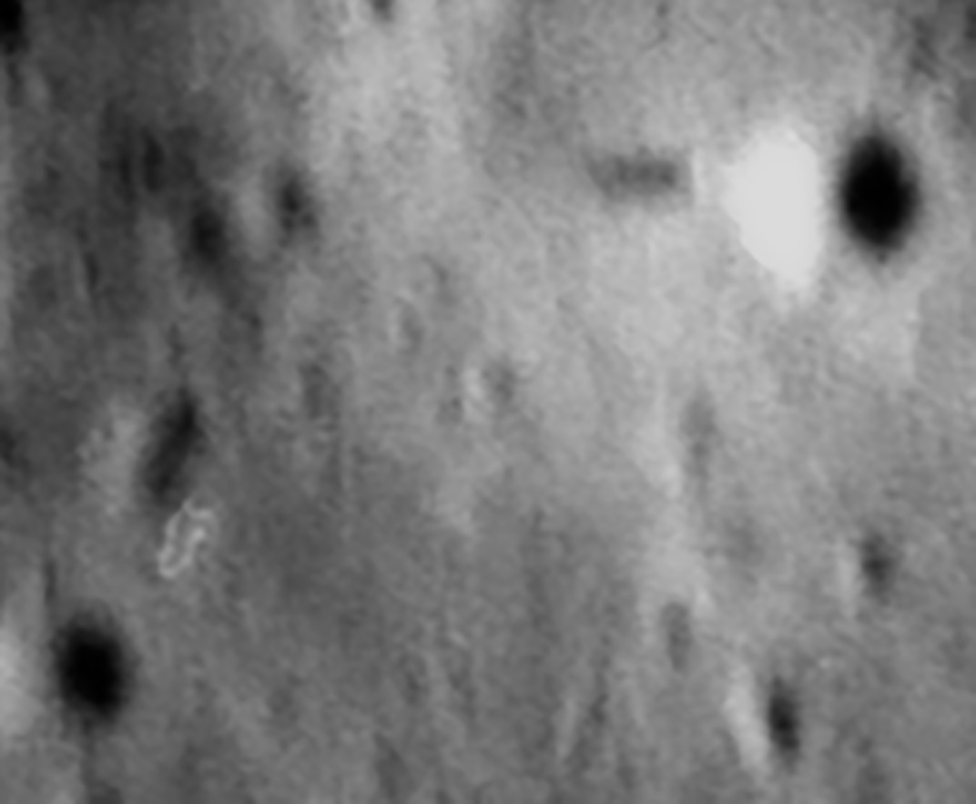
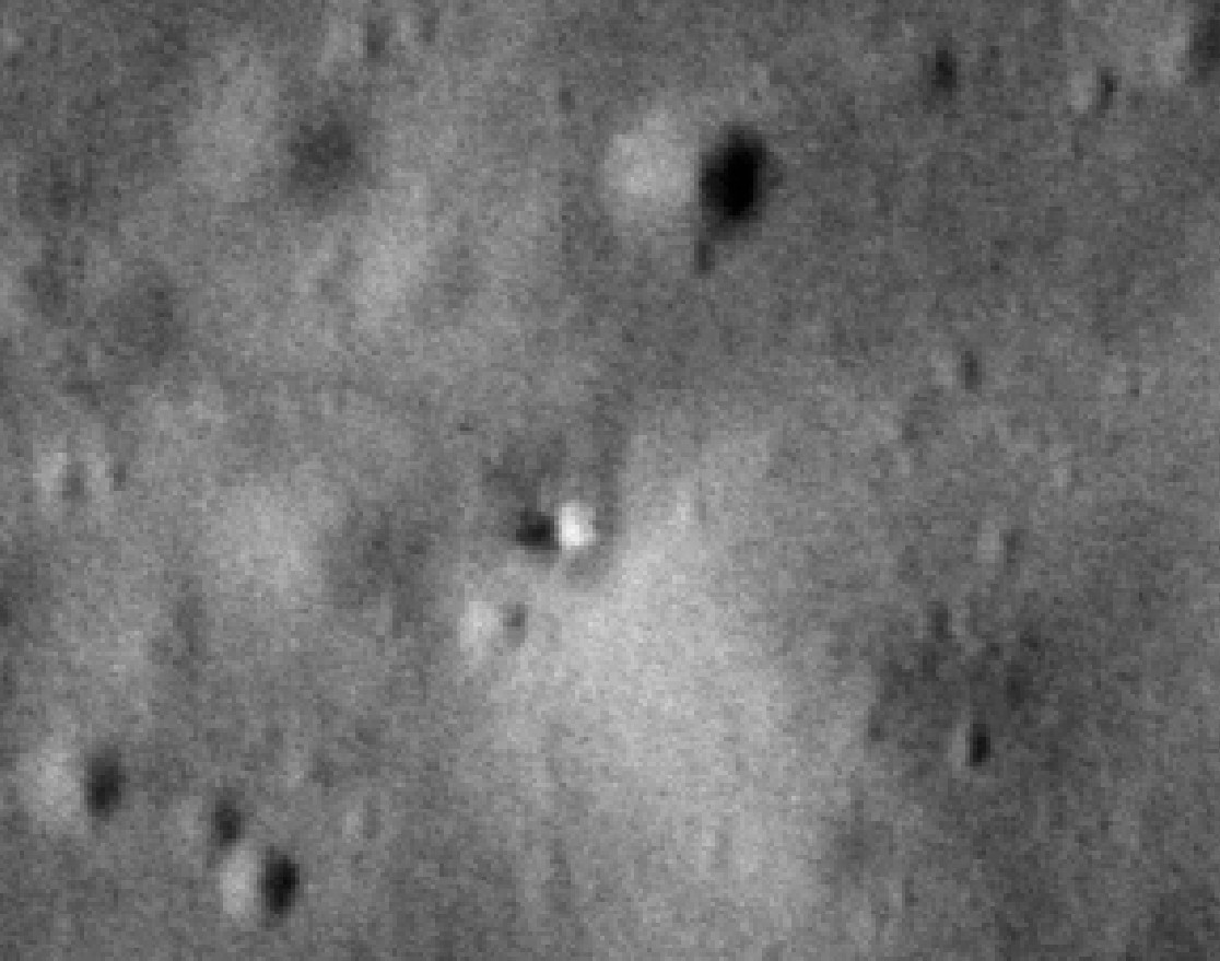
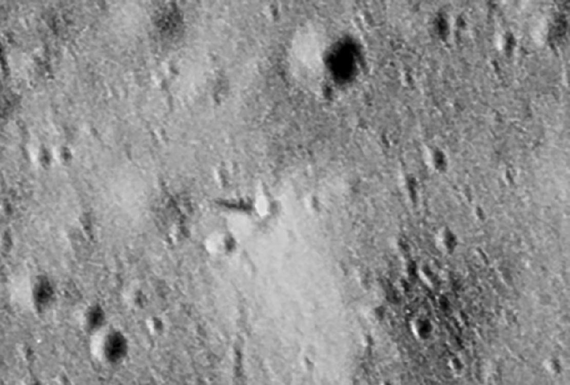
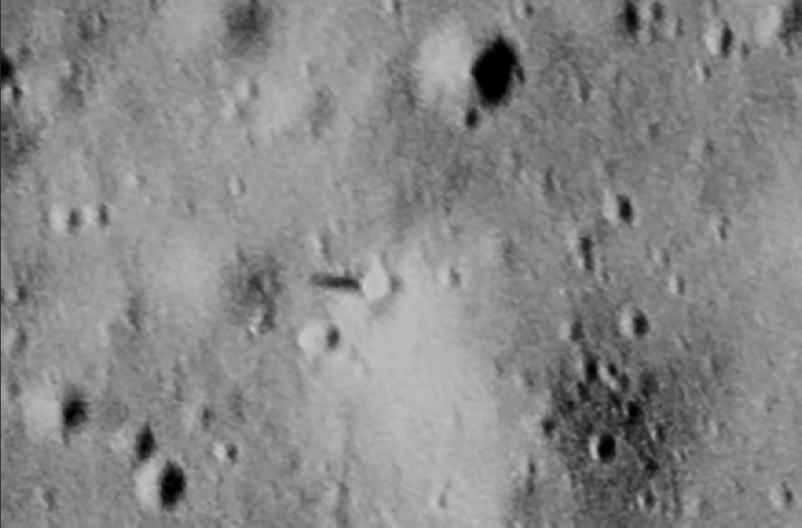
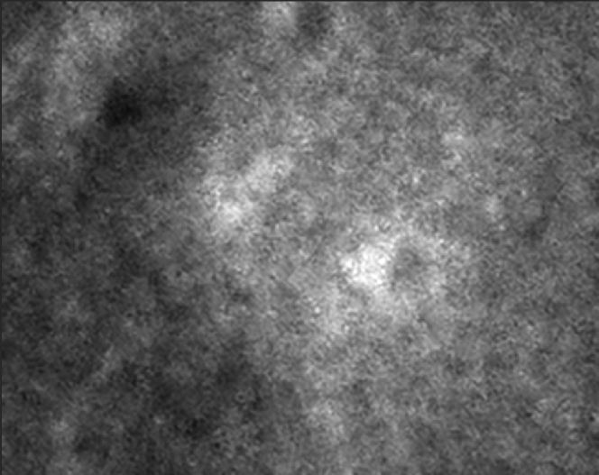
Now let’s zoom into where we know the Apollo 14 lunar module is and compare it with photographs taken by the Lunar Reconnaissance Orbiter mission. Below right is a close up of the LM, and below left the Lunar Reconnaissance Orbiter (LRO) view of the same area.
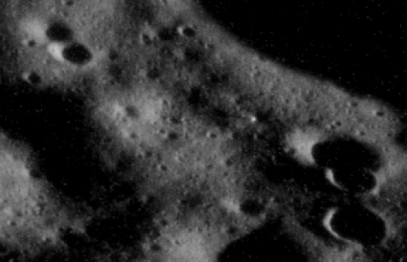
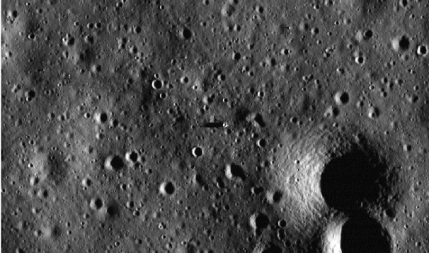
It’s worth pointing out that the bright LM is not a feature that can be seen in any pre-
The APC photograph was taken at 21:58:26 on 22/04/72. At this time on the ground at Fra Mauro the sun would be around 4 degrees above the horizon, producing a shadow length of around 35 metres, which is entirely consistent with what can be seen here.
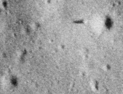
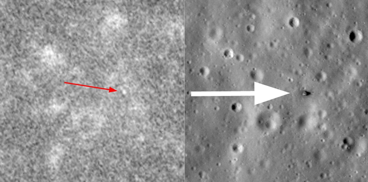
Further to the east of the landing site we have the ultimate destination of their long EVA: Cone crater. While much of the crater itself is in darkness, he eastern rim does have some light on it, and a couple of features are identifiable on it.
Here is the original image, compared with a cropped annotated lunar orbiter view from above:
The 2nd image in the sequence is AS15-
There is clear evidence around the LM of disturbed ground, as well as towards where the ALSEP was set up. The latter involved a considerable amount of activity, which explains why the large area around it is so obvious. The rover took a different route to and from station 1 and 2, which is why the path is much less easy to make out.
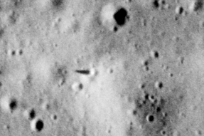
What is easy to make out is a long object casting a shadow just north west of the LM. I’ve zoomed in to it below left, together with AS15-
The tinfoil hatters can’t argue Photoshop for that one. You can also go and buy (as I did) a 1981 copy of Peter Cadogan’s “The Moon -
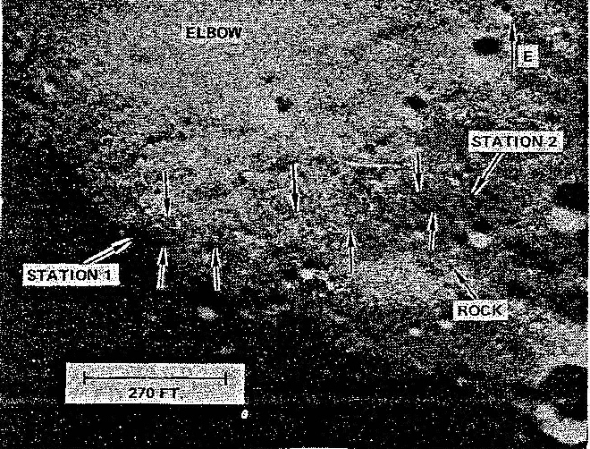
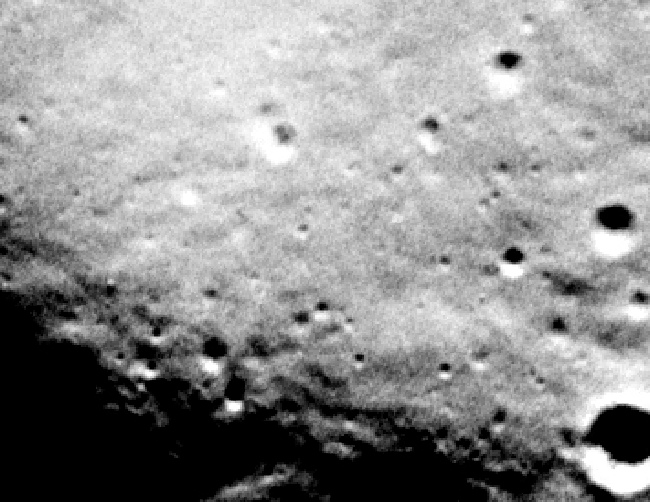
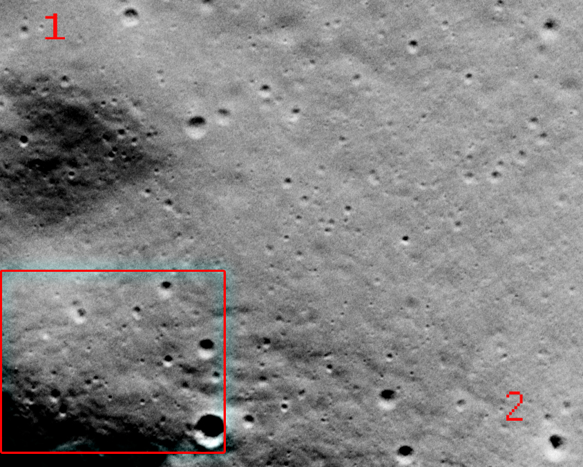
There’s just one small problem: he has got station 1 and 2 in entirely the wrong place. The image below shows where stations 1 and 2 actually are and the relationship with the image in the paper. Kinney bases his findings on the location of a rock, but sadly he picked the wrong rock.
While there are places on the APC photograph in the vicinity of stations 1 and 2 where there are hints of trails, there are many areas where there are hints of trails where the rover didn’t go, thanks to the nature of the lighting, the terrain, and also the photograph itself. It is probably much safer to conclude that the resolution of the images here is not quite adequate to see locations where there was minimal disturbance, and that as in the case of Mr Kinney there is a willingness to see what isn’t there that can cloud judgement.
The next APC photo for Apollo 15 is AS15-
151:27:14 Worden: Okay, I understand. AOS with LM is 151:51 and LOS is about 152:04.
indicating that he would be in communication range of the LM during that session, and therefore passing overhead. We know that comms were established because shortly afterwards we have this:
151:55:06 Worden: Hello, Falcon. Endeavour.
151:55:12 Scott: Hi, Endeavour; the Falcon. How are you?
Shortly afterwards we have this comment from Scott:
151:57:27 Scott: Yeah, I tell you, I hope you can see these Rover tracks, because outside the LM here, it looks like a freeway.
Which is a really cheap plot device to discuss what is visible in this latest image, and more specifically what is different.
There are two major areas of difference here. Firstly, now that EVA-
The next feature is the area extending from the LM to the ALSEP, which is now much more prominent.
The reason for this is that towards the end of the EVA they went back to ‘Station 8’ (close to the ALSEP) to carry out more experimental work, and as a result we now have a pattern much more akin to the view shown from the LM earlier on.
The area around the LM is also now much more disturbed
Here’s a close up of the two of them for comparison, with the earlier one on the left.
The LM shadow is also shorter, something that Dave Scott draws attention to as they pack up at the end of EVA-
The LRV isn’t quite as easy to spot as before, but luckily we have two other photographs in the form of AS15-
The shadow on the LM is considerably shorter this time, partly because it is later in the mission and the sun is even higher, but also because half of the LM is now missing, given that the ascent module has just docked with the orbiting CSM.
As with the other two EVAs, we can be sure of the LRV location on this occasion as well. The reason for this is that at the end of EVA-
You can see the trail this created as a line heading east from the LM, and the LRV itself can be seen on the right hand edge of the photograph.
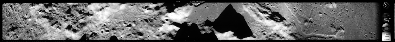
We have one last view of Hadley, AS15-
195:04:14 Allen: Pan Camera, On.
195:04:20 Worden: It's On.
They are no longer taking stereo pairs of images, and this image is looking vertically down, but (as should be obvious) the distant Hadley rille is at a much more oblique angle.
As before, we have a view that is entirely consistent with the object in question being the LRV, in exactly the place that it should be according to the TV footage.
The next view of Hadley comes from a series of images taken on Rev 50. The one I’ve chosen is AS15-
175:34:18 Mitchell: 15, Houston. Stand by for T-
175:34:28 Worden: Standing by.
175:34:32 Mitchell: Mark. T-
Here are the relevant views from this session.
It’s not as clear as the earlier one, but the long LM shadow can still be made out easily.
The reason I’ve included so much of the area around the LM will hopefully become obvious when looking at the next image, AS16-
4623 was taken at 02:02 (128:08) on the 22nd, 2 hours after the end of of EVA-
128 05 48 Mattingly: Okay. I put Power on the Pan Camera and the barber pole's back to gray.
Followed by:
128 06 14 Mattingly: I'll tell you, the old landing site stands out now. You couldn't miss that for anything.
Here are the relevant images.
The next Apollo landing site was the Descartes highlands between two bright ray craters. The mission’s APC captured a small number of views of the LM in situ, and we’ll examine those now.
The first is AS16-
108 27 49 Roosa: And, Ken, just turn the cameras off there.
By way of confirming location, at 108:08 GET Mattingly announces that he is coming up to Crozier, about 1000 km east of the landing site. A moment later he tells Houston he intends to try and photograph Descartes using Hasselblad Magazine PP, and photographs AS16-
108 22 07 Mattingly: there is a definite textural similarity between the material or the bright spot by Descartes Crater and the things around Stone Mountain. However, it is a lighter albedo. It's a shade lighter and the line of demarcation seems to come along the long crater.
So, the camera was running and Mattingly was over the landing site, what could he see?
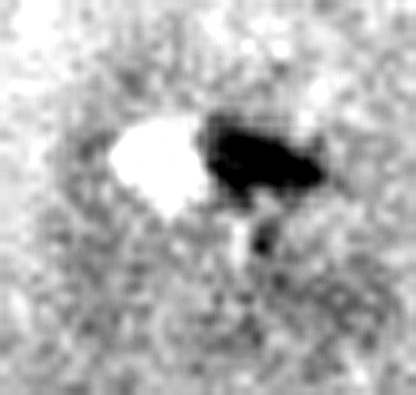
So, what did they do on EVA-
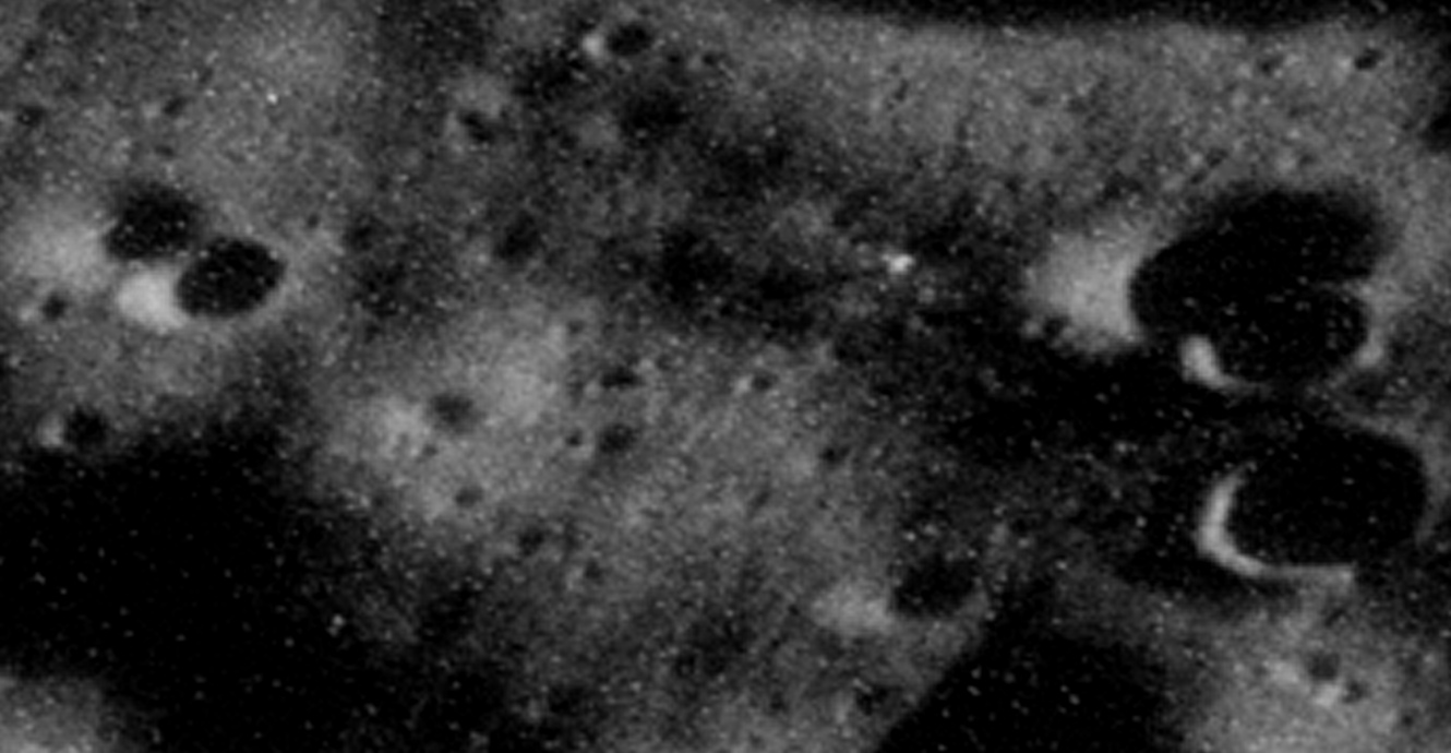
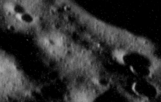
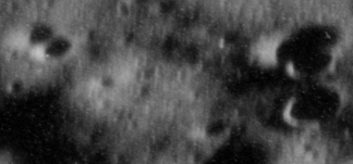
As far as the ALSEP is concerned we can see one clear indicator of their work around it in the form of the PSE, or Passive Seismic Experiment. The PSE is clearly visible in the image above as the bright white blob in the bottom left corner. Why is it so obvious? It’s obvious because it is a large circular object covered in shiny reflective material. You can see it below left in AS16-
If you draw a straight line between the PSE and the LM you will notice a small crater. That same crater can be seen halfway between the PSE and the LM on the APC photograph.
As for the raising of the flag, it’s worth looking at the photograph above centre in conjunction with a zoomed crop of the LM (above right)/ In AS16-
The final images for Descartes are difficult ones to work with, as the large format scan is extremely bright, and there isn’t enough real detail in the half resolution scans. More skilled Photoshop users than I may be able to do something with it, but until they come along there is just this.
The images used are AS16-
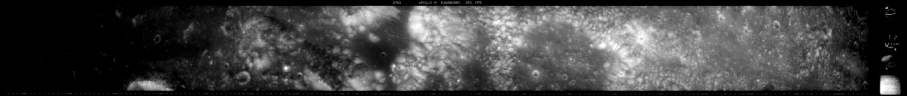
The final chance for the APC to shine was during Apollo 17’s trip to Taurus-
Now that we have seen the landing site before and after the missions, let’s have a look at its progress as seen from the Apollo 17 APC.
First up is a photograph taken shortly after landing, AS17-
113:54:45 CAPCOM Did you get the pan camera start time there, Ron?
113:54:45 CMP That's affirm. But, I got a 31:11 instead of 31:10.
And in a conversation beginning at 114:11:52 we have
114:11:52 CMP I'm right over now.
This coincides perfectly with the time of the photograph, recorded as 23:48:13 on 11/12/73, or 114:15.
Mission timings get complicated here, because 2 hours 40 minutes were added to the mission clock to compensate for delays, so while the pdf scans of the transcript recording in days, hours and minutes say one thing, MET records in modern transcripts have the time added. The Bulova 24 hour mechanism also makes life complicated, as the minute hand moves round 24 times per hour rather than once. I use the pdf transcript timings here, as the AFJ does not yet have a comprehensive modern transcript. My timings are therefore without the added 02:40.
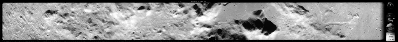
Here are the relevant photographs, framed to cover the same area as the LRO view above.
Note the nice long shadow from the lunar morning sun. You can also clearly make out several large boulders as well as small craters that allow the site to be matched with the Apollo 15 and LRO views.
At the time this photo was taken the crew were just completing their final suiting up for EVA-
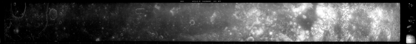
The next view of the site doesn’t actually come until near the end of the mission, just as the ground-
Here’s what he photographed.
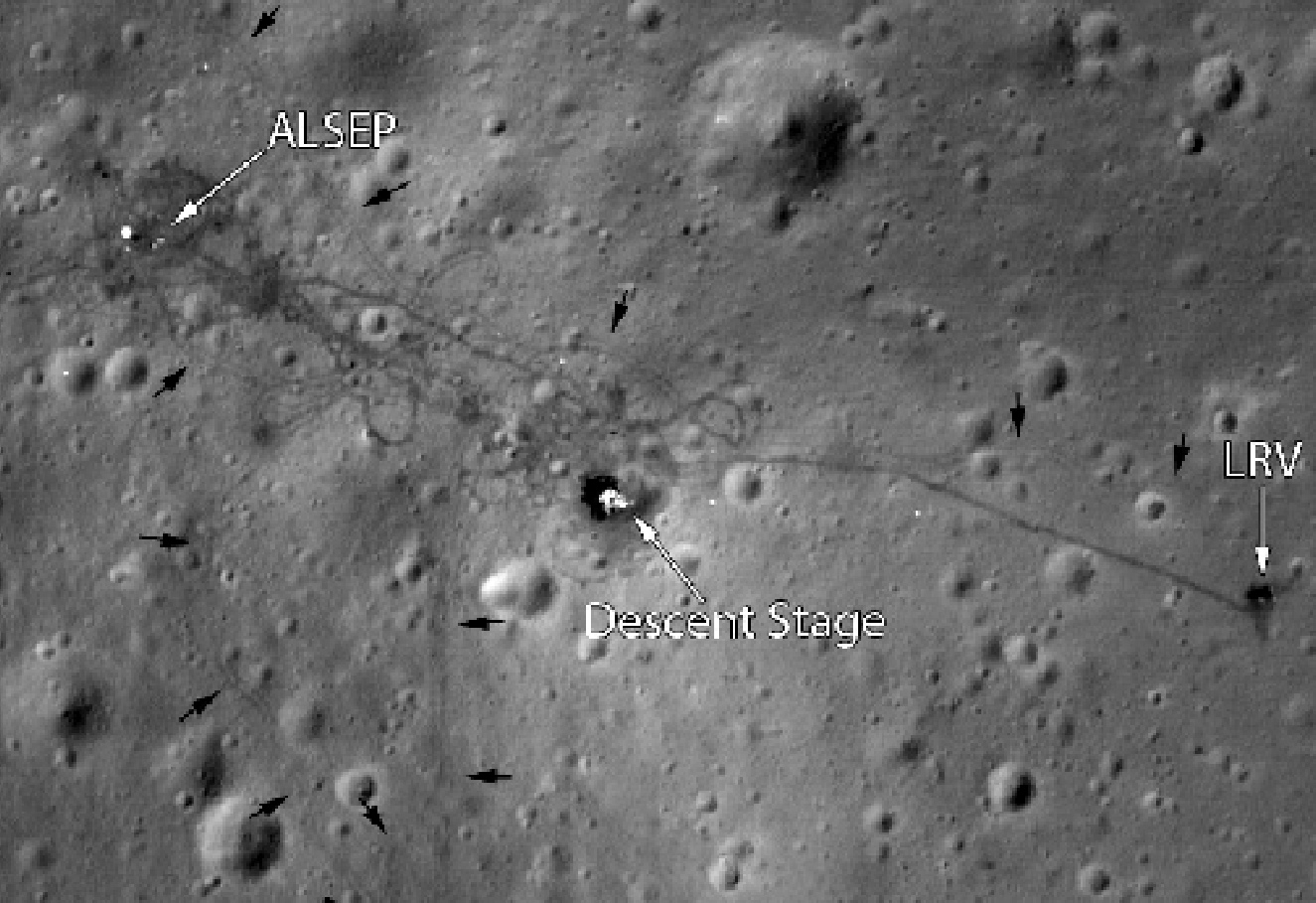
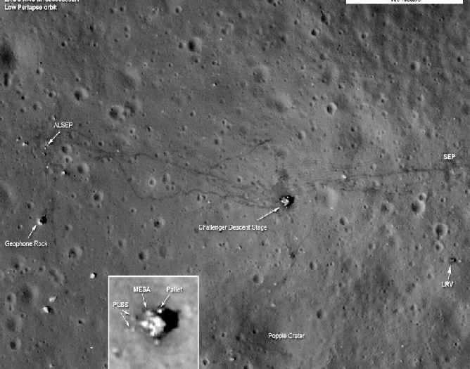
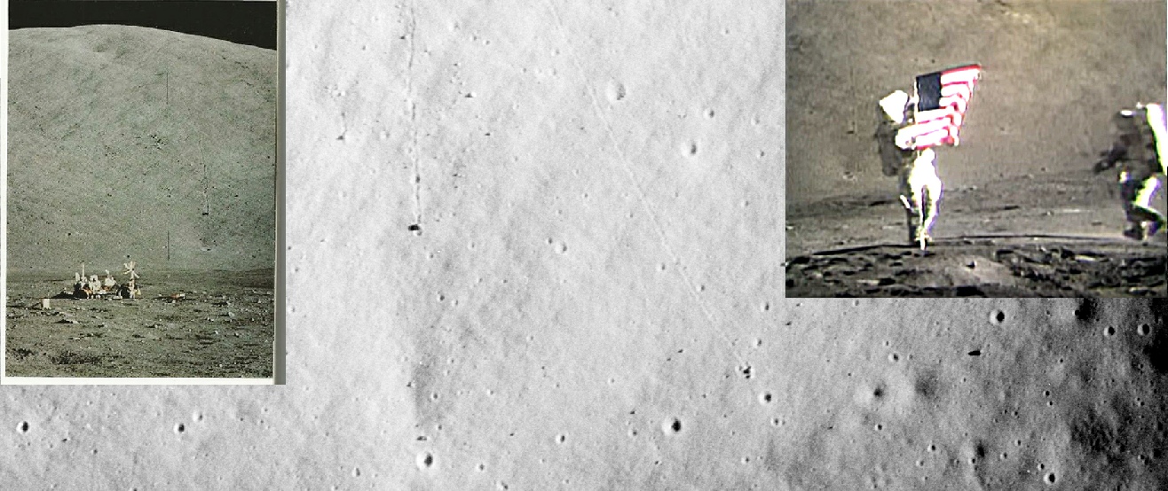
You might, at this point, want to refer back to the LRO photograph shown earlier. What we can see here are tracks from the LM westwards to the ALSEP equipment (and the equipment itself), northwards to the flag , and eastwards to the SEP. Trails leading north and south from the SEP can also be discrned.We can also pick out, at around 4 o’clock on the edge of the image, the final parking place of the LRV and a faint trail back to the LM. Heading south from the LM we can s see another short trail leading towards Poppie crater, explored by Gene Cernan during EVA-
South west of the LM are the same bright rocks identified in earlier images.
For the sake of completeness we have one final image to to look at, taken on Rev 62. By this time, the crew are re-
As with previous examples, the rising of the lunar sun has made the disturbed ground much less easy to see, but we can still make it out very clearly the bright descent module exactly where it should be. It is also possible, just, to make out the LRV and some elements of the ALSEP hardware. Better image processing might reveal the trails that are still just about discernible.
It is worth comparing the LM in the APC image with an LRO image, and as one would expect they match perfectly.


The boulder trail in the APC image is clearly visible on the ground, live on TV as well as from orbit on magazine stands.
Apart from capturing the hardware occupied by people on the ground, and some of the things they saw, the Panoramic Camera also caught images of other parts of the Apollo spacecraft. Apollo 16’s mapping camera managed to photograph the impact crater caused when Apollo 14’s SIV-

Before we call it a day here, it’s worth looking at another feature that can be seen in the APC photographs and on the ground: boulder trails.
Boulder trails are very cool things and indicate that even quite large rocks can be moved around the lunar surface as they are dislodged from one area by impacts or tremors. Taurus-
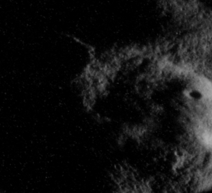
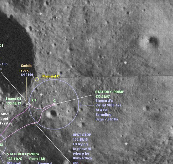
The oblique view of the Apollo 16 image, and the poor lighting, makes it difficult to compare the two and identify any features. To get round this, I’ve taken a screenshot of the LRO’s Quickmap view and used Photoshop’s various stretching tools to align the obvious features. The result is shown below, cropped to show the significant bits, with the LRO on the left, Apollo centre, and the annotated lunar orbiter diagram on the right, all of them aligned to the LRO view,
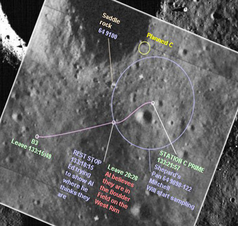
The key features have been identified by coloured circles on the Apollo image. Yellow shows the location of the intended location of station C, which (thanks to them getting confused about their location) they never quite managed to find. The red circle outlines the location of the C’ (or ‘C Prime) station, just visible in the sun.
Most interesting of all is the small blot in the green circle. It could easily be mistaken for a blemish on the photograph, like the smaller dots near it, but when it the photograph is correctly positioned it becomes clear that it is the top of ‘Saddle rock’ catching the sunlight.
The level of information revealed in just this single, accidental shot of Apollo 14’s landing site shows just how powerful the cameras were, and how even without trying Apollo provides consistent evidence that it happened. I should acknowledge the encouragement here of Ken MacTaggart of the Apollo Flight Journal, who was keen to see more than just the lunar module in this photograph.
It’s a shame there wasn’t more coverage of Apollo 14’s site, but thankfully there is much better coverage of Apollo 15-
In the Apollo 15 CSM, CMP Al Worden started his APC photography in earnest on Rev 16, which commenced at 107:40 MET, or 01:14 on 31/7/71. At 02:12 on the 31st we have this exchange :
108:36:12 Scott: Could you identify Index Crater as you go over the landing site, now?
108:36:17 Worden: Yes, I can do that with naked eye right now. I'm just coming up on you now
So we know that at that specific time the camera was running as it passed over the LM at Hadley. A series of images from this pass are available to us, and the time-
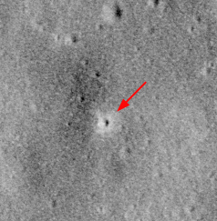
First up is AS15-
You can see in the Apollo image on the right that the bright Ranger impact crater isn’t in the Ranger photo, for obvious reasons. In case anyone thinks they just added the crater later on, it was also discussed (along with other Apollo impact craters) in the Apollo 16 Preliminary Science Report, an original copy of which I own.
So, what have we learned?
For one thing, we have learned that the APC was a remarkable piece of equipment. For another, we have seen that not only do the APC images produce images that are entirely consistent with those of modern probes, they produce images that are entirely consistent with the timelines of the Apollo missions, other probes supporting the Apollo programme, and the missions of other countries, such as the Soviet probes.
They also match photographs taken by probes from eg India.
I’m sure that there will be intellectually stunted individuals out there who will see these images and snort into their bedtime coco-
We went to the moon.
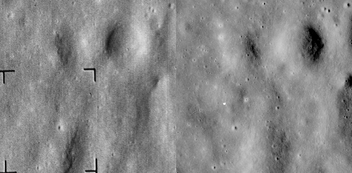
The blank area in the LRO version (above left) is an inset from an LRO image that was confusing things.
In 1971 Luna 20 landed in Terra Apollonius, and Apollo 17 found it in AS17-
Here it is zoomed in closer:
Pretty tricky for a mission that didn’t happen to photograph part of another mission that didn’t happen that is then also photographed by not one but two modern probes, right?
As well as capturing details of Apollo missions, that Panoramic cameras were also finding evidence of Soviet activity on the moon. You can find details here of Apollo 15 and 17 viewing details taken by Lunokhod 2 before the probe landed, but they also managed to snap probes on the ground.
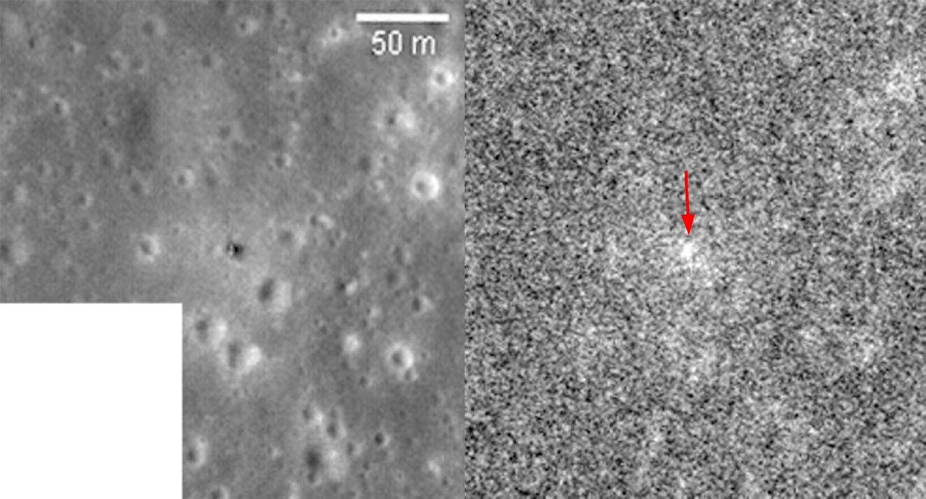
Apollo 16, for example, passed over Luna 16’s site in Mare Fecunditatis, and if you zoom in to AS16-
I found this fact out from this article reporting on the LRO’s imaging of the crater, but the image above is my own version. Just in case you’re doubtful, here’s Chandrayaan’s (partial) view of it.
Other unmanned probes can also be found -
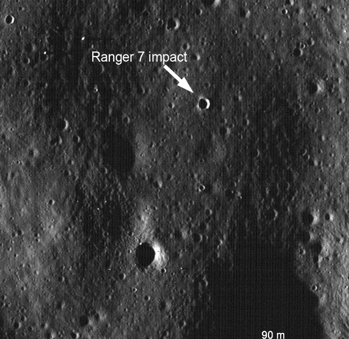
In case you’re not convinced it is the impact crater, here’s a side by side comparison of part of the last image taken by Ranger 7’s ‘A’ camera and the Apollo view from a little further out.
Let’s zoom in a little:

For those morons out there who insist that this is all done on digital images and it was all added later, these photos have been produced in the PSRs, and part of this image this one did actually appear on eBay. Here are two of the images from that sale, dated November 10 1971:
Other people have also examined pre-
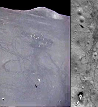
In fact it is mentioned in this paper, part of a conference from 1972. It also identified the rover, ALSEP and trails from the LM to other locations. While Kinney does manage to locate the LM and ALSEP, he gets the photograph of the LM the wrong way round in on one of the images. He is also confident that he has located paths to station 1 & 2 near Elbow crater.
Below is a comparison of the paper’s finding, compared with a modern scan of the image.
The Panoramic camera is viewing the site very obliquely, which means that the craters are seen at a different perspective to the ones viewed from above by the LRO, but what we can do is compensate for that by using our Photoshop skills to skew and stretch the image. I’ve done that here, overlaying the result on the LRO view by matching up the craters.
It should be clear from the animation above that the shiny blob we are looking at is definitely in the right place, and can only be the LM.
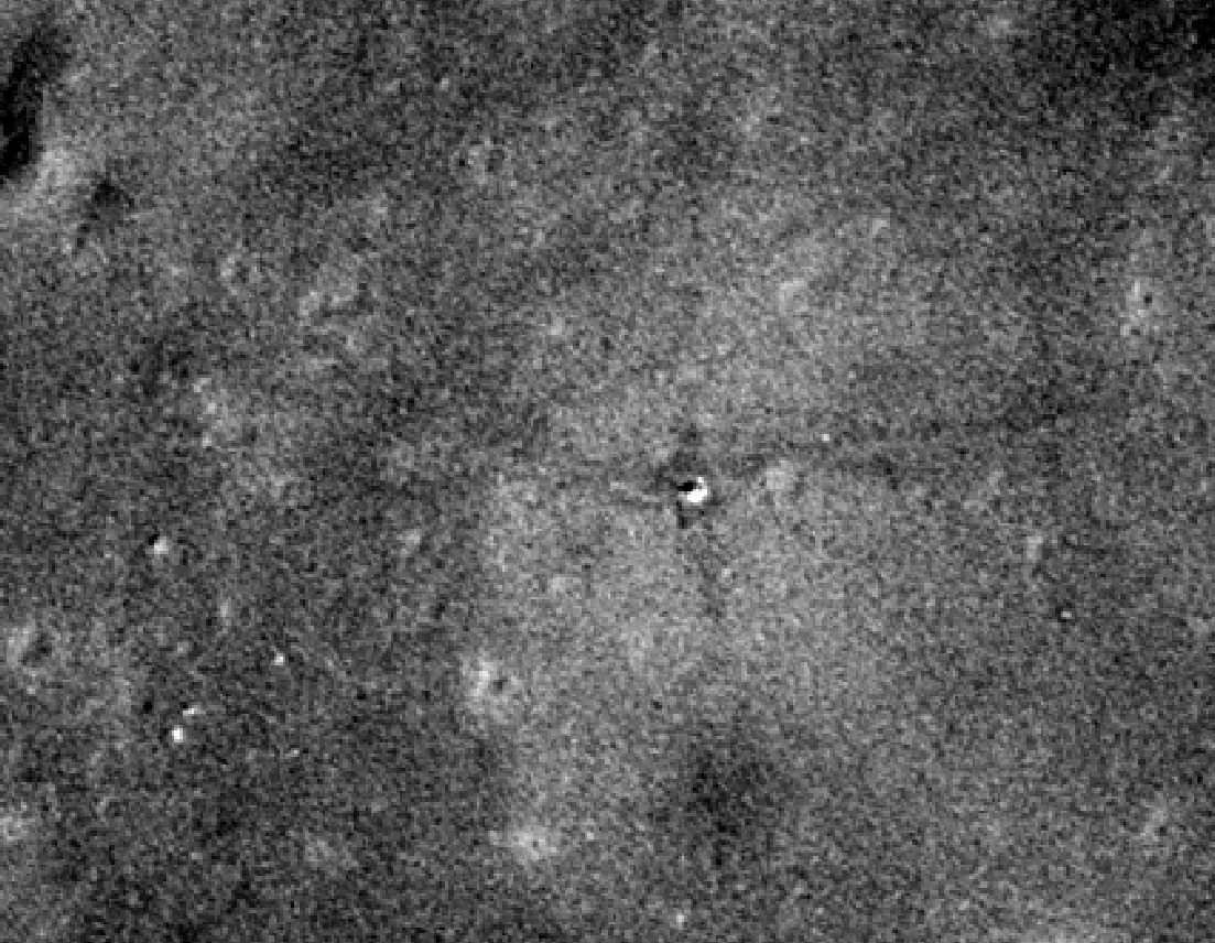
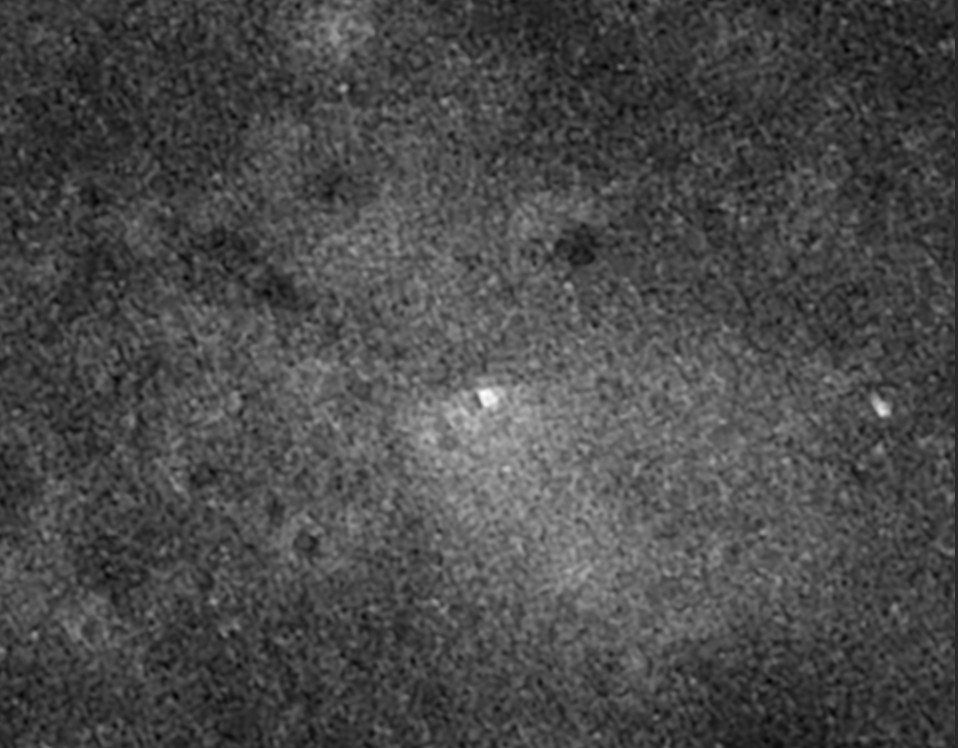
We have another view of the same site in the form of AS16-
The landing site is again at the edge of the image on tile 1, and is nearer the bottom of the photo this time. Here’s a close up view, which I’ve sharpened a little to bring out the detail.
Couldn’t be much clearer.
For the sake of completeness we can find the shiny LM in images AS16-
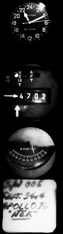
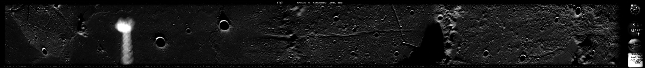
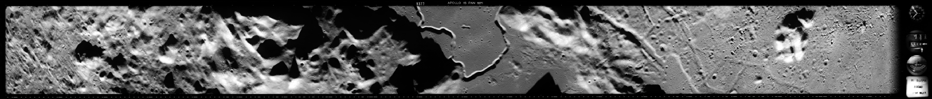
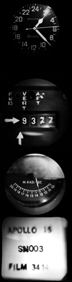
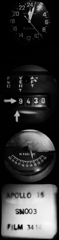
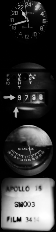
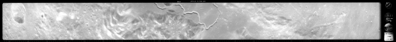
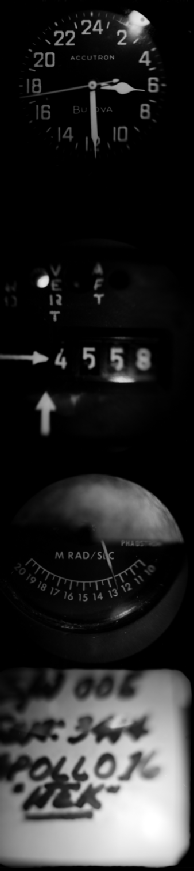
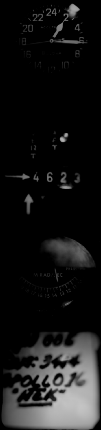
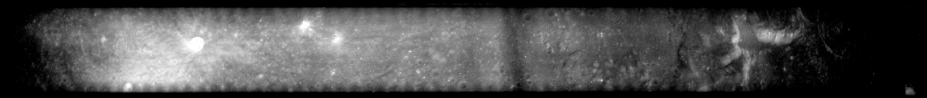
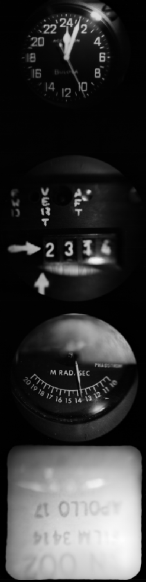
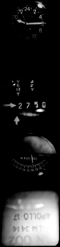
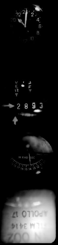
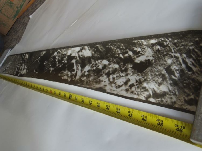
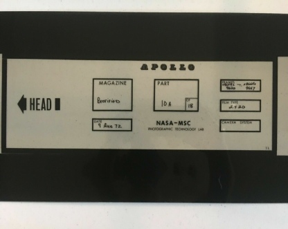
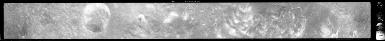
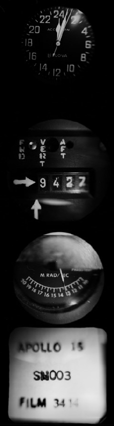
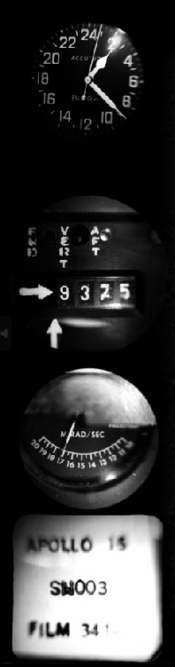
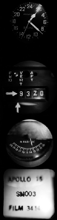
Slits in the SIM bay allowed images to taken straight down, slightly forward and slightly behind. Each exposure was 45 inches by 4.5 inches, and was capable of extremely high resolution identifying objects as little as 1.5 metres across and the image as a whole covered a swathe roughly 290 km by 20 km. Motion control mechanisms compensated for the speed of movement, although this didn’t always work properly.
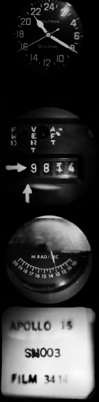
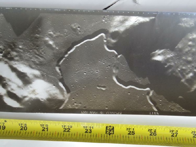
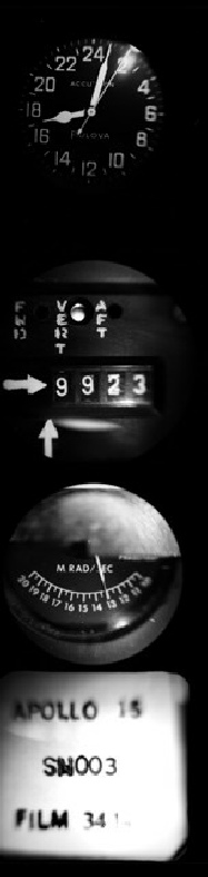
The exposures were time stamped and details of the orbital altitude and camera angle were also recorded, as shown in this example from Apollo 16. Note that the Bulova clock (used on all missions) is a 24 hour dial and is tricky to read!
More information on the camera and its operation are also available here. To give an idea of the size of the images, this one showing the Apollo 15 landing site turned up at a space memorabilia auction.
And here’s another couple of sections of an Apollo 15 example from eBay, this time compared with the online version along with indications of how it was stored.
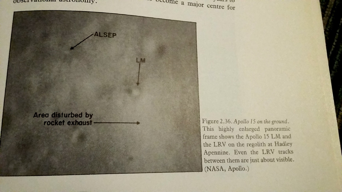
What looks like the same image appears in this March-
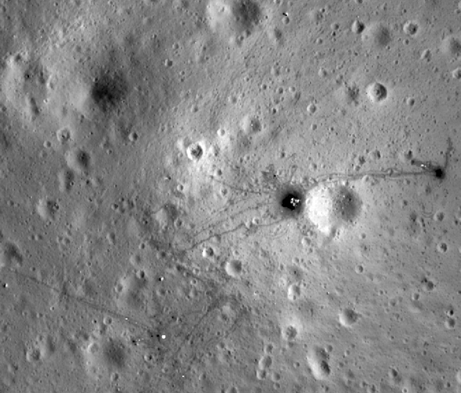
The image is darker thanks to the processing work I’ve done to bring out detail (feel free to reproduce it yourself if you don’t like it), but the trails away from the bright descent stage towards the ALSEP and LRV VIP spot are easy to make out, as is the LRV itself.
Apollo 15’s APC imagery presents us with a chronology of the activity around the landing site, revealing how the lighting conditions and disturbances brought about by human activity changed over the course of the mission. This chronology is (as with every aspect of Apollo) entirely consistent with the documented facts.
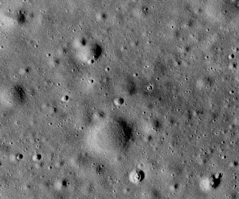
For the record, here is the LRO view of the site so that you can see the area in high resolution.
Apollo 16 landed next to a small crater, and that can be seen next to the LM, whose long shadow reflects the relatively early point in the lunar day. We also have AS16-

Its worth noting the length of the LM shadow, which is entirely consistent with the time the photograph was taken, as well as the lack of any kind of evidence of human activity other than the landing craft itself.
Part of this panoramic view was reproduced by the camera’s manufacturer in a portfolio of documents (see here). As the covering note says, they are sixth generation copies of the original, so some detail has been lost. The printing process itself also introduces a loss of detail. It is still possible, just, to make out where the LM is though.

And finally AS15-
Immediately after that we have AS15-
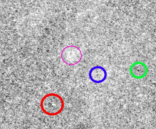
AS16-
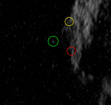
At this point in the mission (197:17), the crew are carrying out a variety of orbital projects, and are reminded to turn on the APC 17 minutes before this. The relatively high sun position has reduced all but the deepest craters to a vague blemish on the landscape, but at the risk of being accused or pareidolia I believe it is possible to identify the LM (blue circle), the LRV parking spot (green circle) and the highly reflective PSE (red circle). The thinner maroon circle picks out a bright impact crater north west of the LM to help locate things. I’ve not picked them out on the later photo
Running from the PSE roughly north-
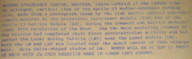
Better evidence comes a little later, with the next pass that covers this area on Rev 27. In addition to the time-
130:19:25 Worden: Okay, Houston. That does the Pan Camera pass over Hadley Rille, and you can let me know when the lens is tucked in.
There are some notable differences between these two images. Firstly, the shadow lengths have changed as the sun has risen in the lunar sky, exposing more of the surrounding craters and shortening the LM shadow. Secondly it is possible to make out the evidence of astronaut activity.
The images were taken at 23:52, just after the end of EVA-