4.6.7 -
As indicated in the introduction to Apollo 14, only two sets of photographs on the lunar surface feature Earth, and they aren’t of very good quality in terms of identifying features of the home planet. I go into much more detail here, but it’s worth documenting them as we can at least demonstrate again that we’re seeing what we should be seeing.
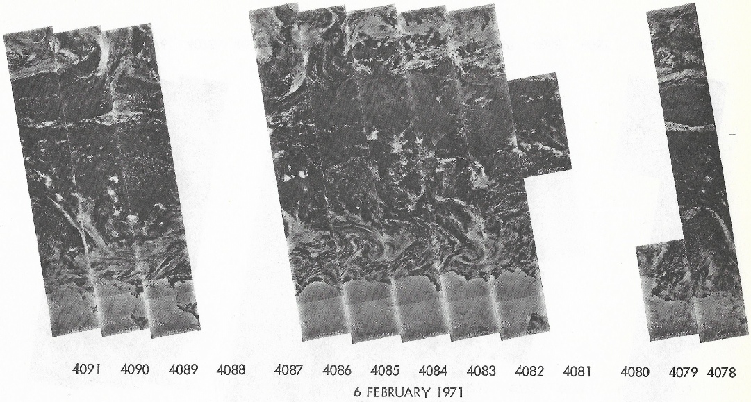
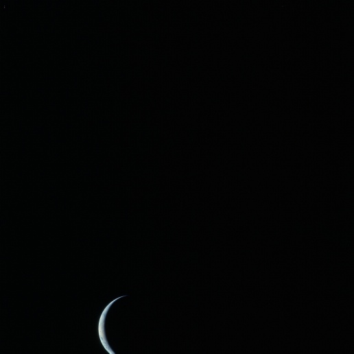
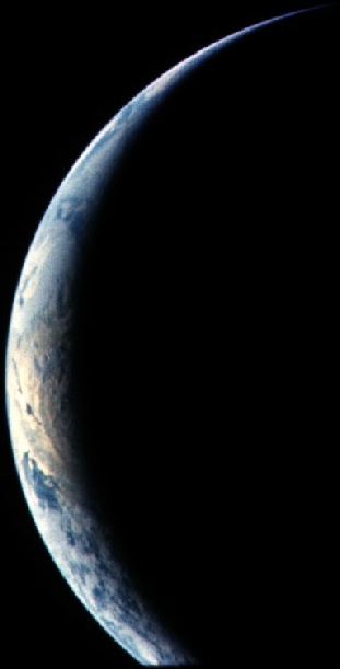
Figure 4.6.7.4: AS14-
When the image is looked at closely, it’s fairly obvious that we’re looking at the east coast of the USA, the Caribbean and south America. This can’t be from orbit 14, as Australia is in view then. The only discussion to be had, therefore, is which day is this from? While the overall data catalog doesn’t have images for February 6th, we do have images of North America available as published in the Sarasota Herald Tribune (figure 4.6.7.5).
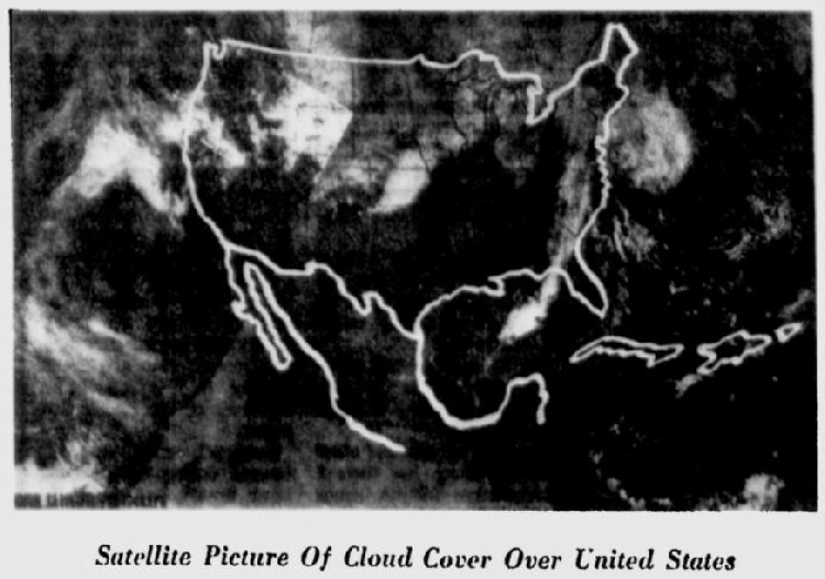
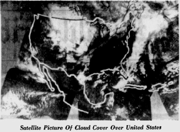
Figure 4.6.7.5: Satellite images from the Sarasota Herald Tribune taken February 5th (top) and 6th (bottom) compared with the North American section of AS14-
While they aren’t the clearest images in the world, or of it, the satellite photos do show differences in the weather patterns visible over the two days. The main difference is the widening of a cloud bank running roughly north-
Now that we’re more certain which day we’re looking, and which time, we can move on to the next sequence, typified by AS14-
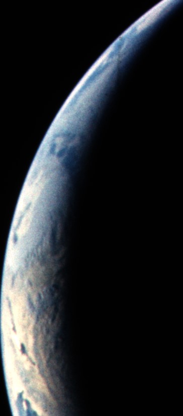
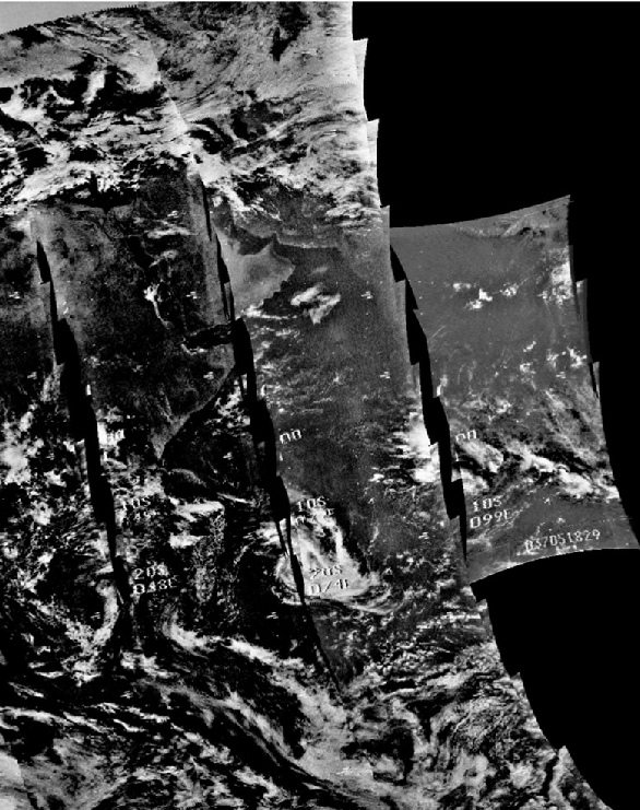
The image shows the Americas on the Western limb, and the main weather features are a long band of cloud stretching in from the terminator towards Mexico, which almost a serrated edge. The south western end of this band appears to have another mass of cloud immediately to the north of it. Over north America is a large mass of cloud, and south America shows scattered clouds over Brazil, with a long chain of cloud runs across South America. Cuba is dissected by a thin band of cloud running roughly north-
Analysis of this image is made difficult by the absence of high quality satellite images for the 6th, but we can examine the satellite images for other days.
This leaves either the 6th or the 7th of February as the likely date. The terminator just off Florida suggests a time of around 22:45 at which time on the 6th the crew are just about to jettison the LM ascent stage, and the same time on the 7th the crew are long past TEI, have made a mid-
Figure 4.6.7.7 compares the data available.
Figure 4.6.7.6: AS14-
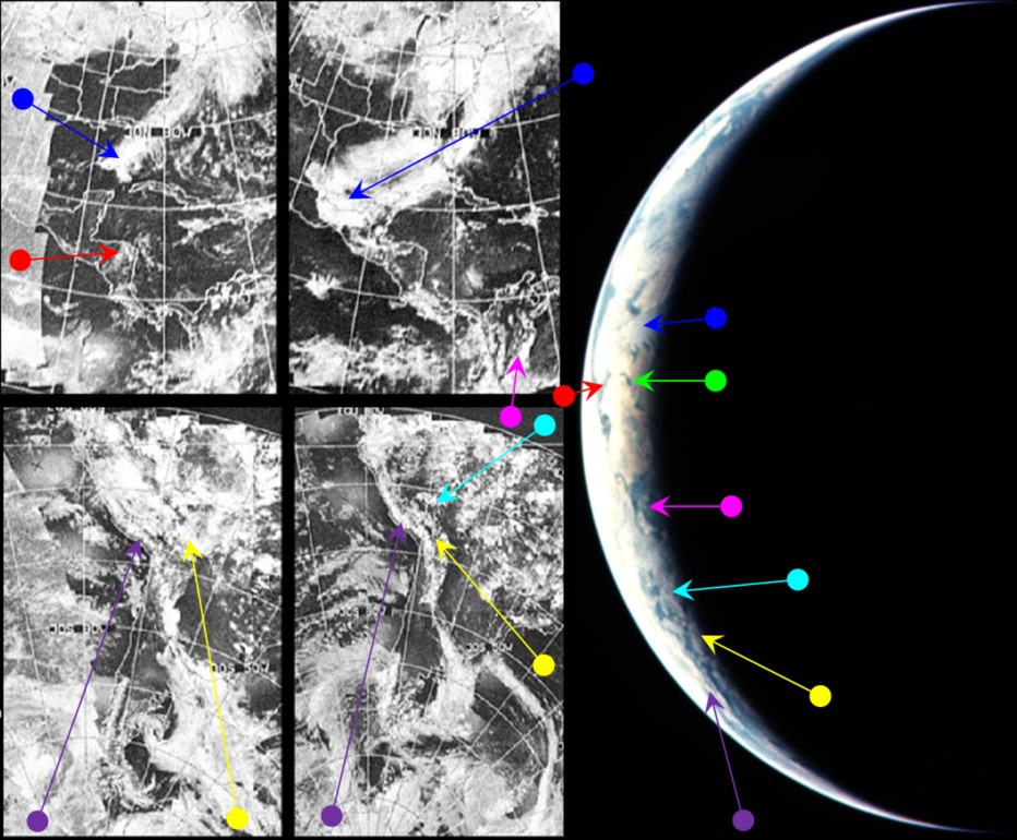
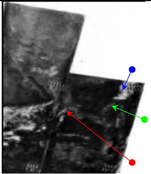
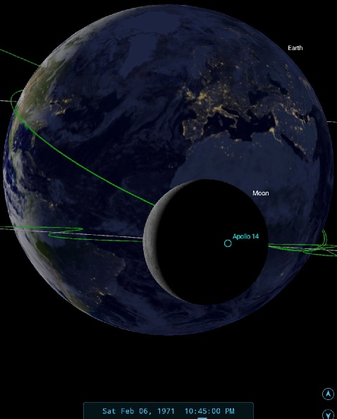
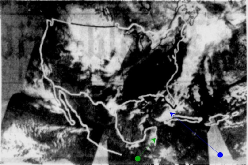
Figure 4.6.7.7: AS14-
The NIMBUS image does show a band of cloud (blue arrow) extending across the Gulf towards central America. A band of cloud is also visible across where Cuba should be (green arrow). What is noticeable is that the extra cloud mass at the end of this band in the Apollo photograph is not visible in this image, but as it is an IR based image, it may be that this cloud simply hasn't registered with the camera. The northern hemisphere image from the 5th is obviously more similar to the photograph than the one from the 8th, where the storm mentioned earlier has begun to develop in earnest. The ESSA northern hemisphere image from the 5th shows Cuba in its entirety, with band of cloud across it.
Looking over Central America, NIMBUS shows a couple of thin bands of cloud running across it (red arrow), and these seem to correspond to similar just visible strands in the Apollo image. The cloud cover on the 8th in the ESSA image is much more extensive over this region, while the that from the 5th does bear some similarity.
The southern hemisphere in ESSA shows a much less dense cloud pattern in the image form the 7th compared with the 5th, particularly over Brazil. The most visible feature from the Apollo photograph's perspective is the long band of cloud running first along the Andes before cutting across Chile & Argentina heading towards the south Atlantic (purple arrow). A number of shorter bands can be seen in the the Apollo image running parallel with the this larger band (yellow and cyan arrows), and one of these breaks away from running strictly parallel (yellow arrow).
None of these features are seen exactly in the ESSA image. There are definite resemblances between the two and these have been highlighted where a definite comparison can be seen. The 7th is the most similar, but it would be fair to state that the image taken by Apollo 14 shows a continental weather system that falls somewhere between the two states given in the ESSA satellite mosaics.
Time to move on to day 8 -
Figure 4.6.7.3: NIMBUS weatehr image from 06/02/71 compared with AS14-
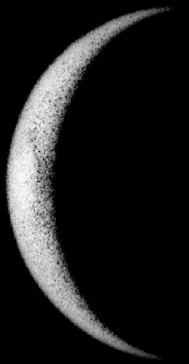
We know we should be looking the area around Arabia and the Arabian sea, and there are hints of variations in surface colours and brightness (and a reasonable match between the two), but that’s about all can realistically say. What we can be certain of is that the amount of Earth visible is entirely accurate.
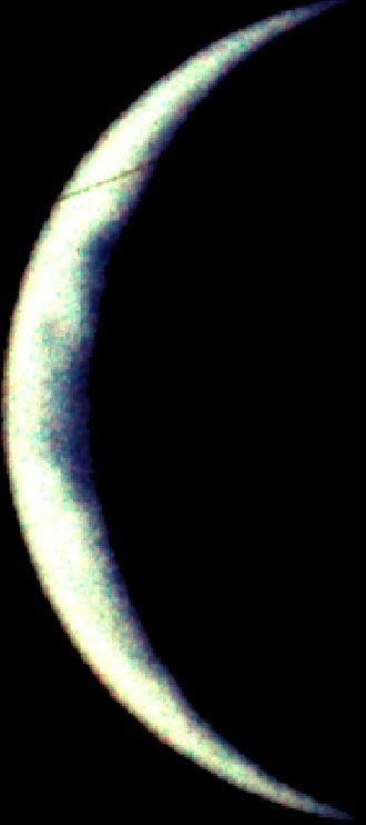
Precise dating of the next set of images requires considerable detective work, as there is very little in the magazine to help us get a precise date other than the Earth image itself. The sequence concerned comes at the end of magazine 72, a series 8 images described in the photography index as being from orbit 14. Close examination of the photographs reveals that it is actually two sets of images, one taken a couple of hours before the other. The full weather analysis will be carried out on the second sequence, as the land mass is more obviously identifiable, but we’ll have a look at the first image (AS14-
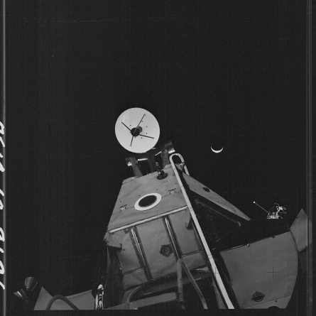
Figure 4.6.7.1: AS14-
This image was taken at the ed of the second EVA, and as we can see the view is exactly what we should be expecting. See this page for the bit about Venus.
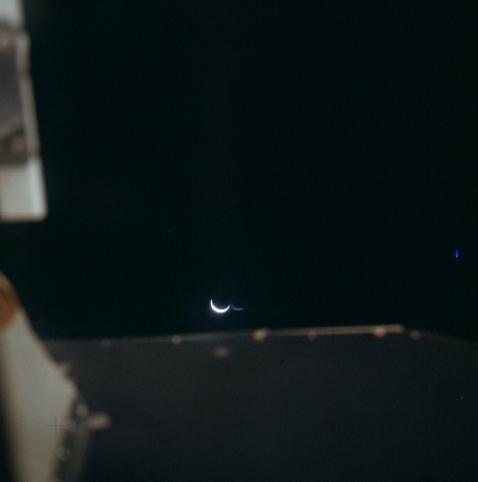
The next sequence was taken inside the LM, somewhere between 14:30 and 15:00 on the 6th (figure 4.6.7.2)
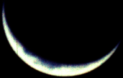
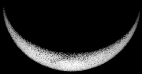
Figure 4.6.7.2: AS14-
It really wouldn’t be sensible to make any definitive conclusions about the Earth’s weather from these images, but we have the data, so we may as well present it -