Apollo & other sites imaged by lunar probes
As well as the LRO, Apollo landing sites have been imaged by a variety of lunar probes, with a variety of levels of detail.
The pages below aim to document those images, with filenames and dates of collection, without comment. See here for my discussions on the details within them.
All the images are freely available to download, although the pages hosting them do change over time. Some photos are in a RAW format that needs processing, while most require some work to bring out detail. Typically this would involve increasing the dpi, applying HDR toning and perhaps some sharpening. If you don’t like that, tough. Do your own work to prove they don’t show what’s in them. Anyone who claims NASA interference in the images needs to prove it. Not every image of the landing site is included -
You can choose between the specific probes, or the Apollo sites. The Apollo sites section will have an LRO image for comparison. Deal with it.
The ‘Danuri’ section includes images they’ve taken of other landers from the early space race and the modern era.
The pdfs below are compilations of all LRO images of the landing sites as of September 2026.
By Probe
By Apollo Mission
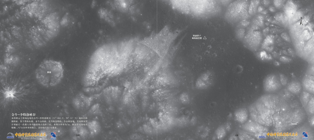
Pages in the Chang’e-
“This image displays the topographical features of the Taurus–Littrow Valley region (31° 46' E, 20° 11' N) on the edge of Mare Serenitatis (Sea of Serenity). Located southeast of Mare Serenitatis and southwest of the Taurus Mountains, it is an intermontane basin at the edge of a lunar mare. The landing site for the final crewed lunar landing of the US Apollo program was selected here. The resolution of this image is 7m. On the Chang'e 2 7m-
https://moon.bao.ac.cn/WEBDATA/CLEPWebMaps/CEAtlas/CE2/Atlas.html#page/113