4.2.1 Apollo 10 Images – Day 1: May 18th
Apollo 10, like many missions, took several photographs of Earth as soon as they were safely in Earth orbit, and these can be seen on roll 34 (Magazine M). It’s worth having a look at a pair of images taken just after the TLI burn, if only so that we can look compare them with photographs taken after the LM had been extracted from the SIV-
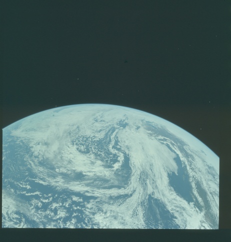
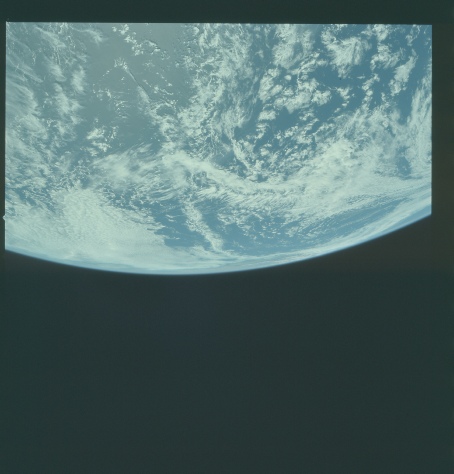
Figure 4.2.1.1 -
Although there aren’t many clues to timing in the first image, the second one does show clear signs of debris from the separation process, and so must have been taken at around 19:52 on the 18th. The AFJ shows separation to have occurred above a point just south of Hawaii (where communications immediately before TLI were routed) and as will be seen this is borne out by the view we see from the departing craft. The image in the centre shows the west coast of the USA. SkySafari’s projection clearly shows that the view in the photographs is entirely consistent with the timeline data.
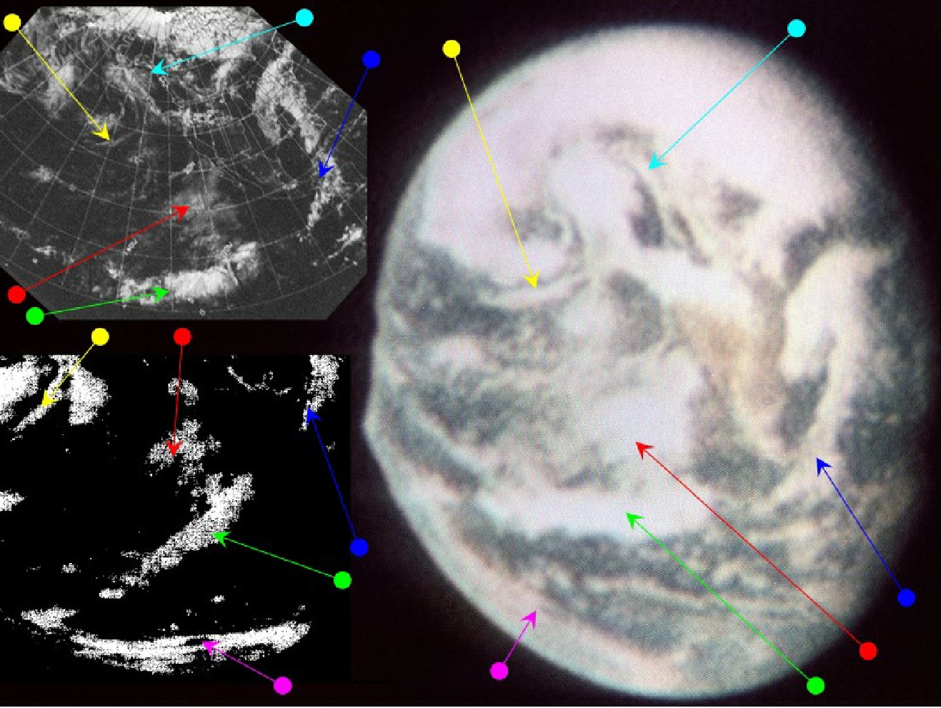
The first full disk image of Earth is AS10-
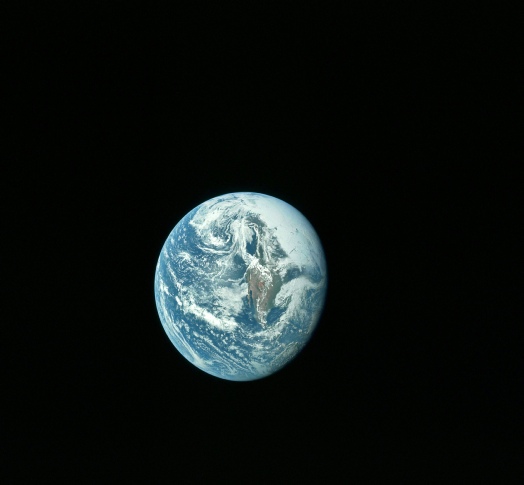
Figure 4.2.1.2: GAP scan of AS10-
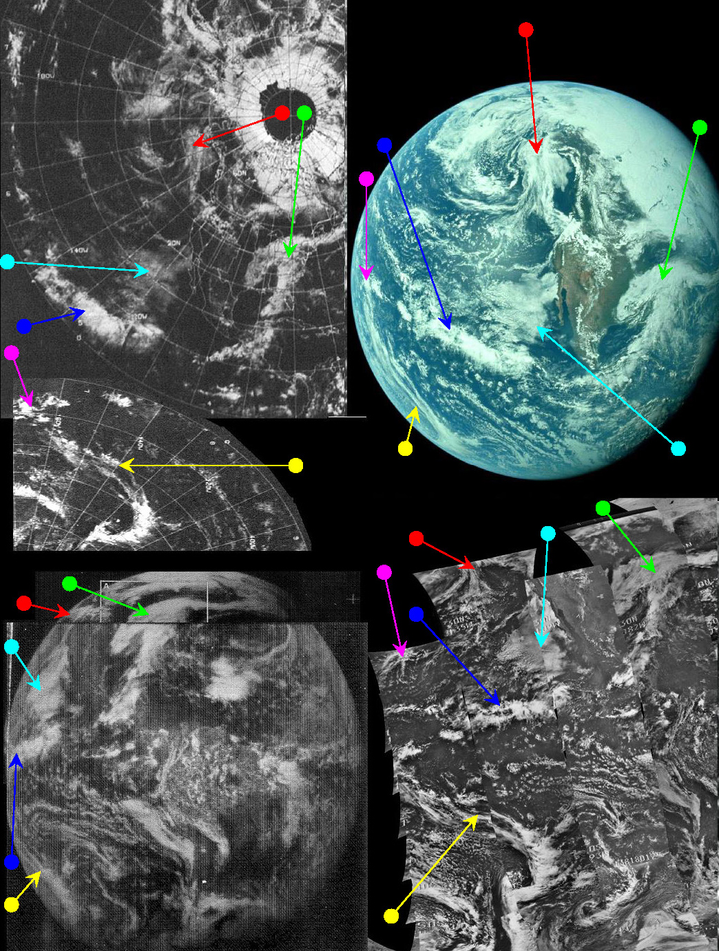

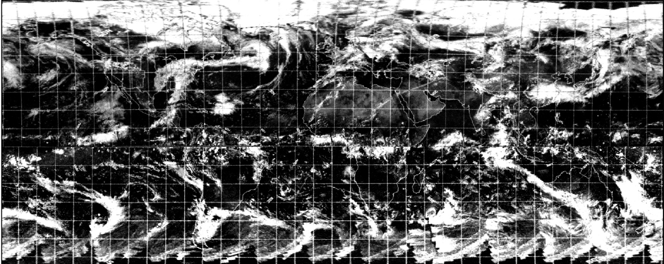
Figure 4.2.1.3: ESSA-
The distinctive hammer shaped system off eastern USA is very much evident. What is noticeable about the satellite images is that many of the cloud systems in them are (while still recognisable) less clear than on their Apollo counterparts. This is a consistent feature throughout these three datasets. Both sets of image data provide perfect matches with the Apollo image when converted to 3D models.
The position of the weather systems suggest that the time of the Apollo image and the ESSA track over north America were very close together. North America is covered by track 3-
The orbital data for NIMBUS show that the satellite image (orbits 461-
Also available are the high resolution infra-
As these are higher resolution satellite images than the others it’s worth zooming in a little more closely. Figure 4.2.1.5 shows the systems identified by the blue and green arrows in the Apollo and infra-
Figure 4.2.1.4: Nimbus-
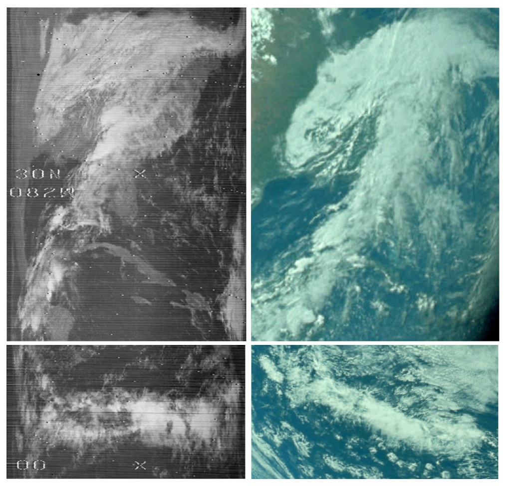
Figure 4.2.1.5: Infra-
Despite the satellite images showing the weather systems in the infra-
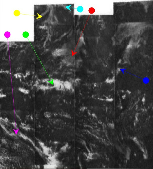
It’s now worth comparing the full disk image with those partial disk ones shown in figure 4.2.1.1. Figure 4.2.1.6 shows the context of where those partial images fit with the full disk one and also how key elements of those images compare with the each other.
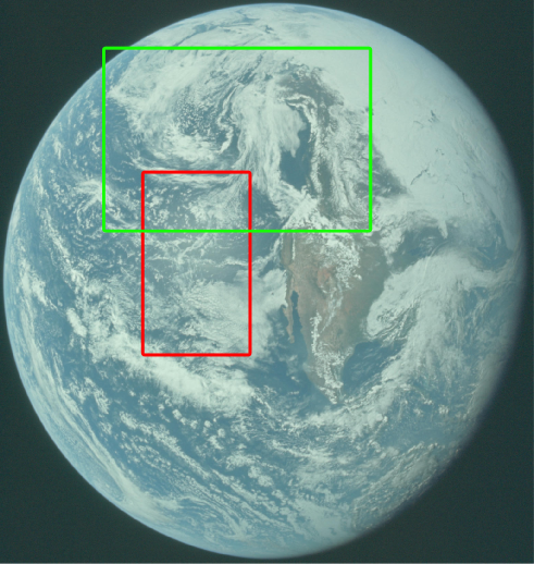
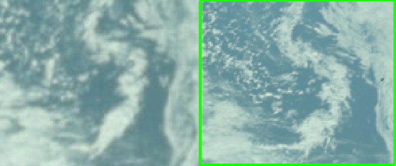
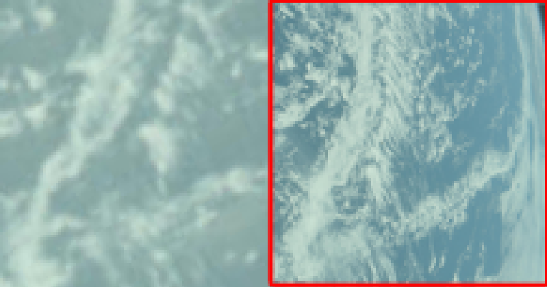
Figure 4.2.1.6: Sections of AS10-
As can be seen in the images, it’s obvious that the full disk image was taken from a vantage point much further out that the ones taken just after TLI, and it’s also obvious that there have been subtle changes in the weather systems on view in the few hours between TLI and the full disk one. These are not cut and paste identical images, they are taken from different vantage points at different times of an evolving meteorology.
The SkySafari estimate of 22:00 is easy to verify thanks to images taken at the same time in what a landmark moment: the first live colour TV broadcast of Earth from space. The mission timeline puts the broadcast at between 21:55 and 22:08 on the 18th, and the transcript of the broadcast can be found here. You can find the actual TV broadcast in this video.
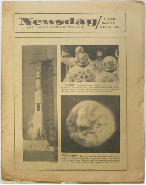
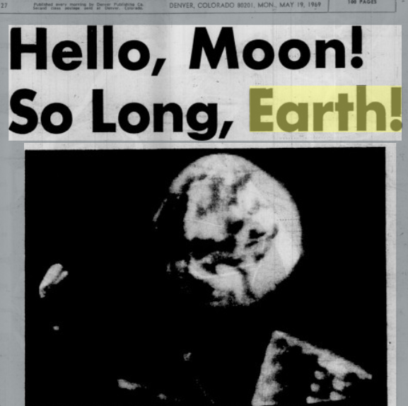
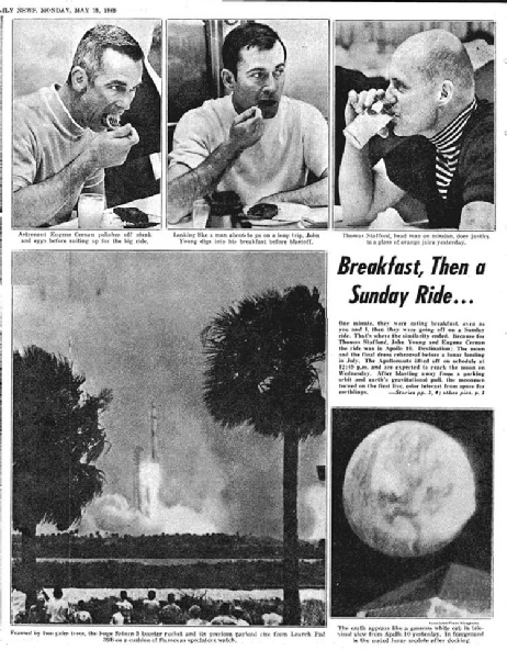
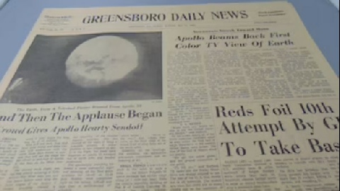
As with Apollo 8, Apollo 10 was well reported in the press and CBS gave the mission large amounts of air time, including the broadcasts from the CSM itself. Most newspapers merely reported the event, or did mock ups of various stages of the mission, but some did present images from the live TV broadcasts on their front pages.
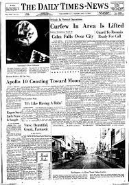
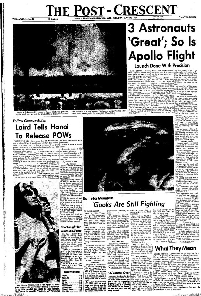
There are reproductions of these front pages available on the internet, but for the most part quality is poor. One relatively decent image can be seen from a local Wisconsin based newspaper, the Post-
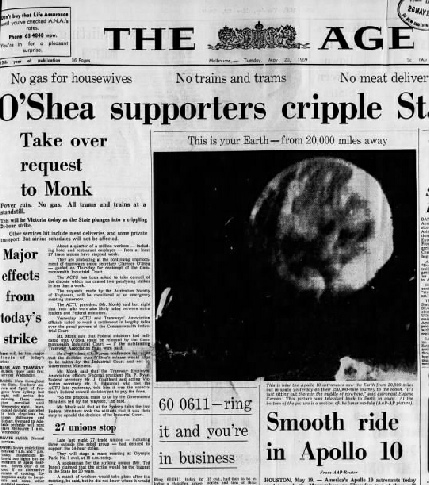
The front page from Australia seems like it’s a long time after the broadcast, but 20:00 GMT on the 18th is around 08:00 local time on the 19th in Melbourne -
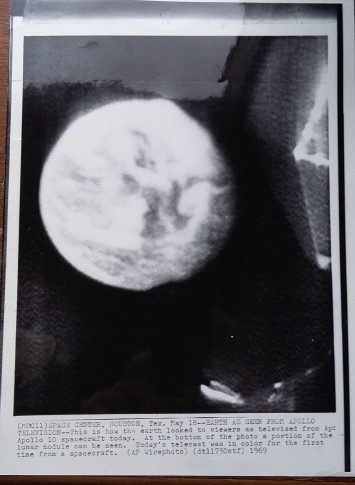
One link that does prove helpful is this one from the NASA Archive that is described as a screenshot from the Apollo live TV broadcast. This screenshot, the satellite images, and the Earth screenshot from the TV broadcast is examined in figure 4.2.1.8.
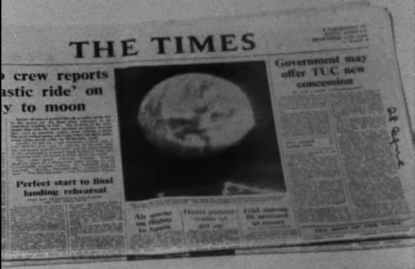
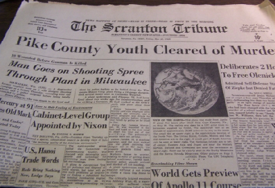
Figure 4.2.1.7: The Post Crescent May 19th 1969 compared with my copy (left) of an AP Wire image from the Baltimore Sun and the front page of The Times, as shown at 12:09 minutes in this film. Reverse side shows the time and date received as 20:09 18/05/69 local time. Also shown are Scranton Tribune dated May 20th, Daily Sketch dated the 19th, referencing the broadcast from the previous day, the Greensboro Daily News, lMelbourne based paper ‘The Age’ dated the 20th and the Daily Times News, Newsday (a Long Island publication) from the 19th. Rocky Mountain News.
As with Apollo 8, it is worth remembering that this newspaper front pages are mostly from May the 19th, the day after launch, and therefore any photograph of Earth can only have been taken before that day. It is also interesting to note how well the Apollo mission is succeeding in distracting the media from the Vietnam war. The moon missions are often accused of being a deliberate distraction from Vietnam, but while Apollo 10 may have temporarily stolen the headlines, it is clear where the remainder of the Post Crescent’s focus lies, and other stories share equal billing with the Apollo image.
More comparisons are available in figure 4.2.1.9, which shows the same TV screenshot compared with a photograph taken in Mission Control during the broadcast as well as the same view taken by the 16mm DAC camera (footage available here) and NIMBUS and ESSA 3D reconstructions.
Figure 4.2.1.8 Comparison of TV broadcast screenshot, Post Crescent front page and ESSA & NIMBUS satellite images from May 18th 1969. SkySafari time estimate is shown above.
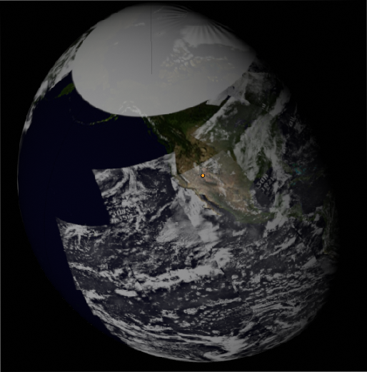
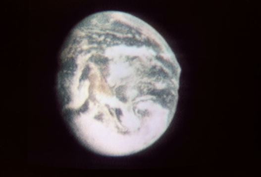
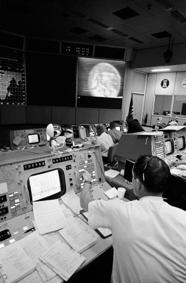
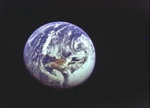
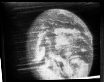
Figure 4.2.1.9: Full (top right) and brightness adjusted crop (middle right) of Mission Control image compared with TV screenshot from Apollo 10. Below these is a 16mm still taken at the same time, and finally 3D ESSA (left) and NIMBUS (right) reconstructions.
Looking at the NASA archive photograpj it also becomes obvious why it is difficult to place things on the newspaper front page: the Earth is upside down. In all Apollo photographs the terminator is always on the Eastern side when the globe is correctly oriented (in some broadcasts, the cameras were turned upside down to ‘correct’ the view for those at home).
ESSA's orbit covering the central part of the daylight image is orbit 1018 (track 4) at 20:02. NIMBUS' orbit is 462, started at 18:10 on the 18th. Those two satellite images show clear correspondence to weather patterns on the TV image that were unique to that day, especially the 3D reconstructions.
One issue that did frustrate the TV networks was the lack of live footage of the Earth. The very first colour TV was not of the home planet, but of a long slow motion docking manoeuvre, which must have been extremely useful for mission control, but less than fascinating to the average TV viewer. The battle between pro and anti-
This particular broadcast was made between 21:55 and 22:08, during which the crew discuss what they can see with the ground. For example they describe the Eastern seaboard, the view of Baja California and Newfoundland, and the colours of New Mexico and the Rocky Mountains. Charlie Duke, acting as Capcom with Dick Gordon, tells them they are 26000 miles out, beyond the highest geostationary satellites.
An interesting variation on this photograph can be found on astronaut John Young’s website. It shows a photograph used on the front page of the Houston Post on May 20th 1969 of Gene Cernan’s wife holding a photograph taken of one of the TV broadcasts. It’s shown below in figure 4.2.1.10.
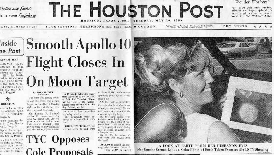
Figure 4.2.1.10: Houston Post dated 20/05/69 showing Mrs Cernan holding a photograph of the previous day’s TV broadcast. Source.
The version from John Young’s website doesn’t seem show much detail on that image of Earth -
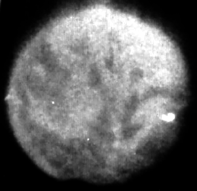
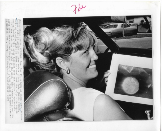
Figure 4.2.1.11: Original press photo of Barbara Cernan holding a photo of Earth
Once you spot the ‘hammerhead’ shape (which is just visible on the unenhanced image) everything else falls into place, especially in the higher quality wire image.
Well, so what? This image is from the 20th, and the TV broadcast was on the 18th -
Not really. The likely sequence of events is that the Houston Post photograph the TV broadcast on the 18th. They then show the photograph they’ve taken to Mrs Cernan (dated the 19th) the following day. This event gets photographed and makes it into the newspaper the day after that -
It shows once again that evidence can be found in the unlikeliest of circumstances, and that technology available to us today allows us to reveal new details of a photograph taken of a live TV broadcast. It helps to demonstrate that the photographs of Earth were contemporaneous with the Apollo missions, and not edited in later. They help prove we went to the moon.
Returning to the content of the broadcast, we have a long series of exchanges between the crew and Charlie Duke as Capcom describing the view.
005:07:03 Young: We've got the whole globe there.
005:07:05 Stafford: Yes, you're looking right at the United States there.
005:07:07 Duke: Roger.
005:07:08 Stafford: See the Rocky Mountains sticking out? Baja California? Can't tell whether you have any smog in LA or not, but Alaska is pretty much socked in.
…
005:07:34 Duke: Okay. Thanks. Hey, Gene-
005:07:46 Stafford: That's right, Charlie. The northeast corner is the North Pole.
…
005:07:51 Stafford: You can see cloud -
…
005:08:10 Stafford: Okay. And it looks like the Rocky Mountains are orange colored to me. The rest of U.S., Baja California, that really stands out as all brownish, and the oceans are blue; but there are so many clouds out to the northeast of the United States, you can't believe it. Covers the Far East over to Europe as far as you can see.
005:08:26 Duke: Roger. We see all that. We've got a brownish spot that's pretty hard to pick out just exactly what we're looking at, but we do see the brown and the clouds out over the ocean about the center of the globe.
005:08:37 Stafford: Yes. Okay. The brown spot is the Rocky Mountains. It runs down around into New Mexico, up into Colorado.
…
005:09:29 Duke: Hey, boy! That is really fantastic. We can pick out Baja and the smog over LA and we see Mexico and we go off to the east, in our picture, and come into the Rockies area. The Baja California and the Gulf, they really stand out beautiful.
005:09:46 Stafford: Okay. We'll move it around.
005:09:49 Duke: Looks like we've got some cloud down over New Orleans and down in that way.
005:10:57 Cernan: Charlie, this is -
005:11:08 Duke: We see it all here, Gene. The colors are really beautiful.
…
005:11:22 Stafford: Looks like the people of New York have a little bit of cloud cover today. It goes all the way down, in fact, down back by the Cape.
…
005:12:07 Duke: We copy, Gene. We are getting a real idea now, for the first time, of what you are really seeing up there. The colors on the oceans are just as blue as they can be and real white clouds all over, and the land is a real deep brown, Almost a reddish brown.
005:12:26 Cernan: And the North Pole, the Arctic area, is just solidly, whitely, snow-
005:12:31 Duke: Roger.
005:12:33 Stafford: It's a brown around in the Rocky Mountains and orange down into New Mexico and becomes a little more of a purplish orange...
Go check the photos. Their descriptions match perfectly.
We even have a close up zoom, which Duke says “has to be the greatest sight ever”. Figure 4.2.1.12 shows a compilation of screenshots from the maximum extent of this zoom along with a still from mission control taken during that sequence (from the film “Apollo 10 -
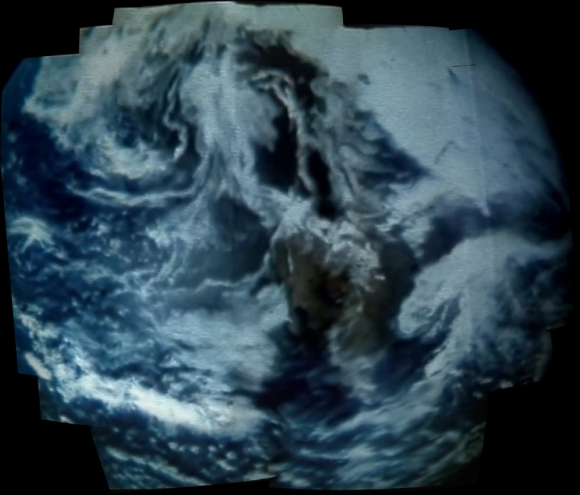
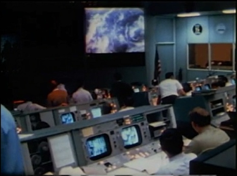
Figure 4.2.1.12: Compilation of stills from live TV broadcast (left), along with a still from ‘Apollo 10 -
It should be pretty obvious that the view you are seeing there is exactly the same one shown in the still image.
The next analysis carried out in detail is of AS10-
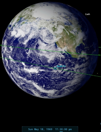
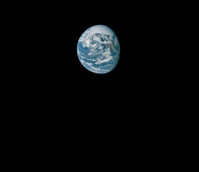
Figure 4.2.1.13: AS10-
The terminator has moved to around the edge of Florida, and there has been clear rotation of the Earth in the 90 minutes or so since the TV broadcast and the approximate time of this image. There’s not much to confirm the timing in the mission transcript, other than capcom confirming the time of transferring over to Hawaii from Goldstone as about 23:15 GMT, and John Yound noting that:
006:35:23 Young: Los Angeles looks clear today except for a little smog, I believe.
The next full analysis is of AS13-
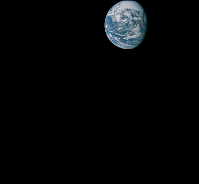
Figure 4.2.1.14: GAP scan of AS10-
AS10-
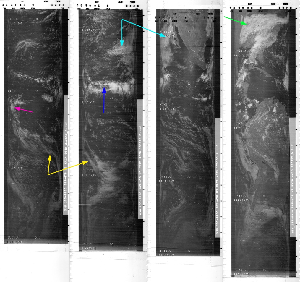
SkySafari shows that it was been taken just after midnight on the 19th of May. The ESSA image suggests that the orbits (tracks 5 to 7) covering the portion of the Earth visible here would have been carried out between 22:08 on the 18th and 02:08 on the 19th, so it is still appropriate to examine the image for the 18th when comparing weather patterns (figure 4.2.1.15).
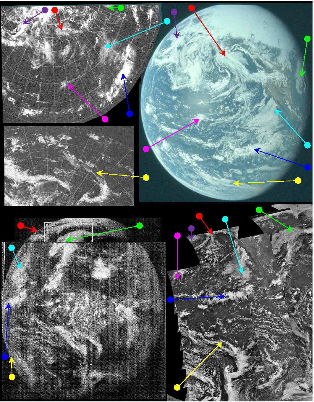
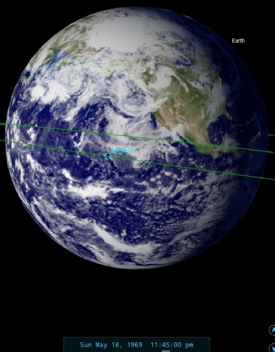
Figure 4.2.1.15: ESSA9 Top left upper & lower), ATS-
The overall weather patterns visible in AS10-
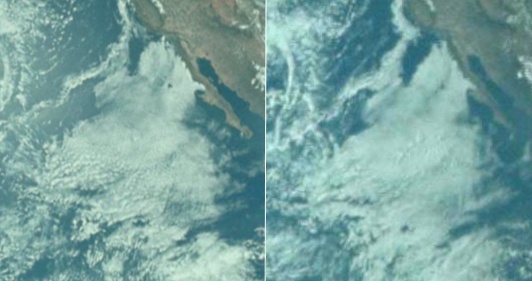
The left hand side is from AS10-
This bank of cloud then joins offshore with a much larger one between Los Angeles and Geronimo Island lighthouse, and it is very likely that these are large fog banks (the same ones mentioned by John Young), as there is a small hole in the cloud in roughly the same position as Guadeloupe The shape and size of the clear area north of Los Angeles is also different in the two photographs. Further to the west, a thin stream of cloud running north-
The existence of fog banks is confirmed by the 1973 WMO report, which describes them further north off British Columbia (see figure 4.2.1.17).
Figure 4.2.16: US & Mexico Pacific coastline from AS10-
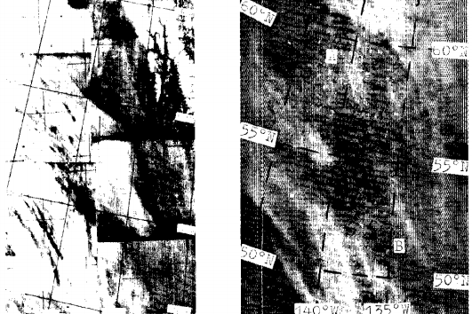
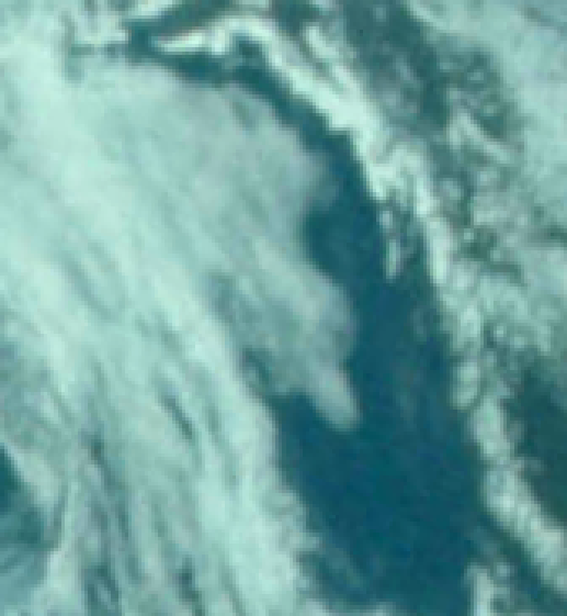
Figure 4.2.1.17: Section of AS10-
Over the whole of figure 4.2.9, there is not a single cloud that has not in some way altered in a manner consistent with weather system development over time.
Like the ATS image, less of the NIMBUS image is available for use because of the orientation of the Earth and the availability of NIMBUS tracks, but those that are shown do feature weather patterns that match those of AS10-
It’s also interesting to compare AS10-
It’s coming up to midnight, so click the link for day 2 to see the next batch of images.