4.2.2 Apollo 10 Images – Day 2: May 19th
We start day 2 with a TV broadcast that is a close match with the last still image on day 1.
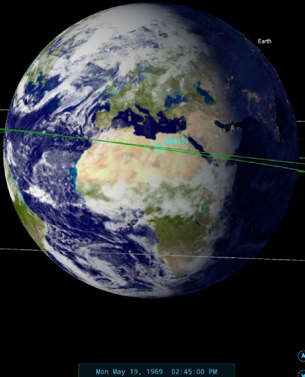
The timeline records it has having started just after midnight on the 19th, ending 25 minutes later on the 19th. Here’s a still from the broadcast, obtained from this youtube video, as well as a brief shot from a 16mm film (figure 4.2.2.1).
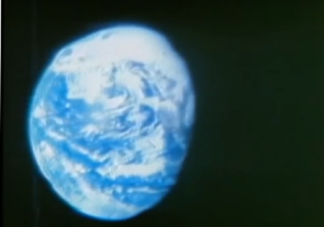

Figure 4.2.2.1: Still from Apollo 10 TV broadcast, a 16mm still from the same time and SkySafari representation of the Earth at the time of broadcast.
There is less of the large weather system over the USA’s east coast visible, hence the previous still image being placed at the end of day 1 rather than at the same time as this view, although it is always possible that it is a result of the difference in camera and film.
As in the previous case, the live broadcast is an exact match for the still image, and again there are numerous descriptions of the view by the crew and the Capcom, this time Bruce McCandless.
007:12:33 Stafford: Roger. That's correct. Looks like a beautiful sight. And either you have clouds over the Sierra Nevada's or they're snowcaps at this time. I can't tell which from here. You can still see the San Joaquin Valley.
007:14:51 Stafford: Yes. They start up in the Northwest Territories of Canada and actually ring out to Alaska, and from there they go down just about to the Canadian -
007:15:48 McCandless: Roger, 10. Up in the vicinity of Alaska, we see a swirl. Does that look like a storm system or low pressure area to you?
07:15:55 Stafford: Yes. You've got a swirl out there right on the -
007:16:16 Stafford: How are the colors coming through down there, Bruce?
007:16:18 McCandless: Oh, the colors are coming through beautifully. The oceans are a beautiful blue-
007:16:38 Stafford: Okay. Good. And you can -
007:16:59 McCandless: That's right. We can see the terminator quite clearly moving up from lower right-
As usual, the descriptions they give are spot on.
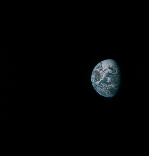
Moving back to the Hasselblad photographs, the next image to be examined is AS10-
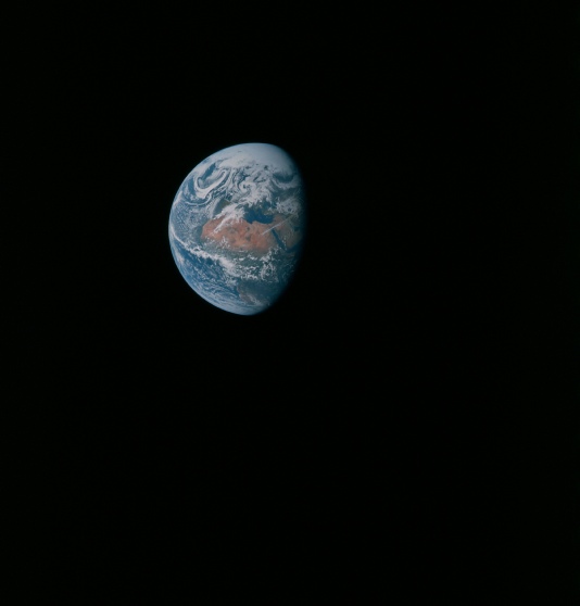
Figure 4.2.2.2: GAP scan of AS10-
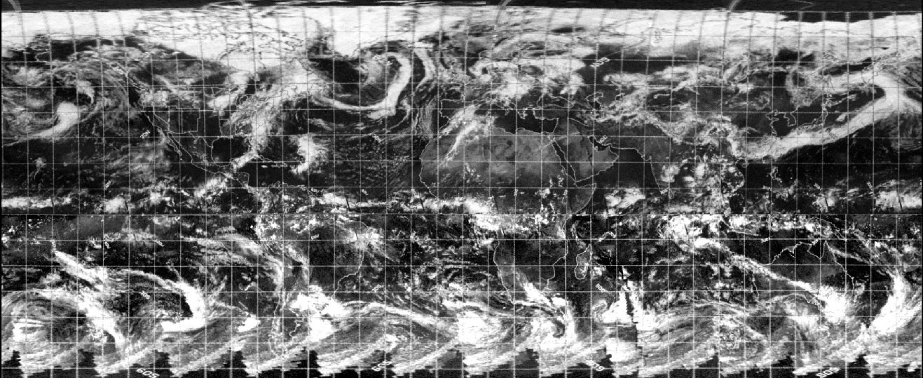
Figure 4.2.2.3 shows the ESSA 9, ATS-
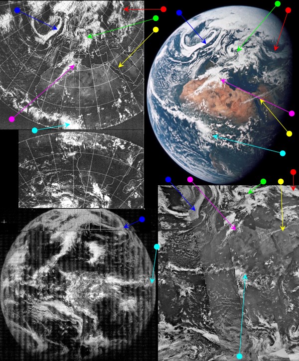

Figure 4.2.2.3 – ESSA-
Examination of the satellite photographs taken during the mission show the Apollo image can only have been taken on the 19th. The clouds visible over southern Spain and north Africa (magenta arrows) are much less developed on the 18th, and by the 20th had moved eastwards towards southern France. The very striking north Atlantic system is also poorly developed on the 18th and a completely different shape on the 20th.
The ESSA track data show that the satellite passed over Africa between 10:00 and 15:05 (tracks 11-
We again have the luxury of infra-
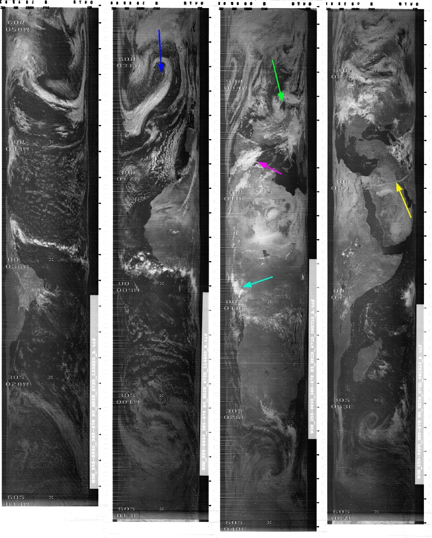
Figure 4.2.2.4: NIMBUS-
As before we can see that there is an extremely good correspondence between the infra-
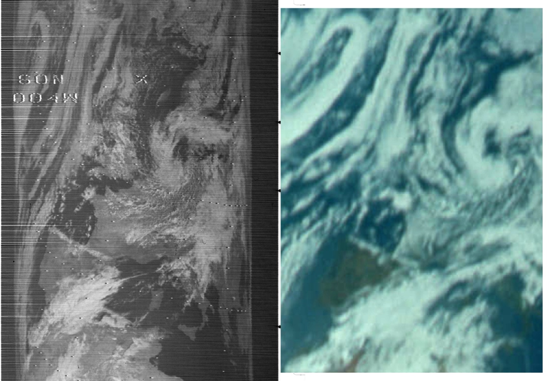
Figure 4.2.2.5: Close up of Europe in Nimbus infra-
Yet again, superb correspondence despite the images being taken in completely different spectra.
The next photographs in this magazine repeat exposures of Africa, and there isn’t much point in repeating the analysis for very similar images. However it is worth demonstrating that they aren’t the same images, and that the terminator changes position over the course of them.
Two images that show this progression are AS10-
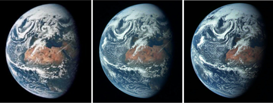
Figure 4.2.2.6: Crops of Earth from AS10-
This set of photographs, then, is taken over a period of a couple of hours and shows an Earth very obviously rotating in a consistent manner so that we lose Africa and start gaining the Americas. We also have some discussion in the mission transcript that confirms what they are looking at. At 21:33 MET, or about 14:22 GMT we have a weather report from the Command Module Pilot:
021:33:10 Young: Roger. It's a European/African weather report. Portugal -
And a moment later the Commander says that
021:34:17 Stafford: Okay; stand by. We want to get, a couple of pictures of Europe; we're in good position right now.
It obviously took them a while to get the photographs as they precede them by at least an hour, but what they describe (in particular the thin cloud across the Sinai peninsula shown by the yellow arrow) is undoubtedly accurate. They Public Affairs Officer (PAO) also confirms that they are receiving the signal via Madrid, which again is entirely consistent with what we’re seeing.
The next set of images taken by the crew shows north and south America again coming into view. The common denominator between this photograph and the previous one is the large swirl of cloud highlighted by the blue arrow in figure 4.2.2.3 in the top left of the Earth's disk, just touching the terminator. The picture in question is AS10-
As before the Earth is visibly smaller, and the scene is dominated by a large polar cloud mass, and the remains of the large 'hammer' shaped formation picked out in figure 4.2.1.2 by the green arrow. The large swirl is now on the terminator, which Stellarium estimates at around 19:30 on the 19th. The comparison with ATS, ESSA and NIMBUS data is shown in figure 4.2.2.8 below.
Figure 4.2.2.7: GAP scan of AS10-
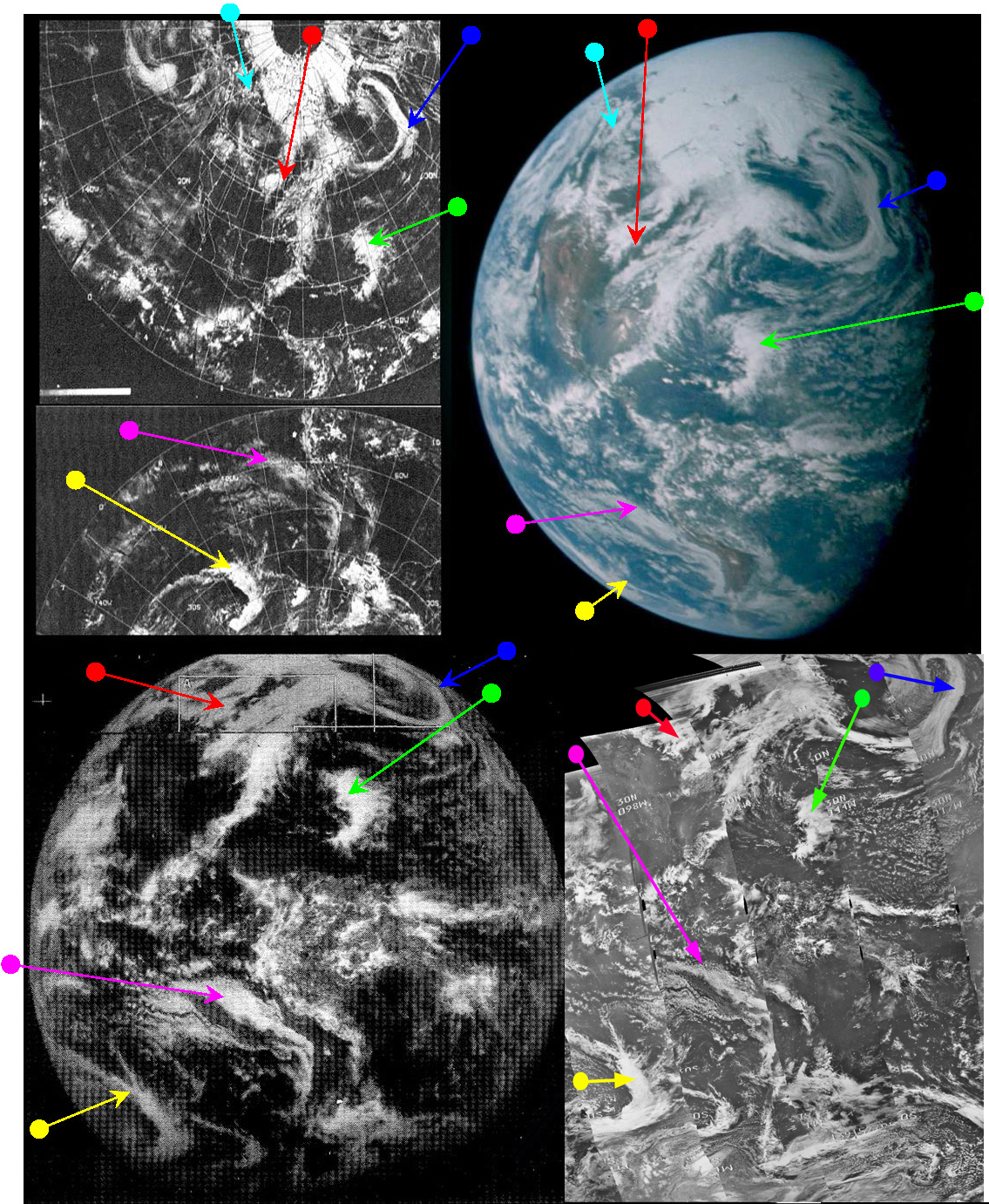
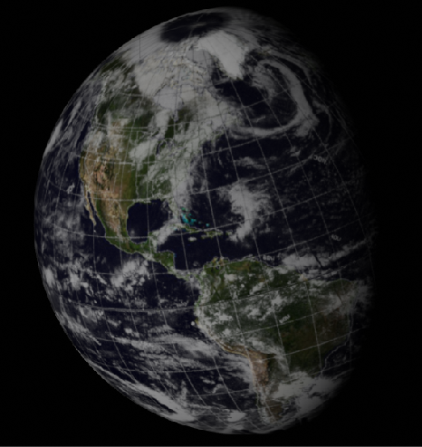
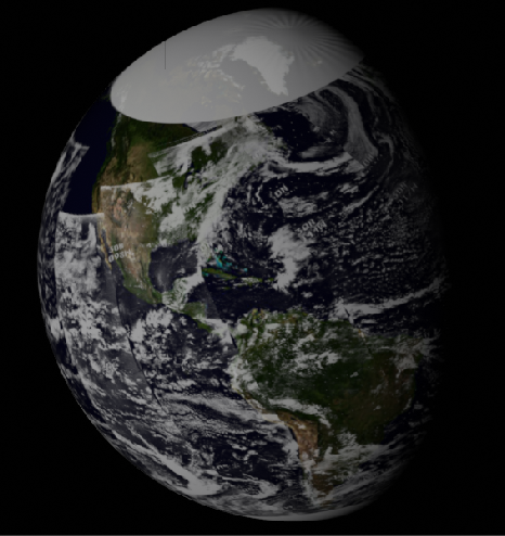
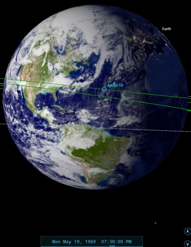
Figure 4.2.2.8: ESSA-
As before the Earth is visibly smaller, and the scene is dominated by a large polar cloud mass, and the remains of the large 'hammer' shaped formation picked out in figure 4.2.2 by the green arrow. The large swirl is now on the terminator, which Stellarium estimates at around 19:30 on the 19th.
The blue arrow in figure 4.2.1.16a points to the same cloud system as the previous analysis, and it should be readily apparent that all three satellite images show the same weather systems as can be observed in the Apollo Earth. These systems are also described in detail by the crew during a TV broadcast made shortly after these photographs were taken. The blue arrow, for example, points to
027:03:02 Stafford: You've got a real weird cloud formation
and
027:03:46 Young: It's a real peculiar-
We also have a general description of the weather on view:
027:05:44 Stafford: …It looks like broken clouds over the southeastern part of the United States. Northeast has a little bit more. Looks like Canada is all socked over today, and over that big cap that goes up over the North Pole and over to Russia it's just solid overcast.
Which is pretty much exactly what is visible in the photograph.
SkySafari’s estimate of the time compares favourably with the ATS image time of just after 17:00. The NIMBUS pass that corresponds best with the terminator (number 472) would have started at 13:51 on the 19th. The ESSA pass nearest the terminator would have been track number 2, or orbit 1029, which commenced at 17:01 on the 19th.
We again have the higher resolution NIMBUS orbits to examine, as shown in figure 4.2.2.9.

Figure 4.2.2.9: NIMBUS-
As before the correspondence with the Apollo image is excellent, and it is worth pointing out that the start time of the final pass covering the area shown in the western limb of the Apollo photograph is 18:54 -
For a closer look at the high quality infra-
Figure 4.2.2.10: NIMBUS-
As before, the correspondence is excellent, and the only differences are easily accounted for by the time lapse between images (about 6 hours) and the different spectra of the photographs.
For our next subject we return to a TV broadcast, this time one made at 20:19 on May 19th. We know this partly from the mission timeline, and partly because it was stamped all over the CBS News broadcast on the day (see figure 4.2.2.11).
Figure 4.2.2.11: Screenshot from a CBS news broadcast (Source).
For the purposes of our analysis, however, a still from this source for the broadcast is much clearer, and the satellite comparison is carried out in figure 4.2.2.12.

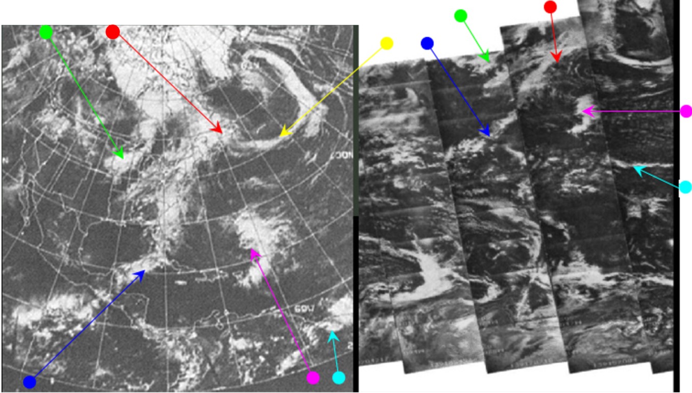
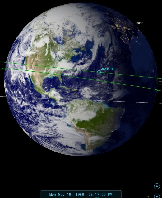
Figure 4.2.2.12: Still from TV broadcast made at 20:17 on May 19 1969 compared with ESSA (bottom left) and NIMBUS (bottom right) data, and a SkySafari time depiction.
As far as satellite timings are concerned, the ESSA’s terminator track (1030) started at 19:06 on the 19th, whilst the NIMBUS one (473) started at 13:51.
While broadcasting the image to Earth the crew again described what they were seeing in great detail:
027:01:25 Stafford: It looks like the North Pole and most of Russia is covered with clouds. The United States is pretty much wide open. In fact, the solar subpoint is right over the Gulf of Mexico now
027:02:08 Stafford: Roger. What you see there -
027:02:23 McCandless: Roger.
027:02:28 Stafford: And in the tropical rain forest over Venezuela and Brazil and Columbia you can see the clouds that hang over there all the time. I noticed how clear it is west of the Andes.
027:03:02 Stafford: You've got a real weird cloud formation coming around down -
027:03:46 Young: It's a real peculiar-
027:05:25 Stafford: Okay. Again, you can see Baja California coming in there just real clear, and the Rocky Mountains, particularly starting into Mexico going up through Colorado and Wyoming, are coming in.
027:05:36 McCandless: Roger. I'm having a little difficulty picking out the landmasses down here today.
027:05:44 Stafford: That's because of cloud cover. It looks like broken clouds over the southeastern part of the United States. Northeast has a little bit more. Looks like Canada is all socked over today, and over that big cap that goes up over the North Pole and over to Russia it's just solid overcast.
027:06:04 McCandless: Roger. We can pick up part of South America. Must be the Andes, just above or just to the west of the terminator down in the southern portion of the globe.
027:06:14 Cernan: Bruce, you should see all of North and South America from where you are. We're going to zoom it in again here. Show you a little bit closer.
As usual their descriptions exactly match what we can see.
The next still image showing any significant degree of rotation is AS10-


Figure 4.2.2.13: AS10-
South America is now beginning to go beyond the terminator compared with the TV broadcast and AS10-
Figure 4.2.2.14: AS10-
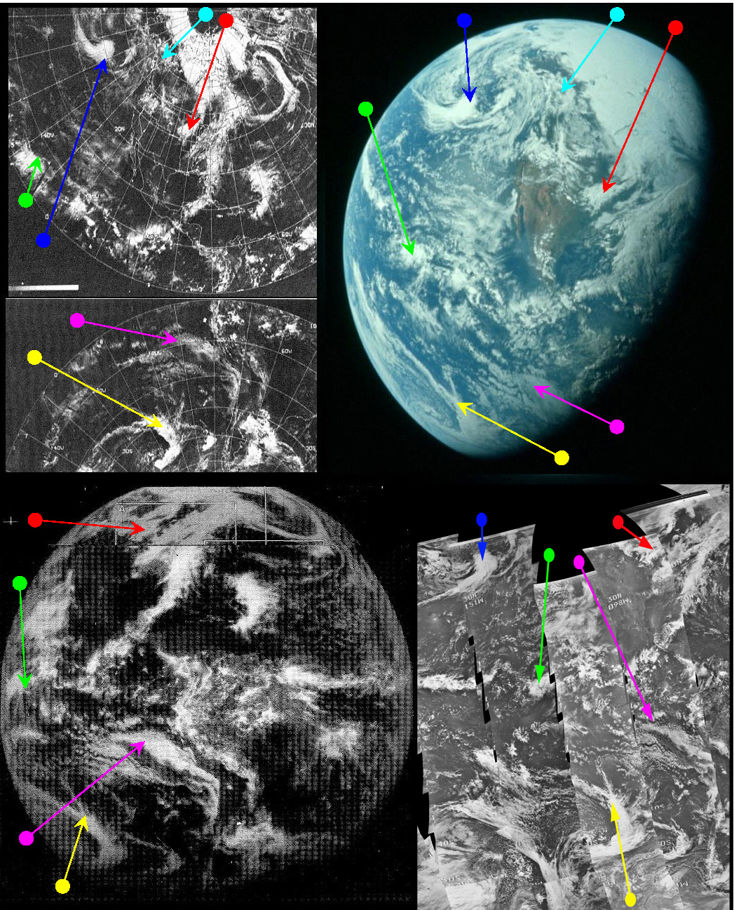
Figure 4.2.2.15: ESSA 9 (top left upper and lower), ATS-
South America has now largely disappeared, but north America is still visible. Some weather systems evident in figure 4.2.16 have now passed beyond the terminator, and there are new ones over the Pacific. The polar cloud mass is still evident, as is the system that runs from the north Atlantic down to central America.
The weather systems are still obviously the same, although new systems continue to appear on the western limb as the Earth rotates, and the large spiral system has now disappeared over the terminator. As the same systems are in view, and they do not look the same on the 20th, they must still be from the 19th, and SkySafari puts the time at around 22:45 on that date. This compares with an estimate of 20:00 for 5036. We already know the time of the ATS-
The next images of Earth in the sequence taken on the outward bound leg of the mission are actually on two different magazines – one on magazine 34 and one on magazine 35. The best example of each image will be used whenever this occurs.
The two images, AS10-
Figure 4.2.2.16. AS10-
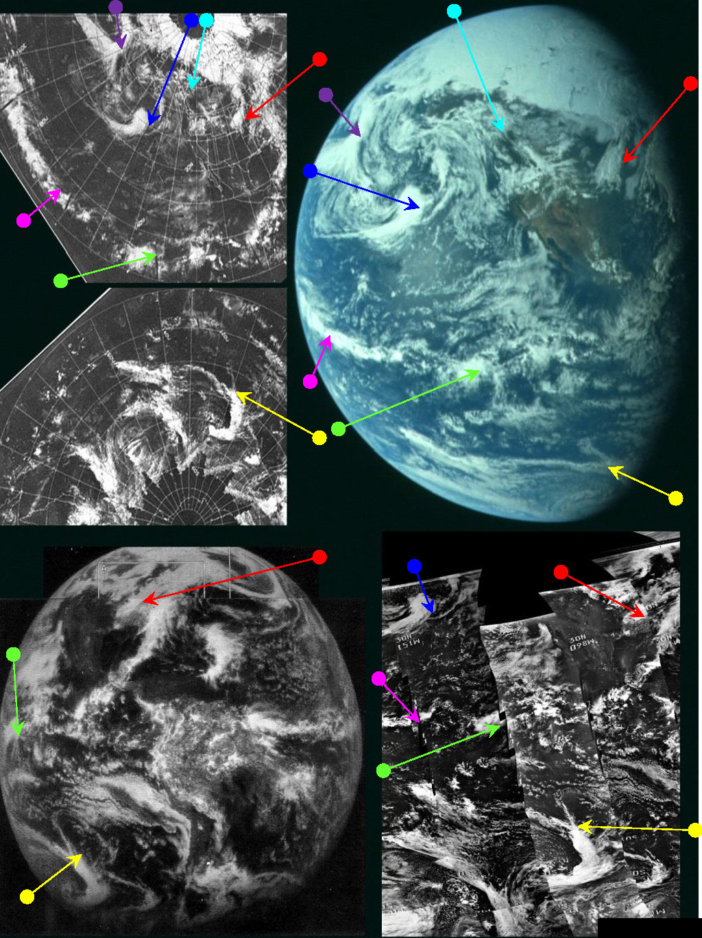
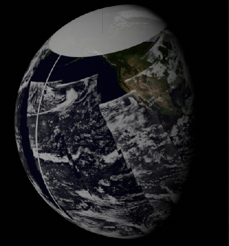
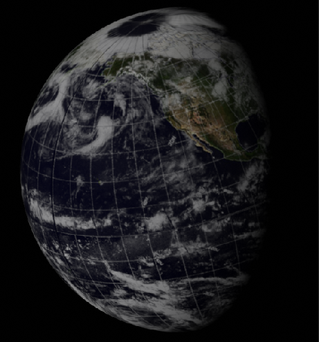
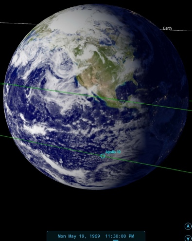
Figure 4.2.2.17: ESSA 9 (top left upper and lower), ATS-
SkySafari suggests the picture was taken at about 23:30, as judged by the location of the terminator near the swathe of cloud cutting across central America. As only 45 minutes have elapsed between this one and the previous photograph examined most of the weather systems identified earlier can still be seen. The satellite timings are also little different, but it is worth while noting that the system picked out by the purple arrow was not imaged by the NIMBUS IDCS camera until 00:48 on the 20th.
We can get some confirmation of the time from the transcript. At 30:27, or around 23:17, Charlie Duke on Capcom tells them that they will be changing to Goldstone in California as their receiving station, and that is pretty much centre stage in the photo. Meanwhile Tom Stafford tells him that
030:34:07 Stafford: From our angle now, it looks like the whole northern quarter of the whole globe is completely socked in there; and, again, the United States is what really stands out and part of Mexico. We can see the Gulf Coast from here real well, right through the hatch window.
Once again we have good coverage of the image by NIMBUS-

Figure 4.2.2.18: NIMBUS-
The correspondence between Apollo and the NIMBUS images is, as usual, extremely good, and to see how good it’s worth looking at the one taken last, orbit 479, which commenced just an hour before the Apollo image was taken (figure 4.2.2.19).
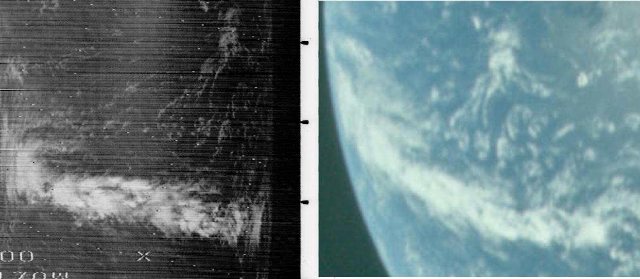
Figure 4.2.2.19: Segment of NIMBUS pass 479 compared with AS10-
The match between the two is extremely close, particularly with the lighter clouds north of the equatorial band. That band appeared in an earlier image (figure 4.2.1.2c) and it’s worth going back and seeing the change in that feature over 24 hours.
Also available from the same time is a 16mm still taken using the DAC camera, and this is shown in figure 4.2.2.20.
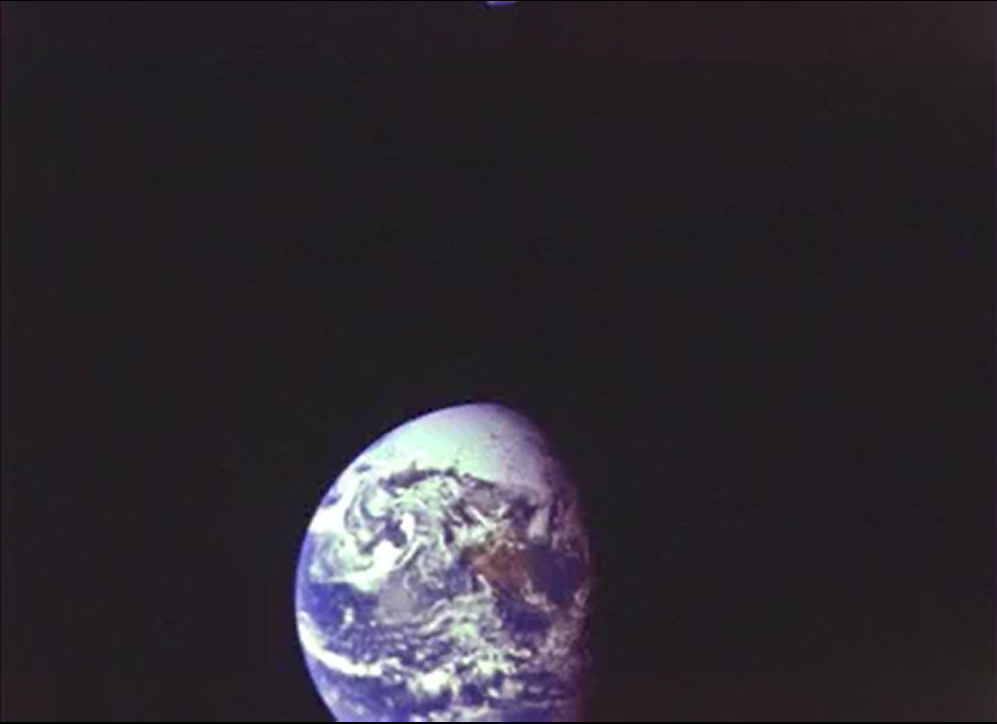
Figure 4.2.2.20: 16mm still showing the same view of Earth seen in figure 4.2.2.17
The next images were taken after midnight, so we move onto day 3.