4.2.8 Apollo 10 Images – Day 8: May 25th
Next up as we start day 8 is a return to still photography. After some photographs of the astronauts inside the CM (in an obviously zero gravity environment), and more shots of a receding moon (including viewing angles not possible from Earth), is image A10-
The image shows north America, as well as the Pacific ocean. The low cloud off Mexico and southern California visible in AS10-
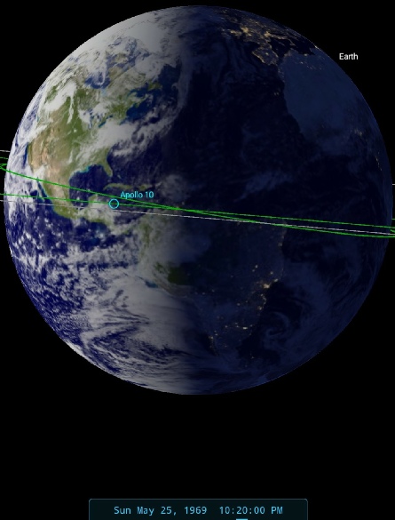
Figure 4.2.8.1: AS10-
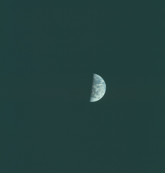
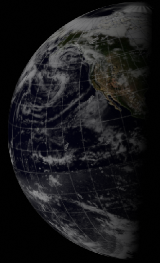
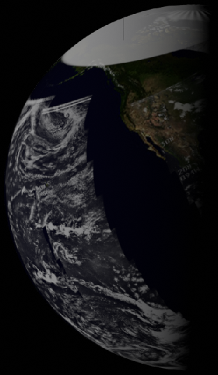
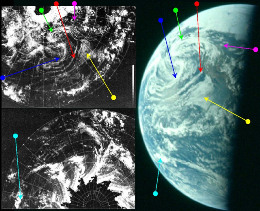
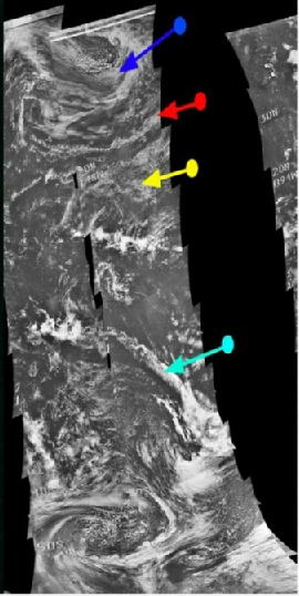
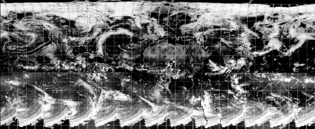
Figure 4.2.8.2: ESSA 9 (left upper & lower and NIMBUS-
The most obvious cloud mass is the complex 'S' shaped system stretching from the central Pacific to the Alaska. Another feature of note is the thin band of cloud off the California coast that stretches out into the Pacific. In the south Pacific there is a long band of cloud stretching from the Antarctic towards the tropics. Both ESSA & NIMBUS images show the 'S' system and the south Pacific arc of cloud, but loss of orbital information along the California coast means only ESSA shows detail there.
The NIMBUS-
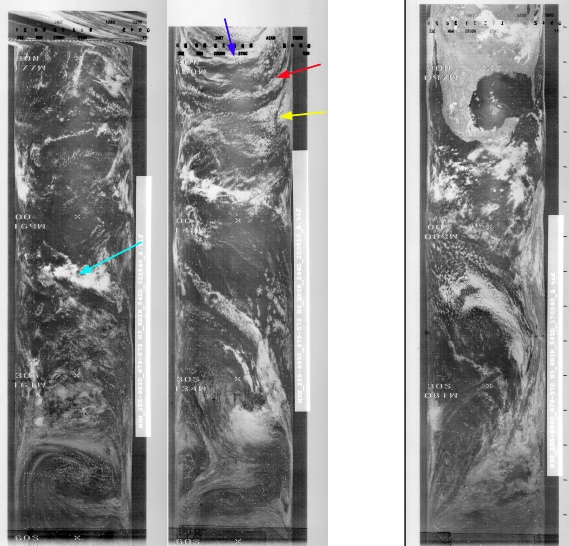
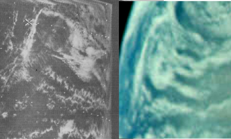
Figure 4.2.8.3: NIMBUS-
As with previous images, the SkySafari date given is that of the 25th, but the satellite images are those of the 24th. As the Apollo photograph was taken after the previous one examined here, it must therefore be after the 24th. The rotation of the Earth means that the only date possible for this image is the 25th, as by the 26th at this time the shape of the terminator moves to a more curved position.
Can this be confirmed by satellite orbital data?
The ESSA orbit for the Pacific part of the image dated the 24th is number 1095 (track 6), started just after midnight on the 25th. As usual NIMBUS' orbit is behind that of ESSA, and orbit 544 from the image dated the 24th was started at 20:57 – 4.5 hours before the Apollo photograph. The final orbit visible in the Apollo image is 545, which commenced at 22:25, just less than three hours in advance of Apollo.
We have two other versions of this view, namely a 16mm shot from Magazine W, and also the view from a TV broadcast. These views are shown in figure 4.2.8.4.
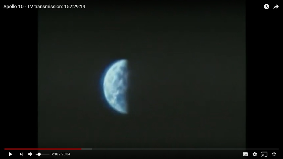
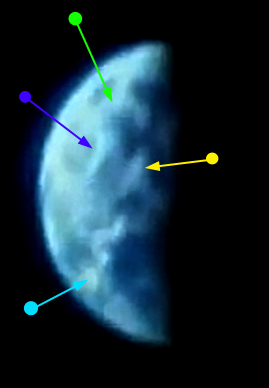
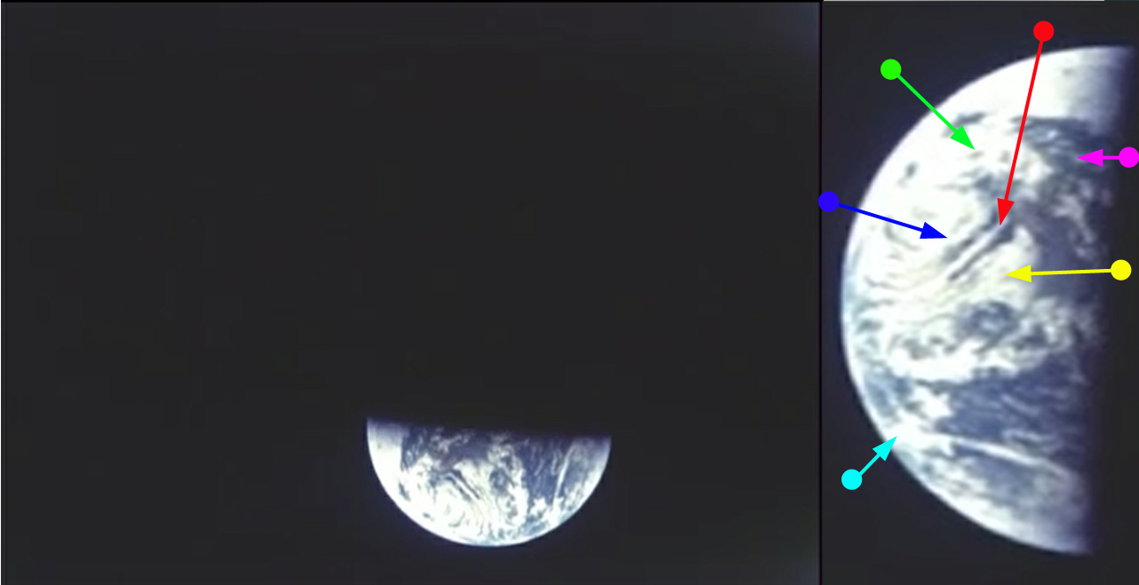
Figure 4.2.8.4: Magazine W and TV broadcast stills. Zoomed and cropped sections use the same arrows as figure 4.2.8.2
It is hopefully obvious that the scenes on show in figure 4.2.70 are an exact match for that of the still image. We also have verbal confirmation of the scene in the crew’s comments to the ground.
152:36:04 Stafford: …As you can see the Earth there, actually it's upside-
…
152:39:31 Stafford: A tennis ball is a good size just looking at it at a distance, but in a correlation, it would be to that. And, Houston, how is the color coming through? Mostly whitish browns to the right of the set and darkish brown in there towards the California coast, and the blue down in the South Pacific. Over.
Once again the description of what is on show is spot on, and could only have been done if they were exactly where they were supposed to be: in cislunar space en route to home.
Returning to the Hasselblads, a few images later in magazine 27 comes AS10-
For reasons which will become clear, 2 different day's ESSA images are used – one (top left) from the 24th, the other (bottom left) from the 25th.
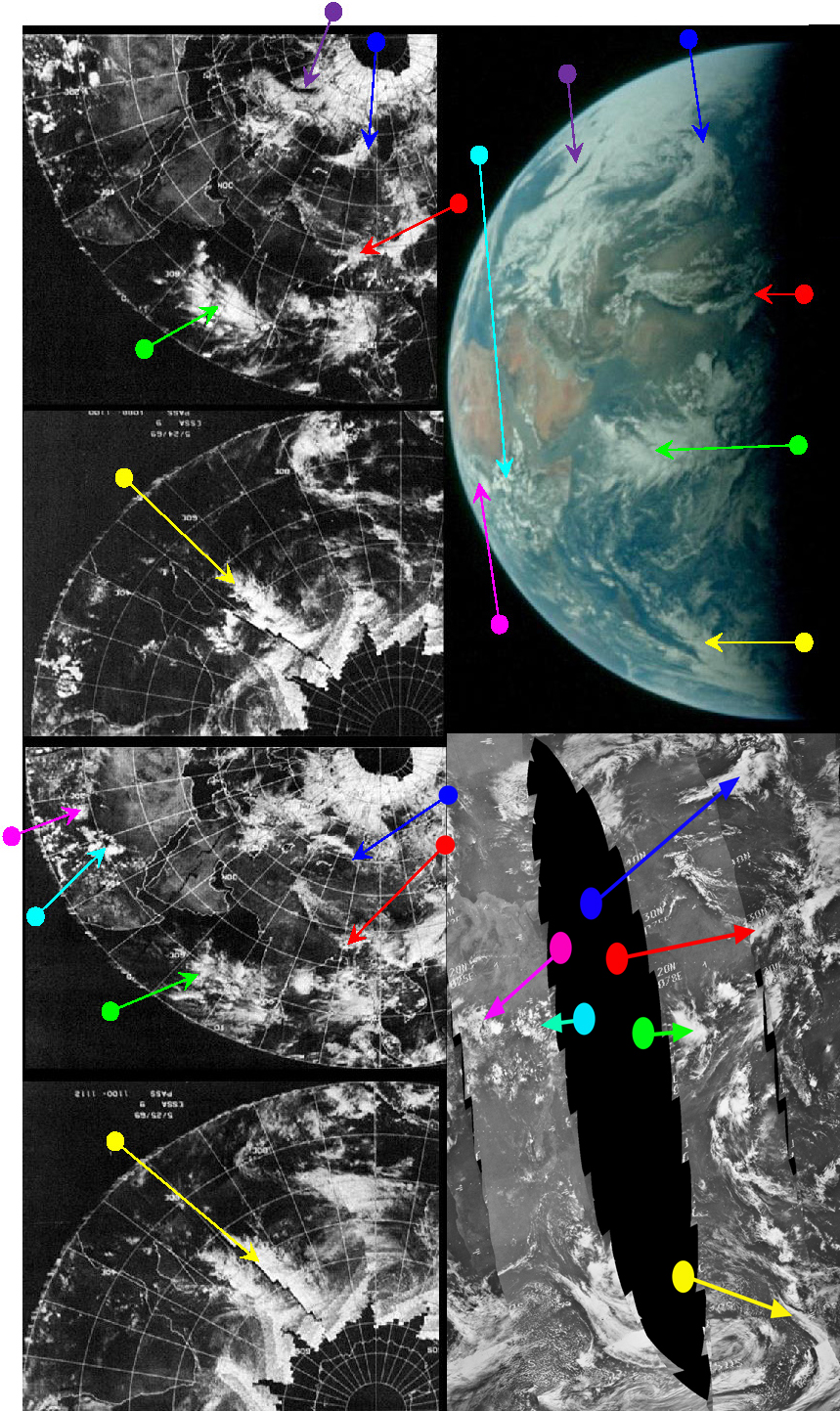

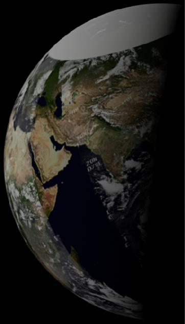
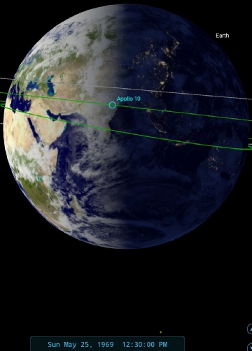
Figure 4.2.8.6: ESSA 9 image dated 24/05/69 (top left upper & lower and 25/05/69 (bottom left upper and lower) & and NIMBUS-
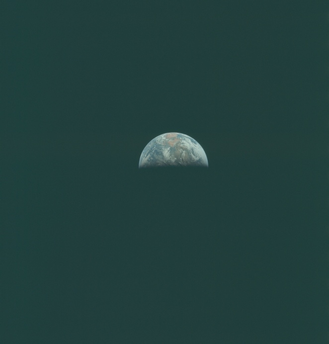
Figure 4.2.8.5: AS10-
Timing the Apollo photograph AS10-
Examination of the satellite photographs used shows that while the cloud formations over India are an excellent match on the ESSA image from 24/05/69, the Africa cloud formations are much better identified on the ESSA image from 25/05/69. The reason for this can be found in the dividing line between the two images used to differentiate the two dates.
While ESSA (& NIMBUS) operate continuously, our need to rationalise the data requires that we separate the information into discrete dates, and in this case the dividing line on the ESSA image from 24/05/69 is easily visible in the Indian Ocean bisecting a cloud formation. The time of ESSA's India orbit on the 24th (track 10, orbit 1099) east of that dividing line is put at 08:01. The track on the African side of the divide on this image is actually orbit 1088 which was commenced at 11:03 on the 24th. This means that the next ESSA image dated 25/05/69 has its first pass (track 12, orbit 1101) at 12:01, which is why the cloud formations over the horn of Africa (picked out with cyan and magenta arrows) are a better match on that image than on the previous day's.
The NIMBUS image for the 25th is much easier to work out, as the part of Earth shown in by Apollo is within the confines of a single set of orbits. The India pass, orbit 549, was commenced at 05:54. We can take a closer look at the NIMBUS image using the infra-
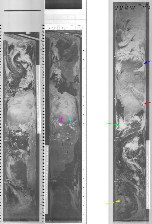
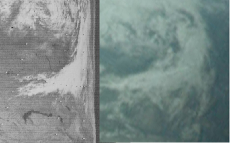
Figure 4.2.8.7: NIMBUS-
As always these higher resolution images show an excellent correspondence with Apollo photography. The change in orientation of orbit 552 is interesting, but it’s as likely to be a problem with the image itself rather than a dramatic change in the satellite’s orbital parameters.
Returning to the earlier analysis, in a nutshell: any image of Earth taken at the boundary line in an ESSA satellite mosaic is going to be a little confusing, but the appliance of logic will reveal the answer! The answer in this case being that the Apollo photograph was taken on 25/05/69 at around 12:30, just after the crew awoke from their rest period. Not long after taking AS10-
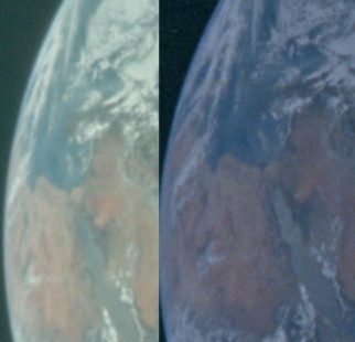
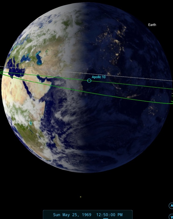
Figure 4.2.8.8: AS10-
There is a definite change in the cloud masses visible on the western limb, and in order to show the same amount of Arabia in the crop from magazine 35, that part of the image has had to be wider than that from magazine 27, indicating a change in perspective as the astronauts get nearer home.
A little while after this pair of still images we have another 16mm clip of Earth, as shown in figure 4.2.8.9, showing more of Africa.
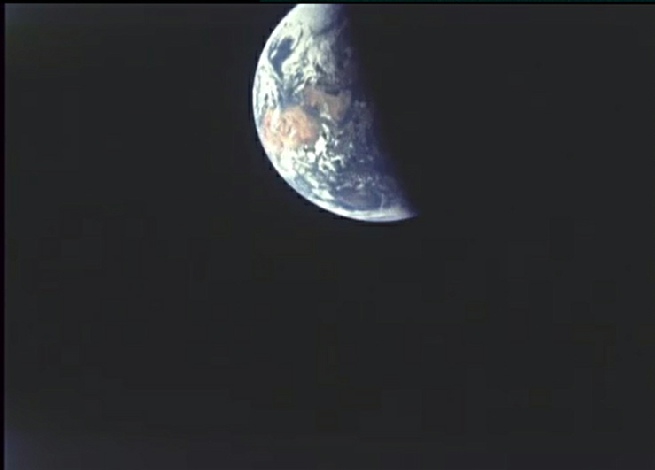
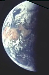
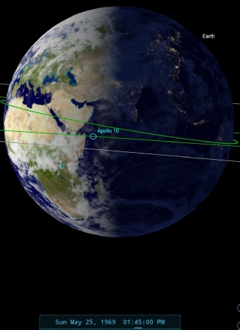
Figure 4.2.8.9: 16mm still of Earth from Magazine W compared with SkySafari time estimate.
The time estimate here suggests around an hour since the previous still image was taken, with only the westernmost tip of Africa hidden by the Earth’s curve.
Shortly after this 16mm shot we have another image from magazine 35: AS10-
Figure 4.2.8.10: AS10-
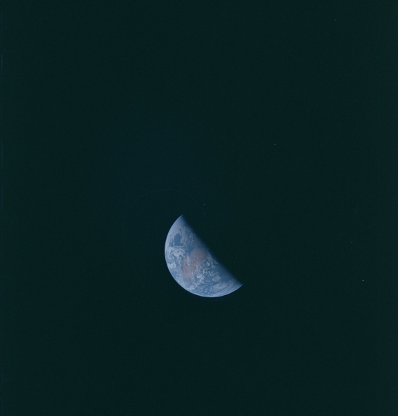
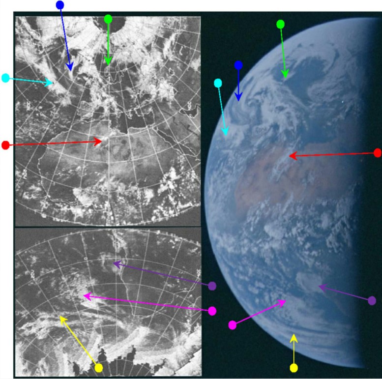
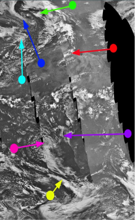
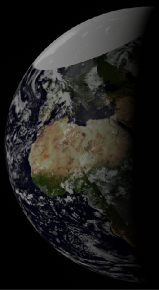
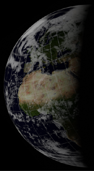
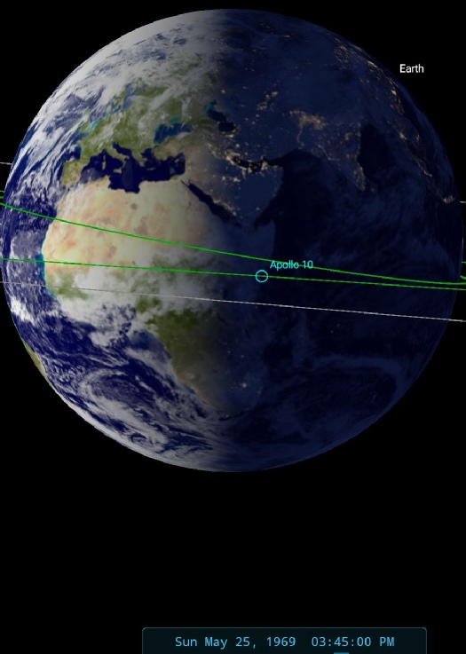
Figure 4.2.8.11: ESSA 9 (left upper and lower) and NIMBUS 3 (bottom left) images compared with AS10-
The tricky area of the dividing line between days has now (with the exception of some high latitude eastern parts of the northern hemisphere) passed beyond the terminator, leaving us with an image that is fairly and squarely taken on the 25th.
The weather systems north and west of Europe are particularly distinctive and do not appear in that configuration on other days' satellite records. Furthermore the Stellarium terminator estimate is 15:45, and by that time on the 26th Apollo 10 was on re-
The ESSA 9 track covering the terminator area is number 12, which corresponds to orbit number 1101, which commenced at 12:01. The equivalent NIMBUS pass is number 549, which commenced at 05:54 on the 25th. There isn’t much extra to be gained from an examination of the infra-
There’s little in the transcripts to identify what the crew are looking at, but Capcom does tell them at 169 hours (17:49 GMT) that they are receiving the signals from them via Madrid.
Shortly after the preceding image was taken, we get to see Madrid in shot in AS10-
Figure 4.2.8.12: AS10-
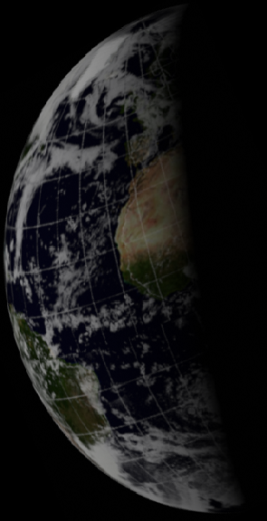
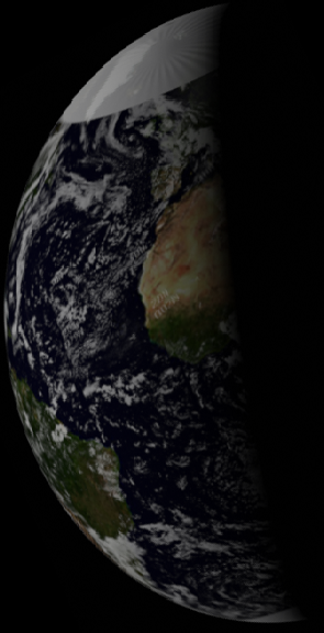
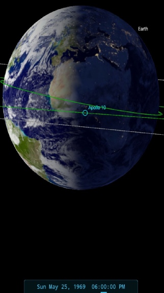
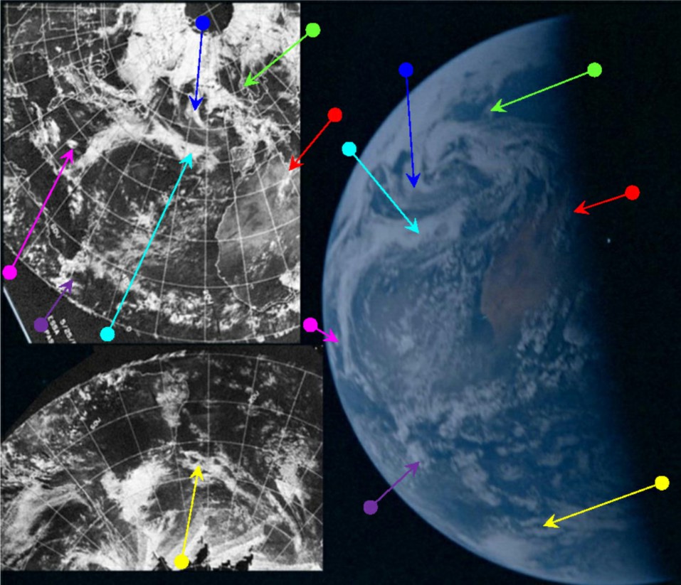
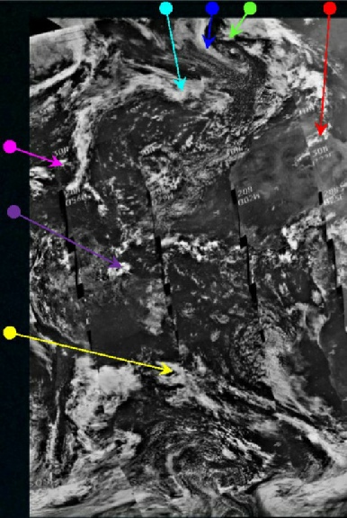
Figure 4.2.8.13: ESSA 9 (left upper and lower) and NIMBUS 3 (right) images compared with AS10-
As can be seen from the SkySafari view, the time for this image is around 18:00 GMT and it is interesting to note that while the broad pattern of weather systems remains the same (and also interesting to see how the change in perspective alters how they look), the passage of a few hours since the preceding photograph has caused subtle changes – particularly over north west Africa as incoming ocean borne weather systems start to interact with the hot air masses of the northern deserts.
We also have the emergence on the western limb of the Atlantic weather system last seen in figure 4.2.7.15. a decayed remnant of the one visible in the Earthrise photographs and another indication that we are observation snapshots in a continuum of weather, not some made up patterns.
As far as the satellite timings are concerned, ESSA’s pass over the terminator would be the first one of its orbits that session (pass 1103), which would have commenced at 16:02. The NIMBUS orbit over the same area would be number 553 which commenced at 13:04 on the 25th. While this is obviously several hours before the Apollo photograph, it’s worth pointing out that the cloud identified by the magenta arrow was not photographed by NIMBUS until 14:56, which would give even less time for the team of alleged photomanipulators and graphic artists and spray painters to work on their perfect rendering of the scene. We can see how perfect that rendering would need to be by looking at the infra-
.
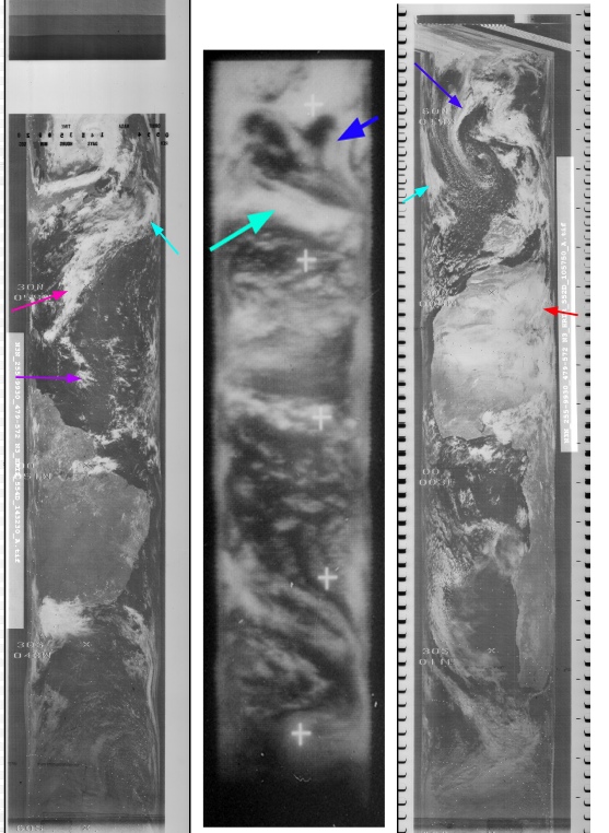
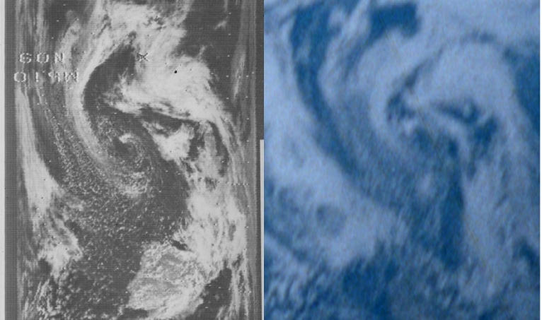
Figure 4.2.8.14: Left -
As before, the infra-
The long band of cloud (magenta arrow) now makes a regular appearance in a series of 16mm and Hasselblad images, first up is this still from Magazine W (figure 4.2.8.15).
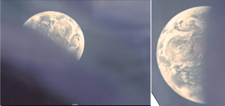
Figure 4.2.8.15: 16mm still from Magazine W, with SkySfari estimate of time at terminator.
We’re definitely getting closer to home now, and the detail in the 16mm view is becoming much clearer. The appearance of clear blue water on the western limb shows rotation of the Earth beneath the returning craft, and puts roughly half an hour on the clock since the previous image. We’ll save the more detailed analysis for the next in the sequence, AS10-
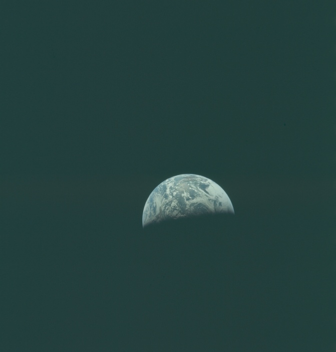
Figure 4.2.8.16:AS10-
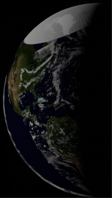
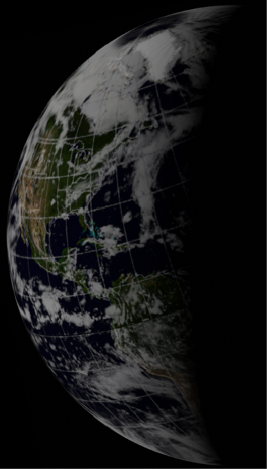
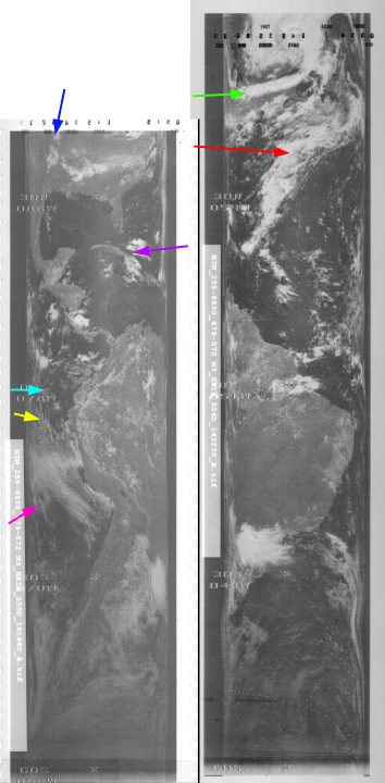
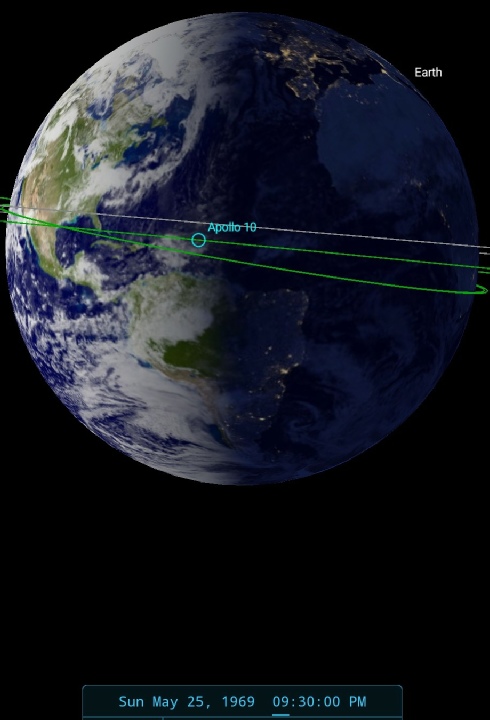
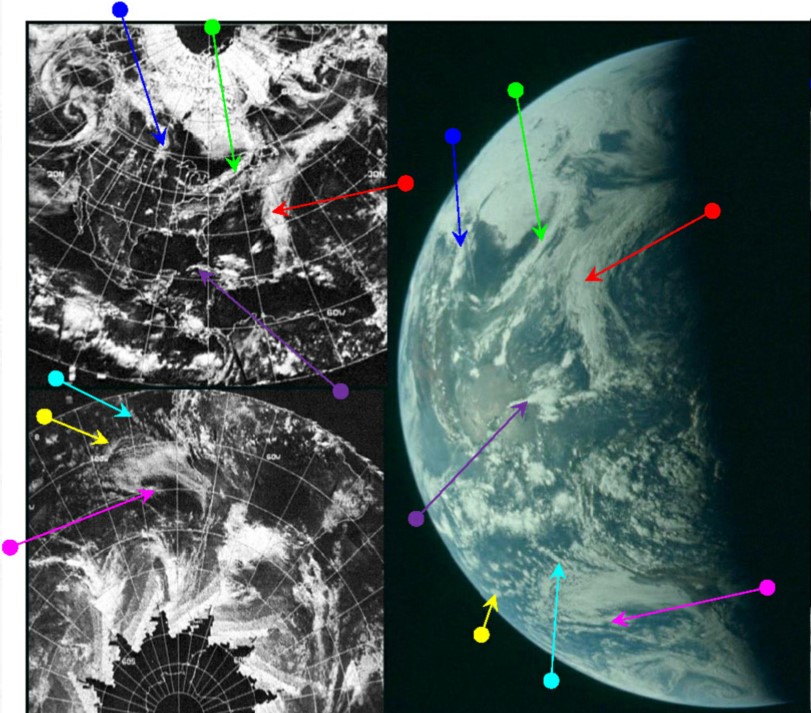
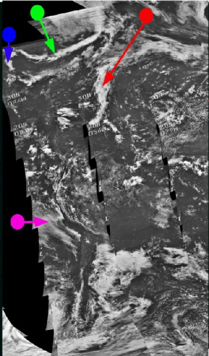
Figure 4.2.8.17: Main image -
The ESSA orbital pass for the Atlantic (orbit 1104, Track 2) commenced at 17:07 on the 25th. NIMBUS' orbit for the same area is number 554, which commenced at 14:51 on the 25th. It’s always worth looking in detail at a small section of the HRIR orbit section (figure 4.2.8.18).
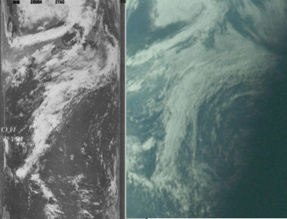
As you can see the Apollo image and NIMBUS match extremely well, despite there being several hours between the images.
SkySafari suggests a time of around 21:30 on the 25th for the Apollo photograph, shortly before commencing their penultimate TV broadcast. The mission transcript records discussions with ground control before the broadcast feature the Apollo crew describing the coast of Florida, Mexico and south America, exactly as featured in this image:
172:52:45 Young: Roger. We're looking at Florida through the optics. The Cape's open today. Looks like y'all may have some clouds out there, little scattered clouds around Houston. Is that right?
172:52:56 Duke: It was like that when we came in 4 or 5 hours ago -
172:53:10 Young: Oh, it's no real problem, we're just sightseeing. Boy, it's a beautiful view. You can see the subsolar pointing's in the Gulf of Mexico right about between the Yucatan peninsula and Mexico proper. And with these optics, I can look all the way into South America as far south as Chile.
Interestingly they also describe the weather system noted previously over Alaska & the Aleutian islands during that TV broadcast.
This area is not quite visible in the photograph, which suggests that it was taken slightly before that discussion took place. Crew comments refer to California appearing on the horizon during the TV broadcast, and they also have to wait for the Goldstone receiving station in California to come into view, which again suggests that this image was taken while waiting for this to happen.
To complete the sequence we have this final still from Magazine D. It could be argued to show exactly the same view as shown in figure 4.2.8.19, but there does appear to be less visible of the systems in the northern hemisphere.
Figure 4.2.8.18: section of NIMBUS-
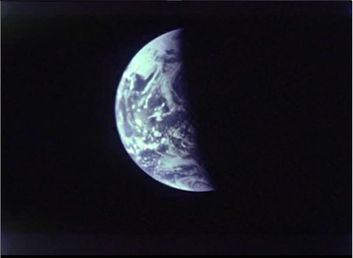
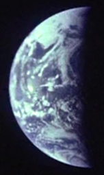
Figure 4.2.8.19: 16mm still showing Earth and a SkySafari estimate of time at terminator.
A short while after the 16mm footage was taken the crew made another TV broadcast. This took place between 22:16 and 22:26 on the 25th and again featured long shots of Earth with the crew describing the view. A still from the broadcast is shown in figure 4.2.8.20.
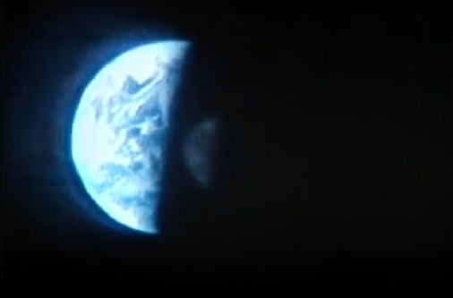
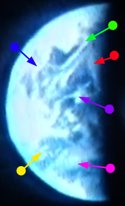
Figure 4.2.8.20: Still from live TV broadcast with SkySafari indicator time at terminator. Arrows used match figure 4.2.8.17
The most obvious feature is the storm marked with purple arrow, and this is west of a feature that (red arrow) that has now rotated beyond the terminator -
173:34:26 Cernan: Charlie, we'll be looking at -
173:35:15 Cernan: We're vertically right now above the Earth, somewhere between Caracas and Panama.
Which is where I’ve positioned Apollo 10 in the SkySafari depiction. We also have this comment:
173:36:47 Cernan: Looks like we won't catch you this time, Charlie, but that big low-
That low pressure system will be be much more obvious in the next image.
In addition to describing the weather, the crew inform Capcom that they are taking photographs and 16mm footage of Earth every few hours to provide a record of its appearance.
That’s it for day 8. Click the links for day 9.