4.2.4 Apollo 10 Images – Day 4: May 21st
The first image from the 21st is AS10-
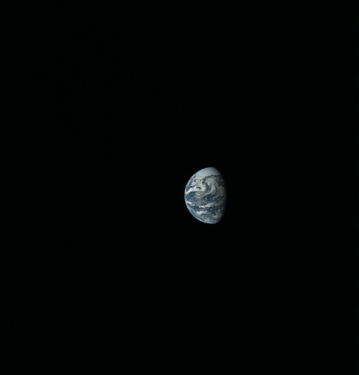
Figure 4.2.4.1: AS10-
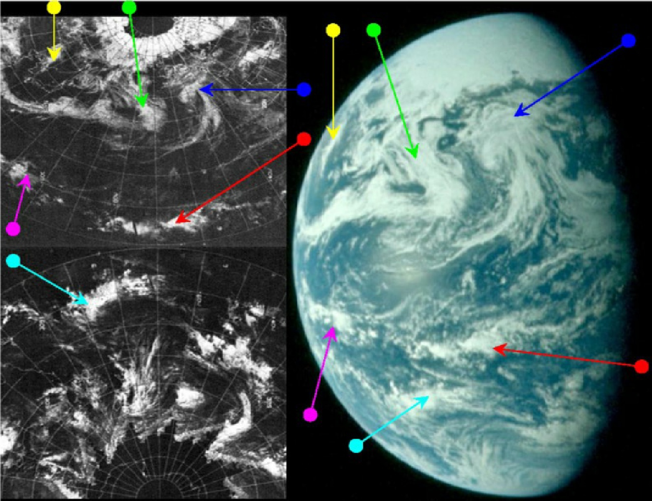
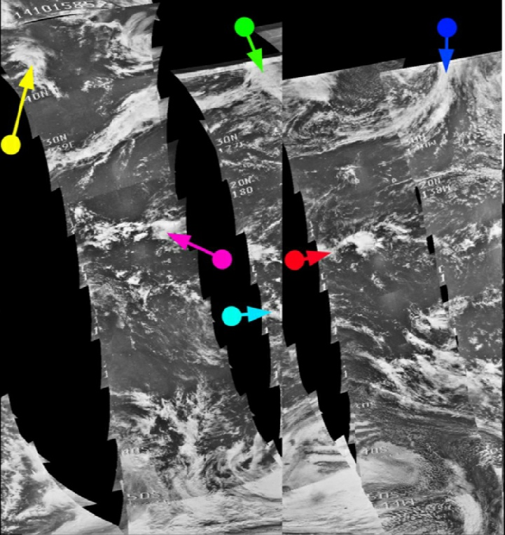
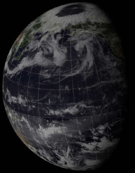
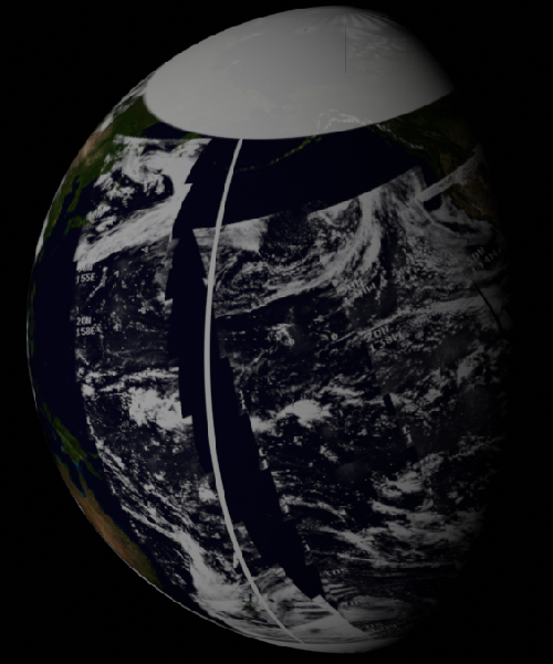
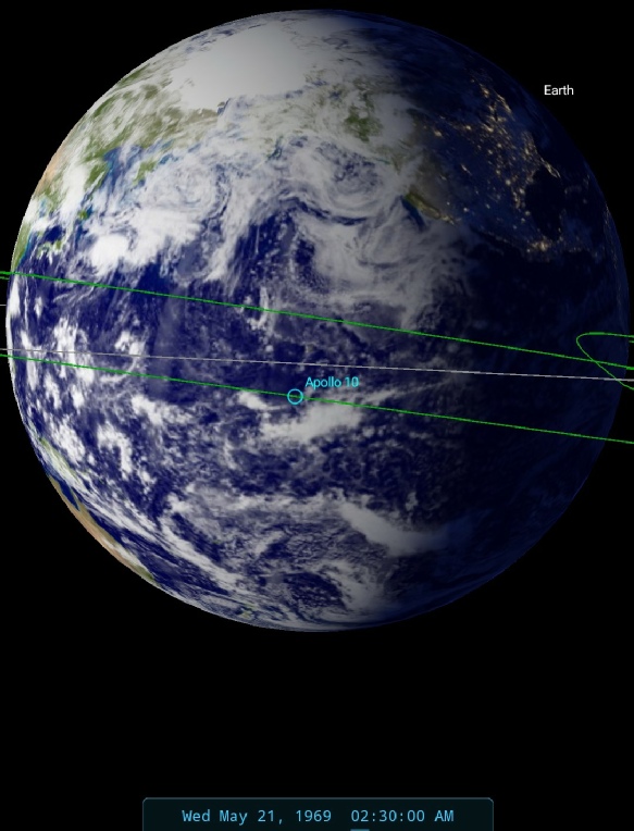
Figure 4.2.4.2: ESSA 9 (top left) and NIMBUS 3 (centre left) images compared with AS10-
The quality of the image is such even without zooming in it is possible to see that the system identified by the blue and green arrows in the previous analysis are still visible in this one, but the systems shown by the purple and magenta arrows have moved beyond the terminator, and are no longer visible. There is no need to use the ATS image in the analysis, as in there is only the fog banks off the west coast of northern America that is still visible on it.
In terms of when the image was taken, SkySafari suggests a time of around 02:30 on the 21st, at which point the crew were roughly at the point where the Moon & Earth appeared the same size to them, and not far off the point where they passed from the Earth's gravitational sphere of influence and into that of the Moon's.
ESSA's most representative orbit for the terminator is track 5, or pass number 1011, which commenced at 22:00 on the 20th. NIMBUS' pass for the same area is number 490, commenced at 20:17 on the 20th.
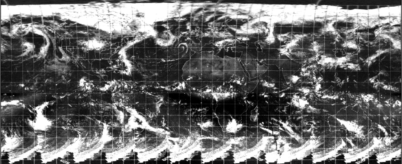
Now that the Earth has rotated a little more it’s worth looking at the higher resolution infra-
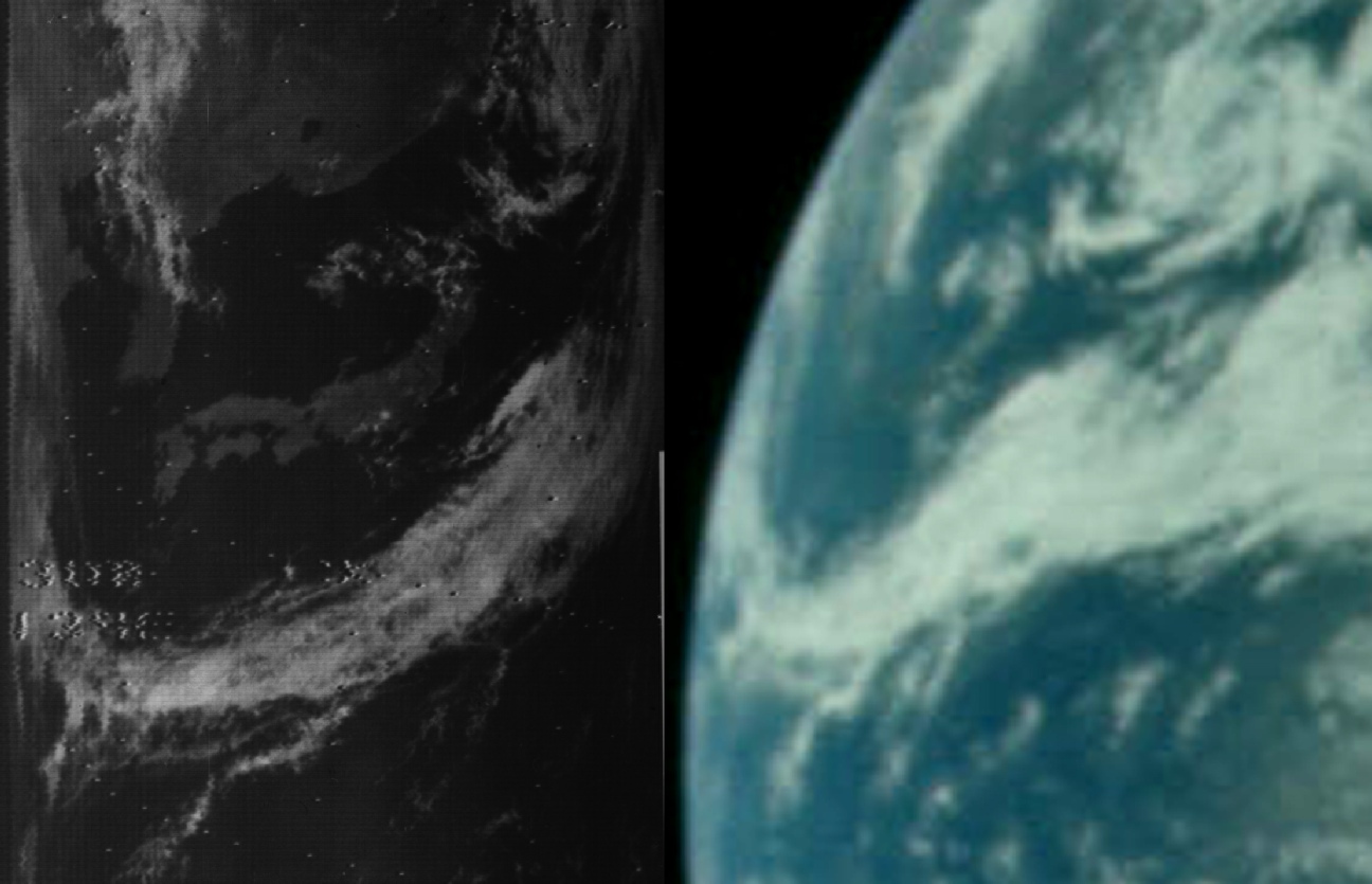
Figure 4.2.4.3: Section of NIMBUS-
As usual with these things the Apollo record and that of NIMBUS are an excellent match. Particularly worthy of note is the circular depression in the top right of both images. While no name storm is given in this area for these dates, it is certainly very obvious. This particular pass was started at 01:20, almost exactly matching the estimate for the Apollo photograph.
Not long after AS10-
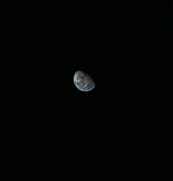
Figure 4.2.4.4: AS10-
Figure 4.2.4.5 shows the analysis, and the most obvious weather systems visible are those in the northern hemisphere, particularly the striking spiral off the coast of Africa (red arrow), and the complex frontal system indicated by the blue and green arrows. Neither of these features were evident on the previous day's satellite images, although they are obviously a development of the systems visible in figure 4.2.3.6 from the previous day.
Figure 4.2.4.5: ESSA 9 (top left upper and lower), ATS-
.
SkySafari suggests a time at terminator of around 16:15 on the 21st. South America is visible in the Stellarium image, but it is difficult to spot in the Apollo image until it is spied under a thin layer of cloud. The yellow arrow points to a triangle of cloud that will be more visible in later images.
ESSA would have imaged the terminator area in track 12 of its orbit. As the image dated the 21st starts with the area covered by track 11 onwards, this means that orbit 1051 is relevant pass, commencing at 12:07 on the 21st. NIMBUS' equivalent is orbit 497, commenced at 08:49 on the 21st.
We have good coverage of this image from the higher resolution NIMBUS-
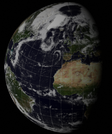
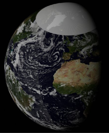
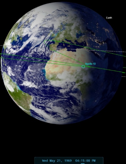
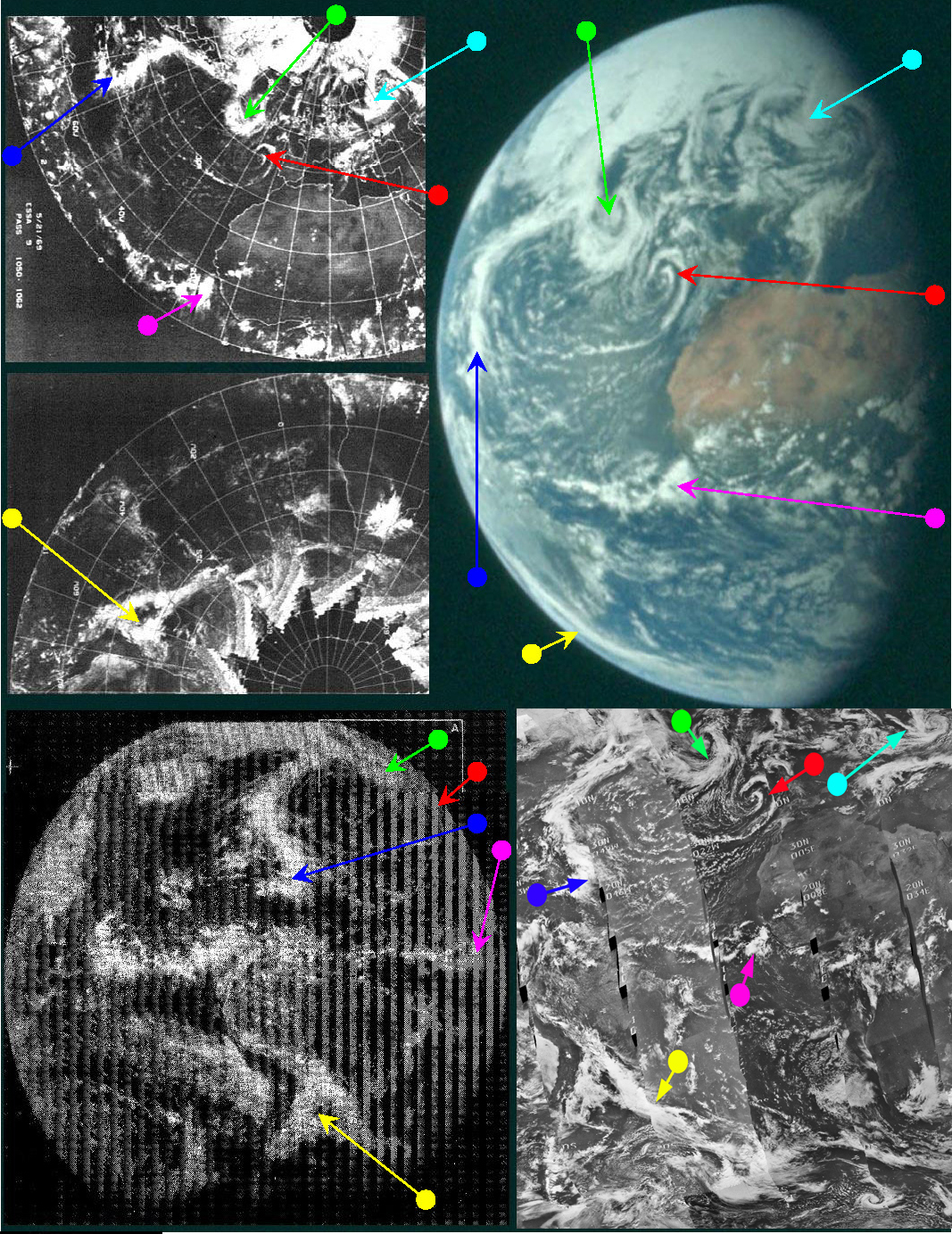
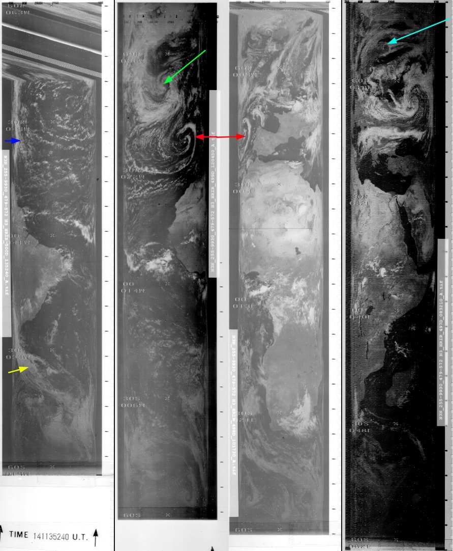
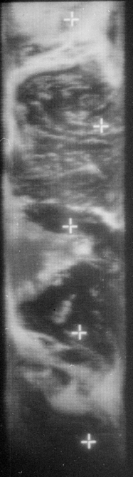
Figure 4.2.4.6: NIMBUS-
As usual the infra-
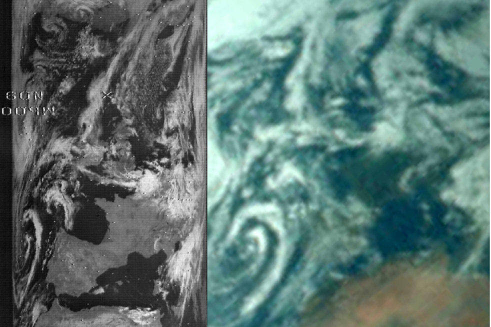
Figure 4.2.4.7: Section of NIMBUS-
Once again, even when zooming into the smallest details the match is exact. The UK can me made out in the centre of the Apollo image, and the Atlantic fronts marching in are easy to make out. The distinctive swirl off Spain is very obvious.
Before the final Hasselblad is examined, we have one more TV sequence to look at. This sequence was broadcast between 17:26 and 17:43 on the 21st. A still from a CBS news broadcast is included in the analysis below (figure 4.2.4.8). It isn’t all that clear, so a still from this source is also included.
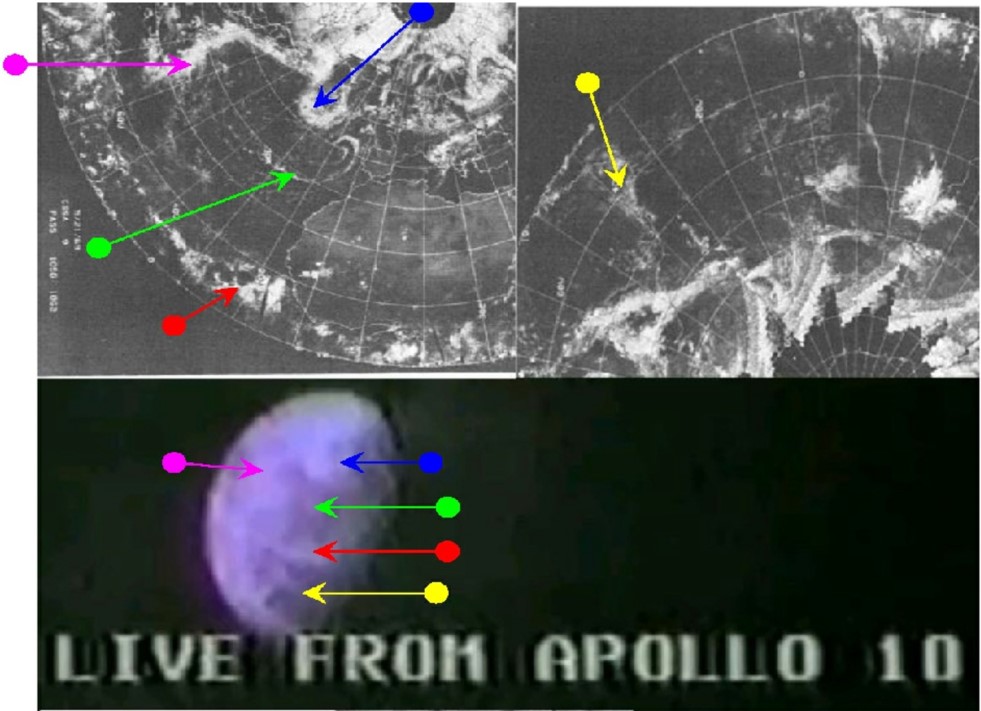
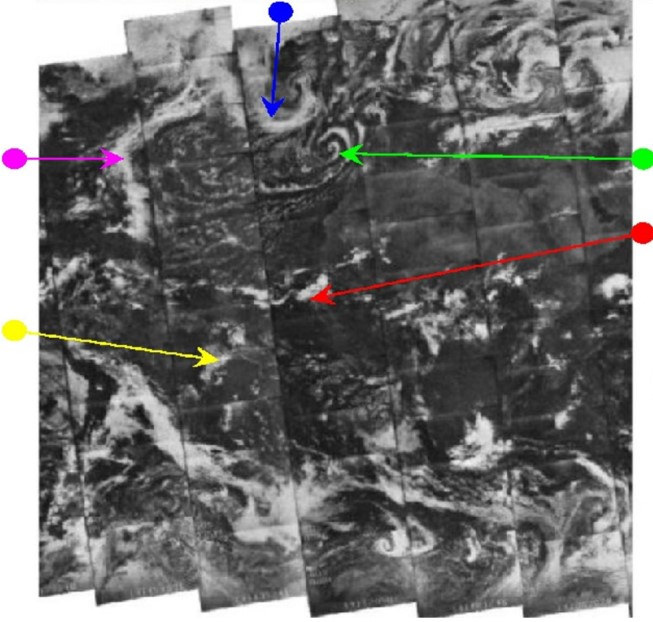
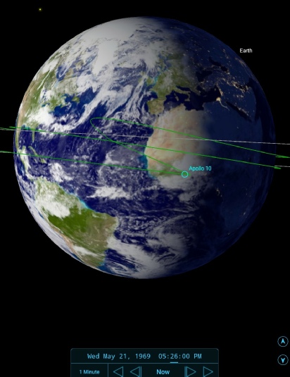
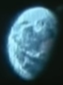
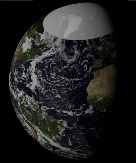
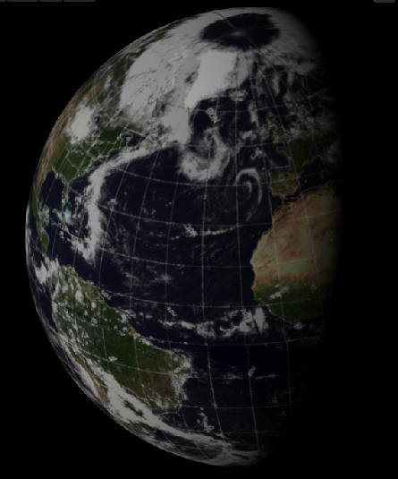
Figure 4.2.4.8: Cropped screenshot of Apollo 10 live CBS TV broadcast with ESSA & NIMBUS images from 21/05/69, and SkySafari insert showing terminator position at time of broadcast. Below these are ESSA (left) and NIMBUS (right) 3D models built using digitally restored data. Below these are ESSA (left) and NIMBUS (right) 3D models built using digitally restored data. Right is a clearer version of the same scene.
As usual with the TV broadcasts there is a detailed description of the scene:
072:38:15 Stafford: Right. You can see the South Atlantic Ocean there and the orange spot to the right is the North African continent. You can see basically the Sahara Desert and, above that, the Mediterranean Sea. The rest of the world is pretty much encased in clouds. The solid cloud cover that's covered the North Pole, and most of Europe, is still with us today. At this time, as we look at the Earth, we are 210,000 miles [389,000 km] away. We've only got about 9,000 miles [16,700 km] to go to the Moon and we're traveling approximately 2,500 miles an hour [4,600 kph] relative to the Earth. Also, in about 15 minutes we will enter the shadow of the Moon and make our major burn to enter lunar orbit in approximately 3 hours. Now, at this distance, the Earth looks slightly smaller than a tennis ball to us and a little bit larger than a golf ball. And I hope it shows up the same way on your screen.
072:39:19 Stafford: ...And again, South Africa -
072:39:27 Duke: Roger. I was just going to add that we can see the northern part of Africa. We had a bluish tint to it at first but now it's coming in to a sort of orangish brown and we can see the South Atlantic and the cloud covers very well. The colors are very good. Over.
072:39:47 Stafford: Roger. Again, the Sahara Desert, the Atlas Mountains, Morocco, Libya we can see from here. It is an orange brownish orange. The night time -
072:53:32 Stafford: Looks like we're right on trajectory, then. Okay. Here's another look at the Earth through the 210-
We also have available another 16mm view of Earth, very obviously taken at the same time (figure 4.2.4.9).
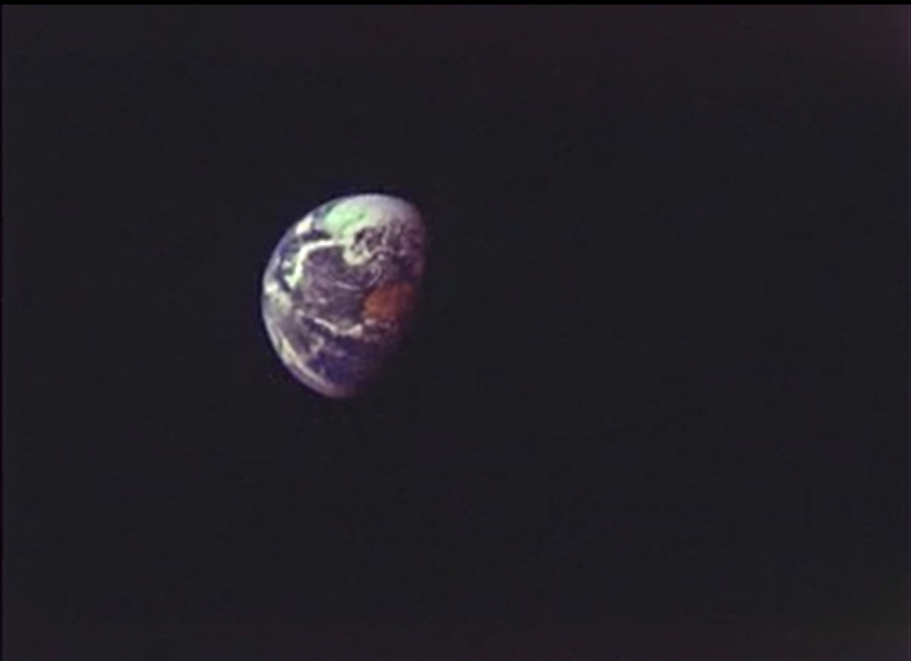
Figure 4.2.4.9: 16mm Apollo 10 still.
One final photograph can be examined before coming to those featuring the Earth with the lunar surface, and this is AS10-
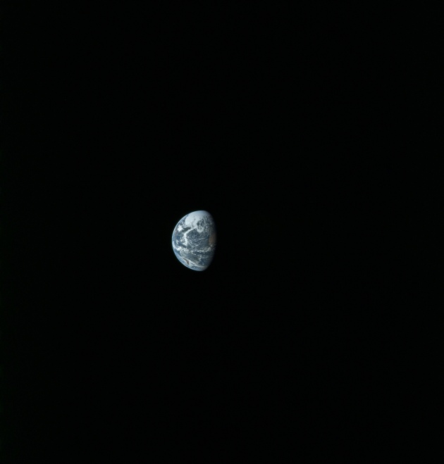
Figure 4.2.4.10: AS10-
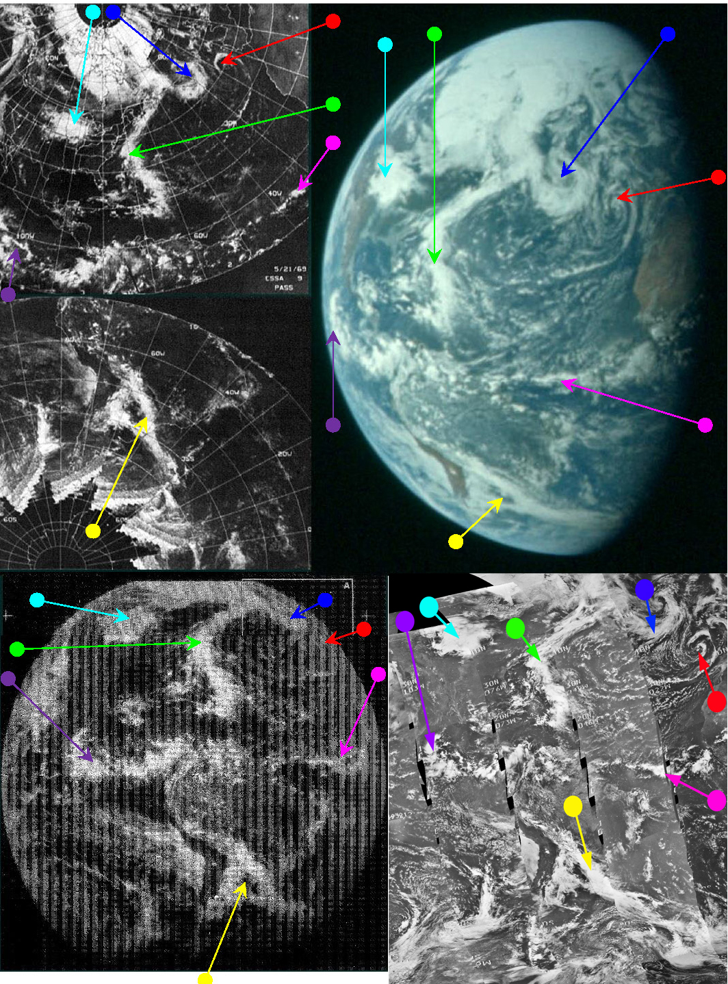
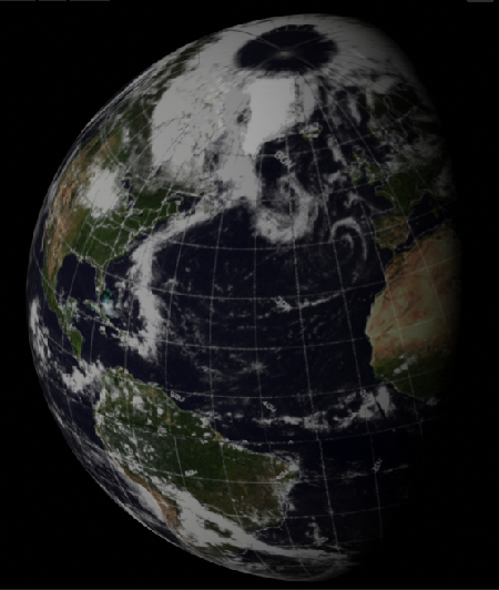
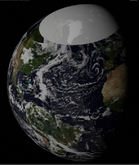
Figure 4.2.4.11: ESSA 9 (top left upper & lower), ATS-
SkySafari suggests an image time for Apollo of around 18:15. The ESSA orbit for the mid-
It should be clear from the Hasselblad still that it is showing the same weather details that can be seen in the TV and 16mm footage.
We have a gap now of almost 24 hours while the crew enter lunar orbit and prepare for the big rehearsal, so click the link below to go to day 5.