4.2.6 Apollo 10 Images – Day 6: May 23rd
The next Earthrise is captured in the early hours of day 6, but is actually just one orbit further into the mission compared with the last one on day 5. Figure 4.2.6.1 has the details.
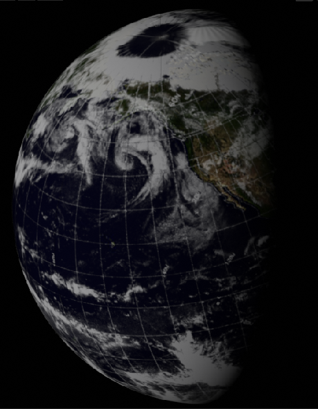
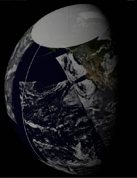
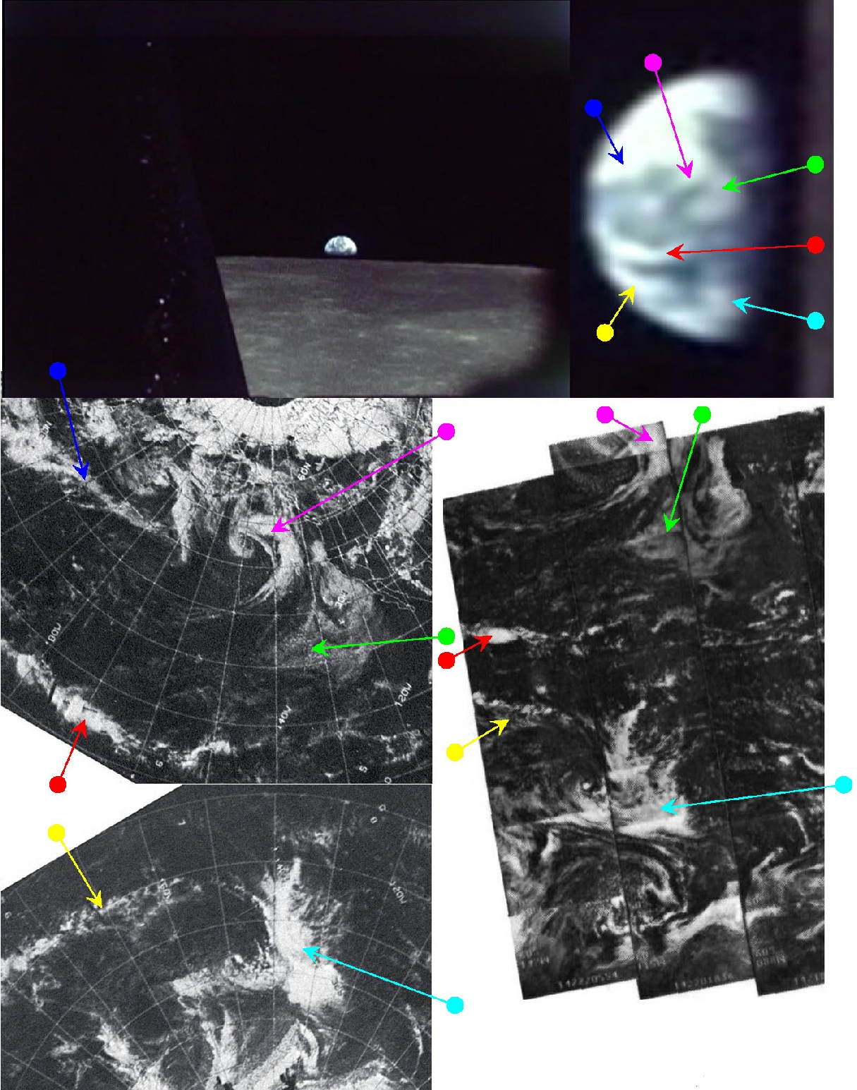
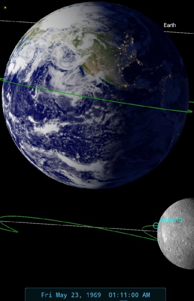
Figure 4.2.6.1: Apollo 10 still (top left) zoomed and cropped (top right) compared with ESSA (middle & bottom left) and NIMBUS (bottom right) satellite images from 22/05/69, and SkySafari time estimate. Below this are 3D reconstructions using digitally recovered ESSA (left) and NIMBUS (centre) data.
Close examination of the zoomed video screenshot show that many of the features in 4.2.5.5 are still visible here, and the principle ones have been identified using the same arrows. The transcript record shows that at 104:22 we have the following exclamation at Earthrise:
104:22:54 Stafford (in Snoopy): Yes. Here comes the Earth! Beautiful. I'll get it. It really comes up.
Followed later by this explanation to Houston:
104:24:00 Stafford (in Snoopy): Roger. We had a nominal burn. Everything went good, and we had a beautiful Earthrise as you came up from behind the horizon.
This time equated to 01:11 on the 23rd, which SkySafari suggests should show a terminator that cuts across the mid-
104:52:23 Stafford (in Snoopy): As the Earth came up, on this Earth day, I guess you would call it, the north pole was to the right and the south pole was to the left, and looks like -
As usual, the description of what, and where, they were seeing is completely accurate.
We have quite a gap as we wait for the next Earthrise. The crew are busy taking images of the lunar surface and preparing for the burn that will send them homewards, but they have Earth in mind and are keen to get a colour photograph of it, as these exchanges show:
119:25:22 Stafford (onboard): Gene-
119:27:28 Stafford (onboard): No. Just the -
and the crew’s frustration with the colour film shows, as we can see in these exchanges:
120:07:37 Stafford (onboard): Hey, look at -
120:07:39 Young (onboard): Oh, God.
120:07:40 Stafford (onboard): Isn't that beautiful?
120:07:42 Young (onboard): That's just fantastic.
120:07:43 Stafford (onboard): Would you believe Africa?
120:07:52 Stafford (onboard): You've never seen that before, have you, John? You just got to see it [garble] Isn't that a beautiful Earth?
120:07:57 Young (onboard): Ahhhhhh! Talking about the dawn coming up like thunder. Man. that's [garble] Look at that.
120:08:06 Stafford (onboard): That's the whole Earth. That's -
120:08:08 Young (onboard): That's unbeliev -
Young’s view from the CSM has obviously not allowed him to view Earthrise until now. Observant readers will notice that the first colour image we look at below only shows the very western edge of Africa, so clearly they didn’t get any colour photographs on this pass either, something confirmed by this statement of frustration:
120:08:11 Stafford (onboard): That's why I want to get this color -
A while later Stafford starts to prepare for the next chance:
121:51:26 Stafford (onboard): And, Gene-
Confirming that the Earth while appear at 122:06. Finally, on the next orbit, they have another crack at it:
122:05:52 Cernan (onboard): There it is.
122:05:57 Stafford (onboard): The Earth. Hit it. Again, baby…
122:05:56 Young (onboard): What?
122:05:57 Stafford (onboard): The Earth. Hit it. Again, baby...
Did it work? Let’s see in figures 4.2.6.2, which shows AS10-
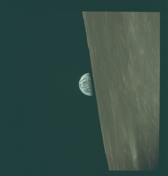
Figure 4.2.6.2: AS10-
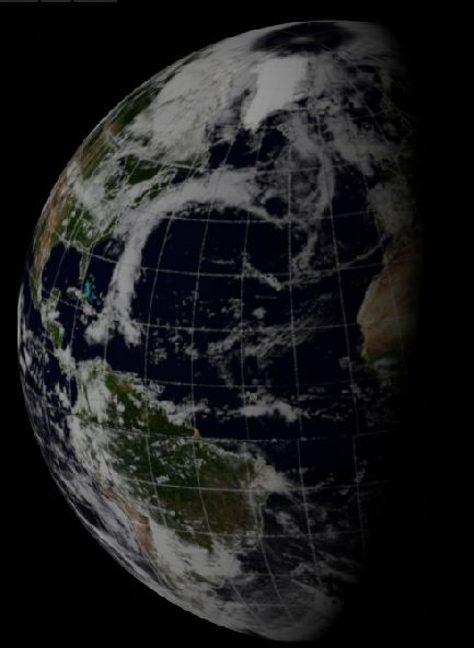
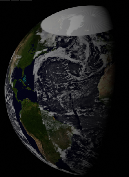
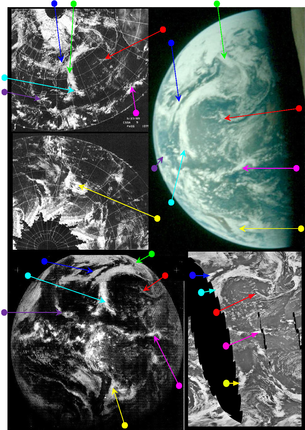
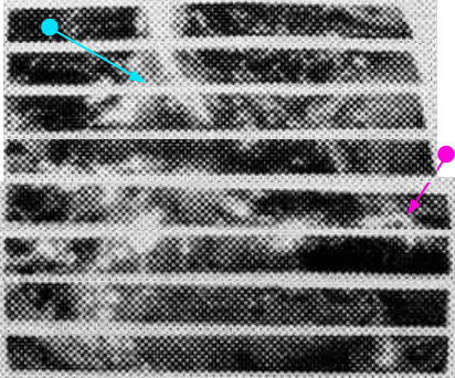
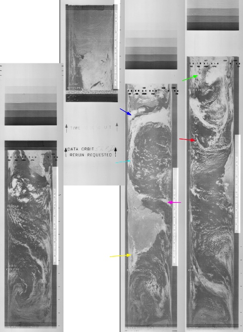
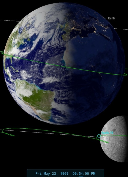
Figure 4.2.6.3: Main image -
The most visible weather system in the photograph the long λ or fishtail shaped pattern stretching from the Caribbean to the mid-
ESSA 9's track covering the terminator in figure 4.2.52a is track 1, or orbit 1078. This would have been started at 16:08. The orbit covering the centre of the daylight part of the Earth (track 3) would have been started at 1900. NIMBUS 3's equivalent orbits are 526 for the terminator, and 529 for the central daylight portions, which equates to 12:44 & 18:06 respectively. ATS-
As with other Earth images, the quality of both the Apollo photograph and the NIMBUS-
Even from nearly a quarter of a million miles away, the Earth is still shown in enough detail to confirm that the weather patterns on it are an exact match with the satellite record. This is even true when you look in much greater detail, for example the area shown in figure 4.2.35 above. NIMBUS orbit 526 commenced at 12:25 GMT, so any minor differences are easily accounted for by that time gap.
Now that the crew are re-
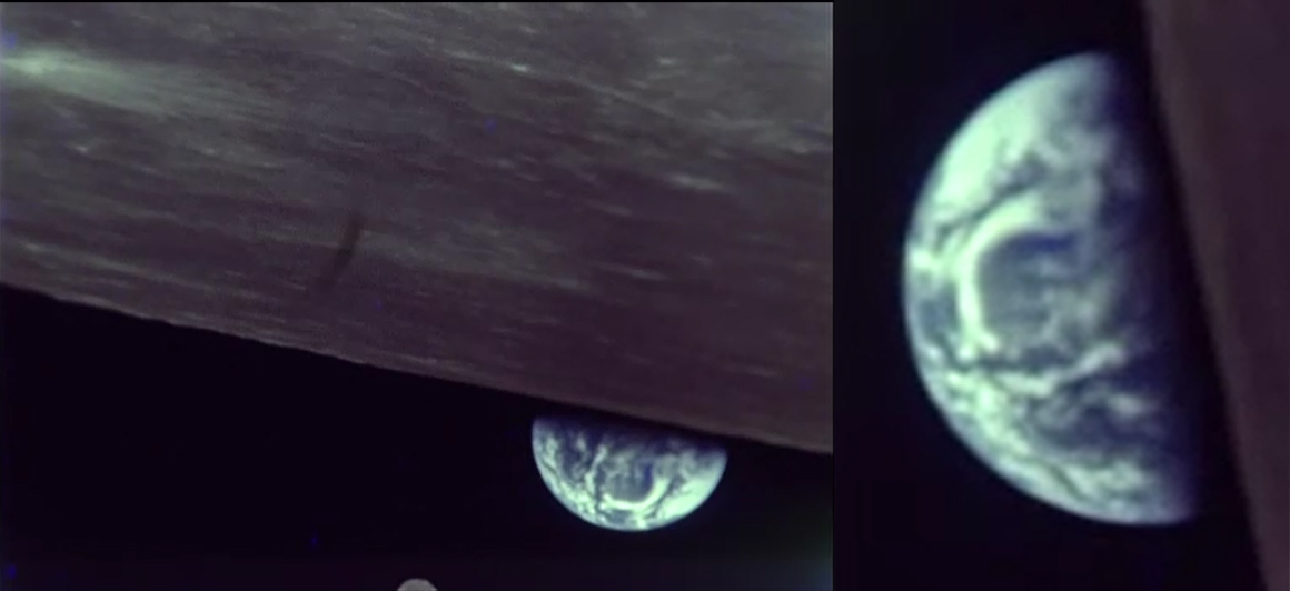
Figure 4.2.6.5: Magazine D still showing Earthrise.
There’s no indication in the transcript when the DAC was turned on, but it clearly was, and all three crew members were very keen to capture the moment. It is, very obviously, the same view of Earth taken at the same time. The 16mm does appear to have been started later than the photographic sequence, as the first shot of Earth is as it is completely over the horizon. There’s also a very obvious nudge to get the camera pointing in the right direction!
Next we have an image from a different colour magazine, and as we shall see from the analysis it was taken on the next orbit. Figure 4.2.6.6 shows AS10-
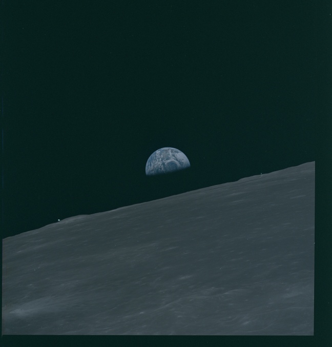
Figure 4.2.6.6: AS10-
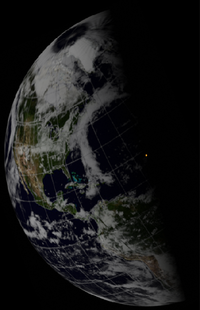
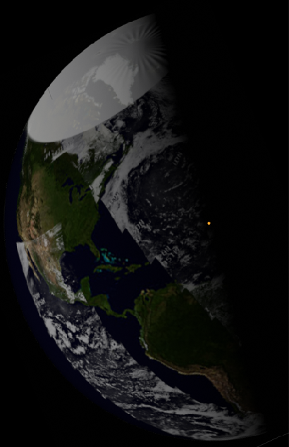
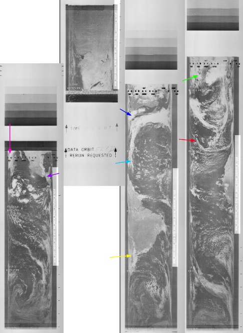
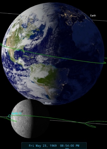
Figure 4.2.6.7: Main image -
By figure 4.2.6.7 the system described in the previous paragraph has moved eastwards. This movement represents the rotation of the Earth as the Apollo craft orbits the moon, which should take around 2 hours per orbit in a high altitude configuration, as opposed to some difference in the position of the craft above the moon (the craters visible in the whole image are the same). A quick trawl through the transcript reveals that each orbit is recorded as starting 2 hours apart.
The transcripts also record the time of the Earthrise and the issues the crew are still having with photography:
124:04:11 Cernan (onboard): What time's that Earth coming up?
124:04:17 Stafford (onboard): Boy, oh, boy. Sun's so bright, I can't -
124:04:29 Young (onboard): [Garble] you don't.
124:04:31 Stafford (onboard): You better. We can get him next time. a se -
124:04:51 Young (onboard): You missed him? You missed him? Know how I could tell he was coming? Because I heard the acquisition.
124:05:01 Cernan (onboard): Yes.
124:05:03 Stafford (onboard): Just take a couple in color, OK. F-
SkySafari has been set at the time of Earthrise on the next orbit, which is recorded as commencing at 20:14, and with first voice contact after AOS being at 20:55. The time in the transcript works out at about 20:54, so again our SkySafari estimate is a reasonable one.
In terms of what is in show, as the globe has moved meaning that more of the weather system that is visible running westwards across the USA has become more visible, as has a large mass of cloud over the Arctic. This system is visible in the next image in the sequence, AS10-
ESSA 9's track across USA on the 23rd was orbit 1080, which would put the time for that image at 19:00. NIMBUS 3's equivalent would be orbit 528 (which is actually missing from the dataset), at 16:18. As not much else has changed we’ll wait until the next images for more infra-
The next view of Earth is shown in figure 4.2.6.8, and analysed in figure 4.2.6.9.
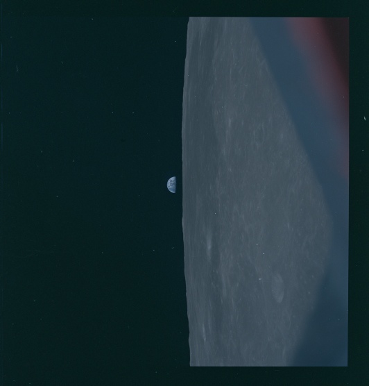
Figure 4.2.6.8: AS10-
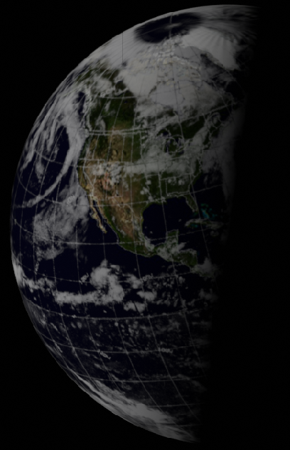
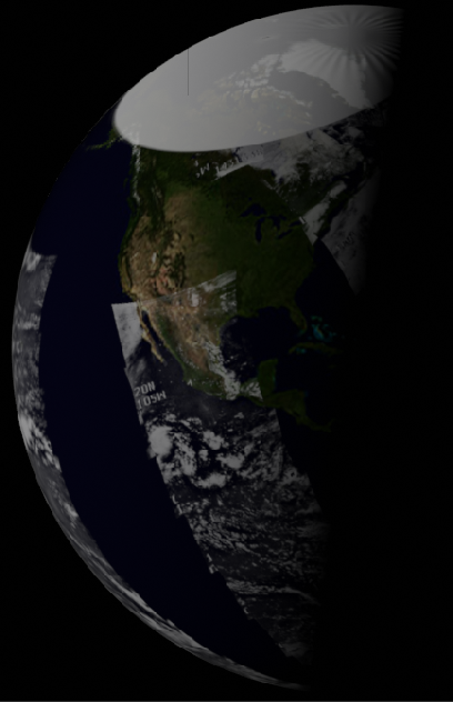
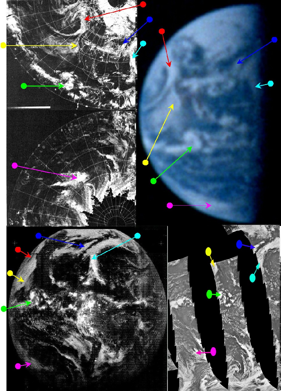
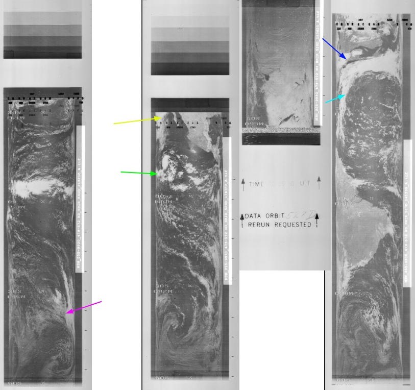
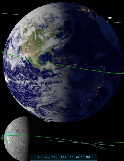
Figure 4.2.6.9: Main image -
SkySafari has been set at 22:50 on the 23rd -
126:02:43 Young (onboard): 39. Did you hear the S-
126:02:44 Cernan (onboard): Sure did. Here it is.
126:02:58 Young (onboard): Shooting at real time there, Gene-
126:02:59 Cernan (onboard): Yes
Cernan is obviously following Stafford’s instruction to ‘get a sequence next time’ and is shooting 16mm at the same time as Young is taking the Hasselblad images. They had already worked out that hearing the first signs of AOS from the S-
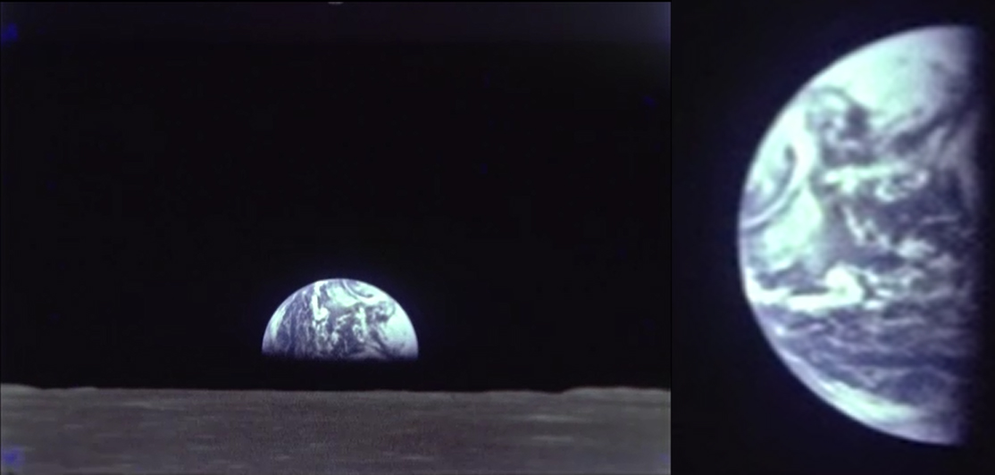

Figure 4.2.6.10: 16mm still from Magazine D showing Earthrise and (right) still from The Tragedy of the Commons.
The 'fishtailed' system pointed out in the first of the Earthrise images is still visible (just) on the eastern side just behind the terminator, while the clouds running east-
Stellarium’s estimate puts the image at an orbit later than the previous image, and again the Earth has rotated an appropriate amount for that time gap. Orbit 26 in the transcript is recorded as starting at 22:12, with first voice contact after AOS at 22:55. ESSA's orbit would now be track 4 for the part covering middle America, which is orbit 1081 commencing at 21:05.
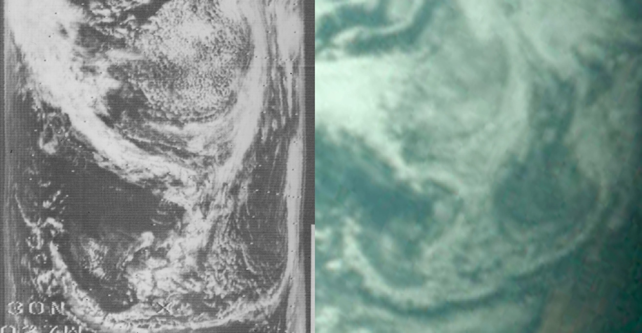
While much of the NIMBUS data is missing from this orbit, it is worth zooming on one of the features that is available, the cloud picked out by the green arrow (figure 4.2.6.11).
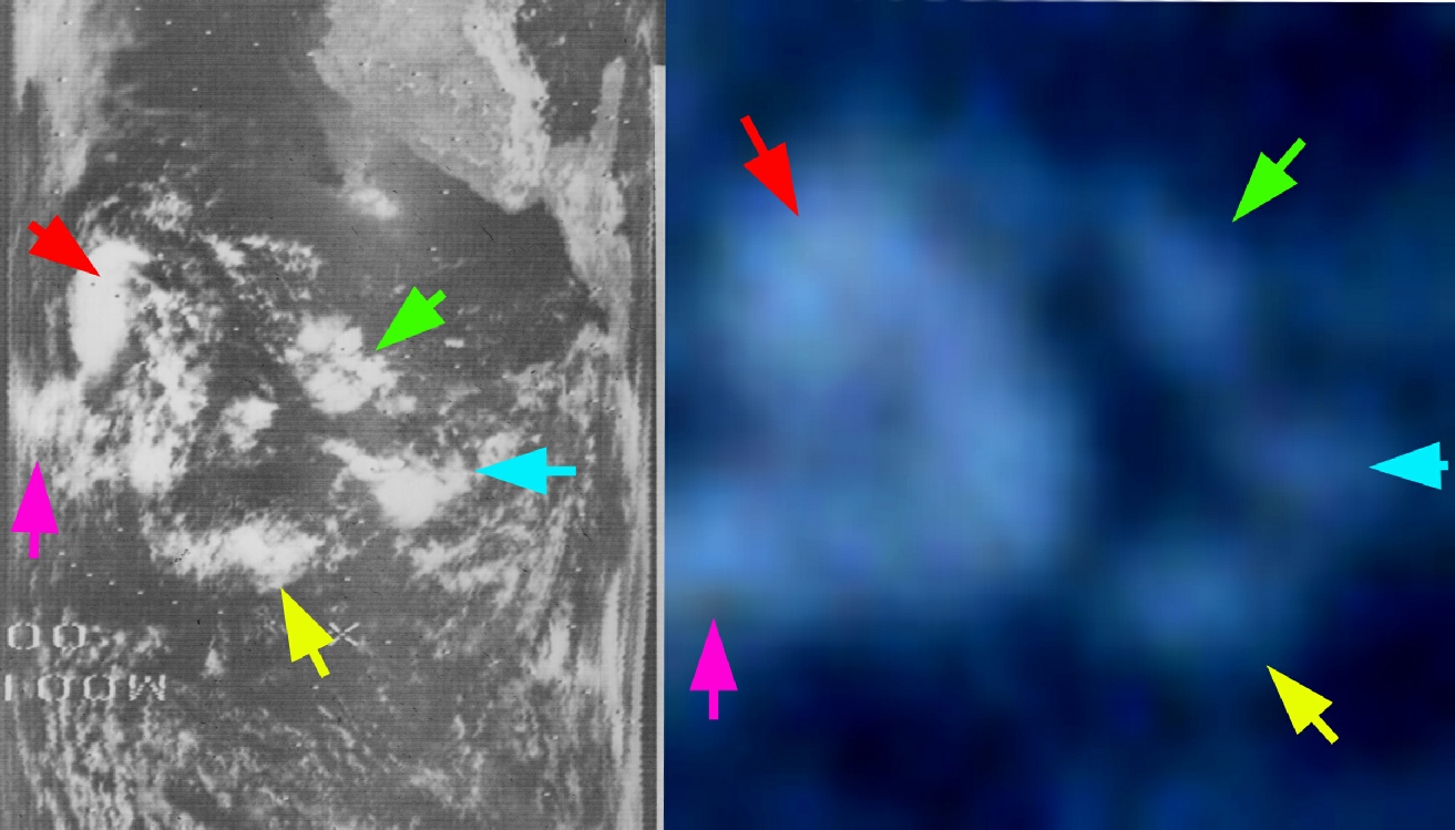
Figure 4.2.6.11 Section of NIMBUS-
The Apollo image is a little blurry so I added some helpful arrows to remove any doubt. It’s the same cloud system.
What we also have here is a black and white image seemingly taken at exactly the same time.
Figure 4.2.6.12 shows AS10-
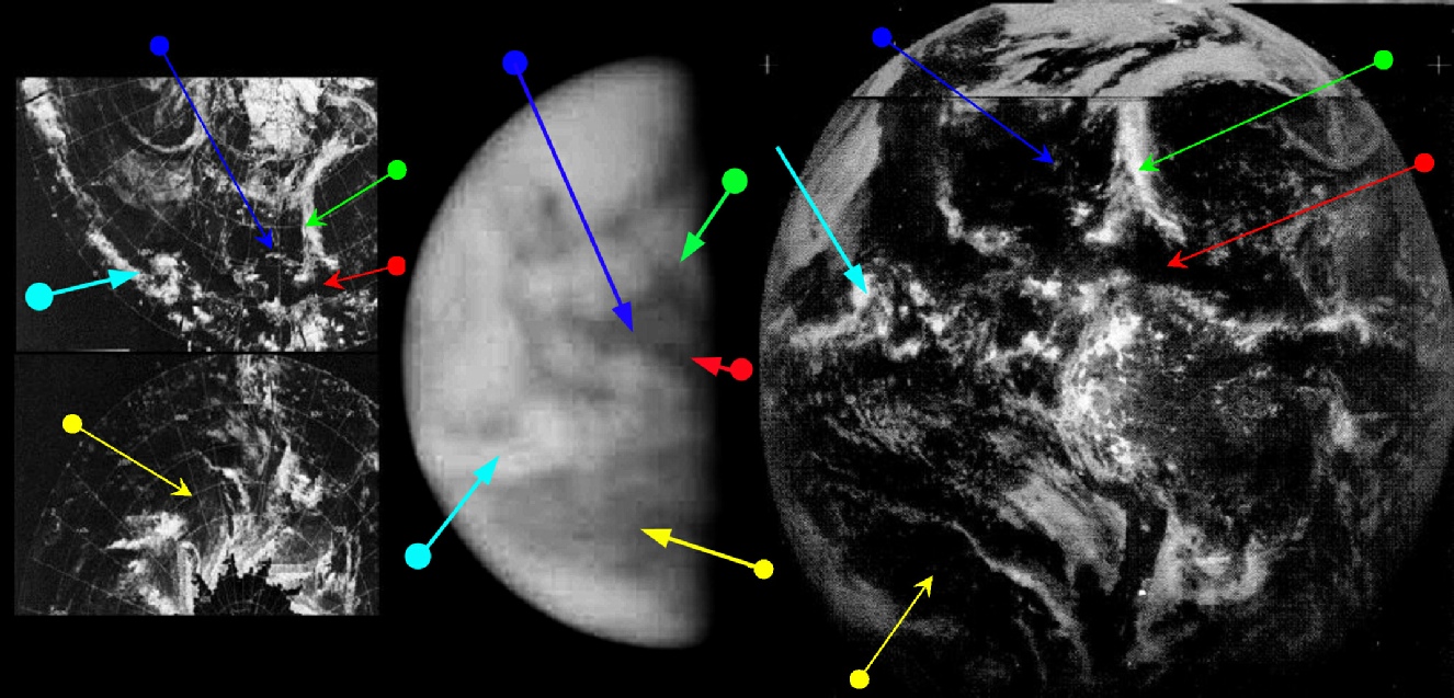
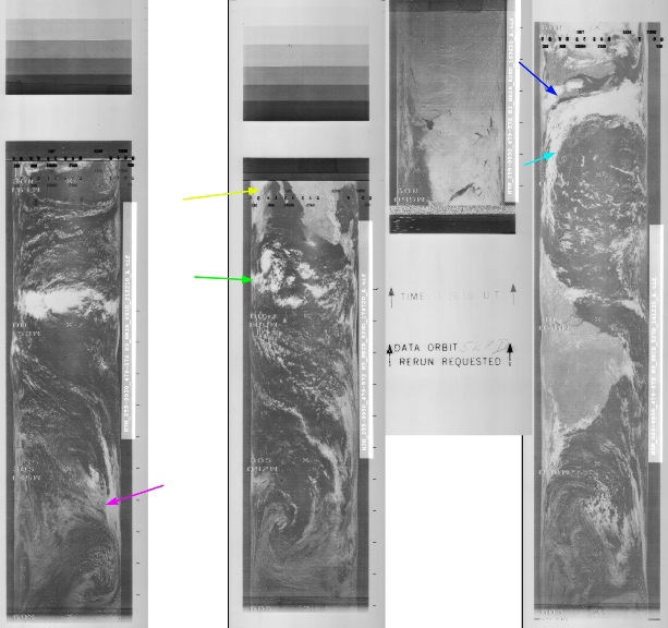
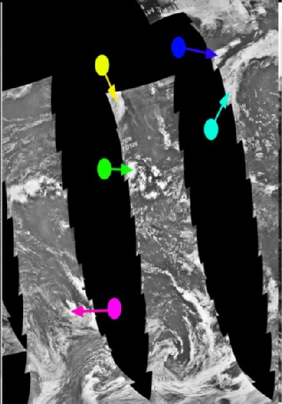
Figure 4.2.6.13: AS10-
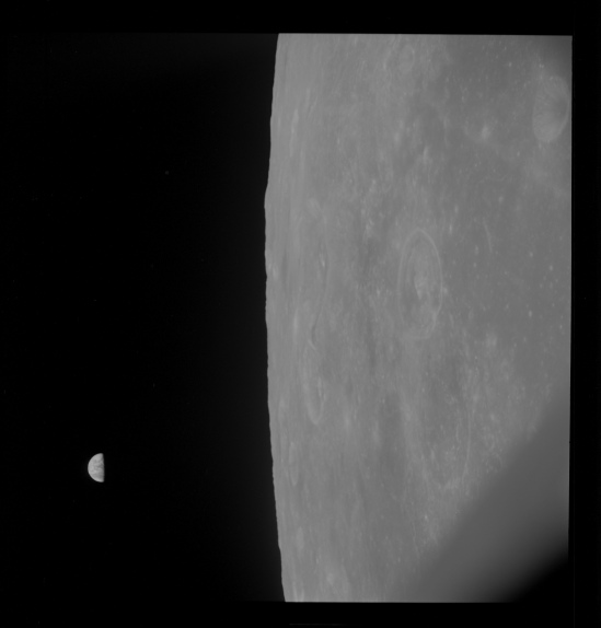
Figure 4.2.6.12: AS10-
The image is not as clear as the colour one, but there are indications that it was taken at the same time.
The key is the cloud identified by the cyan arrow, which is obviously the same shape as the one in the colour image, and is also in the same position. The image also shows dark patches either side of the equator, with the southernmost one being particularly large. It is the contention here that this large area is the south Pacific off the coast of Chile, and the other dark area is the Caribbean. The white patch between these two would be the clouds over the coastal areas of northern south America.
This would give a suggested time of roughly 22 – 23:00 on the 23rd, at which point the crew were carrying out landmark tracking and photography operations. Again referring to the mission transcript, at 123:08 (or about 20:00 on the 23rd), Capcom have some jobs for them to do, but given them the option of continuing with photography work if they feel they haven't yet completed it. The crew reply saying that
123:08:58 Stafford: …We've shot so much photography we're about out of color film. We're saving a little bit for the way back. And we still have some black and white to go, and we'll do some of that
And later
123:56:11 Stafford (onboard): 5, 10, minus 50. Gene-
There’s also this shortly before Earthrise:
125:59:21 Stafford (onboard): ...the Earth comes up. Why don't you stand by and get a sequence camera and also [garble]?
125:59:33 Stafford (onboard): And, John, F-
So they are using 16mm, colour and black and white film by this point -
The next orbit (orbit 25), and therefore the next Earthrise, came at just before 21:00. There is no reference at the time of AOS for photography, but the crew do discuss the weather systems they can see on Earth over the USA (see also the final section for Apollo 10 on Meteorology).
The Earthrise for orbit 26 was at around 22:45, which matches well with what figure 4.2.6.12 & 4.2.6.13 suggest.
The next Earthrise of any description, colour or otherwise, occurs on day 7. Click the links to see them
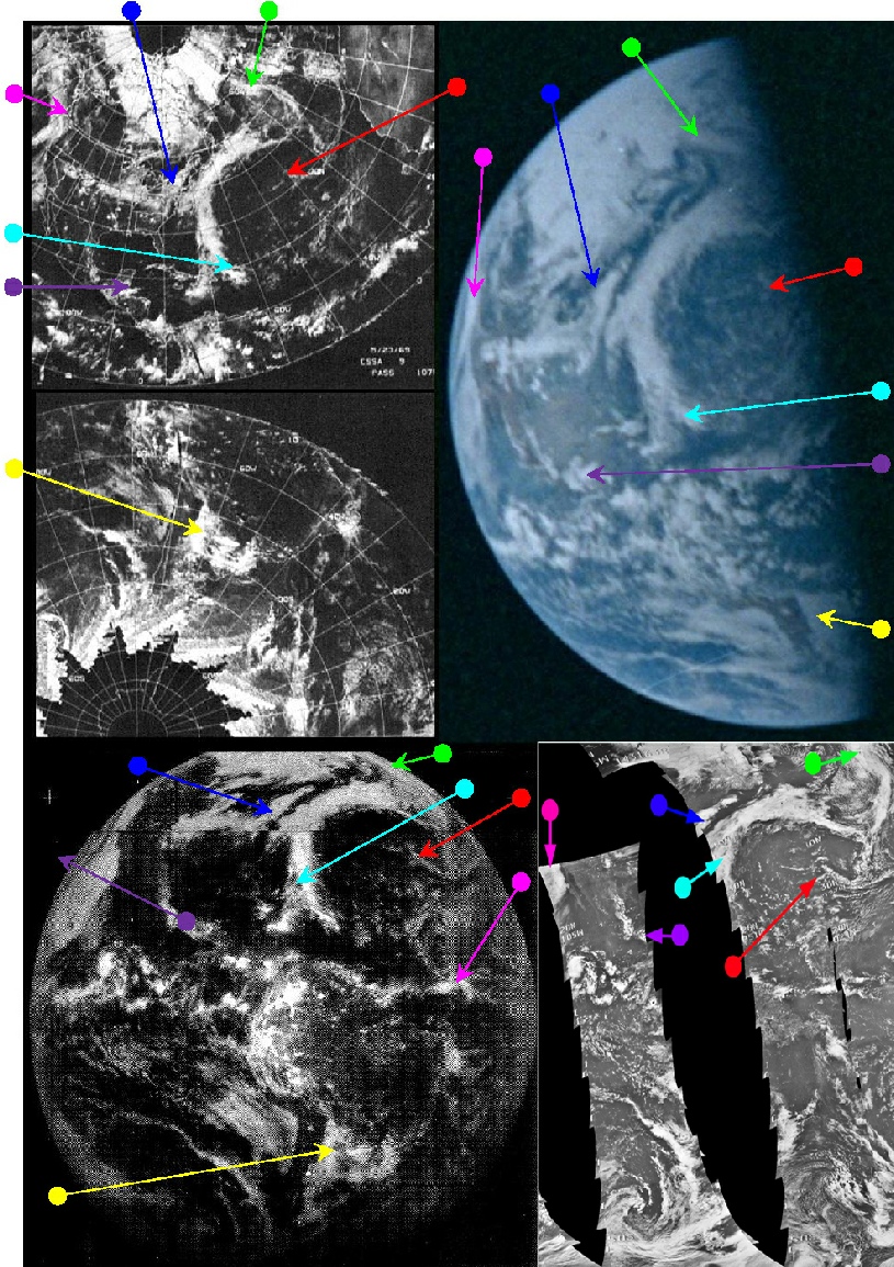


Figure 4.2.6.4: Section of NIMBUS-
