4.5.0 - Apollo 13 Introduction
While the global populace had tired of the Apollo missions, questioning the value of missions in the face of social problems at home and abroad (Gil Scott Heron's “Whitey's on the Moon” captured the mood of many), NASA still had several missions to run, even if the numbers of them were being decreased by budget cuts.
Apollo 13 was launched on April 11th 1970 at 19:13 GMT, intending to land at Fra Mauro on the 13th. As anyone with even a remote grasp of modern history knows this didn't happen. A routine stirring of storage tanks led to a spark that caused an explosion in an oxygen tank, crippling the CSM and causing a substantial proportion of the crew's oxygen supply to evaporate into space. Already well on their way to the Moon, the crew had no option but to carry on towards it and use a gravitational slingshot technique (theoretically understood but never before tried) to propel the craft home after a far side lunar pass.
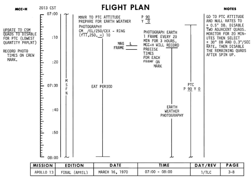
During the mission, they did manage some Earth photography, especially in the early stage of the mission when a weather photography programme meant an image of Earth was taken every 20 minutes. The aim of the photography is discussed in the mission report, and is shown in the final flight plan. It attempted to analyse wind velocity from cloud heights, and wanted to compare ATS images with those of Apollo 13. The report states:
“The photographs required for this test could only have been acquired from an Apollo lunar mission.”
Eleven images were taken, and the times recorded (figure 4.5.0.1). We’ll see how well those values compare in the following pages.
In the foreground of each photograph, towards the bottom left, is what is obviously a satellite photograph - as with other missions, the launch weather is obviously a subject for discussion. Figure 4.5.0.4 shows a cropped version of both images, together with a suggestion of their location from the ESSA images available.

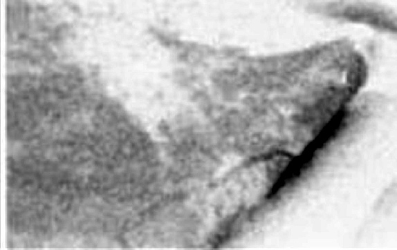
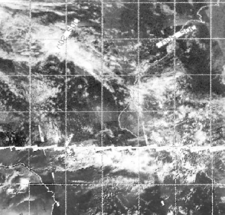
Figure 4.5.0.4: Close-ups of the satellite photographs in figure 4.5.0.1 and ESSA satellite image dated 10/04/70.
Once it’s realised that the photograph is upside-down from our perspective, it becomes clear that it’s a view covering the Atlantic around the equator and southwards.
Now we’ve answered that question, we can get on with the analysis.
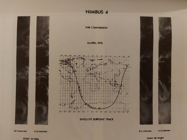
Figure 4.5.0.2: NIMBUS-4 images taken on April 10th and 13th, as published in the Nimbus data catalog (my personal copy).
Given that the crew were somewhat pre-occupied with an exploding spacecraft at the time, this is hardly surprising. This article ESSA News, and this ESSA World article briefly describe the role of satellite meteorology in the rescue effort, but supply no images.
There is also an image available from what appears to be ATS-1 for April 16th showing the Apollo 13 landing site (used to predict likely weather conditions on Apollo 13's return) found in the ESSA publication The first five years of environmental satellites, but while several Apollo photographs were taken on the 16th none of them fell over the area covered by ATS-1.
We are therefore left with the ever reliable ESSA-9 and ATS-3. ATS-3 is not available for all the days of the mission, but is used where possible. ESSA's catalogue can be found here. ATS data are contained in the same volume as those used in the preceding section for Apollo 12. An interesting alternative to the ESSA images comes in this video, which has the images in a ‘flat’ projection and in colour! The Apollo images used are from the Apollo Image Atlas, with the exception of a screenshot from the first TV broadcast. There are a few high quality TIFF images available at http://archive.org/ (namely AS13-60-8588, AS13-60-8591 and AS13-60-8600). All of the http://archive.org images are incorrectly described as being on the journey home. As will be seen shortly, they were all taken on the way to the Moon.
3D reconstructions will be used for date when the digitally restored versions of satellite data are available.
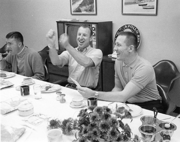
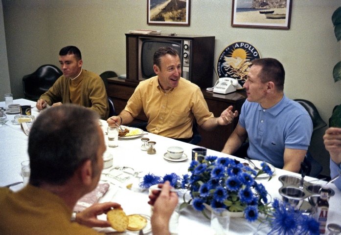
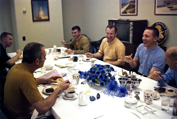
It’s worth looking at a couple of images from the traditional pre-launch breakfast (figure 4.5.0.3.

Later on in the mission, there is a poignancy to the many photographs of home that the crew took and that will be used in this analysis.
Altogether 5 magazines of film were used, exposing 604 images. Many of these are focused on the stricken craft, and of the Moon during their slingshot pass.
The crew did make several TV broadcasts, but such was the decline in interest that the 3rd one, immediately after which came the accident, was recorded instead of transmitted live, and it was shortly after this broadcast that the fateful instruction to stir the tanks was issued. The mission timeline cataloguing the events can be found here: NASA source.
Publicly available satellite imagery is in limited supply compared with previous missions. The NIMBUS-3 satellite had reached the end of its useful life as far as visual imagery was concerned and is not available here. The replacement NIMBUS-4 had not yet started full visual recording of its orbital passes (these commenced in full from April 18th). A test image of Scandinavia for the 10th and 13th of April can be found in the NIMBUS data catalogue volume 1 (figure 4.5.0.2), but examination of the photographs available from the Apollo mission revealed that no Earth images were taken that day. Other modern remappings as geotiffs of the NIMBUS IR data are available here and are included where appropriate.
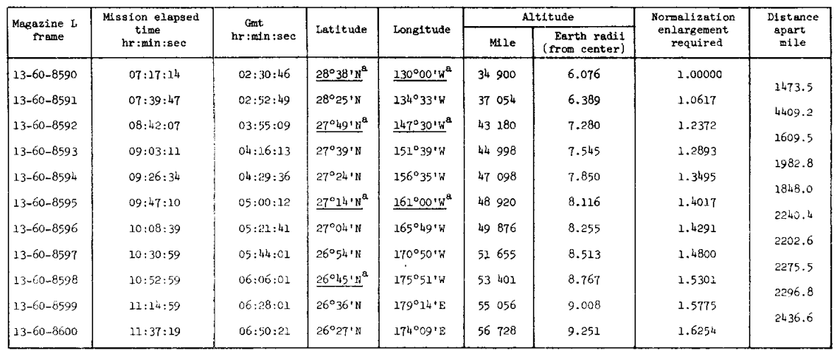
Figure 4.5.0.1: Apollo 13 Earth image timings. Sources given in text.