4.5.6 -
April 16ht marks a different kind of milestone. This article describes how the mission saw the first attempt at “global numerical analysis and prediction to be made under operational conditions” to assist in the “unscheduled splashdown” of Apollo 13. Data collected from a wide variety of sources, including cloud height and temperatures from Nimbus-
While there are no more images to be used from magazine 60, there were still other magazines being used. Magazine 62 features image AS13-
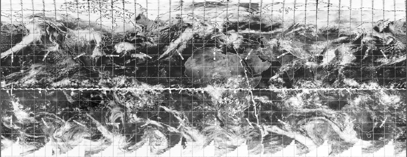
Figure 4.5.6.1: AS13-
It is always a source of amazement that a figure such as the photograph presented above can contain all the information needed to repel a conspiracist's argument. Ostensibly containing nothing, this photograph, and countless like it, contain sufficient detail of the Earth's weather systems to prove that they were photographed at the same time, or at least within a few hours of, a satellite in orbit much much closer to the subject. Figure 4.5.6.2shows the ESSA satellite in comparison with this Apollo photograph.
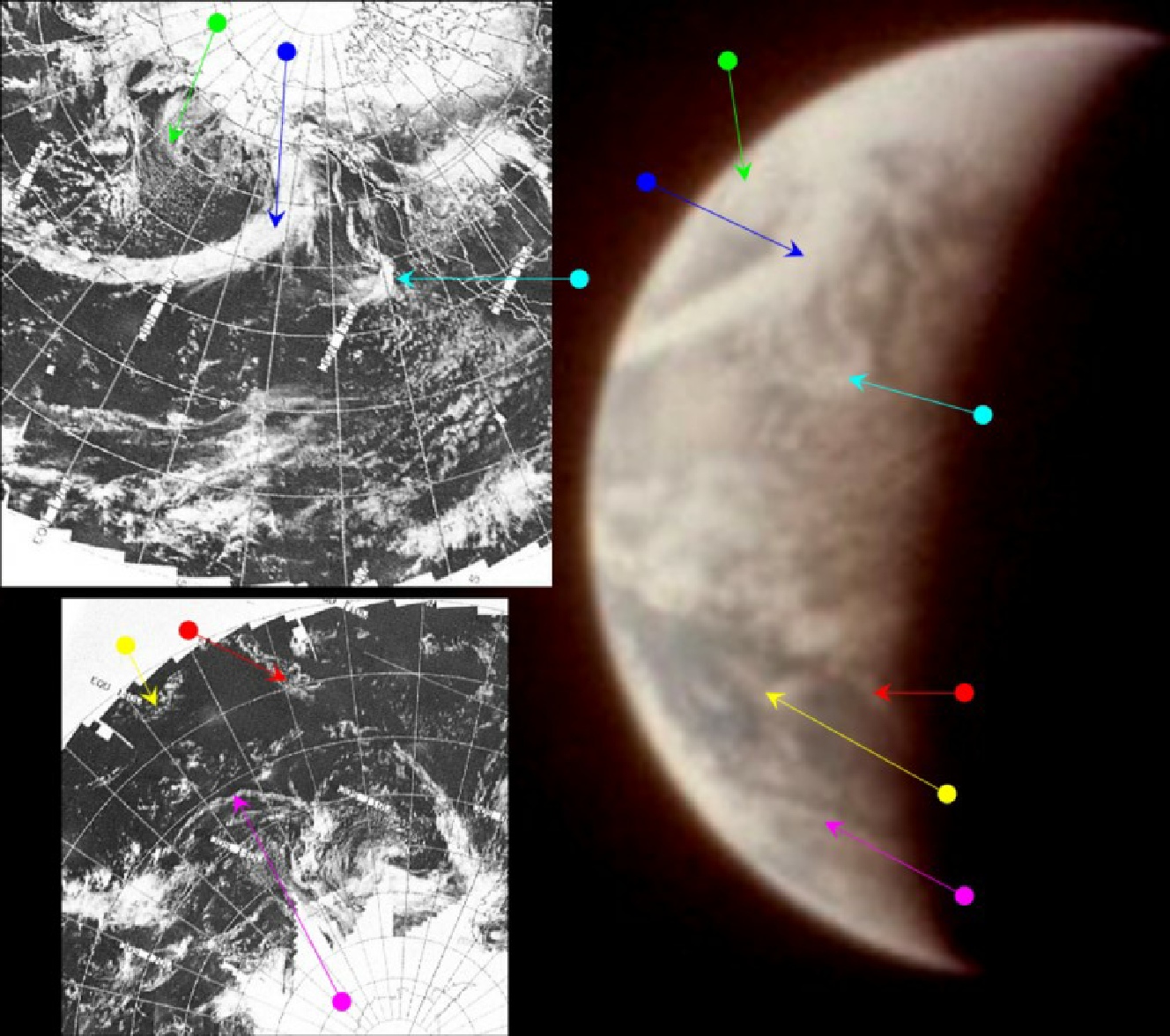

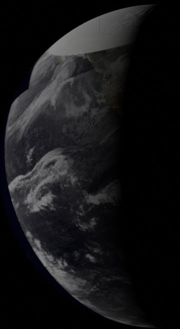
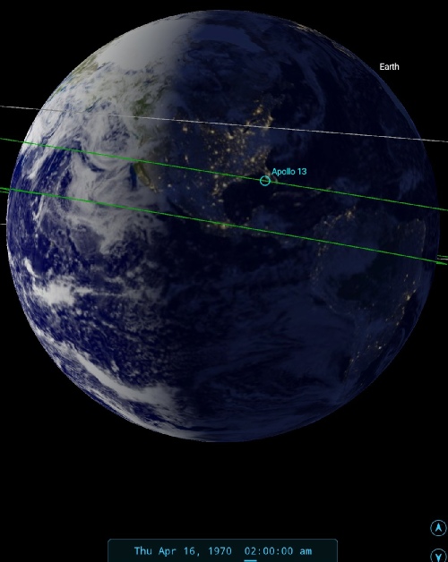
Figure 4.5.6.2: AS13-
The terminator is falling across the west coast if the USA, and this allows the time of the photograph to be estimated at 02:00, which must therefore be on the 16th.
The main feature on this photograph is obviously the large sweep of cloud that has been a persistent feature over the entire mission, and this has extended from the relatively tight curl centred over Alaska to a much broader sweep. Despite the blurred image, the large swathe of wispy cirrus clouds off Baja California are still very much evident. What is also apparent is that the weather patterns identified by the blue and cyan arrows are noticeably further apart in the ESSA image. Although this may be a product of the angle at which the Earth is being viewed and the distorted perspective of the satellite composite's projection, but it could also be that the weather has moved on between the satellite image's exposure and that of the Apollo photograph.
ESSA's most representative terminator orbit is track 4, which runs along the west coast. This would be pass number 5165, which commenced at 20:07. Examination of the records show pass 5166 is not listed in the data catalogue, and this is either because of some technical problem and data from the surrounding orbits has been used to fill in the gaps (there is a degree of overlap), or it has been missed when generating the list. If the latter is the case, it should have commenced at around 22:00, over 4 hours before the Apollo image was taken. Pass 5167 started just after midnight on the 16th.
The final image that attributable to the ESSA composite from the 15th and its attendant satellite analysis are shown in figures 4.5.6.3 & 4 respectively, and involves AS13-
Figure 4.5.6.3: AS13-
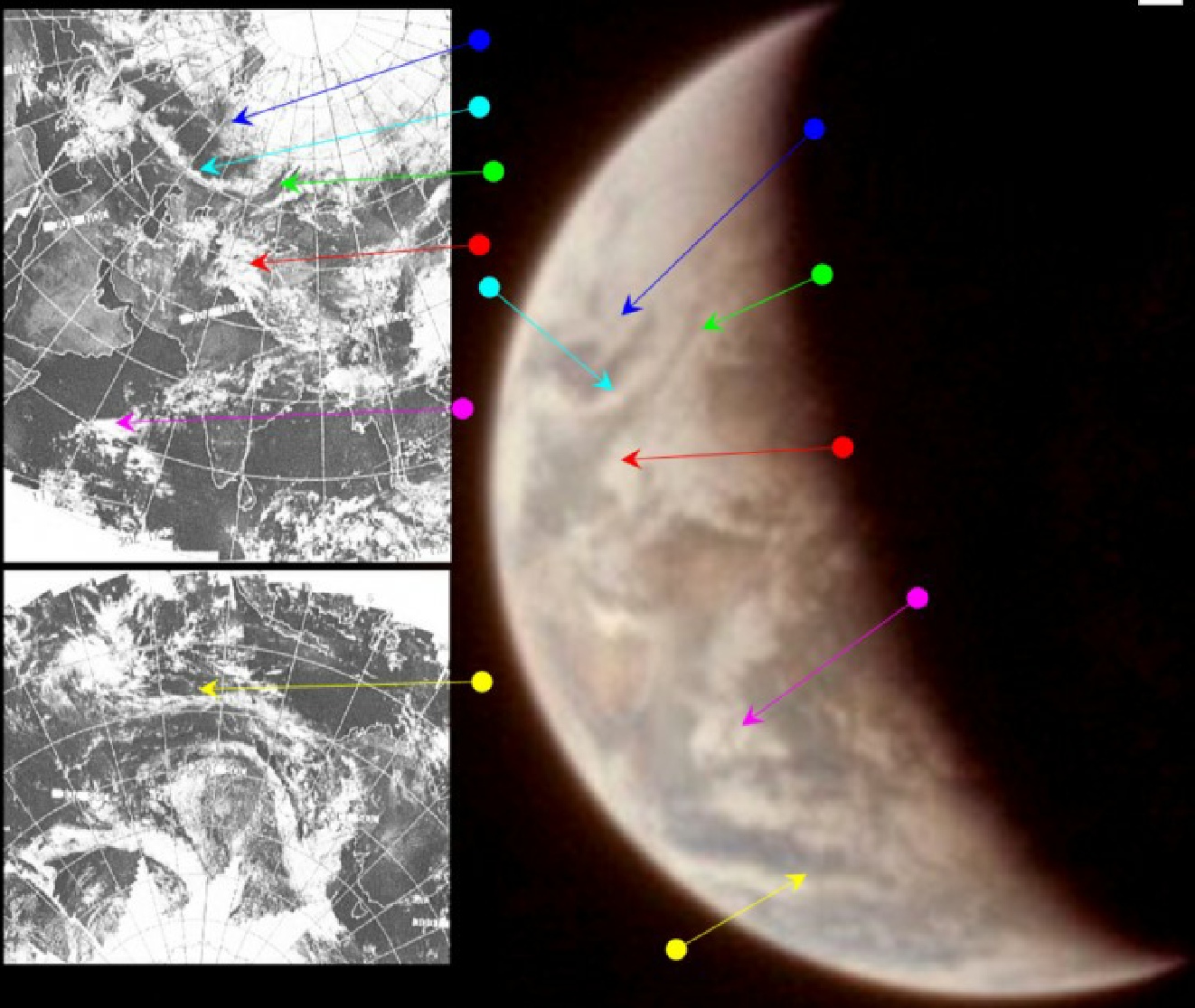
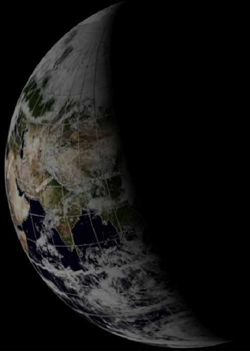
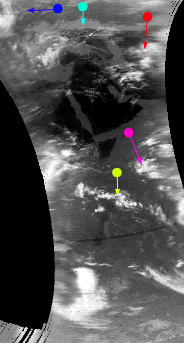
Figure 4.5.6.4: AS13-
The land in the centre of the image is the Indian sub-
ESSA's pass over this part of the world is best represented by orbit 5171 (track 10, which intersects the Bangladesh coastline), commencing at 08:09 on the 16th. At this point in the journey, the crew were busy dealing with repeated problems with one of their batteries, and preparing for the final course correction that would put them in the correct alignment for re-
The weather in the projected landing zone is still bothering people, as noted by this from the mission control audio:
110:18:53 Just got an update on this tropical storm, Helen.
110:18:55 It shows it's continuing to move away from the recovery area about six knots.
And we also have a nice exchange between between Jack Lousma as Capcom and LMP Haise about the storm that’s been bothering them::
112:38:39 CC: The weather prediction for your landing area is still good; 2000 scattered, high scattered; 4-
112:39:02 LMP: A hurricane or a typhoon?
112:41:24 CC: Belay my last. It's degraded to a tropical storm.
The time for that comment is about 11:45 on the 16th.
The next of the final day's images is AS13-
Figure 4.5.6.5: AS13-
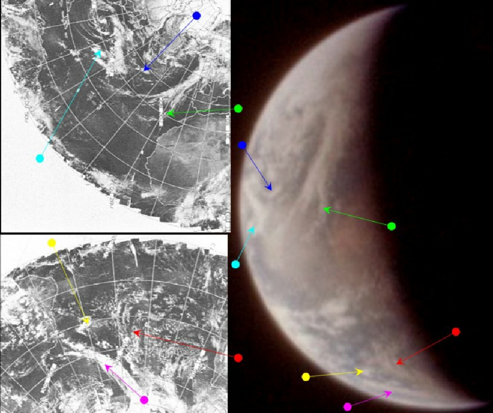
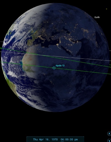
Figure 4.5.6.6: AS13-
The weather front identified by the green arrow is very obviously the same one picked out in numerous previous images, but is also obviously a development of that system and not a reproduction of it. There are, as is often the case, subtle differences between the satellite images and the Apollo photograph that are indicative of a time gap between them. Several more images after this, up to AS13-
The position of the weather front off the north African coast allows us to put a time of around 19:15 for this second image.
ESSA's best path covering these photographs is track 13. In this case this would be orbit 5174, commenced at 14:05 on the 16th. The crew are now 24 hours away from a safe landing and are going through the housekeeping and entry procedures that will see them through those final hours.
The final image of Earth in magazine 62 is AS13-
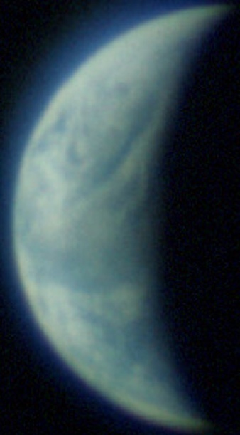
Figure 4.5.6.7: AS13-
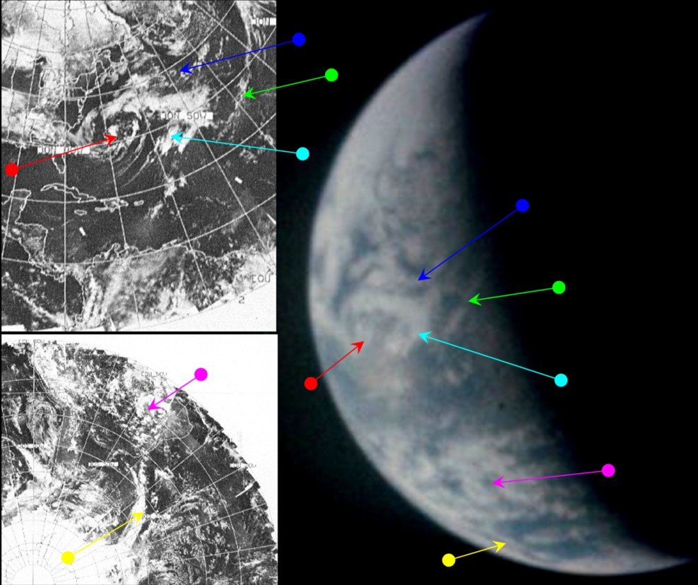
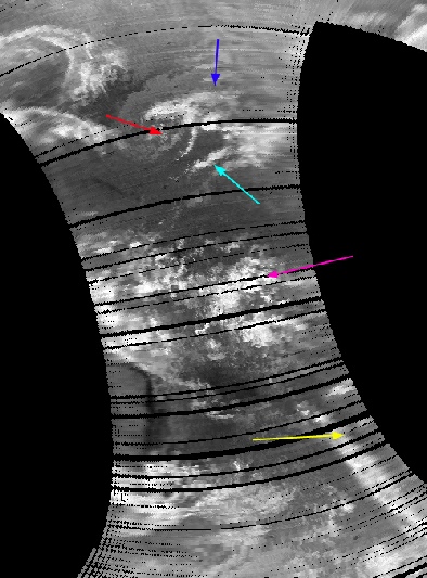
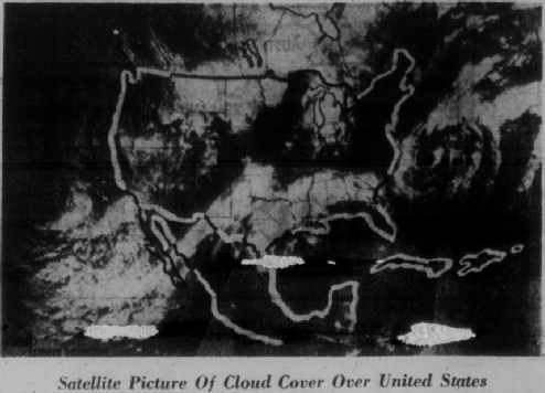
Figure 4.5.6.9: AS13-
The terminator line is now runs down through the centre of the north Atlantic, clipping the eastern coast of Brazil. This places the time of the photograph at roughly 20:45, and as the cyan, green and blue arrows point to the same weather systems shown in the previous image, the Apollo image must, therefore, be from the 16th of April.
The ESSA track that covers the central Atlantic around the terminator line is number 2, which means that the most representative orbit is number 5176, which was commenced at 17:05 on the 16th. As usual, the most obvious explanation for the high degree of correspondence between the Apollo & satellite images is that they were taken at roughly the same time, one from space, one from low Earth orbit.
That’s all for this 24 hour period, click the link for the next set.
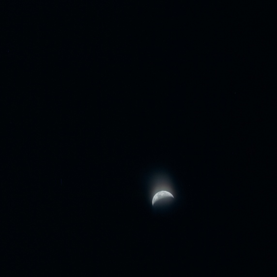
Figure 4.5.6.8: AS13-