4.5.1 -
Before looking at the post-
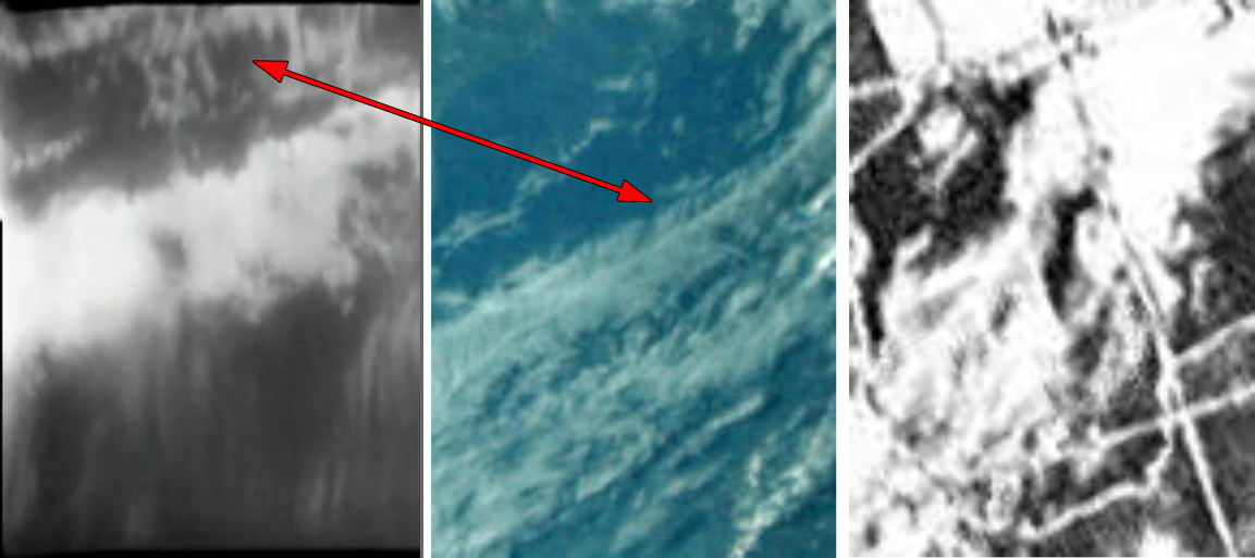
The first one is of interest mainly because it shows their destination. Figure 4.5.1.1 shows AS13-
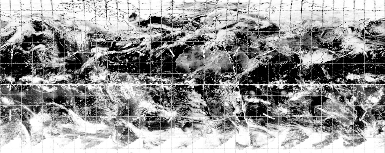
The time has been pinpointed by looking at the moonrise in SkySafari’s mission simulation. That time shows that Apollo 13 was somewhere over the middle of the equatorial Pacific. The clouds we’re seeing in the photograph are therefore likely to be the ones in the centre of the satellite view shown above.
age and a brief image of Earth from a broadcast made in Earth orbit as systems were being checked out. The orbit photograph shows us a view of Baja California, and as the transcript has this:
001:31:13 Swigert: And we're just coming up on Baja, and I've got the TV on. Do you want it?
It seems likely that this is when the photograph was taken. The time translates to 20:43 on the 11th. The image in question is shown below in figure 4.5.1.3, together with satellite views.
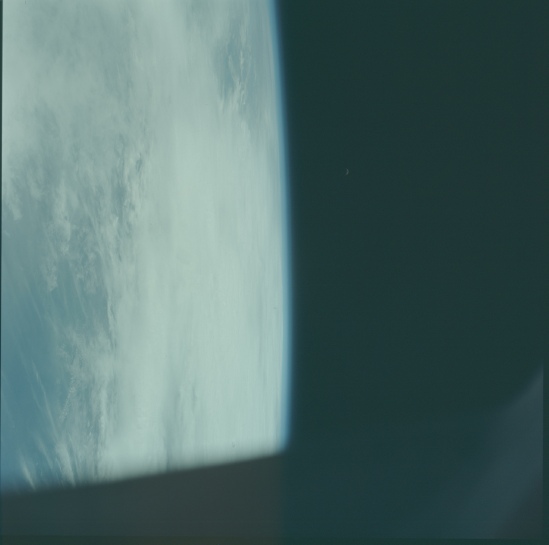
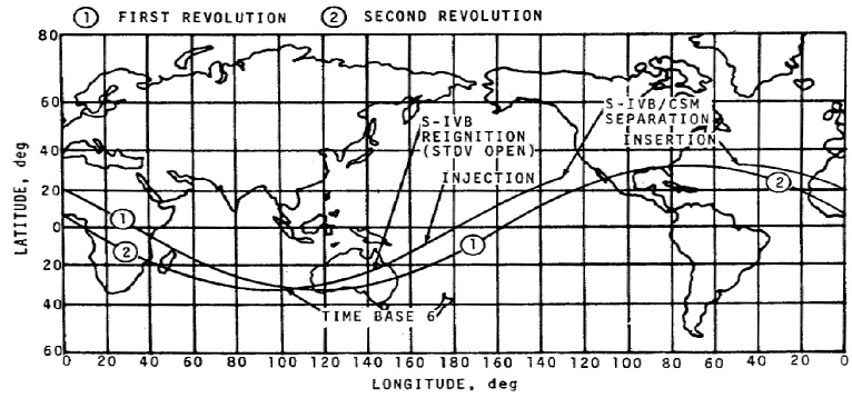
Figure 4.5.1.1: AS13-
As will be demonstrated shortly, the next image in the magazine shows them approaching Baja California, so this photograph must have been taken some time before that. The moon is almost horizontal relative to the horizon, so it must be somewhere around the equator. If there were any landmasses in view, the moon would be much higher above the horizon
Figure 4.5.1.2: SkySafari view from Apollo 13 while taking AS13-
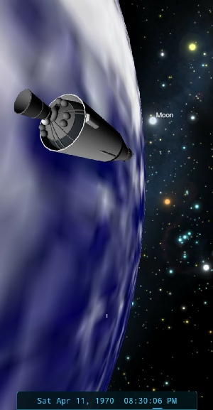
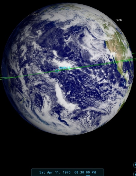
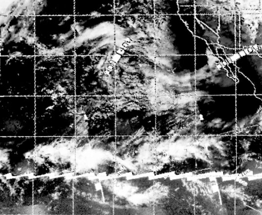
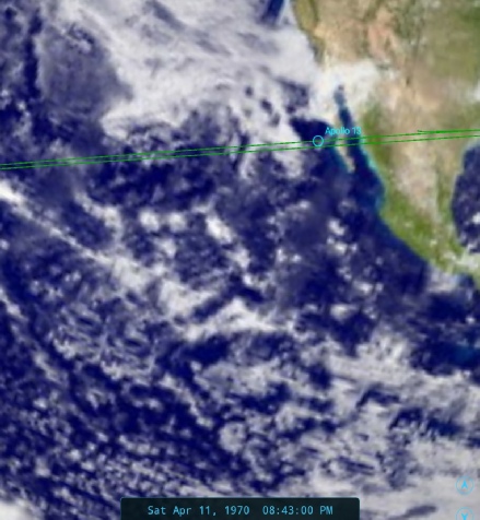
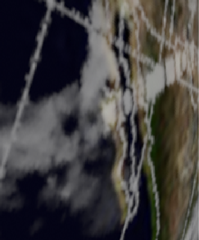
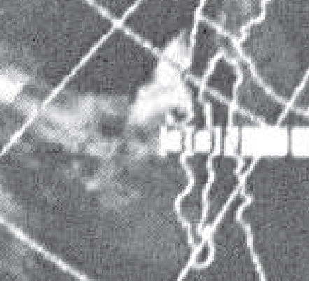
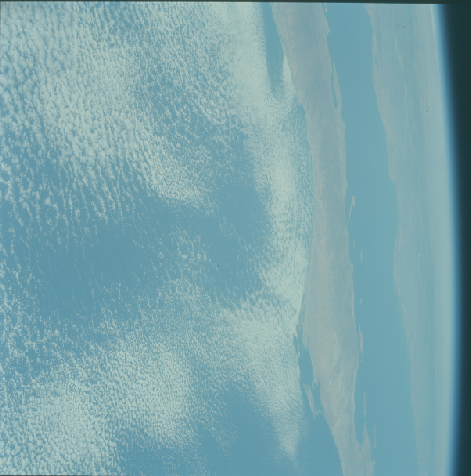
Figure 4.5.1.3: AS13-
The thin cloud is obviously equally wispy on the satellite images, and the gaps in the cloud match up well. If you’re a flat Earther, first of all well done for being able to read, and secondly note the nice curve to the globe on the horizon.
The TV image that eventually arrives, taken here from a Dutch broadcast, shows a broad swathe of cloud. To get an idea of where we are in the world, the crew discuss their location with the ground and they work out that they are crossing the Gulf of Mexico off the southern US coast:
001:38:54 Haise: ...Okay, Joe. There's nothing but clouds outside, and when we get some land down there coming up, I'll switch back to the window, I thought I'd just show you Jim here, to make sure he's still here.
001:41:43 Swigert: [Garble]. You know, I've just been up out of the LEB for a short time here, and I'm trying to find out which country we're over.
001:41:52 Lovell: I have to keep telling Jack that the blue stuff down there is water.
001:41:56 Kerwin: I'll give you a hint. You're in the western hemisphere. [Long pause.]
001:42:10 Swigert: Okay, Joe. It appears like that we've crossed out into the Gulf of Mexico here, and I've got a peninsula or an island that's down there. I don't know whether you can see it. [Long pause.]
001:42:34 Kerwin: Roger, Jack. We see that. Of course, there's a lot of cloud cover and you see it more clearly than we do, but it does look like the Earth, not the Moon.
A colour version of the broadcast can be found here.
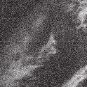
The time stamp on the transcript tell us that this broadcast was made at 20:50 on the 11th. While it’s not possible from that image to tell exactly where we are, we can see of what we can see is consistent with other images. Figure 4.5.1.4 below shows a still from the broadcast together with an ESSA view of the area, and a close up from AS13-

The ESSA image does identify clearly the broad swathe of cloud crossing the Gulf, and while the elapse of three hours means there is a difference in the exact configuration of clouds between the photo and the TV still, there are some similarities between them, notably thin strands of cloud trending north-
After TLI, the crew did the usual retrieval of the LM from the SIV-
Although it is not a full Earth view, the presence of images preceding it of the docking manoeuvre means that the craft was no longer in Earth orbit. Figure 4.5.1.5 shows a screenshot of that footage together with ESSA 9 and ATS-
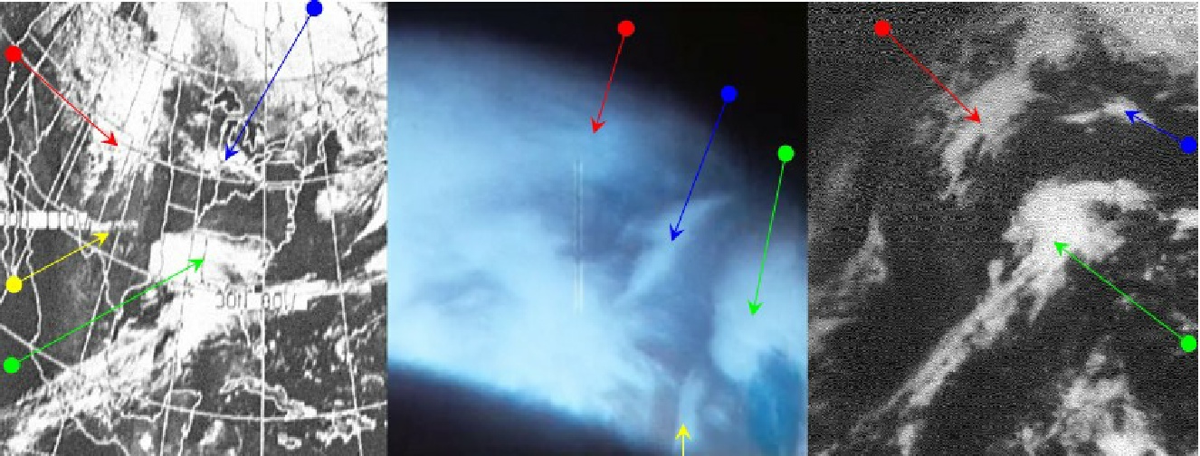

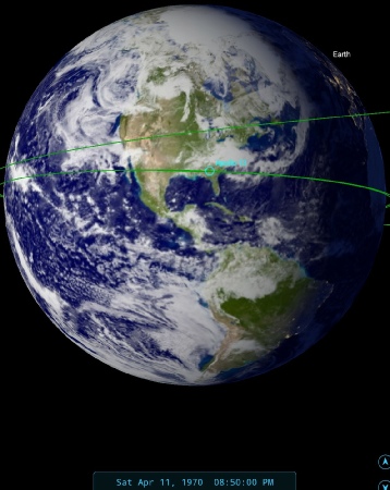
Figure 4.5.1.4: TV still from Apollo 13 Earth orbit broadcast compared with a crop from AS13-
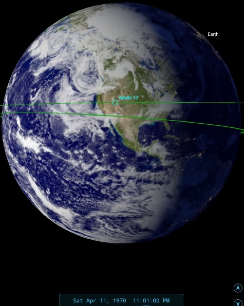
Figure 4.5.1.5: Screenshot of Apollo 13 16mm footage compared with ESSA-
It is not immediately apparent from the screenshot shown in the figure above, but the darkness in the top right corner of the Earth image is actually the terminator line, something that can be seen more clearly when looking at the footage in its entirety. The time of the quote given in the transcript is 23:01 GMT, and the SkySafari view confirms that the view is accurate in terms of the viewing angle and the terminator position. There isn’t much more discussion of the view other than this:
003:48:28 Haise: Okay. I think Jim's holding it now and -
And as we can see from SkySafari, Jim may be able to see Baja California, but the actual view is more like the Great Lakes (figure 4.5.1.6).
Figure 4.5.1.6: Sharpened TV still showing the Great Lakes compared with ESSA satellite image of the same area published in the press.
Another excellent match!
The terminator line we see is just off the east coast of northern America, with the same line in the Apollo screenshot is just to the east of the cloud system identified by the green arrow,. The outline of north America on the ESSA satellite image corresponds exactly with this. The Gulf of Mexico is visible in the bottom right corner of the image, below the green arrowed clouds, and the yellow arrowed cloud is over the Texas/Mexico border.
The ATS image is recorded as taken at 16:23, just over six and a half hours before the Apollo image. ESSA's orbit for that part of north America is track 3, or orbit 5114, which commenced at 18:08. The terminator orbit (5113) was commenced at 16:02.
The satellite images confirm that the footage shot by Apollo 13 as it left Earth for the Moon does indeed show the clouds it should have seen.
Once safely on the way we begin to see images of the Earth as an entire disk. The first photograph showing the Earth as such is AS13-
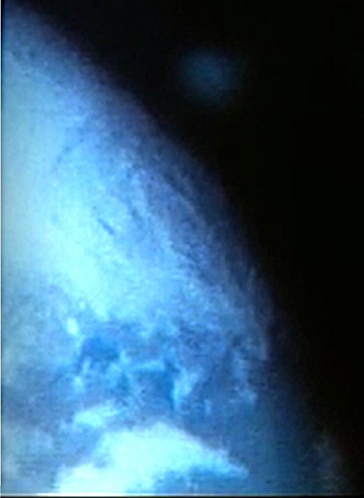
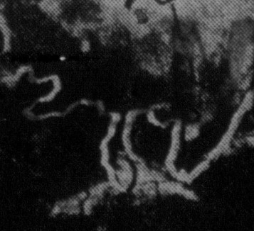
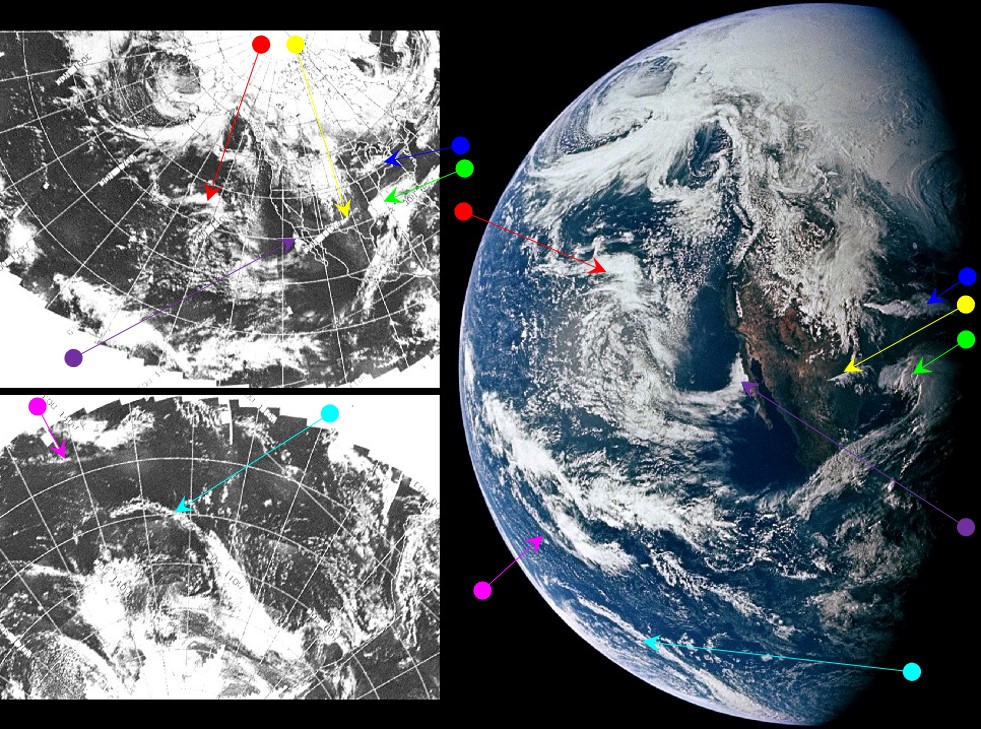
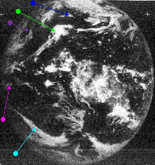
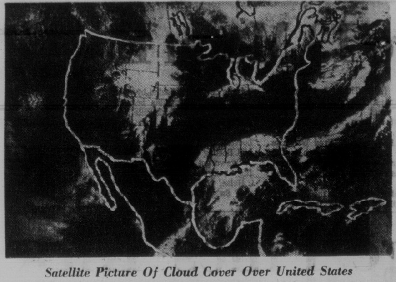
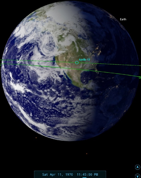
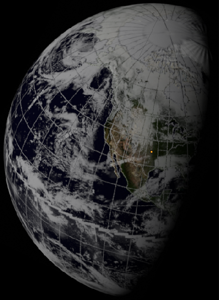
Figure 4.5.1.8: AS13-
Far left is a 3D reconstruction of digitally restored ESSA data. SkySafari view of time at terminator is immediately left.
The additional rotation of the Earth between the earlier screenshot and the Apollo image suggests a terminator line consistent with a time of around 23:45 on the 11th. Zooming in close to the Canadian border on the east coast shows that the great lakes are just visible (showing the same band of cloud below them as seen in figure 4.5.1.6, and Florida would probably be visible if it wasn't covered in cloud.
Of the two satellites ESSA has the best coverage here & the timings are the same as the previous image. The streams of cloud off Baja California are just visible in the ATS image, as is the large system peeling off the Antarctic (cyan arrow), but the north Pacific weather patterns over Hawaii (red arrow) are too far around. A few hours later in the mission comes a period occupied by weather photography, and this falls into the next day of the mission, so click the link below to see them.
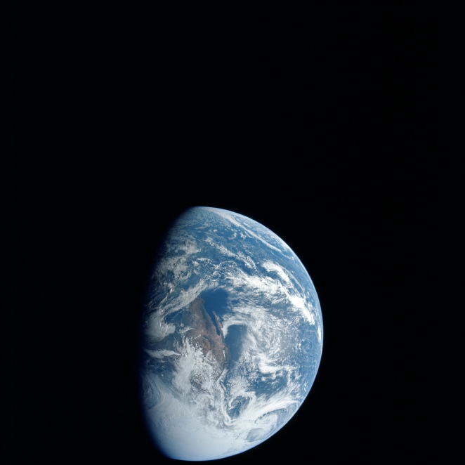
Figure 4.5.1.7: AS13-