4.5.4 - Day 4: Heading for free return
After Apollo 13’s mission plans needed to be unexpectedly re-prioritised, the crew spent less time taking photographs of home, and used different magazines when they did.
The next image in Magazine 60 (AS13-60-8601) is from the 14th, all other images showing it appear after it has passed around the far side of the moon. This particular image will be discussed at the appropriate point in the sequence of images taken on the 14th. Magazine 61's images featuring Earth all appear after those showing a receding Moon (and are therefore obviously on the way home), Magazine 62 shows a few images at the start of the film with a relatively large crescent Moon, after which there are a few images of a very small crescent Earth, and more are shown towards the end of the magazine after a sequence of far side lunar images. Magazine 59 shows pictures of a relatively large crescent Earth immediately before images taken after the damaged service module was cast adrift. These images of Earth will now be presented in the order in which it has been calculated that they were taken.
The first in the sequence is AS13-62-8886, which occurs after the aforementioned set of images of the Moon through the spacecraft window. It’s one of a pair and is followed by another couple showing the LM window frame. Figure 4.5.4.1 shows this image, and 4.5.4.2 the satellite analysis.
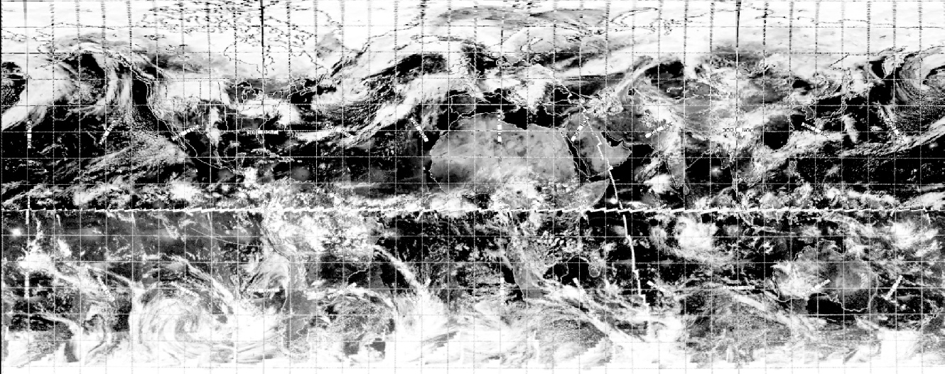
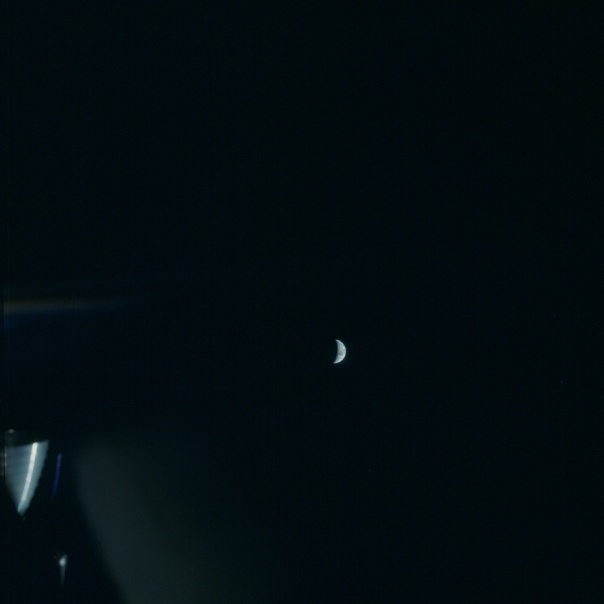
Figure 4.5.4.1: AS13-61-8864 – source given in text
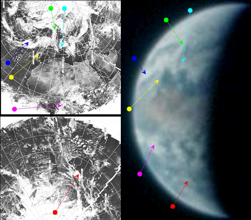

Figure 4.5.4.2: AS13-62-8886 compared with ESSA (top left) and ATS (bottom left) satellite images, and 3D reconstruction using digitally restored ESSA data (bottom right) with SkySafari depiction of time at terminator bottom centre.
The key to identifying this image as belonging to the 14th of April is the cloud system off western Europe (cyan, green and blue arrows) that extends into the Atlantic to off the west coast of Africa. These clouds patterns do not appear in this formation on other days, and as will become clear, the system pointed out by the blue arrow moves progressively towards Africa over the next couple of days. What will also become clear over the next few images is that the blue arrowed clouds are connected to a weather system that extends over America that is visible in subsequent images.
Returning to this analysis, Stellarium's terminator line through Libya puts the time at around 16:30 on the 14th, just over 13 hours after the crew reported that they had “had a problem”. The ATS image is recorded at 14:01. ESSA's most relevant pass is pass 5148 (track 12), which was started at 12:08. As usual, the reason for the close correspondence between the satellite images and Apollo is that there is relatively little time between them.
The next pair of Earth images are taken through the LM window (as shown by the Landing Point Designator markings), and one of these is shown in figure 4.5.4.3.
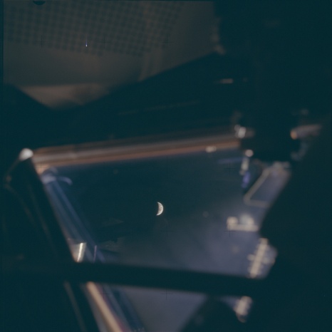
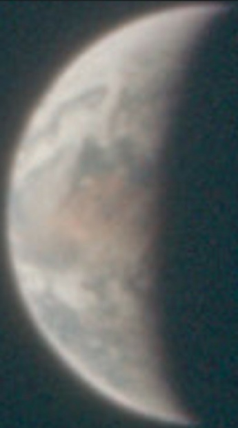
Figure 4.5.4.3: AS13-62-8889, compared with SkySafari terminator estimate
The differences aren’t easy to make out thanks to the lack of clear focus, but careful examination shows that Egypt has moved more into darkness, and the outline of the Black Sea just visible in the preceding image has now gone. Clouds along the equator have also moved nearer the terminator, and my estiamte that it was taken half an hour later than the preceding photograph examined.
The next image in the sequence for the 14th is AS13-60-8601 (figure 4.5.4.4). Readers may wish to compare it with AS13-62-8901, which shows an almost identical viewpoint but is of inferior quality. Figure 4.5.4.5 shows this image compared with the available ESSA, ATS and NIMBUS geotiff images, while 4.5.4.6 shows a close up of the area east of Greenland compared with a higher resolution image taken by NIMBUS’s IR cameras.

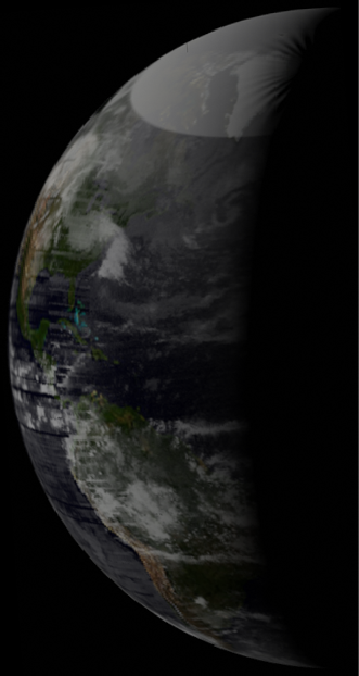
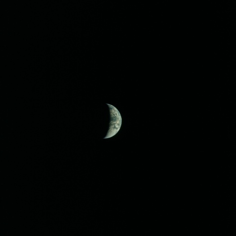
Figure 4.5.4.4: AS13-60-8601. Source: AIA
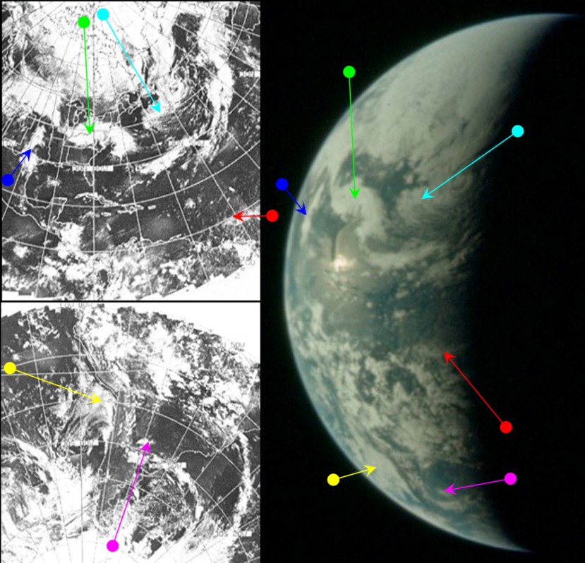
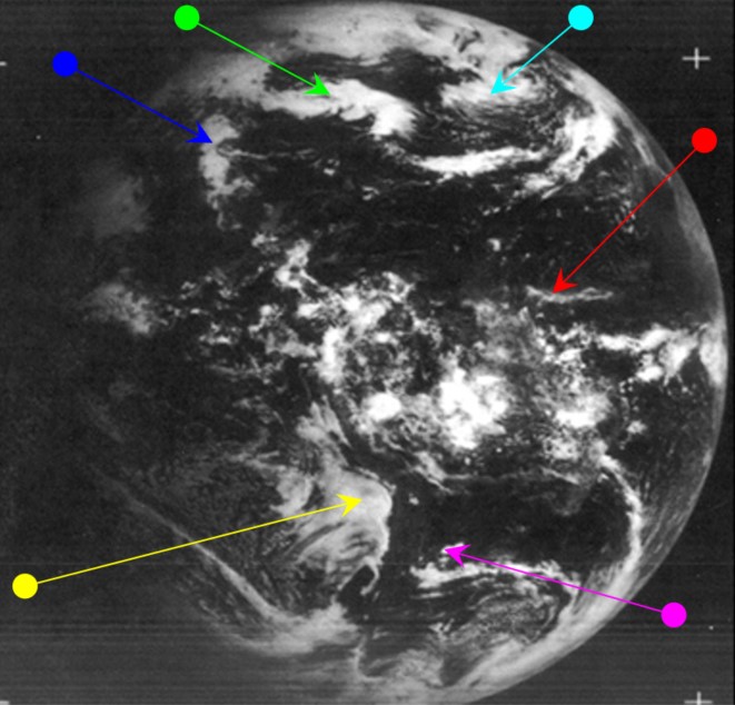
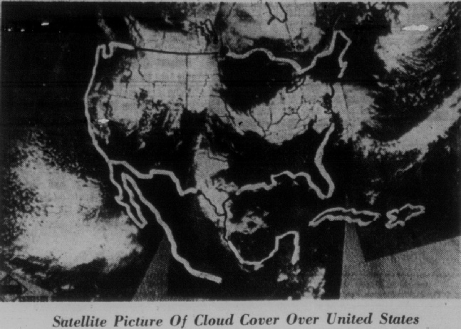
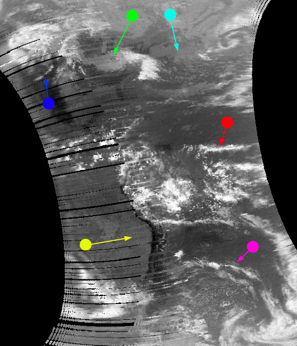
Figure 4.5.4.5: AS13-60-8601 compared with ESSA (top left), ATS (centre left) and NIMBUS IR satellite images (bottom right). SkySafari depiction of terminator to left. Centre right are 3D reconstructions using digitally restored ESSA (right) and NIMBUS IR (far right) data. Bottom left is the ESSA mage of north America as published in the Sarasota Herald-Tribune on April 15th.
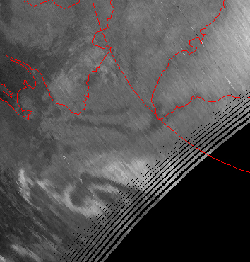
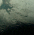
Figure 4.5.4.6: Crop of AS13-60-8601 (right) compared with close-up of NIMBUS 4 IR image.
In the overall image, once 'correctly' oriented, the Florida coastline becomes very obvious, and makes positioning a Stellarium terminator much simpler, placing the time at around 20:45 on the 14th. The close up of the IR image beautifully picks out the swirl of cloud off Greenland.
At this time in the mission the crew are involved with almost continual dialogue with Capcom about the state of the vessel, levels of consumables, and upcoming manoeuvres to orient the craft and position it on a homeward trajectory ahead of a far side lunar pass.
The weather systems picked out by the cyan and green arrows are continuations of weather systems identified in figure 4.5.11 by the blue arrow. The ESSA orbit for the mid-Atlantic would be pass 5150 (track 1) which was commenced at 15:08.
The next images move into Day 5, so click the links below to get there.