4.5.5 -
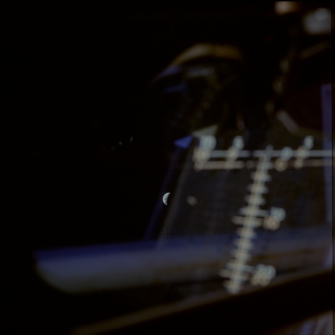
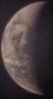
Technically the next image in the sequence is AS13-
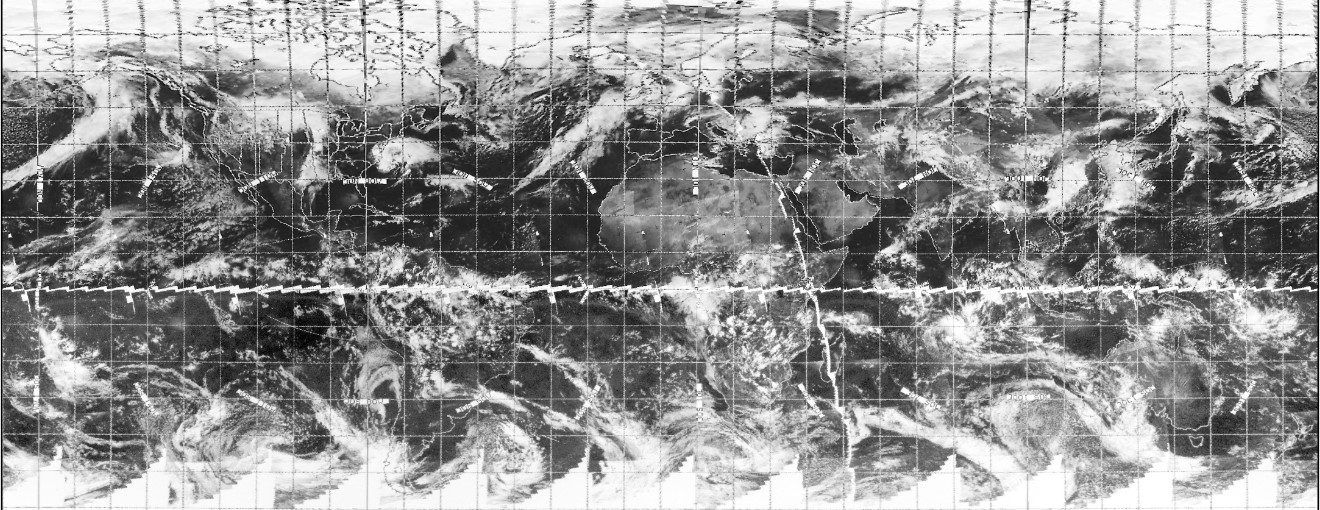
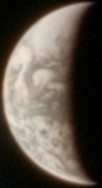
Figure 4.5.5.1: AS13-
The time for this photograph has been fixed largely by referring to the analysis in the next photograph, where there is a clear view of Australia, but we can also look at the satellite image to show that the large swirl of cloud in the North Pacific, which nestles snugly in the Gulf of Alaska. IT even seems to get a reference in the transcripts, where at about 04:55 we have this:
081:35:32 Haise: Man, that's a wicked low pressure down there.
The analysis in figure 4.5.5.3, and 4.5.5.4 makes this clearer.
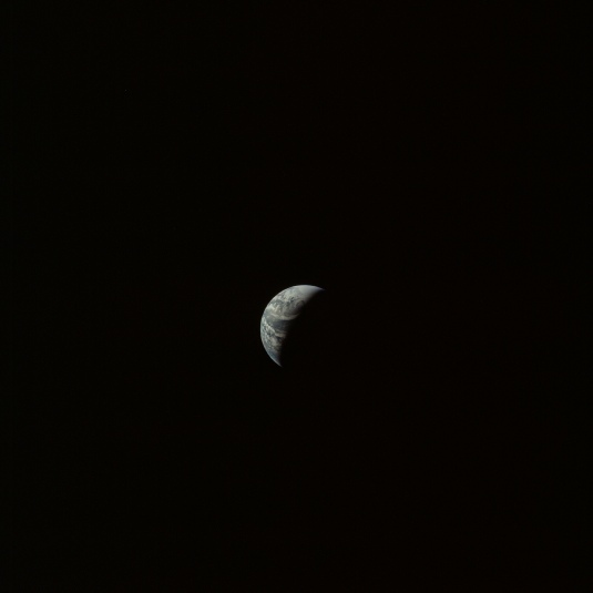
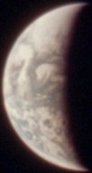
Figure 4.5.5.2: AS13-
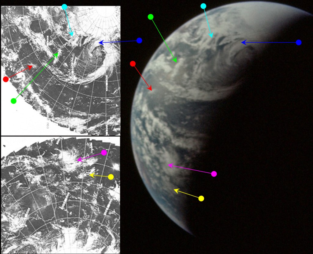

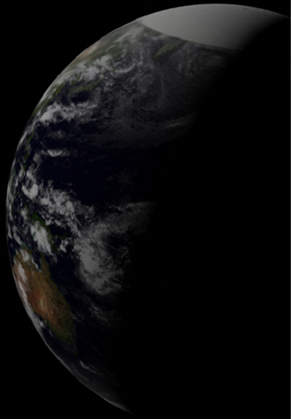
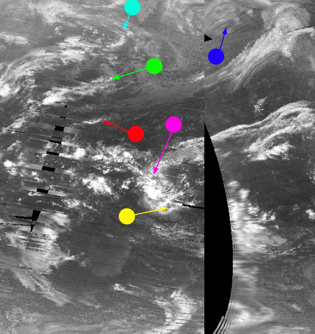
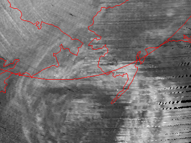
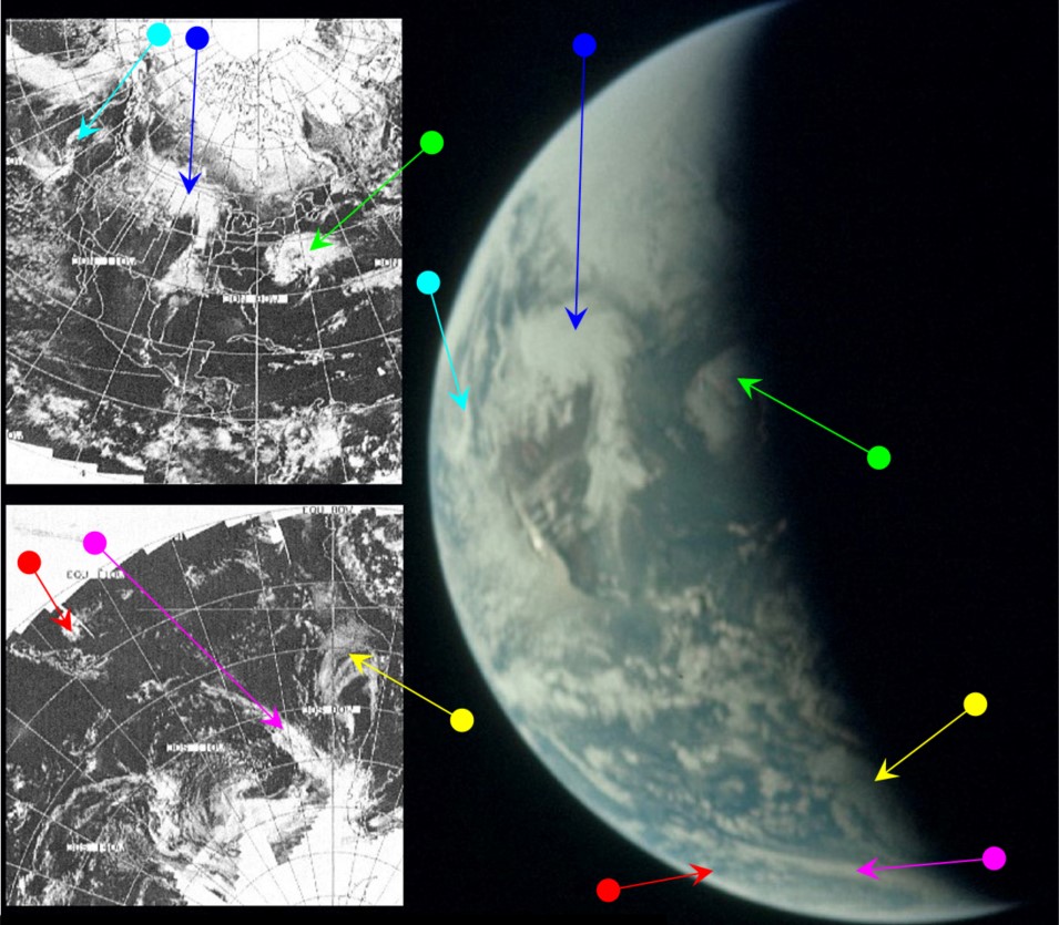
Figure 4.5.5.3: AS13-
The dominant weather system (blue arrow in 4.5.5.3) on the map is a development of the one identified by the blue arrow in figure 4.5.2.2, and its centre is still located roughly over Alaska & Kamchatka. The weather system identified by the magenta arrow is likely to be Tropical Cyclone Isa, which was active between the 14th-
Figure 4.5.5.5: AS13-
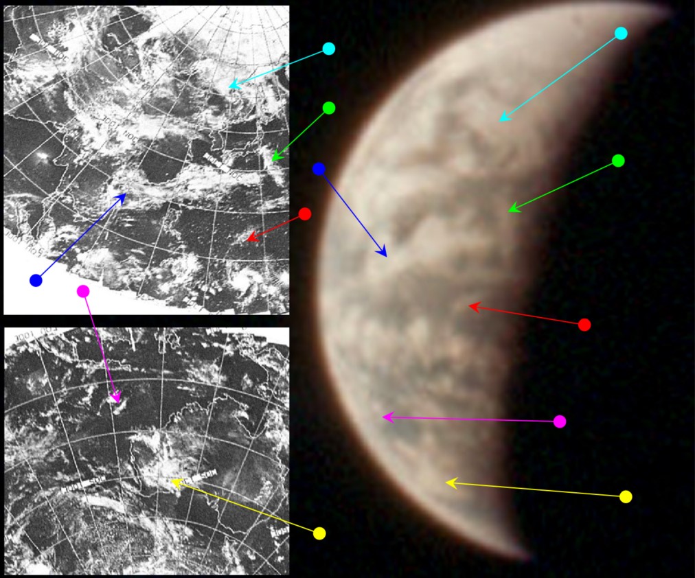
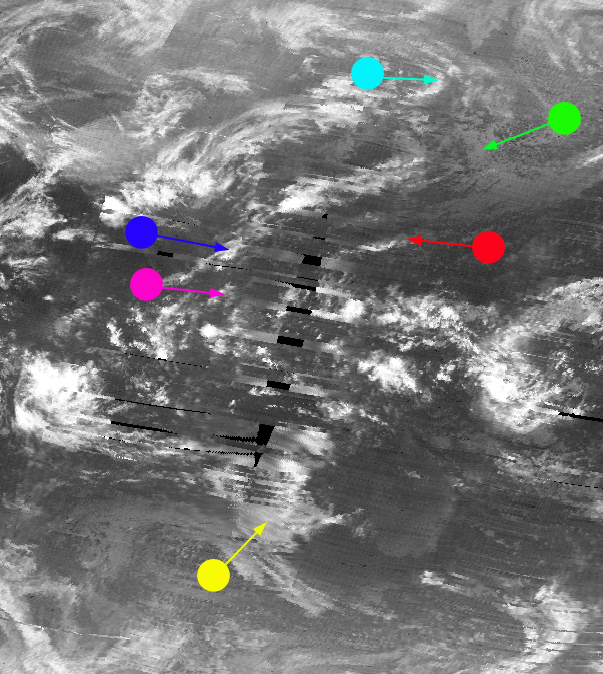
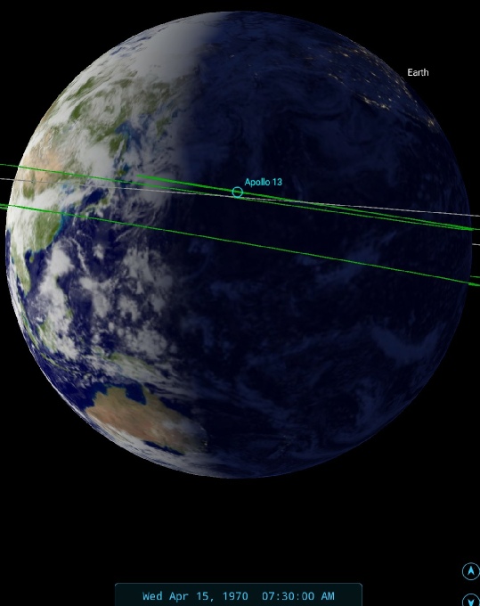
Figure 4.5.5.6: AS13-
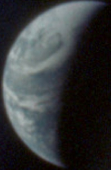
What the image shows is that weather patterns that were towards the west of the globe have moved much closer towards the terminator, and systems identified in figure 4.5.5.3 can also be identified in figure 4.5.5.6. Australia's position on the terminator allows a relatively precise estimate of the time the image was taken: 08:15. As the satellite photograph is dated the 14th this gives the appropriate orbital pass as number 5158 (track 9), commenced at 07:01 on the 15th. A few hours after the Australias enter darkness, ESSA starts a new collection of orbits that will have the next day's date on them.
Two images later in this magazine we have a similar view in AS13-
AS13-
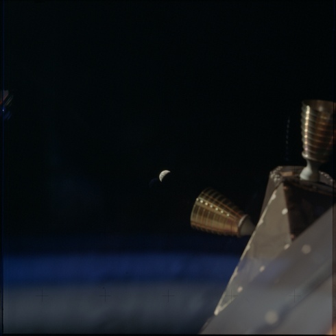
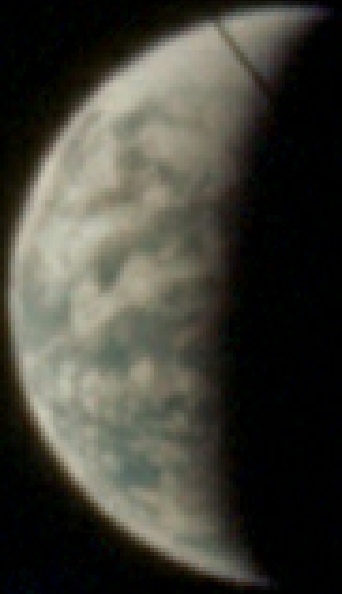
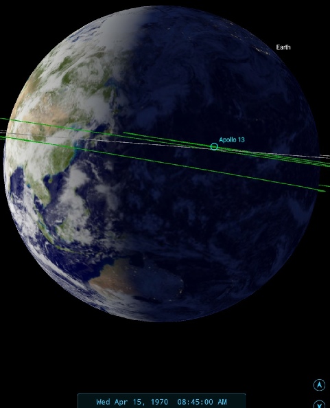
Figure 4.5.5.7: AS13-
There isn’t much point in repeating the analysis, but close examination of the cloud systems along the terminator show that there has been definite rotation. The clouds over western Australia identified by the yellow arrow in figure 4.5.5.6, for example, are now almost on the terminator, as is the system picked out by the green arrow.
There are no firm hints in the transcript specifically about these last two photographs, but capcom is informed regularly at around this time of the angle at which Earth appears on the LPD (Landing Point Designator -
The next Apollo image to be looked at is AS13-
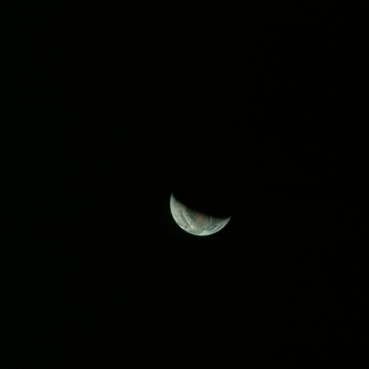
Figure 4.5.5.8: AS13-
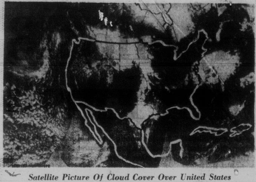
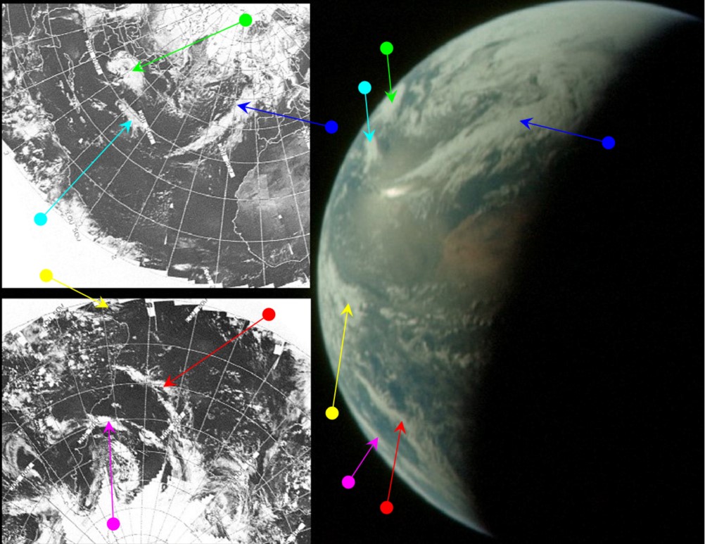
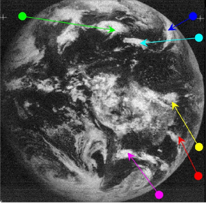
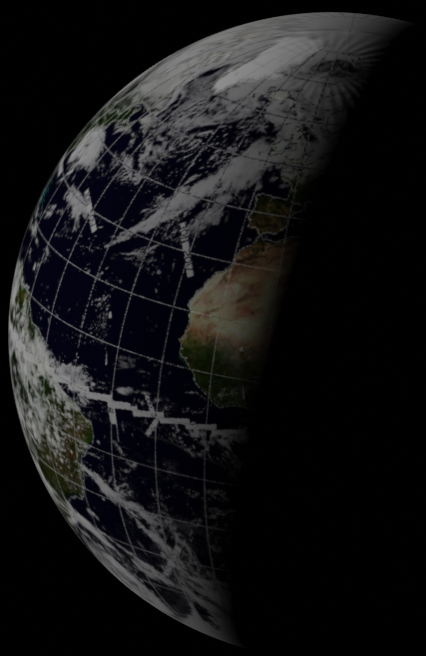
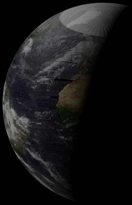

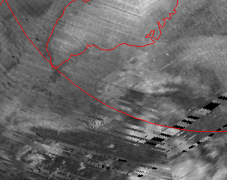
Figure 4.5.5.9: S13-
It doesn't take much zooming in on this image to see that the terminator line crosses north Africa somewhere along the coast of Tunisia/Algeria, which gives a time of the photograph as around 18:00.The main weather system visible over the Atlantic is the same one observed in figure 4.5.4.2, but it has changed in the couple of days since it was first photographed, separating itself from the other clouds in the mid-
The movement of the Earth has also brought the ATS satellite back into play when confirming the timing of the Apollo image. ATS' image is time stamped at 15:59 on the 15th. ESSA's most representative orbit is pass 5161 (track 12), which commenced at 13:06 – not long before the ATS image, and within a few hours of the Apollo photograph.
The next picture to be analysed in full is the final image in magazine 60: AS13-

a) AS13-
b) AS13-
Figure 4.5.5.10: AS13-
The key to timing these two images is the position of the large weather system across the centre of the USA, and the smaller system over New England shown in the ESSA view. The central system is very close to the western limb. There’s enough of the southern Pacific off the coast of Chile to also allow a reasonable time estimate. There is obvious movement between the two, and I’d suggest no more than 30 minutes have elapsed between them.
It becomes much easier to tell the time when we look at the more detailed view shown in AS13-
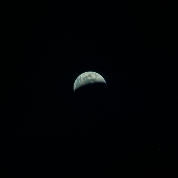
Figure 4.5.5.11: AS13-
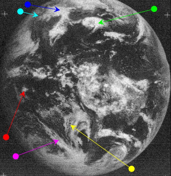
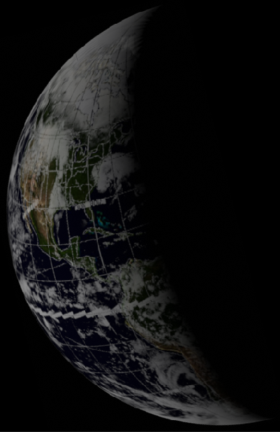
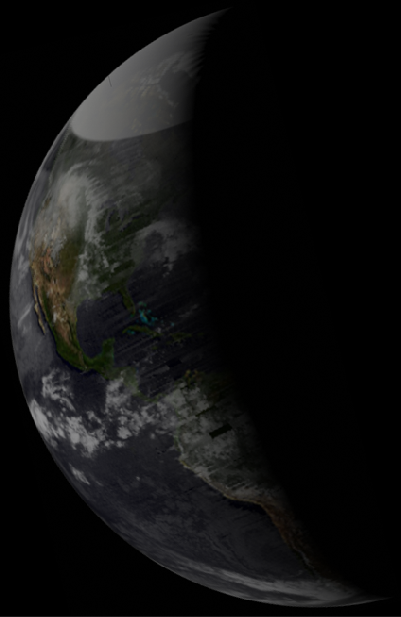
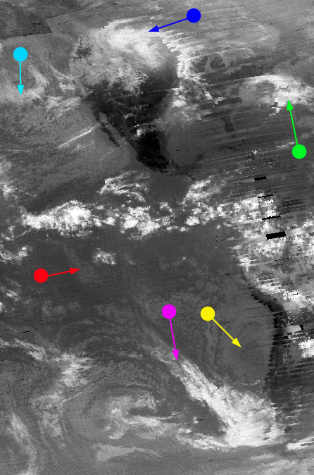
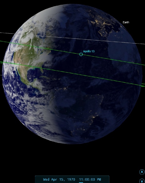
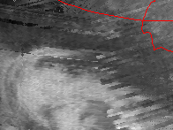

Figure 4.5.5.12: AS13-
At the risk of pointing out the obvious (again), there is a degree of overlap between this image and the previous one. The 'speech bubble' cloud identified by the green arrow in figure 4.5.22 has now been split by the terminator line, and the north American mainland can be made out to the west of it. The more detailed NIMBUS IR image shows excellent correspondence with the Apollo photo over Canada.
Using this terminator line SkySafari times this image as roughly 22:30. The ATS image is till the 15th, and the ESSA image is also dated that day. The ESSA pass covering the Atlantic seaboard is track 2, which translates to orbit number 5163, commenced at 16:07. By this time in the journey the CSM and its attendant LM had just passed into the Earth's gravitational sphere of influence and were beginning to accelerate. The crew were also preparing for a mid-
There’s one more image in this sequence of Earth photos, all timed around the crucial correction burn that ensures their safe arrival back home, and that can be seen in figure 4.5.5.13.
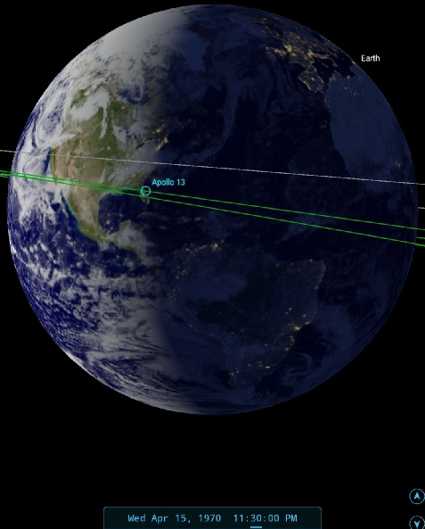
Figure 4.5.5.13: AS13-
The storm over New England has now completely disappeared into darkness, as has South America.
One interesting diversion concerning the satellite record relates to a photograph of mission control taken on the 15th.
It’s often documented that Apollo 13 witnessed a tropical storm on re-
Here’ for example, is a conversation at 20 hours from the Flight Director loop (source):
020:00:57 -
020:01:04 -
020:01:13 -
020:01:16 -
These things were always planned for!
Despite these claims there is no actual mention of it by the crew other than in passing when discussing their landing zone, not re-
The storm threat is discussed in this Universe today article, complete with photograph of Mission Control staff poring over a weather map, and one member of that team discusses it in the article. It’s possible that the discussion is buried somewhere in the tape loops here, but it’s very likely that reports of the crew seeing Cyclone Helen are based on remembering scenes in the Apollo 13 film.
One of those discussions was captured in the photograph below (figure 4.5.5.14).
That diversion dealt with, the crew have survived another 24 hours, and we can move on to day 6 of the mission -
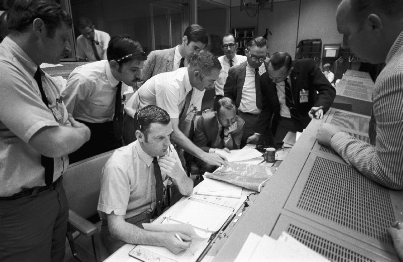
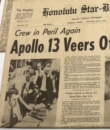
Figure 4.5.5.14: Mission control photograph dated April 15th (Source) and Honolulu Star-
The picture is captioned thus:
S70-
The fun part for us is to work out a) which weather satellite image are they looking at and b) when was the photograph taken.
Figure 4.5.5.15 shows the satellite image rotated and compared with a couple of sources.
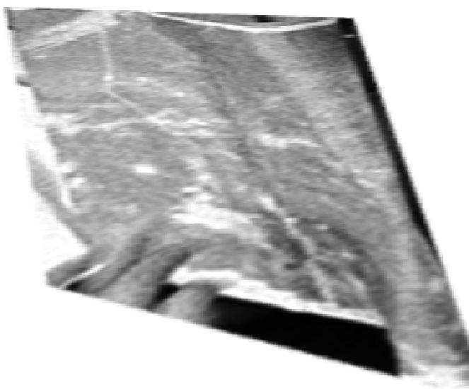
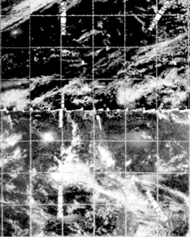
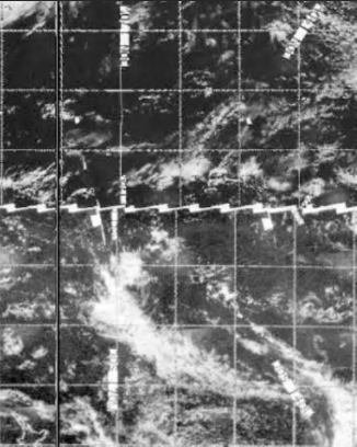
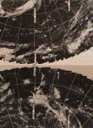
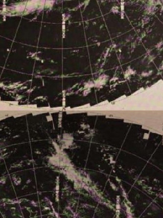
Figure 4.5.5.15: Rotated satellite view from the mission control photograph, compared with restored ESSA satellite images dated the 14th (top centre) and 13th (top right), and original scans (source) from the 14th (bottom centre) and 13th (bottom right).
The small bright spot of cloud is Tropical Cyclone Helen, as pictured sometime around 04:00 on the 15th. The main concern for the forecasters was that changing the location of the landing had implications for when a course correction burn could be carried out, and this was not a mission where resources were limitless. By the time that satellite image had been taken they were confident that the chosen spot would be OK and that they could use re-
“A tropical storm named Helen near the New Hebrides about 1,700 miles away was being watched closely by Navy weather experts. It was not expected to interfere with the planned recovery.”
It should be clear from the satellite images above that the one being used in Mission Control is the one dated the 14th. The satellite record tells us that this image is likely to be from track 6 of ESSA 9’s orbit, and this track was commenced at 01:04 on the 15th (figure 4.5.5.16).
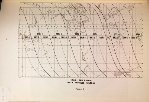

Figure 4.5.5.16: ESSA track data.
It is possible that the image also combines elements of track 7, which commenced at 03:00 GMT on the 15th.
In either case, it’s more than likely that the images would have been downloaded in Australia on track 8, which would have been at around 06:00 GMT. It would then have been printed and sent over to Houston by the fax network available to them.
Can we use this information to decided when was the mission control photo taken? Partly -
The person in the foreground of the photograph is Glynn Lunney, Flight Director of the Black Team running mission control during Apollo 13. These teams typically ran 10 hours shifts, with an hour overlap to exchange data with the next shift. The AFJ has this on their Day 4 page:
“At Mission Control at this time, we are beginning the shift change, the handover, a number of flight controllers have come in from the -
Which equates to 12:16 on the 15th for the time of the announcement, with Lunney’s team taking over at 13:00 GMT. It’s worth noting at this point that Hawaii is 10 hours behind GMT, so their standard time would have been 05:00.
At 98:49, we have this:
“…Flight Director, Gerry Griffin, and his Gold team have relieved Glenn Lunney and his Black team. He has no estimate yet on the time for the change of shift briefing.”
That time is 22:02 GMT, so we now have a window between 13:00 and 22:00 for the time of the photograph. 22:00 would mean a Hawaii standard time of around noon, which is important in terms of newspaper deadlines. The newspaper was formed as a merger of two separate entities, one of which (the Evening Bulletin) was a late edition. The clue’s in the name there.
Even with this information, it;s difficult to work out when the image was taken. We have numerous mission control audio recordings, but the photograph shows that Lunney isn’t looking at the photo, and the active discussion over it doesn’t involve anyone else wearing a headset. Annoyingly, only one person is wearing a watch (figure 4.5.5.17).
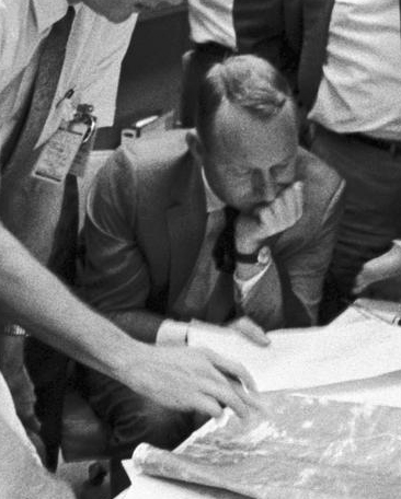

Figure 4.5.5.17: Mission control watch.
It’s very difficult to make out anything out with any certainty. There’s a suggestion of two hands that might be 18:10, or 14:30 but it could equally be a reflection on the glass. Those two times would be equivalent to either 00:10 on the 16th GMT or 19:30 on the 15th GMT -
What’s likely is that the photograph shows the intense discussions relating to a proposed course correction burn later in the day to avoid landing in the path of storm Helen. Figure 4.5.5.18 shows the Flight Director notes referencing the weather, made on the pad on Lunney’s desk.
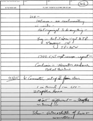
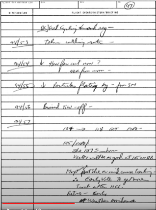
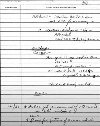
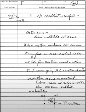
Figure 4.5.5.18: Extracts from Flight Director Lunney’s notes referencing the weather. Source, Source & Source.
We also have some of those conversations mentioned in the mission control transcripts, eg:
091:37:14 For everybody that's listening to the loop, we've been tracking what would be a 4-
091:37:31 And the weather people just come in and they talk about this three times.
…
092:23:10 Hey, Recovery Retro. Hey, Retro. I mean, Recovery Retro. Hey, lookit. Right now, is 168 clear what you think the storm is going to be? The storm where it was right now, we can buy 168 for landing point A.
095:03:16 At 102 hours, if the weather is a problem, they will have enough data to make a decision, I guess from the high ups, if we have to make a midcourse for weather avoidance.
…
095:05:08 Okay, so with the weather, with the prospects for getting any more information, and with the changes that we would have to make, it doesn't look to me like there's any point in discussing any further weather avoidance burn.
…
097:56:32 Hey listen, we saw a map out here a while ago with the past history of this, whatever you call it, storm out there and a prog for it.
Disappointingly, none of this is conclusive. We know that weather was a concern, and that a lot of people were discussing it, and the possible time on the watch would fit in with these discussions.
As for the Apollo 13 the movie, as tension builds before re-
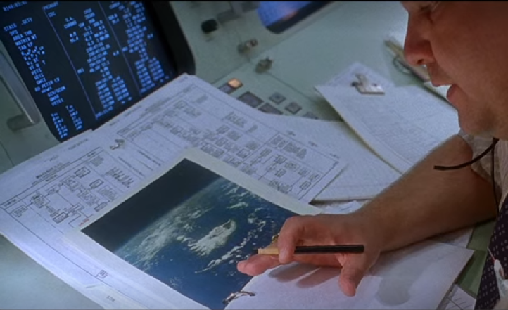
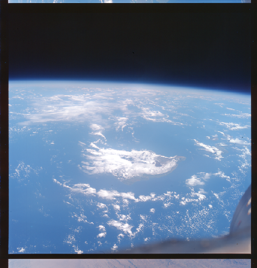
Figure 4.5.6.19: Still from ‘Apollo 13’ and Gemini V image S65-
Close inspection of the south-
It’s worth pointing out that the 3D reconstructions show more of Australia than is actually visible. It’s a fiddly process getting those views right, but the position of the terminator is correct.
The next image in the sequence is AS13-
082:57:30 Haise: Okay. Jack's got the one with the 250-
That transcript time equates to around 06:15
Figure 4.5.5.5 shows the original Apollo image, and figure 4.5.5.6 has the same image compared with satellite photographs.

Figure 4.5.5.4: Location of tropical storm ISA (Source)