4.4.1 -
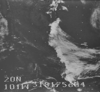
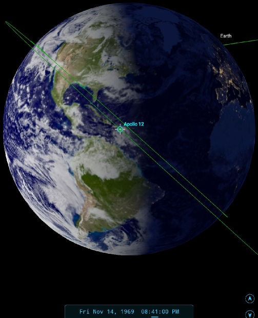
Given the issues with the TV camera it’s ironic that some of the first images of Earth were made in a TV broadcast. According to the timeline the broadcast started at 19:45 and continued until 20:50, and there is a copy of this broadcast available on youtube (from the same source as figure 4.4.0.1). A screenshot from this broadcast is given in figure 4.4.1.1, together with satellite comparisons. While the quality is relatively poor, it's clear that this live broadcast is showing the same features as the satellite images, and also that it could not be a re-
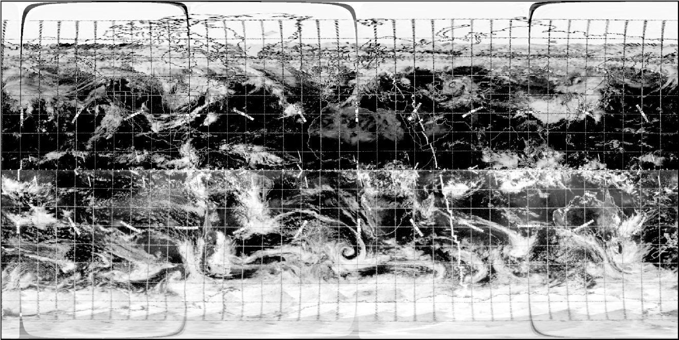
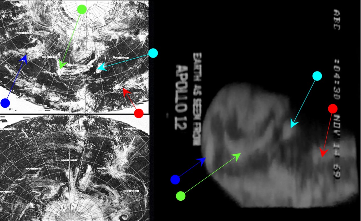
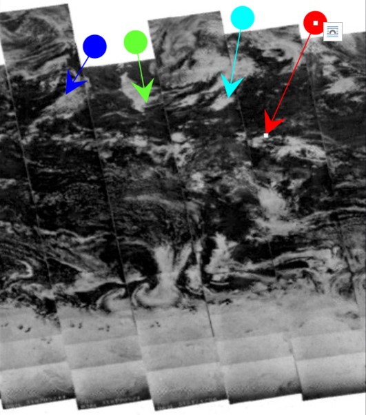
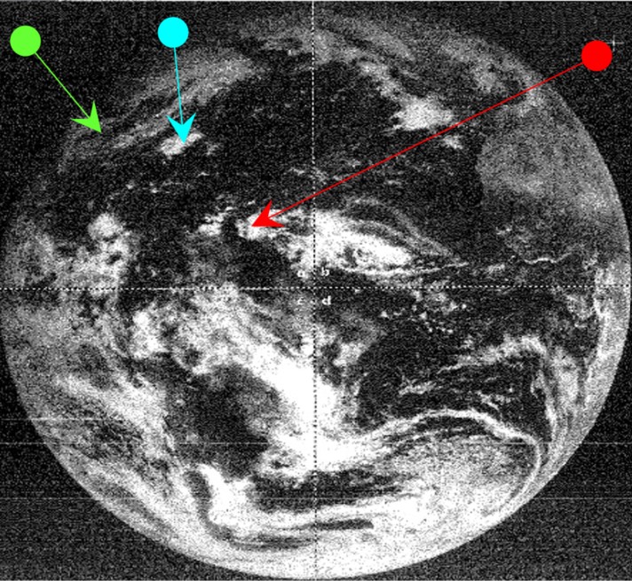
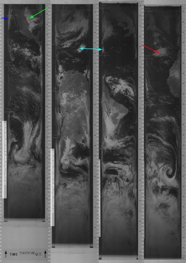
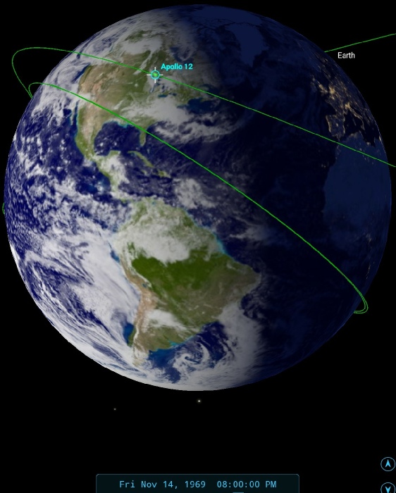
Figure 4.4.1.1: Top right, rotated screenshot from live TV broadcast compared with ESSA (top left & middle), NIMBUS-
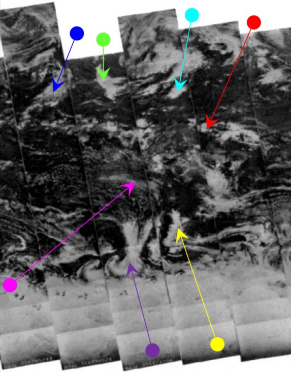
A slightly better version of the footage is available from this youtube source, which is a compilation of news footage shown to Vietnam troops. It includes a zoomed view of the north Atlantic, with considerably more detail. It is shown below in figure 4.4.1.2, together with the ESSA, ATS-
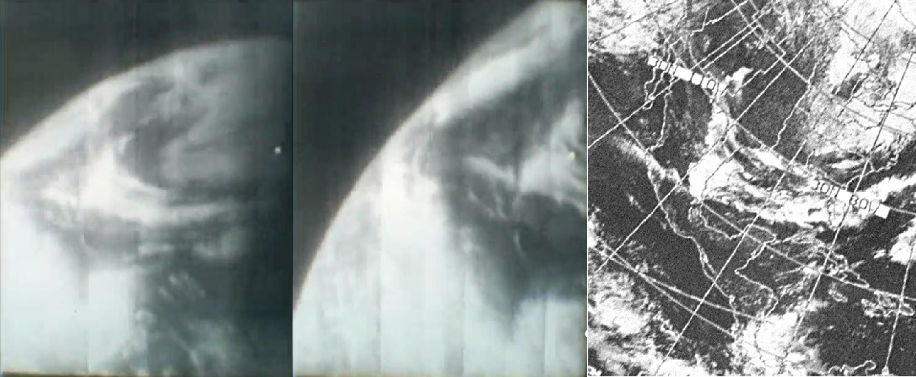
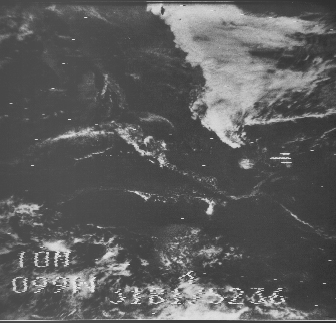
Particularly noticeable in this better quality shot is the band of cloud extending across Mexico, as well as the thin ‘V’ shaped stream of cloud to the south of this, and a similar thin band of cloud along the Mexican Pacific coast. The NIMBUS IDCS tile was taken on day 318 (November 14th) at 17:56 – 2 hours before the broadcast and about 90 minutes before launch. We’ll look at the timings in more detail later.
As in previous missions, the Astronauts communicated their own observations to Capcom of the weather conditions on the ground (these are recorded in the technical air to ground transcripts, available here: here).
At 3:34 MET Dick Gordon says:
003:34:12 Gordon: Okay. You should be looking at the Yucatan Peninsula, Mexico; Baja California is in plain sight. It's a pretty nice day down there. The Gulf -
003:34:32 Carr: Roger.
003:34:33 Gordon: It looks like that garbage we came through down at the Cape is off the coast at this time.
The ‘garbage’ to which he refers is the storm that hit the ascending rocket twice as it launched, prompting the famous “try SCE to Auxiliary” instruction to reset the electronics.
A couple of minutes later we have:
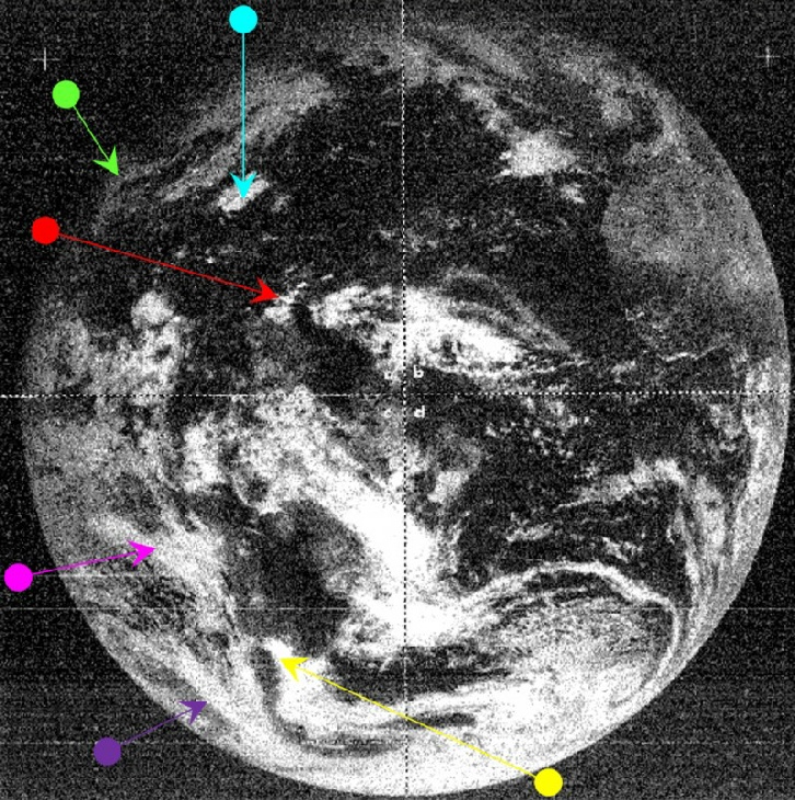
003:36:43 Gordon: Hey, Jer, it's a fantastic sight. The Mississippi Valley has a little bit of cloud coverage coming down from Canada, and there's some in the north -
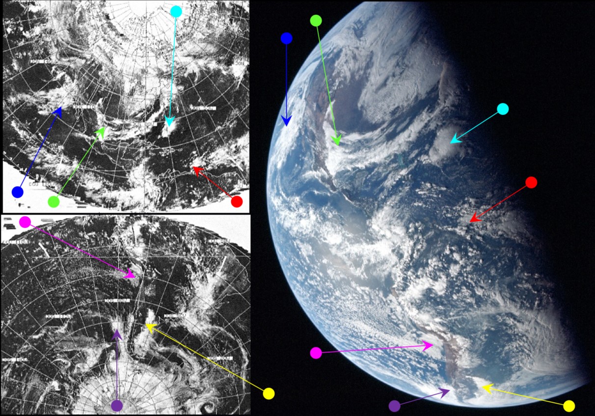
The smog he doesn't want to talk about is the mass of cloud identified by the blue arrow, and Baja California is indeed clear compared with Los Angeles & San Diego. The green arrow points out the system cutting Florida in half, and the cloud systems descending from Canada into the Mississippi are immediately north of that arrow in the preceding figure, and the snow systems over New England are to the east of that.
003:37:21 Carr: Roger. You see any more dry fronts anywhere?
003:37:24 Gordon: Hey, that was one of the driest ones I've seen in a long time; I hope I never see another one like it. As I look up North, there's nothing but clouds up there.
We also have a confirmation of the time of the Earth image:
003:40:02 Gordon: Hey, Jer, I'm going to take the camera out of that left window out the Earth.
Or slightly after 20:00 on the 14th.
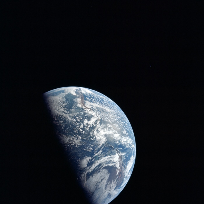
These features aren’t so obvious in the TV, but then you look at the still photographs taken around the same time they most definitely are. The first of those images don’t show a full Earth, but they certainly show good details of it (figure 4.4.1.3.
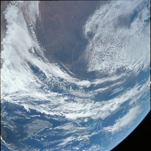
It’s clear from these images that the crew’s descriptions from orbit are absolutely accurate, and the view I’ve shown in the SkySafari depiction indicates how they were able to see those views. The lightning generating cumulus cells are also very evident.
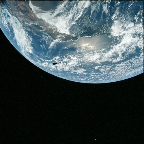
The crew continue to use this magazine as they document the undocking of the CSM, and the first image approaching a full disk is AS12-
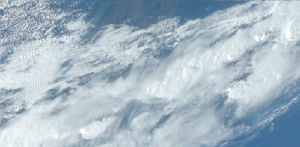
Figure 4.4.1.3: AS12-
Figure 4.4.1.4: AS12-
It’s a clear match for the Hasselblad view.
Immediately prior to this, there are several frames showing the SIV-
The crew took Earth images over quite some time, interspersed with various bits off disappearing hardware -
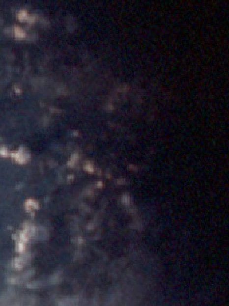
Figure 4.4.1.7: Comparison of a small area of AS12-
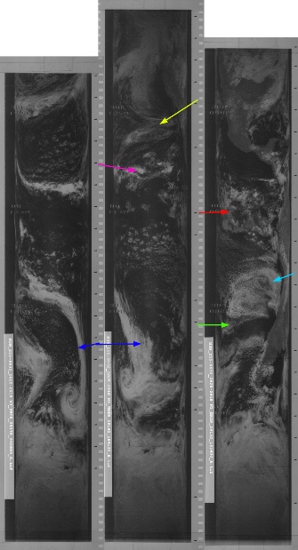
Returning to the satellite imagery analysis, the Apollo image has a number of unique features that are easily visible on the satellite photographs, particularly the large 'tick' shaped feature sweeping from the Mexican coast across the Gulf and up the east coast of the USA. The weather patterns either side of the tip of south America are also very distinctive and easy to spot on the satellite images.
The ATS-
As far as timings are concerned, the ATS image was taken at 14:25. The NIMBUS orbit closest to the terminator would be number 2873, which was started at 14:14. ESSA's image is more difficult to interpret, as unlike previous missions the orbits that comprise the image dated the 14th are not given. However, the track covering the terminator area would be track 2. For an image dated the 14th this would correspond to orbit 3264, which was commenced at 16:06. As the Stellarium terminator suggests that the time for the image derived from the Apollo timeline is entirely reasonable, these figures suggest, at most, an elapsed time of about 5 hours between the ATS image and the Apollo one. This five hours is sufficient for the cloud system highlighted by the yellow arrow to move from the centre of the tip of south America in the ATS image to nearer the east coast in Apollo. This and many other features show that the overall similarity of the images belies a wealth of subtle differences, demonstrating that while all the images show the same thing, they are not identical replicas.
An interesting addition to the data can be found in this journal, dedicated to amateur radio enthusiasts. The edition in question reports one ham’s attempts to intercept weather satellite data, specifically NIMBUS-
Figure 4.4.1.2: Screenshot from Apollo 12 broadcast on 14/11/69 (source given in text) with ESSA view (top right) and NIMBUS-
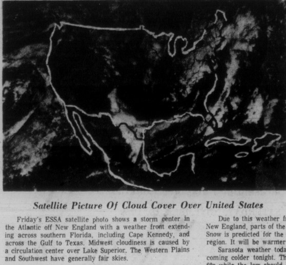
The amateur set up, while subtly different thanks to the way the image has been decoded and projected, is undoubtedly the same IR view as those downloaded from the NSIDC, and equally undoubtedly shows the same weather features as the Apollo photograph. It also reinforces the claim that the USA’s weather satellite data could be downloaded by anyone with the right equipment.
We digress.
As mentioned above, the sequence of photographs around docking continues until AS12-
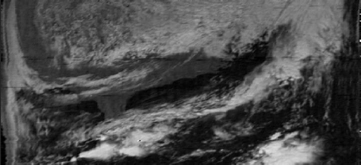
Figure 4.4.1.8: Amateur recording of NIMBUS-
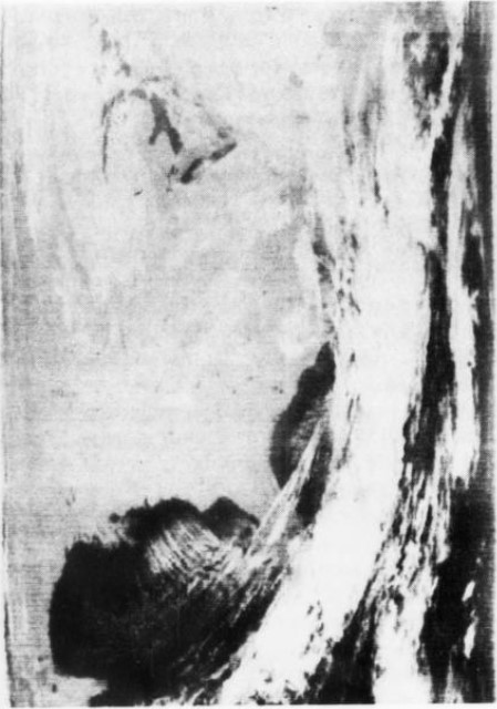
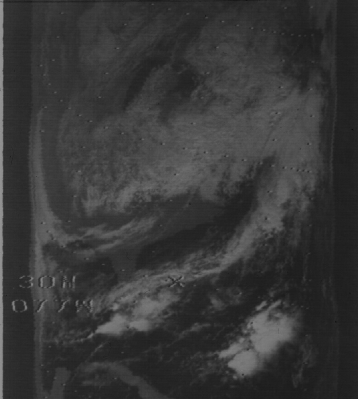
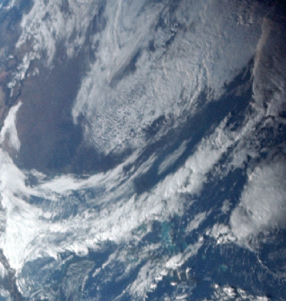
Figure 4.4.1.5: Main image -
It’s now worth introducing a full view of Earth from the transmission, the audio from which puts the time at precisely where those photographs were taken -
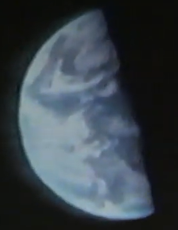
Figure 4.4.1.6: Still from the TV Broadcast.