4.4.2 -
Now firmly on their way, there’s a short gap in photography, AS12-
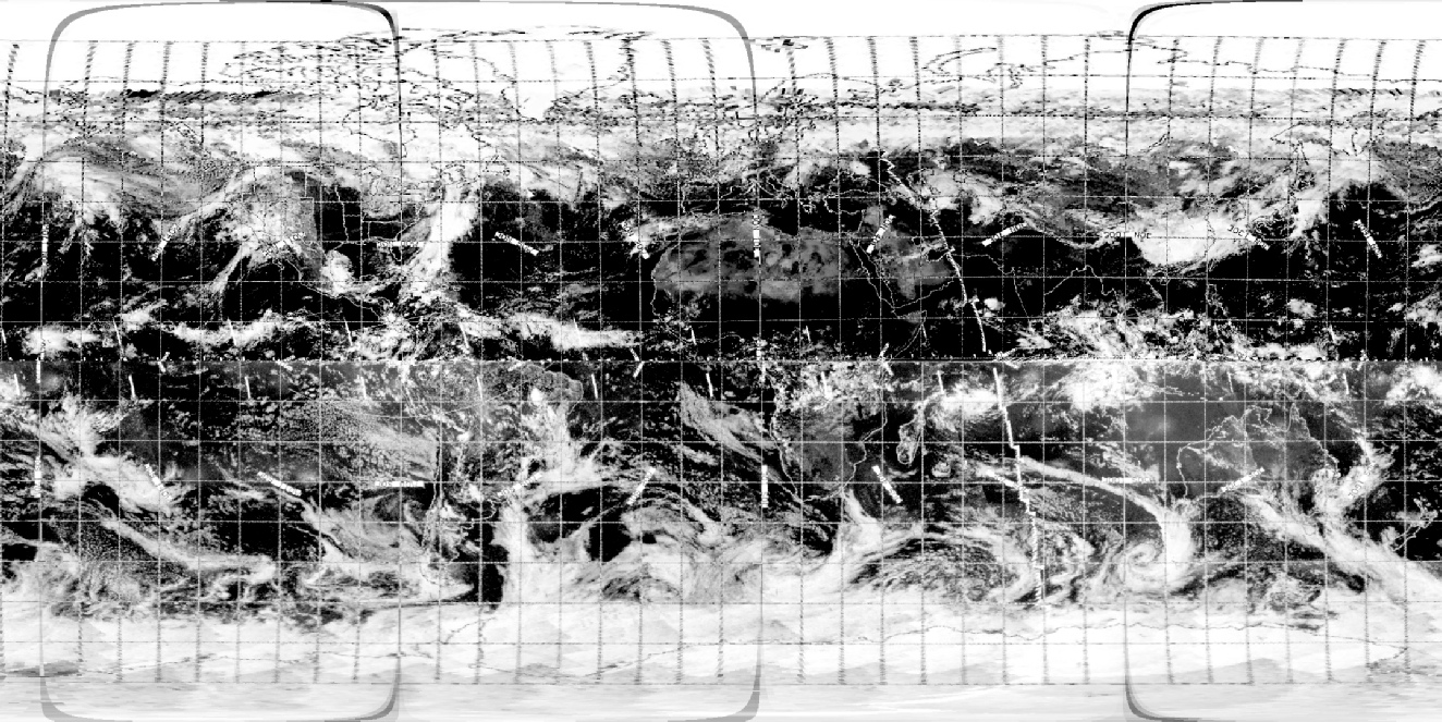
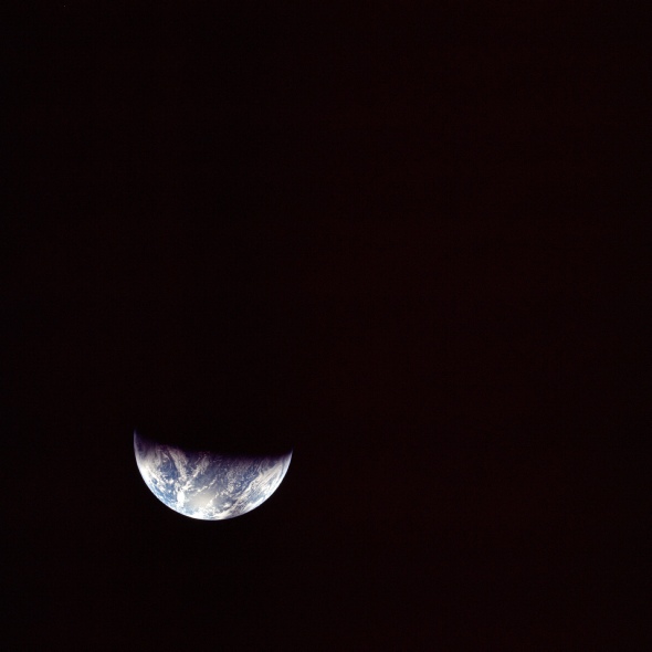
Figure 4.4.2.1: AS12-
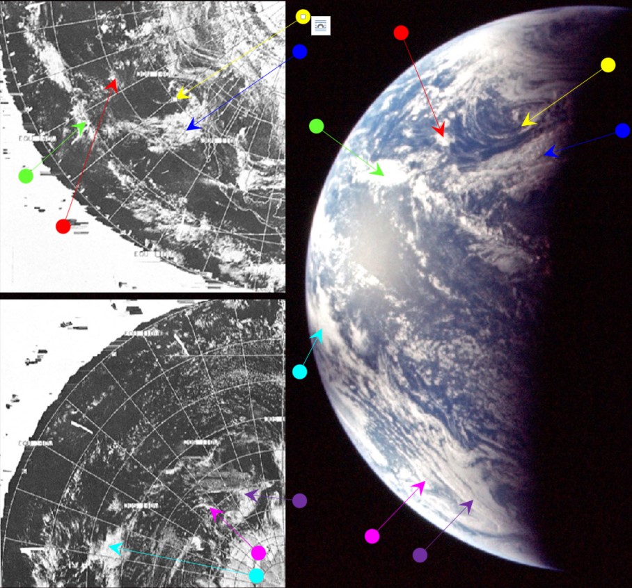
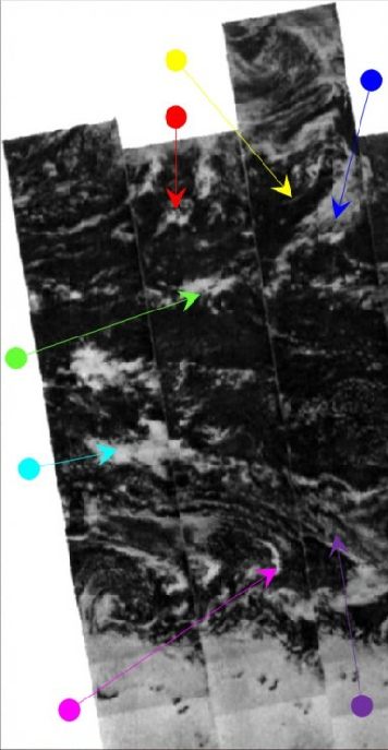
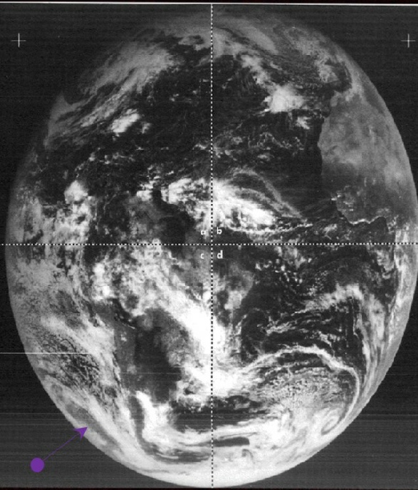
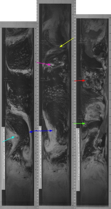
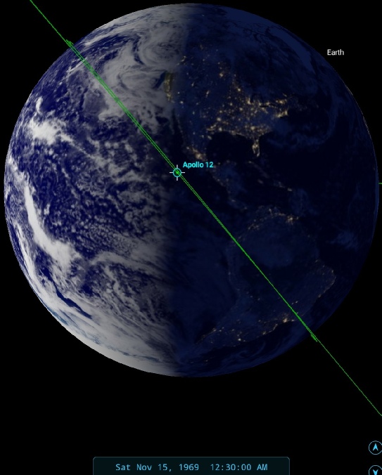
Figure 4.4.2.2: Main image shows AS12-
The SkySafari estimate of time based on the terminator line is difficult for this image, as no land masses are visible, but using the assumption that the weather system identified by the blue arrow borders the west coast of the USA, and using the 3D reconstructions as a guide, an estimate of 00:30 on the 15th has been derived. The satellite images used are still those of the 14th, as these are the nearest in time to that. The Apollo image is definitely from the early hours of the 15th rather than the early hours of the 16th, as the weather system picked out in blue has changed considerably by then.
The ATS image has been included, but as should be obvious from the preceding page, only one fragment of a weather system shown in the Apollo image is visible in it (identified by the purple coloured arrow). This completely eliminates ATS-
NIMBUS' orbits covering the Pacific area in the image are 2876/2877, and these are shown as starting at 19:53 & 21:34 on the 14th respectively. The NIMBUS tile showing the clouds picked out by the magenta arrow was taken at 21:06. ESSA's corresponding orbit would be 3267 (track 5), which commenced at 21:01. Again there is a good five hour gap between the satellite and Apollo images. As with the previous example, this time difference means that some of the weather systems have evolved by the time that the Apollo image is taken. The cloud pattern identified by the green arrow, for example, has moved some distance eastwards to a position more directly below that picked out by the blue arrow, and the red arrowed cloud has also moved much closer to the blue arrowed systems. The same weather systems but evolved into a slightly different configuration by the time the Apollo image is taken, and further indication that the Apollo image is not a straight copy of a satellite photograph.
Again, the crew discuss what they can see on the image, this time Alan Bean says at 08:23 MET (or around 00:45 on the 15th, during inspection of the LM):
008:23:22 Bean: I can't see any landmass at all. All I can see is water with lots of clouds, and I can see sort of a glare point on the Earth. I think that must be the zero phase point to us. Other than that, it's very, very bright. And another interesting thing is, on the dark side, you cannot see where the Earth stops and space begins. It's unlike the Moon at night on in the daytime where you can see it in earthshine. You just can't see anything.
The glare point is very evident, at about 9 o'clock on the Earth, and the absolute blackness of the night side is also obvious from the Apollo image. The 'zero phase point' is a point that won't change on the surface regardless of perspective because it is the light from the sun, and the sun is not going to change position.
A few frames later in magazine 50, after a couple of partial disk zoomed photographs, there are a few more full disk images, and again time has moved on slightly from the previous image. The first of this sequence is AS12-
Figure 4.4.2.3: AS12-
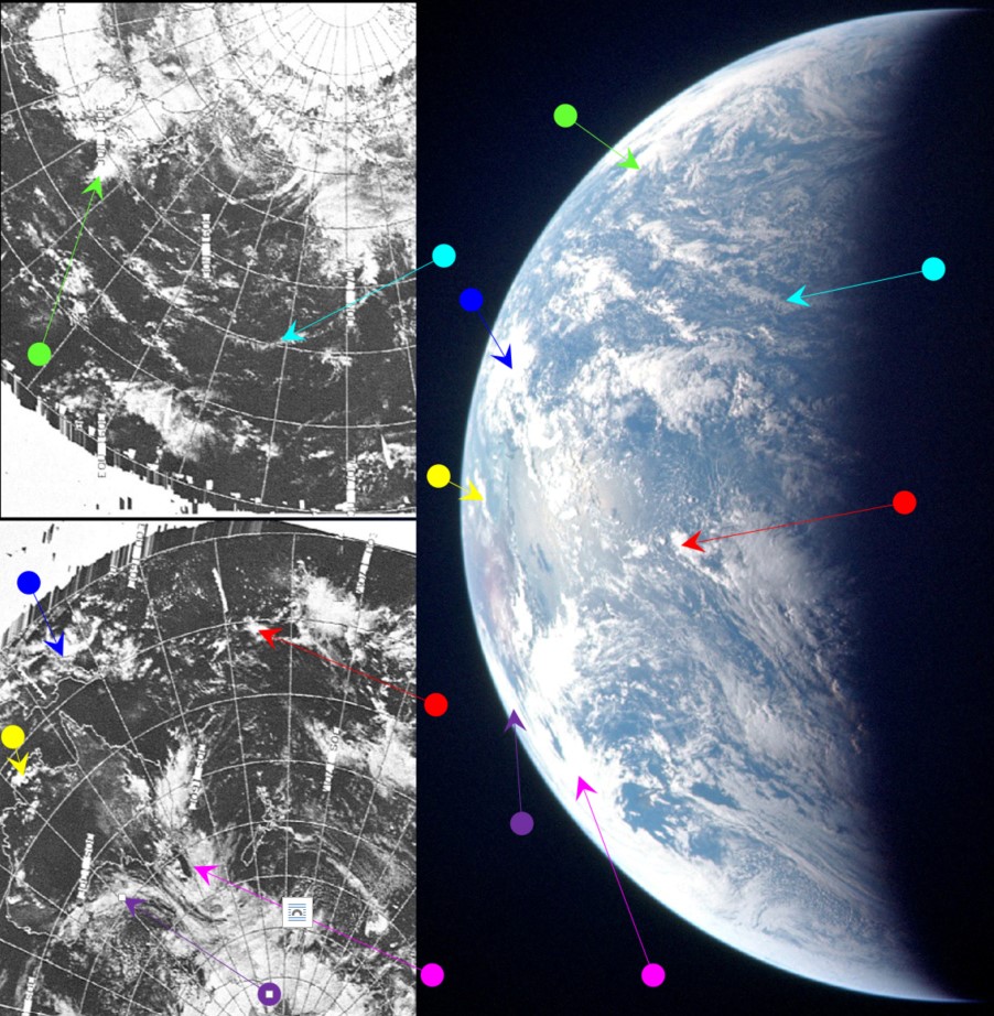
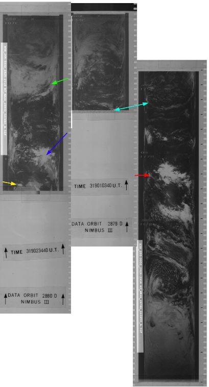
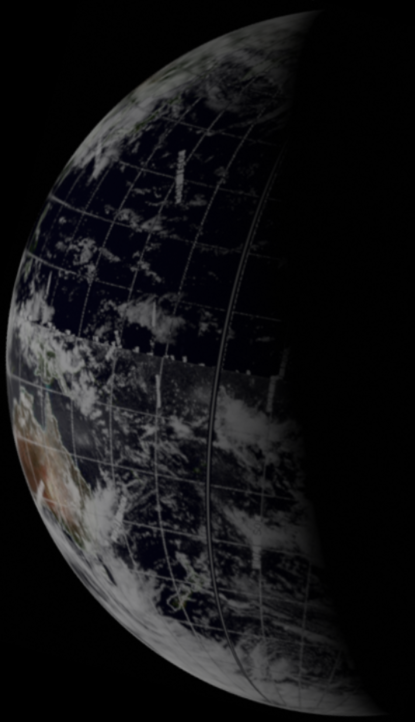
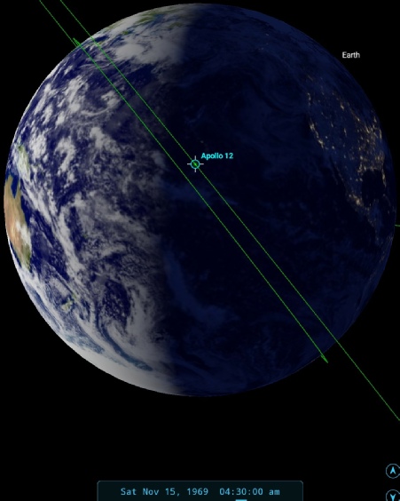
Figure 4.4.2.4: Main image -
SkySafari suggests a time of 04:30 for the picture, and the yellow arrow on the figures point to a system that is only visible on the 15th – on other days that part of Australia is clear. The NIMBUS part of the satellite images consists of orbit 2878-
In terms of crew descriptions, we have several references at around this time. Firstly we have this:
011:59:58 Bean: That sub-
012:00:20 Gibson: Roger. How...
012:00:24 Bean: It looks like we can see the coast of China and Japan now. It's kind of hard to tell. You can see red Earth pretty well, but if there's greens or grays, it is very difficult to discern them from the blues.
12:00 MET works out as 04:22 GMT. The sub-
We can, however, make out Australia, and we have this exchange with Houston, at 12:52 MET (or 05:15 on the 15th) :
012:52:17 Bean: That Earth view is really going to be something weird coming back, Houston, when you only got about a -
012:52:38 Gibson: Roger, Al, copy. You see Australia coming up over the -
012:52:46 Bean: I sort of do. It's difficult to tell, unless the ground is -
…
012:54:37 Bean: Okay, Houston. We've got Australia. [Long pause.]
012:54:53 Gibson: 12, Houston. Say again.
012:55:01 Bean: Roger, we got Australia in sight now at the -
012:56:19 Gibson: Al, are you able to pick out any small islands out there in the Pacific?
012:56:25 Bean: Pete's using the monocular right now and -
012:56:40 Conrad: There's a lot of clouds out there, Houston. I can see a lot of fairly small clouds, but there is so darn much cloud cover out in the Pacific, except right off the Northeast coast of Australia, that I really haven't found any islands yet, but I am sort of scanning for them now.
Australia is definitely at the 8 o’clock position here. Almost two hours later we have another reference to it:
014:46:13 Gordon: I was looking at the Earth a few moments ago. You can see the entire top of Australia. Sure is pretty, and hardly any clouds at all over it. And looks to me like it's to be about one and a half to two times the size of a golf ball at arm's length.
The time given by SkySafari has been determined by the visibility of the clouds identified by the blue arrow. Figure 4.4.2.5 shows the position of Australia at 05:15 -
It’s very obvious that by the time Gordon says they can sell of the top of Australia they very clearly can. What is debatable is whether the Apollo photograph was taken at my suggested time of 04:30 or the time it was referenced in the mission audio. It’s certainly possible to make out the Cape York peninsula and the Gulf of Carpentaria. Beyond that is the small weather system over Darwin and the Northern Territories, but it’s difficult to tell if the there is much of the Timor Sea that would help determine if it was the 05:15 time. My estimate is that the earlier one is the correct reference point.
It’s likely that the clouds off Brisbane in these images are part of a numbered (not named) cyclone system active between the 14th and 15th (see figure 4.4.2.6).
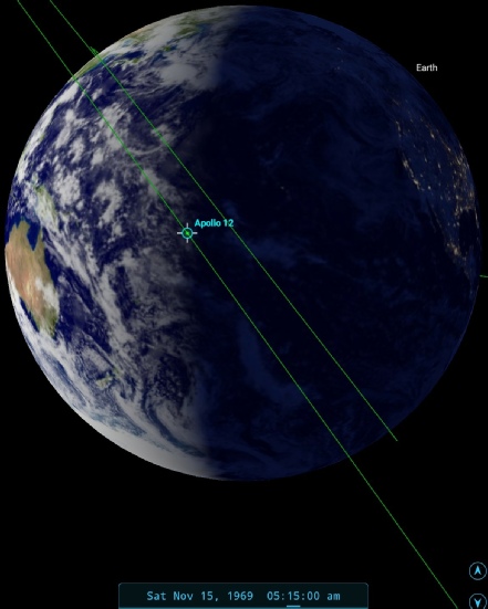
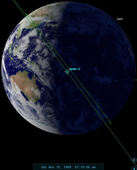
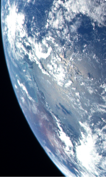
Figure 4.4.2.5: SkySafari time depictions and contrast adjusted section of AS12-
That turns out to be all we have for the 15th, click the link below for the 16th.
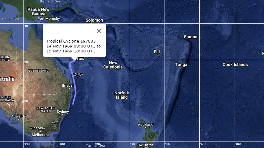
Figure 4.4.2.6: Unnamed cyclone system track (source).