4.4.3 -
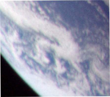
There’s a long break now until the next photograph of Earth, and the first one we get to look at is shown in figure 4.4.3.1, with an analysis in figure 4.4.3.2. They occur in the magazine before photographs of a fouled window in the CSM.
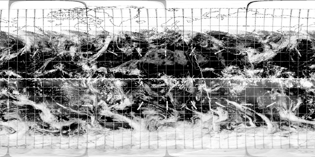
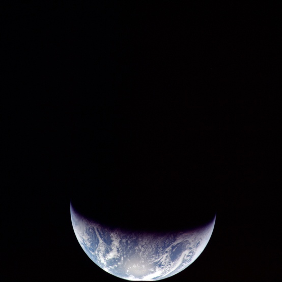
Figure 4.4.3.1: AS12-
The photographs of the fouled hatch were taken sometime after 02:15 GMT, as this is the time that (according to the mission transcript) instructions on how best to photograph the windows were supplied by Capcom. They were first described to Capcom on the previous day, but are gone over in more detail half an hour prior to the photography instructions, so we have a latest time for the photographs of around 01:45.
We also have descriptions from the crew of the terminator crossing Florida (although they do describe difficulties in determining land features) at around midnight GMT on the 16th:
031:43:04 Conrad: Looking at the Earth down there, Houston, it looks like you are littler than a golf ball at arm's length now. Sure looks pretty though. The terminator looks like it's -
It is difficult to tell for them, as obviously the terminator has moved well beyond Florida at this point. We also have these comments:
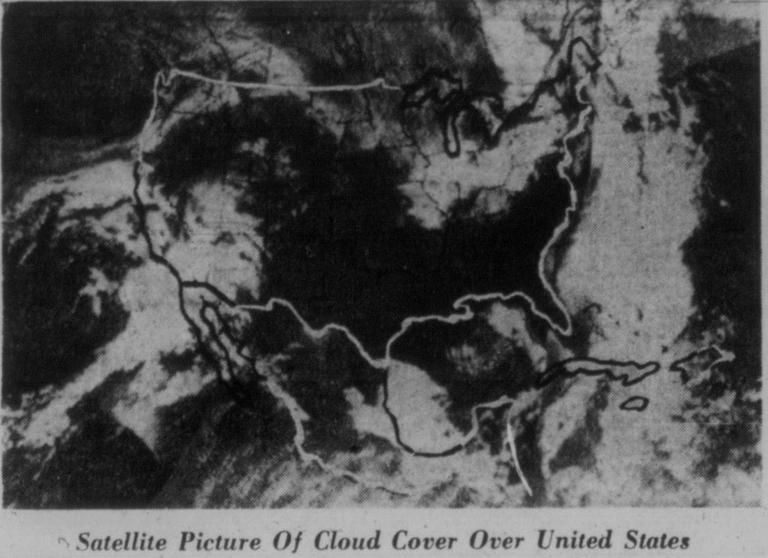
032:05:31 Gordon: We've been trying to look at the United States through the monocular, and it just looks like most of the States is covered with clouds. Are you having bad weather generally over the country?
032:05:47 Carr: We'll have to take a look at an overall map, but here in Houston, it's been CAVU all day and beautiful, a wonderful, clear fall day.
...
032:07:03 Carr: 12, Houston. I've got a weather map here for the United States. All up through the northeast part of the country it looks like it's either overcast or broken. And then in the Southeast and in the South and up through about the panhandle of Texas down into Florida it's all clear. And then, moving on further west, you get into New Mexico, Arizona, California, and you begin to pick up overcast skies again, all the way from Montana all the way down to Arizona. Montana has got a few broken and scattered clouds in the eastern side and then it's pretty bad over on the western side.
032:07:49 Gordon: Yes, we -
With this in mind we have a time for the photograph already of somewhere between those two, putting SkySafari at 01:00 on the basis that no land masses are easily visible in the Apollo image, and using the position of the weather systems on the 3D maps.
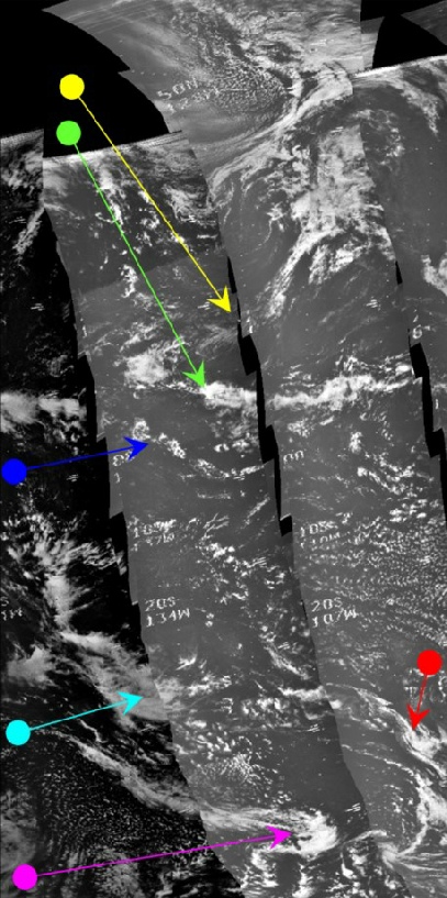
Assuming a terminator line just off the west coast of north America, this would mean that the best ESSA orbit corresponding to that would be orbit 3280 (track 5), which commenced at 22:00 on the 15th. The equivalent NIMBUS pass is number 2889, which commenced at 18:18 on the 15th. The magenta arrow points to a cloud system imaged at 20:22 on the 15th, which is also shown in the image and matches exactly the NIMBUS tile.
The next image to be examined is AS12-
Figure 4.4.3.3: AS12-
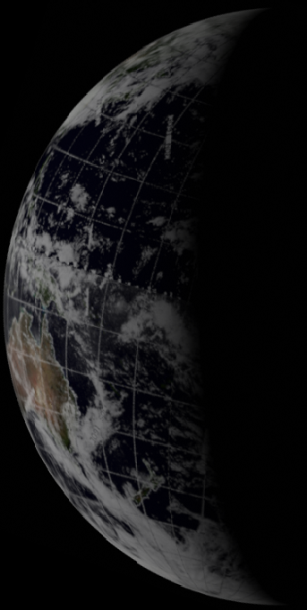
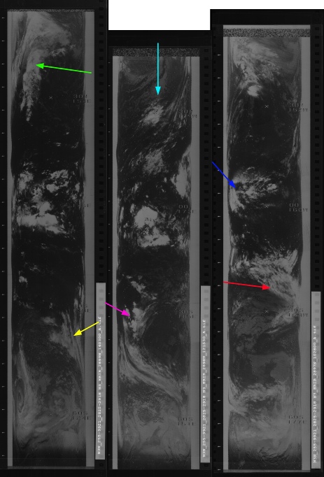
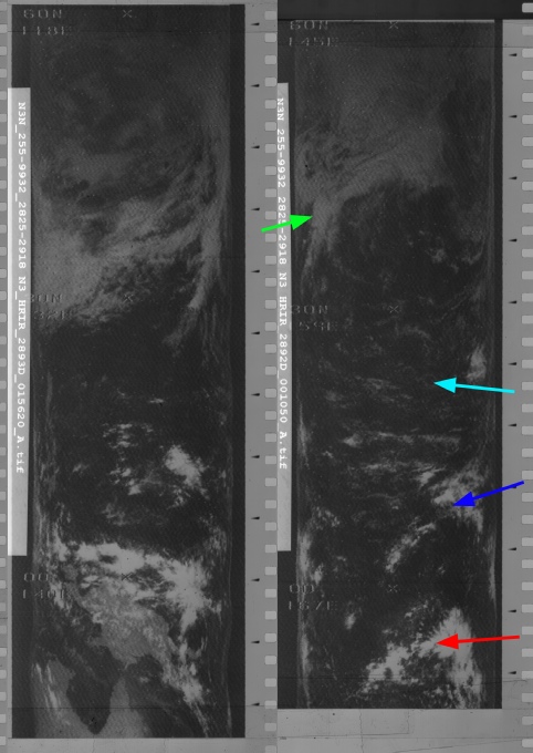
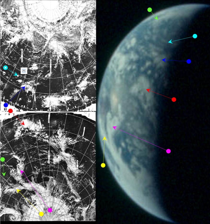
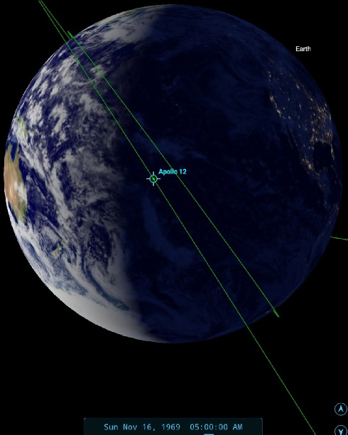
Figure 4.4.3.4: Main image -
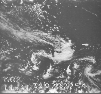
The NIMBUS data in the preceding image is night time infra-
As for ESSA, the Apollo image terminator is mostly covered by track 6, or orbit number 3281. This pass was commenced on the 16th at 00:05 and appears on the image dated the 15th.
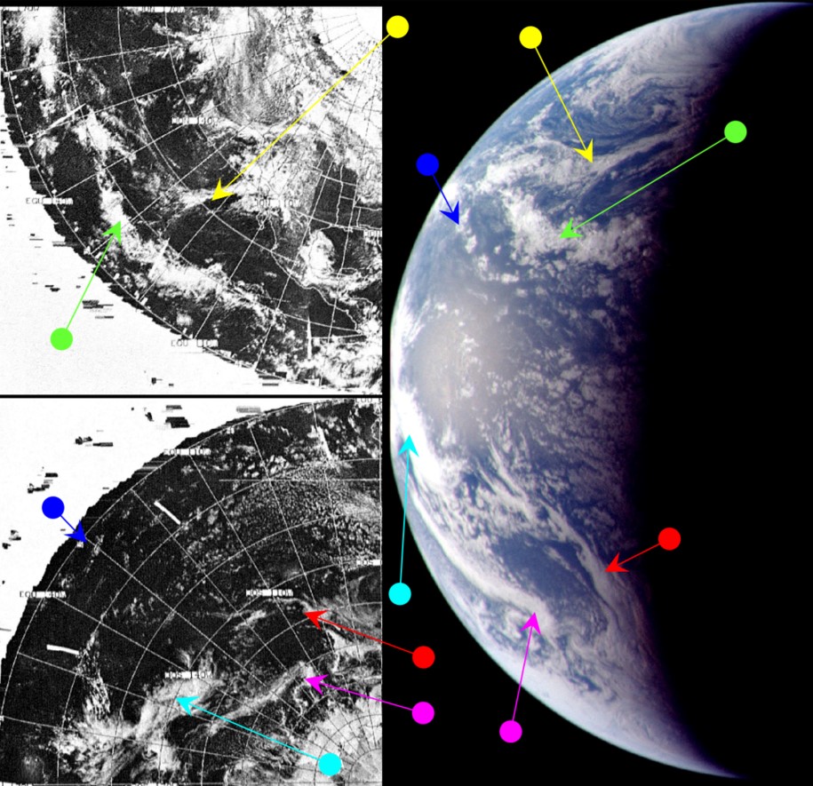
The date of the 16th can be confirmed convincingly by the weather pattern over south-
It is shown below in figure 4.4.3.5, and analysed in figure 4.4.3.6.
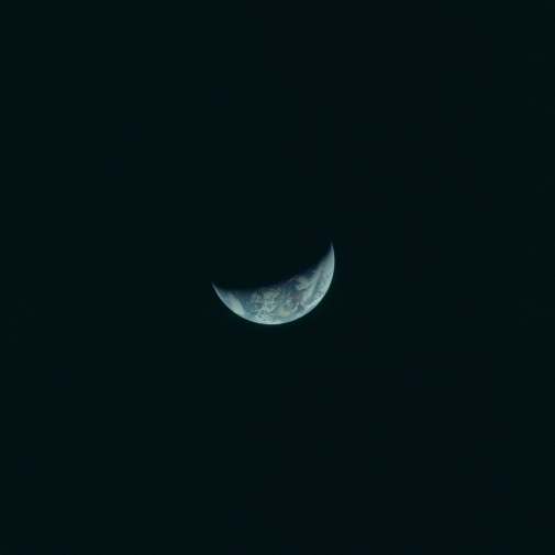
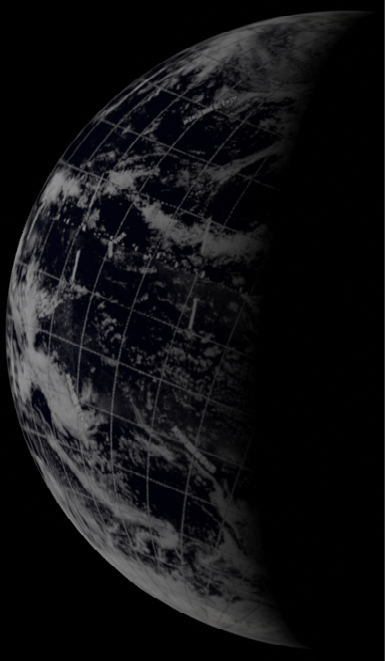
Figure 4.4.3.5: AS12-
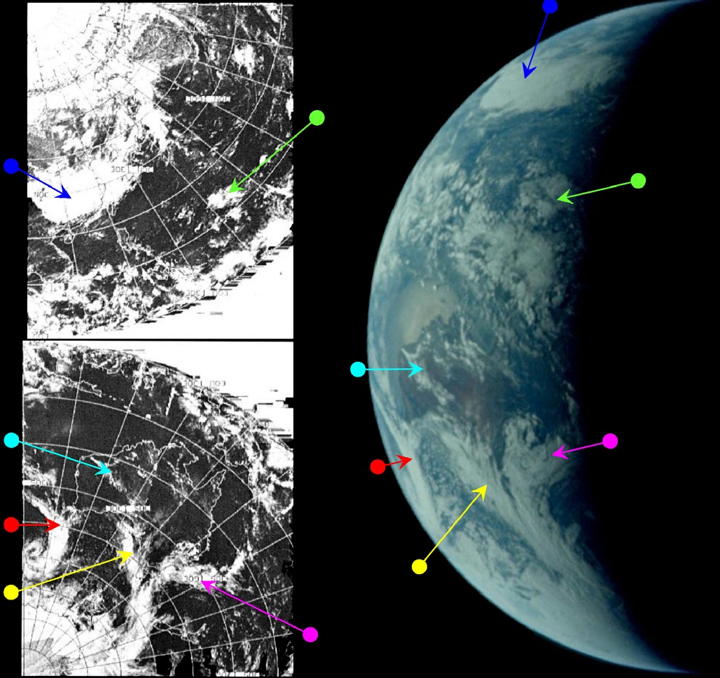
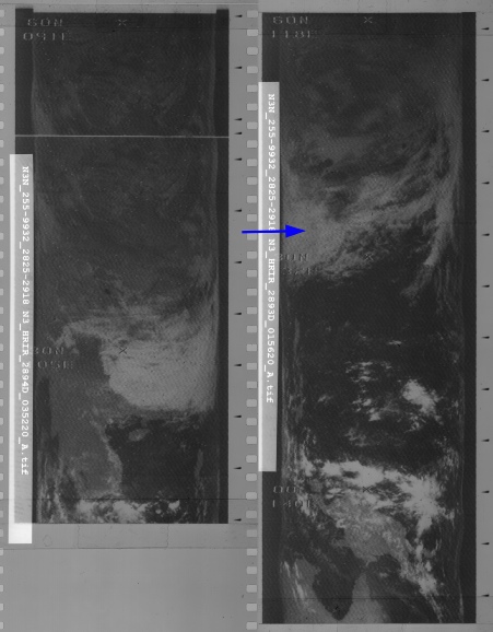
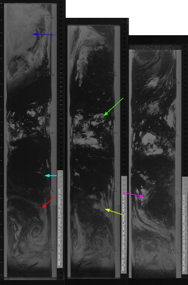
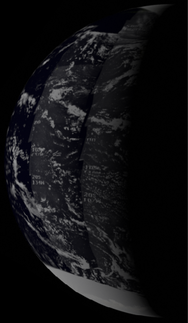
Figure 4.4.3.6: Main image -
The distinctive plume of cloud below Australia (marked by the yellow and magenta arrows) has moved much closer to the terminator than in the previous analysis, which allows a more precise estimate of the time of the image. Stellarium puts this photograph as being taken at around 07:00 GMT.As with the previous image, the night time infra-
The NIMBUS orbit nearest the terminator is number 2897, which was started at 09:50 on the 16th. ESSA's terminator orbit is number 3283 (track 8), which commenced at 04:06 on the 16th.
We have another conversation with the crew to support the timings:
040:02:56 Gibson: How's that cloud cover over the Pacific at this time?
040:03:02 Conrad: Well, Australia is real clear again, and it doesn't look quite as cloudy north of Australia. It's sort of a -
040:03:23 Gibson: Roger. What's the smallest piece of land you can pick out? Can you see any of the Pacific islands?
040:03:34 Conrad: [Laughter] No, we haven't -
040:03:46 Gordon: You can't see it with your naked eye, though.
040:03:51 Conrad: I think one of the problems is that -
040:04:19 Gibson: Roger. You still getting a pretty good glint off the surface then?
040:04:25 Conrad: Yes. Dick says the subsolar point is just west of Australia. By the way, how far out are we now?
Borneo is certainly visible, and the subsolar point. Just on the Timor Sea here would indeed by west of Austalia by the time of this conversation (around 08:30 GMT).
A few images later in magazine 50 there is a short sequence of images that can be identified by the cloud patterns as somewhere east of Australia. This automatically puts it almost a day after the previous image, so we move on to day 4.
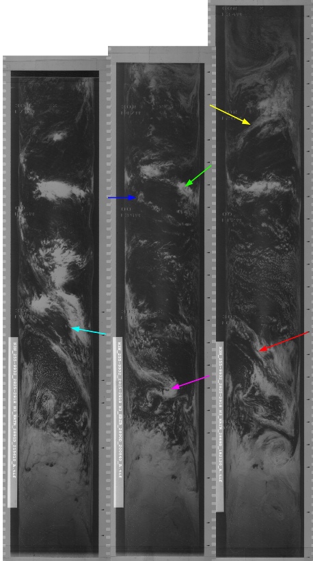
Figure 4.4.3.2: ESSA-