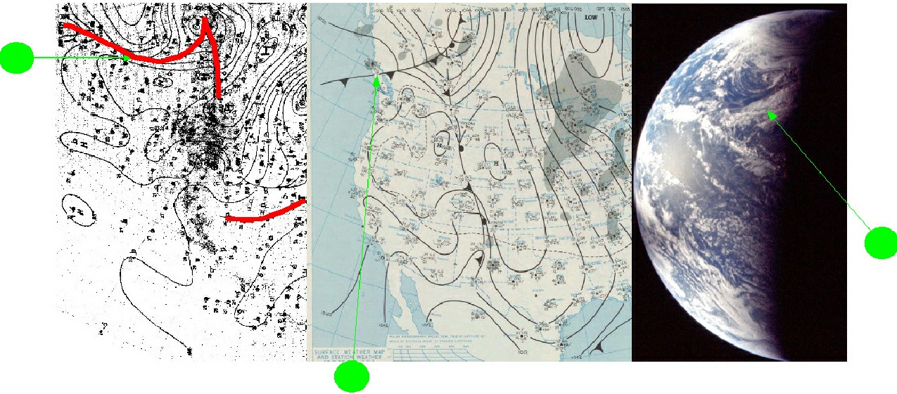
Figure 4.4.M.1: German (left) & NOAA (middle) weather charts from 14/11/69 compared with AS12-50-7354.
The main frontal system picked out here is the one trending roughly west to east over the Pacific before veering to the north-east near the US coast. This front ends in the centre of a low over Canada/Alaska. Other fronts visible on the charts are not visible on the Apollo image. The Apollo image shows that front as a cloud mass in front of it, the cold air of the cold front pushing the warmer, moister air upwards causing the moisture to condense out.
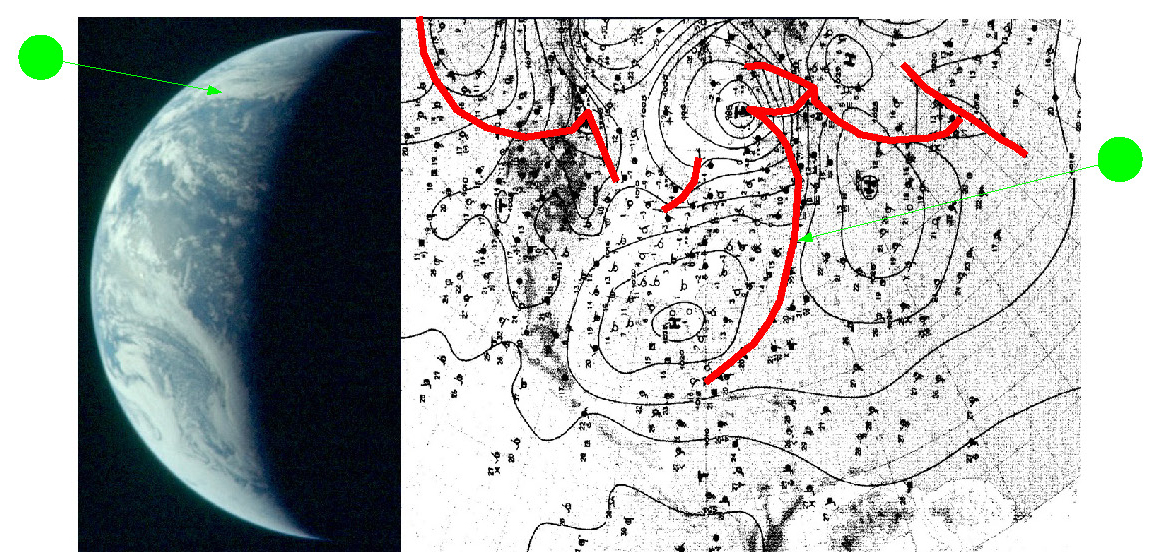
Of the images examined in the previous section, the next one featuring any kind of frontal system that are shown on the weather charts is from November 16th, AS12-50-7385 (figure 4.4.M.2).
4.4.M- Meteorological comparisons
For much of this particular mission, the phase of the Earth, the timing of the photographs themselves and the winter season (the Earth's tilt angling the northern hemisphere away from the lunar viewpoint) mean that the German, NOAA & South African data are of less use, at least for the latter part of the mission.
For the early part, however, we have a few days over which to confirm that the satellites were accurately reflecting the situation recorded by terrestrial meteorologists (and are therefore not fabrications), as well as the ground based recordings providing an accurate representation of the reality recorded by Apollo. The sources for the NOAA meteorological data are the same as those given in the preceding sections, and the German data can be found here.
The Apollo image for the 14th of November (the first one used in this analysis) does feature enough of North America to allow the use of at least the German & NOAA weather charts. Figure 4.4.M.1 shows the relevant parts of these two charts compared with AS12-50-7354.
Figure 4.4.M.2: AS12-50-7385 compared with German meteorological charts from 16/11/69.
The system picked out in green is the one extending across the Atlantic from the Mexican Gulf towards Europe. The large weather system extending south-eastwards from Brazil does not reach far enough over to Africa to feature on the South African weather charts.
An image from the 17th examined earlier can also be looked in terms of the weather charts available (figure 4.4.M.3). AS12-50-7394 shows North America, with a band of cloud running west-east across from the Pacific into the southern USA. A large mass of lighter cloud can be observed extending across the north-east of the continent.
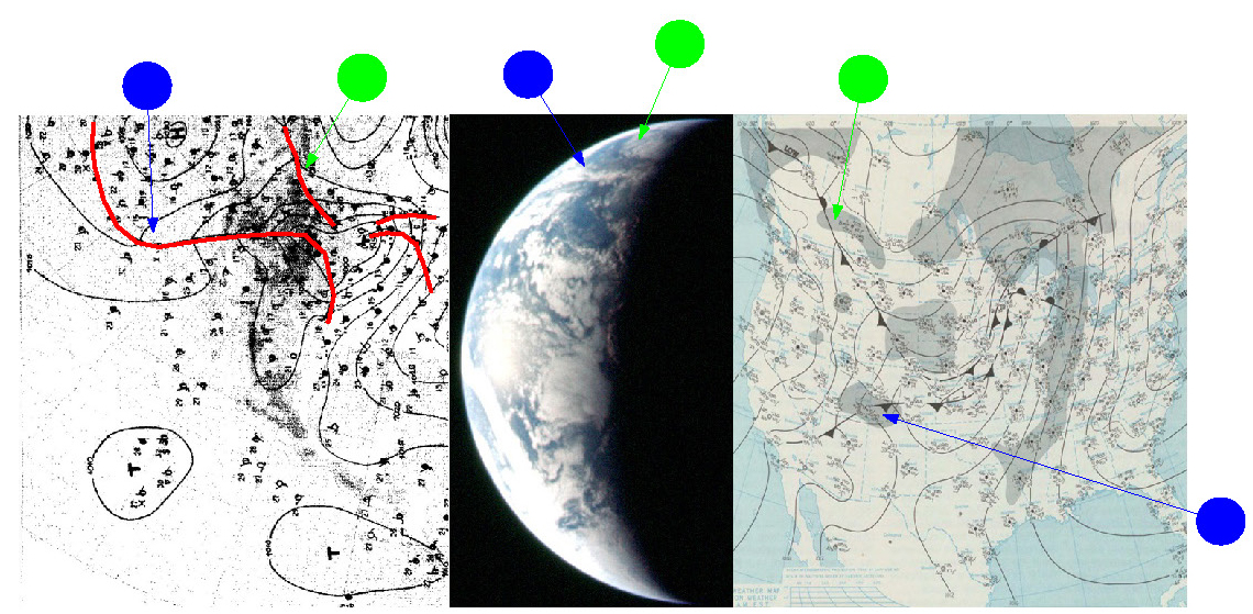
Figure 4.4.M.3: AS12-50-7394 compared with German (left) & NOAA (right) meteorological charts.
As with previous examinations of these meteorological charts from other missions, no absolute guarantee can be given of the accuracy of the author's interpretations, but it doesn't seem unreasonable that the long sweeping frontal system (blue arrow) is the same one in the synoptic charts and the Apollo image. The larger cloud mass over the north-east is bounded, it would seem, by the front indicated by the green arrow.
Apollo 12 then, as with the other missions examined so far, shows a wealth of detail in photographs of Earth that could not have been created in an artist's studio, and accurately portray the weather systems shown on the satellite images for the simple reason that they are photographs of those weather systems, taken from space.