4.4.4 -
Heading towards their lunar encounter, we have almost an entire day without images of Earth. As we’ll demonstrate below the view is of weather systems East of the ones pictured on day 3, so they automatically have to be taken on day 4. Figure 4.4.4.1 shows AS12-
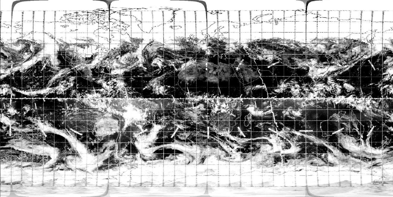
Figure 4.4.4.6: AS12-
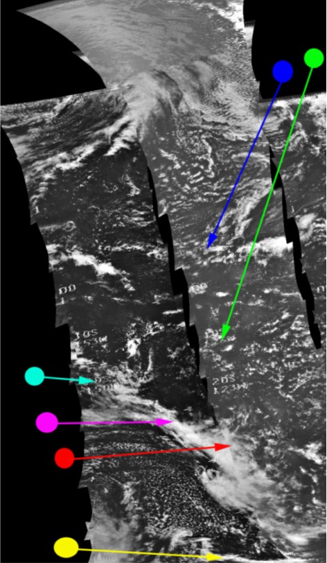
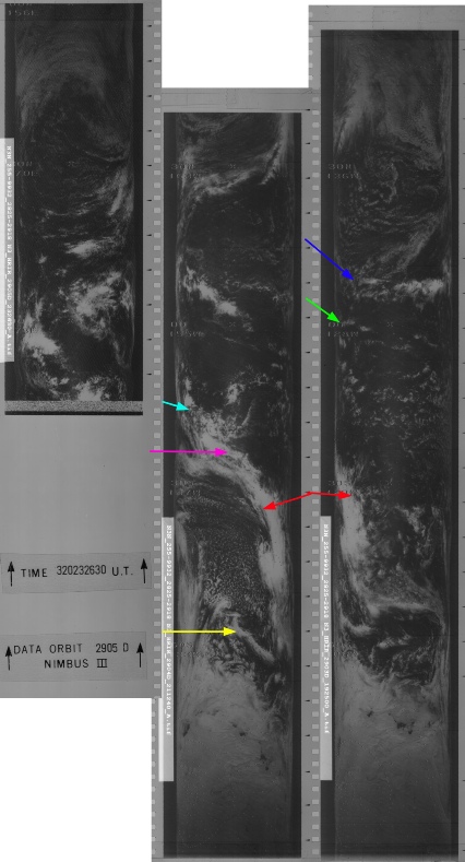
Around 24 hours since the last view of Australia and there is again a change in the configuration of the large frontal cloud mass south of Australia that extends up from the Antarctic (magenta arrow). The two distinct branches of the plume have gone, and smaller lobes extend off into the Australian interior than was the case the previous day. Australia is just visible on the western limb, and this puts the time of the image at around 04:30 on the 17th. The red and crimson arrows match figure 4.4.4.2.
ESSA's orbit nearest the terminator is 3293 (track 6), which commenced at 23:09 on the 16th. Australia itself would not have been imaged completely until 05:05 on the 17th (track 9, orbit 3296). NIMBUS is even further behind, at least for the visible spectrum images, which covered the terminator at 19:25 (pass 2903) on the 16th, putting the NIMBUS satellite some 10 hours behind the Apollo one. This would help to explain the discrepancies in some areas between the cloud patterns that are easily identifiable on the Apollo and ESSA images, but not the NIMBUS ones (eg the blue and green arrows). Night time infra-
In the next photograph (AS12-
Figure 4.4.4.7: ESSA-
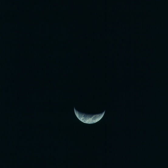
Figure 4.4.4.1: AS12-
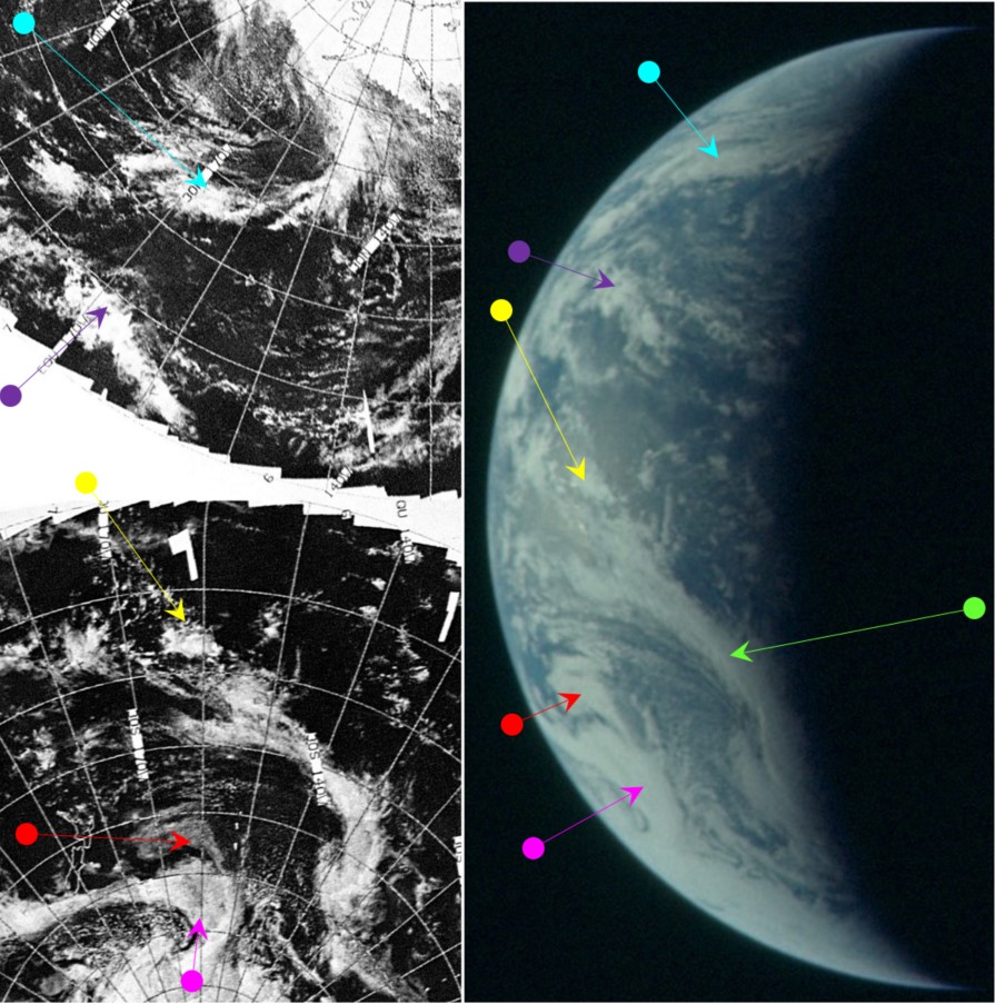
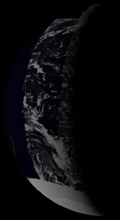
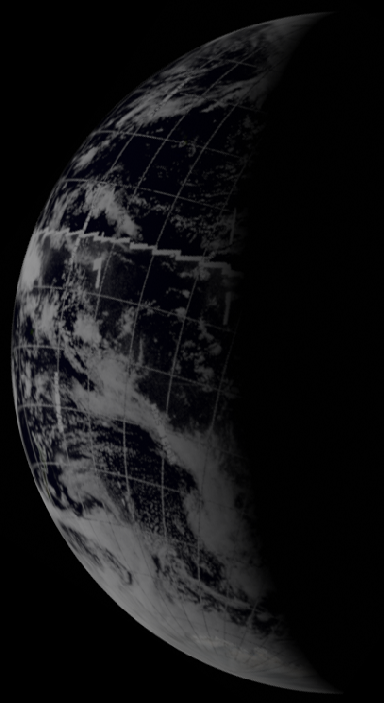
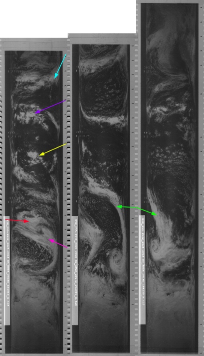
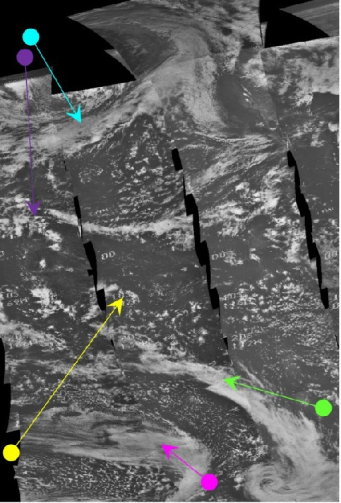
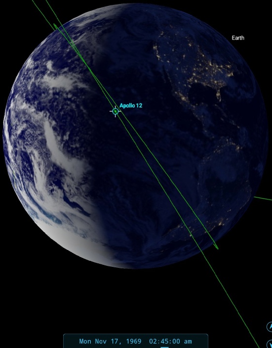
Figure 4.4.4.2: Main image shows AS12-
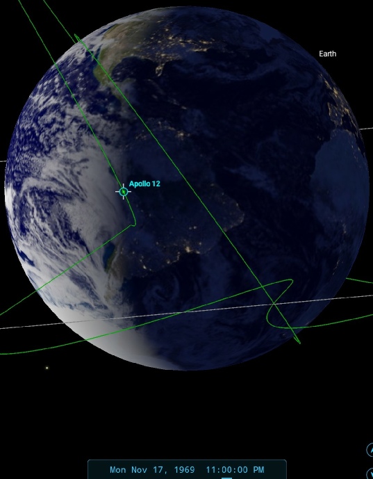
With no land masses present, the only time reference available to us is the terminator cutting across the large cloud bank in the southern Pacific that ends up around New Zealand, and the time works out at somewhere around 02:45 on the 17th. This estimate would put the mission time at around 58:22. A couple of hours earlier they were discussing weather conditions on the west coast of the USA:
055:40:01 Lind: Roger. What does the weather look like out there?
055:40:10 Bean: Looks beautiful. See it real well. It doesn't appear to be any clouds -
….
056:04:53 Bean: Been looking at the Earth some more through the monocular, and I think maybe the part of the U.S. that I thought was the lower left-
056:05:38 Lind: Roger. A little smog out there in L.A.? Can't see through it?
056:05:47 Bean: No. I don't think its smog. I can't see any of that area. I think it's probably just that the Earth out there has more trees, shrubs, and the like, and that makes it sort of a gray-
It’s difficult to tell which crescent system he’s referring to, but there is quite a large in the north Pacific, the tale end of which is picked up by the cyan arrow above.
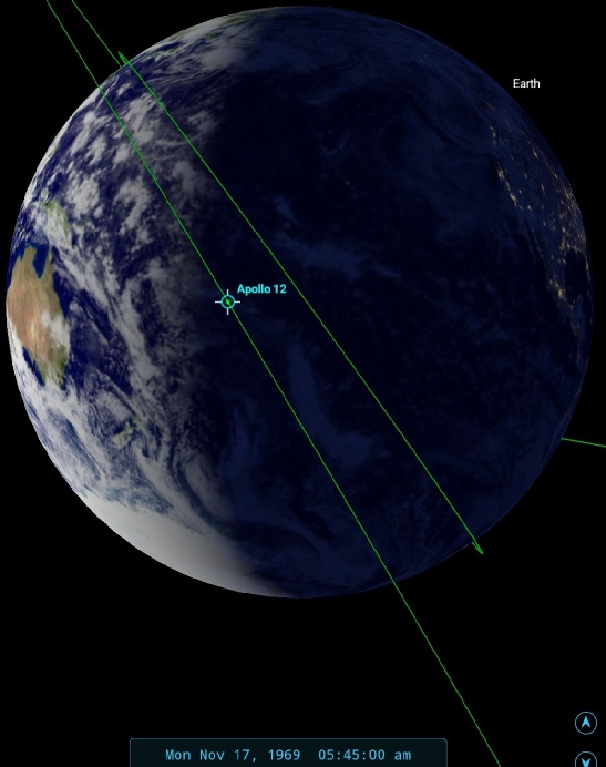
The time stamp for that conversation makes it around midnight GMT, and the SkySafari time depiction in figure 4.4.4.3 shows that they would indeed have been looking at LA.
NIMBUS' daylight visible spectrum view over the east coast of south America would be from orbit 2916, which commenced at 20:06 on the 17th. Depending on how accurate our estimate of the time is the NIMBUS coverage on the 16th could be closer to it time by a couple of hours, but the coverage provided by that day’s picture is not as good.
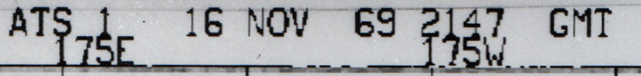
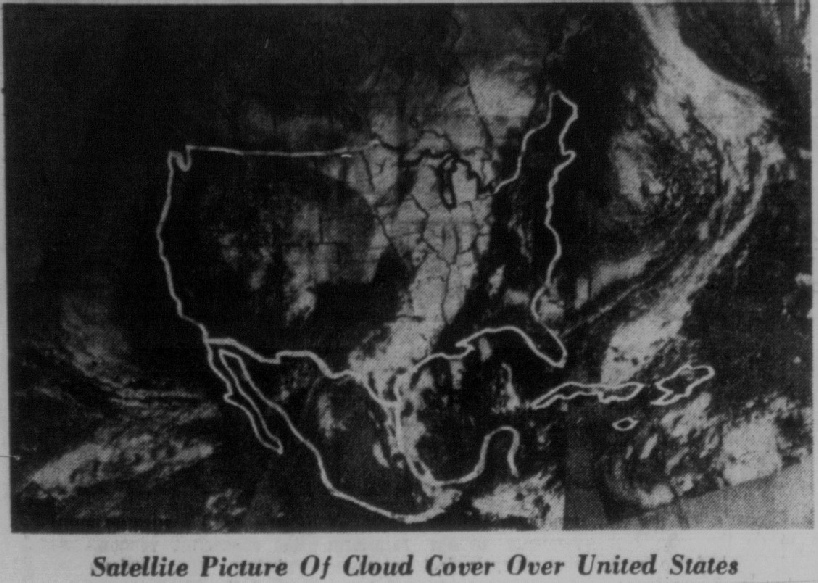
We can get a clear idea of the location of the US coast line to the weather patterns in the image by looking at a ATS-
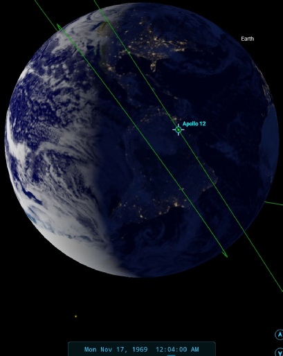
Figure 4.4.4.3: SkySafari depiction of Earth at the time of the above conversation.
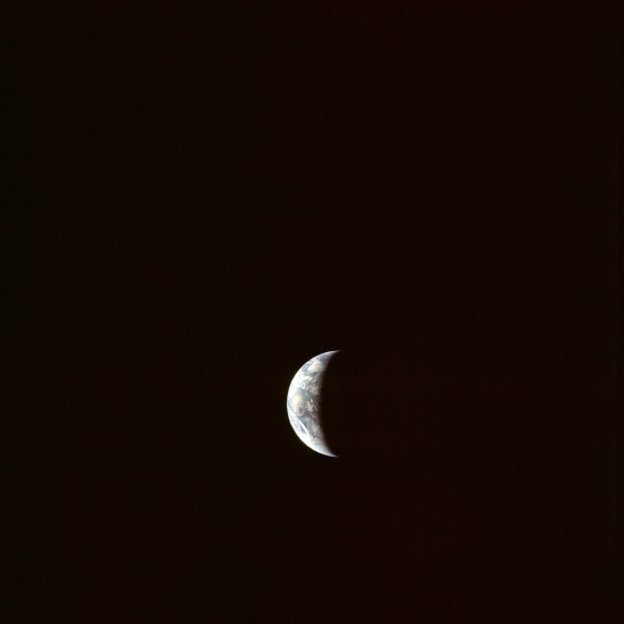
Figure 4.4.4.8: AS12-
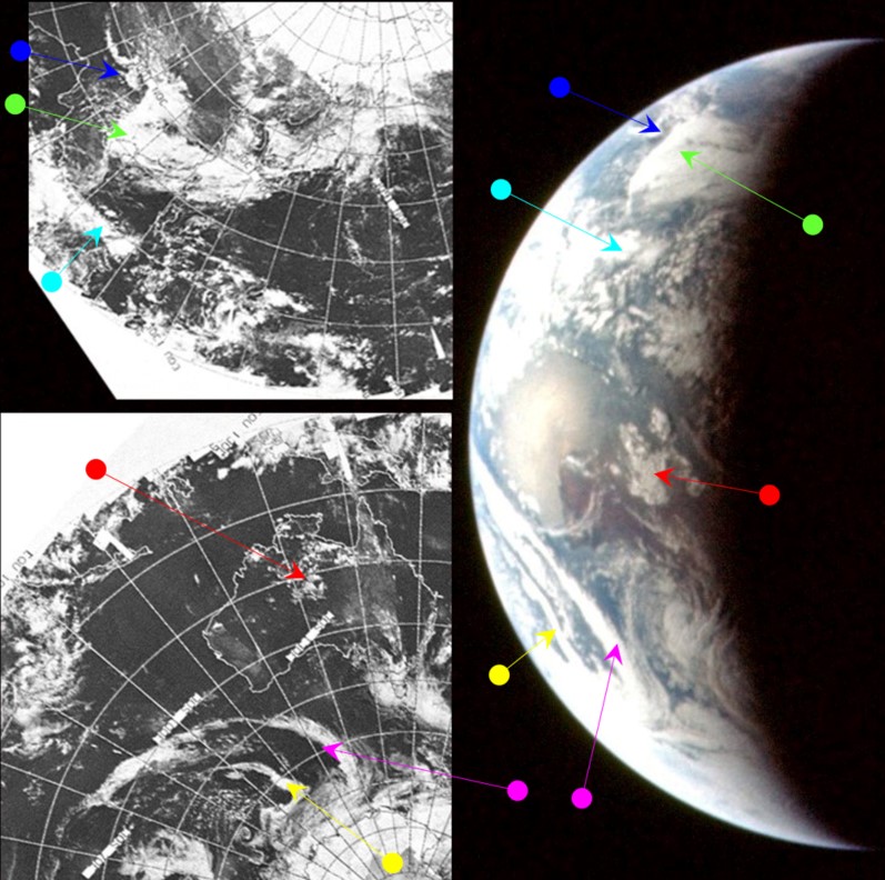
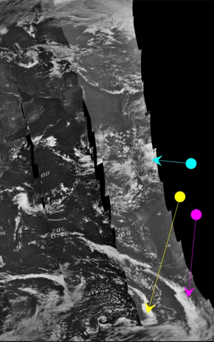
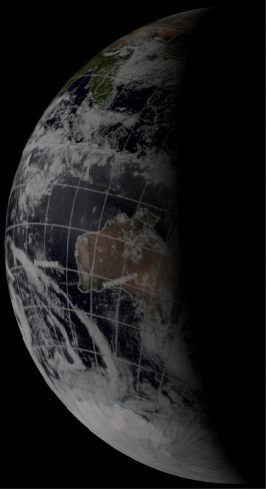
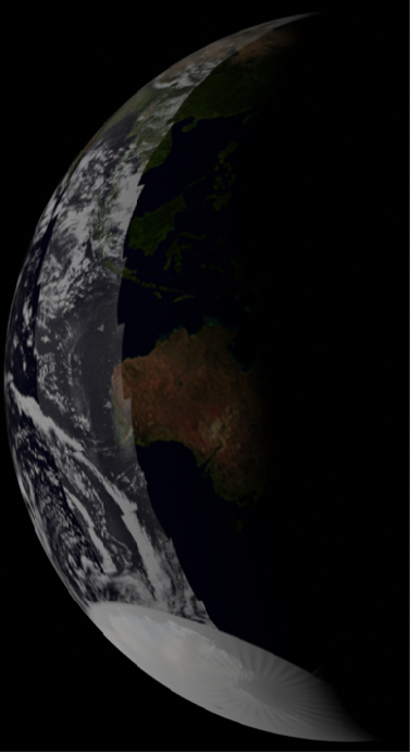
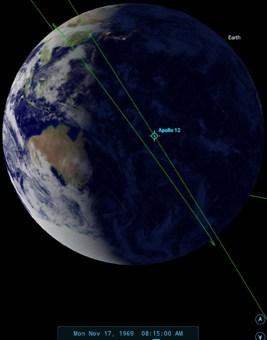
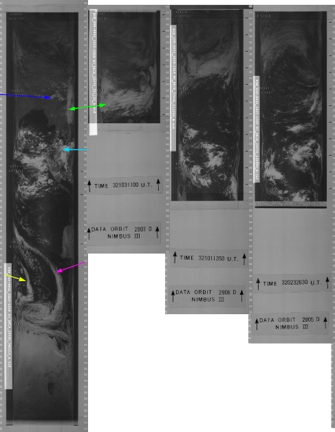
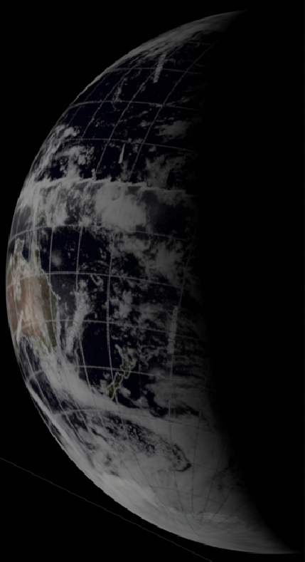
Figure 4.4.4.9: Main image shows AS12-
The position of the terminator on the very edge of eastern Australia puts the time of the Apollo image at around 08:15.
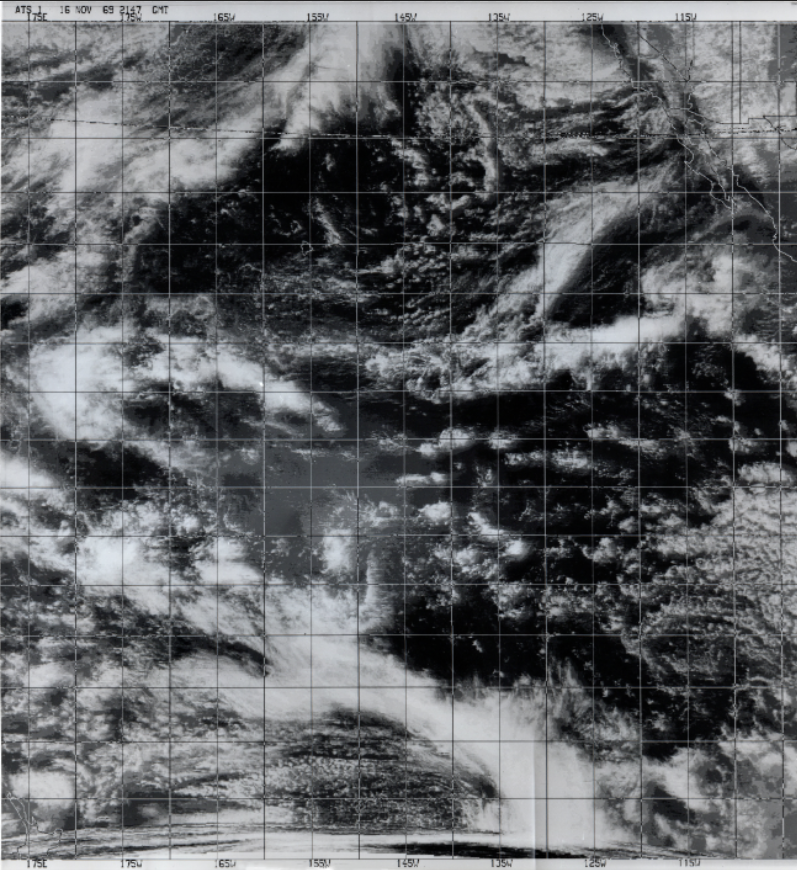
What decides the date of this image is the large pointed weather system off western Australia (picked out by magenta and yellow arrows on the satellite images. ATS-
We get additional confirmation of the time from a TV broadcast made on the 17th between 07:14 and 08:10. While the broadcast was being sent through Goldstone in California, Australia got the show live through their own receiving stations, and the crew confirm that Australia is centre stage:
063:34:11 Gordon: Hey, Jerry, I have the Earth again. Is that a better picture?
063:34:15 Carr: That's a much better picture. [Pause.]
063:34:29 Conrad: That landmass you're looking at there is Australia.
063:34:32 Carr: Roger. We can't..determine anything on the Earth there, but it looked quite a bit more like the Earth now than it did before. It looks like you got it stopped down considerably more.
063:34:51 Carr: 12, Houston. The word is Australia is getting your TV show live.
063:34:59 Conrad: Roger. They're getting it live, and I wish they could see their landmass. It's almost right in the middle of the Earth. And they ought to recognize the snow cap of South Amer -
…
064:07:54 Conrad: It's amazing how well you can see when you're looking at something you recognize. I got the monocular here, and I'm looking at Australia, and I can see 80-
We can have a quick look at a still from that TV broadcast in figure 4.4.4.10 (derived from a better quality source), with some of the same features from 4.4.4.9 identified:
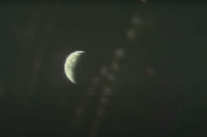
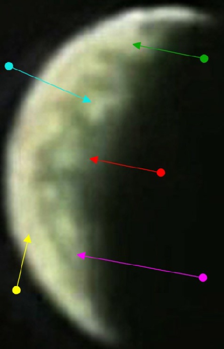
Figure 4.4.4.10.: Still from youtube video of newscast featuring Earth, and cropped and enhanced version of Earth with features identified as in figure 4.4.4.9.
While the quality is obviously not as clear as the still image, there is sufficient resolution to allow for identification of some the same features.
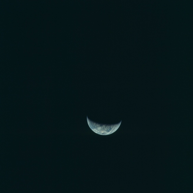
It is also worth noting that between this and the next sequence of Earth images there are two photographs of the Moon. They are noteworthy because they show the Moon in a completely different phase to that visible from Earth. Figure 4.4.4.11 shows the Moon from AS12-

Figure 4.4.4.11: The Moon as seen from Apollo 12 shown in AS12-
The Apollo Image Atlas identifies this image (and the one following it) as showing the 'far side' and before the CSM's first lunar orbit ('Pre-
One final image will be examined from magazine 50 today, the penultimate one taken before LOI. Figures 4.4.4.12 and 4.4.4.13 have the photograph and analysis respectively.
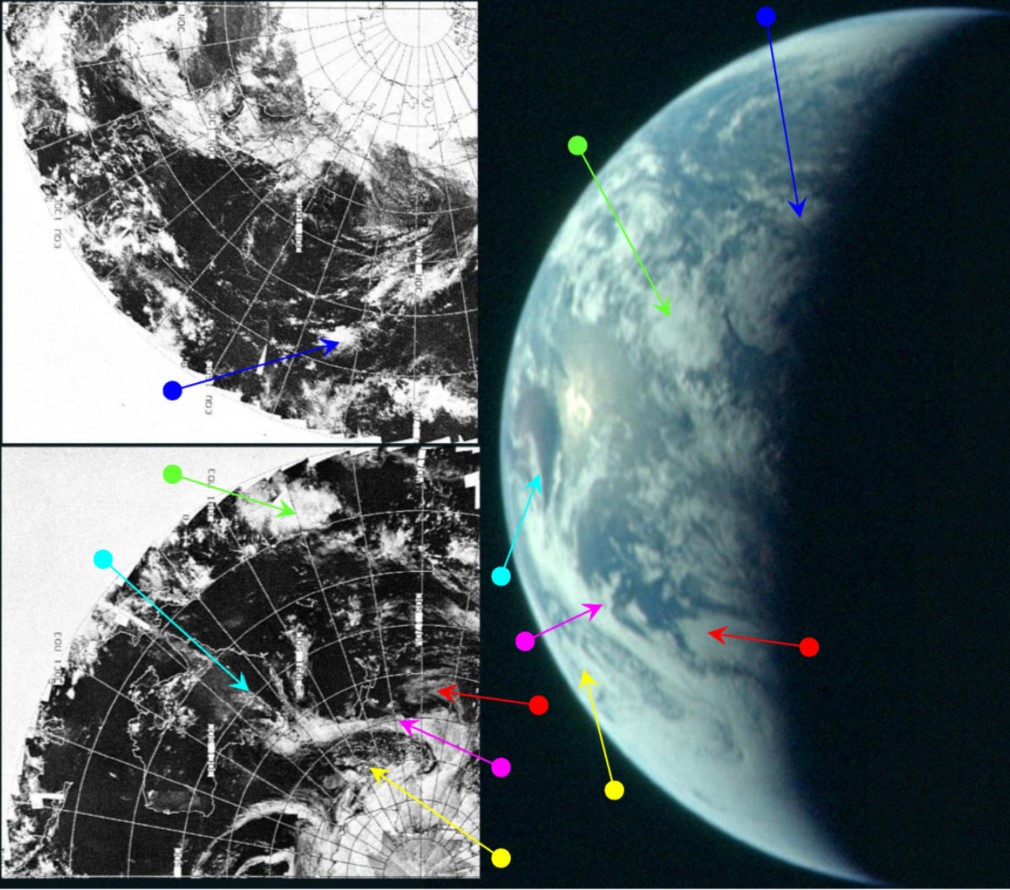
Figure 4.4.4.12: AS12-
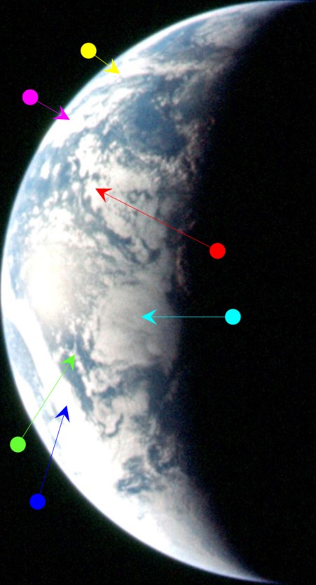
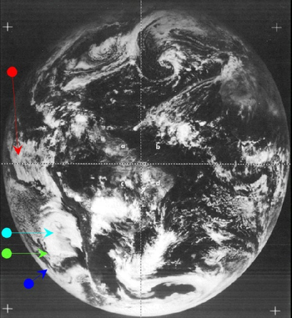
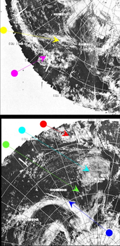
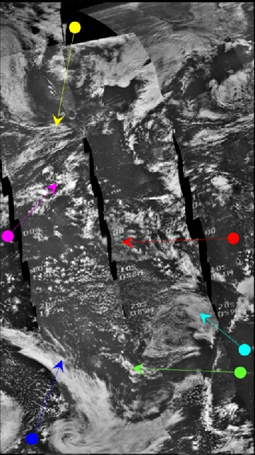
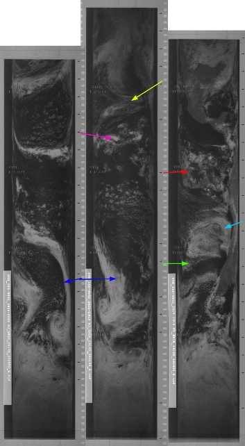
Figure 4.4.4.13: AS12-
Timing the image is relatively easy thanks to the west coast of South America being just visible, and most of north America, which allows SkySafari to put the time at around 23:00.
The most obvious features are the large circular cloud off Chile picked out by the cyan arrow (and the attendant flecks of cirrus clouds west of that that are visible once the circular feature disappears in to the night portion of the globe), the long finger of cloud stretching from the Antarctic north-
The ATS-
The next photograph in the magazine is also of Earth, but it was taken after midnight so click the link for day 5 to see it.
The ATS-
ESSA's best fit pass for the same area is orbit 3289 (track 6) 23:09 on the 16th. Once again, an Apollo image shows weather patterns that are only visible at a specific time on a specific day.
The next series of Earth photographs occur immediately before two images of a distant lunar far side of the moon as Apollo 12 approaches LOI. That photograph is shown in figure 4.4.4.6, and analysed in figure 4.4.4.7.
Figure 4.4.4.4: ATS-
Seeing as we have an original, it would be a shame not to look at some key areas of it (figure 4.4.4.5).
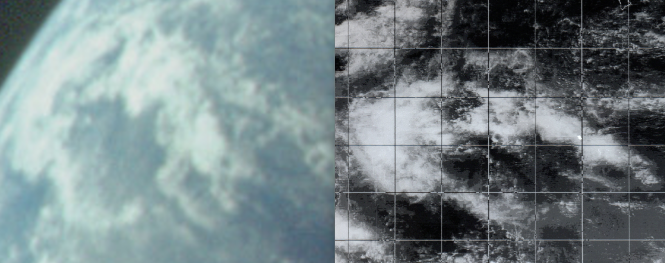
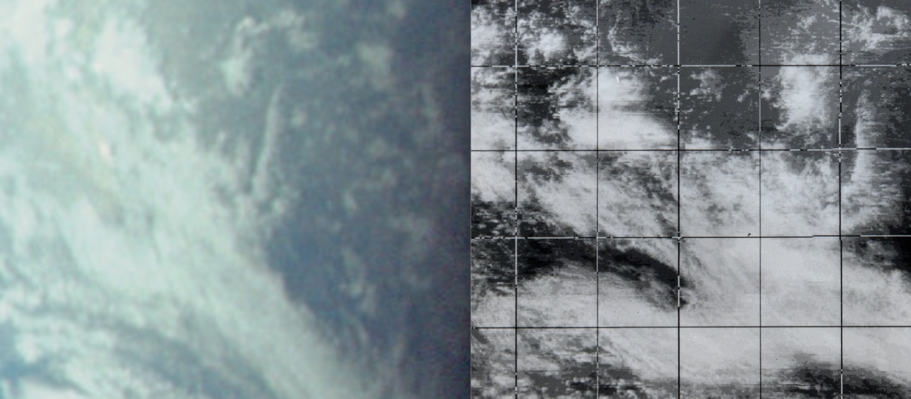
Figure 4.4.4.5: Elements of ATS-