4.4.5 - Apollo 12 Day 5, lunar orbit
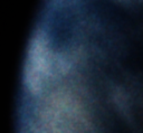
The next photograph in Magazine 50 was taken not long after the last one on day 4, and is the last one of Earth before LOI. AS12-50-7396 is shown in figure 4.4.5.1, and analysed in figure 4.4.5.2.
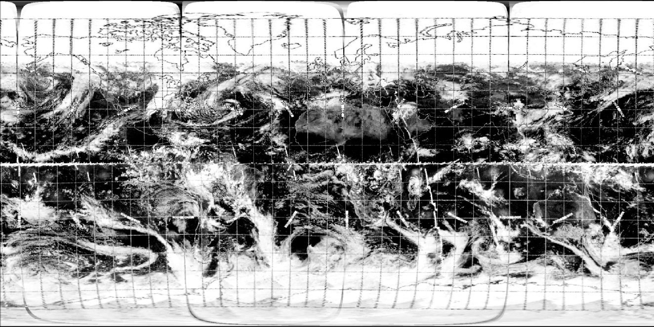
Figure 4.4.5.1: AS12-50-7396 (Source)
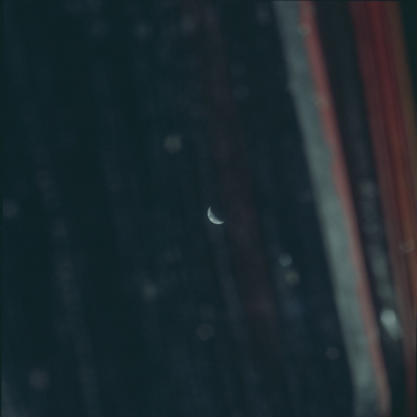
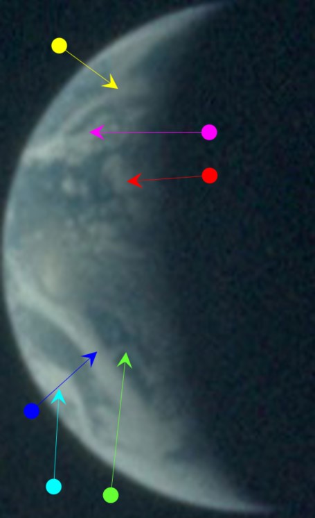
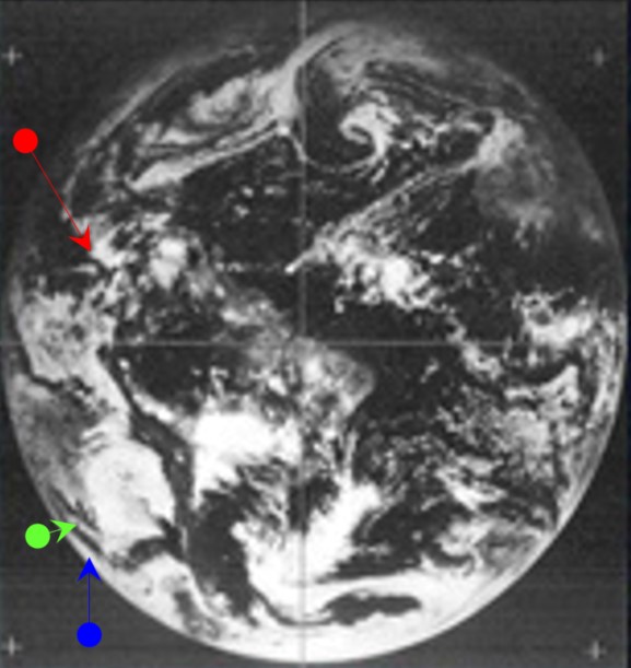
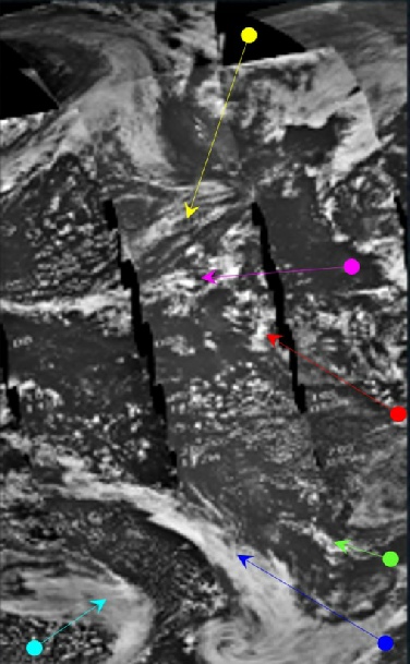
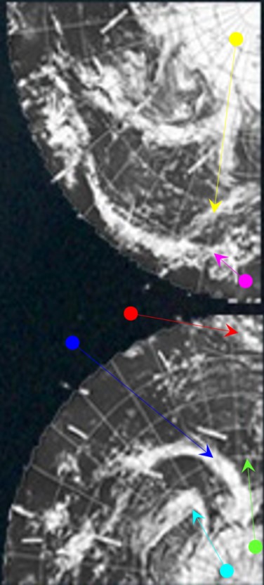
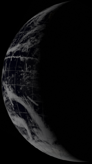
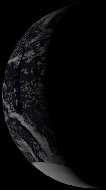
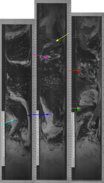
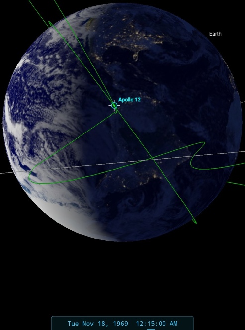
Figure 4.4.5.2: Main image - AS12-50-7396 compared with ATS-3 (top right), ESSA-9 (centre left) and NIMBUS-3 IDCS (centre right) with Stellarium time estimate. Bottom row are NIMBUS-3 HRIR image (left) and 3D reconstructions of digitally restored ESSA (centre) and NIMBUS (right) satellite data. Stellarium estimate of time at terminator to left. All arrows except cyan as 4.4.4.11.
The most representative daylight IR passes for NIMBUS are 2916, which commenced at 18:41. NIMBUS imaged the clouds identified by the blue arrow at 19:02. ESSA's most representative passes are tracks 4 and 5, passes 3305, commenced at 22:02. The ATS-3 image is timed at 14:43 on the 17th. The suggested timings for the Apollo images are vindicated by the timings of the satellite photographs.and the weather systems are largely the same. It’s just possible to make out the Baja California peninsula, and the join of the Pacific weather patterns with it suggest a time of 00:15 on the 18th.
The remaining images on magazine 50 are close ups of the lunar surface, starting with very rounded lunar horizons and ending with much flatter ones, indicative of a space craft approaching the Moon. LOI for Apollo 12 is recorded as being carried at 03:47 on the 18th, so it seems that AS12-50-7396 is the last photograph of Earth taken before entering lunar orbit, and the first lunar orbit proper started at 03:53 on the 18th, shortly before LOS.
We next have an isolated view of Earth taken on a new magazine to discuss. Magazine 51 starts with a large number of images of the lunar surface looking straight down, placing it firmly in lunar orbit. AS12-51-7489 features a very distant shot of Earth, immediately after which comes a sequence of images showing the LM after separation, which means it has to be before 04:16 on the 19th.
Image 7489 must therefore have been taken before separation at 04:16 on the 19th, and after LOI at 03:47 on the 18th. As with the previous image, the image is out of focus and blurred, with only large scale systems can be identifiable, but there should be sufficient detail to demonstrate the point. Figure 4.4.5.3 shows the original image and figure 4.4.5.4 the satellite comparison.
A beautiful, named tropical storm, right where it should be!
And that’s it for day 5 - the crew have far too much to do to waste it on pretty pictures of home, so we move on to the next day. Click the links below.
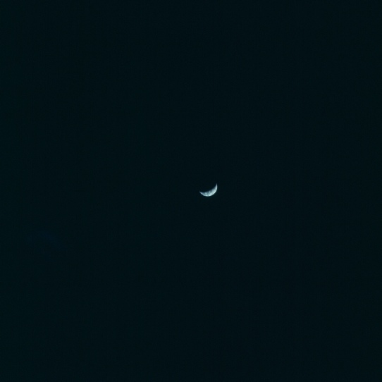
Figure 4.4.5.3: AS12-51-7489 (Source)
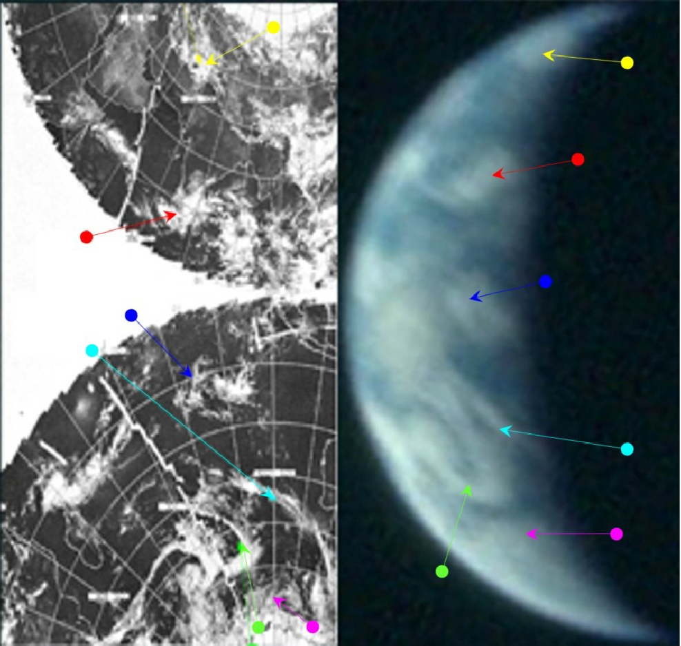
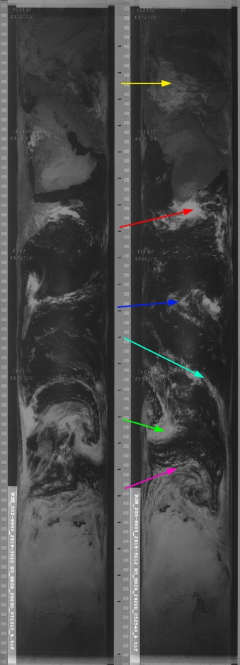
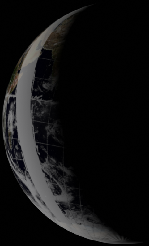
Figure 4.4.5.4: AS12-51-7489 compared with ESSA (top left) & NIMBUS-3 HRIR images (far left). Centre left is a 3D reconstruction of digitally restored ESSA data. SkySafari estimate of time at terminator above.
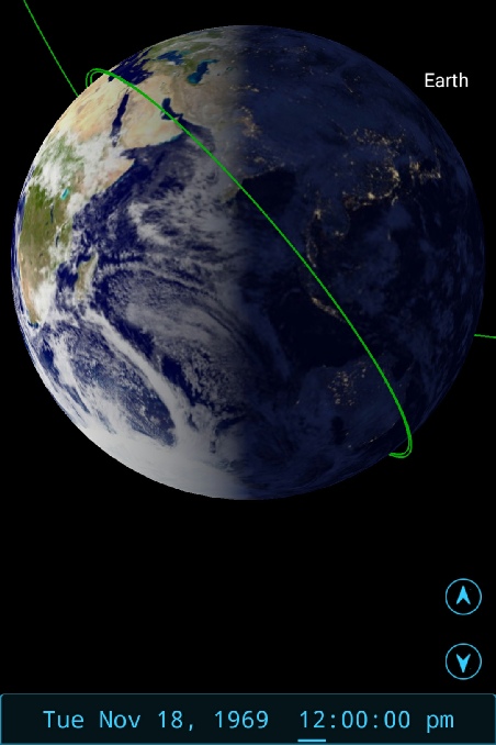
The key weather systems here are the two identified by the green and cyan arrows off the western coast of Australia. The system picked out in blue is just off the Sumatran coast, which also helps to narrow down the location of the terminator, as does the weather system over the western Himalaya (yellow) on the edge of the disc, and the one over Sri Lanka (red arrow). It is unfortunate that this weather system crosses the boundary between two day's ESSA data, and more unfortunate still that there is not as much overlap between the two day's data shifts in terms of longitude (so that we can't use the data from the next day to corroborate), but you can't have everything. The NIMBUS view does show that we have the correct weather system in our sights. The best estimate for the terminator position here gives a time of approximately 12:00 on the 18th. ESSA's best orbit from this image is orbit 3310 (track 10) which was actually commenced at 08:09 on the 18th, while NIMBUS' best available orbit is 2922 which commenced at 05:25 on the 18th. The orbits covering Australia exactly do not feature clear images, or are absent.
A time of 11:30 would put the still joined spacecraft in lunar orbit after the second circularisation burn. This is supported by the first few images in the magazine, which shows an initially lit lunar surface over Mare Nectaris (on the eastern near side), followed by darker frames, then a brightly lit one of Mare Nubium in the south-east before the darker frames and then the photograph of Earth. The position of the lunar terminator (as documented here) supports a time of around 11:30. In fact the terminator position caused a re-assessment of the time of this photograph, as it was initially thought to feature Australia more prominently, putting it far too early in the process. Were this the case, areas shown to be just lit on the lunar surface would have been in complete darkness. 11:00 would equate to 90:00 MET, so we would be on the near side and not long before LOS - pretty much in the right place for the post terminator photography.
It’s worth pointing out on the Western limb of Earth a small smudge of cloud at the same location as Madagascar. That smudge is Tropical Storm Corrine, and we’ll be discussing it in more detail in the next section, but as a taster here it is in figure 4.4.5.5 compared with a NIMBUS image from the same day.
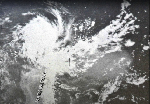
Figure 4.4.5.5: Storm Corrine (Source) compared with AS12-51-7489