4.4.6 -
For the 24 hours after the previous photograph the crew are somewhat busy checking out the LM and preparing for separation of the two craft and initiating the descent to the surface. This separation of the crew and their attendant cameras provides two vantage points for the Earth – one from the CSM & the other from the LM. Magazine 47 has a couple of Earthrise sequences before showing images taken on the lunar surface – one taken before separation from the CSM and one after, while magazine 51 shows one image of a distant Earth before separation, and several photographs of Earth taken on different orbits, including an Earthrise.
Pinning down exact timings of the images in these two magazines involves a certain amount of detective work.
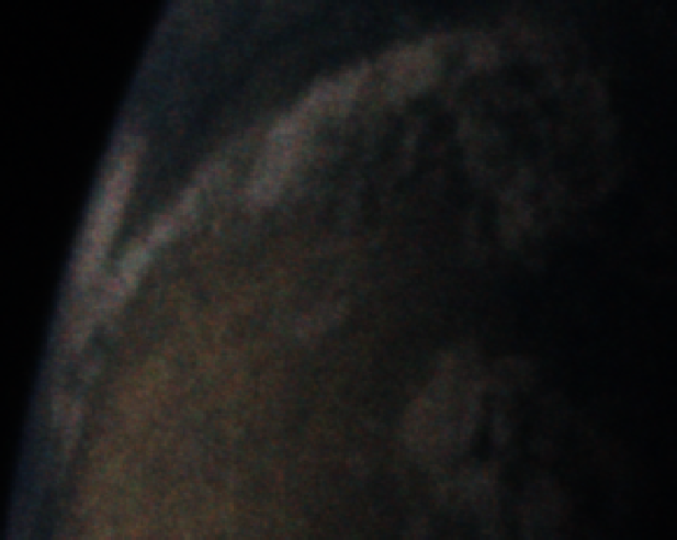
After LOI, the LM pilot entered the LM to perform system checks at around 08:50 on the 18th, finally entering with the mission commander at 00:42 on the 19th, where both crewmen remained. The LM & CSM separated at 04:16 on the 19th. Just after the start of magazine 47 are 4 images of an Earthrise. These occur immediately before 2 images of the CSM taken in to the sun, but after two images of the lunar horizon and a distant Tsiolkovsky – a far side crater proving that the image was taken after LOI.
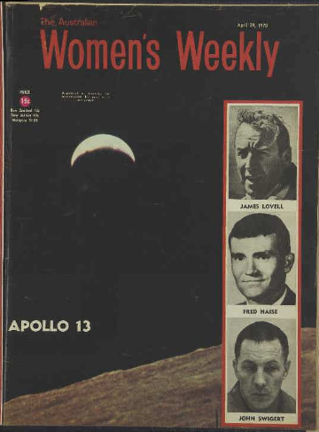
It does not take a great deal of logical leaps to conclude that the 4 Earthrise shots were therefore taken before this time. Also featured in the images is one of the LM's quad thrusters, which suggests that the photographs were taken while in the LM, and it seems reasonable to assume that this was after all the camera equipment and other gear needed for the landing was transferred. A likely time seems around 105 hours and 41 minutes, which would be around AOS on the final orbit before separation.The fact that the LM windows are reported to be frosted over before this time, requiring the heaters to be turned on, confirms that they have to have been at the start of rev 12.
The 2 photographs immediately following this short Earthrise sequence feature Copernicus, a prominent near side crater almost completely opposite Tsiolkovsky. Copernicus gets an enthusiastic mention by the crew at 106 hours 30 minutes, but prior to this they report that they were unable to find it, which would seem to confirm the suggestion that it the Earthrise was taken on the final orbit before separation, after their sighting of Tsiolkovsky.
This would give a working estimate of around 02:00 on the 19th for this sequence, and AS12-
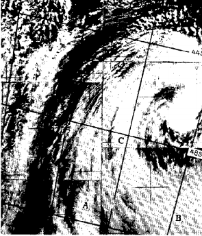
Figure 4.4.6.1 shows this image (together with another one from that sequence used to illustrate an Apollo 13 story 5 months later), and figure 4.4.6.2 does what satellite comparison is possible.
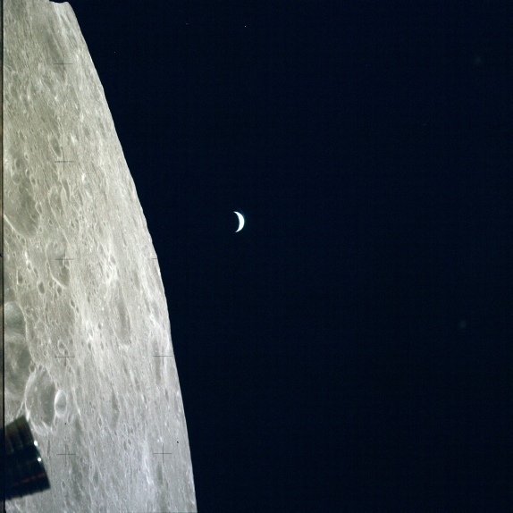
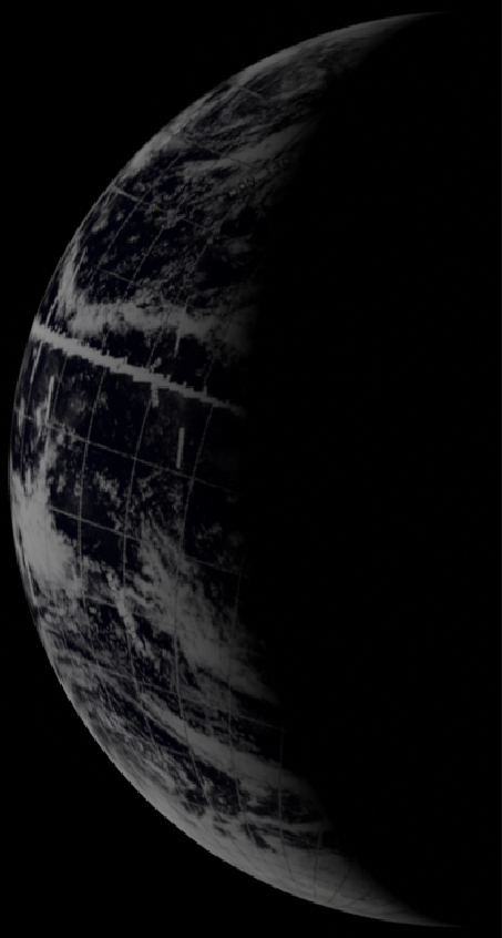
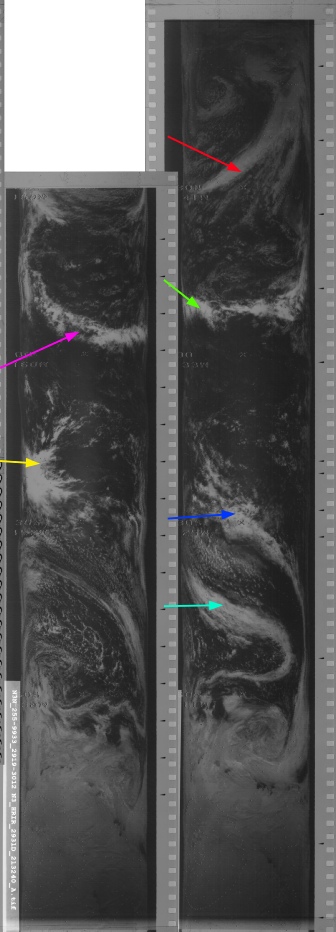
Figure 4.4.6.1: AS12-
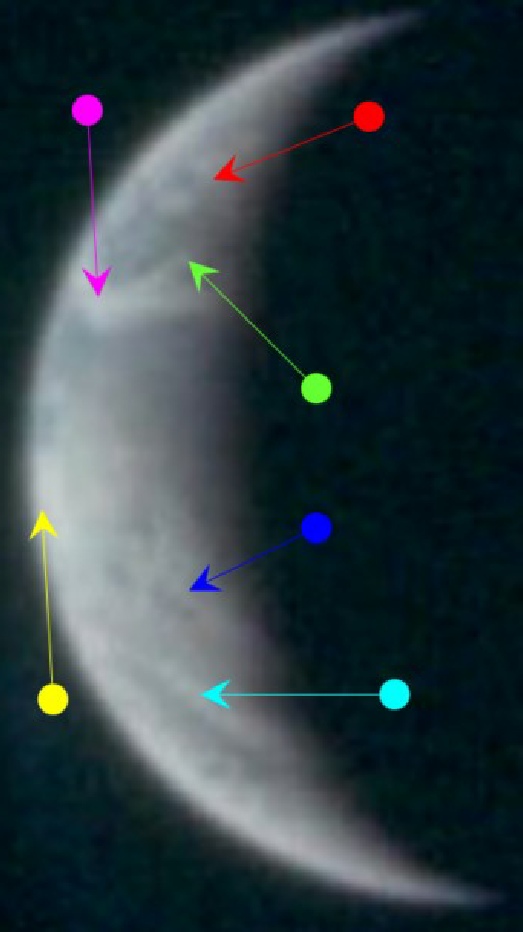
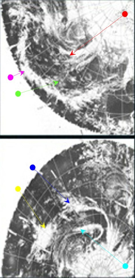
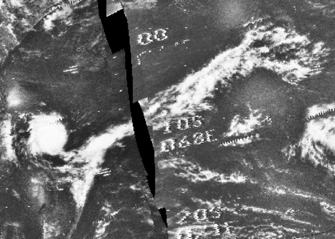
Figure 4.4.6.2: Main image -
Timing this image is difficult as there is little in the way of landmass visible to pinpoint the terminator's exact location. The absence of land mass does allow a certain amount orientation in Stellarium. Australia does not appear until 5 am, and California disappears at 1 am, so the image must fall between these two times. The yellow arrow points to a cloud system that falls on the 170 degree longitude line, and if it is assumed that this is the same one picked out on the Apollo image, them the western horizon is at 170 degrees. If this is the case then the terminator falls roughly along the line picked at 140 degrees longitude in the northern hemisphere, a line which also falls on Alaska. That same terminator line crosses over the cloud system marked by the green arrow some distance off the west coast of the USA. We know that it has to before LM separation from the CSM, and after the LM windows defrost, and as AOS on this orbit is around 02:00 it’s the only possible time for it.
Both of the satellite images chosen are from the 18th, as their orbital passes are closer to this time than they would be in images taken on the 19th. ESSA's best orbit is 3318 (track 6) which commenced at 23:01, & NIMBUS' orbit 2930 on the daylight IR image is the most appropriate one for the Apollo picture, and this commenced at 19:48.
Immediately after separation of the LM from the CSM in magazine 47 is a sequence of Earthrise images. As magazine 47 went to the lunar surface, and didn't complete more than one complete revolution as it did so, timing the image is much simpler than the preceding two, It is also helped by the astronauts' chatter in the LM as they discuss the upcoming Earthrise and making sure that they captured it (see the LM Voice transcript) at 109:43 hours MET, or around 06:00 on the 19th – 55 minutes before landing.
Figure 4.4.6.3 shows one of these images, and figure 4.4.6.4 the satellite comparison.
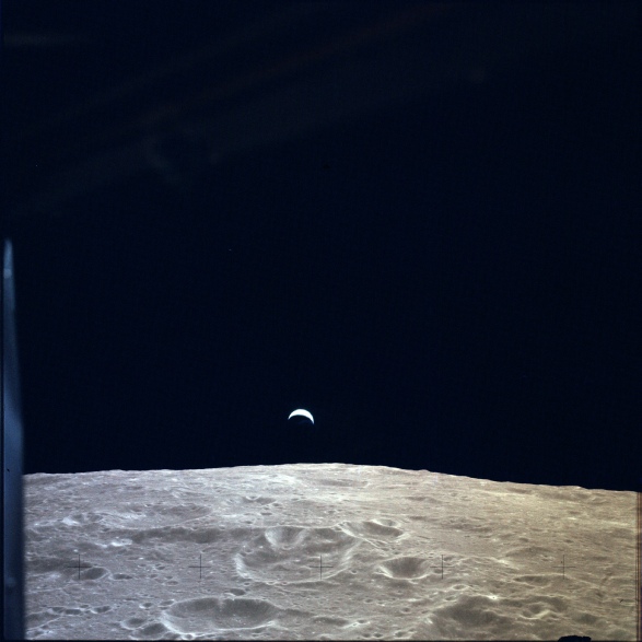
Figure 4.4.6.3: GAP scan of AS12-
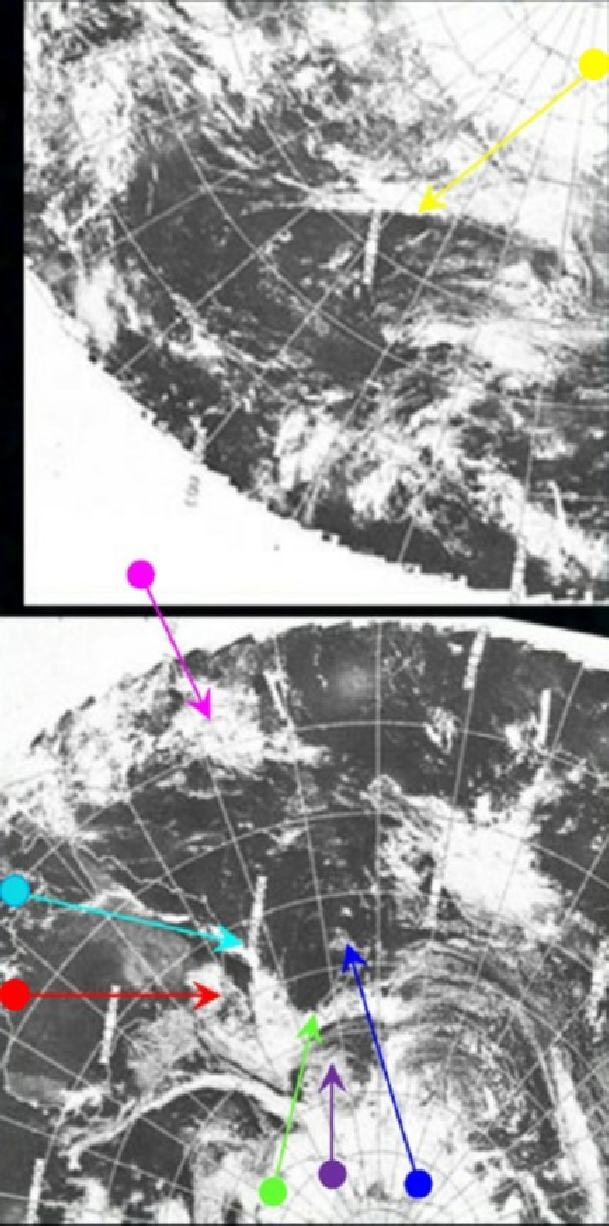
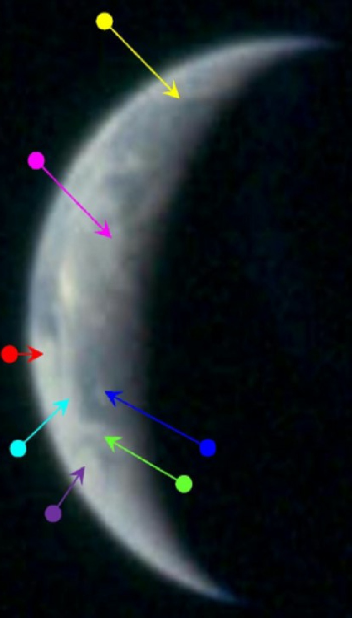
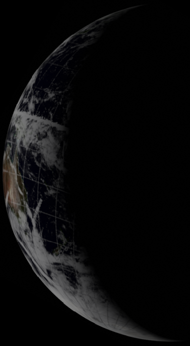
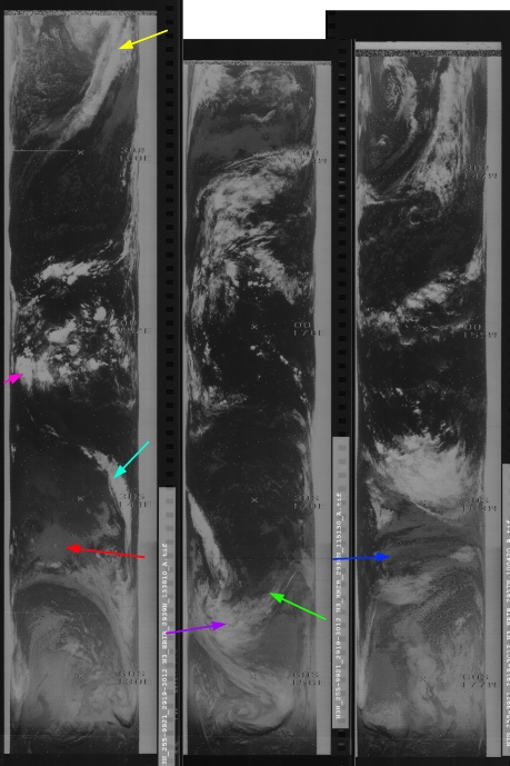
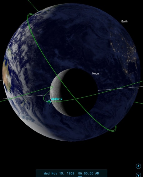
Figure 4.4.6.4: AS12-
As with the previous analysis, the key to this one is the weather system off south-
109:42:10 Conrad (onboard): All right. COAS is to the overhead window; DOI postburn report was good; helmets and gloves are on; Cabin Repress is Close; Suit Gas Diverter to Egress, Egress; Cabin Regs A and B, Egress; and we're standing by for the Updata Link switch. Going to get earthrise in just a second. You ought to have earthrise by now, Dick.
109:42:35 Gordon (onboard): Not yet. I haven't yet. I'm looking backwards.
109:42:40 Conrad (onboard): Oh, that's right; I forgot.
109:42:51 Conrad (onboard): Going to be at 109:46:30. Going to be right straight out there or what? I wonder.
109:43:01 Bean (onboard): I'm kind of guessing it is. It may be another -
109:43:17 Conrad (onboard): Fifteen more seconds.
109:43:23 Bean (onboard): Hey!
109:43:24 Conrad (onboard): Huh?
109:43:27 Bean (onboard): I thought I saw it coming up.
109:43:30 Conrad (onboard): All right; 30 seconds.
109:43:33 Conrad (onboard): There it is! Look at it! Gosh darn! [Garble] just click them off. Oh, that is fantastic!
The satellite images are able to confirm the date as the 19th.
ESSA's best track over this area is again number 8, and orbit 3321 on the image dated the 18th was commenced at 05:07 on the 19th. For once, the NIMBUS night time orbit gives the best visible data (and the day time images are absent!), and pass number 2938 on the 19th was commenced at 11:15 – 5 hours later than the Apollo image but providing a good match.
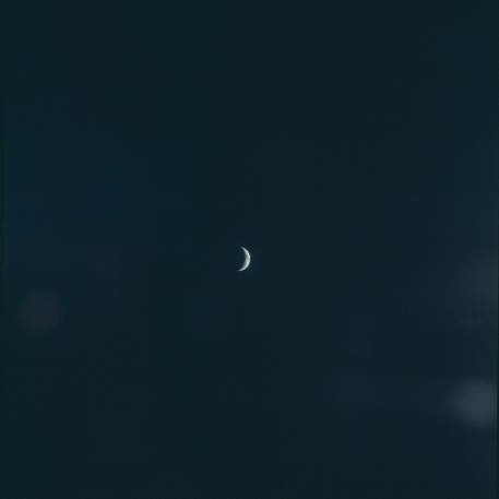
No more images of Earth from other orbits are available on this magazine, and none were taken by the crew on the lunar surface. By this time it was becoming an increasingly thin crescent and would not have presented much of an object in the sky.
While Bean & Conrad set off for the surface, Gordon continued his orbits, and took a further 3 sequences of Earth images in magazine 51. The first of those sequences occurs immediately after the separation images. Of the two available, the image chosen is AS12-
As is pretty obvious, there is very little time difference between the two images, but they were definitely taken at different times: they had to be given that Gordon couldn’t actually see the initial Earthrise. The photographs either side of the CSM Earth view are a relatively short distance apart over Ptolomaeus crater, compared with Apollo 12’s Earthrise location some 3000 miles earlier over Pasteur. SkySafari suggests that a time of around 06:30 would put the now solo Gordon in roughly the right spot. Figure 4.4.6.6 shows a comparison of Australia, which does indicate a small amount of movement consistent with what we would expect to see, as shown by SkySafari.
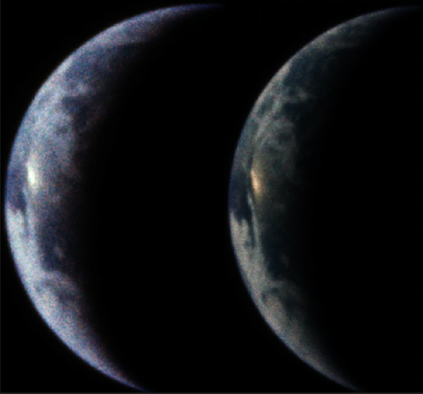
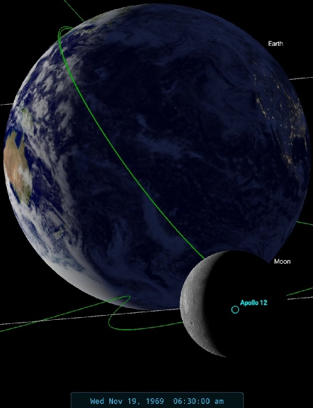
Figure 4.4.6.5: AS12-
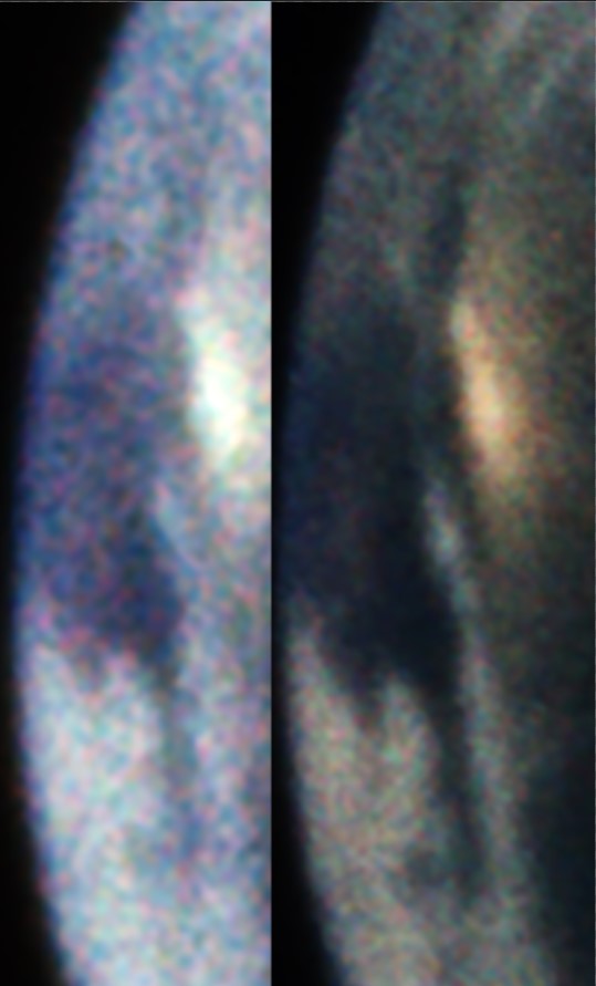
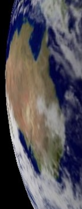
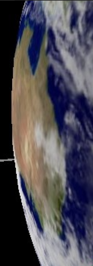
Figure 4.4.6.6: Comparison of Australia from AS12-
After separation, the CSM continued to orbit and captured another 2 sequences of images. The first one consists of two photographs of a crescent Earth with no lunar surface visible. This is not an Earthrise sequence, but the CSM has obviously passed around the moon at least once since the preceding image as there are photographs of the lunar surface in various stages of light and shade, and Mare Nubium on the east followed by far side craters such as Mendelev.
The image chosen from these two is AS12-
Figure 4.4.6.7: AS12-
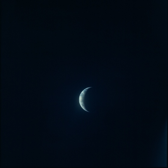
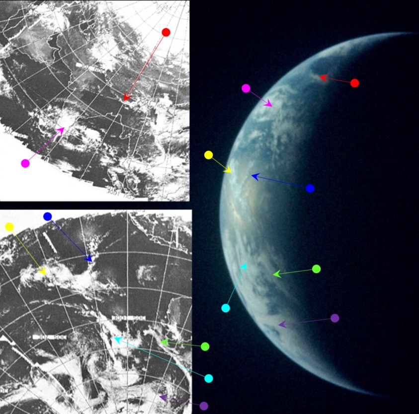
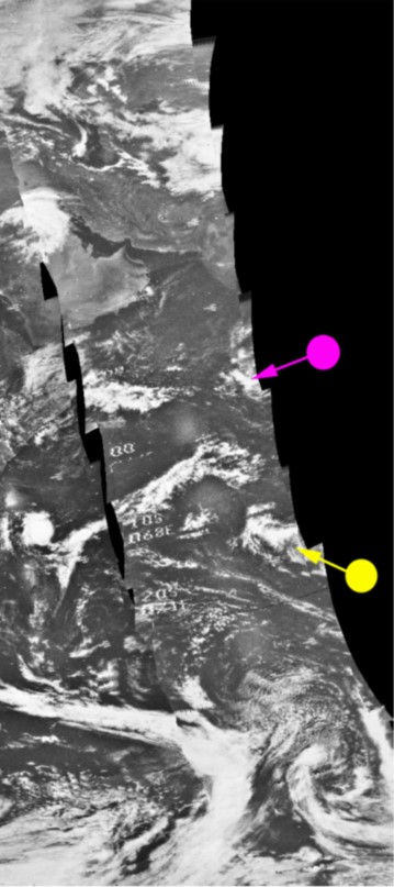
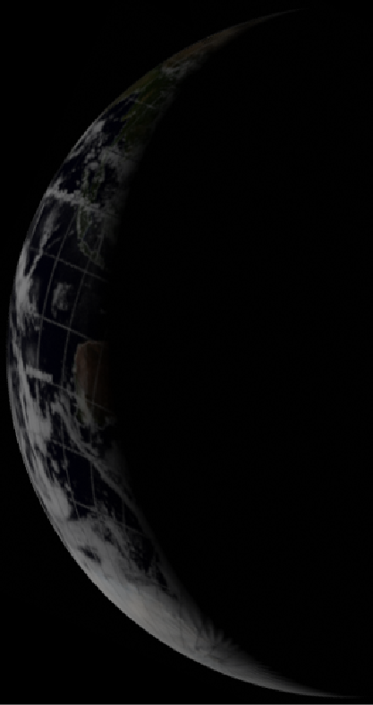
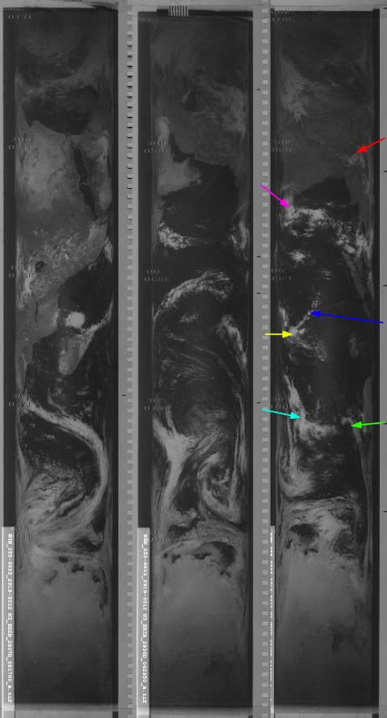

Figure 4.4.6.8: Main image -
The ESSA image used is again from the 18th, and the most obvious cloud that specifically pins it down to that day's image is the one highlighted by the yellow arrow, and as with previous images once the most obvious cloud is identified the rest fall into place. Track 10 covers most of the image's daylight portion, and this corresponds to pass number 3302, commenced at 07:03 on the 19th. The NIMBUS image is the daylight IR data from the 19th, and pass 2935 covers the coast off western Australia up towards India. This was started at 04:42.
Looking at the top of the Earth's crescent in this image reveals a landmass, and it is this that allows the time at terminator to be picked out. The clouds identified by the red arrow are over that landmass, and which puts the terminator position as at roughly 10:30 – about 3 orbits later than the preceding photograph. As it is not an Earthrise image it could have been taken at any point in the nearside part of the lunar orbit, but there is at least one orbit between the previous image analysed and this one. 10:30 would put the mission elapsed time at just over 114 hours 10 minutes, or 4d18h in. We know that the CSM was over the daylight side at that time, because at 4d18h23m Dick Gordon announces that he has sighted the LM through the sextant:
114:23:33 Gordon: I have him. He's on the Surveyor crater; he's about a fourth of a Surveyor crater diameter to the Northwest.
114:23:44 Gibson: Roger, Clipper. Well done.
114:23:49 Gordon: I'll tell you, he's the only thing that casts a shadow down there.
114:23:55 Gibson: Roger.
114:24:04 Gordon: He's got a fairly good sized crater just to the North and slightly East of him; out directly behind him; he is on the Surveyor crater.
114:24:14 Gibson: Roger, Clipper. [Long pause.]
114:24:37 Gordon: Al1 right, Ed. Now I'm directly overhead. He's a third of the way between the Surveyor crater and the head.
The image immediately after this one is again over Ptolomaeus crater (some 600 km east of Surveyor -
The final Earth sequence (but not the final Earth image) to be examined was taken immediately after the preceding one. AS12-
The image is shown in figure 4.4.6.9, and examined in 4.4.6.10.
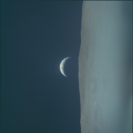
Figure 4.4.6.9: GAP scan of AS12-
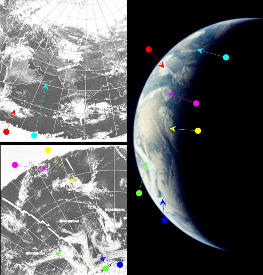
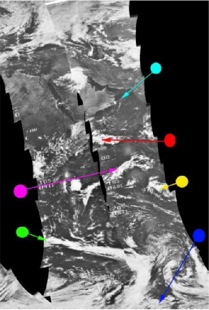
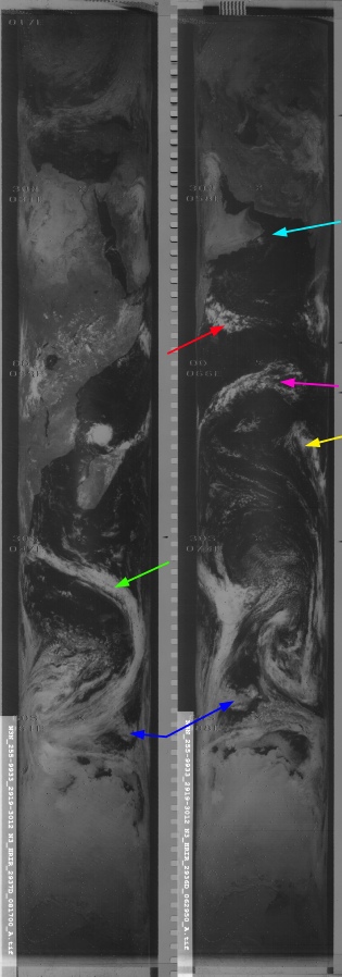
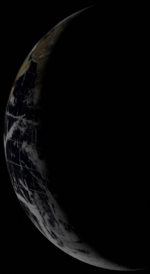
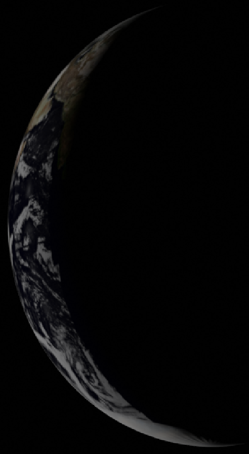
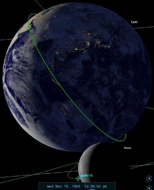
Figure 4.4.6.10: Top image -

There are no intervening pictures of lunar surface to act as a guide for how many orbits have elapsed between AS12-
Consequently, there is not much difference in the satellite image timings for the visible part of the Earth's surface. NIMBUS orbit 2936 is the major part of the daylight IR image used, which commenced at 06:29 on the 19th. The magenta arrow identifies clouds imaged at 06:57 by NIMBUS. ESSA's companion pass is 3323 (track 11), which commenced at 09:08. As usual, two satellites show images from a specific day with specific cloud formations unique to that day, and that match the Apollo image. The WMO image is identified as having been taken at 03:49 GMT.
Another thing that has emerged as Earth turns is a tropical storm just north of Madagascar. The storm’s development is described here. It was first identified on the 11th and resulted in numerous fatalities. It was first photographed by Apollo on 18th (see here) and the Figure 4.4.6.11 shows NIMBUS image from the 18th and 19th compared with the Apollo 12 photographs..
The storm is positioned over Madagascar and is at the western end of the long cloud system picked out by the magenta arrow. Can we be certain of the day it was taken? Figure 4.4.6.12 shows the relative positions of Corrine on the 18th and 19th.
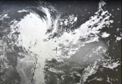
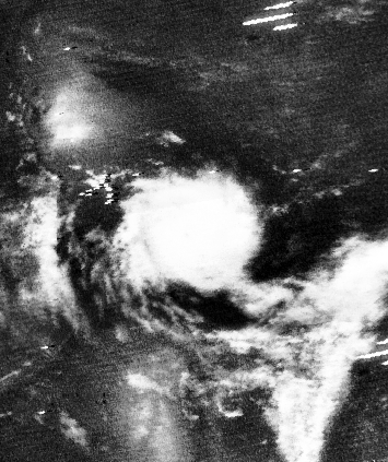
Figure 4.4.6.11: NIMBUS images of Corrine taken on November 18th (top left Source), 19th (centre, Source), digitally recovered NIMBUS tile (left) and AS12-
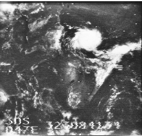
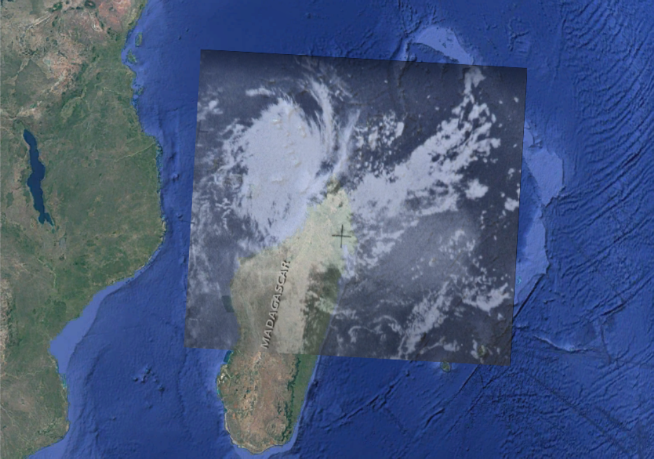
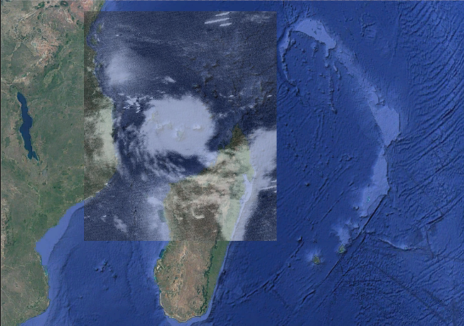
Figure 4.4.6.12: Location of Corrine on November 18th( left) and 19th (right)/
The storm has moved slightly westwards in 24 hours, and is still positioned off the north of Madagascar. Close examination of the Earth’s western limb in figure 4.4.6.10 shows that Madagascar is just visible, and it is definitely in the right place. The main difference comes when seeing how the long band of cloud extending Eastwards behaves. On the 19th it is much more clearly defined and extends further, ending in the distinctive curl identified earlier (see figure 4.4.6.13), and while the image isn’t as well focused, it’s different to the same storm as pictured on the 18th.
Figure 4.4.6.13: Corrine in its wider context
Interestingly, the Tananarive tracking station on Madagascar (then known as the Malagasy Republic) was described as being “out of the network” by the mission PAO at the start of the mission, but it’s clear why that is the case.
In short, we have a named and documented tropical storm, with a unique formation, visible in an Apollo 12 photograph taken from lunar orbit in a formation that matches the satellite record.
That’s it for today, onwards to day 7.