4.9.2 -
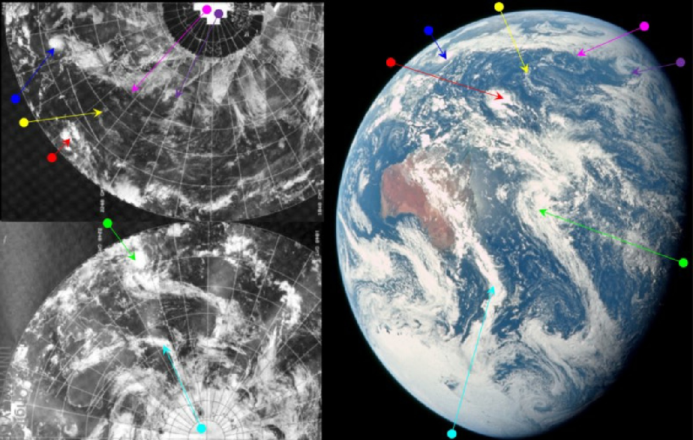
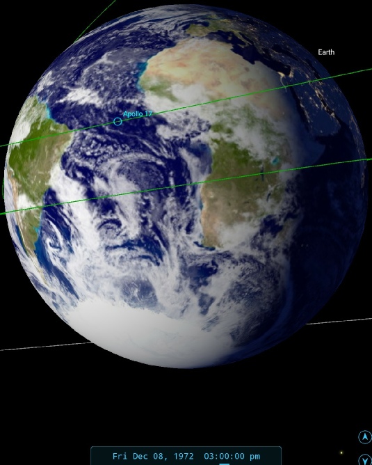
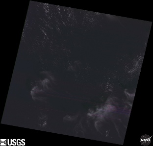
The next view of Earth sees the crew firmly over the Pacific, and Australia is just heading into view. Figure 4.9.23.1 shows AS17-
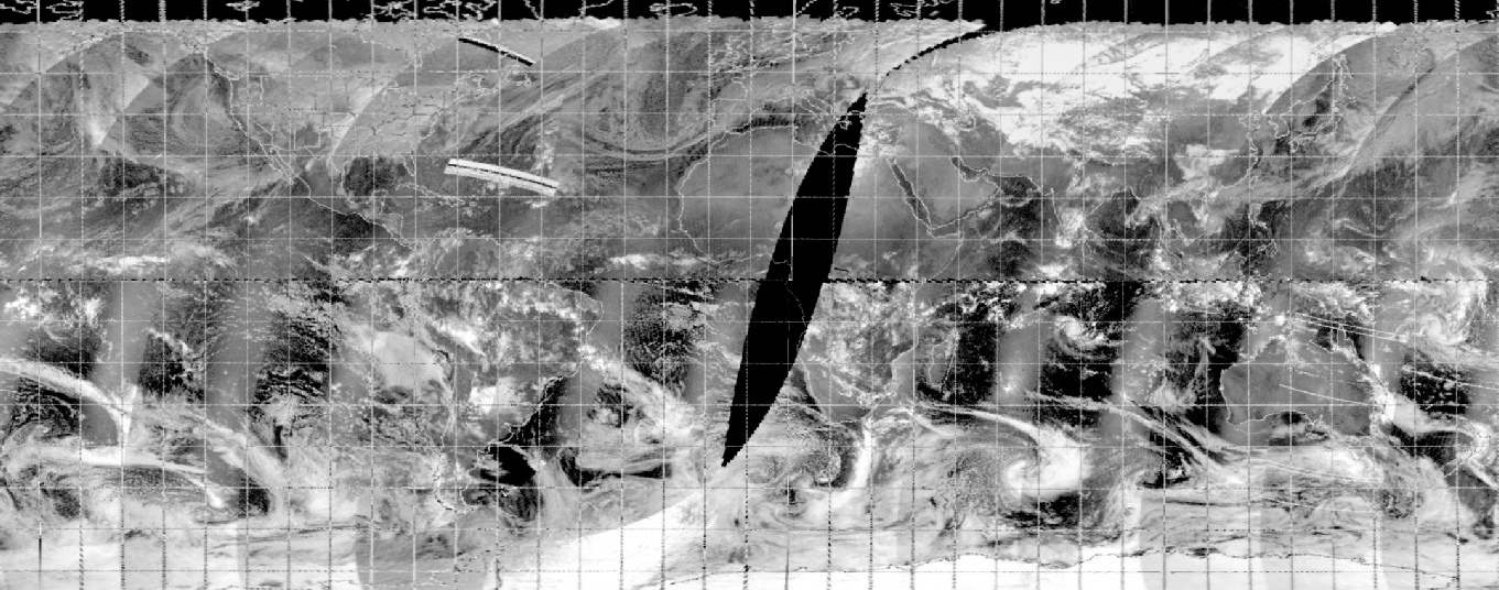
Figure 4.9.2.1: AS17-
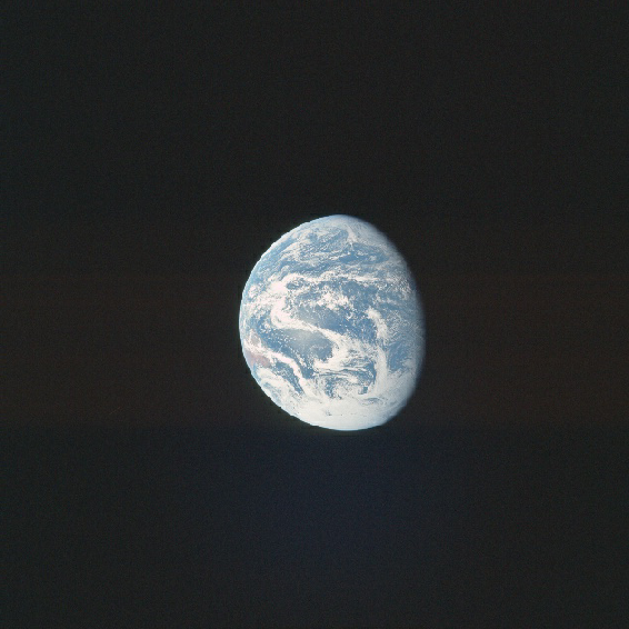
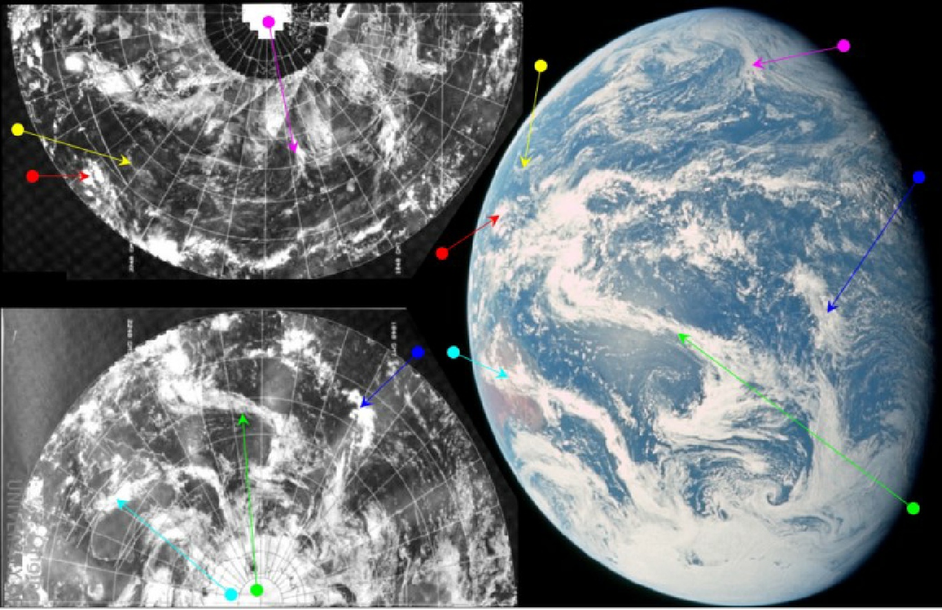
Figure 4.9.2.2: AS17-
The visible portion of the globe has shrunk again since the previous image as time passes and the Earth's orientation relative to Apollo 17 changes – certainly Stellarium's visible disk showing Earth as seen from the moon is much larger. The time markings on the satellite suggest a time around the terminator of around 10:40 GMT on the 7th, with Australia being overpassed about 12 hours later. The appearance of Australia in the frame is useful in terms of confirming that suggested time of.
The communications between the crew help to narrow down the time. At just short of 19 hours (00:30) Capcom tell the crew that:
018:58:32 Fullerton: 17, we'll be having a communications handover to Honeysuckle in about a minute and a half.
with Schmitt responding:
018:58:45 Schmitt: That's great. Next time I look at the Earth, I'll see what's happening in Australia.
As communication is by line of sight and Goldstone in California was just about to disappear, Honeysuckle in Australia becomes the next link in the communications chain as it comes into view. Australia is visible in the image, whereas the coast of the USA is not, which suggests a time for the image after that statement.
Schmitt then gives a lengthy description of what he can see:
019:55:59 Schmitt: Okay. I -
019:56:25 Overmyer: Roger.
019:56:26 Schmitt: Have to change windows. [Long pause.]
019:58:42 Schmitt: Okay, Bob. That front looks like it starts and develops as a small -
More helpfully for us, we then have this:
020:00:22 Schmitt: I took two 5 -
Which is the time SkySafari has been set at.
020:03:14 Schmitt: Bob, I got our orbital map out now, and that front is going off across to the coast of Australia north of Sidney and largely a little south of Brisbane and -
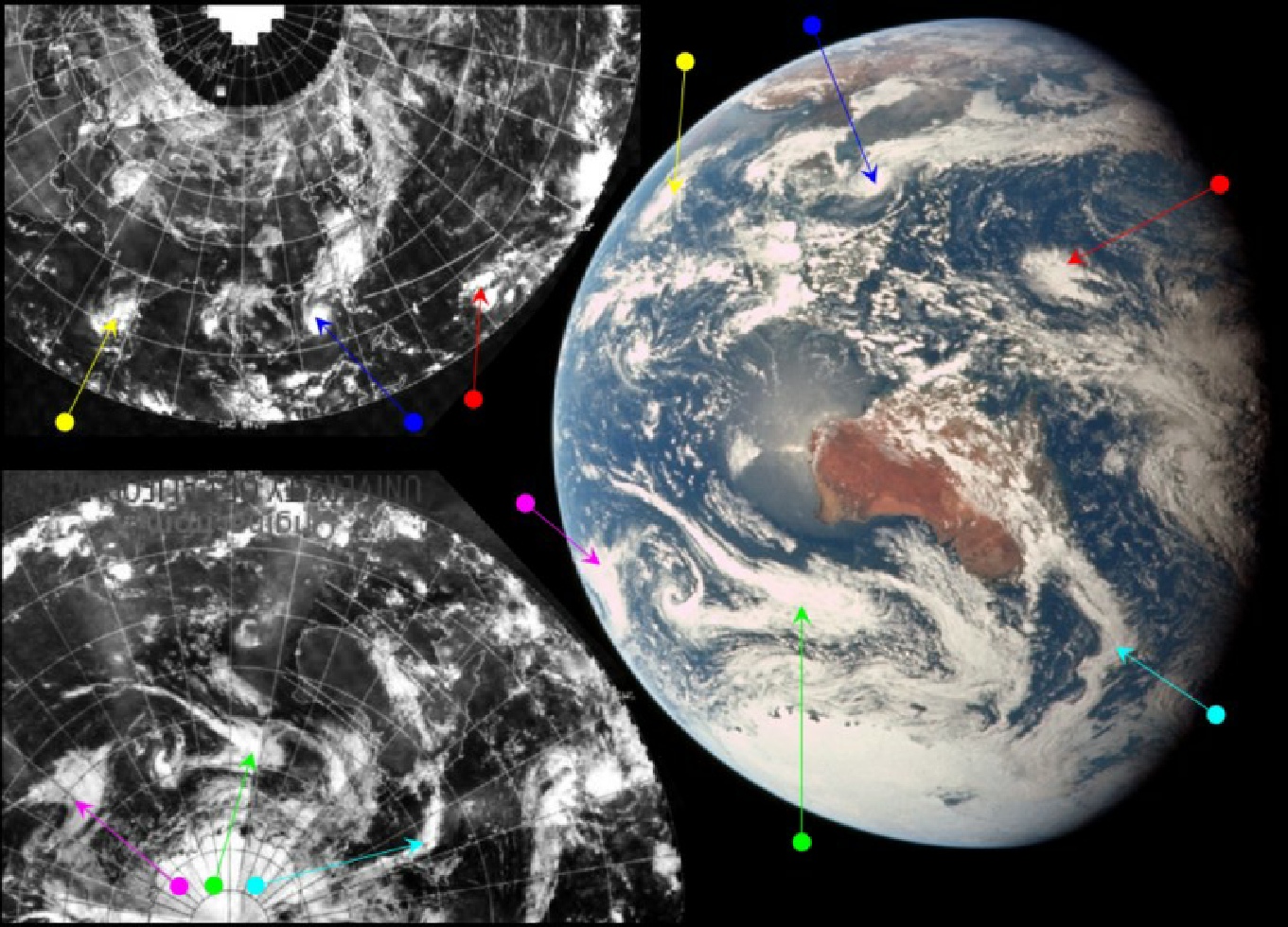
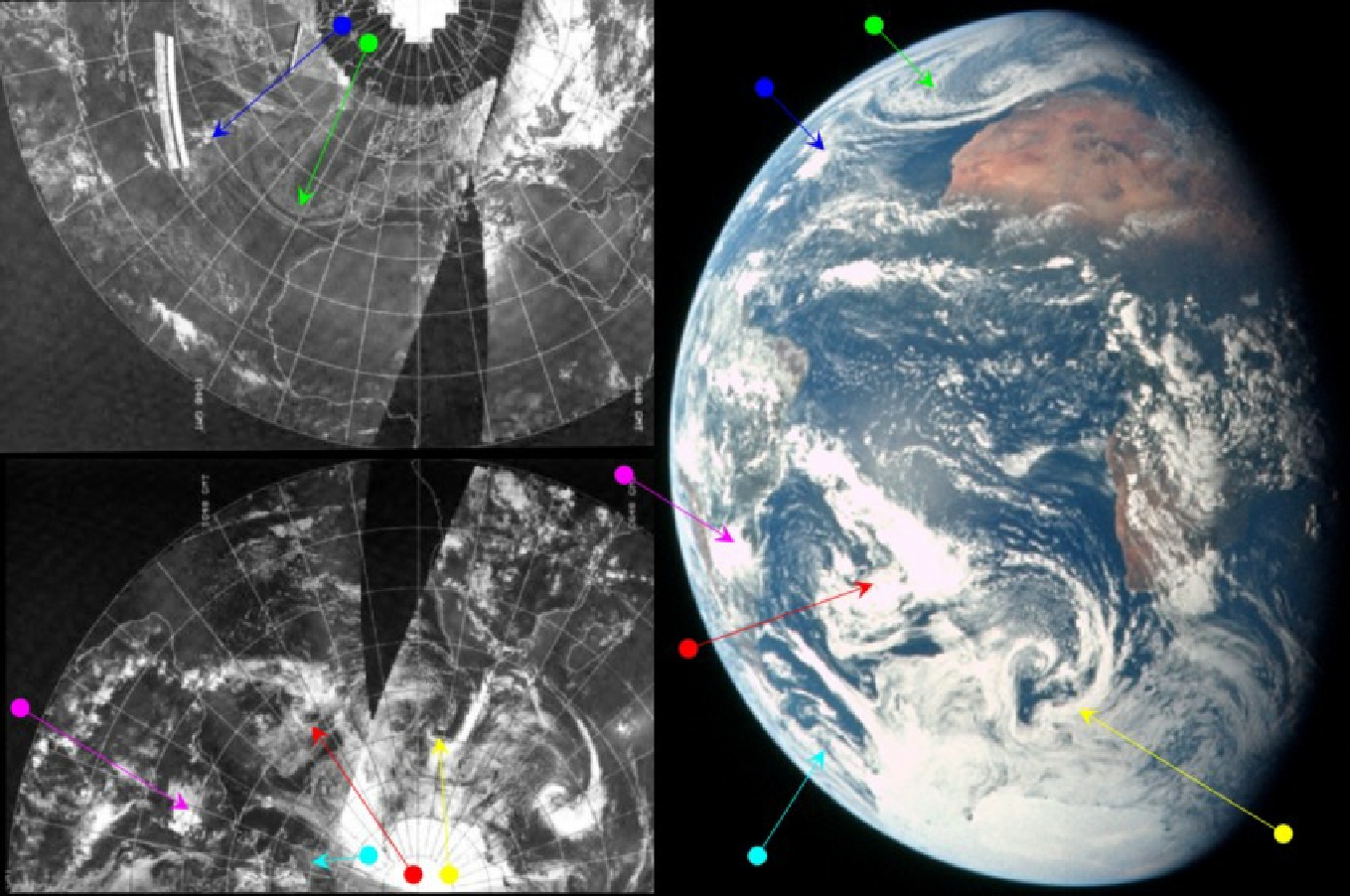
That front is identified by the green arrow in figure 4.9.2.2. As before, he describes the scene uncannily accurately, almost as if he was actually looking at it!
He goes on:
020:12:00 Schmitt: Okay. Bob -
…
020:13:03 Schmitt: Now, it -
…
020:13:58 Schmitt: Now to the north of Antarctica. Let's see now. I ought to give you a better orientation than that. But, anyway, there is a large cyclone circulation pattern that has its southern extremity right on the edge of the ice shelf. And that -
…
020:16:22 Schmitt: Between New Zealand and Australia, the front I was discussing previously has some fairly strong transverse cloud patterns. It's hard to say whether they're high cirrus or not. But the clear area to the south of the front suggests that maybe the jet stream is roughly paralleling that front in that area.
Sas always, heis description is unerringly accurate.
At 02:20 GMT, Schmitt says:
020:53:30 Schmitt: I've been trying to spot tropical storm Teresa, which is -
The Philippines are only just visible on this image, and Schmitt also refers earlier to the Hawaiian Islands weather, which is further support that he is looking at a scene where Australia has only just become visible.
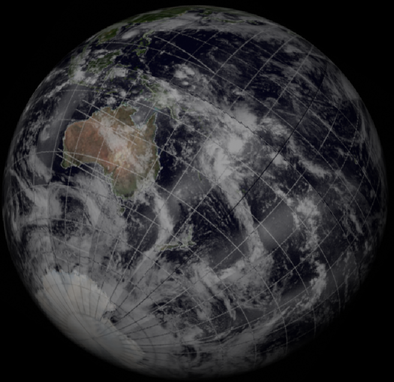
Tropical storm Therese began life on 30/11/72 and lasted until December 12th, but causing damage to the Philippines and Vietnam on the 3rd and 9th respectively and the introduction to this section provides links to the images of it. This storm becomes more interesting in light of the next couple of images analysed. Before we do that, it’s worth taking a quick look at a set of Landsat images from the evening of the 7th that covers the Antarctic region (figure 4.9.2.3).
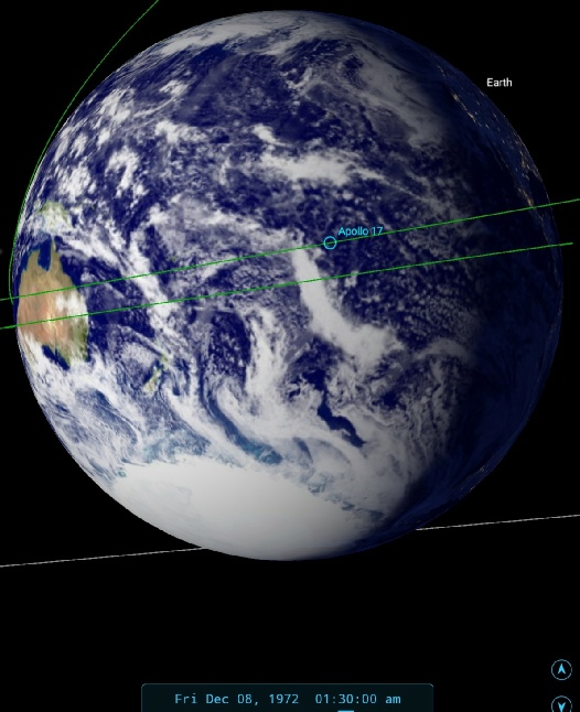

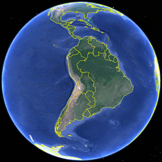
Figure 4.9.2.6: Google Earth showing Landsat passes over Australia (bottom left). The same locations are shown on AS17-
Despite the few hours gap between Landsat’s image and the later Apollo 17 photograph, there are many points of similarity between the two. Coastal cloud over Nhulunbuy separated from other clouds on the coast of Papua by blue ocean. We then have a gap in the cloud before we get to the broader swathe of it over the Tanami desert. The coastal cloud in the later photograph is obviously absent in Landsat’s view, but is much less obvious in the earlier Apollo photograph. Certainly the inland cloud is a good match.
As with the preceding image, the first question to settle for figure 4.9.10 is the time at terminator. SkySafari’s figureis given as 04:00, and the main reason for this is, unsurprisingly, Schmitt’s own confirmation:
022:26:02 Schmitt: Okay, I had a quick -
…
022:27:19 Schmitt: Oh, and, Bob, I got another pair of pictures. And that would be up to 134.
Which pretty much nails the time.
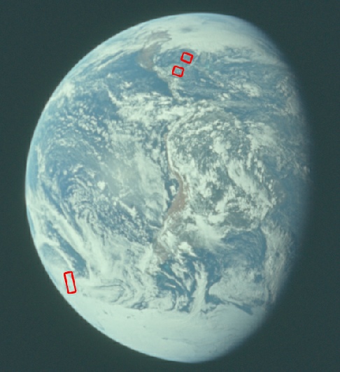
xamination of the Apollo photograph does indeed show that East and SE Asia are just beginning to be visible. Guam is located north of the area of cloud arrowed in red. New Guinea (now called Papua New Guinea) is just north of Australia and south of Guam. From this description it looks as though he suspects that the red arrowed cloud mass is Therese – but is he correct?
Fortunately for us, we have a few satellite photographs available, as described in the introduction to this section, namely the original NOAA-
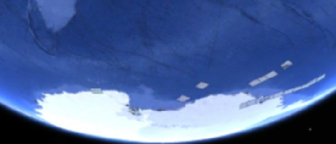
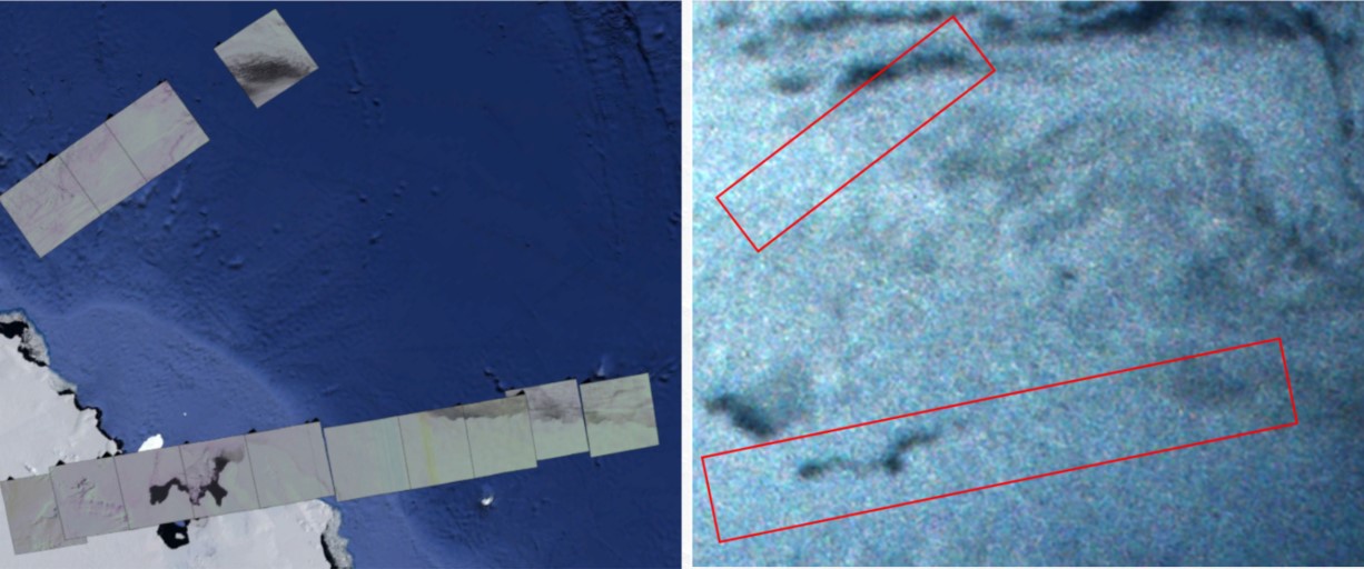
Figure 4.9.2.3: Landsat passes over the Antarctic region on 07/12/72 compared with AS17-
The area of clear water between the edge of the Thurston peninsula and the off-
Moving on now, a short while after Schmitt's long range weather report, another couple of photographs are taken. AS17-
Figure 4.9.2.4: AS17-
Before assessing the photograph, it’s worth drawing your attention to the area over the Northern Territory , where we have another Landsat image we can examine. Also included is the same section of AS17-

Figure 4.9.2.5: AS17-
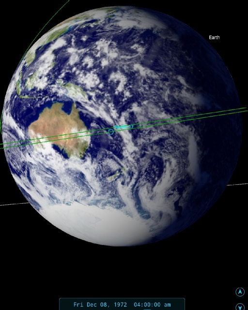
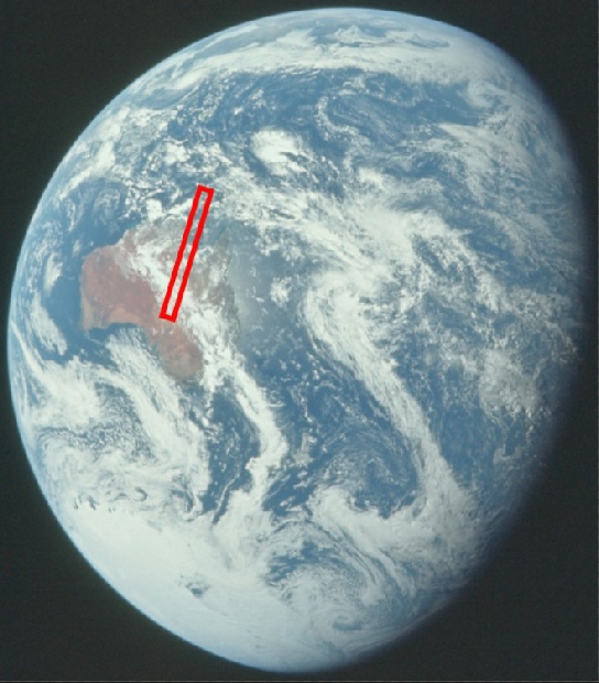
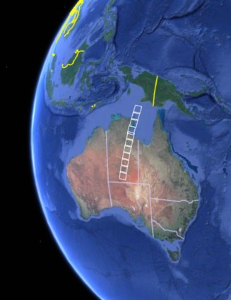
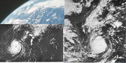
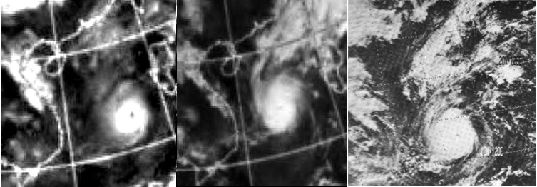
Figure 4.9.2.7: AS17-
The spiral arms of the storm are nicely picked out by all three images, and the long band of cloud trending north-
It is a pity that there are no publicly available photographs from the 8th of December that would tie in more precisely with the Apollo image, but (like the Tamil Nadu cyclone) it is present in the image where it should be.
Cynics will argue that Schmitt (and presumably NASA and ESSA) knew about the storm, and would know that it should be in the photographs. They will probably also argue that Schmitt's apparent inability to see Therese was a pretence, instead of the reality that he was observing the Earth through distant optics. The mission transcript does indicate exactly what information Capcom had to hand, and this will be dealt with shortly.
We can at least attempt to clarify the exact date of the NOAA-
Figure 4.9.2.8: NOAA2 mosaic segment dated the 6th (left) and 7th (centre) compared with NOAA2 image dated the 7th (right) in the MWL (source given in the introduction to this section).
Figure 4.9.12 illustrates 2 things. Firstly, that the NOAA-
We will return to Jack's hunt for Therese shortly, but first he has other descriptions of what he can see for Capcom. At 22:35 MET he gives a lengthy description of Australasia's weather (you might want to consults an Atlas for a lot of this!):
022:35:06 Schmitt: Okay. Good. Nice to talk with you. Hey, I don't know whether you were around, Gene, the other day when I was talking about the circulation patterns around Antarctica. We were looking then at the Indian Ocean -
…
022:36:32 Schmitt: That would make four of those major convex fronts that I can see from this view crossing -
The fronts he describes are those that appear south and then east of Australia in the photograph, with the green arrow identifying the largest of them.
Having briefly gone over Australia and the Antarctic Ocean, he then returns to the search for Therese. He starts the discussion with:
022:37:04 Schmitt: On -
So, while we know exactly where Therese is at this point, Schmitt is still unsure, and is picking out what to him would appear as the largest and most obvious tropical disturbance, rather than Therese's actual location at the end of a longer band of cloud. Capcom, meanwhile, have their own maps and are trying to locate Therese as well, and they respond with:
022:37:21 Kranz: It looks like it's just a bit to the west of Manila there -
To which Jack replies:
022:39:37 Schmitt: Okay, Gene, if you're still there, I don't like to argue with you but I think our analysis chart is a little more up to date.
We then have the following exchange between Capcom and Schmitt, which reveals interesting information about the weather data held by ground crews supporting the mission:
022:40:27 Kranz: You're over in the area between Guam and the Carolines, then. You're saying it would be just about due west of the Carolines, then. Okay.
022:40:38 Schmitt: Yes, you're probably looking at a -
022:40:44 Kranz: Yes, that's the one I had for launch date.
022:40:49 Schmitt: Okay. Well, it's -
022:41:02 Kranz: Okay. I'll get a new prog in and compare your estimate there.
022:41:10 Schmitt: Okay. I think that's pretty good -
022:41:52 Schmitt: Yes, of course, that is Port Moresby. I can see that point there, and between those two -
022:42:02 Kranz: Okay. We'll get a satellite photo and bring it in here in just a bit.
It appears from this exchange, then, that Capcom are predominantly using synoptic charts for their information, and are looking at relatively old data compared with Schmitt's view. As the main concerns for the weather are mainly with launch day and re-
Briefly mentioning the front over New Zealand (cyan arrow in figure 4.9.2.5), he then returns to SE Asia:
022:56:33 Schmitt: Okay, Bob. That storm off the -
He has now managed focus in on the correct area for Therese, which is lurking at the end of that storm front over Japan. Tropical Storm Sally was a small event that had pretty much died out by the time Apollo 17 launched, and the tropical depression he describes is actually Therese! Capcom can't identify that depression on their current chart (probably because Jack has confused them by mis-
023:00:59 Schmitt: As I recall, they had a tropical storm called Sally that went into -
023:01:49 Schmitt: Mainland China, Bob, was the last pass here. I can't see the Ear -
And later:
023:15:34 Schmitt: Okay, Bob, a little update on the coast of Asia. It looks like some residual cloudiness would be affecting the Pusan region of Korea. And, also, that's residual after the frontal passage. And it looks like maybe Shanghai, after all, may have some storms associated with it, but it's really hard to pick out exactly -
It's worth pointing out that the above conversation took place over 45 minutes after the Apollo photograph under discussion took place, so that while initially the coast of China would have been difficult to make out clearly, it would have moved into view by the time Jack made the comments above. He is, however, managing to pick out areas and their weather conditions accurately, even if the storm that is Theresa is still confusing him! By now it is 23h17m MET and Capcom ask Schmitt about the storm around Guam, to which he responds:
023:16:34 Schmitt: Okay. I see there is this cloud concentration between New Guinea and Guam. The more I look at it the less well developed it appears to me compared to some of the other circulation patterns. It could be just a residual depression from Teresa that has moved out into that area. It is an isolated, a relatively isolated cloud pattern, fairly small, but apparently fairly dense. But has -
He has therefore managed to identify that the circulation pattern we would expect for a cyclonic storm is absent in the clouds near Guam, but is still sticking to his guns that it is a leftover from the (still active) Therese, despite the very obvious cyclonic pattern he can actually see on the storm that is Therese!
Twenty minutes later, he gets asked about Wake Island, prompted by requests from the ARIA support team based there, to which he responds:
023:33:44 Schmitt: Okay, Bob. I'll probably have to work on this one a little more, but -
…
023:35:14 Schmitt: Well, my guess is, Bob, and it's purely a guess, is that there -
The general cloudiness is obvious on the Apollo photograph, although the circulation pattern of the cloud would appear to be more perceived than actual, as it is difficult to pick out with any certainty any rotational evidence other than a slightly arced band on the eastern side of the cloudy area he is describing. The old front moving south-
Capcom then deliver a bombshell to Schmitt:
023:36:11 Overmyer: Roger. The prog I got in my hand for 3-
The 'prog' they refer to indicates that they still don't have an up to date satellite image, and instead are relying on synoptic charts. Jack then responds with:
023:36:25 Schmitt: Well, I don't -
Schmitt is displaying a classic symptom of confirmation bias, which is ironic because it is something of which conspiracy theorists are routinely guilty: he has made a judgement based on incomplete information, and despite all evidence to the contrary suggesting he is wrong, he is sticking with his original story! He believes Therese to be a spent force, so the obviously active storm he can see can't be Therese! His final comment on the subject for the day is that:
024:36:44 Schmitt: Bob? This is Jack. Your last report for the day as the Earth goes past window 5. The first thing I noticed was that our zero phase point is not nearly as bright on the west coast of Australia as it is on the -
Following this statement, and with a few technical and housekeeping matters, the crew (who have all taken sleeping tablets) have a rest period and Jack's weather forecast service ends for the night, but not before he takes another pair of photographs. He confirms this before the final weather observation cited above, saying at 24:00 MET (05:30 GMT):
024:17:53 Schmitt: Okay, Bob. On the film status, we're still where we were, November-
After the rest period, Schmitt confirms that he did take two photographs before retiring, and one of those, AS17-
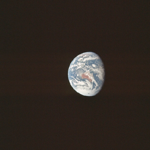
Figure 4.9.2.9: AS17-
Australia has moved around under the CSM while Jack has been delivering his synoptic sermons and is pretty much directly below them. New Zealand is now equidistant between Australia and the terminator, and this allows a quick determination of the time to be not long after Schmitt said he would take the photograph. The added rotation of the Earth allows a much better view of Theresa, and we can confirm that it is where Capcom think it is, and not where Jack thinks it is, and also that the image mosaic dated the 7th is correct for Therese, and not the one dated the 6th. This can be seen in figure 4.9.2.10. The full satellite analysis for this image is given in figure 4.9.2.11.
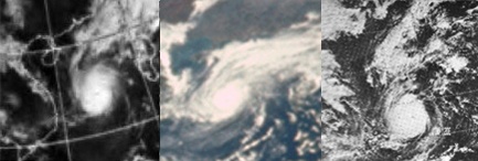
Figure 4.9.2.10: Tropical storm Therese as seen on the NOAA mosaic dated the 7th (left), AS17-
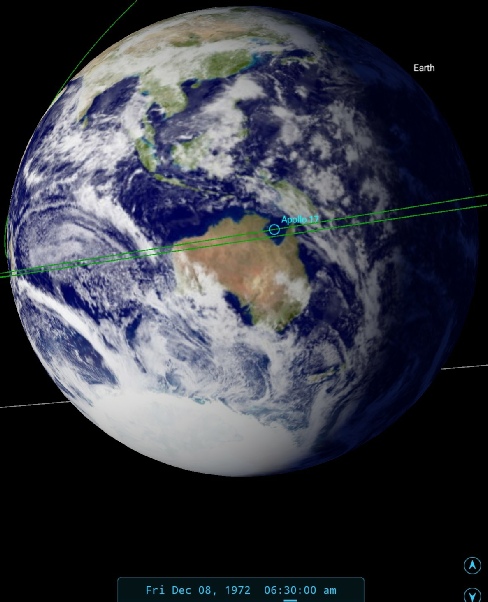
Figure 4.9.2.11: AS17-
There is little to add to this image, given that we have already had a lengthy description of it from Jack already. It is worth mentioning the obvious rotation of the Earth over time that is entirely consistent with the narrative recorded in the mission transcript. The remnants of the Cuddalore cyclone first identified in AS17-
In the spirit of open reporting, we also have a couple of areas covered by Landsat in this image (Borneo, Burma and Korea), though they are less than revealing in terms of producing any conclusive proof that they show the same thing. Figure 4.9.2.12 identifies the locations concerned and shows the image comparison.
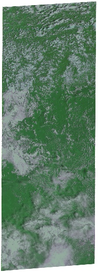
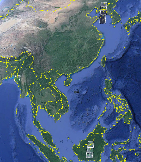
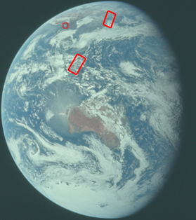
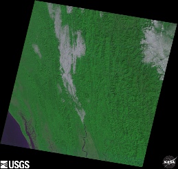
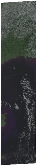
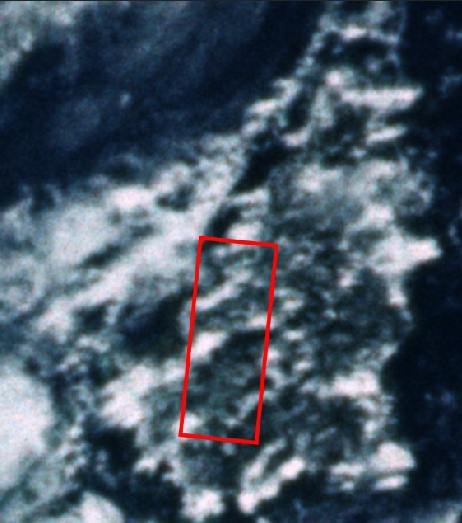
Figure 4.9.2.12: AS17-
While the Apollo 17 image is timed at around 04:00, the Korea images were taken around 02:00 with Borneo imaged shortly afterwards. Burma was photographed at 03:44. With this in mind it is more likely that the Burma image would show the greatest degree of correspondence with the Apollo photograph, but the viewing angle and poor focus makes this difficult to state conclusively. There are certainly clouds near the coast that fit the bill. The Korean and Borneo images are similarly inconclusive, but are certainly not inconsistent with the Apollo image when you allow for the time gap involved.
Later in this mission day, Schmitt asks Capcom if they had managed to find any more information on the storm he had picked out by the Philippines. Capcom confirm that the storm is, in fact, Therese, after which Jack asks about the storm he had thought was Therese over in the Guam area. Capcom tell him that they have no detailed charts of the Guam area. It is likely that the more detailed charts over the Philippines and Vietnam are a consequence of the still ongoing military operations in that area.
As well as confirming that he had taken a pair of photographs before going to sleep, Schmitt also advises Capcom that he has taken another couple at 33:30 MET, or about 15:00 GMT. One of those photographs, AS17-
Figure 4.9.2.13: AS17-
The first observation that can be made here is that, with increasing distance from Earth (the crew are now over halfway to the Moon), the shape of the visible Earth is becoming much more similar to the view from the Moon as given by SkySafari’s depiction.
The satellite image suffers the usual problem when viewing Africa of featuring a portion of the image that was actually scanned the following day. The yellow arrowed cloud pattern is one that is further East on the satellite image compared with the Apollo version for that reason. The time at the terminator on the NOAA mosaic is difficult to determine because of that, but an estimate of around 08:00 GMT on the 8th would fit in with the time markings shown on the lines of longitude.
In this mission, if there is a photograph of Earth, our resident meteorologist has observations to make about it, and this image is no exception:
033:45:31 Schmitt: Africa, looks in pretty good shape. There is a -
His most obviously accurate description is of the 'spectacular spiral' in the north Atlantic (green arrow), which is visible very faintly in the NOAA mosaic but is still clearly there. There is indeed cloud cover over what is now Zimbabwe and Zambia just to the north of it. The yellow and cyan arrows pick out the fronts off the Cape and Falklands respectively. The thick cloud over Argentina is identified by the magenta arrow.
Shortly after that description he confirms the time at which he took the photograph:
034:29:28 Schmitt: Gordy, film update on mag November November. I'm on frame 138, and that includes a couple of pictures I mentioned to Bob I took just before I went to sleep. And also, two pictures this morning at about 33:30. Those are the Earth.
33:30 converts to 15:03 GMT, so my SkySafari version is just about bang on.
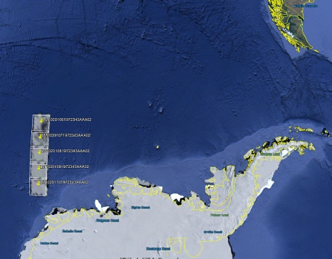
Again we have a series of Landsat passes covering the area, figure 4.9.2.15 shows where they are.
Figure 4.9.2.14: AS17-
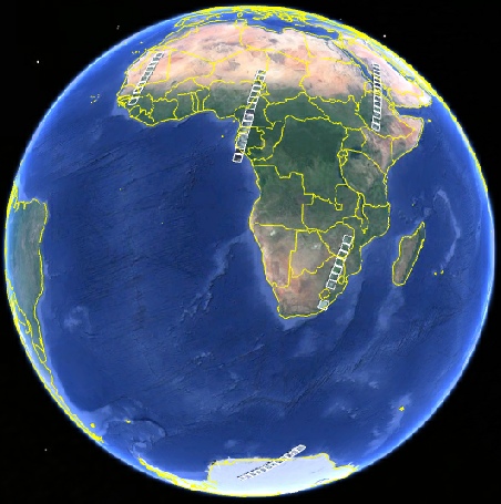
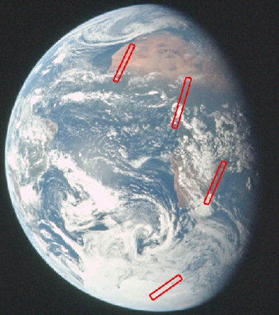
Figure 4.9.2.15:: Landsat paths shown on Google Earth and on AS17-
We’ll only be looking at four of the path here, as the one over Arabia and Ethiopia is under darkness at the time of the photograph, and these are shown in figure 4.9.2.16.
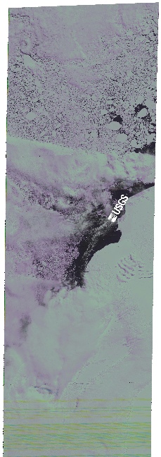
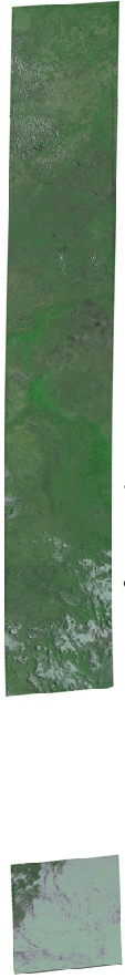


Figure 4.9.2.17: Comparisons of Landsat passes with AS17-
As far as timings are concerned, Antarctica was imaged at around 06:00. No time is given for the southern African images, but as the central African ones are timed at around 09:00 they are likely to be on the previous orbit at around 07:30. Likewise no time is given for West Africa, but it’s likely they were taken at around 10:30. All of the images therefore pre-
One final look at this photograph is to use the satellite photograph published in the Guardian on 09/12/72, using the satellite image from the 8th (figure 4.9.2.18).
It’s not the clearest of images, but it is recognisable, and it’s more proof that the satellite images were not a secret and could not have been manipulated to match Apollo as some claim.
Continuing with the mission analysis, Schmitt has much more to say about the next image he took. He begins his narrative at 38:19 MET (c. 19:45), but the key moment for this research is his statement at 38:33 (c. 20:00):
038:34:05 Schmitt: And about 15 minutes ago, Gordy, I took two more Hasselblad shots of the Earth.
We therefore have photographs taken at about 19:45 on magazine 148, and also on Sierra Sierra, magazine number 162, a colour roll of 35mm film in a Nikon Camera. The image chosen to examine from magazine 148 is AS17-
The satellite analysis of the Hasselblad image is given in figure 4.9.2.18. The Nikon image is not of good quality and the usual procedures of level and brightness/contrast adjustment did not much more than confirm they show the same features. The focus therefore has been on the better quality image.
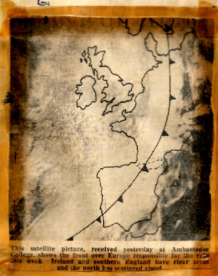
Figure 4.9.2.18: Satellite image printed in The Guardian compared with the same area of AS17-
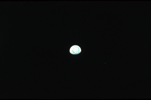
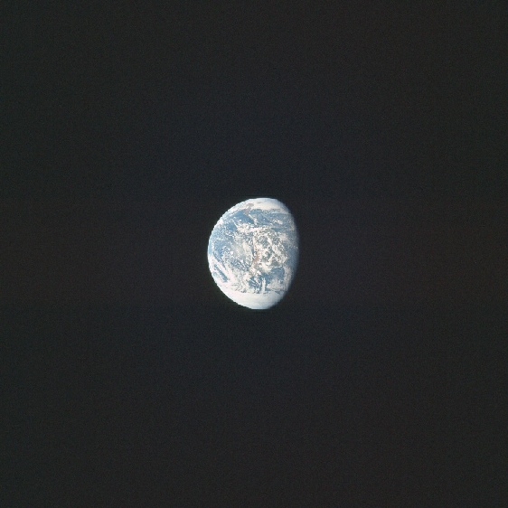
Figure 4.9.2.17: AS17-
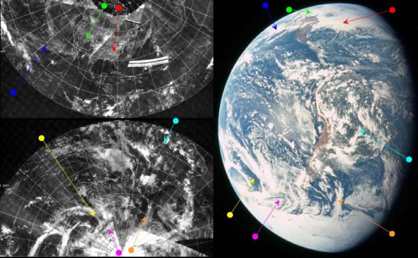
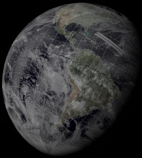
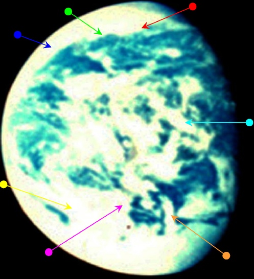
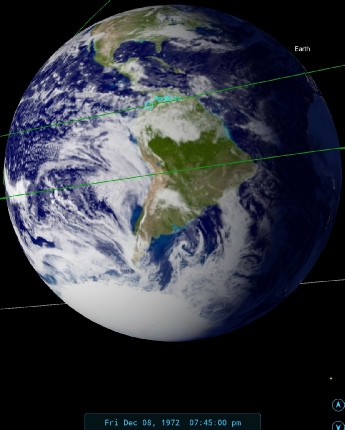
Figure 4.9.2.18: AS17-
As far as dating the image is concerned, the SkySafari depiction is again a perfect match for when Schmitt states he took the photographs, and both photographs show the same features, with the Hasselblad's superior zoom lens giving the better detail than the overexposed Nikon.
In terms of what can be seen, we may as well let Jack do the talking again. His opening statement at around 19:40 GMT is:
038:19:40 Schmitt: Okay, Gordy, going from south to north on noontime, at least our noontime weather, it looks like there is a fairly strong mass of polar air moving from the southwest up towards Tierra del Fuego. It's mixed with some cloudiness that extends from that area all the way down to the Antarctic ice shelf. But it looks like some pretty good movement patterns from the southwest, north -
The developing cyclonic system, and the frontal clouds associated with it are picked out by the magenta arrow. The cyan arrow identifies the clouds running from the east coast to central America. The clouds over Buenos Aires aren't given an arrow, but they are visible south of the system pointed out by the cyan arrow.
038:22:00 Schmitt: Except for scattered clouds, Central America and Mexico, for the most part, are clear -
His assessment of the central Americas is completely accurate, and despite the fact that the US is 'out on a limb', he makes a good job of that too. The bank of cloud stretching to Nova Scotia is identified by the red arrow, and the clear area in the centre of the USA is obvious without an arrow to find it. It is bounded to the north by a cloud mass shown by the green arrow.
Capcom are able to confirm his observations on their synoptic charts and also on a satellite image, although they are not up to date. The satellite image is probably an ATS-
038:25:11 Fullerton: No, I haven't. I was just told, Jack, that the -
Jack comments on Houston’s damp weather before casting his gaze elsewhere in the US
038:26:11 Schmitt: Okay. Well, I suspect comparable weather extends all the way across the eastern United States. That looks like awful dense clouds, although there's no obvious frontal pattern. It just stretches from the Midwest to the East Coast. And, also, there's no good indication of stratification of those clouds, as if they'd be fairly -
…
038:26:52 Schmitt: Looks like Arizona, New Mexico, and northern Sonora probably have some -
038:27:19 Schmitt: There's some transverse cloud patterns over the Mississippi-
…
038:29:11 Schmitt: Gordy, there is one minor weather disturbance, possibly just about over Puerto Rico or maybe just -
038:29:45 Fullerton: I think I see what you're talking about on the satellite picture, but I don't have a surface analysis that goes that far. I do -
So while the crew don’t have a satellite picture, what with them being on the way to the moon, th ground clearly do, but even that isn’t enough to help explain what Schmitt is relaying back to them. He continues his observations.
…
038:31:23 Schmitt: You got anything on there coming in from the northwest now, say up in Wyoming and Colorado?
038:31:38 Fullerton: The way it's drawn on this surface charts shows that -
038:32:15 Schmitt: Okay. Well, that makes sense. That would match with that -
…
038:33:04 Schmitt: Gordy, the zero-
The zero phase point is the spot of bright sunlight reflecting back off the ocean, and if you go back and check, you ‘ll see exactly what he means.
And finally we get confirmation of when he took the photographs.
038:34:05 Schmitt: And about 15 minutes ago, Gordy, I took two more Hasselblad shots of the Earth.
At around 20:15 GMT, Schmitt goes back to the southern hemisphere to describe the scene there:
038:49:04 Schmitt: Gordy, let me try to give you a description of something that is a little bit unusual than what we've been seeing. The -
…
038:50:38 Schmitt: And there just, oh, there are probably a dozen, if you tried to pull them out, cloud bands between the Ross Sea and Tierra del Fuego that bend around the same axis. Quite striking.
The Ross Sea can be found south of New Zealand, and the 'axis' he is describing is really the edge of a bank of cloud running along a rough line of latitude starting from there and ending at the northward trending cloud arrowed in purple. The cloud bands and fronts to which he refers appear to almost 'peel off' this long axial bank of cloud, then double back on themselves. His description is complex, but it does match what is there.
038:51:07 Schmitt: Now there's some indications, to me at any rate, that the jetstream in that area may be essentially east-
…
038:52:09 Schmitt: There's a linear clear area in that area north of the Ross Sea that -
…
038:52:36 Schmitt: Now that should show up real well on the 250-
..
038:55:51 Schmitt: Gordy, as you might expect, the whole coastline of Chile is -
His accuracy also extends to the absence of weather patterns over Chile and Peru (although admittedly a lack of clouds over Atacama is no great surprise).
As with previous images we also have several Landsat images to choose from, with varying degrees of usefulness. Figure 4.9.2.19 shows the areas identified on the Apollo image and Google Earth.
As you can see there aren’t many, but we’ll have a go anyway. The first area to examine is the path covering the Antarctic ocean. We’ll do this in figure 4.9.2.21, but first up 4.9.2.20 examines whether we can be sure we have the right area by looking at an extremely brightness adjusted close-
Figure 4.9.2.19: Landsat images shown on Google Earth and AS17-
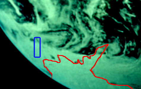
I should point out first that not all of the coastline is visible in the Apollo image, and I have used my best guess in places, but as far as I can work out I have the blue square in roughly the right place. I’ve also used the weather patterns visible in the satellite image to double check the location. You are welcome to do the same. Let’s have a look at how it compares with the actual Landsat images, together with the ones from the Mexican gulf and coast identified in figure 4.9.2.19.
Figure 4.9.2.20: Antarctic area shown in a brightness adjusted crop of AS17-


The areas covered by the single Mexican and Caribbean frames are very small on the Apollo image, and all that can really be said is that they aren’t inconsistent -
There follows quite a gap between the previous image and the next one, largely thanks to the Schmitt, the lunar module pilot, being heavily involved in checking out the LM systems, which means that the next Earth view is taken on the 9th. Click the link to see it. It’s worth pointing out here that the AFJ relies on this comment:
040:53:01 Evans: Hey, Jack, if you get a chance, take a picture back this way.
As Schmitt enters the LM to put a time of of around 22:00 to the above photos, but this would put much more of South America in darkness. It looks like Jack forgot.
Figure 4.9.2.21: Areas of AS17-