4.9.5 - Apollo 17 Day 5 - Landfall
The next photograph to be analysed is also from magazine 151, and is part of a short series taken from the CSM, showing the LM, the lunar horizon, and the Earth hanging just above it. The orientation of the home planet shows that it is an Earthrise image. The LM is still obviously attached here, and there is a later sequence of photographs showing it after separation, which tells us that it must have been taken before 17:20 GMT on the 11th, but obviously after 23:30 on the 10th, the previous Earth images in the magazine.
A time of 17:20 would put the terminator over Africa, and close inspection of this image shows that it still features that spiral storm described so vividly by Cernan. It must, therefore, be taken shortly after the previous image.
We know that AOS on Rev 3 was at 93:05, or around 00:27 on the 11th, which (given the the fact that the lunar surface is in shot) must means it was taken shortly after that. We also know the count in magazine 151:
093:59:06 Schmitt Okay, Houston. Mag Oscar Oscar is 85.
Which tells us that the three images in that Earthrise sequence were all done by then rather than a later orbit.
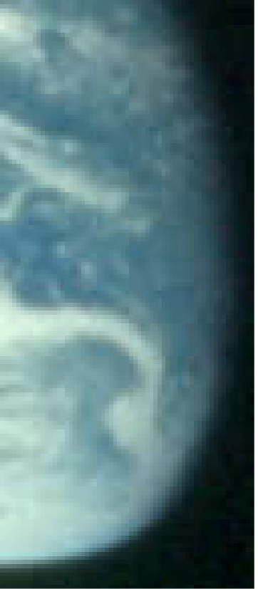
AS17-151-23188 is shown below in figure 4.9.5.1, and analysed on the next page in figure 4.9.5.2.
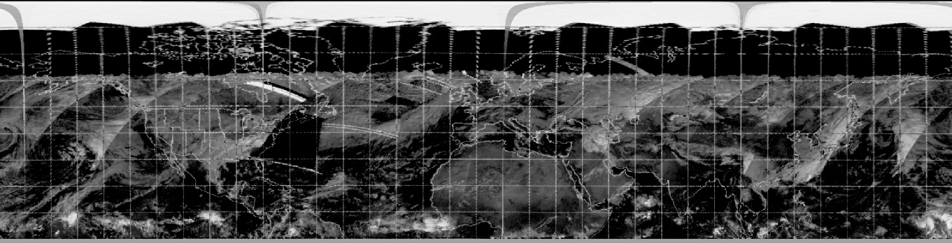
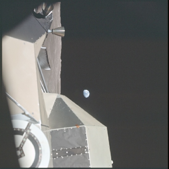
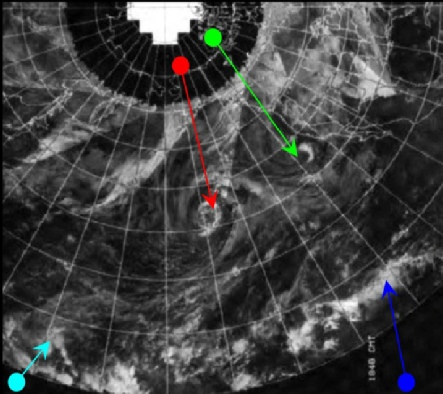
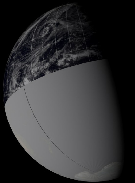
Figure 4.9.5.2: AS17-151-23188 compared with NOAA visible spectrum (left) and IR (right) mosaics, partial reconstruction, and SkySafari time depiction.
In terms of the weather systems we can see, there is little to add from the previous image, but we can remind ourselves of Cernan’s comments:
94:17 Cernan: ..here is really one heck of a big low-pressure area developing somewhere off the coast of California, Washington, or Canada, out in the Pacific north-west part of the country...we were watching it earlier today, but I tell you, now, it's really dragged in some other clouds with it. it must cover an enormous distance and it's got some real spectacular circulation."
94:18:26 Cernan We were watching it earlier today, but I tell you, now, it's really dragged in some other clouds with it. It must cover an enormous distance and it's got some real spectacular circulation.
after an interruption from Capcom, during which he confirms he is using binoculars to see this, he continues, saying that he has lost sight of the continent now, and describing a:
094:19:54 Cernan Okay, I was just going to say, it's got a - looks like a tremendous trailing front. Roughly, north-northwest, south-southeast, and it looks like it may just sweep up the western coast. It's hard to tell how far off the actual center rotation or even a front is. I just remember from earlier this morning, when I could see landmasses, that it appeared to me to be off the Pacific Northwest out in the ocean.
What is obvious is that the Earth has rotated some distance since then in a manner consistent with roughly an hour's worth of rotation. The crew had, during this orbit, gone from the higher LOI orbit to the lower descent orbit for LM separation, and thus the orbits were still relatively long.
As Cernan observed, the west coast of the US has now disappeared, and Australia is just coming into view on the western limb, which matches the time on SkySafari of 00:30 for the 11th.
NOAA's mosaics are the same ones used before, and the area will have been passed at a correspondingly later time.
We can also make first use of NIMBUS 5 data, even if it is for a very small area. The first image from the newly launched satellite was obtained from orbit 6 on the 11th, an orbit that passed along the west coast of the Americas and over SE Asia. The latter is out of sight from Apollo, but the former is just visible. Figure 4.9.5.3 shows the Fourmilab prediction of of the sunlit area of the globe at the time of the Apollo image, together with the strip from the NIMBUS 5 ESMR instrument.
Figure 4.9.5.3: Fourmilab illustration of the daylight portion of Earth at 00:30 on 11/12/72 compared with EMSR data from the same date and a portion of AS17-151-23188.
The terminator therefore, just clips the west coast of the USA, something not easily visible in the satellite image, but shows much more of the south Pacific and the tip of South America, which the satellite image does show. AS for the Apollo view,despite there being a good 12 hours between the two images, the curl of cloud off south America and the band of cloud further north can be made out easily in the Microwave Scanner view.
Short and sweet for the 11th, the next photos are actually on the surface! Click the link to see them.