4.9.11 - Apollo 17 Day 11 - EVA 4
During TEC, Ron Evans, the command module pilot, carried out an EVA to retrieve equipment from the CSM SIM bay. During that EVA, several photographs were taken that show the Earth, including the clearest view of Earth, show below in figure 4.9.11.1 (analysed in figure 4.9.11.2), AS17-152-.23395.
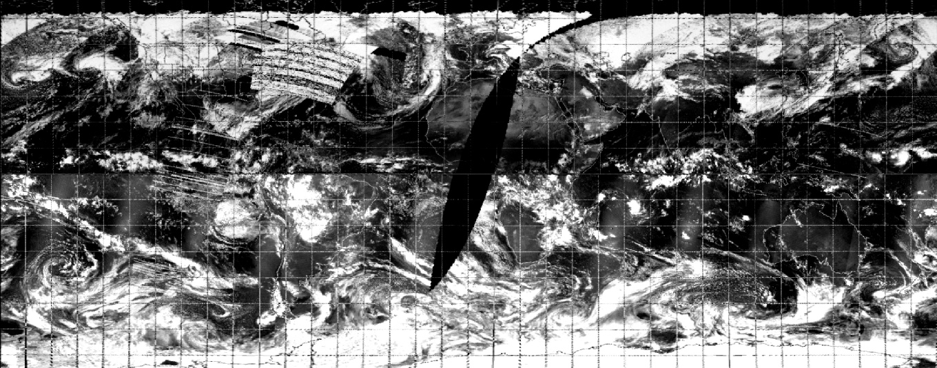
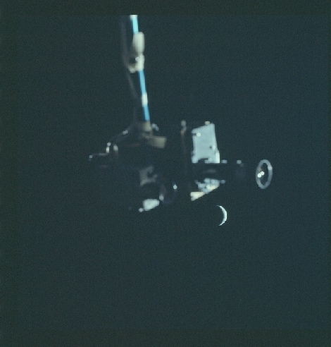
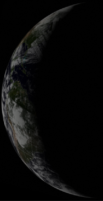
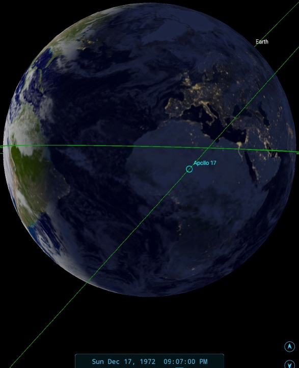
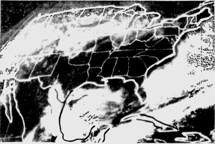
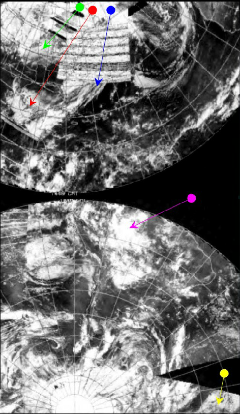

Figure 4.9.11.2: AS17-152-23395 compared with NOAA mosaic and SkySafari time depiction. Also shown is a 3D reconstruction using digitally restored NOAA data, and the NOAA image as printed in the Sarasota Herald Tribune on the 18th.
The NOAA satellite would have imaged the area around the terminator at around 13:30 GMT.
The EVA commenced at about 20:30 on the 17th, ending just over an hour later. Evans makes several references to the crescent Earth and mentions wanting to take photographs of it, but doesn't mark specifically when photographs were taken Although the photograph used (featuring one of the cameras that recorded the event) appears relatively early in the EVA sequence, a mid-point time of 21:00 has been used for the Earthview terminator estimate, which again has again been used to identify the distribution of landmasses in an increasingly thin crescent. Evans takes a moment to describe that crescent:
257:45:26 Evans (Laughter) Okay. Beautiful! Hey, the paint on here is just a - it's a silver paint - and it's just little blisters on it, is all. You just kind of peel it off with your fingers. Yes, it rolled off the other way. Hey, I can see the Moon back behind me! Beautiful! The Moon is down there to the right - full Moon - and off to the left, just outside the hatch down here, is a crescent Earth. Maybe I can get a picture of that - the Earth as I'm coming back in there. But the crescent Earth is not like a crescent Moon. It's got kind of like horns, and the horns go all the way around, and it makes almost three-quarters of a circle.
The most obvious weather pattern, and one that can definitely be identified, is the large 'tick' shaped mass in the northern hemisphere, partially obscured in the NOAA mosaic by data errors. This band, the cloud mass to the north of it, and the gap between them, are easy to pick out. The Amazonian cloud masses and south Atlantic weather bands are also simple to locate once the correct orientation of the land masses at the time of the EVA is determined.
At the end of this magazine come the final pictures of Earth. There are half a dozen of them, seemingly in sets of 4 and 2, and they follow a number of photographs of the moon. Close inspection suggests that the first 4 were taken about an hour before the last 2, and this will hopefully be demonstrated by the following. Interpretation is difficult for these remaining shots in that it’s difficult to make out any land features with any certainty, there are no references at all in the transcripts, the satellite record is somewhat patchy, and while we are still using the view from the moon as a reference point the crew are now nearer Earth than their lunar embarkation point, so the width of the crescent is not necessarily as reliable as it was when it comes to determining the date of the photograph.
The final Earth images, probably taken over the course of the remainder of the mission, are analysed on the next page.