4.9.6 - Apollo 17 Day 6 - Flag day
The next image of Earth, at least in a time-based series, that we can use for analysis turns out to be in magazine 134. This magazine went to the lunar surface, and starts with the first EVA after the extraction of the LRV and the erection of the flag. This latter event is recorded as being at 01:13 on December 12th 1972.
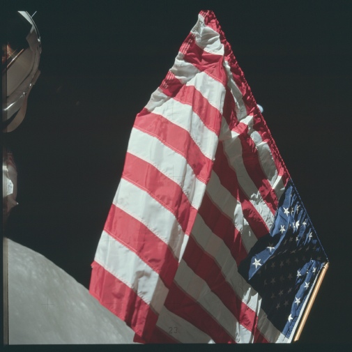
The first image showing Earth on this magazine is after flag deployment, which gives us a start marker for the event, and is part of a short series of pictures showing astronauts in close up with the flag. Two of those images feature the flag, and the 2nd one of these, AS17-134-20387 is used here. This image is shown below in figure 4.9.6.1, and analysed in figure 4.9.6.2.
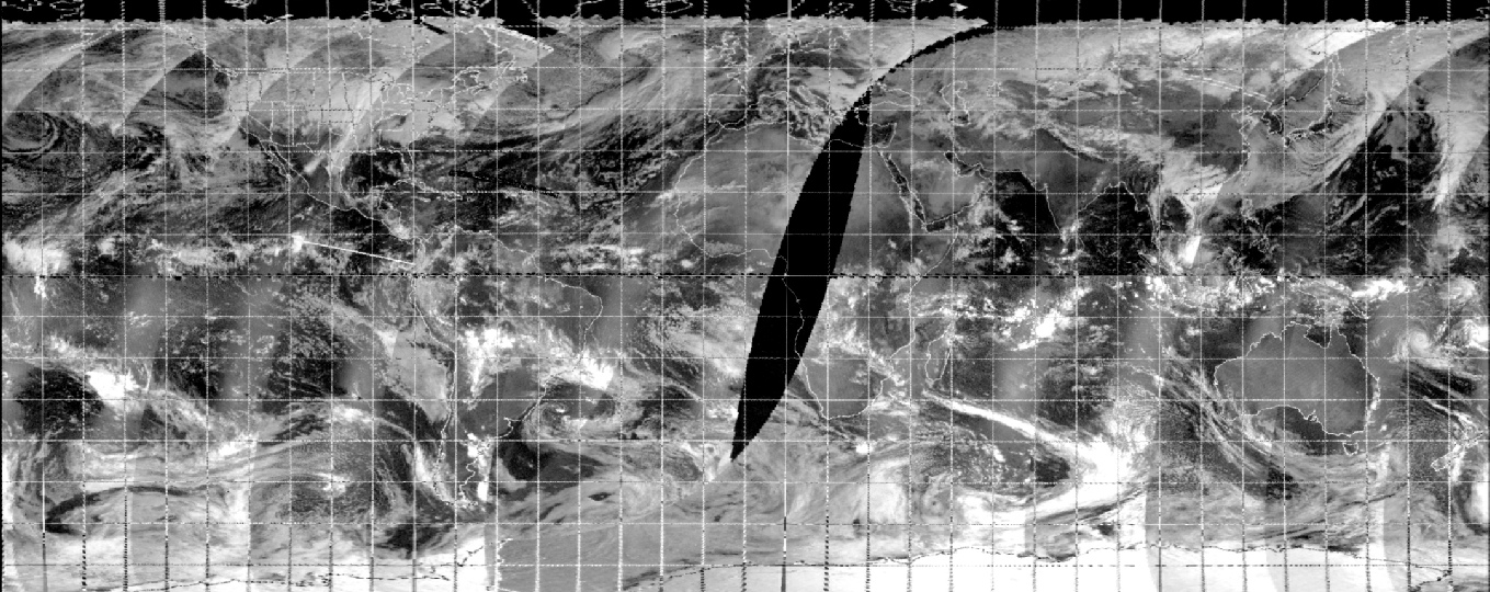
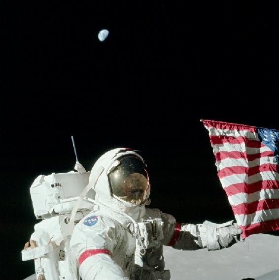
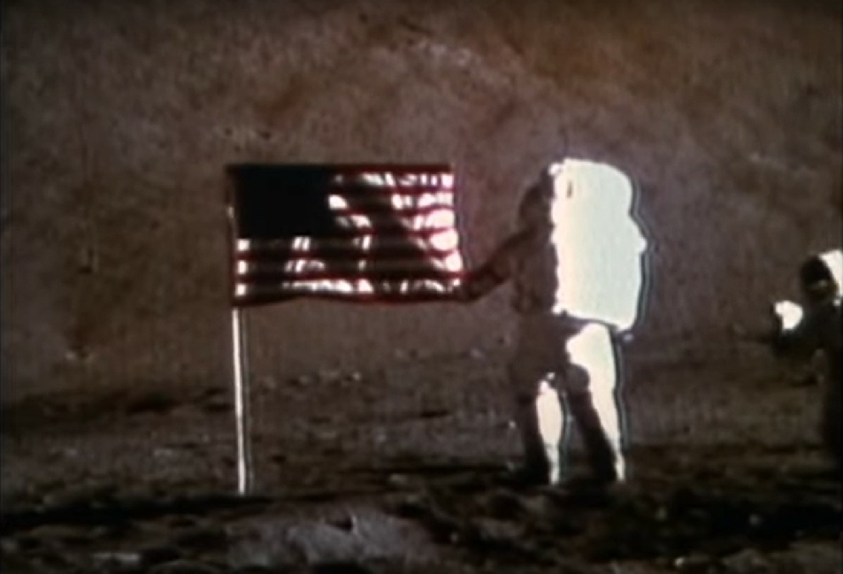
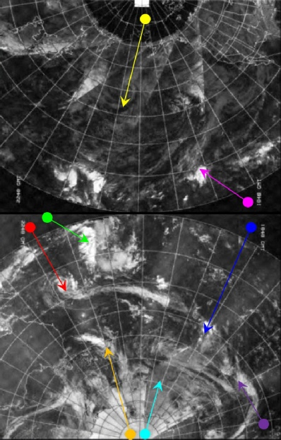
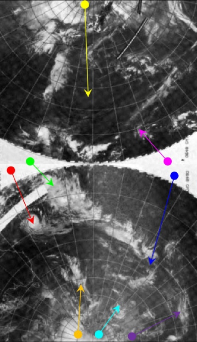
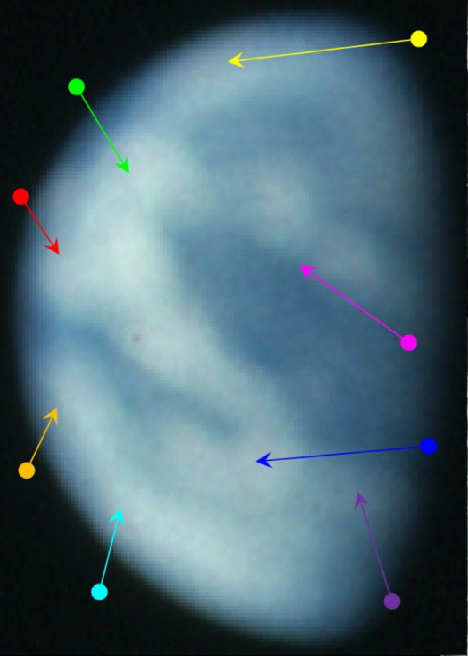
Figure 4.9.6.2: AS17-134-20387 compared with NOAA IR (top left) and visible spectrum (bottom left) mosaics, and SkySafari depiction of time. Partial 3D reconstruction to far left using digitally restored NOAA data. Below: Diana from a NASA report (Source)
Both NOAA mosaics covering this time have been included here (the IR one actually dated the 12th), as the IR one has a better definition of the visible features. The passes over the terminator line are given as roughly 08:00 and 20:00 GMT on the 12th for the infra-red and visible respectively. The visible spectrum image is dated the 11th as this is closer to the Apollo photograph’s time.
Recording the time of the image requires a little deductive work, as the image is not clear. The main cloud feature dominating the image is the one starting at the equator in the west (green arrow), heads roughly eastwards before looping back on itself in a kind of letter mirrored 'C' formation (blue arrow). The terminator falls some way east of this inverted C.
The location of the blue arrow on the NOAA mosaics suggests that the terminator is perhaps another 20 degrees of longitude to the east. The western end of this long band of cloud meets up with tropical storm Diana (red arrow), now east of Australia. Close examination of the image shows that blue sea is just visible beyond Diana, which suggests that Australia is only just coming into view. This would suggest a time for the photograph of around 01:00 – 01:30 GMT.
The ALSJ gives a specific time for this image as 118:26, which is almost 04:00 GMT. If this were the case, then Australia would be clearly visible. The timeline that has been used so far, however, says that at 04:00 Cernan and Schmitt would have just completed installing the lunar seismic experiment equipment at the ALSEP, not at the flag. The most obvious answer is that the ALSJ is using GET, which is 2 hours 40 ahead of the timeline and transcripts. If this time difference is removed from the ALSJ time, we get a time of 01:20 GMT, putting the astronauts exactly where the photograph says they should be (at the flag) and the Earth's features exactly as they should be.
This article in ‘Designs’ claims that my interpretation is incorrect, stating that:
“We believe that the above explanation has nothing to do with GMT, or local time for that matter, since the ALSJ GET time of 118:26 simply indicates 118:26 h from lift off (ie the start of the mission), irrespective of the time system used. We believe that a better explanation is the following: one can assume that the Earth image was staged before the start of the mission 118:26 GET [sic]. Hence the “planned” image of the Earth would be 2 h and 40 min behind the actual time and could not correspond to the correct view.”
What they conveniently ignore is that the satellite images could not have been staged in advance, despite their claims that ‘professionals’ could have, and that the astronauts broadcast the taking of these photos on live TV. That broadcast also shows them bending their knees to get the shot, something else the authors failed to notice. In ‘Apollo: the definitive sourcebook’, in the actual mission transcripts, and in the timeline given by NASA here, the launch delay has been accounted for and their timing agrees with mine.
They also state that NASA have never officially commented on the photo’s authenticity, and that by referring to this study they accept my arguments. Firstly, the ALSJ is hosted by NASA, not run by it. Secondly, they have no need to comment on its authenticity, as they know it’s genuine and taken on the moon. Hilariously, the journal that hosted this article have retracted it, saying that:
“Serious concerns were brought to the attention of the publisher. The article was re-examined, revealing that the complaints were valid and that the article does not meet the standards of editorial and scientific soundness for Designs.”
Well done to whoever complained, and bravo to the journal for retracting it.
The real clincher, however, and one that hoaxtards usually forget, is that the whole thing was broadcast on live TV - even if few people were watching, journalists were.
Figure 4.9.6.3 shows the moment the image was captured:
Figure 4.9.6.4: Cernan captures Schmitt and the Earth in the TV broadcast.
Cernan even makes it clear that’s what he’s doing:
118:25:46 Cernan Well, I want to get something here.
118:25:49 Schmitt What's that?
118:25:50 Cernan I want to get the Earth.
And just to prove it was witnessed by journalists, here’s a front page (figure 4.9.6.5).
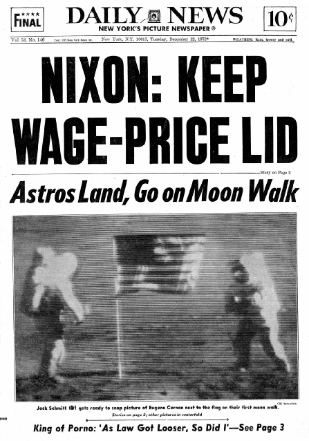
Figure 4.9.6.5: Daily News front page showing the flag ceremony.
The highest resolution scan (on the left (shows none of blockiness of the low resolution one on the right that people often take to be signs that it has been “photoshopped” in. The fact that copies exist from immediately after the mission (like my own one here), proves it hasn’t been photoshopped. The fact that Earth’s weather matches the satellite record shows it’s genuine.
We can also double check what should be on show by looking at the ephemeris values listed in the introduction either side of the photograph time.
1972-Dec-12 01:00 *i 240.663822 45.068425 234.055833 -8.459035
1972-Dec-12 02:00 *i 240.621968 45.028441 219.506797 -8.239681
Let’s see how that compares with predictions from Stellarium and Fourmilab (figure 4.9.6.8).
Some hoax believing idiots make some other very stupid claims about the sequence of flag images.
One claim is that the Earth in AS17-134-20384 shows the terminator at the wrong angle. This merely displays the conspiracy theorists typical inability to think in three dimensions, or appreciate the contortions and camera twisting that was involved in taking the photo. Figure 4.9.6.6 shows that photo, together with the one immediately before it in the magazine.
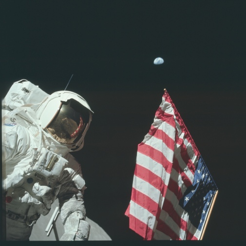
While there is some of the South Massif included in the ‘contentious’ photograph, there is much more in the preceding one, clearly demonstrating that the camera is at an angle, something easily seen in the TV broadcast.
The other claim frequently made about AS17-134-20384 is that Earth has been ‘Photoshopped’ into the image. This claim largely results from the people making it not understanding how jpeg compression works, and also not understanding that it has been freely available for many years before Photoshop was actually a thing (see figure 4.9.6.7).
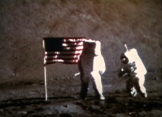
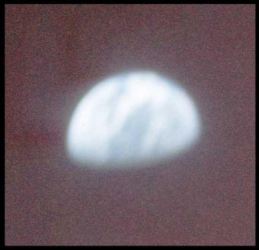
Figure 4.9.6.7: Level adjusted Earth from AS17-134-20384, from March to the Moon, and low resolution jpg from ALSJ

Figure 4.9.6.8: Stellarium and Fourmilab views of Earth at the suggested photography time.
As usual, there is nothing inconsistent about the timelines, the photography itself, or the images of Earth in them. See this page for a far too lengthy discussion about the Earth’s azimuth and elevation by someone prepared to die on a hill to whom the location of it seems a mystery.
Next up, day 7!

