4.9.4 -
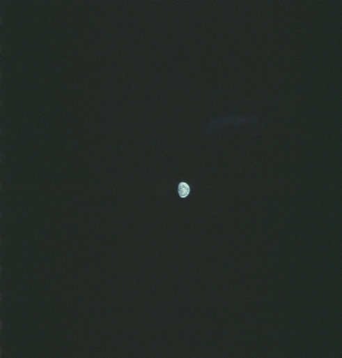
The next view of Earth is again from magazine 148, and again there is much narrative description of the view they have as the image is being taken by Cernan and Schmitt. The photograph in question is AS17-
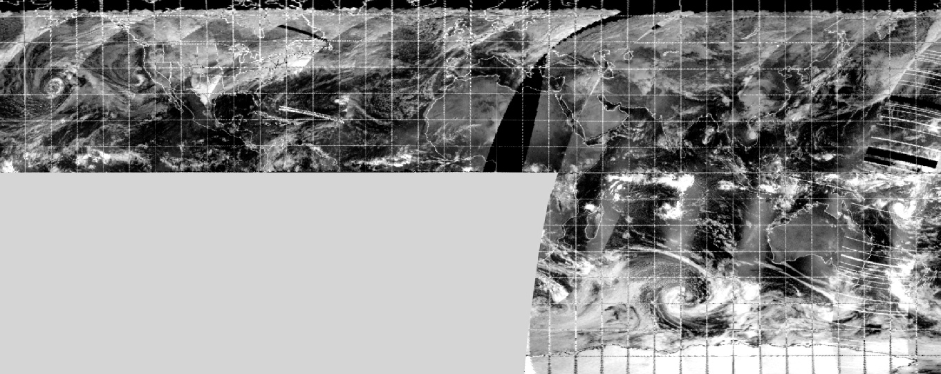
Figure 4.9.4.1: AS17-
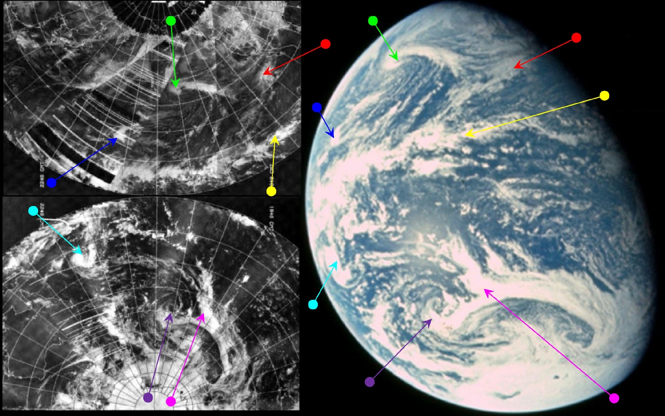
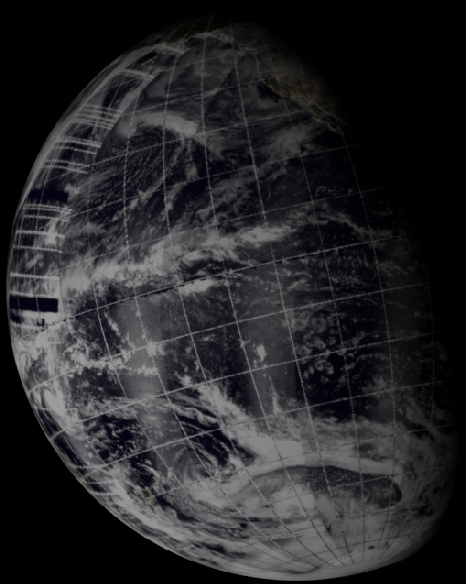
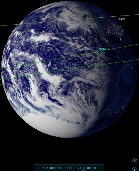
Figure 4.9.4.2: AS17-
The absence of South America but the persistence of the 'mushroom cloud' shows that this image was taken not long after the previous one, and therefore the NOAA mosaic is still the one dated the 9th of December. There is a sliver of Australia just visible. The similarities between the Apollo photograph and the NOAA mosaics are still obvious, and the reader should, as usual, have no problem identifying any particular cloud from Apollo in the NOAA image. The time markers on the mosaic suggest that the area around the terminator was scanned at around 17:00 GMT on the 9th.
As far as the crew's observations are concerned, obsdrvations mae at the ned of the previous day obviouslyt still apply. The 'fir tree' analogy they use describes the cloud formation identified here by the green arrow, and is perhaps easier to understand if the globe is viewed from the same angle as astronauts were seeing it. The strong cyclonic pattern he describes is where the green arrow head is.
Capcom are able to find (after first misunderstanding Jack's description of the location) on the satellite image they have available, and also on their synoptic charts. The term actually used is “from one of our satellites”, which is an indication that other satellite images may be available in addition to the ATS ones.
Jack gives us more details on this cloud formation at around 00:30 GMT on the 10th:
069:37:17 Schmitt: Bob, that line of clouds I called a fir tree pattern that swings up towards Hawaii -
The use of the word 'up' needs again to be taken in the context of the upside-
Schmitt doesn't mention at the time when he took the picture of the scene he is describing, but he does mention it sometime later. He was describing the view just after completing an experiment designed to explore what was believed to be the influence of cosmic rays on the crew – the widely reported phenomenon of 'light flashes' seen on the retinas while they had eyes closed or blindfolded ready for sleep. He says, at c. 02:15 GMT
071:24:33 Schmitt: Say, Bob, I took another picture of the Earth and forgot to give you the GET on it. That was about 15 minutes before the end of the ALFMED experiment, if you can go back that way.
The light flash experiment ended at 00:12 GMT, which supports the SkySafari depiction of midnight for the time of the image.
Once again we have a Landsat pass available to us, on this occasion crossing the Antarctic, see figure 4.4.10.3.
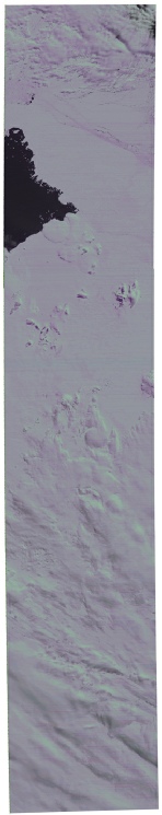
In the absence of visible landmasses we first need to verify whether we are looking at the right locations, and we can do this by double checking the weather features in the satellite image. The easternmost Antarctic image starts along the 105 degrees west line of longitude, with the clear patch of ocean visible at around 110 degrees. Close examination of the NOAA-
The other area, just off the Antarctic coast, can be found by looking for the arc of cloud covering New Zealand that then extends to the Danfell peninsula. There is clear ocean visible around the Antimeridian, and the Landsat pass covers the area north-
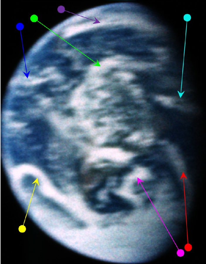
The next image of Earth in magazine 148 is one of a pair showing Australia taking more centre stage. Image AS17-


Figure 4.9.10.3: Landsat passes shown on Google Earth (bottom left) and AS17-
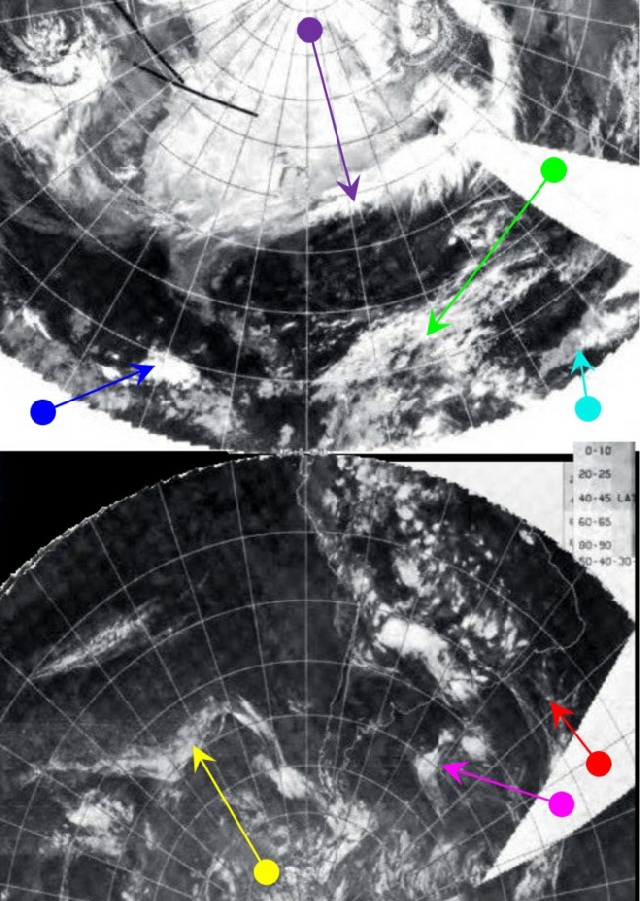
The NOAA image from that the 9th does have quality issues for a large part of the Pacific and Australasia, but the underlying cloud pattern is still visible. A rough guideline for the time the terminator region was scanned would by 21:00 on the 9th. The cloud patterns visible can be found easily on both NOAA mosaic and Apollo image, and some features (notably the clouds identified in figure 4.9.33 by the blue arrow). The storm system shown by the cyan arrow in figure 4.9.4.2 is identified by a green arrow in figure 4.9.4.5, and the front shown by the red arrow in figure 4.9.4.5 appears to the east of the system identified by the purple arrow in figure 4.9.4.2. An estimate of 04:00 has been given as the time of the Apollo image.
There is therefore, as usual, an obvious continuity between the images.
The crew's description of the view begins some time before the suggested time of the photograph, with Schmitt beginning his narrative at c. 01:05 GMT:
070:13:12 Schmitt: Okay, Bob, I'll get to that camera in just a second. The coast of Australia is starting to come into view. Still looks pretty clear. We'll give you more on that later, probably. That cyclone I talked about yesterday in the vicinity, I believe, of the Solomon islands, looks even better organized than yesterday. It's really tightening up. Starting to look very bright and dense right in the core, not too dissimilar from Therese. Although it has a little broader extent in the southeast quadrant.
070:13:56 Overmyer: Roger, Jack. Trying to match that up in my prog here. I can't find it.
070:14:05 Schmitt: Well, you didn't have it there yesterday either. It certainly looks like a tight little storm now though.
The Solomon Islands are in the region of the large cloud mass identified by the green arrow, and after Capcom state their difficulties finding it, he confirms that it is the system he began to describe before he was so rudely interrupted to be the tedious business of organising preparations for LOI.
070:14:31 Schmitt: Well, I'll try to give it to you a little better later. It's the one I was talking about yesterday as being in the vicinity of the Solomon islands. That's somewhat east-
Although the photograph analysed shows Australia very obviously in view, anyone with SkySafari (other astronomy software is available) can easily confirm that it would be appearing on the western limb at around 01:00 GMT.
Capcom are then able to find the storm:
070:15:17 Overmyer: Oh. Roger. I've -
070:15:39 Schmitt: Well, there is a lot of cloudiness in the equatorial regions, the intertropical convergence zone in there. This is south of that, sort of on a -
As usual, the ground personnel have access to satellite images, but they are relatively out of date, and as usual Schmitt’s account is completely accurate.
At c. .01:30 GMT, they resume their discussions:
070:30:42 Schmitt: Okay; that storm I'm talking about -
070:31:02 Overmyer: Yes, that kind of matches up, Jack. Does it look like New Guinea and that is pretty well clobbered?
070:31:11 Schmitt: No, not really. New Guinea is at the western edge of a cloud zone that is part of that inter-
070:32:03 Overmyer: Roger.
070:32:07 Schmitt: It's getting very tightly wound in the -
070:32:40 Overmyer: Roger. We understand, Jack. [Long pause.]
070:33:17 Schmitt: Our zero-
070:34:15 Schmitt: Okay -
He correctly picks out the location of Papua New Guinea and the ITCZ cloud under which it is hiding. The Solomon Islands weather is below that cloud, and the storm itself is probably Tropical cyclone Diana, described in this link: Australia Severe Weather. The storm track shown in the link suggests it was around from the 6th and persisted throughout most of the mission. Unfortunately no other information seems to be available about this storm.
The line of clouds he mentions running towards Hawaii is likely to be the one identified by the cyan arrow, and again Capcom confirms that they are visible on a satellite photograph.
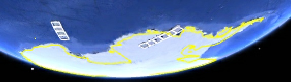
We then get some commentary about the Ross Ice sheet:
070:49:49 Schmitt: Okay, I mentioned earlier, I can't remember exactly when, that it looked like the wa -
070:50:28 Overmyer: Roger. Must be getting towards summertime down there.
070:50:33 Schmitt: Well, I'm very surprised that it's changed shape as much as that, and it could be that that triangular pattern was caused by a cloud bank that split what is now open water and made it look as if it was icepack.
The area in question is identified by the black arrow.
At 68:48 MET (c. 02:20 GMT), after some discussion on the sub-
071:28:33 Schmitt: Roger. That weak front that I talked about south of Australia yesterday has moved north, but it looks considerably weaker than it did yesterday even. Just a very thin line of clouds -
This particular one is the system identified by the magenta arrow in figure 4.9.3.4, and it has evidently got much thinner since that photograph was taken, although it is not quite touching land just yet. Capcom again point out the shortcomings of the data they have available to them in response to this:
071:31:32 Overmyer: Okay. That -
Thus confirming earlier suggestions that the ground personnel would have information relevant to their part in the mission, rather than global data ready to cover any point the Apollo crew may wish to discuss. Capcom's role was not to prompt the crew to describe what they could already see on the ground, it was to have information about the launch and re-
Jack's response to this is:
071:31:49 Schmitt: Okay. Well, it -
and he is therefore describing the much larger cloud formations shown by the magenta arrow in the current image.
He then returns, at 68:53 MET, to tropical cyclone Diana:
071:33:58 Schmitt: Bob, Ron got you all -
New Zealand is nestling in the arc of cloud shown by (and just to the east of) the red arrow,. It requires some zooming in to see that, and this is something Jack is able to do using the sextant, which he describes as a fine instrument, and better than the binoculars he has also been using.
We then get detailed discussion around Hawaii:
071:42:02 Schmitt: I was going to say, using your terminator time as a partial -
That cloud system is to the east of the cyan arrow itself.
Moving on:
071:42:50 Schmitt: Also, that major front we talked about last night as being east and south of Japan has progressed even farther and is, oh, maybe 20 degrees longitude -
It's not immediately obvious which front he is referring to, but in the vantage point of the image Japan is on the north northern part of the horizon, while Hawaii is in darkness over to the east in the photograph. This makes it likely that he is describing the cyan arrowed band of relatively thin cloud stretching horizontally (as portrayed in the preceding figure) across the northern quarter of the photograph.
Capcom confirm that this is shown on the satellite photograph and charts, before Jack briefly describes the clear sky over Australia.
071:45:08 Schmitt: Australia in general is still very clear except in the northeastern portions where it looks like they have got scattered clouds; but it looks like a pretty night -
Again, he’s exactly right and those scattered clouds are clearly visible.
At around 03:15 GMT, after suggesting he may not have got the position of Hawaii correct, Jack makes an interesting comment:
071:54:59 Schmitt: I hope you're going to save all those charts you're gathering together as we talk about it on this outbound leg. Be interesting to compare them and the pictures we take sometime in January.
Capcom confirm that the 'weather people' are very keen to do just that, and it would be really interesting to know if this meeting and its results are recorded anywhere.
As a brief aside, Schmitt does give some insight into his meteorological interest in an oral history interview that many astronauts gave many years after the missions, available on this website Oral history.
He describes his fascination with the changing views of Earth as it receded, and then he is asked how he it arose that he took on the role of meteorologist for the mission. He describes his childhood interest in the subject before going on to say:
“as I approached the launch, I started talking with the Air Force meteorologist at the air base that supported the launches down in Florida {Patrick Air Force Base}...They got interested in this, and so just as I suited up, one of my friends with that group brought in the latest satellite pictures that covered the Earth, that gave me the whole southern hemisphere of the Earth. So I had those in my pocket as we went out to the launch pad.
I had planned, and we had talked about it, that in my spare time on the three and a half days to the Moon I would try to build on those, what those satellites pictures showed, primitive as they were, and try to experiment with how well could I forecast the weather, because the Earth in what we called a lunar reference trajectory, we would see the Earth turn every twenty-
Of course, we were getting farther and farther away and the Earth was changing from full to about two-
Interestingly enough, somebody just recently has contacted me and they want to put together a journal of that particular phase of the mission, which is not in the [ALSJ]... So I think we're going to see a Web-
Well, Jack, it certainly has been of very great interest! It's useful to know that he did have some satellite photographs with him – he evidently had something to work with from the start, but it's also informative that he says quite clearly that those images were primitive. It's also useful to know that he only had images of the southern hemisphere, which of course is the only part he would be able to see at the outset of the mission.
He confirms this story in his diary of the mission, which he has started to publish here. He has this to say:
“As most pilots in the modern era, we received our last weather update before flight from the Air Force meteorology team from Patrick Air Force Base. They not only covered the launch area weather but also the several abort landing areas around the world. In addition, these gentlemen delivered copies of the latest geosynchronous weather satellite photographs that I had requested a few days earlier. I wanted to carry these near-
He also mentions in this video that he specifically wanted to monitor the changes in the weather over time, and his photos were a way of recording his accuracy in predicting what would happen.
Returning now to the Apollo 17 mission; as with the previous image, Jack doesn't record immediately when he took the image we have just discussed, but after a rest period the following day at c.13:15 GMT Cernan says that:
082:24:49 …just completed two pictures of the Earth about 5 Minutes ago. And there's one that I did not report late yesterday at about 72:30 GET. A set of two pictures of the Earth.
We need to remember here that this time is actually 2 hours and 40 minutes later than the actual time of the photograph, so this would convert to an MET (as used here) of 69:50, or around 03:30 GMT. Putting that time in to SkySafari, however, gives too narrow a gap between Australia and the western limb, so my suggestion is that he has misremembered that, and the actual time was around 73:10 MET, or roughly 04:00.
This quote also provides a useful reference point for the next image to examine in magazine 148, AS17-
Figure 4.9.4.5: AS17-
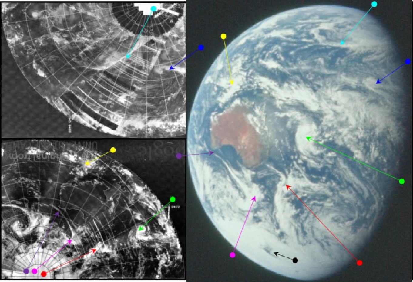
Figure 4.9.4.6: AS17-
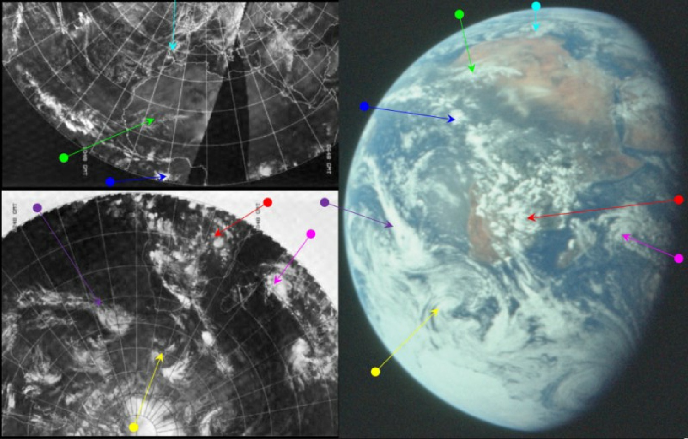
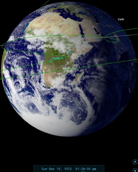
Figure 4.9.4.7: AS17-
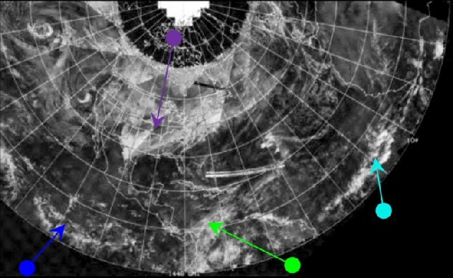
As this image features the whole of Africa, and therefore the dividing line for the start and end of new satellite mosaics, there will be the same issues of interpretation as previous images of Africa. The analysis of that image, containing the NOAA mosaic, can be seen in figure 4.9.4.7.
It's fairly easy to tell where the join is between the start and end of the mosaic started on the 10th, and the estimated time that NOAA would have scanned the terminator is around 07:00 on the 10th. The 3D model is built from two days’ worth of images.
We may as well see what Jack has to say about the view, seeing as we know he will have done. He starts at around 12:30 GMT with this:
081:40:02 Schmitt: I'm not sure we're ready to talk yet, Bob, but I just thought you'd like to know we got a pretty spectacular view of -
So far so accurate, there is indeed more of Europe on display than in previous views of this type, certainly in comparison with the classic 'Blue Marble' image, although his inability to see Spain may be more influenced by the cloud over it than its position on the horizon.
It's after this initial comment that he records taking his two pictures of Earth mentioned earlier, and these are the last two on this magazine before the landing, and only one more image of Earth is recorded on it during TEC.
As far as the rest of the weather conditions are concerned, he continues just before 13:30 GMT with:
082:37:13 Schmitt: Bob, although we're getting close to concentrating our attention on the Moon, it doesn't decrease the interest in looking back at the patterns of activity we can see on the Earth. That storm I talked about yesterday that was in North Africa, looks like it has left that area and has moved in -
082:38:02 Parker: Okay; copy that, Jack.
082:38:03 Schmitt: It does not look very well organized, but -
082:38:17 Parker: Okay.
082:38:18 Schmitt: The storm I guessed yesterday -
The initial description is correct, and the storm over north Africa has gone, but it may have moved north as there are just visible circular bands of cloud on the horizon and on the satellite image, picked out by the cyan arrow over the Iberian peninsula (he has now realised he can see Spain). Storm south of the Cape (yellow arrow) that started to the south-
The depression he describes north-
An hour later, Jack has more to say, this time about the southern Africa and the South Atlantic:
083:35:00 Schmitt: Gordy, it looks like the cloudiness and possibly the showers associated with the intertropical convergence over Africa are moving as far south as Johannesburg right now. It's quite a distinct change from even an -
and 15 minutes later still we get back on the Antarctic:
083:48:46 Schmitt: Gordy, for some reason, it's a lot easier to tell the difference between the Antarctic Continent and the icepack.
083:49:00 Fullerton: Roger.
083:49:07 Schmitt: Maybe the glancing Sun is picking up the breaks in the icepack and giving it a different appearance.
083:49:18 Fullerton: Roger. [Long pause.]
083:49:33 Schmitt: The continent itself -
083:50:05 Fullerton: Copy. [Long pause.]
083:50:21 Schmitt: And except, maybe, for the area just -
083:50:53 Fullerton: Roger.
083:50:56 Schmitt: I know we don't have many listeners in Antarctica, but it looks like they're having a -
083:51:13 Fullerton: Roger.
083:51:20 Schmitt: That weak front I mentioned in the South Atlantic stretches from the apparent storm center around Goa island -
083:51:50 Fullerton: Roger. [Pause.]
083:51:57 Schmitt: Our sub -
The words 'Goa Island' have been taken directly from the transcript, but Jack clearly means 'Gough Island', which is in the South Atlantic (not Goa Island off Mozambique) – he does say that he is unsure of its pronunciation. It is, at least, in the correct place as the starting point for the large band of cloud marked by the purple arrow.
His noting of the ability to differentiate between ice pack and snowbound landmass in Antarctica is also borne out by the photograph.
We again have Landsat paths over two sections of Africa -
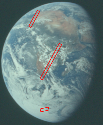
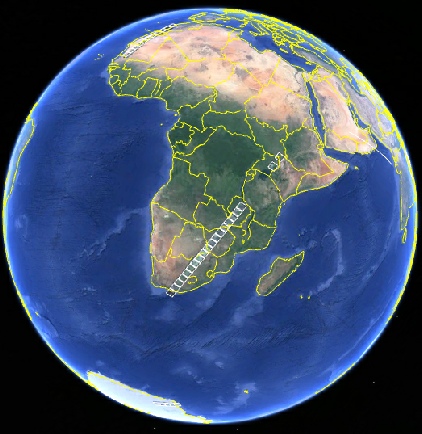

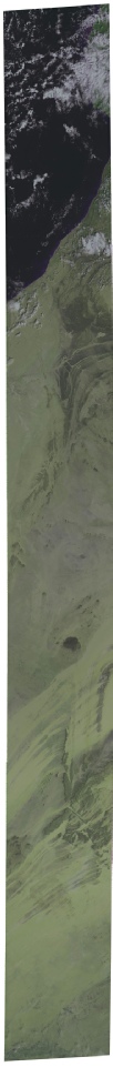


Figure 4.9.4.8: Landsat paths shown on Google Earth (bottom left) and AS17-
For the southern African view I’ve decided not to bother with the two outlier frames in the north, it makes the images less detailed when presented here. That southern Africa pass was captured between 07:31 and 07:39, compared with 13:15 for the Apollo image. Despite the time gap we still have some broad matches -
Returning to the Apollo images, at 3 days 10 hours 7 minutes, we have a mention of an additional source, namely the movie footage, with film taken through an adaptor intended for stellar viewing:
084:47:19 Evans: Okay, Houston. At 84:45, we've got about 2½ to 3 Minutes at 1 frame a second on mag Bravo Bravo, through the sextant adapter of the Earth.
Which converts to 15:40 GMT.
In the 16mm footage, we have this brief glimpse of Earth shown in figure 4.9.4.9, obviously shot through an eyepiece. If we compare that view with what we should see of Earth using SkySafari it’s pretty obvious that this is the footage to which he is referring. Little has changed in terms of the visible weather systems, hence no satellite comparison.
Figure 4.9.4.9: 16mm video still compared with satellite reconstruction and SkySafari time depiction
Even without the satellite photographs in attendance, it should be self-
90 minutes after this last observation, magazine NN, ore number 148, is stowed away for the time being, and we will move onto other magazines, at least until the journey home.
The next image viewed is from magazine 149. This magazine evidently stayed on board the CSM during the mission as it contains pictures of a returning LM. The photograph in question is AS17-
Figure 4.9.4.10: AS17-
The first point to make about the satellite comparison is that southern hemisphere data for the mosaic in the visible spectrum are missing. In order to compensate for this, the mosaics for the IR spectrum are included. By and large, these show the same cloud patterns as the visible one, but it should be remembered that colder clouds will not show as well as warmer ones, and warm air masses will also be included in the image. IR scans are done during the dark parts of the NOAA orbit, and therefore have different time values to the daytime visible spectrum passes. The terminator position is estimated as being at around 19:00 using Stellarium, and the time at terminator on the NOAA mosaics is roughly 23:00 on the IR spectrum and 11:00 for the visible, however the bulk of the image was taken in the early hours of the 11th.
It will also be fairly obvious that the Apollo image is not of the best quality, and has been affected by camera shake.
For once, the time of the Apollo image isn't recorded directly, but despite the mission entering one of its most intense periods of activity (LOI), Schmitt still finds time to give a casual observation:
088:13:51 Cernan: And just to round out things as we pitch back into LOI attitude, lo and behold from over the top of the LM came the Earth.
088:14:05 Fullerton: Very good.
088:14:09 Cernan: Got the whole thing in one big package. [Long pause.]
088:15:13 Cernan: Pretty interesting, Gordo. We can -
He makes this observation at 85:35 MET, or just after 19:10 GMT.
Although the image quality is not the best, it is still evident that south America is central to the image, and the Gulf coast is clear below the prominent front picked out by the blue arrow. This cloud band for this front is visible north of the Gulf coast in both the IR and visible spectra.
The other weather systems on the Apollo image are also relatively easy to pick out, particularly the long band heading north west from the tip of south America that eventually loops back downwards, seemingly towards the Antarctic (yellow arrow). On the opposite side of south America there is another well-
The northern hemisphere's feature picked out by the blue arrow is a twin pronged thin band of cloud that is likely to appear in a subsequent image, hence its being identified in this one.
It's also interesting to compare this image with one from magazine 154, AS17-
Figure 4.9.4.11: AS17-
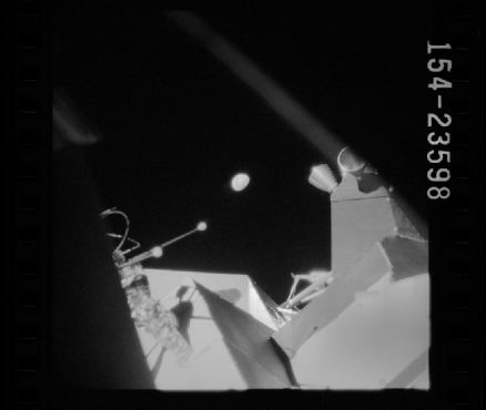
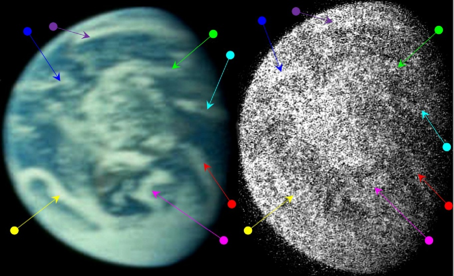
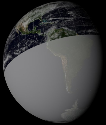
Figure 4.9.4.12: AS17-
The first is the Earth seen over the lunar module, and the reader's attention is drawn to Harrison's previous statement about the Earth appearing over the top of the LM. The remaining clues are to be found earlier in the mission transcript from the time of the previous photograph used here, and the magazine as a whole. This photograph occurs after several images of a crescent moon as seen through windows suffering greatly from glare from the sun.
The nature of the mission trajectory meant that for most of the flight, the Moon was not actually visible as the sun was behind it. Only when it finally got to the lunar surface did the lit part of the surface come into view, initially described as
“a sliver of a sliver”
and gradually becoming larger.
At the same time, the crew made numerous references to the glare from the sun, and how difficult it is to see through it (even suggesting that they shut the blinds at one point). Capcom also help them orient themselves, pointing out that if the crescent is at the bottom of their field of view, then north is on the right, and this is how the moon appears in the photographs at the beginning of the magazine..
With some processing, we can also just about make out the same weather patterns identified in figure 4.9.4.11
On a general point, it should be clear that the size of the visible Earth, and the curvature of the terminator, is the same as that of the colour image, suggesting again that it was taken at the same point in the mission. While the black and white photograph lacks the fine detail of the colour one, the broad patterns of weather fronts are still discernible. The most obvious reference point is the long swirl of cloud (yellow arrow) extending into the South Pacific from Tierra del Fuego, below which is a mass of cloud associated with the Antarctic ice cap. The curl of cloud extending from the southern Atlantic and eventually crossing into central South America (magenta arrow) is also noticeable, as is the relatively clear area between this front and the yellow arrowed cloud mentioned above.
The lighter cloud covering most of the Amazon basin is also identifiable, and it can be seen that the shade of grey on the black and white image is much less intense than the sharp white of the more solid cloud cover over Antarctica.
The cyan arrow identifies the same band of cloud across the north Atlantic.
These general features do appear to suggest, when viewed in the context of the mission transcript, that the black & white image was taken at roughly the same time as the colour one. It’s also interesting to consider that an image buried on a photograph sharing website and not previously publicly available on the internet still manages to reveal the same weather details, and that those details match the satellite images of the day.
It’s also worth throwing into the mix a satellite image shown in a weather forecast on December 10th 1972 (see here for more on that) -
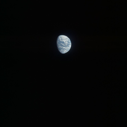
Figure 4.9.4.14: AS17-
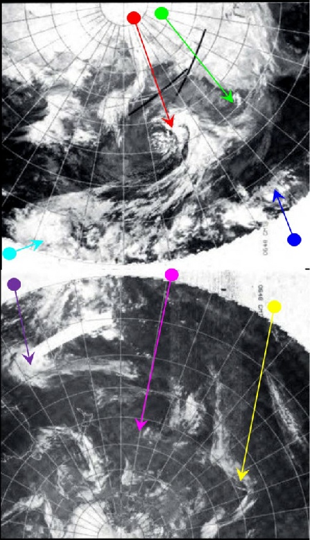
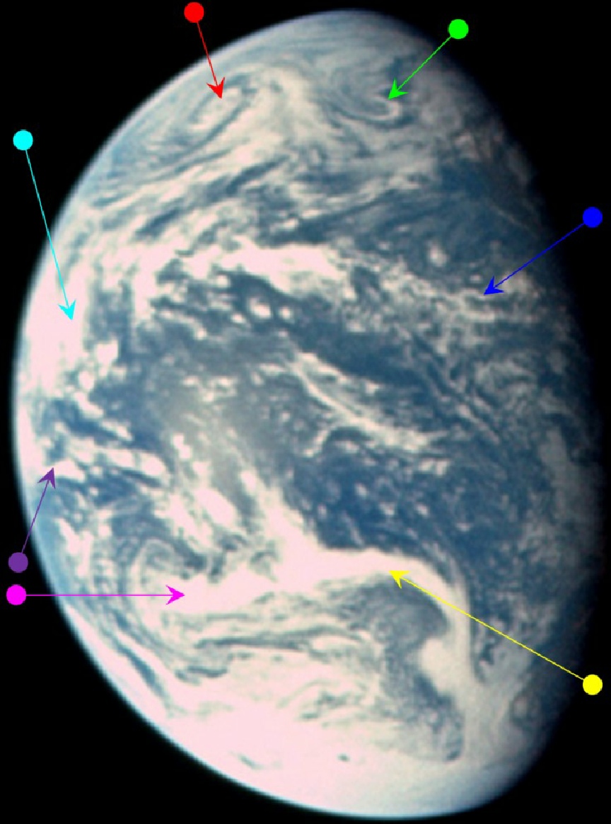
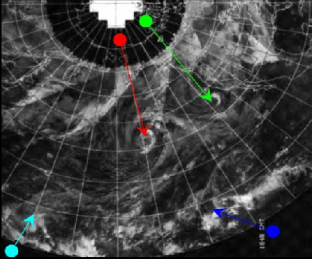
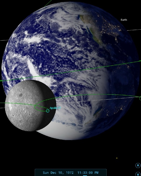
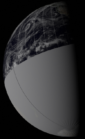
Figure 4.9.4.15: AS17-
Before discussing anything else about this photograph, it is worth drawing attention to what it is. We have become accustomed to seeing Earthrise images from Apollo, but this one is the start of a sequence of Earthset pictures, ie it is looking back at the Earth as it disappears behind the Earth. The next few images in that sequence show an Earth sinking below the lunar horizon, increasingly obscured by mountains and crater rims.
As far as timing the image is concerned, zooming closely in on the photograph shows that the west coast of north America is still just visible, which would give a time, as shown by Stellarium, of around 23:30. The date is identified by the weather patterns visible on the NOAA mosaic, which is dated the 10th and shows patterns not visible on those formations on other days. As before, the IR mosaics have been included thanks to a lack of southern hemisphere data for the 10th. The pass covering the area of the terminator would have been around 18:00 on the 9th, on the visible image, and 06:00 on the 11th for the IR.
We also have Jack Schmitt, who helpfully asks Capcom to:
“...log us a picture of the Earth at 92:40 on mag Oscar Oscar”
Magazine Oscar Oscar is number 151, and 92:40, thanks to the time adjustment, is 90:00 MET, or 23:33 GMT.
Schmitt also says that:
092:40:59 Schmitt: You've got a lot of healthy weather out there in the Pacific today. Looks like most of those things we talked about yesterday, up in the Hawaii region and also in the south, have intensified.
This time of the image puts the craft in just the right place for a few follow-
Figure 4.9.4.16: AS17-
The most obvious feature that can be made out on both the mosaics and the Apollo image is the large spiral of cloud towards the top of the Earth, shown by the red arrow. It is Gene Cernan who, on the next lunar orbit at c.01:10 GMT on the 11th gives us some more detail on it:
94:17 Cernan: ..here is really one heck of a big low-
94:18:26 Cernan We were watching it earlier today, but I tell you, now, it's really dragged in some other clouds with it. It must cover an enormous distance and it's got some real spectacular circulation.
after an interruption from Capcom, during which he confirms he is using binoculars to see this, he continues, saying that he has lost sight of the continent now, and describing a:
094:19:54 Cernan Okay, I was just going to say, it's got a -
This large cloud mass is also visible on an ESSA 8 picture, obtained from a Midway Island veteran website described in the introduction to this section. The ESSA image (which has been converted from its original sepia to a slightly clearer monochrome) is shown, together with the relevant part of AS17-
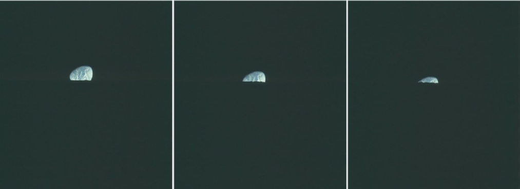
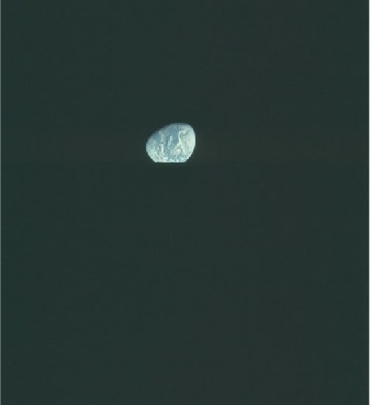
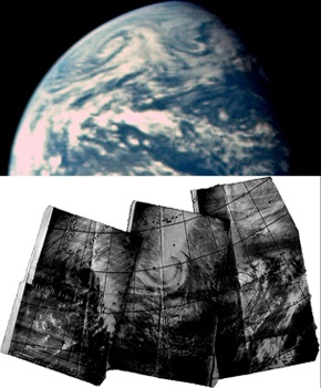
Figure 4.9.4.17: Part of AS17-
Both the cyclonic cloud mass and the trailing front are very obvious, dominating the north Pacific.
An interesting feature of the ESSA image is that it there appear to be the marks of a spiral bound notebook across at least one section of it (the left hand part of the triptych, halfway down the page). It looks very much like a printout (possibly from a fax machine) that has been manually compiled and then photographed. In the interests of continuity, there are other weather systems shown on the Apollo image that are a follow-
Tropical storm Diana is just about coming into view, and is identified by the purple arrow on the western limb. The IR image gives a much sharper view of this emergent storm than is shown by Apollo.
Tomorrow is another day, we land on the moon for the last time, so click the links for the final surface chapter.
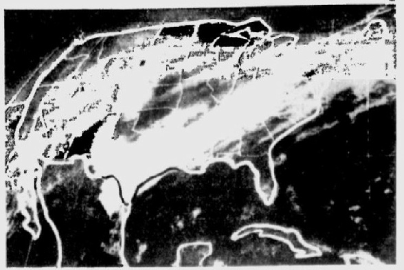
We don’t know where the satellite image was sourced, but we can identify the same long band of cloud stretching from southern Texas to the east coast identified by the magenta arrow in the earlier analysis. A live TV weather forecast showing details in Apollo photographs!
The next image for examination is from magazine 151. AS17-

Figure 4.9.4.13: Satellite image from a TV weather forecast, December 1972.