4.9.7 -
The next image comes from a different magazine, number 137, and was taken during EVA 2. AS17-
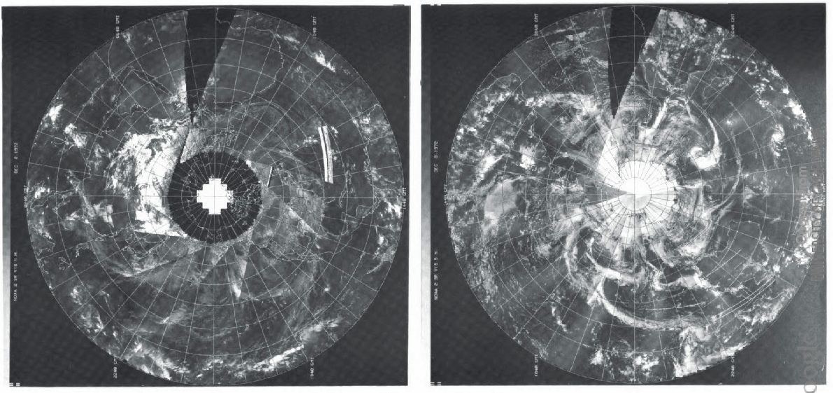
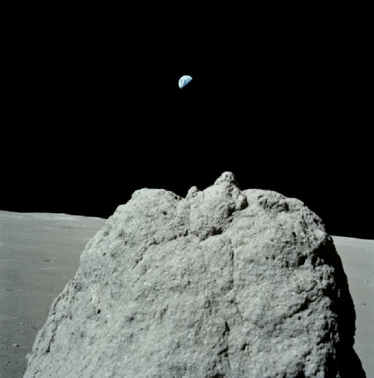
Figure 4.9.7.1: AS17-
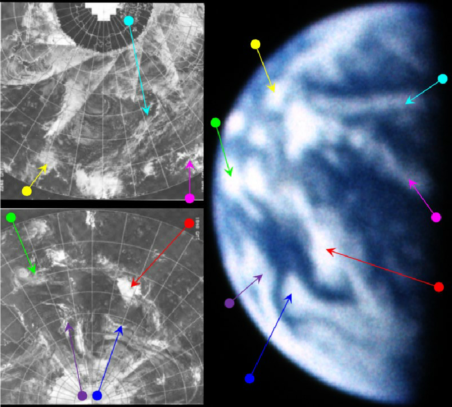
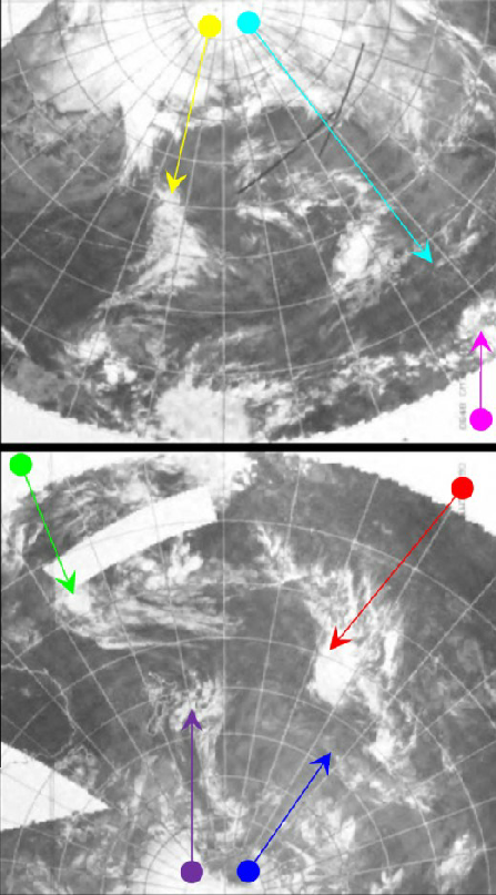
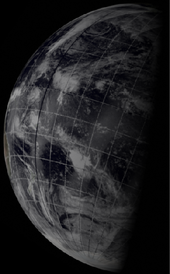
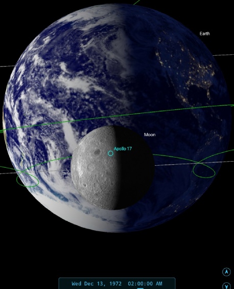
Figure 4.9.7.2: AS17-
As with the previous image, there is some detective work to do in the absence of obviously visible land mass (something that automatically points towards a view of the South Pacific in the early hours GMT). The size of the visible disk is narrower than in the previous photograph, which means that it must be later in the mission.
The key areas on the photograph to pinpoint where the terminator is falling are the two lines in the northern tropical area (cyan and magenta), and the purple arrowed lobe of cloud near the western horizon. In the case of the former, following the line of longitude north would put see that line crossing half way through Alaska. The latter clouds are a good 15 degrees east of Australia, which would therefore not be visible. The NOAA times for visible and infra red passes over this area would be approximately 19:00 (on the 12th) and 07:00 (on the 13th) respectively.
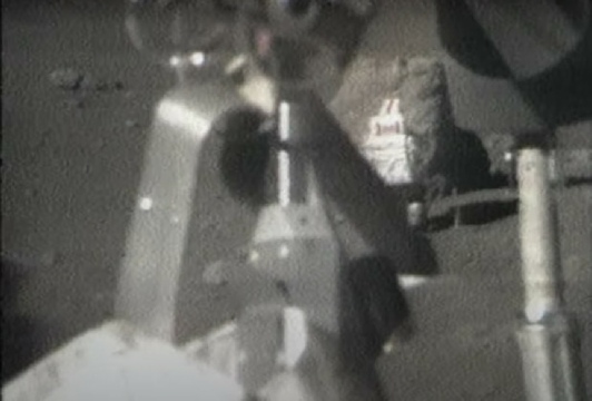
At 01:35 on the 13th, we find from the timeline that Cernan and Schmitt are indeed at Station 2 on EVA 2, and they leave it 65 minutes later. A photograph of a damaged LRV fender's repair was taken just before that departure (AS17-
This image contains enough detail to try and examine photographs taken by the ESMR instrument on NIMBUS-
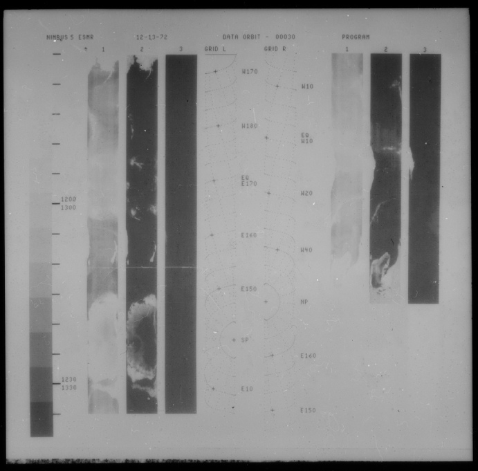
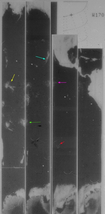
Figure 4.9.7.3: Nimbus-
The arrows used in this image are the same as those in 4.9.7.2. It’s worth pointing out that the image is measuring microwave radiation and as a result is inferring the water content of clouds. The path covering eastern Australia and New Zealand was made on orbit 30. It’s difficult to tell when this orbit commenced as data are not given in the accompanying catalog, but the image itself records times around 12:30 GMT, which would be consistent with night-
While my use of arrows should be treated with caution, it’s clear that there are areas that tie in with that shown on the ESSA image and consequently the Apollo photograph.
Returning to the visible spectrum, something else that should be visible in the image is Tropical Storm Violet. Violet developed over the Marshall Islands, a small group of islands just north of the equator and just west of the 180 degree longitude line.
The storm began as Therese died away, but was most active between the 12th and 15th of the month. On the 13th, the MWL (reference given in the introduction to this section) shows a more detailed NOAA image of Violet, with lines of longitude and latitude clearly marked, and this is shown below in figure 4.9.7.4.
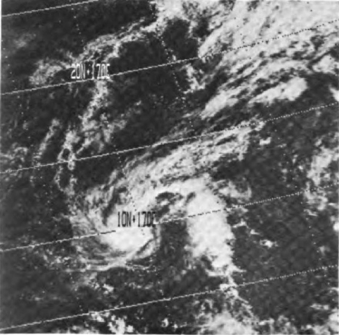
Figure 4.9.7.4: Tropical storm violet from the Mariner's Weather Log. Source given in text.
The first thing to note on the MWL image are the latitude and longitude markings, which puts the storm as being at 10 degrees north and 170 degrees east on the 13th of December. If figure 4.9.7.2 is examined, particularly the NOAA mosaic, then there is indeed a storm there with a similar, but less detailed, configuration as is shown in figure 4.9.7.3.This storm (identified by the yellow arrow) also has the same overall shape (a sort of extra-
If the corresponding point is searched for on the Apollo image, the same storm pattern can be found, as can the bank of less well defined cloud to the north-
Additional evidence for the time comes from TV signals sent back to Earth from station 2. The ALSJ has video links to some of this TV coverage, and one of them, found here: ALSJ, contains a picture of Earth. A screenshot of from that video is shown below in figure 4.9.7.5, together with a zoomed in version of it and the NOAA visible spectrum mosaic from 4.9.7.2.
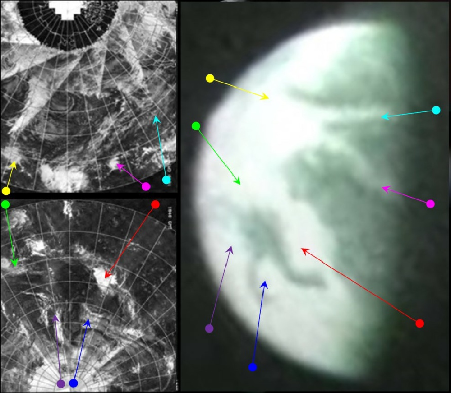
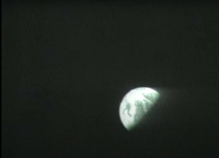
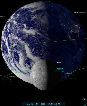
Figure 4.9.7.5: Video screenshot from EVA-
The screenshot shows the same scene as was shown in figure 4.9.51, and the text of the broadcast confirms its timing. At 140:37 MET (roughly 02:10) Capcom tell the astronauts:
143:20:03 Mission Control And, 17, if you want to just take a minute, you might look up in the sky and notice that our camera is taking a beautiful picture of Mother Earth.
143:20:14 Cernan Isn't that pretty over -
143:20:18 Mission Control Now we're coming down to look at the massif. isn't that a beautiful picture of the Pacific there? Ed finally found it. Now we see the massif.
If the video is watched from the start, the camera operator does take a while to find the image, and the words spoken there coincide with the Earth appearing in shot. The similarity between the video screenshot and the astronaut photographs is undeniable, as is the resemblance to the satellite mosaics.
A still from this broadcast also made it into the next day’s newspapers. Figure 4.9.7.6 shows the New York Daily news, which contains a still from the TV broadcast and details of the exchanges between Houston and the crew on the surface, tellingly published far from the front page.
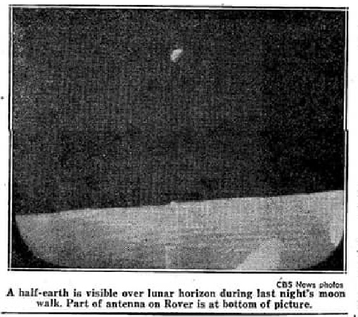
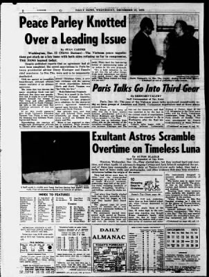
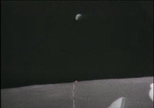
Figure 4.9.7.6: New York Daily News image, published Wednesday December 13th 1972, together with a still from the TV broadcast itself.
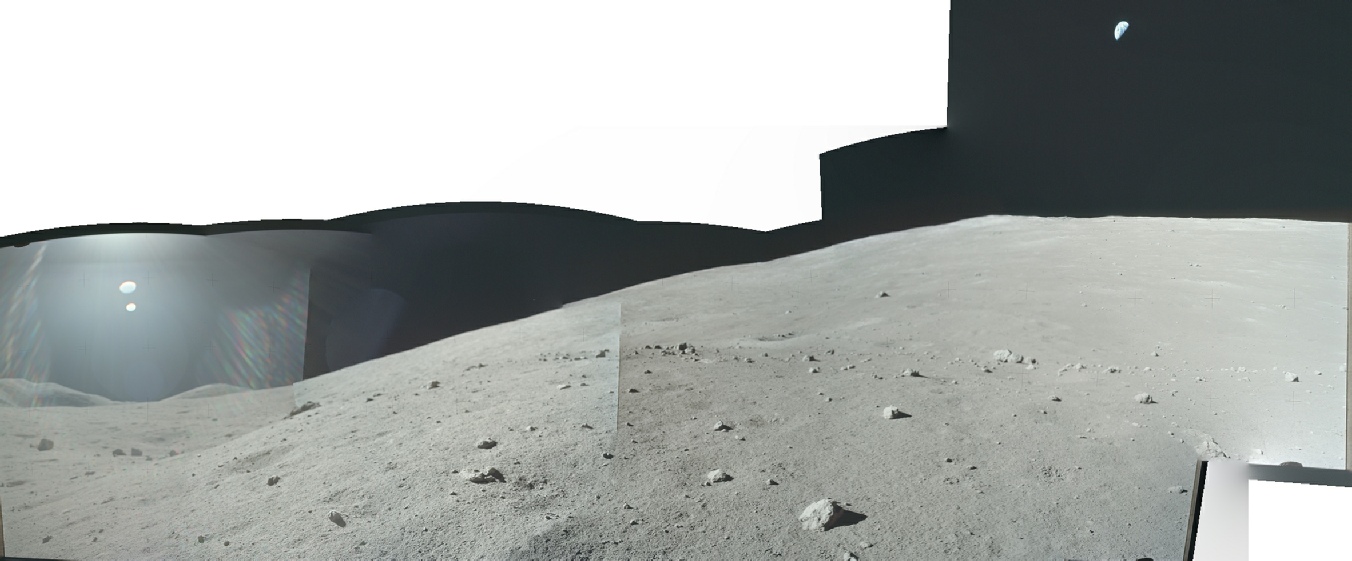
Figure 4.9.7.9: Panorama from Boulder 2 with Earth added.
While many boulders can be seen in all three photos, the split boulder in the centre of AS17-
Why does this matter? It matters because it establishes a timeline. It matters because with a timeline comes something that happens when you see Earth over time: rotation.
A few minutes after these shots of Earth, and 15 minutes after the earlier boulder 2 shots of Earth, Cernan takes a panoramic view of the Taurus-
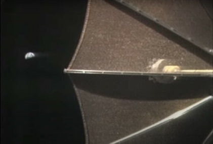
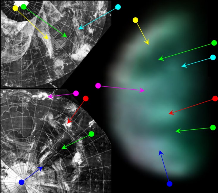
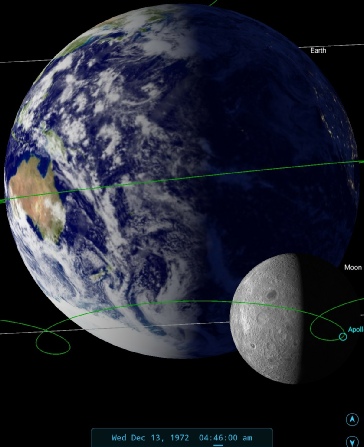
Figure 4.9.7.12: Screenshot from EVA TV broadcast at Station 4, NOAA satellite image, 3D reconstruction and SkySafari time depiction
SkySafari tells us that, at the time of broadcast, Australia was quite fully in view, and should now be visible on the Earth's western limb. There is a suggestion of discolouration that might represent the Australian land mass, but this could also be a product of the treatment the image has had.
The main features of the adjusted Earth image are a band of cloud in the southern Pacific, a pair of cloud bands in the Equatorial region, another clear patch of ocean in the northern Pacific, and a final band of cloud towards the northernmost visible latitudes. It should also be clear that there is a good correspondence with the TV image in figure 4.9.7.8.
As far as the satellite comparison goes, the bands of cloud seem to correspond to the line of cloud east of Australia (red arrow) and along the equator to the north of Australia (magenta arrow). There is a suggestion of the north-
The clear patches of ocean match in the screenshot are evidently there in the satellite photograph (green arrows), as is the cloud cover in the extreme north and south (yellow and blue respectively). In short, despite the poor quality of the video still's representation of Earth, there is still a high degree of agreement with the atmospheric features visible on the satellite image that was taken 8 hours before on the 12th (the image from that date being nearer to the time of the Apollo still).
The next views of Earth are on the 14th, so click the links to see them.
Flat Earth and moonhoax denial dismissed in one gif! It’s worth noting that the later photograph has the east coast of Australia just emerging, and this can also be seen in the Apollo photograph as a brownish discolouration.
A short while after this broadcast, there is another video segment from the EVA TV broadcast showing an image of Earth. This time, the crew are at Station 4, and are busy sampling the famous 'Orange soil' that was initially suspected to be some form of oxidation. The mission audio puts the time of the footage at 145:53, or 04:46 GMT, 13/12/72.
There is a version of the video available at the ALSJ , and various versions if variable quality on Youtube, eg here. A screenshot of the scene in question is in figure 4.9.7.12, together with a comparison with satellite images. The levels have been adjusted considerably in the screenshot to reveal detail, as it is not zoomed in as closely as the previous video of Earth. What is visible is blurred, but as with other images of this type broad patterns can be determined.
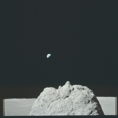
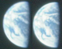
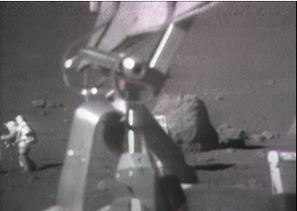
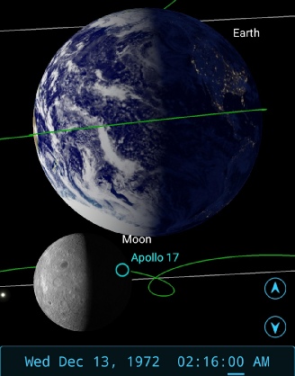
Figure 4.9.7.10: AS17-
Fifteen minutes is just enough time at this scale to show discernible rotation, and that’s exactly what we see when we compare the two Earths. On the upper left a band of cloud has emerged on the horizon, and features near the terminator have moved closer towards it. For the avoidance of doubt, see figure 4.9.7.11:
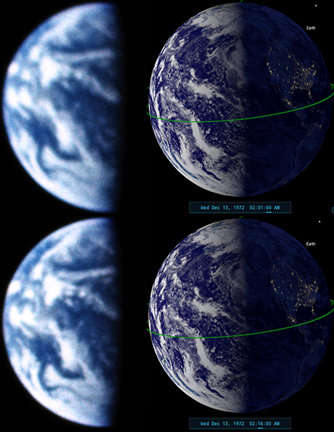
Figure 4.9.7.11: Rotation in Apollo 17 Earth views 15 minutes apart. The images used are from the March to the Moon archive. On the right is a section of the later Apollo image showing the east coast of Australia.
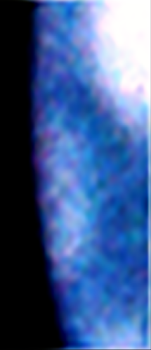
While the broadcast was made in the early hours of GMT on the 13th, in New York it was late evening, plenty of time for it to make onto the next day’s front page.
At about this time. Gene is taking a panoramic shot of the scene from a position upslope of boulder 2 (see figure 4.9.7.7).

Figure 4.9.7.7: Panorama taken from above boulder 2 (Source)
While he’s there, probably prompted by capcom’s mention, he snaps three additional views of Earth. We can tell that these photos were taken from this location, rather than below the boulder, by looking at the position of a few rocks in the image (figure 4.9.7.8).
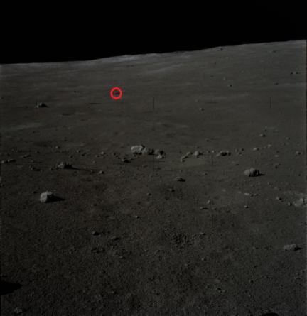
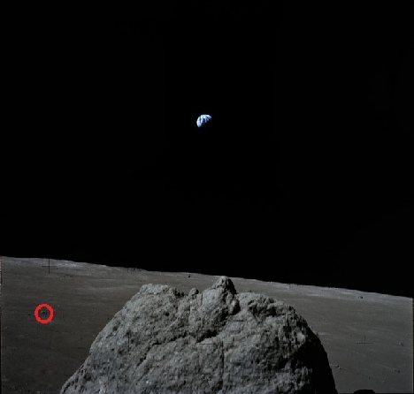
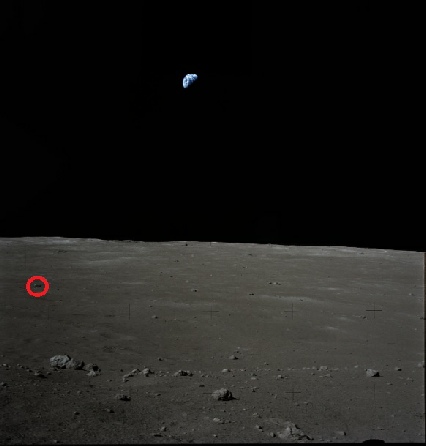
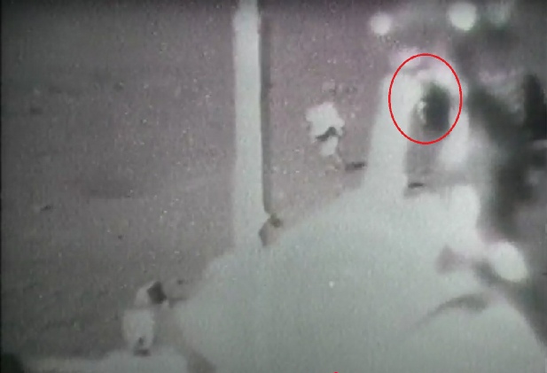
Figure 4.9.7.8: AS17-
Just for fun, here’s part of Cernan’s panorama with the Earth above the massif added (figure 4.9.7.9).
