4.9.10 -
The crew continue to orbit the Moon for some time after re-
AS17-
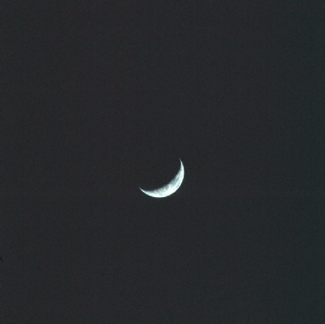
The crescent Earth is an early indicator that some time has passed since the last photographed examined here. The timeline tells us that the LM & CSM were re-
At the risk of carrying out exactly the sort of pre-
217:20:23 Evans . ... We've been taking its picture just as we came up.
Can we therefore find weather patterns on the crescent Earth that we would expect to find at that time and date?
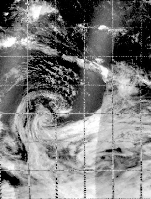
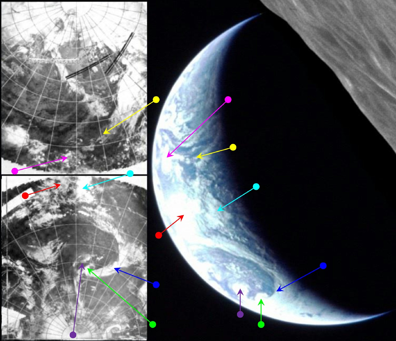
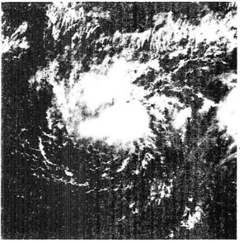
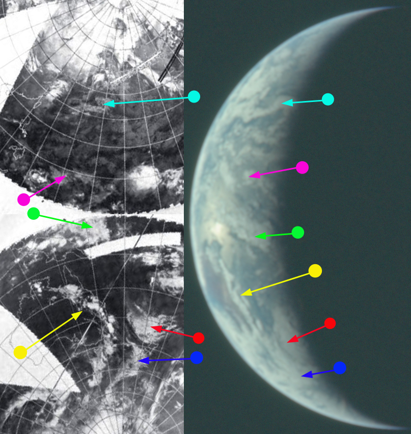
Before going on to answer this question, it is first necessary to point out that only the IR spectrum image was available covering this time. No original data were available for the 15th in the visible spectrum, but which is the mosaic that would have been required to cover the early hours of the 16th. The time of the orbital pass at the terminator would be around 06:00 on the 16th.The most obvious feature to be seen is the large arc of cloud just on the terminator, and this can easily be made out on the IR mosaic. That cloud is in the mid-
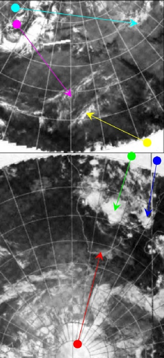
One of the best clues to look for here is the return of Storm Violet into the frame -
Figure 4.9.10.2: AS17-
Figure 4.9.10.1: AS17-
If you care to check the location of the storm in the Apollo image and compare it with the coordinates given, you’ll find they match, just as the storm itself does perfectly.
The next image presents us with something of a dilemma, for reasons that will become apparent. It is a return to magazine 148, the final Earth image in the magazine, and is shown in figure 4.9.10.4. It is analysed in figure 4.9.10.5.
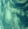
Figure 4.9.10.3: DMSP image of Tropical Storm Violet compared with a section of AS17-
Now we come to the tricky part -
Initial studies focused on South America as the land mass on the eastern limb. This is because the mission photo index records it as being taken between two lunar surface features -
What we need to do is trace through the records to see when these images were taken. We have this exchange during rev 66:
217:29:40 Evans And, I took a picture of that one in Smythii -
That image is AS17-
A few hours later, recorded at 07:20 GMT, we have Schmitt stating that:
220:27:36 Schmitt Bob, that's the most beautiful crescent Earth I've ever seen.
and then (captured by the CM tape recorder but lost in the transmission):
“That bright spot. See it -
If you look at the photograph you can see that there is indeed a bright solar reflection in the centre of the Earth crescent, and it seems likely that Schmitt was impressed enough at the time to photograph it. Shortly after this they then enter a rest period and there is no communication recorded with the ground. By way of confirmation that he photographed Earth, we have this remark from the Command Module transcript as he continues to discuss Earth’s crescent at 07:26:
220:33:55 "Oh, darn. There's the picture. Oh gosh. Never even thought about it. Oh well. Remember it, gang."
To be fair it’s not an absolute confirmation that he took the photograph, but he was certainly indicating that he wanted to.
So where has the confusion come from? It would appear that it comes from the crew relating back details of photographs taken during the preceding hours during their rest period.
For example at 18:22 and 18:37 GMT we have Evans saying:
231:29:17 Evans Okay, Houston, frame 163 and 164 and 165 were taken of the mud craters in Smythii. And 166, I guess, was taken of the great slopings -
231:44:42 Evans And, Houston; 166 and 167 were taken of a crater that looks like it's got a reddish dike in it and it's on -
Those image numbers are actually AS17-
Rev 67 was commenced at 218:33:45, or 05:26 GMT, with communications resumed at around 219:16, or 06:09 GMT. We do have this at 218:53, recorded in the CM transcript:
218:53 SC Take a picture of Earth, Ron.
CMP Yes.
Which converts to a time of 05:46 GMT. It isn’t clear whether that’s an instruction to do it there and then, or at the next opportunity, but again, the configuration of Australia isn’t quite right for that time. The one that matches best is the description of the beautiful crescent Earth at 07:10, so we’ve gone with that.
To cut a long story short, the obvious conclusion is that the image of Earth was not taken during rev 73 but several orbits earlier, and the way the information has been given by the crew in discussions held later on has led to them being mis-
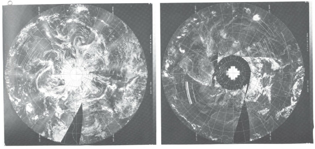
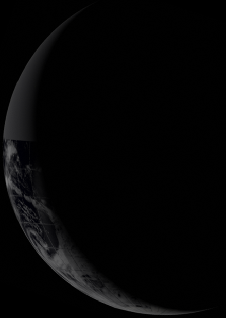
Having decided when we are seeing the image, we can look at what’s in it. Again we are restricted to an infra-
We also have a Landsat pass over Australia on this date, and we can see this in figure 4.9.10.6.
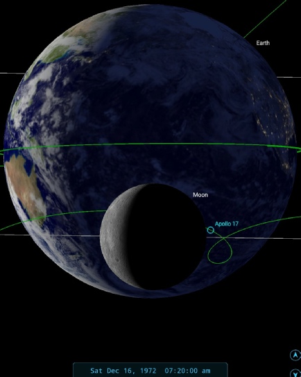
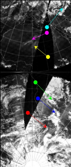
Figure 4.9.10.4: AS17-
Figure 4.9.10.5: AS17-
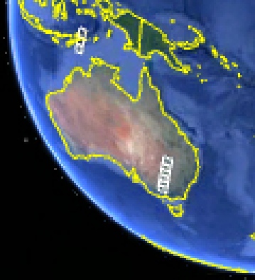
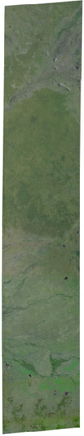
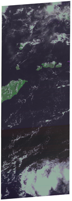


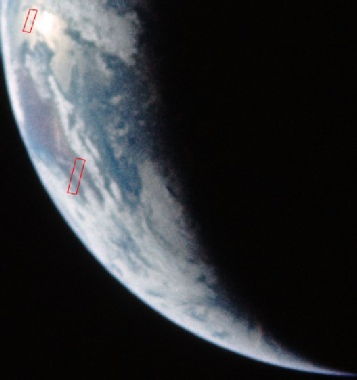
Figure 4.9.10.6 Landsat image paths shown on AS17-
It would hardly be reasonable to draw any solid conclusions from these images, but there we are -
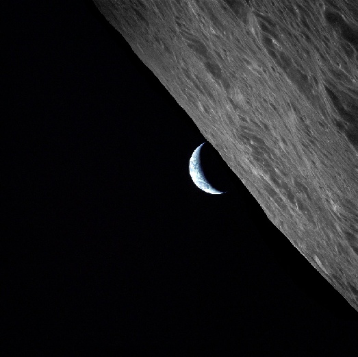
Moving on from the confusion over image timings after the Earthrise sequence in magazine 152 shown earlier, there is an Earthset, comprising AS17-
Figure 4.9.10.7: Earthset -
In addition to photographs from magazine 152, we also have a contribution from 139, this time in black and white. Magazine 139 was taken to the lunar surface, and the first half of the photographs on it are those from an EVA. AS17-
Again, we can use the Photo Index and mission transcript to act as a guide as to what part of the Earth's surface is appropriate to start looking, and we find that the photos are recorded as being taken on orbit 71.
The mission transcript has this to say towards the end of orbit 71 at 15:!3 GMT,
228:19:59 Cernan Beautiful, Bob. We're going to get your picture as you set this time. Right out number ...
LOS on orbit 71 is recorded as 225:45 MET, or 15:25 on the 16th.
Both these images are shown in figure 4.9.10.7, and they are analysed together in figure 4.9.10.8.
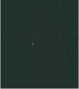
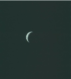
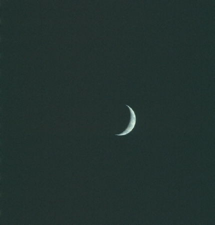
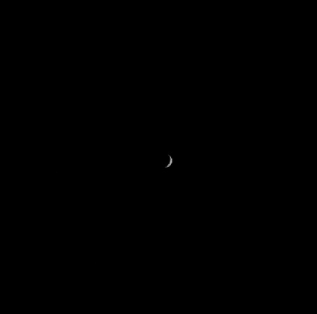
Figure 4.9.10.7: AS17-
If the colour version of the image is examined carefully, it is possibly to make out the coast of South Africa, and the fog shrouding that coast is marked by the red arrow. Land continues north of that fog almost all the way up the image, so we can be confident that our prediction for what should be visible is correct, and the images do show Africa.
As far as the NOAA images are concerned, the visible spectrum image (now available again) has the usual problem of half of Africa being commenced at the start of the day in question, and the other half 24 hours later. The IR spectrum however has no such problems. The times for these mosaics at the terminator are roughly 19:00 GMT for the IR image, and 07:00 for the visible spectrum. For the visible spectrum, most of Africa was started on the 16th, but the terminator area would actually have been imaged on the 17th. SkySafari image confirms that Africa should be visible at the time of the photographs.
We can also conclude that the clouds shown in the central part of the image are the same ITCZ clouds, and the long strips of cloud in the top half of the image are over the Sahara in the mosaics.
We also have a good pass over Southern Africa by Landsat, and the details are shown in figure 4.9.10.9
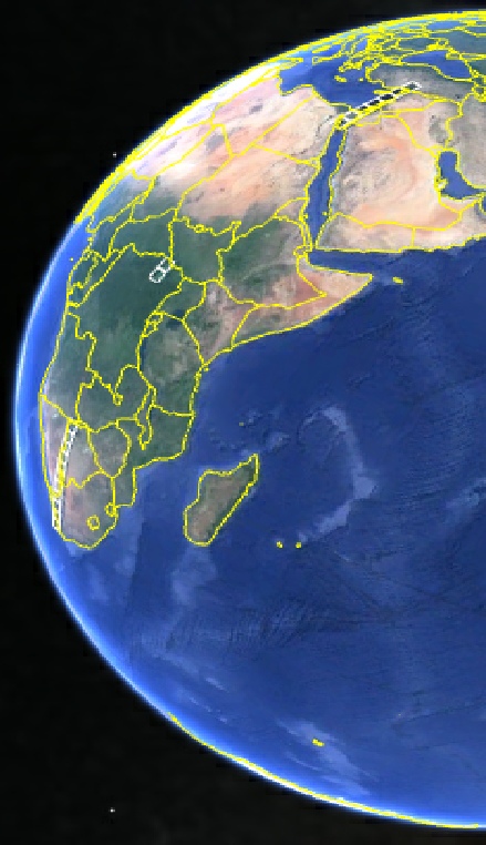
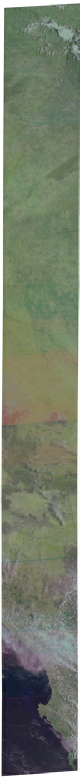
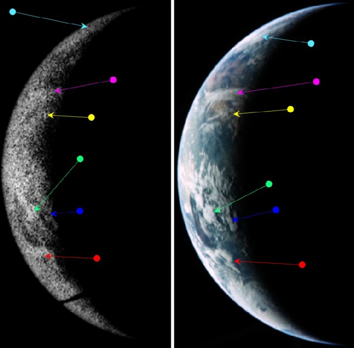
Figure 4.9.10.8: AS17-


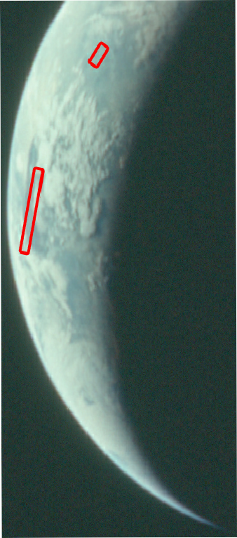
Figure 4.9.10.9: Landsat passes recorded over southern and central Africa as shown on Google Earth (bottom left) and AS17-
As before the angles are oblique, and several hours have elapsed between the Landsat images and Apollo (South Africa was photographed at 08:05), but again we have a broad consistency between the two. We have clear air over most of the areas covered with some coastal cloud. The pass over the middle east is hidden in darkness for the Apollo photograph.
That’s the last of the images from lunar orbit -