4.9.13 -
Between the end of the EVA and splashdown we have a final images of Earth to examine, including a few 16mm shots, but thanks largely to the poor quality of the satellite record, the tricky part is determining when they were taken.
All the still images are taken on magazine 152, and must have been taken after the EVA to retrieve the SIM bay film canisters, which ended at 21:33 on the 17th. Re-
The photographs themselves consist of two photography sessions, one for AS17-
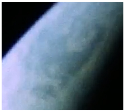
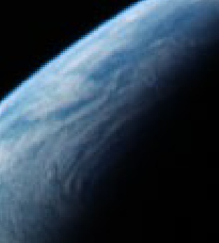
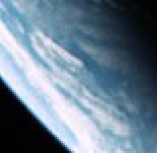
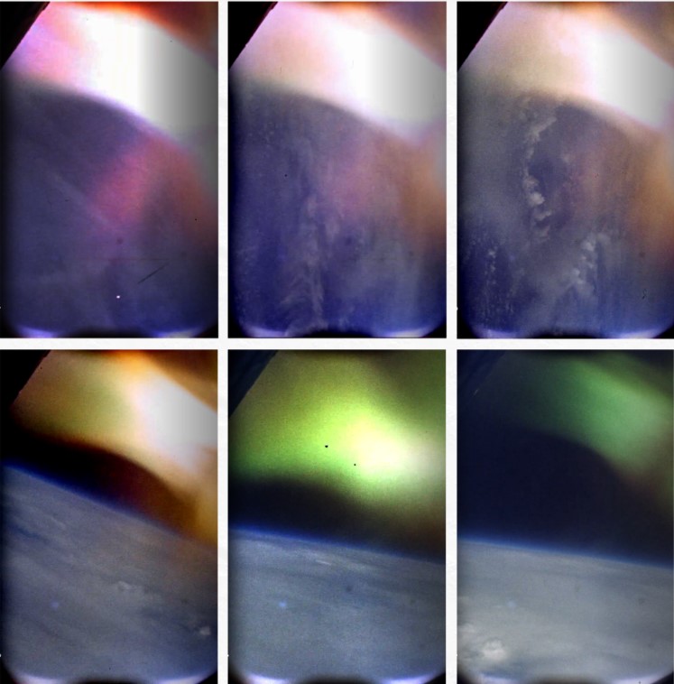
Figure 4.9.13.1 shows the first and last photographs in the sequence, and figure 4.9.13.2 shows the Earth from those two images in close-

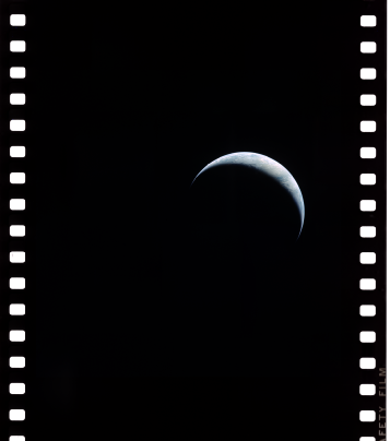
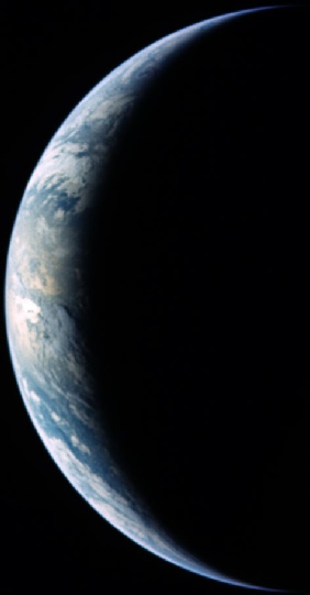
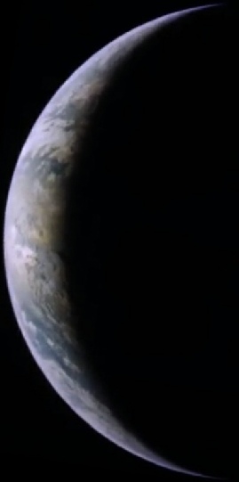
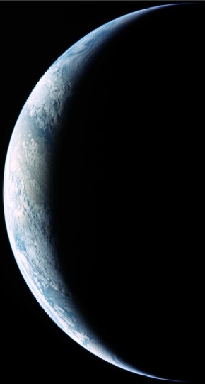
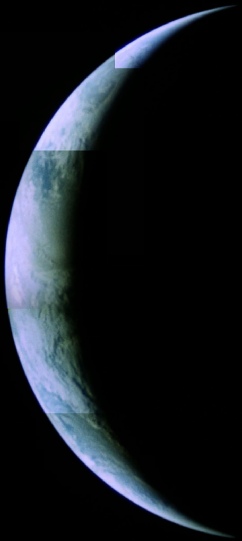
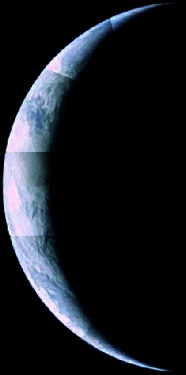
Figure 4.9.13.1: AS17-
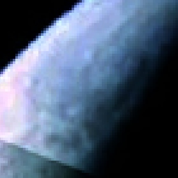
Figure 4.9.13.2: Left to right: AS17-
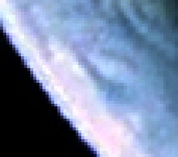
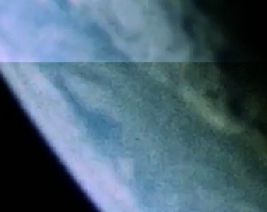
The views above are shown in the order in which they were taken, based no the appearance of the same features and the order in which they were taken. The 1st sequence of 16mm footage was obviously taken at roughly the same time as the first Hasselblad, but there has been a degree of rotation between the two that has meant some clouds have changed position, or even disappeared altogether. The next three images are marked by the movement of a large spiral system in the north, and what look like markings on land in the south (figure 4.9.13.3).
The task now is to try and place those markings on a map.
Try as I might, the dark markings in the southern hemisphere proved elusive. After assuming they were of land, no suitable candidates emerged. The only conclusion that can be reasonably made is that it’s patterns of light and shade caused by cloud -
Easier to identify are the two spiral weather systems in the northern hemisphere. Or are they?
The one evident in the first two images in the sequence are at a higher latitude than the later one. That system disappears, and if it’s the same storm in the second sequence they would have to be taken 24 hours apart. There isn’t enough change in the width of the crescent for that to be true, so they must be two different systems taken with a short time period (a matter of hours) apart. Figure 4.19.13.4 shows the same view 24 hours apart on the 18th and 19th.
There is obviously more change in the size of the crescent than is seen in figure 4.9.13.2, so there isn’t a 24 hour time gap between them. It’s also evident when looking closely that the size of the crescent is more of a match to the 19th than the 18th.
Having established that they are two different systems, what evidence do we have to locate where they are?
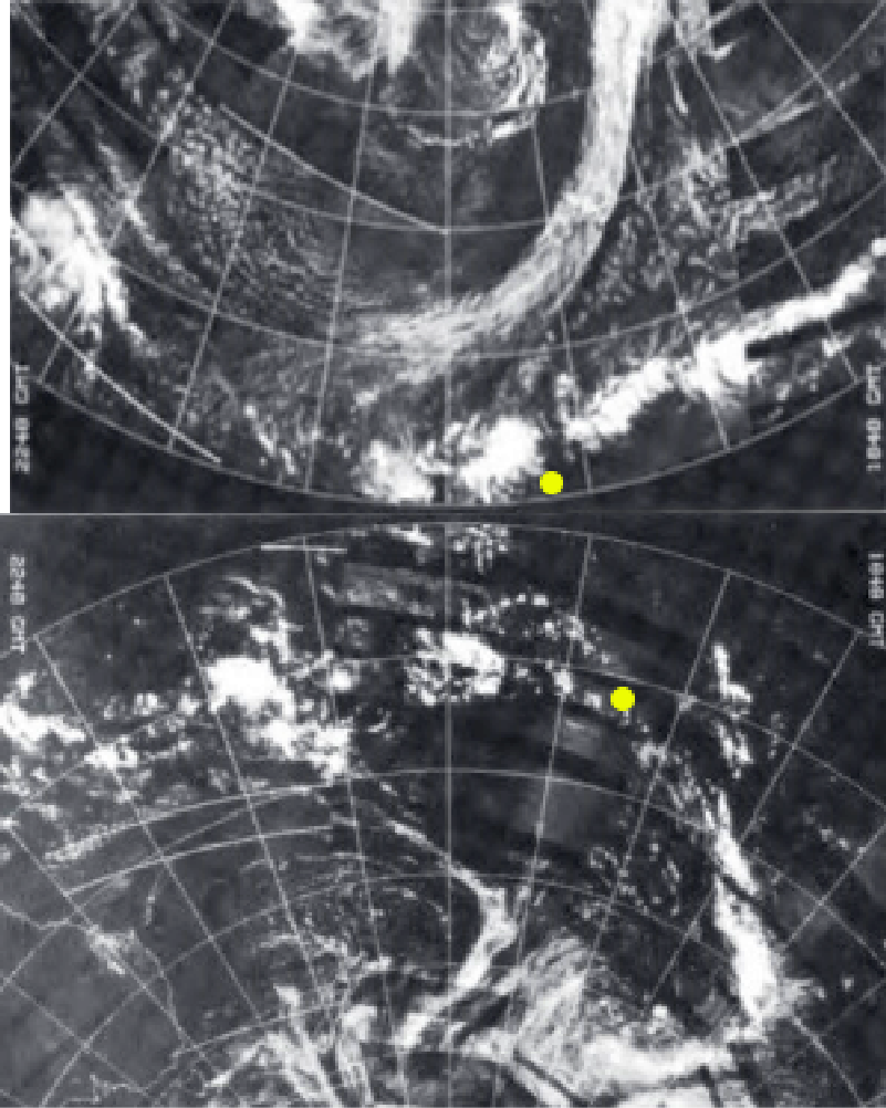
The obvious thing to do now is to look for spiral systems at the right latitudes on the satellite imagery, and it just so happens that we have two ideal candidates -
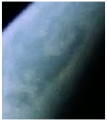
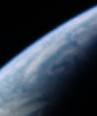
Figure 4.9.13.5: Section of AS17-
My interpretation is that the circular spiral in the first Hasselblad is the one highlighted by the red arrow, the one by the 16mm (and ultimately the final Hasselblad) is the one highlighted by the green arrow. It fits in with what’s visible in the images and with the timeline. The satellite images there are the infra red view, where the timing on the red and green arrows are 06:40 and 10:00 GMT respectively on the 18th, and visible spectrum on the 17th at 18:40 and 22:40 GMT respectively. Figure 4.9.13.6 attempts to identify more weather features using the visible spectrum view form the 17th, as it arguably shows more detail. The reason for using these two satellite images is because the day they photographs are more likely to have been taken (the 19th) has a much poorer satellite view, both in terms of the visible spectrum and IR images. What these earlier images do is allow us to pinpoint the same systems on the poorer quality views taken on the day itself.
Figure 4.9.13.6 shows what analysis is possible.
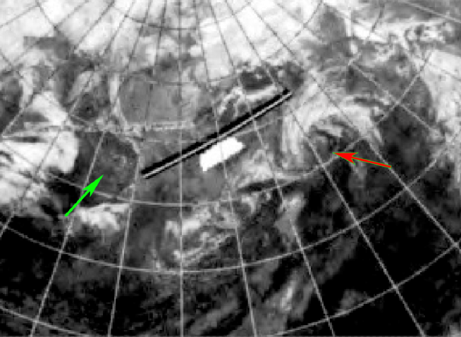
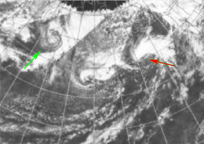
Figure 4.9.13.6: AS17-
Figure 4.9.13.3: Sections of 16mm footage and AS17-
Figure 4.9.13.4: Comparison of the same time on the 18th and 19th of December.
So, assuming we have things identified correctly, we’re looking at a series of Earth images (both photographic and video) taken as the crew look on at the Pacific over a period of a few hours early on the 19th. Are there are any references in the transcripts we can drawn on?
It turns out we do. At 01:11 on the 19th we have this exchange:
286:18:24 Schmitt Gordy, for the first time in seemingly several days, we see the Earth.
286:18:32 Mission Control Roger. Standing by for a weather report.
286:18:40 Schmitt (Laughter) Afraid I don't know whether or not there's any weather down there.
286:18:57 Mission Control Guess you can't see too much of it, huh?
286:19:02 Schmitt No, sir. You're down to a fingernail, if you'll pardon the expression. It -
286:19:23 Schmitt Got picture, Ron. (Chuckle) You can see it later. (Laughter)
It’s interesting that he mentions not having seen the Earth for some time, which further reinforces the idea that this the 19th. A few moments later, recorded on the Command Module tapes:
You're looking at the Pacific, ... and -
Then at
286:21:26 LMP Hey, gang, do we have any film?
CDR Want a mag?
LMP Why don't you dig it out, Ron?
CDR Think we ought to have a picture of the Earth, Ron?
…
CDR Can you get the ... millimeter?
The inference here is that they are looking for the 16mm camera at a time that matches the first Hasselblad photographs and 16mm sequence.
Later on we have more photography references, this time also involving the sextant. Again partially recorded in the CM transcript, in an exchange starting at 04:28, or 289:35:34:
CDR How's the sextant -
CDR You get the Earth coming around the other side?
CMP Yes.
The exchange ends with:
290:07:45 Cernan It's a -
A time that equates to 05:00 GMT on the 19th.
So we have a couple of references to Earth photography and accurate descriptions of the scene roughly at the times suggested by the satellite imagery analysis.
No more full images of Earth exist for Apollo 17, and the next stop for the crew is the final re-
As with other missions,. That re-
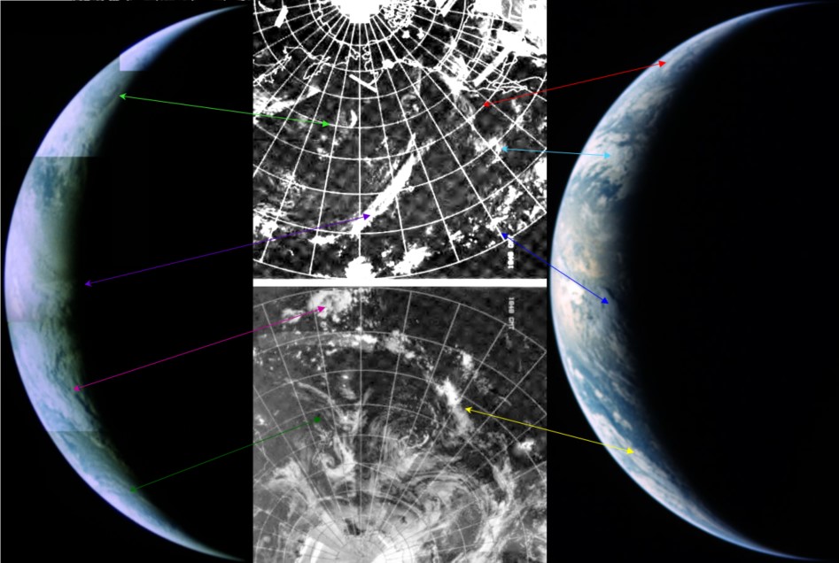
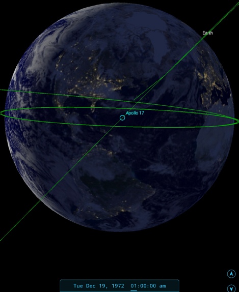
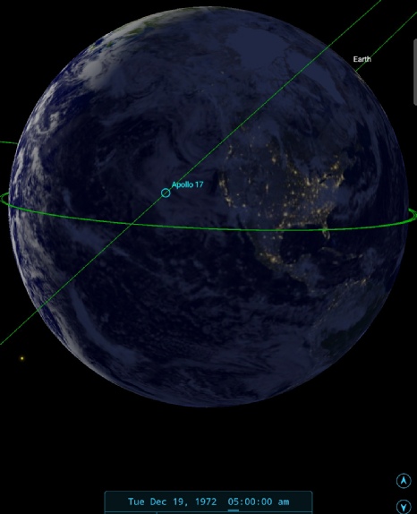
Figure 4.9.13.7: Stills from re-
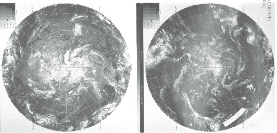
The view is roughly towards the north, looking backwards as the CM heads for the Pacific, and we can look at what the satellite imagery shows for that area (figure 4.9.13.8).
Figure 4.9.13.8: NOAA-
As with other re-
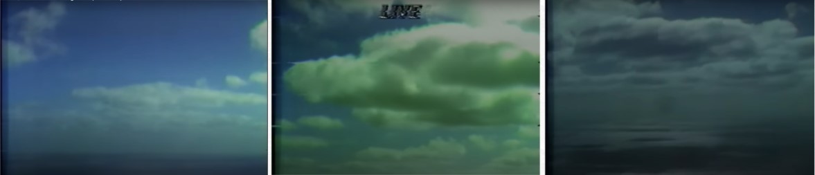
This broadcast of the splashdown shows the broken cloud visible immediately below them when the drogues are released (figure 4.9.13.9)
Figure 4.9.13.9: the scene at the landing zone.
Again, not proof as such, but the satellite imagery (such as it is), the footage from the CM itself, and that taken on the ground, are entirely consistent with each other.
So there we are, Apollo 17 safely back to Earth. Time now for a quick look at the synoptic data.