4.3.5 -
While checking out the cameras to use on the surface, the crew pick an obvious target for their test: Earth. We therefore get several images that allow comparison of different parts of the Earth's surface during those preparations.
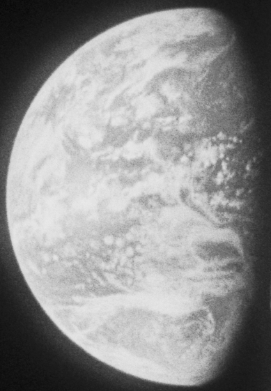
The first images to be examined are AS11-
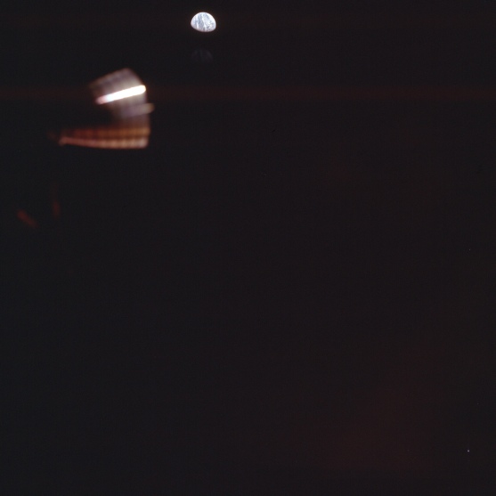
Figure 4.3.5.1: AS11-
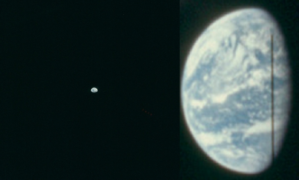
Figure 4.3.5.2: AS11-
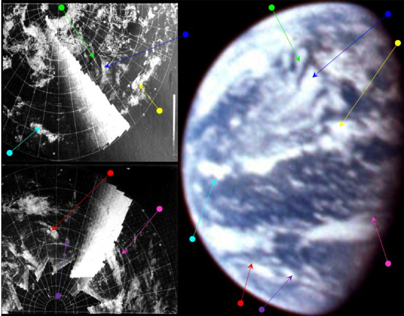
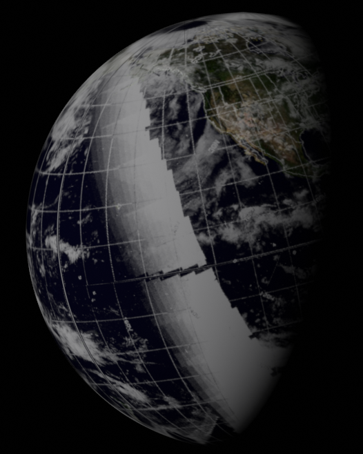
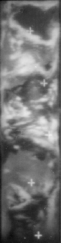
Figure 4.3.5.3: ESSA-
Both magazines are from cameras that made it to the lunar surface, as they both feature the surface in them later on. Magazine 36, from which most of the preceding images were taken, was taken with a camera that remained on the CSM, as can be seen by photographs taken later in the magazine 36 that show parts of the LM after Aldrin & Armstrong had transferred to it.
AS11-
AS11-
The first thing to note about the Earths visible in the figures is that they are pretty much identical, and the immediate question must be: why would two photographs be taken at exactly the same time? SkySafari's terminator puts this time at roughly midnight on the 20th (confirmation of the date will follow) which would be around 82 hours and 30 minutes into the mission -
082:12:44 Aldrin (onboard): Alright, then, I think -
Followed at 82:15 by
082:15:32 Collins (onboard): I'm just fooling around. What do you need -
082:15:50 Aldrin (onboard): Okay. I'll get another good picture of what comes along. Well, hell, I guess we might as well load the other camera and make sure it works, too, huh?
At 82:16 minutes Collins says
082:16:06 Collins (onboard): Well, look, if we load this one -
At 82:32 Aldrin says:
082:32:07 Aldrin (onboard): But I can't see [garble] -
Then 5 minutes later
082:37:23 Aldrin (onboard): I got the Earth down by the strut.
That strut and this picture could easily have been AS11-
An hour later, after Aldrin & Armstrong have transferred to the LM, we get this from Aldrin at 83 hours and 19 minutes:
083:19:09 Aldrin: Roger. Understand. I'm checking out camera number 4 now. [Long pause.]
Then finally:
083:19:35 Aldrin: Roger, Houston. Eagle has checked out both 70-
So, it becomes pretty clear from this discussion that the reason for the two identical photographs is that just around 82 -
For ESSA, the relevant pass on the image dated the 19th occurred at around 21:03 (track 4, number 1798) – only 4 hours away from the actual time the images were taken. No NIMBUS data exist for the 19th, so none are given for this image.
As for the weather systems, the most obvious features are those of the low cloud off the coasts of north & south America. These cloud banks persist into the following day's satellite images, but their shape has clearly changed over the half a day+ interval between the Apollo images and those taken on the 20th by ESSA. SkySafari and the ALSJ transcripts provide, in this case, a better fix on the timing of the image.
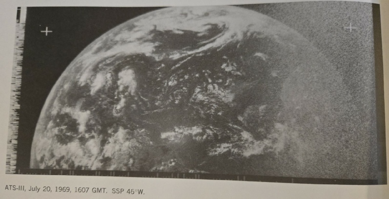
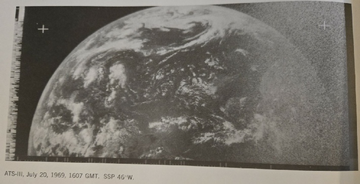
Over the next 12 hours the crew busy themselves preparing the LM, and the next image to be examined is one taken from the CM a few hours into that preparation around the time of a rest period. AS11-
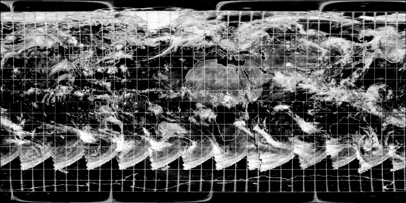
Figure 4.3.5.5: AS11-
The ALSJ initially reported that this image was probably taken sometime during lunar orbit 12 or 13, which would suggest a time of 98 hours or 100 hours in to the mission, or roughly between 15:00 – 17:00. Immediately following this Earthrise sequence, there are a number of photographs detailing the separation of the CSM from the LM, which we know is timed at 18:11 on the 20th. As time has moved on slightly from the previous analysis, two satellites are once again available and the satellite analysis is given in figure 4.3.5.6, together with the usual SkySafari terminator screenshot. The NIMBUS data used are visible spectrum, as they provided the best image. ATS-
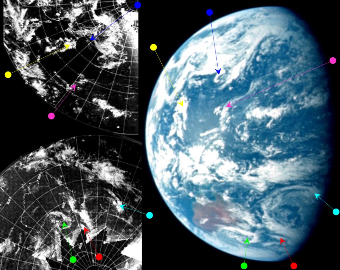
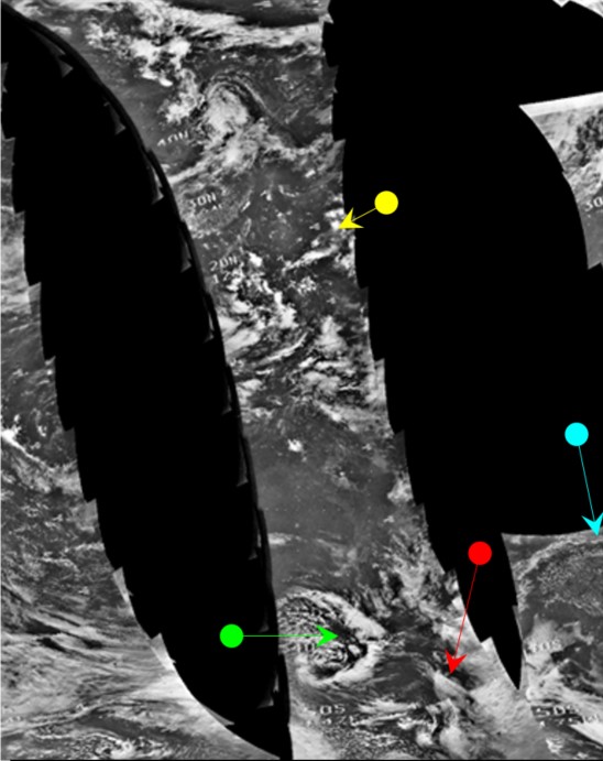

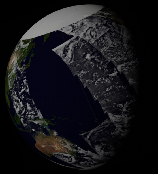
Figure 4.3.5.6: ESSA-
In this case, SkySafari suggests that the time of the image would have been somewhere around 04:00 in the morning, seems to be at odds with the ALSJ's interpretation of when the image was taken, and would put it as being taken somewhere after start of orbit 6, after which the crew got some sleep before the next phase of the mission. Had it been taken on orbit 12, it would have shown the Atlantic rather than the Pacific.
Orbit 6 commenced at 86:06 MET, with Earthrise on this orbit at about 86:30 MET, or shortly after 04:00 GMT. At this time in the CM transcript, we have this exchange between Collins (CMP) and Armstrong (CDR):
086:24:48 Collins (onboard): Where the hell is the horizon with the world coming over it? I guess it's behind us, huh?
086:24:58 Armstrong (onboard): Up there? We should be getting Earthshine -
after which they discuss which films are available, so they are apparently looking for Earthrise with cameras at hand.
Both north and south Pacific have distinctive weather features that should be readily identifiable, notably the large swirl off eastern Australia, the '>' shaped feature over SE Australia itself, & the cedilla shaped cloud off China. All these features are clearly visible on the satellite photographs.
As far as placing a time on the satellite images, ESSA's track covering the terminator line on the 20th is actually orbit 1796 on the image dated the 19th. This pass commenced at 03:05 on the 20th, so the satellite passed over Australia not much before the time the Apollo crew took their picture. Unsurprisingly, the weather patterns observed by ESSA match exactly those in the Apollo image.
The NIMBUS image is difficult to decipher because there is relatively little of it and what is there is of relatively low quality. There is, however, a clearer image made available by the Australian Bureau of Meteorology. This image was sent after an initial inquiry as to whether they had any data. This inquiry led to them finding an unscanned collection of old NIMBUS images, requiring them to buy new scanning equipment to archive it. The author would like to apologise to the Australian taxpayer for costing them money.
From the information they sent, the image was from orbit 1297 (which is how the composite image in the previous figure was selected – the continents were difficult to pick out otherwise), and the time for this pass was commenced at 01:22 on the 20th – 4 hours before the Apollo image. This NIMBUS image is shown with a zoomed & cropped part of AS11-
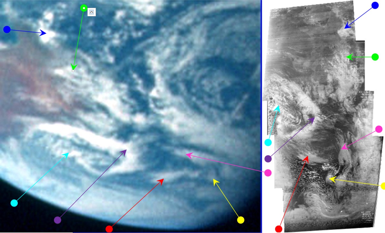
Figure 4.3.5.7: Parts of NIMBUS orbit 1297 supplied by the Australian Bureau of Meteorology compared with the South Pacific and Australia from AS11-
Even allowing for the NIMBUS' flat images and the Earth's curvature, there is a huge amount of correspondence between the two pictures. It is a useful example that the level of detail present in many of the Apollo photographs belies the argument that they are clumsy, hastily produced fakes. The storm over Australia appears in both photographs because both cameras were where they claimed to be: Over Australia, one passing in from a few hundred miles, one from 240000 miles in orbit around the Moon.
Amusingly, one of the chief proponents of the ‘Apollo was hoaxed’ myth, the ‘Aulis’ website (I’m not linking to them, Google it) where you can buy lots of material (there’s a clue there people) also seem to have cottoned on to clouds as an indicator of precision.
The author of one article on here, who claims to have a PhD but is ‘too scared’ to put his real name to it, also noted that ‘orbit 12’ error (who knows, he may even have spotted it here), and has cleverly spotted the similarity in clouds patterns between the two images, and even notes that Australia is on view. He says this:
“Another aspect that could confirm the genuineness of any given shot of Earth at any given moment is the pattern of the clouds. Taken at a certain time, on a certain day over the Pacific Ocean, the cloud patterns on AS11-
It’s very strange that while he says the clouds could confirm the genuineness of the image he doesn’t actually bother trying -
As always, these people prefer to latch onto a simple mistake and try and attach way too much importance to it.
Here’s more evidence they can ignore: In another study of one of these same Earthrise photographs, a youtube user has also tried to verify the time of the images, this time by looking at the Earth’s physical appearance in terms of the angle of the terminator relative to the lunar horizon. His conclusion is the same as mine: it as taken at around 04:00 just as NASA said it was, in orbit around the moon, just as NASA said it was. I should point out that he gets the orbit wrong and says it is on orbit 5! The youtube analysis is below.
As this video shows, it isn’t just the clouds that prove Aulis wrong -
It’s also worth pointing out that even 12 year olds can spot the use of satellite images -
Figure 4.3.5.8: comparison of AS11-
The article recognises that the satellite image takes time to be composed, allowing for slight differences in the ‘instant’ Apollo photo, and notes how the infra-
One unexpected bonus of this long sequence of images is that it represents the passage of time, and the passage of time when it comes to Earth photographs means rotation. We have a sequence of Earth images taken over a short period, so can we see if there’s any evidence of actual Earth rotation?
Well, it seems we can. Because some enterprising individuals (in other words, me) have mapped out the location of these images on Google Moon, we can work out that the start and end sequences allow roughly 130 miles to pass beneath their feet. At an orbital speed of roughly 1 mile a minute, that means we have roughly 2 minutes between the start and end of the sequence. Does this allow measurable rotation to be seen? Well, let’s have a look (figure 4.3.5.9).
Figure 4.3.5.10: AS11-
The photograph is obviously taken from inside the lunar module, and time has clearly moved on as far as the Earth is concerned as the main landmass visible is Africa. The ALSJ records a photograph taken a few frames before this one (AS11-
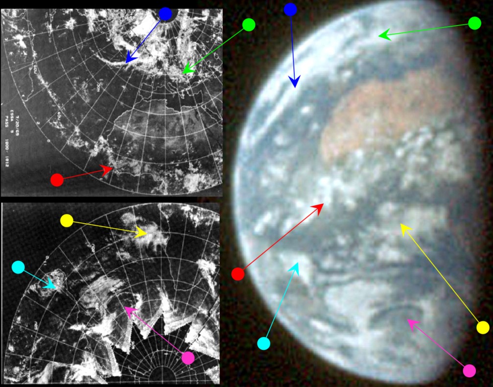
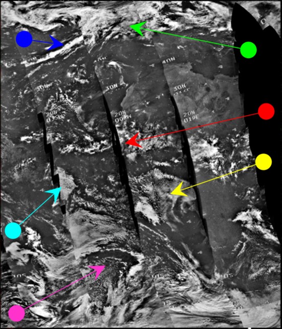


Figure 4.3.5.11: ESSA-
We’re at the moon, it would be rude not to take a closer look, so here’s that swirl off South America (figure 4.3.5.12).
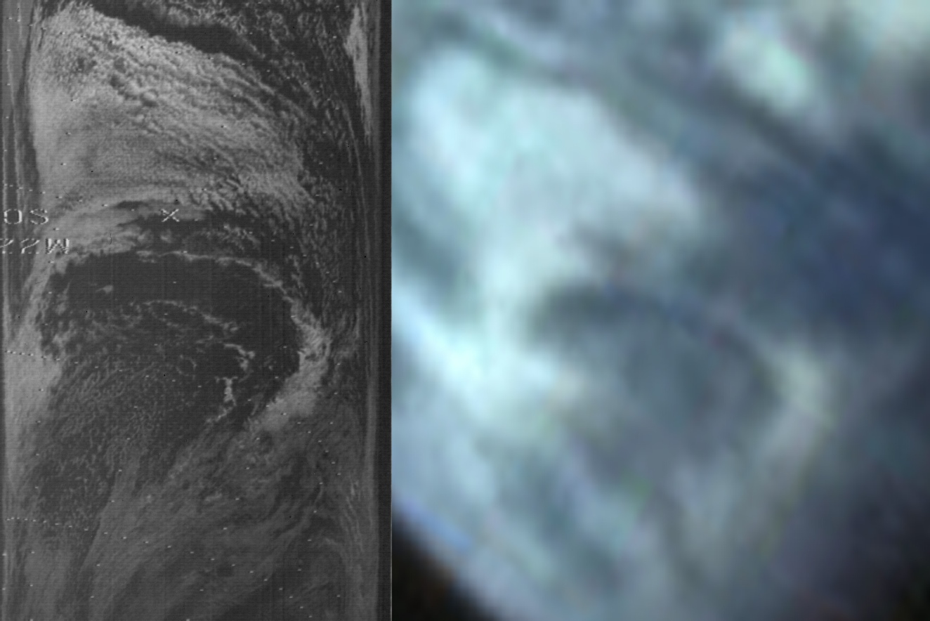
Figure 4.3.5.12: Section of NIMBUS-
Anyone who denies that there is an exact match in this image is an idiot.
In terms of satellite timings, the ATS-
The satellite comparison again shows that there is excellent correspondence between all 3 satellites' images and the Apollo photograph. The most obvious weather system is that shaped like a bass clef picked out by the blue arrow. The large cloud pattern off Africa shown 24 hours earlier is still visible (magenta arrow) but has changed shape and position.
It's interesting to note that the blue-
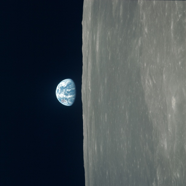
While Armstrong & Aldrin were in the LM, Collins was left to orbit the moon alone in the CSM, and part of his responsibility during those orbits was to take photographs of the lunar surface (and with any luck identify Tranquillity Base. While orbiting he captured a series of black & white Earthrise images & one of those, AS11-
Figure 4.3.5.13: AS11-
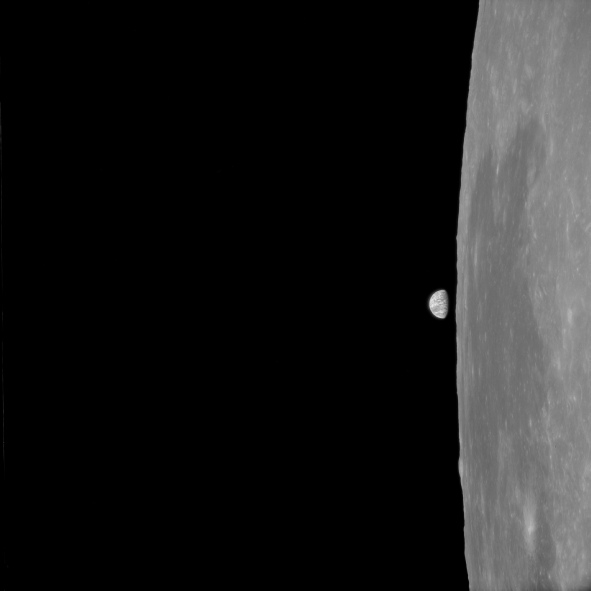
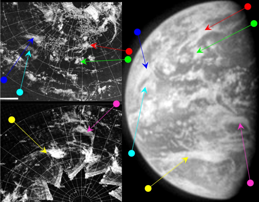
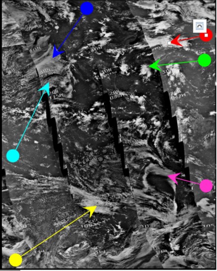
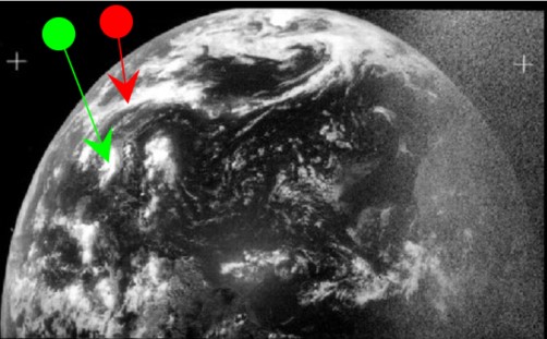
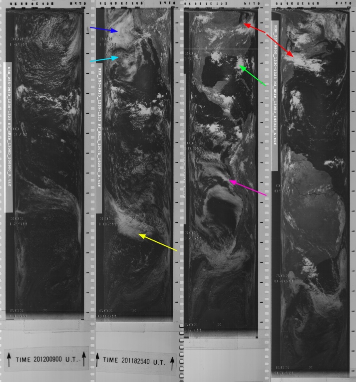
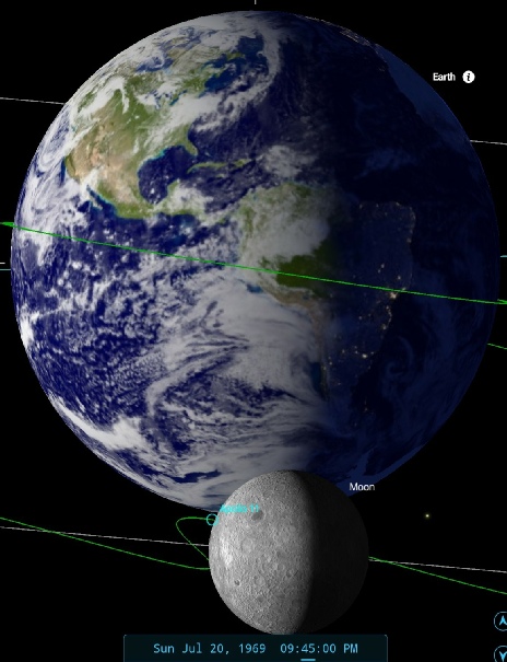
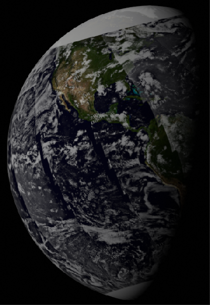
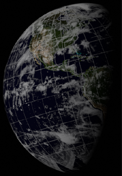
Figure 4.3.5.14: Top row: ESSA-
The ATS-
As the cloud masses picked out in red & green on the ATS are still visible in the Apollo image, it is reasonable to assume it that it was also taken on the 20th. ESSA's image on the 20th covering the western coasts of south America was commenced at 20:02 (track 4, orbit 1805), while NIMBUS orbit 1306, covering the same coast, was commenced at 16:39.
The Apollo 11 transcripts show that at 103:24 MET signal was lost from the CSM as it disappeared from view, and 41 minutes later at 104:15 (or 21:47) on orbit 15, Mike Collins says:
104:15:00 Collins: Houston, Columbia. How's it going?
as he emerged from behind the moon and has acquired a signal from Capcom again. Given that an Earthrise photo is taken at AOS, it seems reasonable to suggest that the black & white photograph was taken just before Collins makes his 'How’s it going' radio call. SkySafari's terminator set at 21:45 shows that the Earth in the Apollo image is an exact match for what should be there.
This Earthrise photo is part of a sequence that has been compiled into a video, and this can be seen here.
As with the earlier colour Earthrise, we can try and see if the Earth is rotating in the time it takes to run the sequence. We have an even longer sequence this time, taken as roughly 500 miles of moon passes beneath Collins over roughly 8 minutes. As there are so many photos we can even have the luxury of discarding incomplete Earths! Figure 4.3.5.15 shows the comparisons.
I can’t guarantee the Earth is oriented 100% correctly, but I can guarantee that parts of South America and its associated weather disappear beyond the terminator, showing Earth rotating as time passes during Collins’ orbit.
That’s it for Day 5. Collins is carrying out his lonely vigil, Armstrong and Aldrin are on the surface. The next shots of Earth are a mix of surface and orbital images on Day 6. Click the link to see them.
Even a this time period allows us to demonstrate that the Earth shown in the photographs is rotating. Explain that flat Earthers!
12 hours later the crew were in the process of undocking the LM, recorded as being at 110 hours 12 minutes, and image AS11-
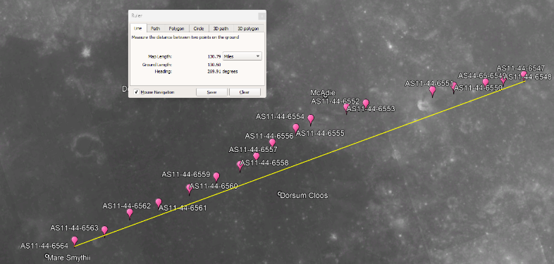
Figure 4.3.5.9: AS11-
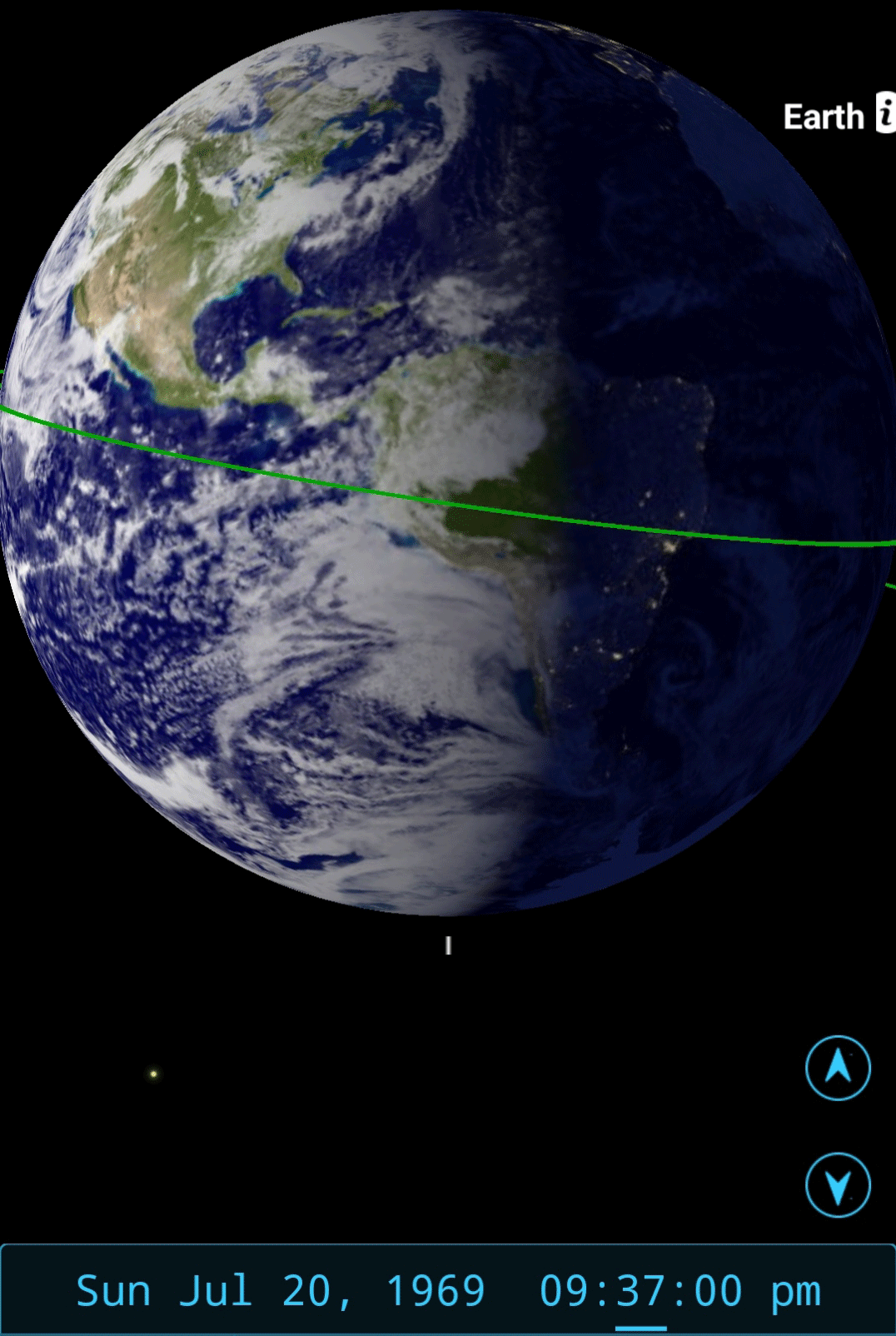
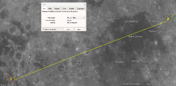
Figure 4.3.5.15: AS11-