4.3.3 -
The next still image in magazine 36 was taken not long after the previous one on day 2, so there’s not much point in going to town on it, especially with another TV broadcast coming up. We will, however, include it in the record as figure 4.3.3.1.
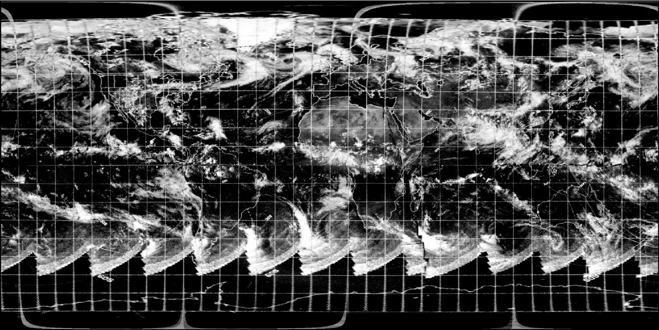
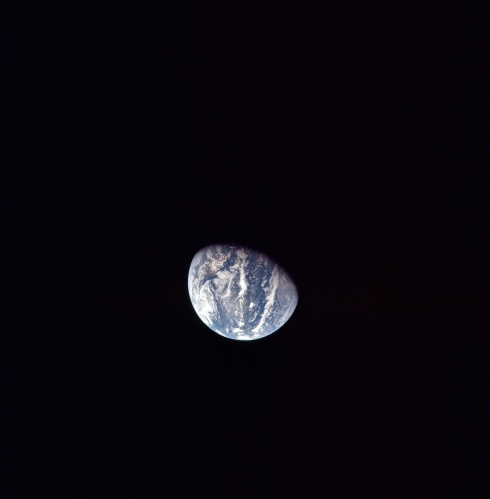
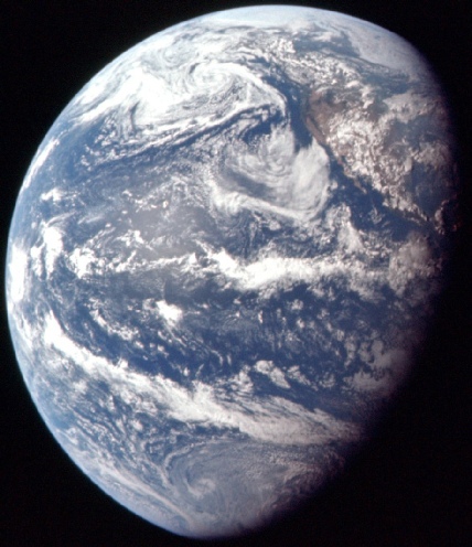
Figure 4.3.3.1: AS11-
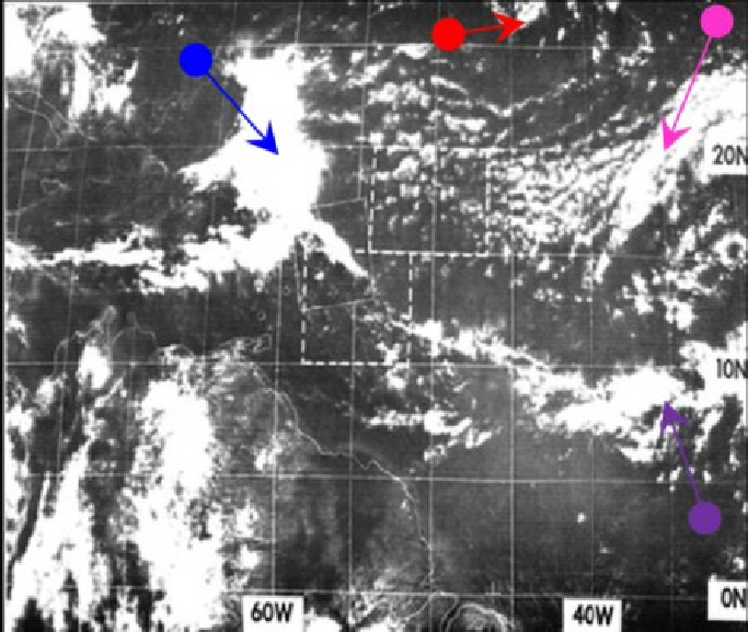
The key to getting the time right is a small band of cloud running north south along the western edge of the Yucatan peninsula, much more easily made out in figure 4.3.2.34. The whorl in the storm off Chile is still just visible in that photograph, demonstrating that Buzz would definitely have been able to see it in the TV broadcast, and therefore the purple arrow is definitely pointing towards it in figure 4.3.27. The next photograph with any significant degree of Earth rotation is the next image in the sequence, AS11-
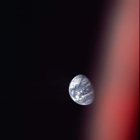
Figure 4.3.3.2: AS11-
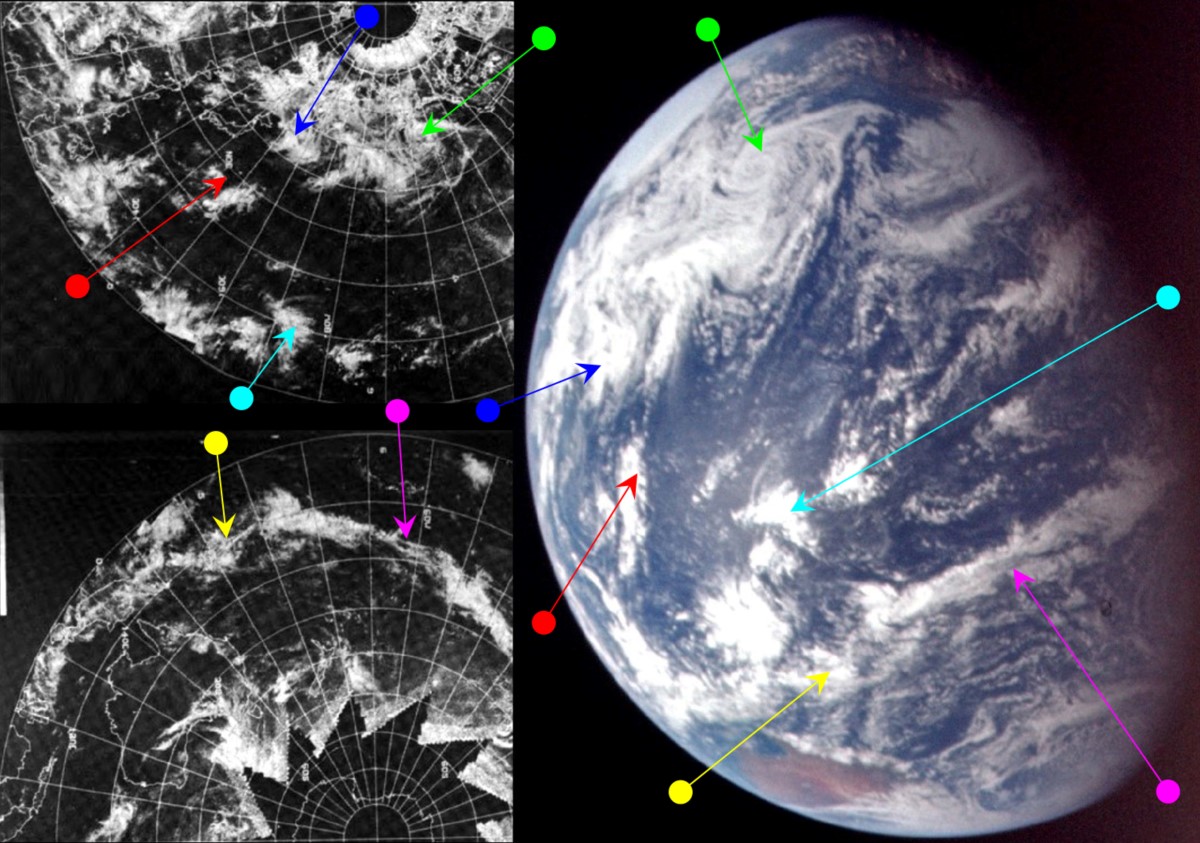
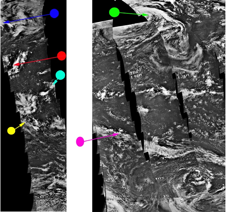
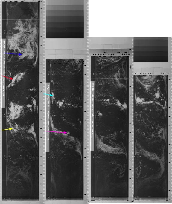
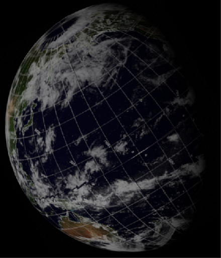
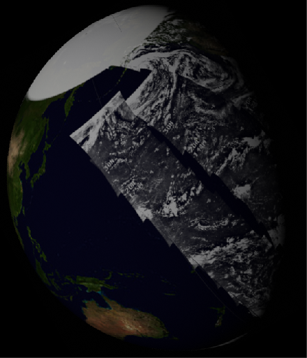
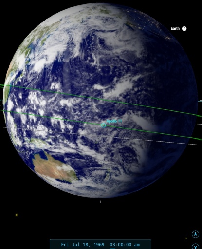
Figure 4.3.3.3: ESSA-
Australia has now come into view, and only a thin part of the US west coast is visible, so there has been a longer time lapse between images than has been the case for the previous few photographs. Australia will be seen several more times during the orbital and landing phase of the mission, so it's worth making a mental note of the cloud formations around the coast for future reference.
It is still just possible to make out weather systems identified in those pictures, but they have mostly not been marked here. The storm off Chile, for example, is just passing beyond the terminator, but the Alaskan one is more visible and is picked out by the same green colour as in the previous analysis.
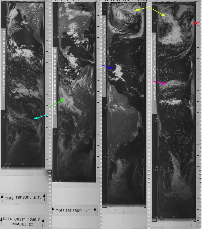
As for when this image was taken, SkySafari shows an estimate of around 03:00 on the 18th. ESSA's best fit orbit for the terminator region is number 1769 (track 5) which commenced at 23:02 on the 17th. The NIMBUS image is actually a composite from two days' worth. The westernmost pass included here is actually from the image dated the 18th, and the remainder the 17th. The orbital path covering the terminator is number 1267, which started at 18:50 on the 17th.
The next image in the sequence shows Africa returning into view. This represents a considerable time gap compared with the others, but the mission transcript shows that shortly after image AS11-
AS11-
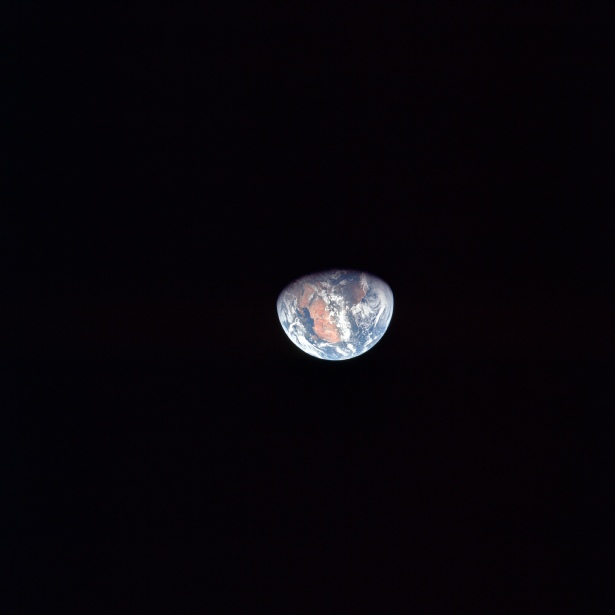
Figure 4.3.3.4: AS11-
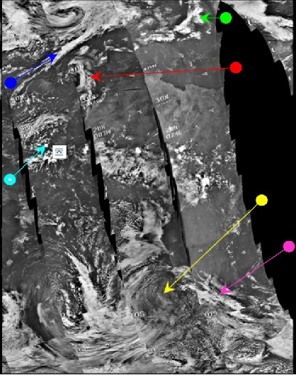
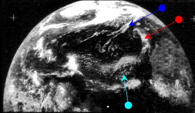
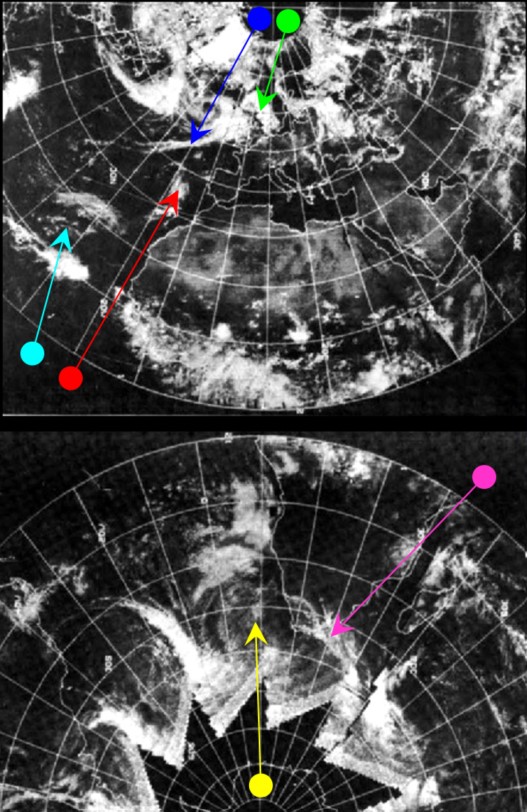
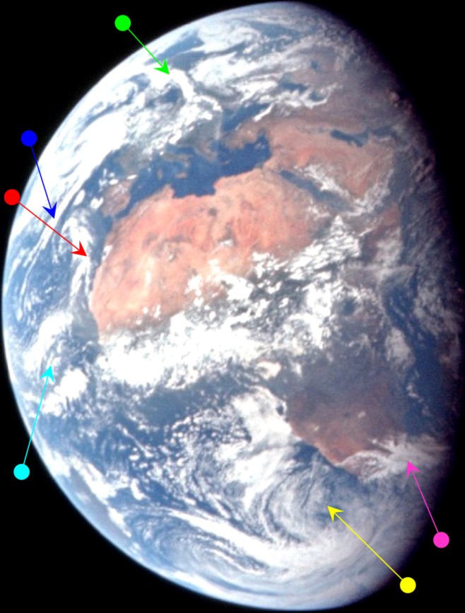
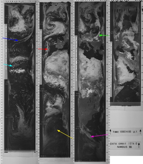


Figure 4.3.3.5: ESSA-
SkySafari estimates the terminator time as 14:00 on the 18th, which is approximately 48:30 MET . At 48:32 in the transcript, we have the following (edited) quote from Aldrin:
048:32:35 Aldrin: Houston, Apollo 11. We've got the continent of Africa right facing toward us right now, and of course, everything's getting smaller and smaller as time goes on. The Mediterranean is completely clear. The Sun looks like it's about to set around Madagascar. The equatorial belt of Africa stands out quite clearly. We're seeing a dark green or a muddy colored green, compared to the sandier colors of the southern tip of Africa and, of course, the Sahara northern coast of Africa. There's a rather remarkable cloud that appears in the vicinity of the border between Afghanistan and Pakistan. It's just about to go into the sunset now. It is casting quite a large shadow. It's isolated. There don't seem to be any other clouds. The band of clouds near the tropical convergent clouds down around the equator clearly separate the clockwise and the counter-
The Afghan border cloud is not identified specifically in the preceding figure, as it would not be featured on an ESSA image dated the 18th. If we isolate that area of the globe and compare it with the ESSA image dated the 17th (which would show that storm on its final orbits on the 18th), we get figure 4.3.3.6.
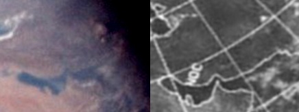
Figure 4.3.3.6: Section of AS11-
It should be evident that there is a cloud in exactly the same place on the ESSA image in isolation. The boundary line of the ESSA image on the 17th is given as track 10 (orbit 1774), although the dividing line appears to be one later (orbit 1775) at the start of the image dated the 18th. The commencement times for these orbits are 09:09 and 11:04 respectively. ATS' time is recorded as 14:55 on the 18th, while NIMBUS' orbit 1273 started at 05:46 on the 18th. The HRIR image doesn’t show the cloud clearly, but you can see the wispy cloud over the Arabian Gulf.
In the next image ((figure 4.3.3.7) Africa has started to disappear into darkness, but not enough has changed to merit a full treatment. We can check that it’s as it should be though.
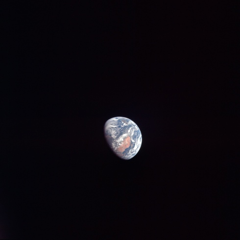
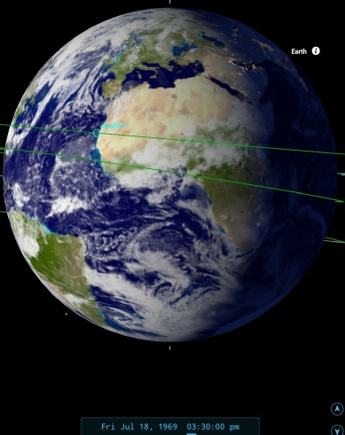
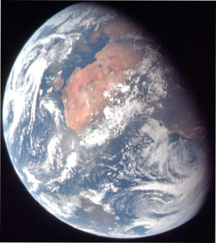
Figure 4.3.3.7: AS11-
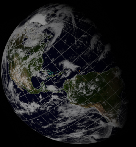
SkySafari suggests that the photo was taken 90 minutes or so after the previous image. The photograph after this one does show significant rotation, and retty much all of the Americas are in view, as can be seen in figure 4.3.3.8, and the analysis in figure 4.3.3.9.
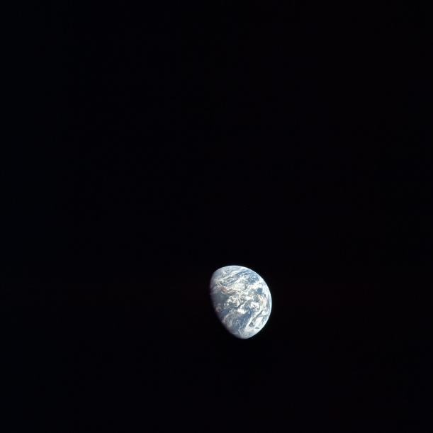
Figure 4.3.3.8: AS11-
Also shown is a version of the image from this document, published in 1970 and available for sale at Bonhams auction
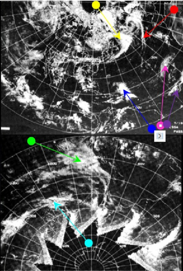
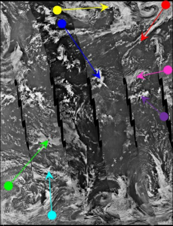
The observant reader will have noticed several more images in figure 4.3.3.9 than is usual, with the additional images coming from detailed sections of an ATS image from a journal, , ATS strips from a University of Wisconsin report, and an ESSA image from the BOMEX study referenced in the introduction to this section. The cyan arrow in figure 4.3.35 picked out the area between a pair of parallel clouds, which in this figure have been picked out by the magenta and purple arrows, as using both clouds allows more detail to be picked out in the zoomed in ESSA & ATS image.
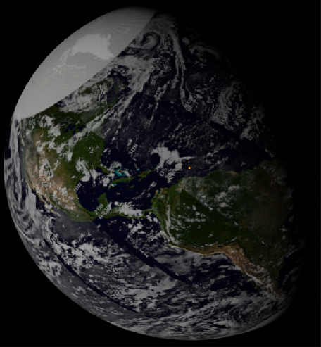
SkySafari estimates the terminator to be at around 20:15, shortly before Aldrin and Armstrong enter the LM to inspect it, and this Apollo image is the last in magazine 36 before that inspection. The ATS-
The NIMBUS pass over the Caribbean (orbit 1278) commenced at 14:31, which would explain why the weather system picked out by the blue arrows is more similar to the ATS-
Although the NIMBUS image is again of poor quality, all 3 satellites clearly show the same weather systems as the Apollo image, and these systems are also very obviously part of developing global weather systems.
The Apollo image also marks the end of a long sequence of images showing continuous coverage of the Earth, ie one weather system is always visible in at least two consecutive shots. Stringing these images together allows us to see the Earth’s rotation as Apollo 11 travels away from it. This can be seen in the videos below (assembled by the author). Video 1 shows the Earth as it retreats as the astronauts would have seen it, while in Video 2 each photographic frame has been stretched to keep the size of the Earth the same.
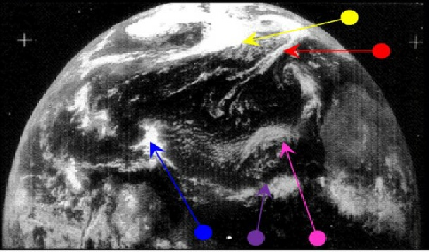
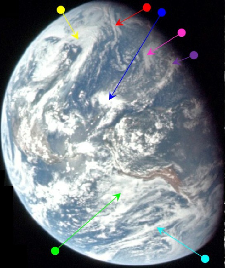
While inspecting the LM, another live TV broadcast to Earth was carried out, most of which consisted of film inside the LM showing the various control panels & equipment. That broadcast also featured an image of Earth, and a screenshot of this – taken from a BBC documentary – is shown below in figure 4.3.39. This youtube link shows the Earth footage as broadcast on the news on the 18th. A comparison with ESSA & NIMBUS sources is shown in figure 4.3.40. A better quality version of the footage can be found here and a screenshot of that is used in the analysis in 4.3.3.10.
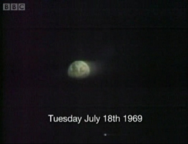
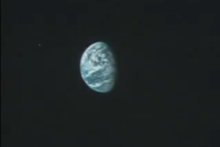
Figure 4.3.3.10: Screenshot of Apollo 11 live TV broadcast 18/07/69. Source: BBC
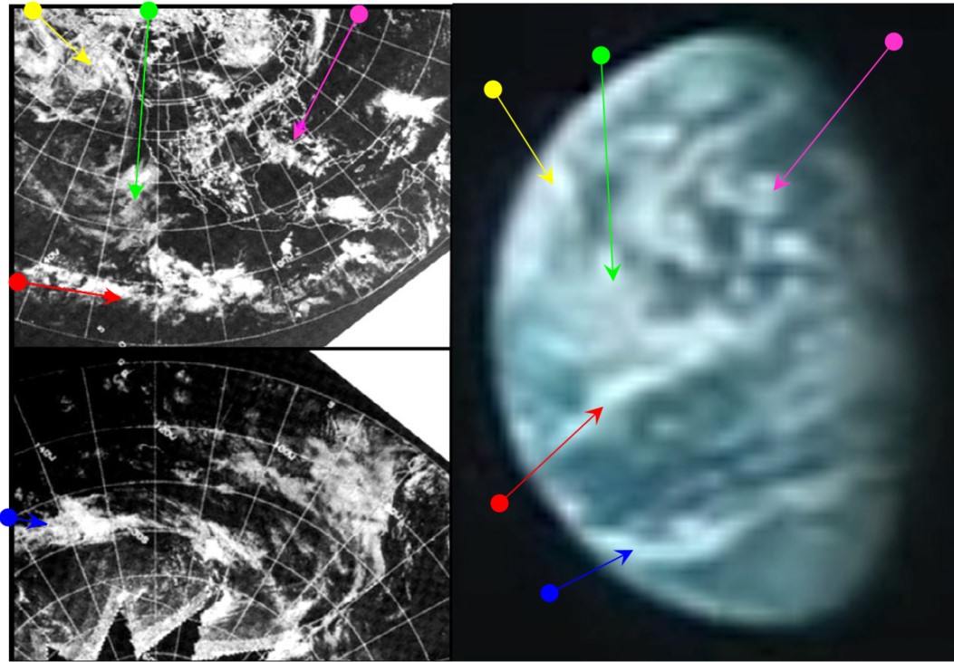
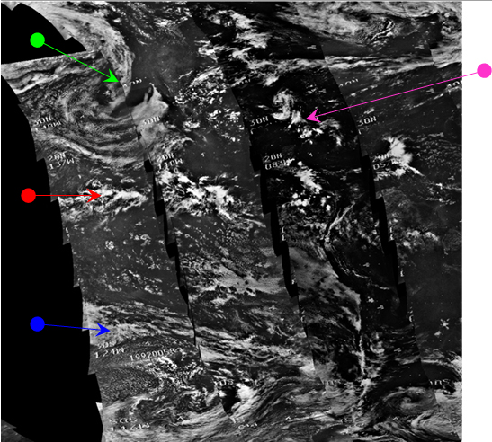
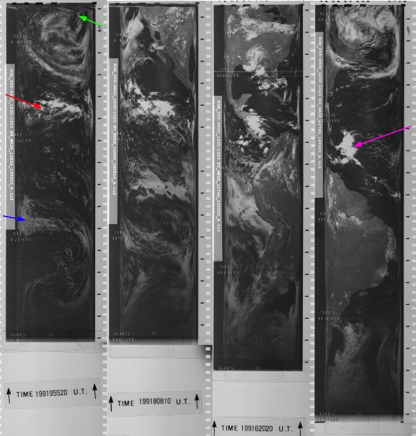
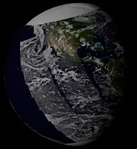
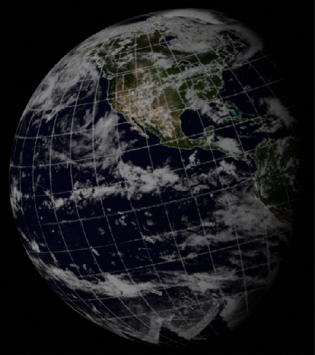
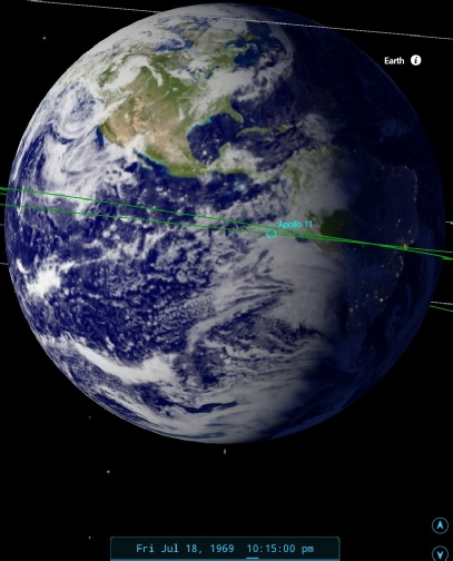
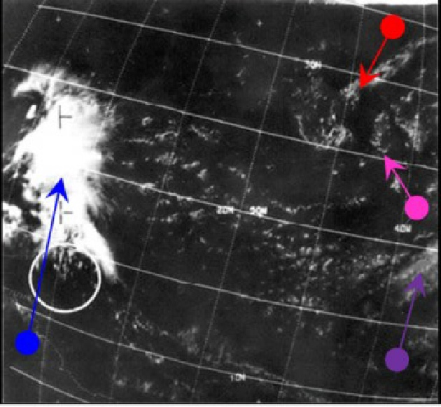
Figure 4.3.3.11: Brightness adjusted close up of video screenshot from 18/07/69 compared with ESSA (top and bottom left) and NIMBUS 3 (right) images from the same date, and Stellarium depiction of terminator at time of broadcast. The lower images are from recently restored IDCS (left) and HRIR (right) NIMBUS-
We can pinpoint the timing of the TV picture fairly accurately by looking again at the mission transcript. At 56:38, we have the following exchange between Capcom and Armstrong:
056:38:55 Duke: 11, Houston. If that's not the Earth, we're in trouble.
056:39:00 Armstrong: That's the Earth, and we have a very good view of it today. There are a few more cloud bands on than yesterday when we beamed down to you, but it's a beautiful sight.
.And a few moments later we get a brief description of the view:
056:41:34 Duke: 11, Houston. We see the -
56:41:51 Aldrin: Yeah, that's the way it looks, Charlie. Same as yesterday.
056:43:32 Duke: 11, Houston. We have you -
056:43:46 Armstrong: That -
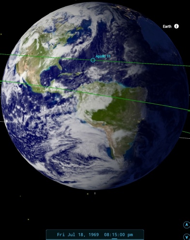
This puts the view of Earth just before the end of the TV transmission at around 22:10 on the 18th. SkySafari's view in figure 4.3..3.11 shows that the description is accurate. It’s worth noting that the final NIMBUS-
Although the detail in the screenshot is not perfect, it is still possible to make out the long band of cloud just north of the Equator (red arrow), and the banks of cloud off the California coast (green arrow). The much lower latitude band of cloud off South America is also evident (blue arrow). The magenta arrow suggests the location of the cloud around the Florida coastline, but it is not absolutely certain. There are also differences in colour between the areas that should be occupied by ocean and land. In short, the screen capture is consistent with a planet Earth that has rotated over the short time interval since figure 4.3.3.9, and shows the weather patterns it should show. The higher quality screenshot, found much later in the writing of this piece, confirms these observations.
There’s one final image to be examined here, which SkySafari estiamtes to be taken around midnight, but as the next photographs of Earth occur over Africa again, it makes more sense for it to be in this page, see figure 4.3.3.12
Figure 4.3.3.13: AS11-
There’s not enough change to warrant a full analysis, but the view is consistent with the mission timings: Armstrong an dAldrin enter the LM at 23:27 to inspect their lunar home, and this photograph occurs after that. The terminator position around the eastern edge of Yucatan forms the basis for the timing.
The next images of Earth are unequivocally taken on day 4. Click the links to take you there.
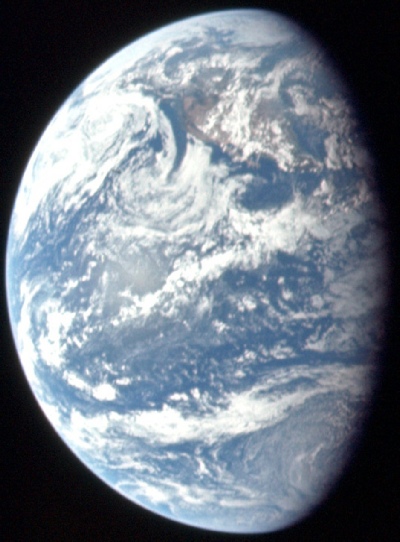
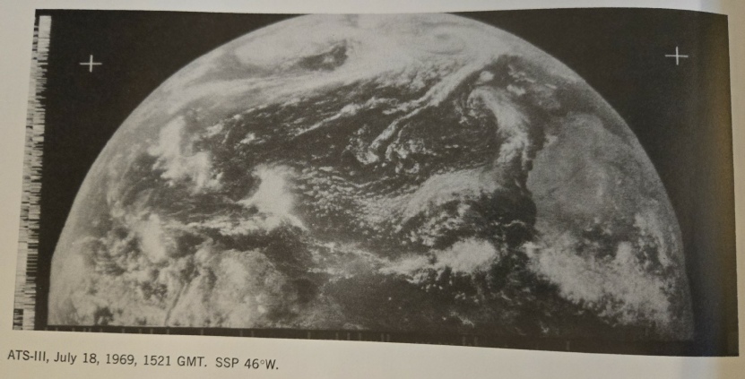
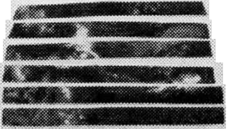
Figure 4.3.3.9: Top row: ESSA-
Second row: Journal ATS-
Third Row: Scanned ATS-
Fourth row: NIMBUS-
Fifth row: 3D models from digitally reconstructed data from ESSA (left) and NIMBUS (centre) satellites and SkySafari time estimate.
Left: ATS-