4.3.1 -
As with other missions, Apollo 11 settled into a couple of laps of the home planet before leaving for its satellite, and while they were there they managed a couple of photographs of the scene below them. One set of photographs is of particular significance, and more of that later. Before we get to that, let’s set the scene. Figure 4.3.1.1 shows the orbital pathway of Apollo 11.
Figure 4.3.1.1: Earth Parking Orbit tracks for Apollo 11. Source.
The important part here is the area that takes them over the Pacific, heading towards the West Coast of the USA via Hawaii. As they get there, we have this conversation:
001:24:51 Collins (onboard): Trees and a forest down there. It looks like trees and a forest or something. Looks like snow and trees. Fantastic. I have no conception of where we're pointed or which way we are or a crapping thing, but it's a beautiful low pressure cell out here.
001:25:10 Aldrin (onboard): Yes, go ahead and take a picture. Keep your [garble] down.
001:25:16 Aldrin (onboard): Must be past Hawaii by now. 01:28 is AOS.
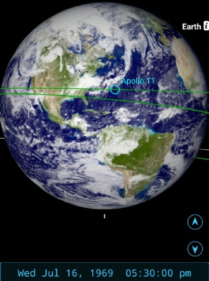
001:25 works out as 15:05 GMT, and as figure 4.3.1.2 shows, the timings clearly put them off the west coast.
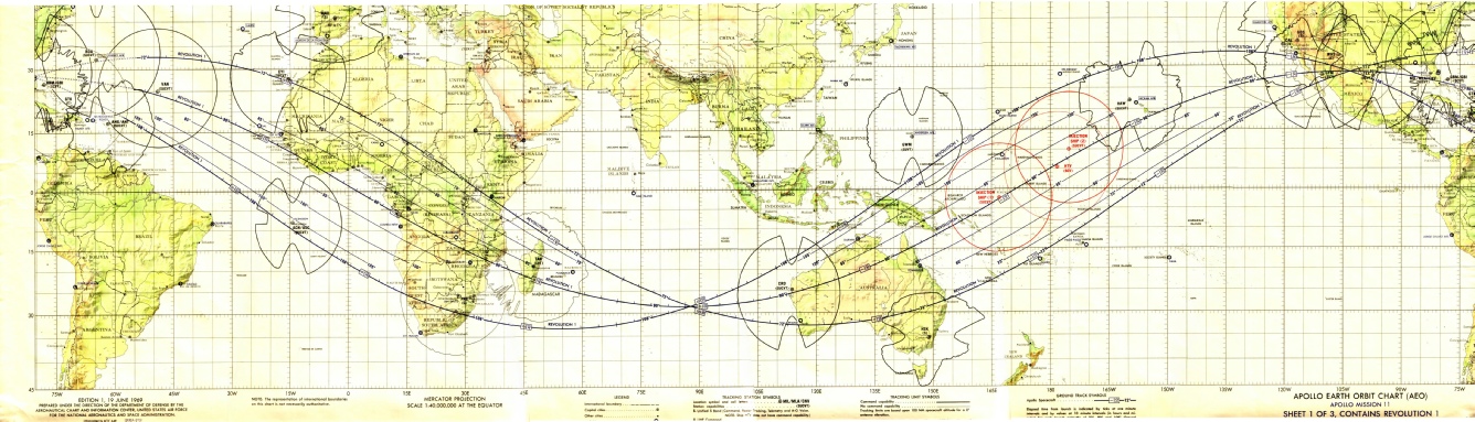
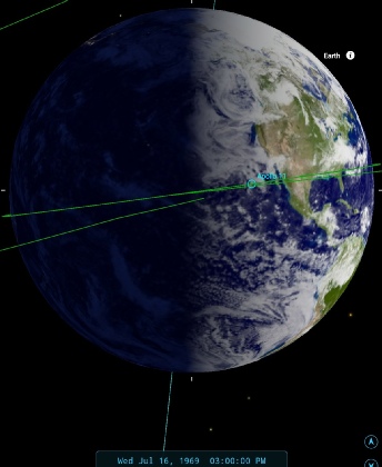
Figure 4.3.1.2: projected location of Apollo 11 after 90 minutes, with a SkySafari depiction of their location
It’s at this point that Michael Collins takes the first photographs of Earth in the mission, showing the low pressure system to which he’s referring (figure 4.3.1.3).
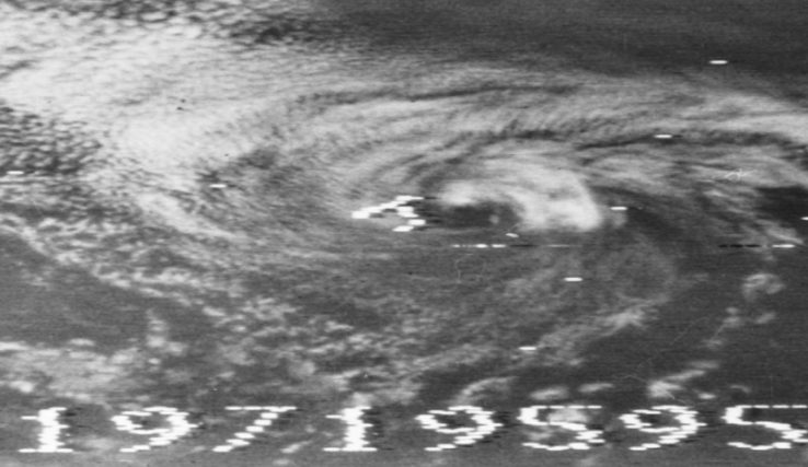
Figure 4.3.1.3: AS11-
It’s worth noting that this is just after sunrise, which is exactly as the SkySafari representation depicts, and that the next image after the ones showing this depression (AS11-
The next shots of Earth are clearly from much further out, and the Earth’s curvature shows that they are evidently now on their way to the moon. The TLI burn occurred at 16:22, an the shots after these images of Earth in magazine are of the S-
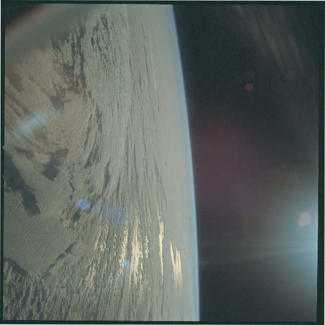
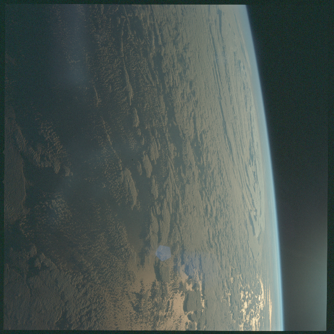
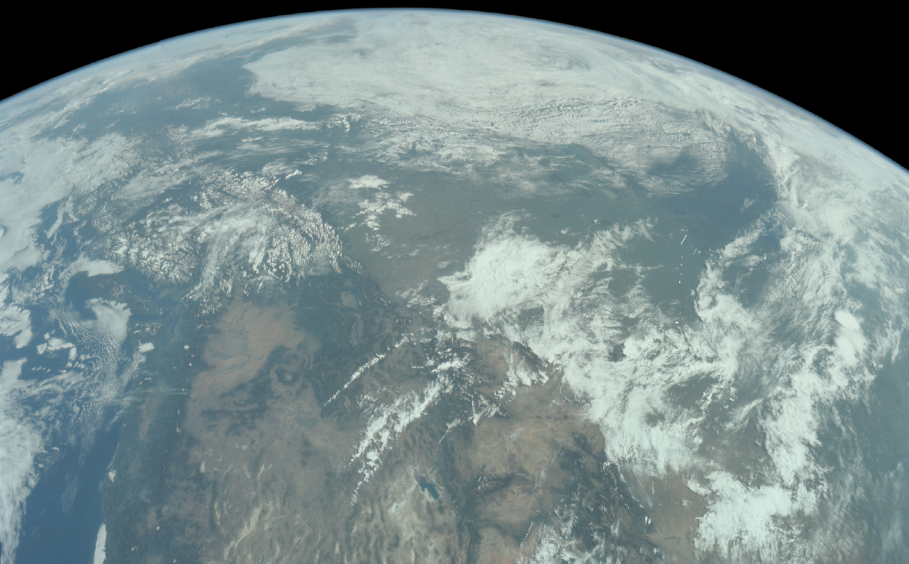
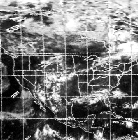
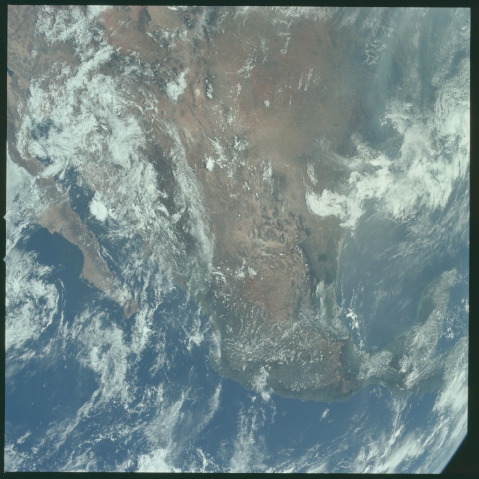
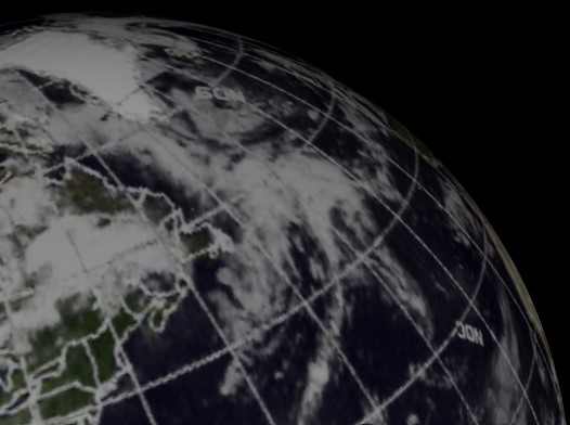
Figure 4.3.1.4: Photomontage of AS11-
This article, hosted by aulis.com and written by yet another of their imaginary PhDs, tries to make the claim that the 16mm image of Earth shown here, and the others taken around the time of TLI, were actually taken in Earth Parking orbit. It jumps through all manner of mathematical hoops using an a priori assumption to justify its claims but fails to do the simple thing: look at what the image is showing. It simply is not physically possible to film or photograph the areas covered in the images in a parking orbit with an altitude of 190 km, nor could a single receiving point of the transmission be possible during the docking sequence. One has to wonder why they didn’t check what was visible to verify their findings: the Atlantic off the coast of Europe and North Africa, Nova Scotia, Greenland. It’s almost as if they were being, you know…dishonest.
The reality is that the photographs shows exactly what it should, and could not be taken in a parking orbit.
Soon after this we have a short section of 16mm footage, and the weather system visible on the breakfast table satellite photos makes an appearance in it. Figure 4.3.1.5 shows a still from that footage.
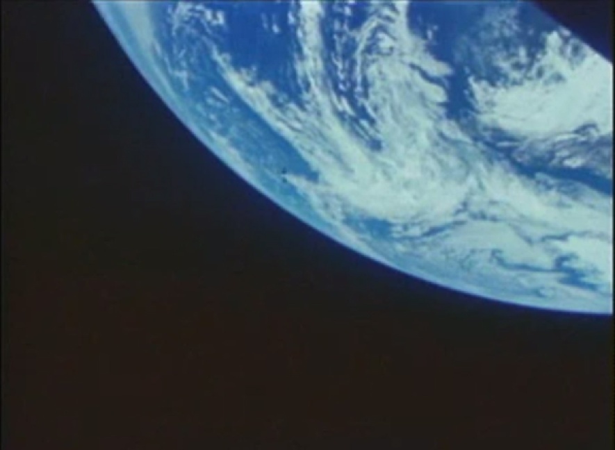
Figure 4.3.1.5: Screenshot taken from the opening of Apollo 11 LM docking footage, 16/07/69. Source.
If the weather system seen dominating this view of Earth looks familiar, it should. It is the same one shown in figure 4.3.2 over the north Atlantic. What becomes clear on closer inspection is that it is not the same as the satellite photograph – there are subtle differences. The satellite images from July 15th and 16th are compared with this screenshot in figure 4.3.1.4.
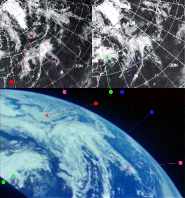
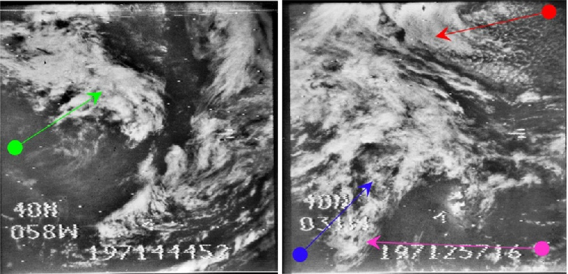
Figure 4.3.1.4: ESSA images from the 15th (top left) and 16th (top right) of July 1969 compared with screenshot from the docking sequence video. Below this are two newly restored NIMBUS-
The UK and African coast are just on the edge of the eastern limb of the 16mm reconstruction, and Canada and Greenland are very obvious. Notice how much of the Earth is encompassed by the view. Not possible in EPO, and no amount of smoke and mirrors with equations and bending the data to fit the facts is going to change that.
The reason two different day’s ESSA images are included is to show that the 16mm image is not the same as the satellite photograph at the launch breakfast – there are subtle differences. the most obvious difference between the two days’ images is the area of cloud developed over north America (green arrow) that isn’t shown in the one being examined over breakfast. That part of the satellite image is obscured on the breakfast table, but the rest of the image confirms that the date is correct.
A more subtle change is the small pair of narrow clouds forming a kind of ‘=’ sign (blue arrow) that isn’t visible in the breakfast image but can be seen in the Apollo screenshot and the ESSA image from the 16th. The cloud bank to the north of the main weather feature (red arrow) is much closer and larger on the launch day image, and the lower section of north-
The next views of Earth are from a sequence of photographs sandwiched between a completely docked LM and a discarded S-
The storm off the west coast of the USA is the same one picked out in figure 4.3.1.3, and we’ll be dealing with it again shortly.
It’s difficult to be exactly certain when this photograph was taken as we have no terminator by which to judge (the lower half is obscured by the CSM window).
As discussed above, it does appear immediately before shots of a distant and now empty S-
Many estimates suggest 4 hours into the mission, or sometime around 17:30, which is what I’ve used here. It’s worth taking a look at the position of Spain in the photo, which hasn’t moved much further round.
At 18:24, we have this comment from Armstrong, giving more detail of the view and the weather conditions and expanding on his earlier account.
004:52:19 Armstrong: Well, we didn't have much time, Houston, to talk to you about our views out the window when we were preparing for LM ejection; but up to that time, we had the entire northern part of the lighted hemisphere visible including North America, the North Atlantic and Europe and Northern Africa. We could see that the weather was good all -
The satellite record matches his description, and the ATS-
After the photographs of the empty and departing S-
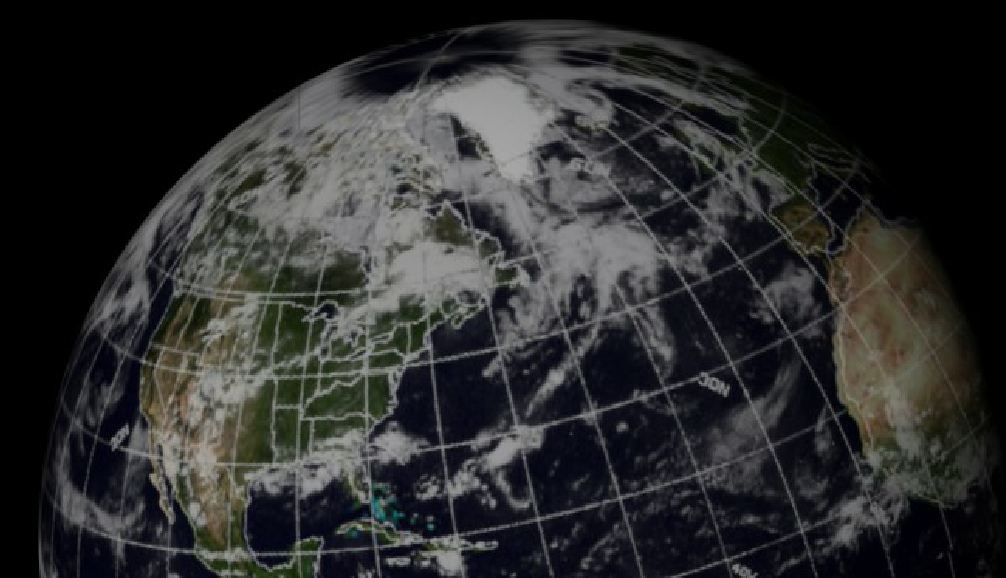
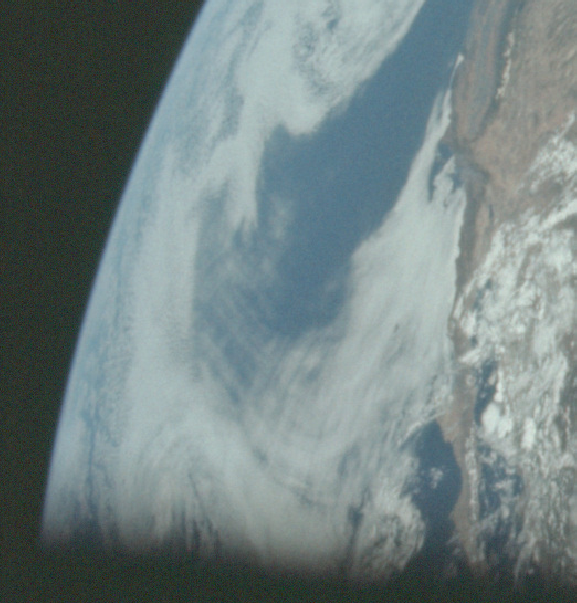
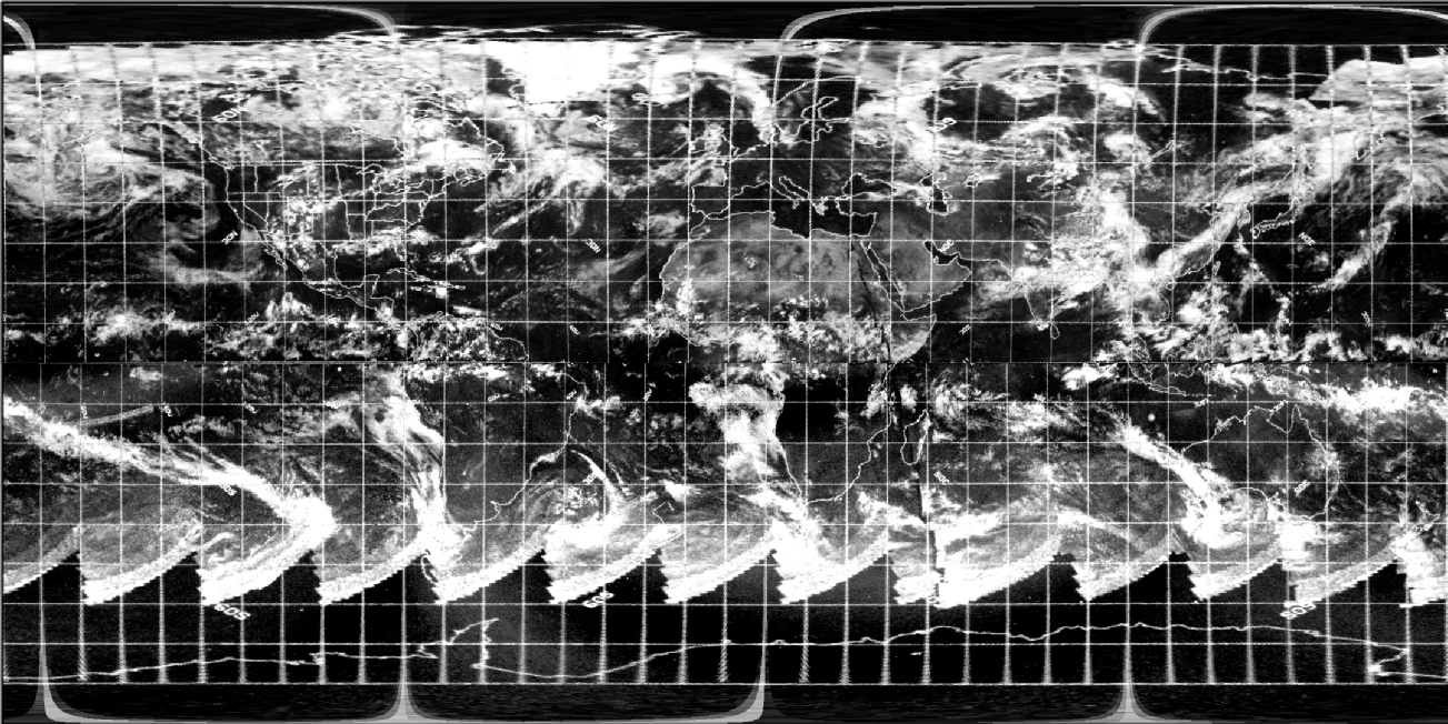
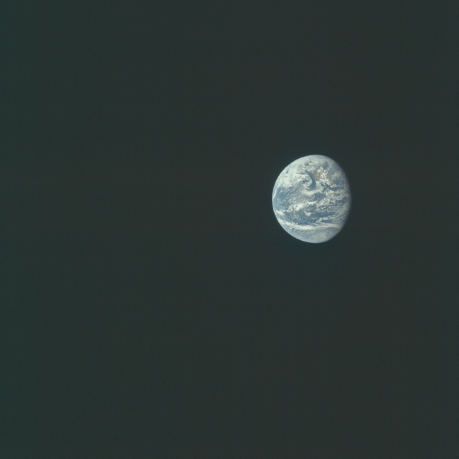
Figure 4.3.1.10: AS11-
SkySafari suggests a time of 23:00 for this image, just an hour before their first TV recording (broadcast to Goldstone in California and then relayed to Houston at 01:30 on the 17th), and well on the way to the moon from Earth.
The annotated ESSA & NIMBUS satellite data from the 16th are displayed, along with a zoomed & cropped image of Earth from AS11-
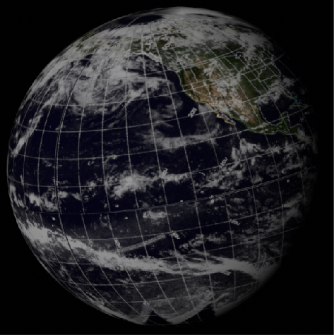
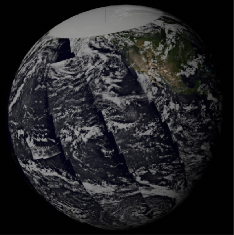
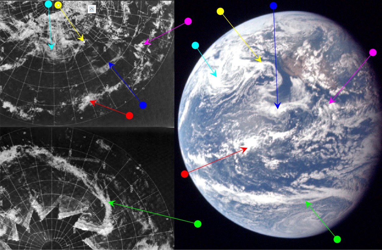
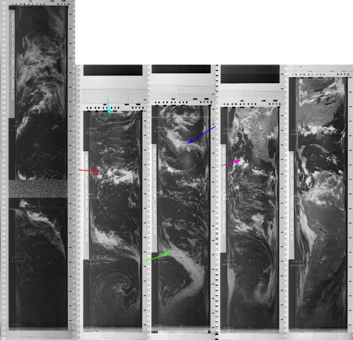
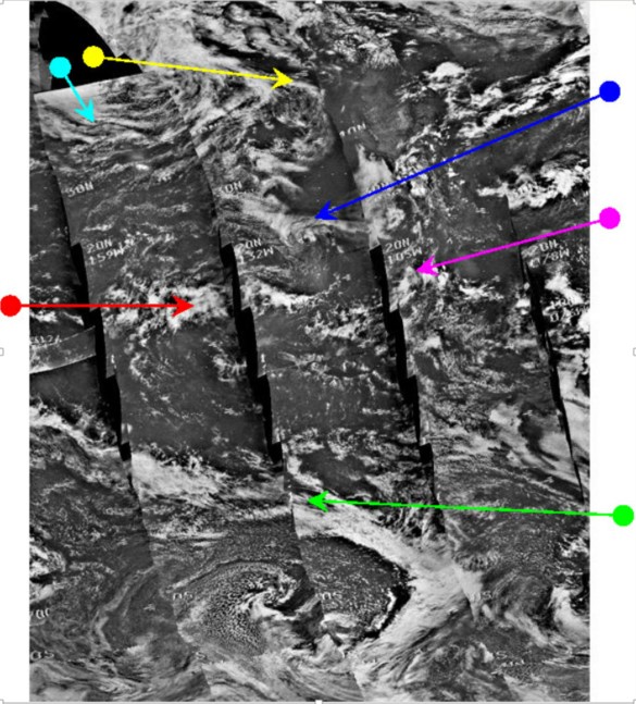
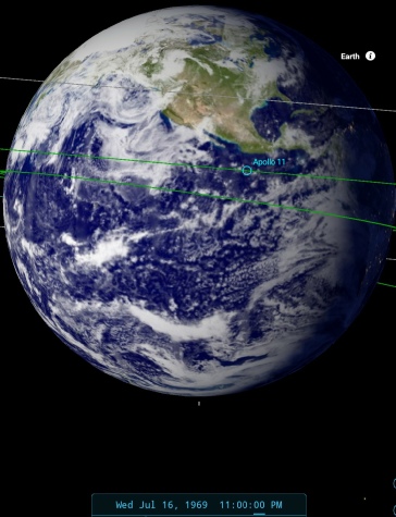
Figure 4.3.1.11: AS11-
The ESSA data suggest that the orbit covering the west coast of the USA (track 4, orbit 1755) was commenced at 20:07 on the 16th, with the areas west of this covered in the early hours of the 17th. The terminator was covered at 16:07 (track 2, orbit 1753) NIMBUS' orbital data for the west coast suggest that the same west coast orbit image (number 1254) was taken between 19:34 & 20:23 on the 16th. The IDCS view is timestamped at 18:12 over Central America. The final MRIR orbit covering the Apollo view was commenced at 23:30.
There’s not much commentary on the view, the crew are busy getting star fixes to confirm their position, but we do have some comments in advance of their upcoming (but unscheduled) TV broadcast:
010:05:45 Aldrin: Hey, Charlie, I can see the snow on the -
010:05:57 Duke: Roger, Buzz. Copy. Looks like there's a good view out there then.
010:06:00 Duke: And, Apollo 11, Houston. We'd like you to keep the O2 fan on. It will give you an ECS configuration prior to sleep. Over.
010:06:14 Aldrin: Okay. Fine. [Long pause.]
010:06:46 Aldrin: Charlie, with the monocular, I can discern a definite green cast to the San Fernando Valley.
010:06:56 Duke: Roger.
010:07:00 Duke: How's Baja California look, Buzz? [Pause.]
010:07:07 Aldrin: Well, it's got some clouds up and down it, and there's a pretty good circulation system a couple of hundred miles off the west coast of California.
That circulation system is picked out by the blue arrow, and is the same one pictured in the Earth Parking Orbit shots 4.3.1.3 and just after TLI in figure 4.3.1.5. We’ll be discussing it in much more detail in the page dedicated to the 17th.
Shortly after these brief descriptions, we have this offering from the crew:
010:21:56 Armstrong: Roger. If you'd like to delay PTC after -
And after a few minutes consideration we have agreement for the broadcast:
010:25:56 Duke: Apollo 11, Houston. We're ready at Goldstone for the TV. It'll be recorded at Goldstone and then replayed back over here, Neil. Any time you want to turn her on, we're ready. Over.
When they get the equipment turned it’s become the 17th in GMT terms, so we’ll save that for Day 2. Click the links below.
The question here is exactly when these were taken. We know that docking occurred at 16:56 GMT, and the newly conjoined CSM/LM did a separation burn from the S-
The AFJ has the first 8 photographs taken at around the time of docking and the last pair in the sequence some time later. The first question therefore is were they taken at separate occasions? Figure 4.3.1.6 compares the Earth in AS11-
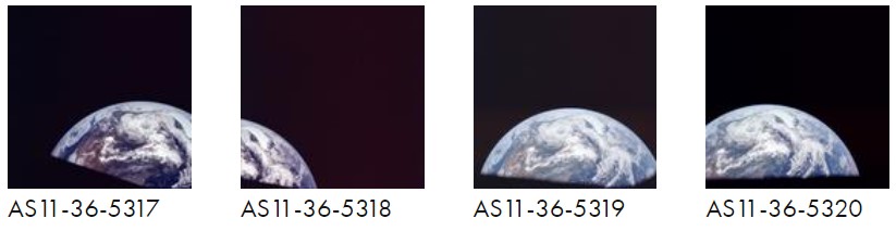
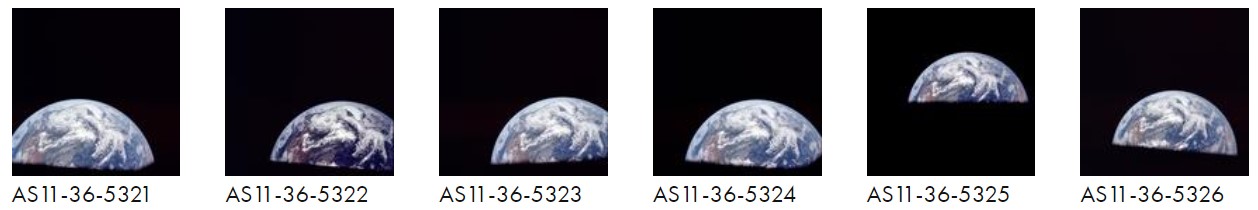
Figure 4.3.1.5: AS11-
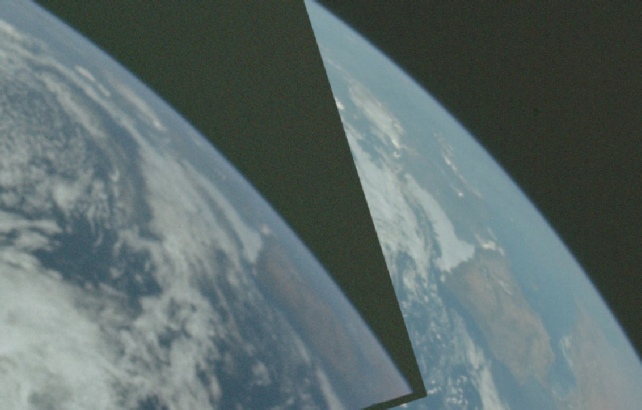
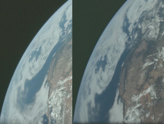
Figure 4.3.1.6: Comparison of AS11-
The two comparisons above were carried out by aligning the Earth’s curve and using Greenland as an obvious central feature. The most obvious change in the two images is the movement of the Iberian peninsula, which is much more in view in the later shot. It isn’t as immediately obvious, but the reverse change has occurred on the western limb, with the clouds and American landmass further to the west.
It doesn’t take a rocket scientist to work out that this is the opposite direction to the Earth’s acutal rotation, so the only explanation for the change in view is the movement of the spacecraft is it heads moonwards.
Does this help us work out timings? Well, we know that roughly 20 minutes elapsed between the footage shown in figure 4.3.1.4, and there’s been quite a change in the location of the storm system picked out by the blue arrow (see figure 4.3.1.7).
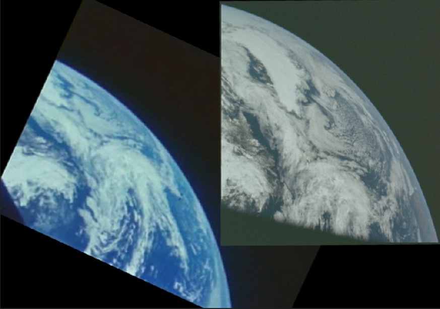
Figure 4.3.1.7: Comparison of 16mm docking sequence footage and AS11-
The leading edge of the storm system is obviously in a different position in the Hasselblad photograph, much more than could be accounted for by rotation over such a short timespan. There is also arguably much more apparent change than is visible in the movement of Spain over the sequence of Earth photographs, so arguably there is less time difference involved.
It’s difficult to be precise, but we do have Collins at 03 :28 GET saying:
003:28:33 Collins (onboard): Whatever you do, take some pictures.
Which would suggest that this first batch of 8 were taken shortly after docking.
A few minutes later we have a description of the view from Armstrong:
003:53:05 Armstrong: And Houston, you might be interested that out my left-
He’s obviously exact in his description.
It’s worth looking at how the Iberian peninsula view changes over the sequence -
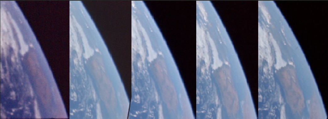
Figure 4.3.1.8: Changes in the position of Spain over AS11-
The positional change is slight, but it is there, which is a bit of a nuisance for all those claiming it’s some sort of static fake.
The other feature, noted in the AFJ, is the size difference in Earth between these first 8 and last 2 in the sequence. As11-
Speaking of the the last two, let’s do some actual weather analysis and look at the last in the set, shown in figure 4.3.1.9. As it’s not a full Earth, we’ll just show a 3D reconstruction of the view using ESSA data.
Figure 4.3.1.9: AS11-
