4.3.9 -
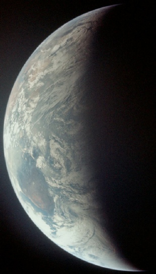
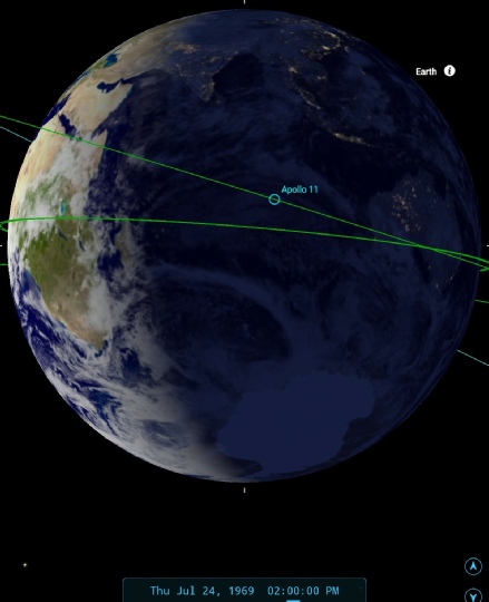
The start of the final day of the mission sees a return to colour images, and the first one is from just a short while after the TV broadcast. Figure 4.3.9.1 and 2 have the photo and analysis respectively.
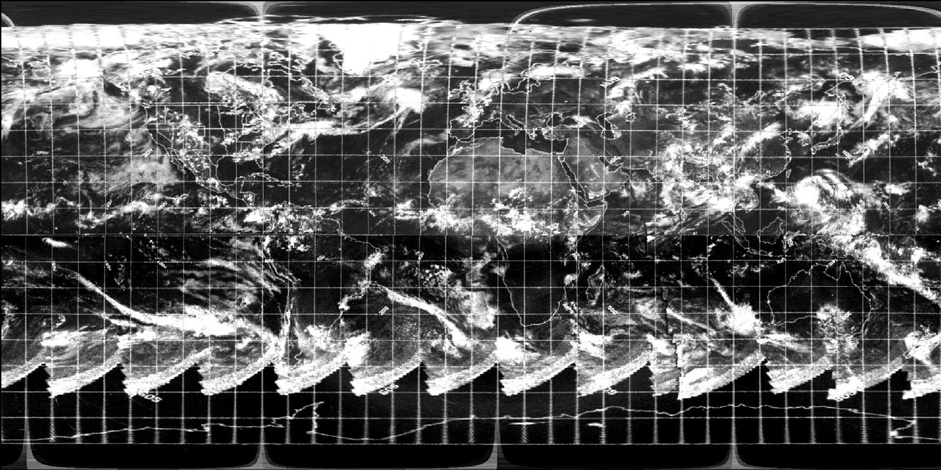
Figure 4.3.9.1: AS11-
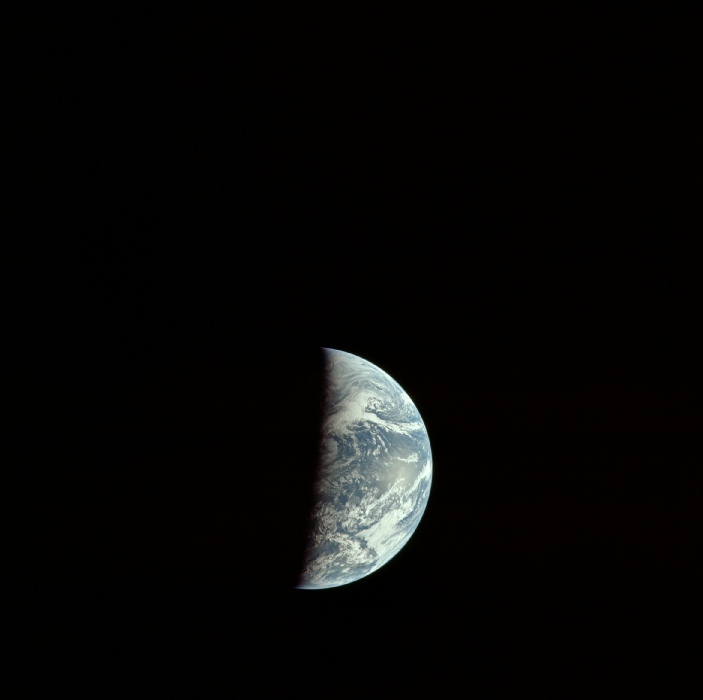
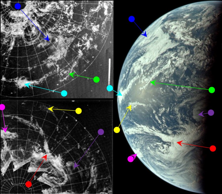
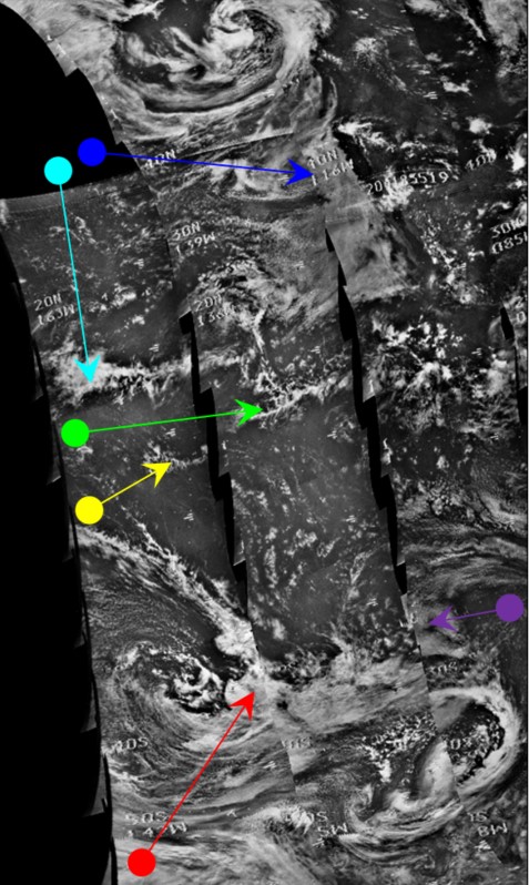
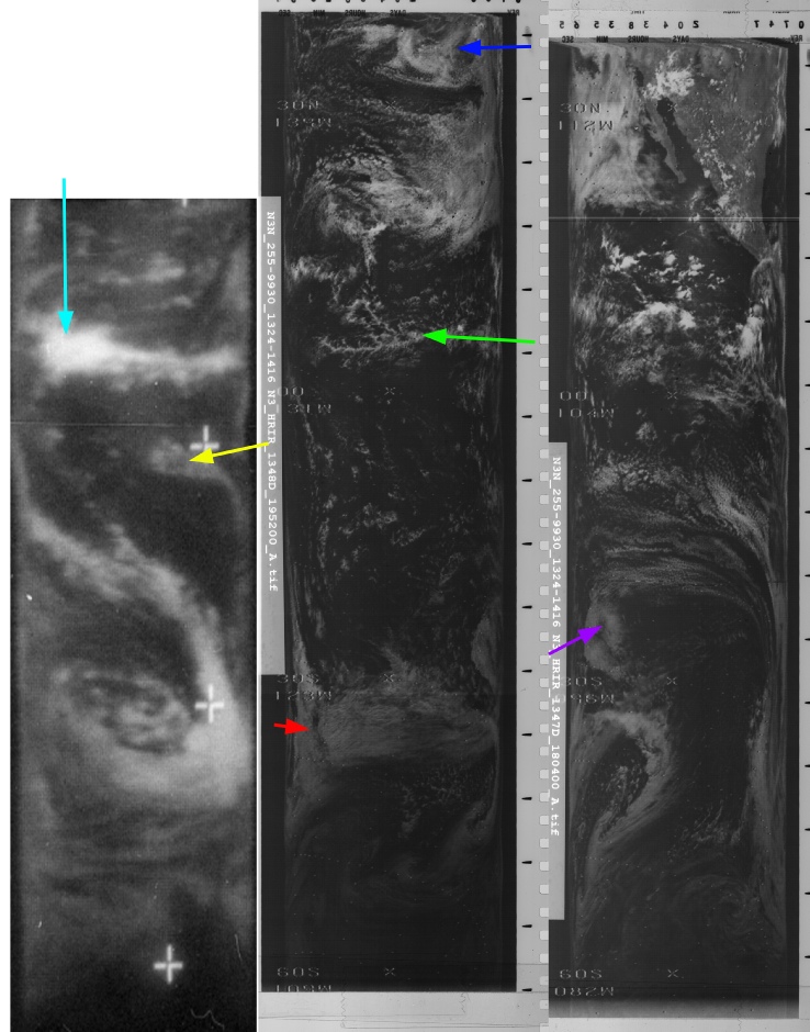
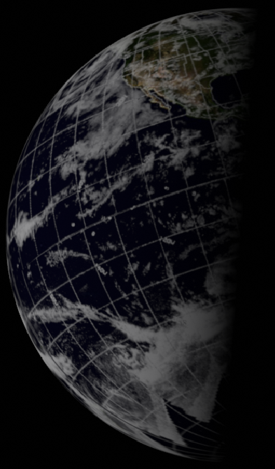
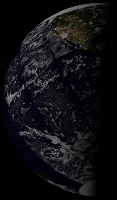
Figure 4.3.9.2: ESSA-
This photograph is clearly taken not much later than the preceding one from the TV broadcast. Now all of south America has gone, but much of north America is still visible, and the persistent fog banks off California (blue arrow) dominate the view of the northern hemisphere. The large system in the south identified by the red arrow is also visible in figure 4.3.79, but in a slightly different formation, and slightly further east.
SkySafari puts the terminator, just off the east coast of the USA, at around 00:45 on the 24th, some 16 hours before re-
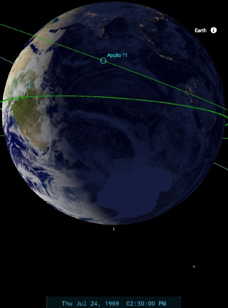
As with the Apollo 8 mission, July 24th is a day that sees the use of a Corona satellite, and three sections of that day’s orbits cover the USA seen in this Apollo image (figure 4.3.9.3).
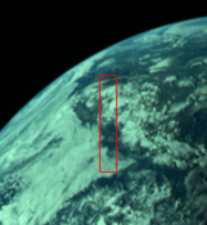
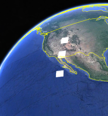

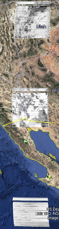
Figure 4.3.9.3: AS11-
It’s worth pointing out here that the Apollo image (as well as having brightness and contrast adjusted) has ben rotated to match the Google Earth orientation.
What the corona images show is an area of cloud south of Baja California, broken cloud over the Sonoran desert, and thicker cloud over Utah. While it would be unwise in this case to state definitively that this is exactly what we can see in the Apollo image, there are certainly areas of agreement -
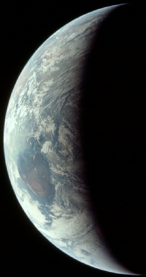
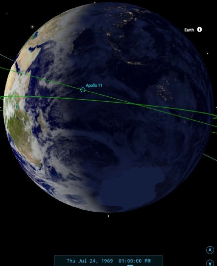
The next image of Earth on magazine 38 shows a very similar scene, and was taken only an hour later (if my SkySafari settings are correct) than AS11-
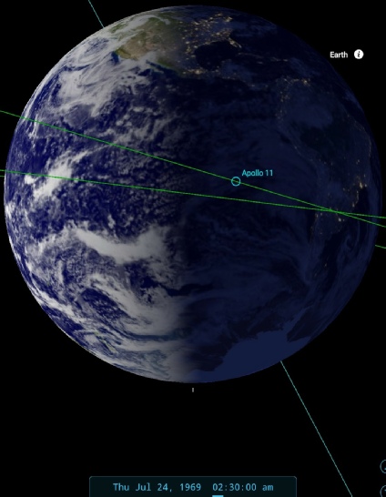
Figure 4.3.9.5: AS11-
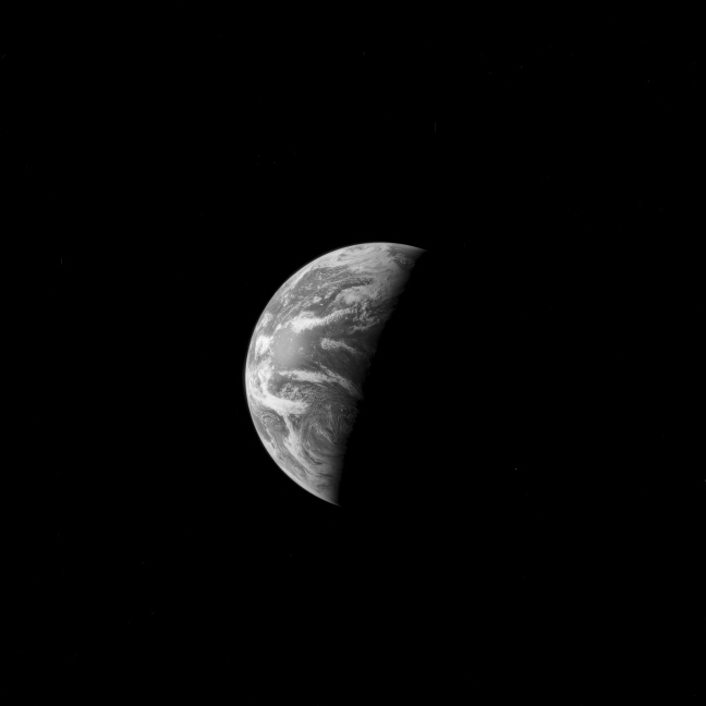
Figure 4.3.9.6: AS11-
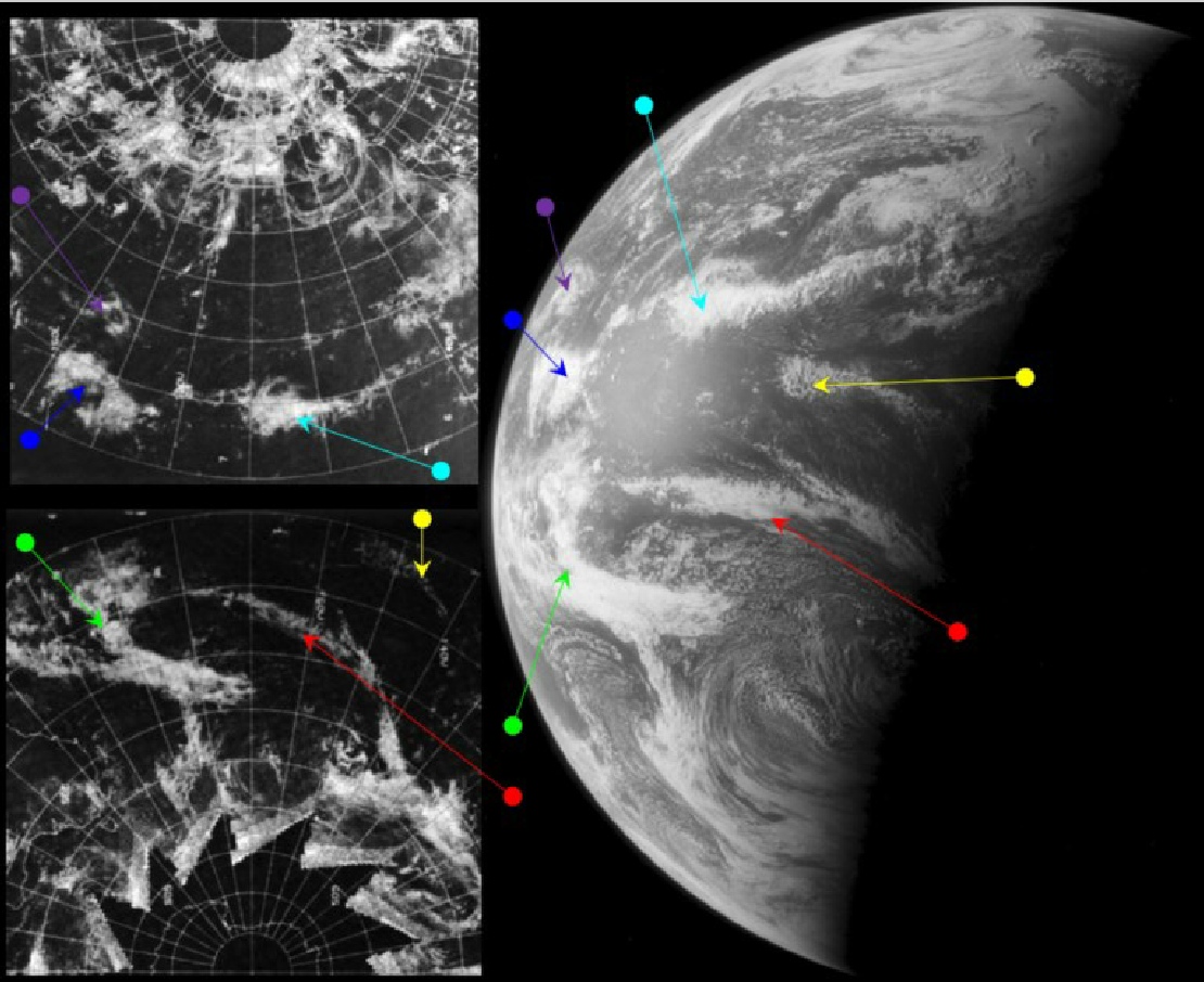
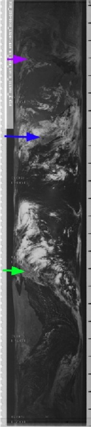
Figure 4.3.9.7: ESSA-
It should be evident that there are still features visible on this photograph that are also visible on the previous two pictures used from this magazine. The red, yellow and cyan arrows all point to the same cloud features shown in those colours in figure 4.3.99 while the magenta arrow in that figure picks out the eastern end of the band of cloud marked by the green arrow in figure 4.3.102. The banks of fog off the US coast are still visible at the northern end of the terminator line.
ESSA's nearest orbit to the terminator is number 1843 (track 5), which commenced at 21:03 on the 23rd. SkySafari's estimate is that the photograph was taken at 03:30 on the 24th, 13 hours before re-
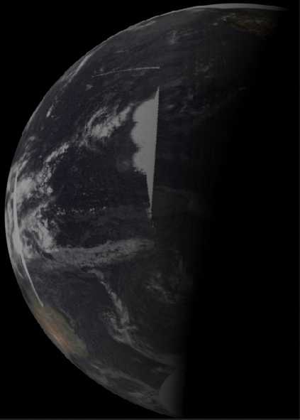
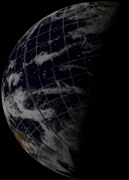
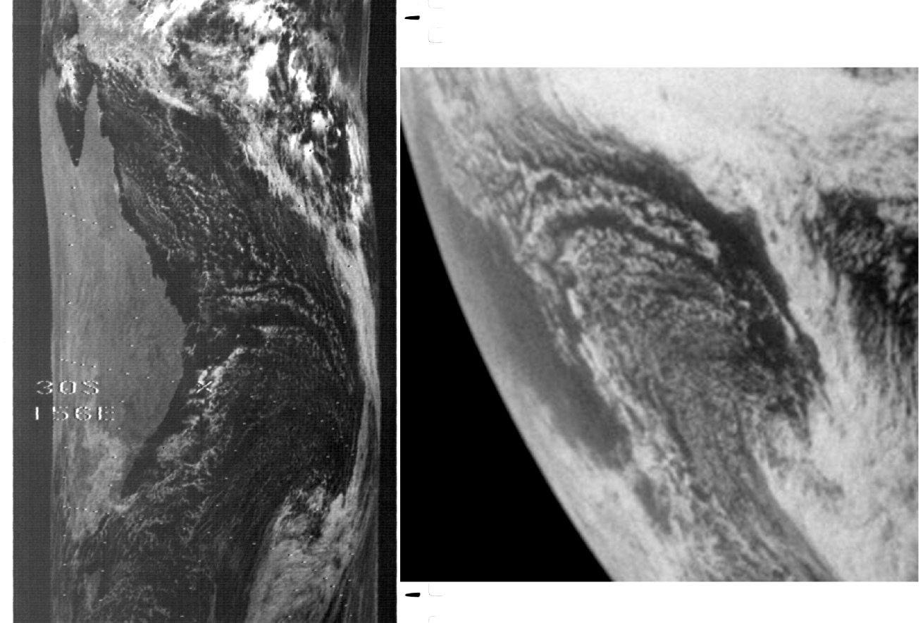
Figure 4.3.9.8: Section of NIMBUS-
The closer examination makes it much clearer -
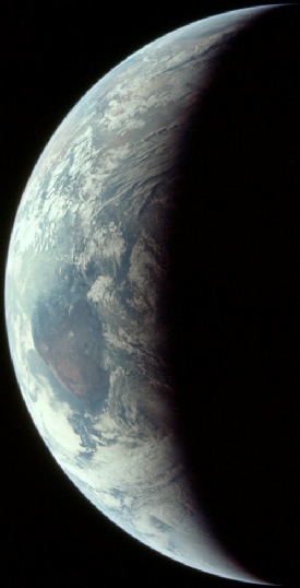
The last images on magazine 38 are all repeat exposures of the image just examined, and we now return to magazine 44 for our final two images of a full Earth. The penultimate image examined is AS11-
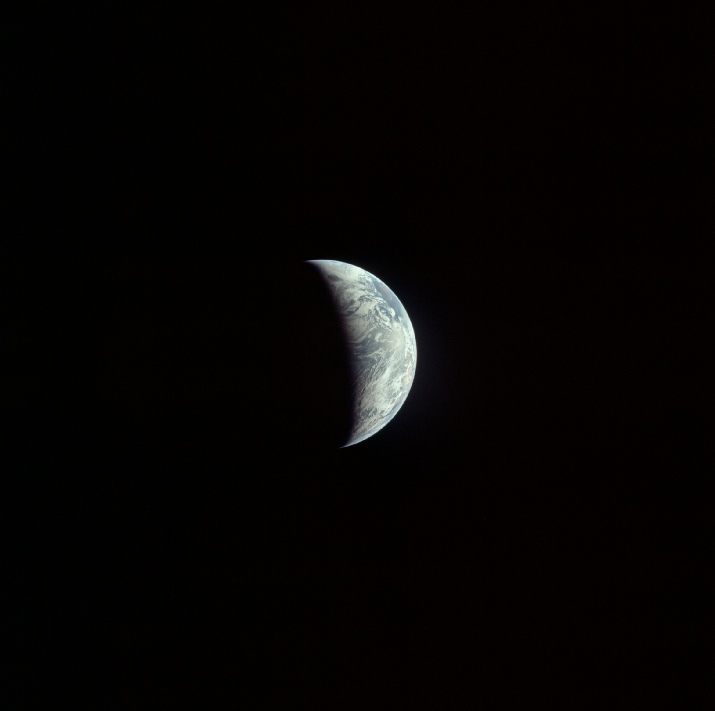
Figure 4.3.9.9: AS11-
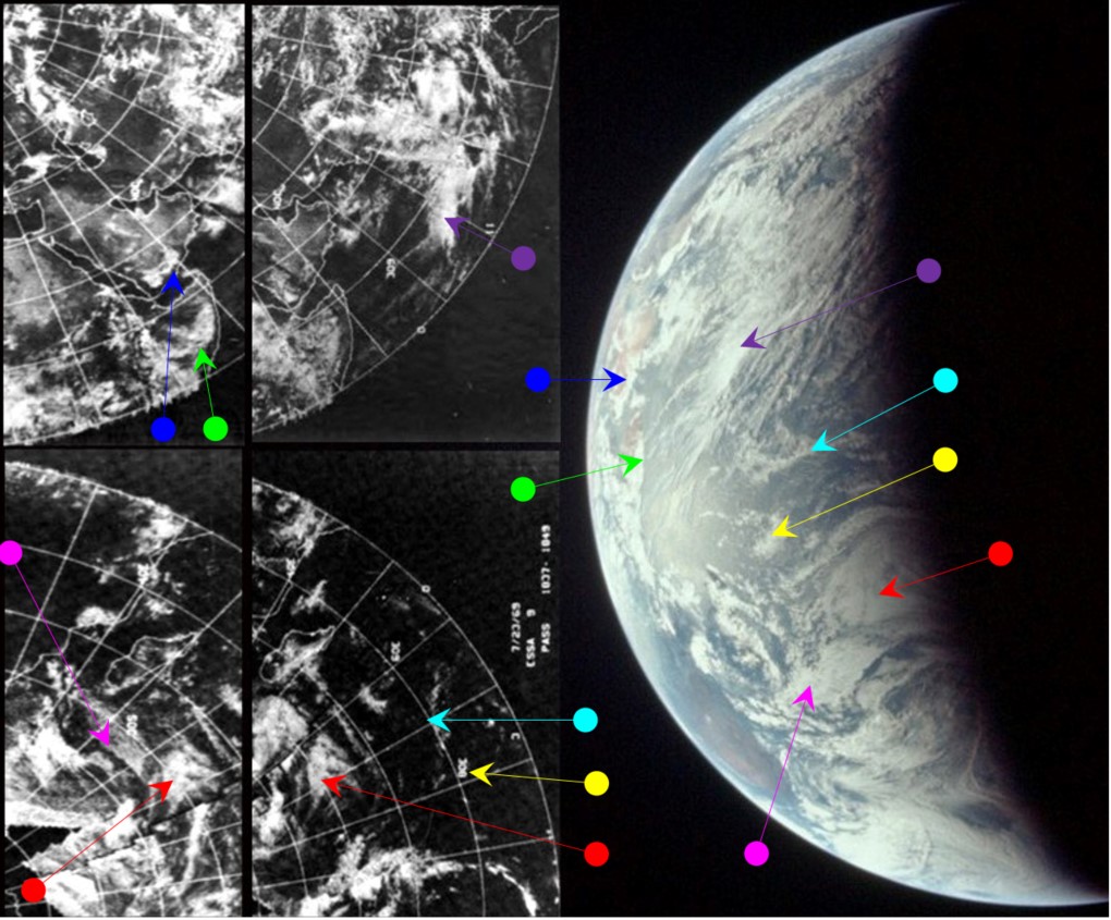
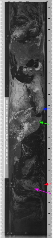
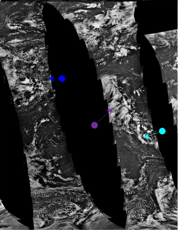

Figure 4.3.9.10: Main image -
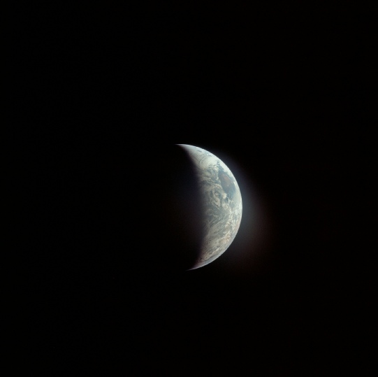
As the Earth becomes increasingly crescented, identifying cloud masses becomes a little trickier. The first task here is to identify the landmasses visible on the western limb, and close inspection reveals that we are looking at the east coast of Africa. The blue and green arrows point to clouds over Somalia and Arabia respectively.
Life is complicated even further by the fact that as the image features Africa, the area visible on the western limb features weather patterns shown on the ESSA image dated the 24th, while those over the Indian ocean are the last featured on the image dated the 23rd. For this reason, sections of both ESSA mosaics are included. The NIMBUS data are poor quality and much of the area visible is either not available or difficult to make out, and for this reason only the blue and purple arrows are used with any confidence, and only ESSA has a 3D reconstruction.
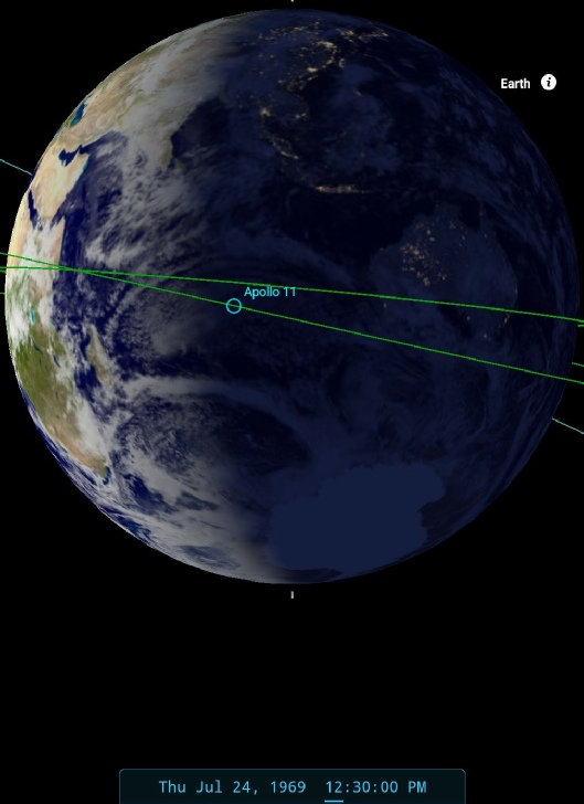
The cloud masses identified by the blue and green arrows are not visible on the image dated the 23rd, but are shown on the one dated the 24th, which helps date things more precisely. SkySafari estimates that the Apollo image was taken at around 12:30 on the 24th. ESSA's nearest orbit to the terminator is number 1848 (track 10), which commenced at 07:00 on the 24th. NIMBUS' nearest pass is number 1353, which commenced at 04:15.
The final image examined, and the final full disc image of Earth taken, is AS11-
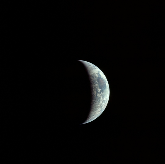
The movement is subtle, but nonetheless there, particularly when you examine the areas around the equator, and Africa’s inexorable march towards the terminator. It’s also noticeable that the visible portion of the Earth is actually getting smaller, that’s because it’s heading from west to east as we look at it (see Figure 4.3.9.14). Earth is also getting inexorably larger!
The 16mm still image, when examined the right way up, looks to be a good match for the final image in the sequence shown above.
The final image examined, and the final full disc image of Earth taken, is AS11-
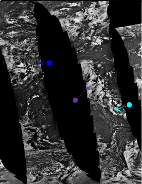
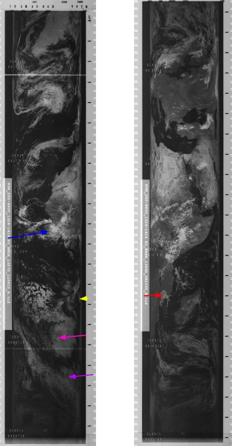
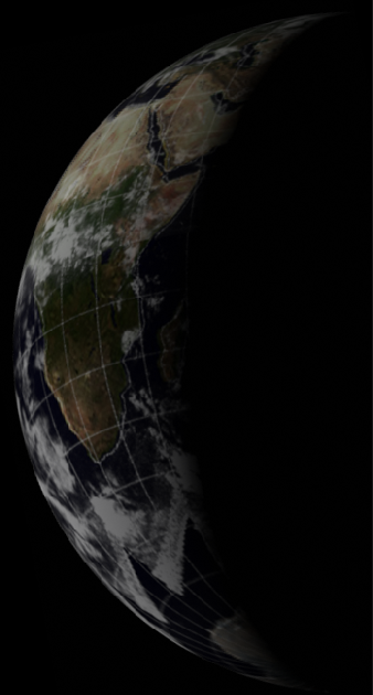
Figure 4.3.9.13: Main image -
Left, sequence of images taken during final approach showing rotation of Earth and shrinking daylight portion.
It should be evident to even the least observant that the preceding figure used only one 3D satellite photograph. We do have the restored image from NIMBUS, but the path that is available covering Africa shows very little useful information relevant to the visible part of Africa on the Apollo image. No useful part of ATS-
As for dating the image, the most representative track relating to the Apollo image terminator is number 11, which is 1849, and commenced at 09:05, which compares well with the 14:30 time suggested by Skysafari.
We get few clues from the transcript, but at 193:03 (14:35) we have this from Collins:
193:03:03 Collins: The Earth is really getting bigger up here and, of course, we see a crescent.
193:03:12 Collins: We've been taking pictures and we've still got four exposures to go, and we'll take those and then pack the camera.
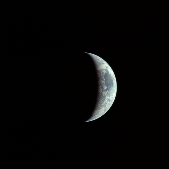
As it turns out there were much more than 4, and the remaining images in the magazine are zoomed in much more closely on Earth. The terminator line on these is closer to the African coast, indicating that they were taken after this statement was made. (Figure 4.3.9.14).
Figure 4.3.9.14: AS11-
SkySafari suggests this was taken around 30 minutes later than the one examined above.
One thing that is worth examining relates to data supplied by NOAA from their work rescanning and processing ESSA imagery mentioned in the introduction. They supplied an image not in the usual polar projection, but one where all the individual tiles have been overlaid as a flat image -
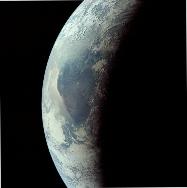
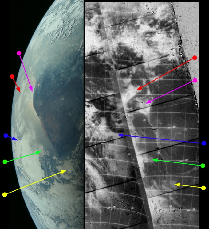
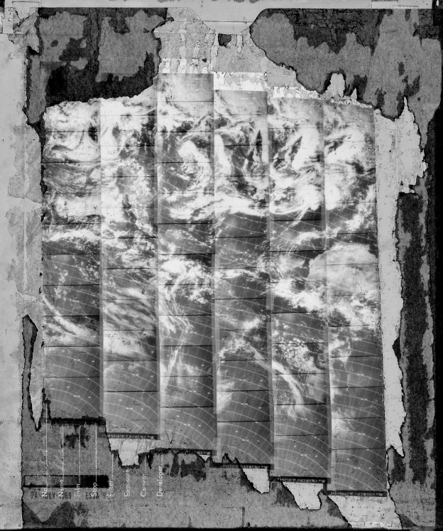
Figure 4.3.9.15: ESSA 9 image compilation supplied by NOAA (left) AS11-
The backing paper has seen better days, but you can easily identify the landmasses on show. As only Africa is visible in these last Apollo images, it’s worth zooming in on a the African part of this image to see how it compared with the most zoomed in image taken. As you can see there is an excellent match with the clouds in both images, particularly the arc identified by the blue arrow.
One final image tells the tale of the approach of Apollo 11, the last photograph in magazine 44: AS11-
The photograph is only a partial one, they’ve almost run out of film, and it ostensibly shows the same features as the the previous ones in the frame: Africa dominating the sunlit part of Earth. Figure 4.3.9.16 shows the image, and some key details in it in comparison with AS11-
There’s room for error in creating the animation above, but not much. There’s clear evidence of rotation between the two photographs.
Roughly two hours after the Apollo image was taken the CM separated from the SM and the crew began the re-
So there we have it, the first lunar landing covered from start to finish, with every series of photographs of Earth analysed and compared with satellite photographs to demonstrate that the pictures taken by Apollo 11's cameras could only have been taken where they were claimed to have been taken, including, for the first time, the surface of the Moon.
Having compared a variety of satellite images with photographs covering all parts of the Earth's surface during all parts of the mission, there really should be no more need for any meteorological analysis, but there is always a need for thoroughness.
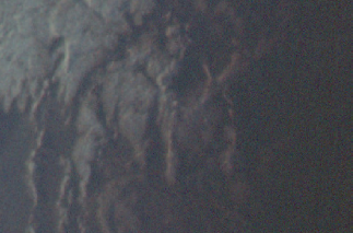
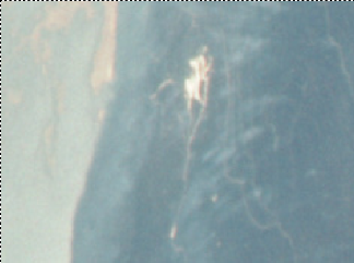
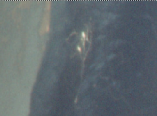
Figure 4.3.9.16: AS11-
The quartet used for comparison show a definite change in lighting conditions over the two area concerned -
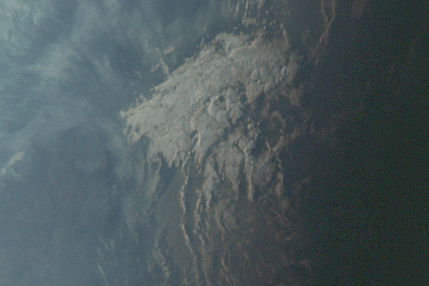
Figure 4.3.9.17: Animation of the same area of the terminator in AS11-
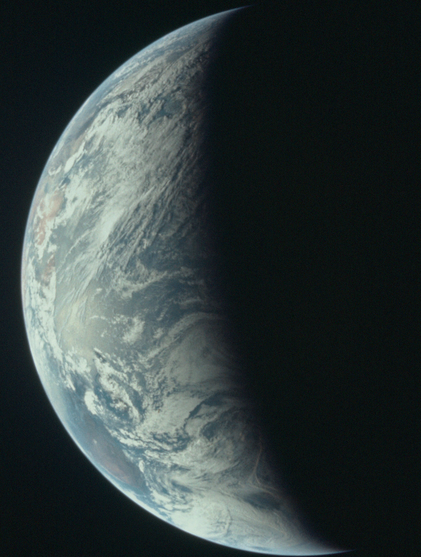
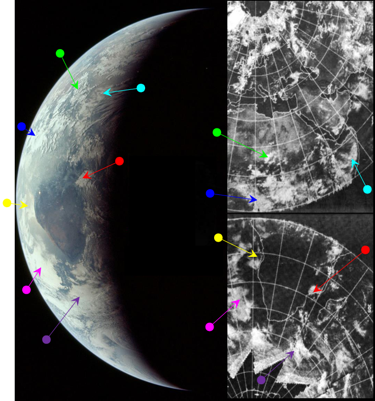
Figure 4.9.3.12: AS11-
Figure 4.3.9.11: AS11-