4.3.6 -
At around the same time as the last Earth image on day 5 was being taken, the decision was made to start the EVA procedure, and a few hours later at 02:56 on the 21st of July, 109 hours and 24 minutes after launch, Neil Armstrong sets foot on the Moon.
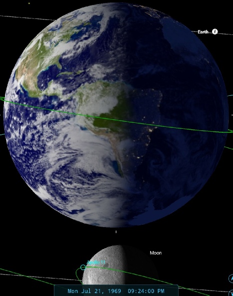
While Aldrin & Armstrong worked on the lunar surface, Collins continued his orbits around the Moon and captured another Earthrise image on magazine 44 in AS11-
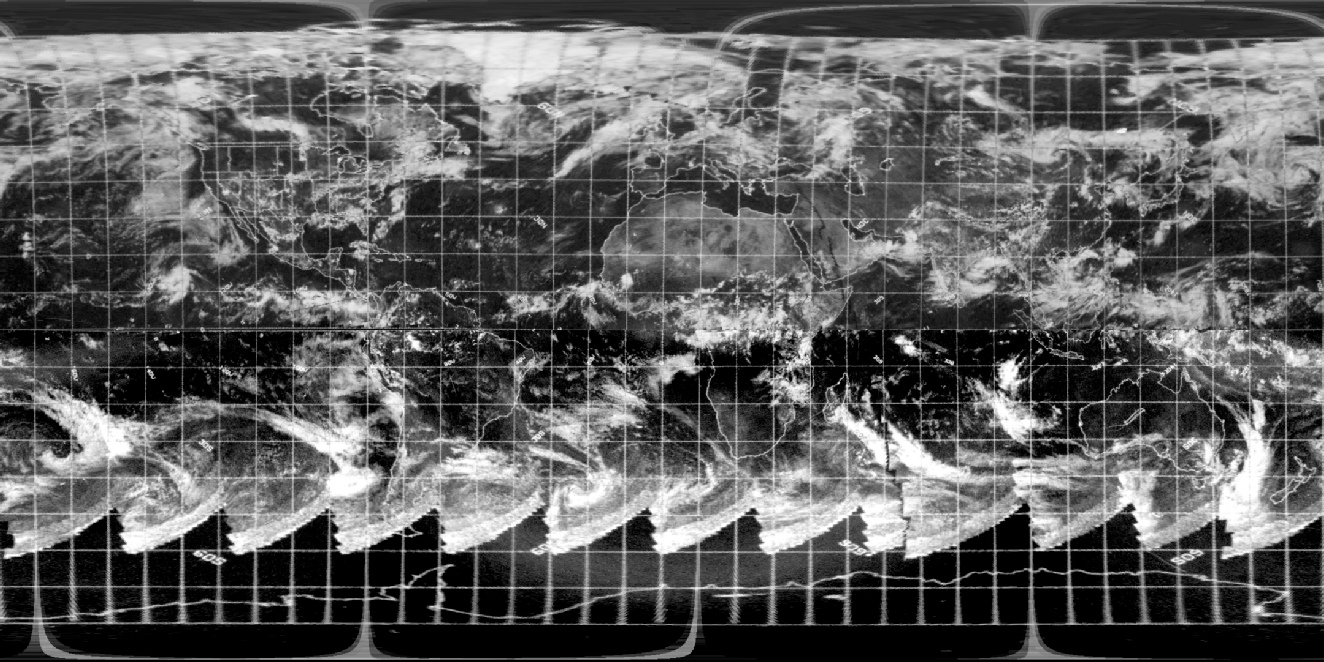
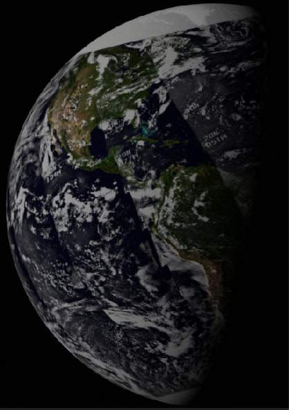
Figure 4.3.6.1: AS11-
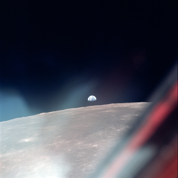
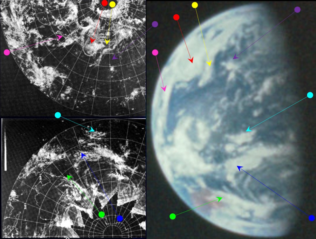
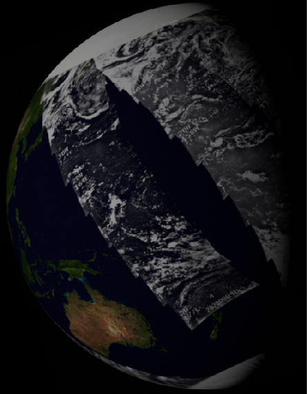
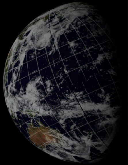
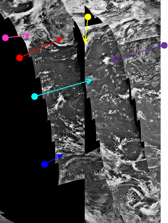
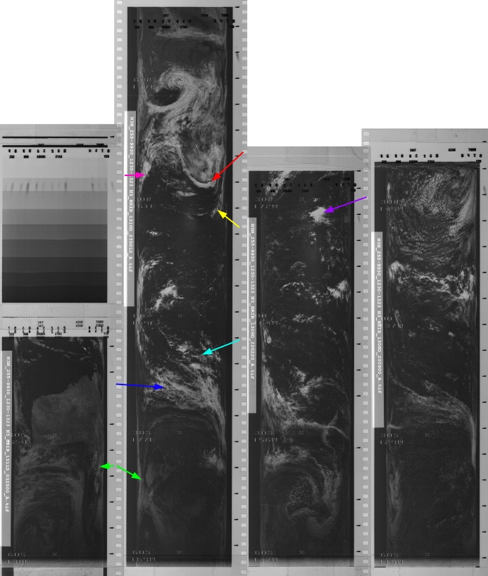
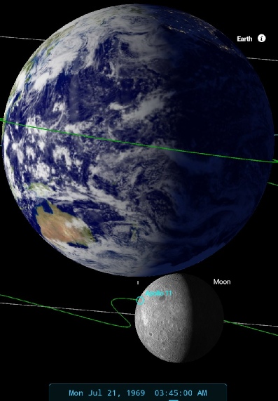
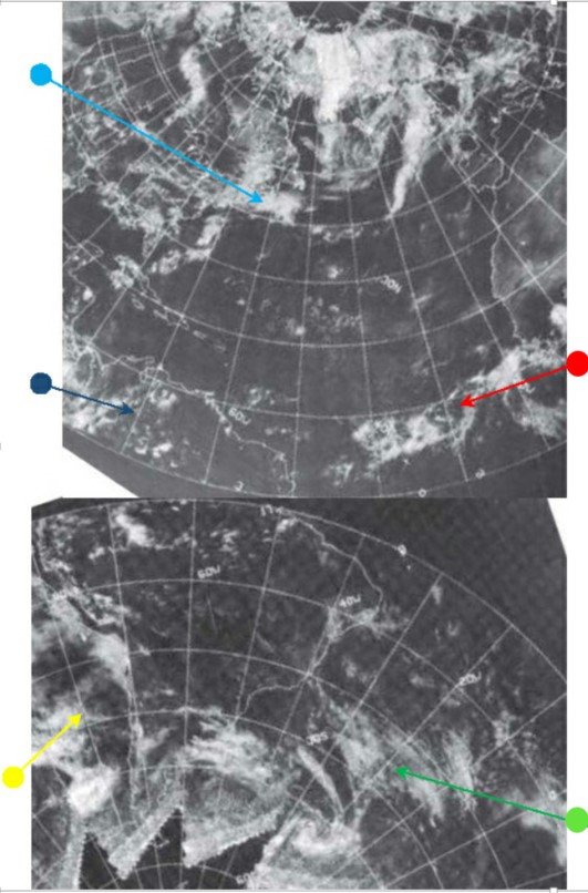
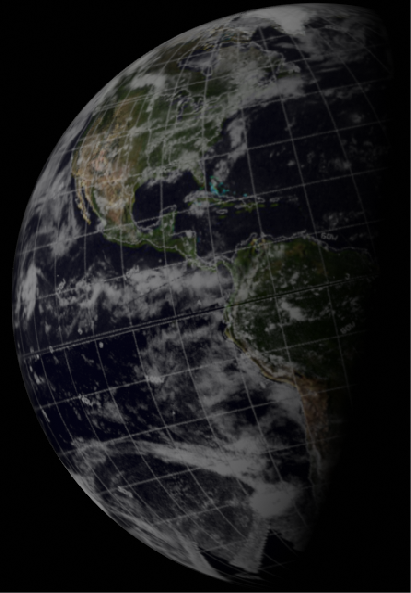
Figure 4.3.6.2: ESSA-
A small subsection of the above is examined in 4.3.6.3.
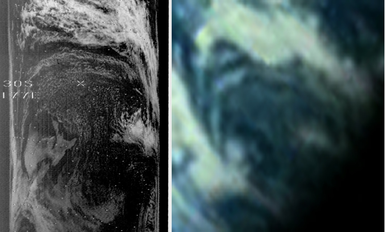
Figure 4.3.6.3: Section of NIMBUS-
According to the mission transcript, at 4 days 14 hours and 7 minutes (or 110 hours 7 minutes or 03:39 GMT) & 20 minutes after the start of orbit 18 Capcom contacts the CSM to confirm AOS, which Collins acknowledges some 30 seconds later (it maybe that his message to Houston is not a confirmation of AOS, but querying Houston as to whether he had it).
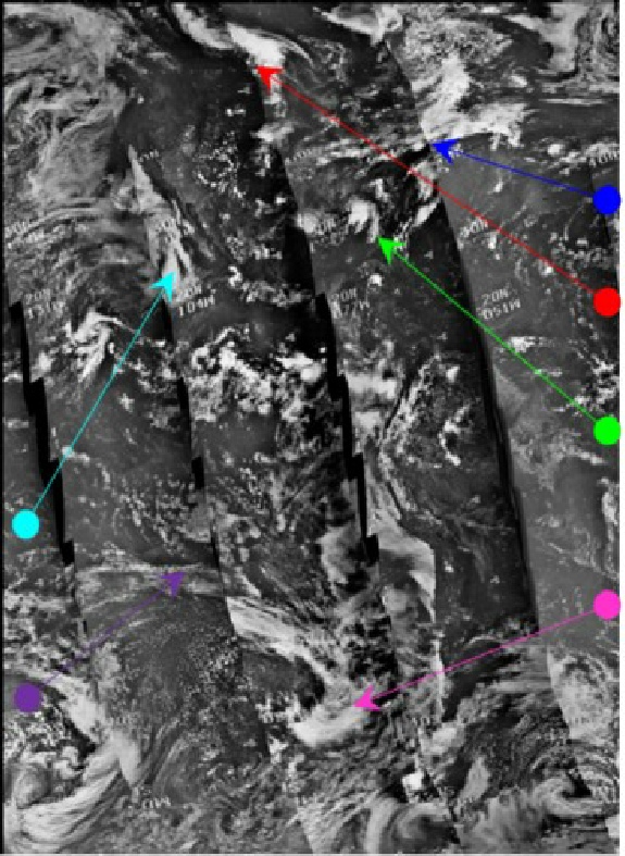
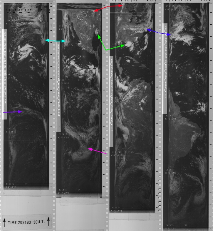
SkySafri has been set at 03:45 on the 21st, and there is a clear match with the photograph in terms of Australia's position and the position of Columbia. As with previous photographs where Australasia is featured, the ESSA image featured is not from the 21st but from the 20th, and the NIMBUS image is a composite of strips from the 20th and 21st, The timings will be examined shortly. As far as the weather patterns that are visible are concerned, the system picked out by the green arrow in figure 4.3.49 has moved from a position south of Victoria state to one covering New South Wales coastline. The detail in figure 4.3.6.3 of the cloud circulation around North Island New Zealand is superb. The clouds over Japan and off the coast of east & south east Asia have persisted, but have changed configuration from figure 4.3.49.
For the satellite timings, ESSA 9's track 8 is the nearest one to pass the east coast of Australia. The ESSA composite dated July 20th shows this track (orbit 1809) as commencing at 04:03 on the 21st. As mentioned previously, the two passes available from NIMBUS covering the area shown in the Apollo image are picked from orbits 1309 and 1310. The former is shown on the composite image dated the 20th, the latter on the composite dated the 21st, these were commenced at 22:02 on the 20th and at 23:50 on the 20th respectively, several hours before the start of the EVA and the Apollo image.
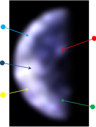
Meanwhile on the surface, Armstrong and Aldrin are collecting samples and installing a variety of scientific equipment. They take many photographs, three of which show the Earth (two of these are the same scene taken twice). The first of these images to be analysed here is AS11-
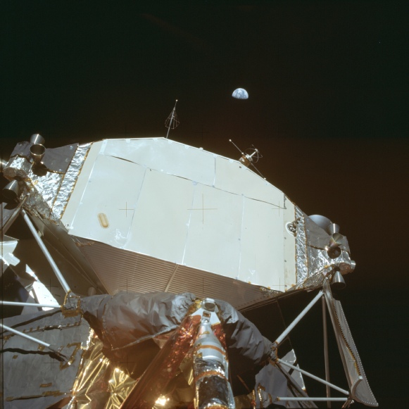
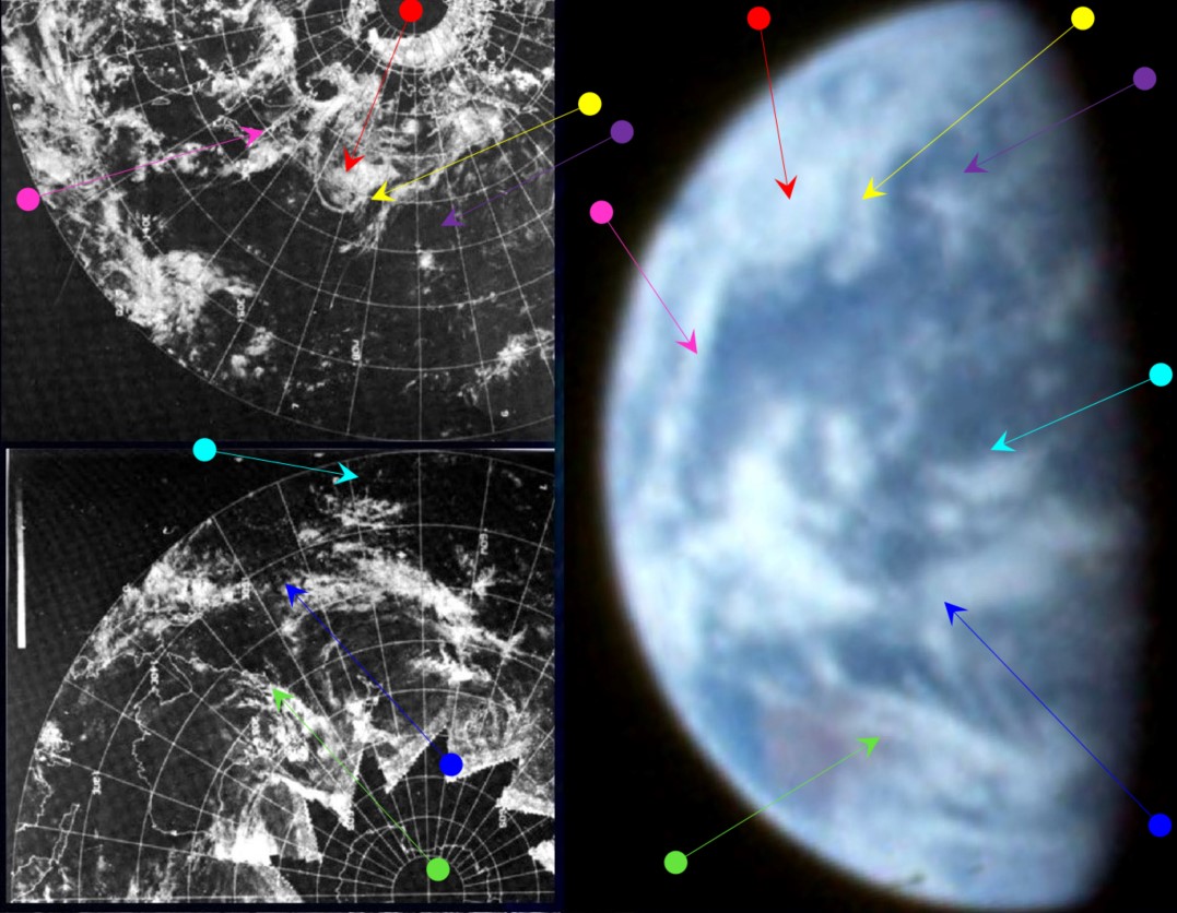
Figure 4.3.6.5: ESSA-
The weather patterns in shown in the image taken from the surface are a clear match with the ones taken from the orbiting CSM, although there is more detail observable in the clouds, particularly over Australia, and satellite timings will be the same. To save cluttering up the page, I’ve only added the ESSA image with arrows, but feel free to scroll up and check.
The first check to make now to justify that choice is to see whether it is the same view of Earth or not, and figure 4.3.6.6 compares Australia's position in AS11-
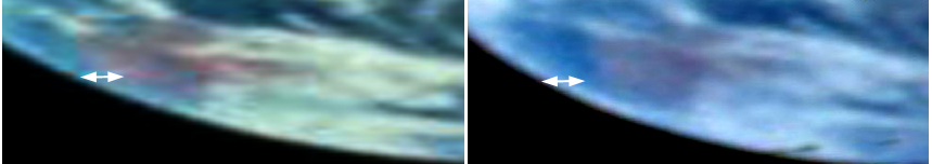
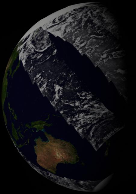
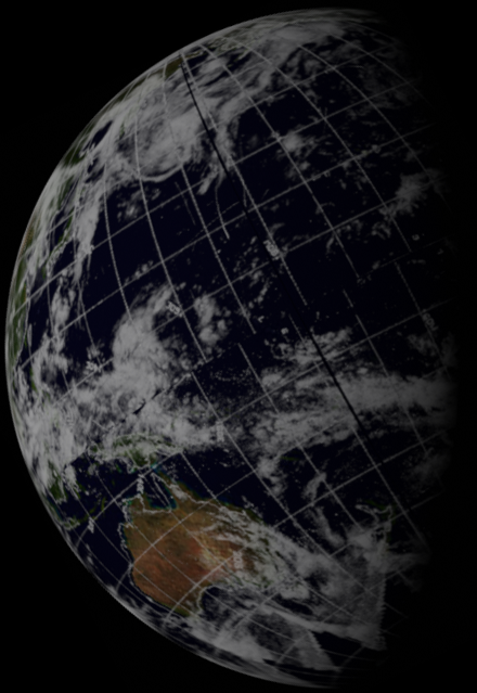
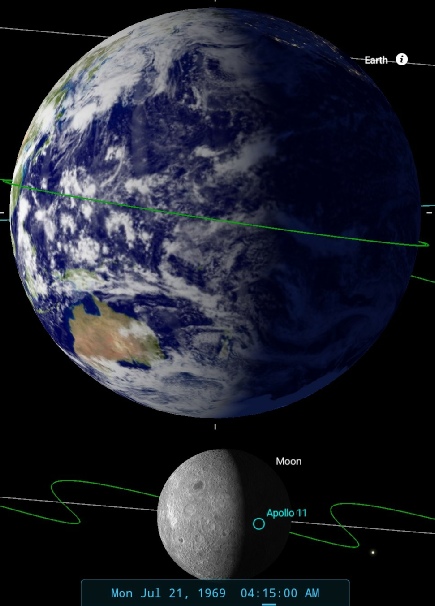
Figure 4.3.6.8: AS11-
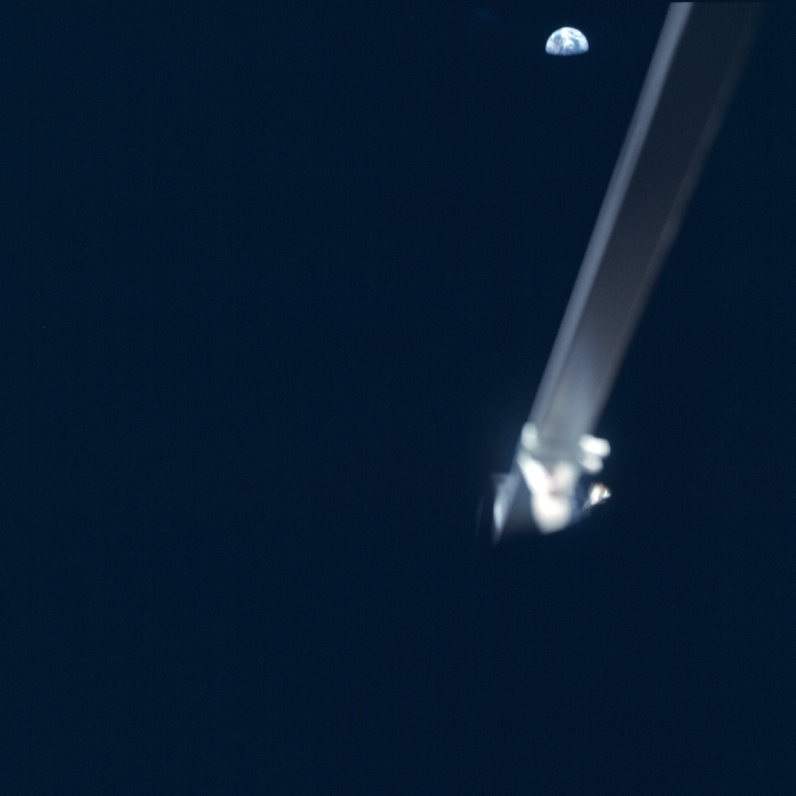
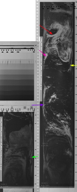
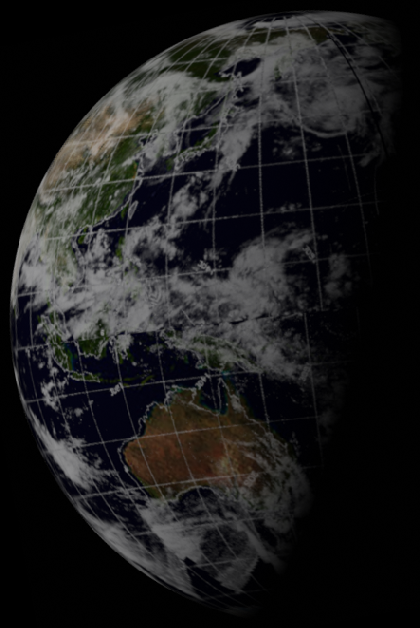
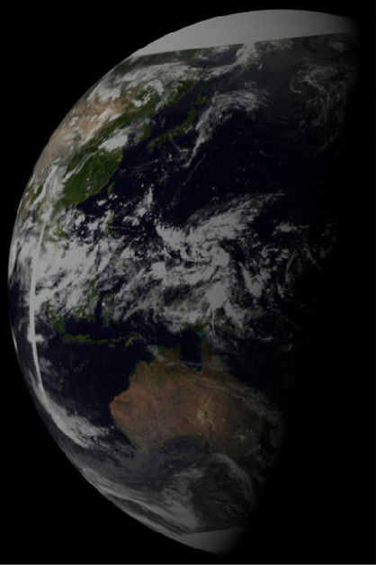
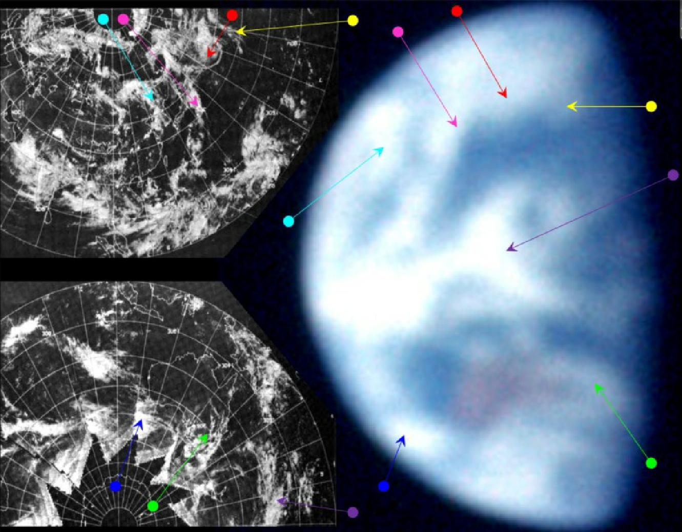
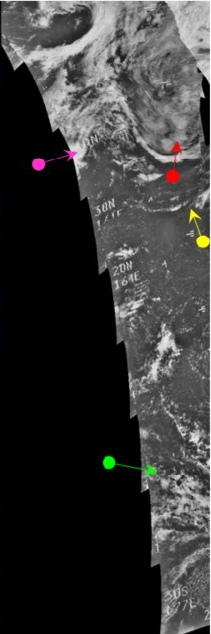
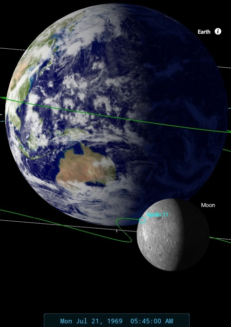
Figure 4.3.6.9: AS11-
This photograph is the only successful attempt of several made to take a picture of the Earth from inside the LM. As the flag and astronaut footprints are visible in the images preceding and following this one, it is reasonable to assume that the crew are back inside the LM after their EVA, so this photograph must have been taken sometime after 05:11, when the LM hatch was closed but before returning to orbit.
Despite the lower quality, brought on both by Armstrong photographing the Earth through the LM window and mis-
The weather system that started off south over Victoria State before moving east of New South Wales appears to have progressed further eastwards, although it is difficult to tell how far. What is evident is that Australia has moved further eastwards with the Earth's rotation, consistent with being taken 90 minutes later than the previous image, and also fitting in with the timeline of the mission. By 05:45, the time suggested by SkySafari's terminator, the crew had been back inside the LM for around 30 minutes, but 90 minutes later the Hasselblads were jettisoned on the lunar surface to save weight. No more images could have been taken from the LM after that time.
The ESSA orbit at the terminator corresponds to track 8, or orbit 1809, and was commenced at 04:03, so the satellite's orbital progress is matching Earth's rotation as seen from the Moon. The clouds picked out by the red arrow were imaged at 00:18 by NIMBUS.
As with the previous surface photo, the ephemeris values can be compared:
Date__(UT)__HR:MN Azi____(a-
1969-
See figure 4.3.6.10.
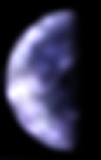
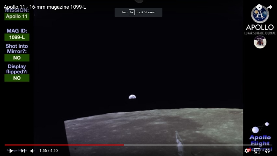
Figure 4.3.6.11: Still from 16mm footage taken between lunar lift off and docking with the CSM
The magazine starts with lift off from the lunar surface and after the Earthrise shows the CSM approaching, so the Earthrise must be some time between launch and docking. As will be seen below there is footage already from the CSM, as well as clear still images, that even while the view in the figure above is blurry obviously shows very different scenes. The reunion of Eagle with Columbia didn’t occur until three and a half hours after lunar lift off, which gives time for at least one orbit before docking. Earthrise for that would have been at around 19:30, and as can be seen in figure 4.3.6.12 this puts south America firmly in shot.
SkySafari shows us that the main landmass that ought to be present is South America, with the bulk of the top half of Earth being the north Atlantic. On the western limb is the eastern seaboard of the USA. Africa and western Europe would just be visible on the north-
The next usable image of Earth comes from a fantastic sequence of Earthrise images taken as the LM ascended towards the CSM. The Apollo Image Atlas only has poor quality images of most of this event, but the ALSJ has better ones. There is also a large TIFF image of AS11-
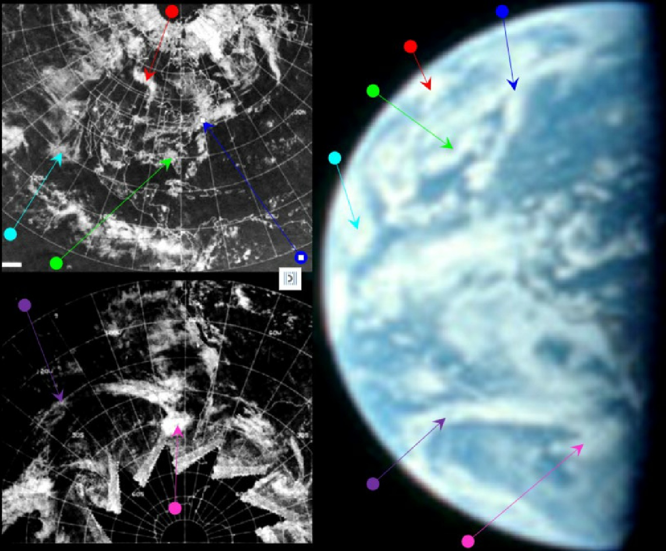
Figure 4.3.6.12: ESSA 9 images dated 21 July 1969 compared with still from Apollo 11 16mm footage and SkySafari suggestion of time at terminator. Below these are 3D reconstructions using digitally restored ESSA (left) and NIMBUS (right) satellite data.
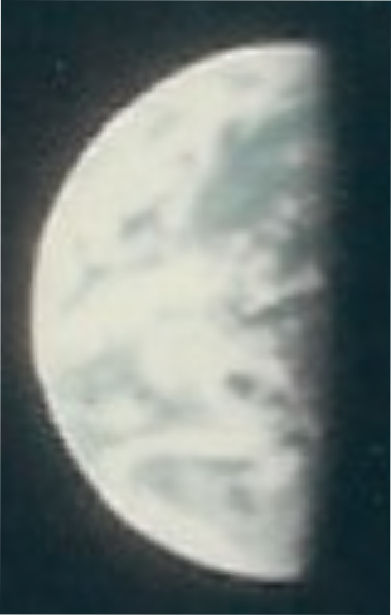
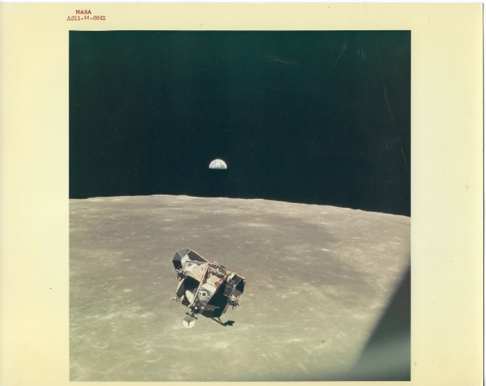
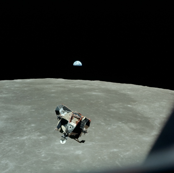
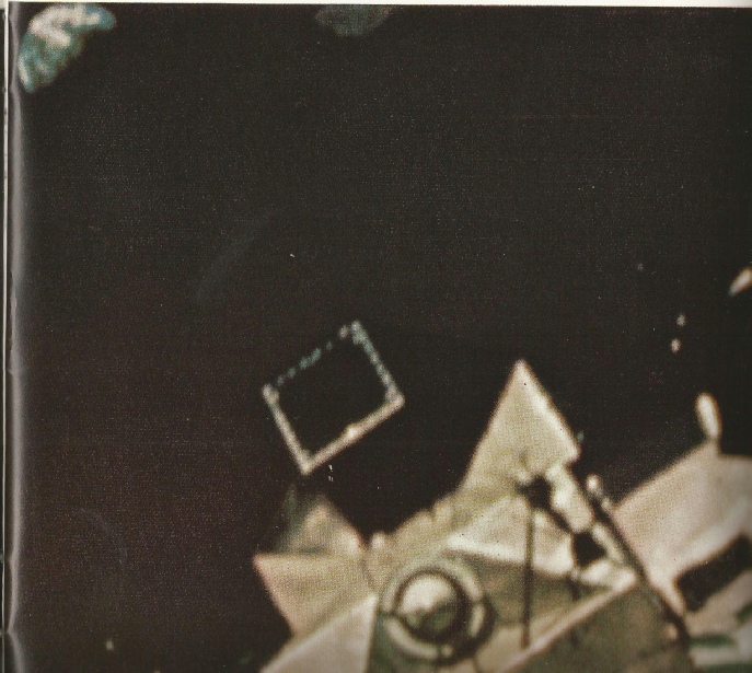
Figure 4.3.6.12: AS11-
We also have some close up views from satellite images contained in reports -
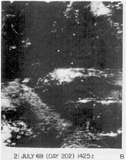
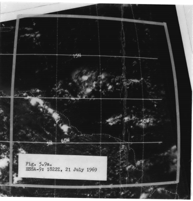
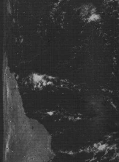

Figure 4.3.6.14: Section of AS11-
Dating this photograph within the official chronology is pretty straightforward. The transcript at the ALSJ has this:
127:51:36 Collins (onboard): [Garble] I got the Earth coming up already. It's fantastic!
and records the photograph as taken immediately afterwards. LM AOS is reported shortly afterwards. The MET equates to 21:24, and this is the time set on the SkySafari view.
As far as satellite timings are concerned, the ATS-
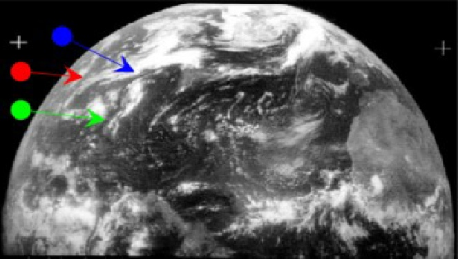
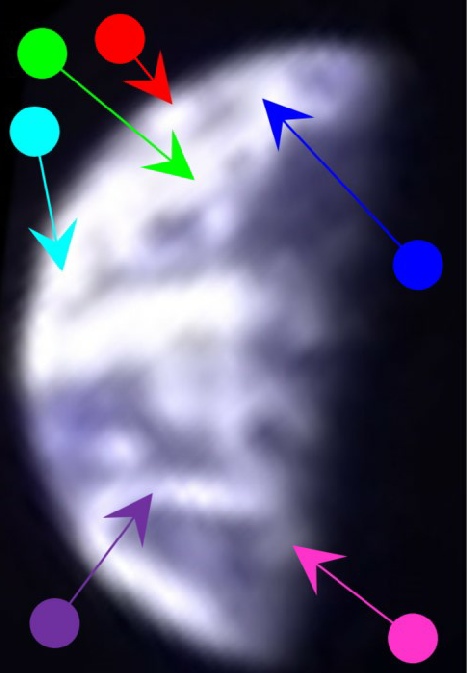
It is, as usual, obvious that the Apollo image matches the satellite images for the date in question, displaying distinct features not visible in the same configuration on preceding or subsequent days. Particularly obvious are the large 'X' shaped formation over the north Atlantic (marked by the blue arrow in the preceding figure), and the elongated 'C' shape to the south-
Fog banks are also visible off the coast of California and Chile that differ in shape and extent from other days in the mission. Figure 4.3.6.14 shows that the formations in the Caribbean off the northern coast of south America are also identifiable.
On the subject of Chile, another satellite image is available covering that area for the 21st, as mentioned in the introduction to this section (shown in figure 4.3.6.15, along with part of AS11-
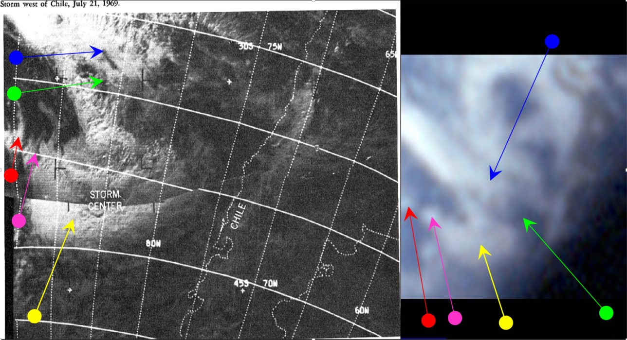
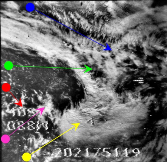
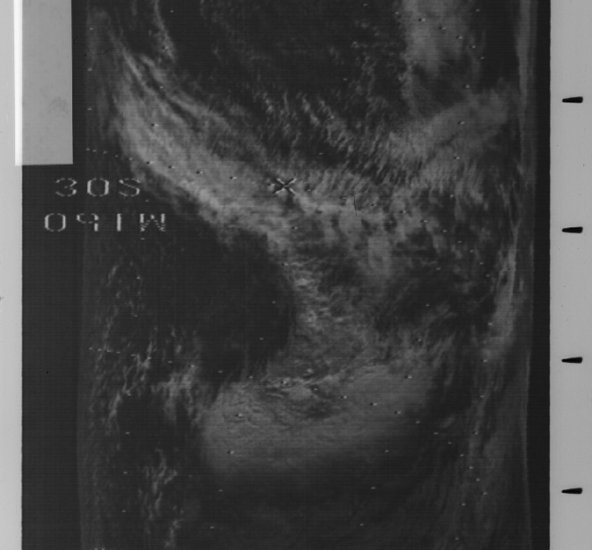
Figure 4.3.6.15: Unnamed satellite image of Chile and part of AS11-
Although this adds little to the overall analysis, it is again an illustration that very fine detail can be picked out on the Apollo images with an educated eye, and also that the sources of satellite information were never a secret. This particular image was used to pass on information about a storm in an area that was poorly covered by conventional forecasting, and part of the reason for the report in which the image was printed was to point out the usefulness of satellite data in meteorology, something that was still being evaluated.
While storms were gathering off Chile, the LM ascent module was heading towards the CSM to re-
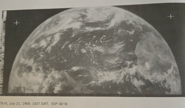
Figure 4.3.6.13: Row 1 -
Row 2 -
Row 3 -
Row 4 -
Right: Zoomed crop of a 16mm still from this video.
Figure 4.3.6.6: Comparison of Australia's position in AS11-
Australia has evidently moved between the two images (the white arrows are the same length), and this movement is consistent with the suggested half an hour time gap between the time of AOS in Collins' orbital image and the Stellarium estimate of time in the ground based picture. It’s also worth noting the position of Columbia in the SkySafari depcition, showing it to be well past Tranquility Base. At this pointin the mission he is relaying his attempts to see the site back to Houston. While he’s doing that, the timeline and mission transcript shows Aldrin engaged in photographing the LM landing gear, and AS11-
As outlined in the introduction to Apollo 11, another tool available to us in checking that we’re seeing what we should is the use of ephemeris values generated by JPL Horizons. Here’s what it returned for 04:00 on the 21st:
Date__(UT)__HR:MN Azi____(a-
1969-
Figure 4.3.6.7 shows what Earth looked like in Stellarium for that time, and Fourmilab Earth viewer’s depiction of it.
Figure 4.3.6.7: Stellarium view of Earth at the time of the EVA photograph and Fourmliab’s plot of the ephemeris location
The location of the centre of the Earth, and Stellarium’s elevation and azimuth values, are a match (you need to do the maths to get the two coordinate systems to match, but they do) -
The next photograph of Earth is AS11-
Figure 4.3.6.10: Stellarium view of Earth at the time of the EVA photograph and a fourmilab plot of the ephemeris location
Again, we’re seeing exactly what we should be seeing.
The next view of Earth requires a little speculation and interpretation. It comes in the form of an Earthrise sequence shown in magazine D of the 16mm footage -


