4.3.7- Apollo 11: Day 7, Trans-Earth Coast
After their rendez-vous, the re-joined craft continued to orbit the moon until the TEI burn at 04:55 on the 22nd, and during these last orbits a final series of Earthrise images was obtained. One of the best of these photographs is AS11-44-6651, and a high resolution version is available here. Even without zooming into the image, Australia is visible, and this should already tell readers that it was taken in the early hours of the morning (GMT). As this image occurs after the station-keeping photograph shown in the previous Apollo image analysed, a date of the 22nd is already a good starting point for the satellite images. It is shown below in figure 4.3.7.1 and analysed in figure 4.3.7.2.
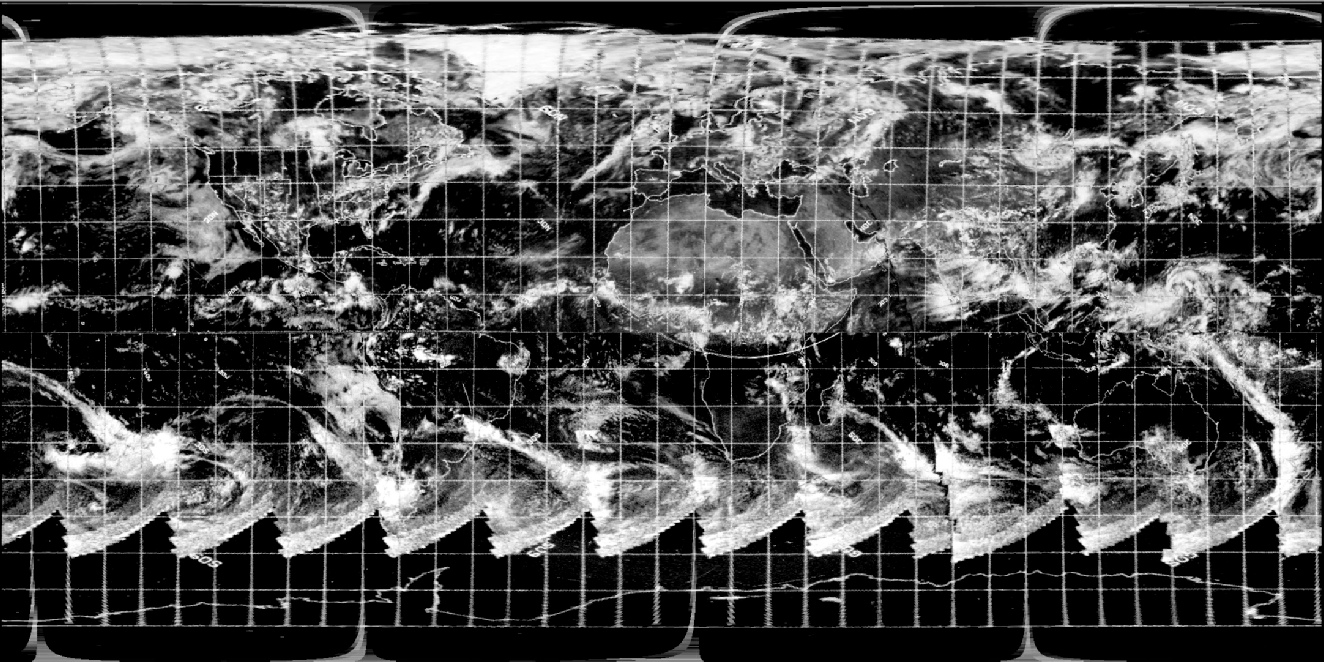
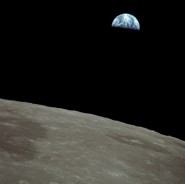
Figure 4.3.7.1: AS11-44-6651. Source
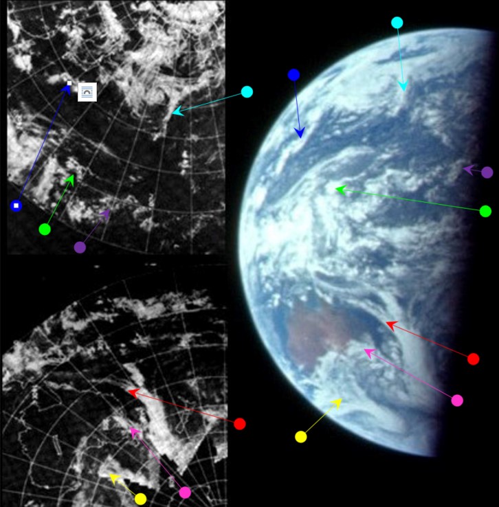
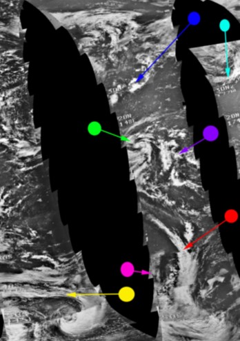

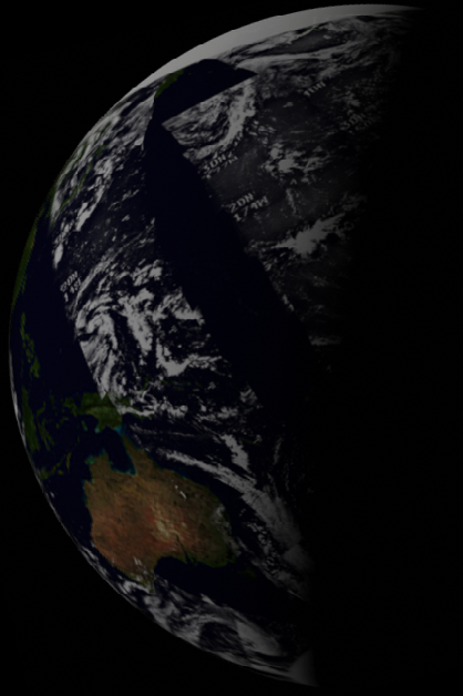

Figure 4.3.7.2: Main image - ESSA-9 compared with AS11-44-6651. Below this is newly restored NIMBUS-3 ISDC mosaic (left) and HRIR image (right). Below these are 3D reconstructions using digitally recovered data from ESSA (left) and NMBUS (right) satellites.Finally a SkySafari illustration of Earth at AOS after TEI.
As far as timing is concerned, the ESSA pass over the terminator for the image dated the 21st is number 1820 (Track 7), which was started at 01:01 on the 22nd. The NIMBUS orbits used are the first started on the 22nd (1324). The last of which started at 00:54 on the 22nd. The restored NIMBUS version shows patterns much more clearly and other features can be identified.
According to the timeline information and the ALSJ, the TEI burn was performed at 04:55, or 135:23 MET, shortly after what would have been the start of orbit 19. Although before the burn the crew were concerned about the cameras getting in the way (as g forces would be generated by the engines, any free floating equipment is a potential hazard), after it had completed they were very keen to take more photographs, and there are many exchanged discussing what films are available and what should be photographed. We then have this conversation in the CM transcript:
135:34:11 Collins (onboard): Yes, more than two. AOS.
…
135:34:41 Aldrin (onboard): Hey, I hope somebody's getting the picture of the Earth coming up.
135:34:44 Collins (onboard): [Garble]. Not quite pitched far enough. Well, maybe I can get it out...
135:34:53 Armstrong (onboard): I can get around to here.
135:34:54 Collins (onboard): [Garble] your window.
135:34:57 Armstrong (onboard): Upside down, turn the camera upside down. Then it'll look right.
At the time Aldrin was asking whether Earthrise was being photographed, the CM had increased its altitude to over 500 miles, which explains the increased curvature of the lunar surface, and it would seem that the photograph just analysed was the final Earthrise seen after the TEI burn. For this reason Stellarium has been set at the time of AOS, and the match between what should be there and what is there is obvious.
The scene was also captured on 16mm footage, and a high resolution version of the shot can be found here. Figure 4.3.7.3 shows a screenshot from the footage and a close up of Earth.
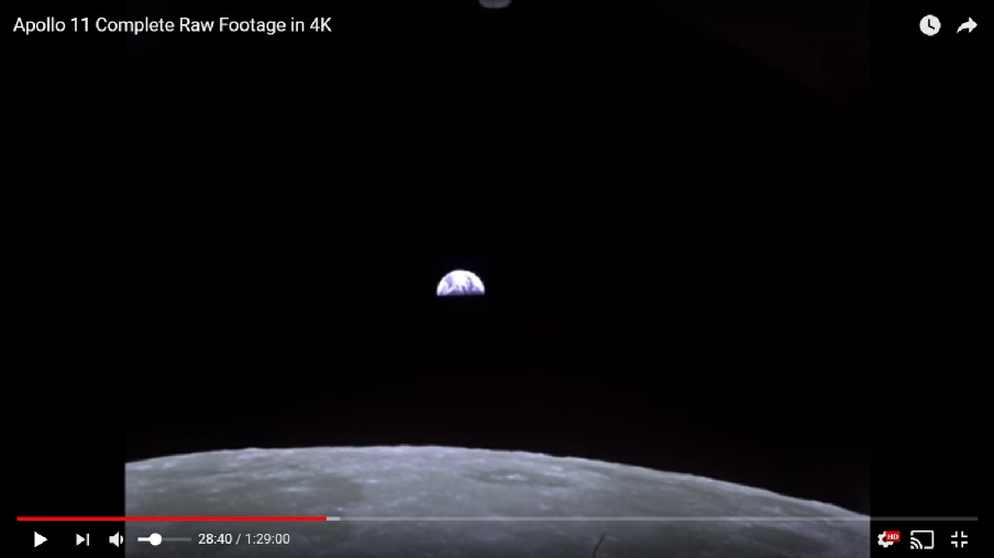
Figure 4.3.7.3: Sill from 16mm footage in lunar orbit.
Again we have video footage that matches the still images, and the satellite record. It’s almost as if they were actually there.
It takes a while for the next view of Earth, the crew have been somewhat busy setting their sights on home. he first image examined on the return journey is AS11-38-5684, and is the first one taken on magazine 38 to feature the Earth after a series of images of a departing Moon. It is shown below in figure 4.3.7.4 and analysed in figure 4.3.7.5.
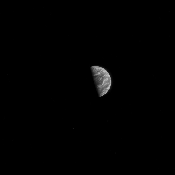
Figure 4.3.7.4: AS11-38-5684.Source
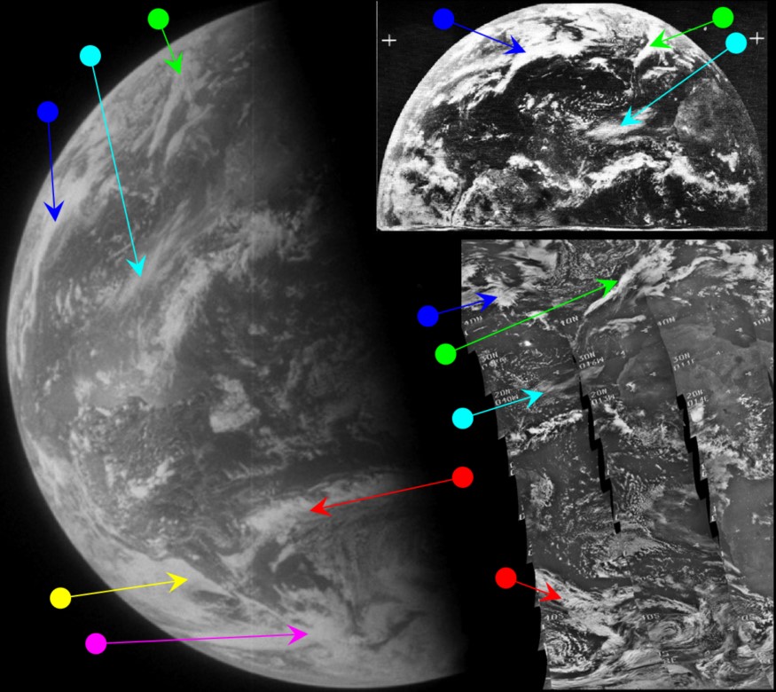
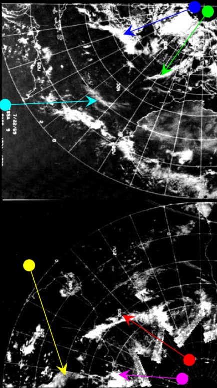


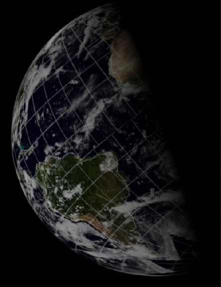
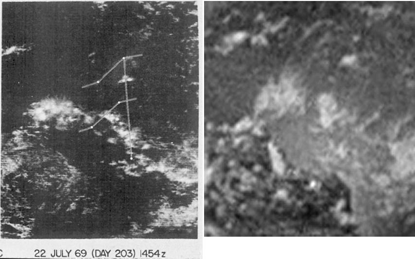
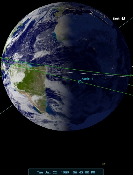
Figure 4.3.7.5: Main image - ESSA-9 (left), ATS-3 (top right - above which is a photo of the same image from my copy of this report) and NIMBUS-3 (bottom right) images compared with AS11-38-5684. Below this (left) is a NIMBUS-3 HRIR mosaic and a SkySafari time estimate. Bottom images are 3D reconstructions of digitally restored ESSA (left) and NIMBUS (right) satellite data.
On the now magnified Earth, the storm identified in figure 4.3.6.12 off southern Chile (magenta arrow) has moved onshore and there are still persistent fog banks off northern Chile (yellow arrow). When the ATS-3 image for the 22nd is compared with that of the 21st, the large 'X' shape of clouds over the western north Atlantic is still discernible (blue arrow), but has changed configuration slightly while progressing eastwards towards Europe. A large circular cloud just inland from the east African coast has moved further inland and changed shape (but is not visible on the Apollo image). The ATS-3 image was used as part of an analysis (referenced at the start of this section) analysing the development of Hurricane Anna later in July. The band of cloud stretching from South America to Africa is part of the inter-tropical convergence zone, and instability in this zone led to the hurricane. The detail of the ATS image still shows identifiable cloud patterns off Venezuala and Guyana despite being taken 4 hours earlier.
The SkySafari time estimate puts the terminator at roughly 18:45 GMT. As far as satellite timings are concerned, the main ATS-3 image is recorded as being taken at 15:18, a few hours before the SkySafari timing. ESSA's orbit over the terminator commenced at 15:08. The NIMBUS orbit over the same area is number 1330, which commenced at 11:38.
There is a very similar colour photograph on magazine 44, AS11-44-6669, shown below in full and with a close-up of Earth from it (figure 4.3.7.6). A small section of the photograph around the terminator is shown in figure 4.3.7.7.
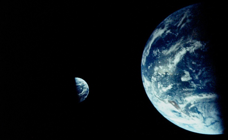
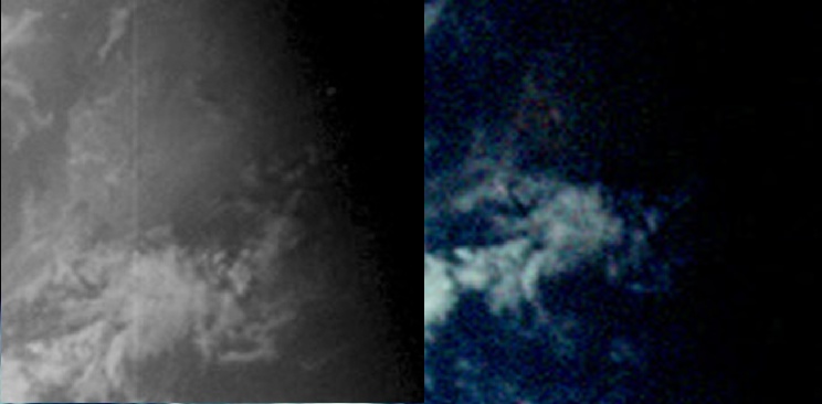
Figure 4.3.7.6: AS11-44-6669 (left, Source) and in close up (right)
Figure 4.3.7.7: Section of West Africa around the terminator from AS11-38-5684 (left) and AS11-44-6669 (right)
Although seemingly the same view of Earth as the black and white image from magazine 38, the colour image shows much less of Saharan Africa along the terminator. The view on the opposite limb, however, shows that the same weather patterns are present, and that the difference along the terminator is more a product of the different films and exposure used. It’s highly likely they were taken at the same time for comparison.
The next image from the 22nd is again one that is duplicated in magazines 38 and 44, although on this occasion there is very little difference between the two, and therefore they must have been taken very close together. On this occasion, the colour image (AS11-44-6670) will be used as the one for satellite comparison, and this is shown below in figure 4.3.7.8 together with its black and white companion. It is analysed in figure 4.3.7.9.
Figure 4.3.7.8: Left AS11-44-6670. Source, Right AS11-38-5687 (Source) and zoomed & cropped.
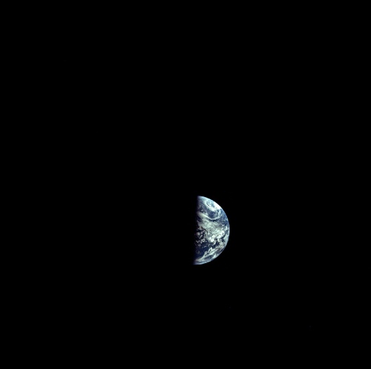
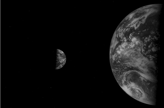
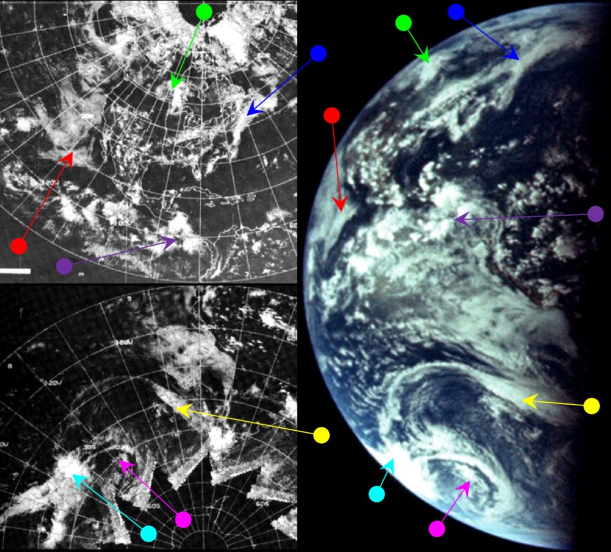
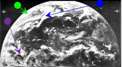
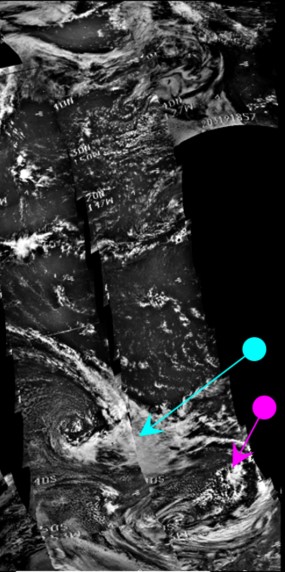
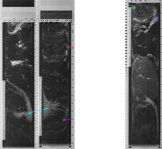
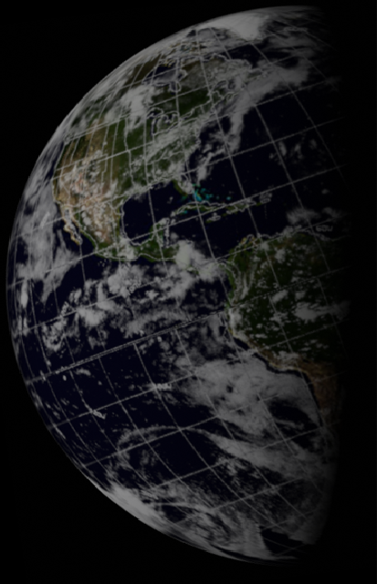

Figure 4.3.7.9: ESSA-9 (top left), ATS-3 (right), including a photograph of the image from my copy of this report and NIMBUS-3 ISDC (top right) images compared with AS11-44-6670 and SkySafari time estimate. Above are the NIMBUS-3 HRIR images. Also shown are 3D reconstructions using digitally recovered data from ESSA (left) and NIMBUS IR (centre) satellite data.
The 'X' shape (blue arrow) is much more visible now, and is evidently not in the same configuration as the 'X' shown on the 21st. The storm systems off south America are coming into view, and these are also in a different configuration to those shown on previous days.
SkySafari estimates a time of around 23:00 for the photographs, and this compares with an estimated start time for ESSA's terminator orbit (track 3, pass number 1829) of 18:09. The NIMBUS track for the terminator is orbit 1332, which commenced at 15:12.
Having suggested that the two photographs were taken at the same time, it's worth double checking that they aren't actually just the same photograph. Figure 4.3.7.10 shows a comparison of the two images at the terminator region over Chile.
Figure 4.3.7.10: AS11-44-6670 (left) compared with AS11-38-5687 (right).
The suggestion here is that the colour image was taken marginally before the black and white image, as the large band of cloud running left to right across the centre of the images appears closer to the terminator in the black and white version, and there are similar differences elsewhere on the photographs. They could, however, just be reflections of different image quality, but what does emerge is that there are enough subtle differences to show that they are not identical images rendered black and white through some sort of image processing. It is likely that the colour image was taken first, and the difference in the two around the terminator represents the time difference involved in setting down one camera, picking up the other, checking the settings and taking the photograph.
That’s the last photograph taken on day 7. Day 8 sees us nearer home, and a dramatic story of meteorology to the rescue! Click the links below to read about it.

