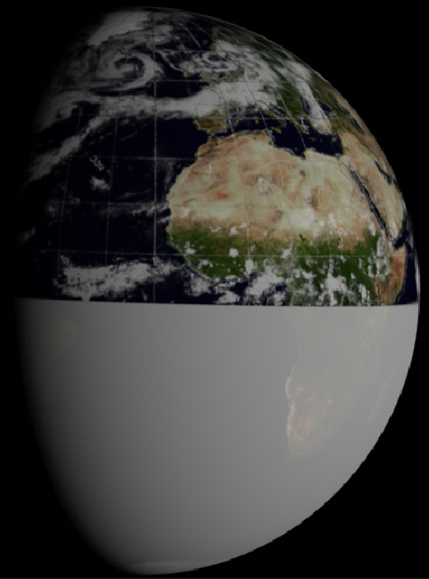
The landmass just below the centre on the right of the terminator is north Africa, and once you know that you can match the cloud patterns quite easily, especially when you use the 3D view.
The Soviets also returned images from of Earth from around the Moon from their many probes. The better quality images of returned by the Zond probes are shown on a number of websites, for example Mental Landscape. Zonds are now widely acknowledged as the USSR’s rehearsal craft for a manned lunar mission, and used a similar photography technique to Lunar Orbiter (and arguably did it first in the earlier Luna probes, but possibly using technology already being developed by the US), using film scanned on board and transmitted home. Ironically, the first images taken by the USSR of the moon were done using captured US spy camera film (source).
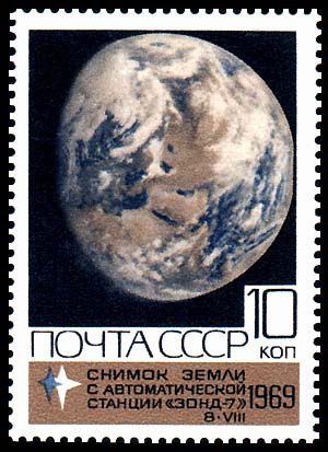
Figure 5.7.2 shows one of the images from Zond 5. Encyclopaedia Astronautica states that Zond 5 was launched on 14/09/68, performed a lunar flyby on 18/09/68 and splashed down in the Indian Ocean on 21/09/68. The ESSA data for this period can be found here: TIROS anniversary site and the Zond 5 image can be found here: Mental Landscape. ESSA and Zond images were compared in this article.
As an aside Zond 5 has its own place in the hoax mythology as it carried a biological payload around the moon (including some tortoises), proving that space radiation was not instantly lethal. It also returned a signal to Earth featuring cosmonaut voices. Initially this was thought to be taped, but is now thought to have been cosmonauts sending the signal from Earth to test communications in space. While conspiracy nuts like to claim that ‘if the Soviets could fake transmissions so could we’, they usually fail to mention that the source of the voices was determined even before the craft landed back on Earth. They also shoot one of their own arguments down in flames given that the transmissions were tracked independently by observatories in several countries (including the US, Germany and the UK -
Returning to the weather, for once you can make up your own mind, Does the ESSA mosaic show the same weather patterns as the Zond 5 image? The mosaic used is from the 21st of September, and the location of Arabia suggests a time of around 12:00 GMT for the image – 4 hours before re-
The next lunar mission, Zond 6, also returned a view of Earth, though as can be seen in figure 5.7.3 it’s not exactly the best, certainly when you see what the Zond cameras were capable of.
Because of the image quality, working out what it shows requires a fair amount of deductive guesswork.
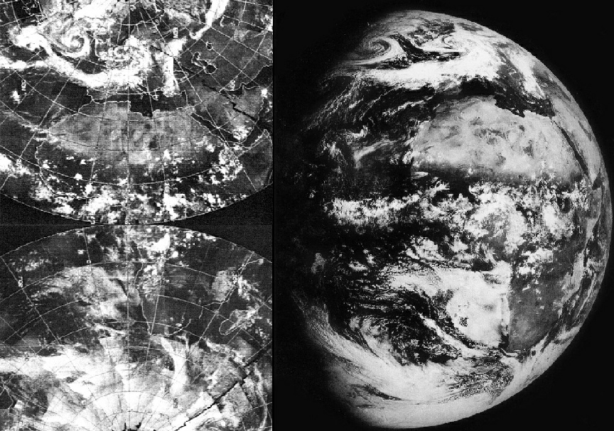
Figure 5.7.6: Zond 7 image compared with ESSA mosaic dated 10/08/69 and 3D reconstruction using digitally restored ESSA data
As with the NASA images, the ESSA mosaic is dated the 10th, but this part of the world would have been imaged on the 11th. As before, you can answer the question for yourself: does the Soviet image match the data supplied by their superpower rival? It's a shame that the craft did not wait a little longer to take its images, as lurking off to the west in the Caribbean is Hurricane Camille, which caused considerable damage in August 1969.
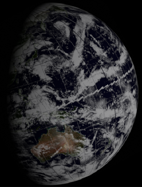
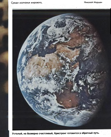
One final image from the Zond program can be found from Zond 8. This photograph (source: Mental Landscape) is usually referred to as an Earthrise, but a quick check of what it shows (and which can be confirmed by Stellarium) proves that it is actually an Earthset.
The probe was launched on October 20th 1970, and orbited the Moon on the 24th. A close look at the images from that probe show that Australia can be seen in the image, which means that any showing it as an Earthrise are actually upside down.
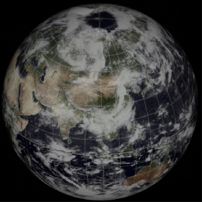
As it features Australia, this means that the ESSA mosaic needs to be dated the 23rd in order to show it. The ESSA data catalogue can be found here (source: TIROS Anniversary) and a comparison of the relevant part of the mosaic with a close up of the Zond 8 image can be seen in figure 5.7.7.
Figure 5.7.7: Zond 8 images compared with ESSA mosaic dated 23/10/70 and 3D reconstruction (right) using digitally restored NOAA data.
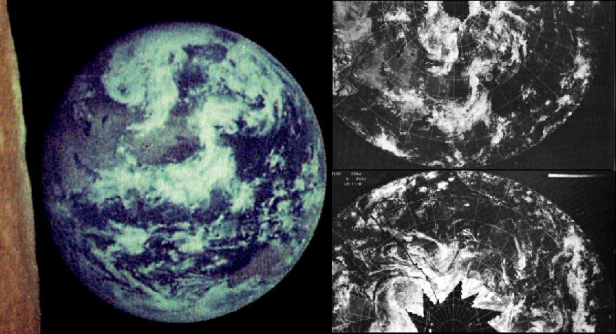
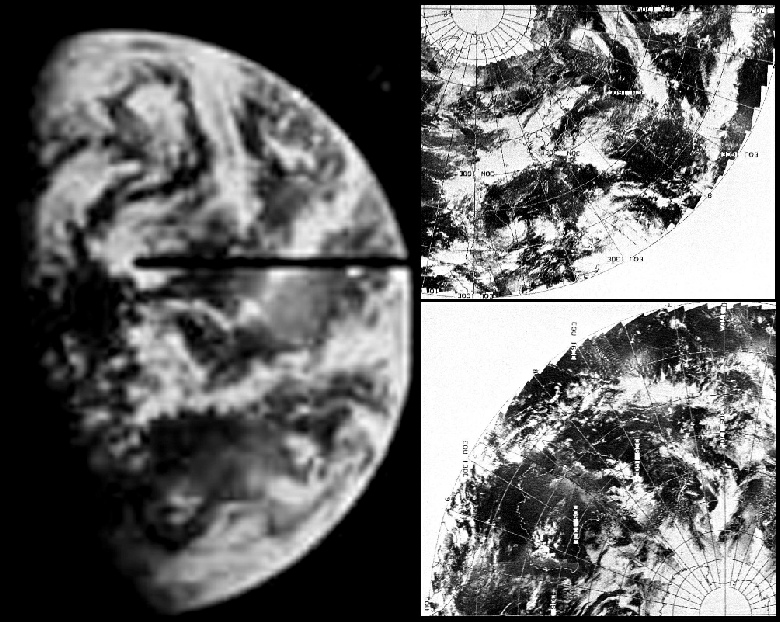
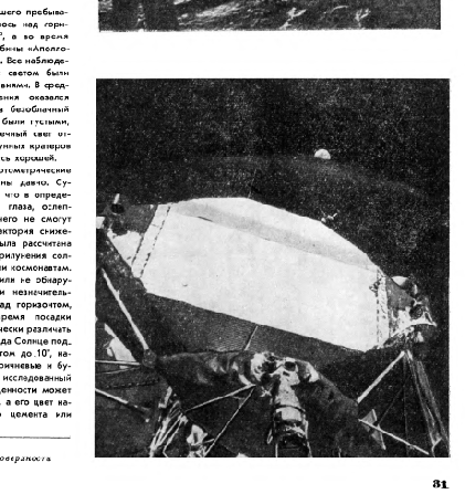
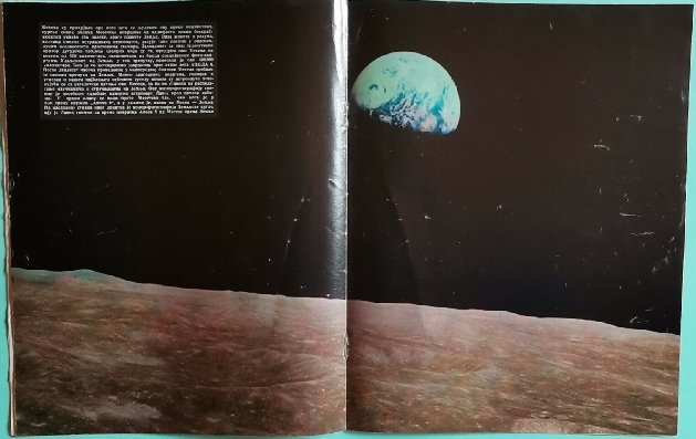
Figure 5.7.2: Zond 5 photograph of Earth compared with ESSA mosaic from 21/09/68 and partial 3D reconstruction using digitally restored ESSA data (right). Below is the image shown in the USSR publication ‘Soviet Photo’ from August 1969.
Again, you be the judge: do the weather patterns match or not?
It should be pretty obvious that in all the Zond images the satellite mosaics are a match.
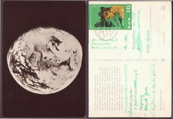
It’s also worth pointing out that while these photographs are less freely available in the west, they were being issued publicly in the USSR. As well as the magazine print of Zond 5 shown in figure 5.7.2, figure 5.7.8 shows a souvenir postcard issued in what was then East Germany and a Soviet stamp from 1969. They also appeared in many other publications, eg here, and here.
They weren’t entirely unavailable to the west though, as shown by figure 5.7.9 which features an Italian newspaper front page (available on eBay) covering the Apollo 13 crisis and where the artist has used the Zond image to produce the graphic.
So not only does NASA data match that of their political enemy, the Soviets were also in a perfect position to blow the US out of the water with their own views of Earth.
They never did. Ask yourself why.
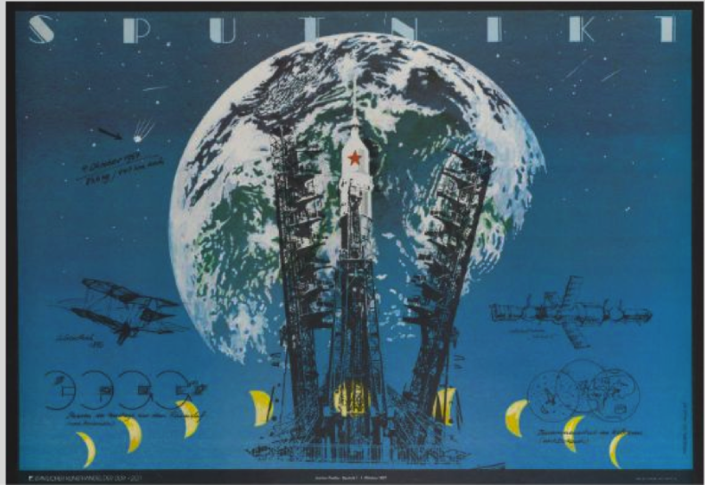
There is an amusing side note to Soviet Earth images. This website does some pretty deep analysis of the poster shown in figure 5.7.10, noting how it is intended to ram home images of Soviet superiority in the space race.
Unfortunately, the image of Earth superimposed on the image is actually one taken by Apollo 8, AS08-
Apollo images were not the only ones ‘borrowed’ by the Russians for their propaganda needs. Figure 5.7.11 shows a 1970 Soviet poster intended for classrooms that shows a somewhat doctored (and upside down) version of the ATS-
All these articles were either about space exploration in general or (in at least one) about Apollo 11 specifically. At no point is there any suggestion that the Apollo 8 images are not genuine.
Soviet media (and those of their communist satellite nations) were, in fact, all over Apollo. This site features a wealth of articles from popular magazines, newspapers and scientific journals demonstrating that they had exactly the same access to US photographs and TV footage as anyone else. They may have been several months behind similar publications in the West, but they are still there. Figure 5.7.13 shows some of the ones gleaned from that site and others featuring Earth, but there are many more showing mission images and stills from TV.
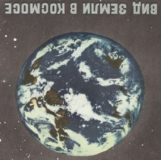
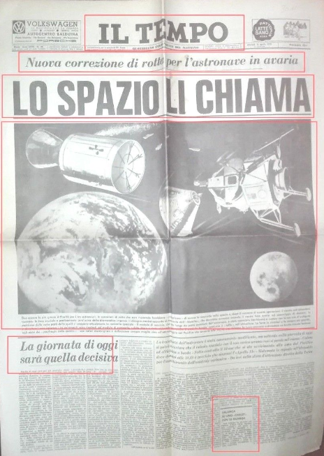
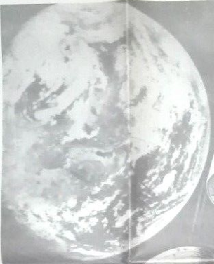
Figure 5.7.10: Soviet propaganda poster featuring an Apollo image.
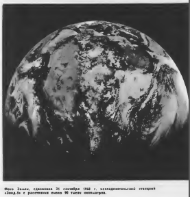
Figure 5.7.11: Soviet educational poster compared with ATS-
Apollo images also made their way into popular Soviet journals, particularly one of them -
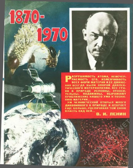
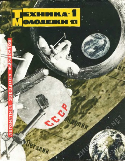
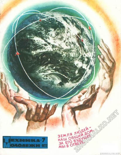
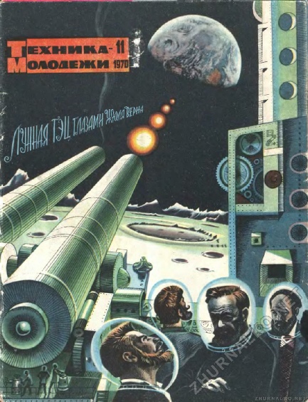
Figure 5.7.12: Technology and Youth magazine images from June 1969 (top left), October 1969 (top centre), April 1970 (top right), January 1971 (above left), February 1972 (above centre), July 1973 (above right) featuring AS08-
The British Interplanetary Society’s “Spaceflight” magazine cited above even has an article reporting an interview with Victor Bugayev, director of the World Weather Centre in Moscow, who stated that their Meteor satellite launched in March 1969 had observed Hurricane Bernice -
In a nutshell, Soviet images are verified by US satellites. The Soviets also had access to those satellite images as well as their own, and knew what was in the American photographs and live TV footage. They had the capability and ample opportunity and means to blow the alleged hoax out of the water. They never did. They were more than happy to demonstrate their own prowess and applaud that of their bitter rivals.
There is one final point: I genuinely do not believe it has ever occurred to anyone at NASA, or ESSA, or NOAA, or whoever has the data in their hands at the moment, that the weather data they had held the key to so much supporting evidence for the Apollo missions. The Soviets had access to US weather satellite imagery, as confirmed here, within hours of it being taken -
Aside from the fact that no-
As a footnote to this part, a common argument put forward by proponents of the landings is that the USSR would certainly have loved to have blown the whistle on the missions were fake, one contributor to the discussion claims never to have seen any acknowledgement from the Soviets that they happened (figure 5.7.18).
Examples like these: Kosmoplov 1969, Galaksija April 1972, Galaksija May 1972, Galaksija June 1972 and Galaksija February 1973 show how well informed Eastern Bloc countries were about Apollo. One of those publications (‘Amerika’), was actually a US owned publication, allowed for sale in the USSR as long as they were allowed to sell ‘Soviet Life’ in the USA! Amusingly. The August 1969 edition of Soviet Life is full of the glories of the Soviet space program, but Apollo hardly gets a mention.
We also know that the Soviets were more than capable of producing their own weather satellite images as well as having access to US ones, as shown in figure 5.7.14.
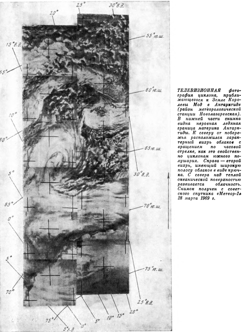
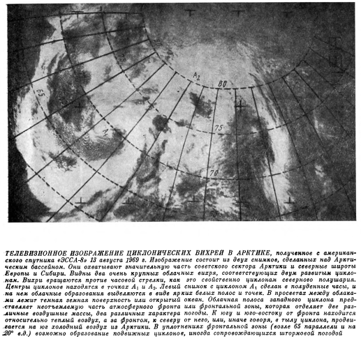
Figure 5.7.14: Meteor-
5.7: Oh those Russians
If NASA’s airbrush monkeys were busy faking the satellite record to match Apollo (as some have claimed), they were equal opportunity fakers and did it for all comers.
As reported in Chapter 2, the Soviets published a photograph of Earth taken on May 30th, 1966 by a communications satellite that happened to have a camera attached to it. That image can be compared with the NIMBUS images taken the same day (figure 5.7.1).
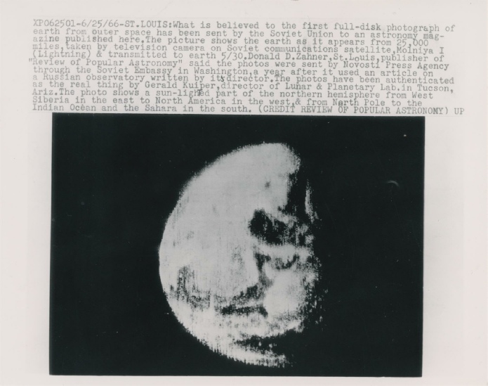
Figure 5.7.1: Press photo of a satellite image taken by Molniya-
They were also keen for we capitalist lackeys to know about this, as can be seen in this late 1960s propaganda pamphlet, see Figure 5.7.15.
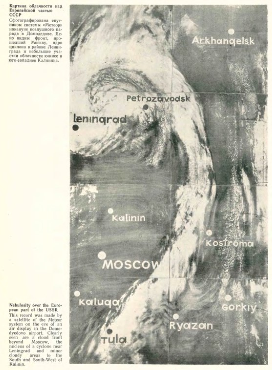
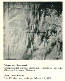
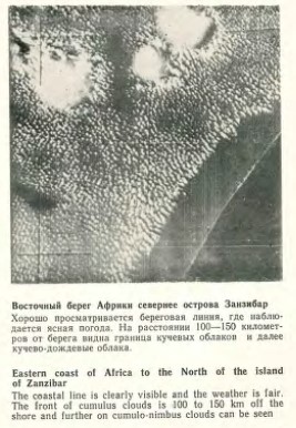
Figure 5.7.15: Examples of Soviet satellite weather imagery (source in text).
Figure 5.7.8: Zond 7 image of Earth from an East German postcard. The image was taken on 21/08/69, but the postcard itself is stamped 1982, 7 years before the fall of the Berlin Wall.
Figure 5.7.9: Zond image used in a graphic on an Italian newspaper front page.


According to this source, Zond 6 launched on 10/11/68, and entered lunar orbit on 14/11/68. Two photography sessions were conducted on that day between 03:00 and 06:00 Moscow time, or 00:00 to 03:00 GMT. On its final orbit, the spacecraft lost contact at with Moscow at 02:49 GMT and re-
Figure 5.7.4: Earth & Moon orientation at 02:45 GMT 14/11/68 using Celestia (centre & left) and Stellarium (above).


The orientation of Earth at this time shows that it’s actually an Earthset vew -
We now know where, and when we should be looking for our satellite imagery, so we should now be able to work out if the view is correct. As before we have the restored ESSA archive to work from, which allows us to reconstruct the view in 3D, and perhaps correct the history books. The result of that is shown below in figure 5.7.5.


The quality of the original image isn’t helpful, but the view on the right seems the likelier of the two. It hjs the clear area of the Indin Ocean, the curled cloud masses at the southern end, and appropriate weather patters in the north,
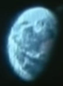
We stand a much better chance of a reliable comparison with 7, which shows spectacular colour images of Earth as seen rising above the lunar horizon. Zond 7, according to this page, was launched on 08/08/69, and managed several photography sessions of Earth. A close up of the Earthrise photo is shown in figure 5.7.6, compared with an ESSA mosaic from 10/08/69. The ESSA mosaic is found here Hathi Trust, and the Zond 7 image is from here: Mental Landscape.


Figure 5.7.5: Zond 6 image (far left) compared with ESSA reconstructions set at 02:45 (centre), and 00:45 (right). View showing the time set at 00:00 GMT shown right.


Figure 5.7.18: Social media claims.
If they’d seen the images reproduced above, they’d already know that the USSR happily used Apollo imagery without question in their own media, but a fraction of a second’s internet searching produces front page articles from Pravda and Izvestia from July 1969 showing it was reported quite publicly (figure 5.7.19).


Figure 5.7.19: Soviet reporting of Apollo 11.
See also the many other examples here and here, and the reports in the US Press of Soviet media’s coverage of Apollo 11, and this for Apollo 8. The Soviet public were well informed about them while they were going on.
The British Interplanetary Society’s “Spaceflight” magazine from December 1969 featured a translated interview from Soviet publication “Novosti” (see here), where Academician Anatoly Blogonratov offers his view on the Apollo 11 mission, saying:
“I congratulate the heroic crew of Apollo 11…on the successful fulfilment of their difficult programme. They have justly won a deserving place in the ranks of space pioneers”
‘Soviet Life’ has many records of Soviet citizens following the missions, including the orbit of Apollo 8, Apollo 13, and of a team of oceanographers congratulating their American colleagues with vodka on the landing after following it on the radio while at sea.
You’ll also find numerous Russian names on the scientific analyses of the Apollo lunar samples. So yes, the USSR knew they went, reported that they went, but really wish they’d got there first.
They also monitored the mission’s progress. This Russian publication details how Soviet engineers were tasked with developing a network of stations specifically aimed at monitoring Apollo missions, including ships and one at Simferopol.
Figure 5.7.20 shows what is reported to be signals received by these stations from Apollo spacecraft.

Figure 5.7.20: Spectra obtained from Apollo spacecraft by Soviet receivers (Source given above)
It’s fairly obvious: they had to have monitoring systems capable of tracking and reporting on their own devices, they were therefore capable of tracking Apollo, and it was in their interests to check the USA’s progress -
You’ll also see hoaxnuts claiming the Soviets did not have the capability to intercept S-
“Under [M.S. Ryazansky's] leadership, a ground control complex was created to control Soviet manned and unmanned spacecraft for lunar exploration, which included two flight control centers, six ground and three ship control posts equipped with appropriate tracking stations, and located both on the territory of the Soviet Union and at certain points in the World Ocean. However, these facilities could not be used to receive information from the Apollo ships, since they operated in a different frequency range with signals that had a different structure. Therefore, at the suggestion of M.S. Ryazansky, it was decided to create a special control complex capable of receiving data from the Apollo ships. It was supposed to receive not only telephone (voice) and telemetry information from the American spaceships, but also television information.
It was decided to include in the control complex the TNA-
It was later used as a receiving antenna for the Saturn-
To operate as part of the control complex, the TNA-
The control complex, created in a short time by the enterprise in cooperation with several industrial enterprises, was ready to receive signals from the Apollo spacecraft in November 1968.
In order to track American lunar ships during their flight in orbits around the Moon and during landing on its surface, it was necessary to have ballistic data of these orbits to calculate target designations for the antenna. However, such information was not published by the Americans. Therefore, data on flight orbits were calculated by ballisticians based on the time of launch and arrival to the Moon of the Apollo ships, which were reported by American radio. Based on this data, targeting instructions were calculated for pointing the antenna, which were refined based on signals received by the control complex from the lunar ships.
This approach to calculating target designations made it possible to receive signals from the Apollos quite reliably. The task of searching for signals was made easier by the fact that the antenna pattern covered almost half of the Moon's disk.
The Apollo 8, 10, 11, and 12 spacecraft were tracked from December 1968 to November 1969.
All these ships received good quality telephone conversations between astronauts and Earth and telemetry information about the state of onboard systems. The received television signal was of low quality due to the insufficient energy potential of the radio link based on the 32-
They also had S-
The Soviets also continued to monitor Apollo long after the missions ended. This report shows the readings identifying the Apollo ALSEPs recorded by the USSR’s RATAN-
The comment about poor quality interception of TV signals is interesting, particularly given the image shown in figure 5.7.21.
The West was also well aware of their capabilities thanks to translations of their academic journals and conference proceedings (figure 5.7.16), compilations of published abstracts, and regular briefings given to the US President about Soviet space program developments. One of the key figures in Soviet satellite meteorology even gave a lecture to the American Meteorological Society in 1973, showing many examples of Soviet images (the same lecture that compared ESSA images with Zond cited above!). Soviet satellites were claimed to have higher resolution thanks to their lower orbits, but as a result had less coverage.


Figure 5.7.16: Soviet weather satellite images in a translated academic journal papers, and an analysis of NIMBUS data by Soviet authors. Source (above), Source (top and centre right), Source (right).


Figure 5.7.13: Apollo images of Earth from Soviet sources Top left, top centre, top right, far left, left, secoond row bottom right and bottom row from Yogoslav magazines


And apart from the academic reports and papers, there’s the twice daily exchanges of data over the so called “cold line”, as reported in this 1973 edition of Soviet Life (figure 5.7.17), and mentioned in this August 1969 article interviewing Academician Bugayev. This 1975 article mentions that:
“The Department of General Circulation of the Institute of the Physics of the Atmosphere, Czechosl. Acad. Sci., Prague has been receiving for some time pictures of cloudiness from meteorological satellites operating in the I37 Mc/s band: the U.S. ESSA 8, NOAA 2, NOAA 3..”
using equipment they sourced themselves, and while it’s talking about images taken in 1974, two of those satellites were in operation during Apollo.

Figure 5.7.17: Soviet satellite images being prepared for transmission to Washington.
The image is labelled as being “ An image of the Earth received on a television channel from one of the Apollos” here, and “an image of the Earth rising over the lunar horizon, received on a television channel from one of the Apollo spacecraft.” here.
We know there were no images of Earthrise broadcast on TV, so I suspect something is being lost in translation somewhere, and it is very debatable as to whether it’s actually Earth, the moon, or a lunar crater (the filename from one of the websites linked to above is “CraterTV”!). If it is Earth, these Apollo 10 views look likely potential candidates (figure 5.7.22).
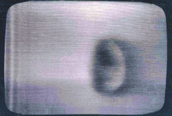
Figure 5.7.21: TV image from Apollo, intercepted by the USSR (source given in text).
As the Russian authors point out, they could only receive signals that were also coming through Madrid, so the one on the right seems more likely. Take it or leave it.
Those seeking to dismiss Soviet efforts seem also to think that you had to have an ability to interpret the S-
The Russians knew we went, reported that we went, and that success meant they gave up trying.

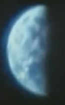
Figure 5.7.22: Potential candidates for the alleged view of Earth, taken during Apollo 10.
This article even reports how one academic got an up to date satellite image from the USSR just by asking nicely, with Life magazine also Time both carrying the story where Main State Museum wanted a satellite image of the state for their opening. After having no success with American sources (who variously cited viewing angles, security issues and a focus on clouds, not land), they asked the Soviets nicely (and paid either $100 or $120, depending on the source!), and they obliged with the image in figure 5.7.18.
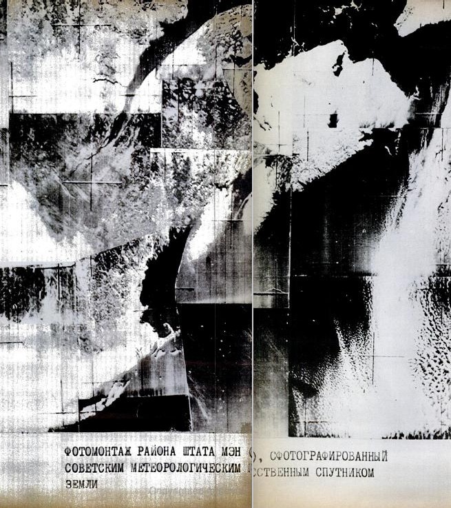
Figure 5.7.18: Satellite view of the north-