4.9.8 -
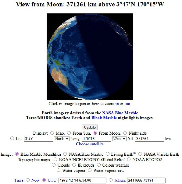
First up on the next calendar day is another LRV shot of home, this time from . We get another LRV camera view when the crew visit Station 6. While Gene and Jack examined “Tracy’s Rock” (the unofficial name for a large mass of material that rolled down the North Massif slope). The camera pans around and eventually manages to find Earth again. Videos of station 6 are on youtube, including this one, as well as at the ALSJ. The time is recorded at 165:24 minutes (according to the transcript), which is 00:17 on the 14th of December. Unfortunately the quality of this image is even less clear than previous views from the rover, but we can still have a go at identifying what’s there. Figure 4.9.8.1 shows a still from the transmission, together with a zoomed, cropped and level adjusted view of Earth from it.
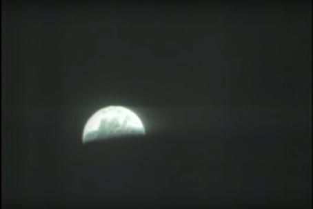
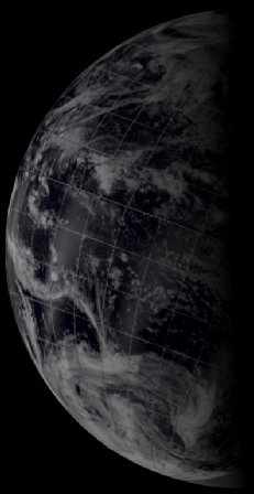
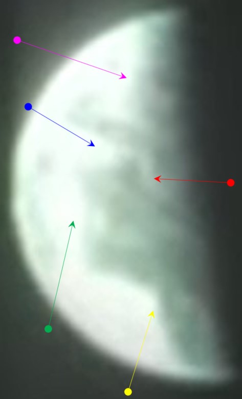
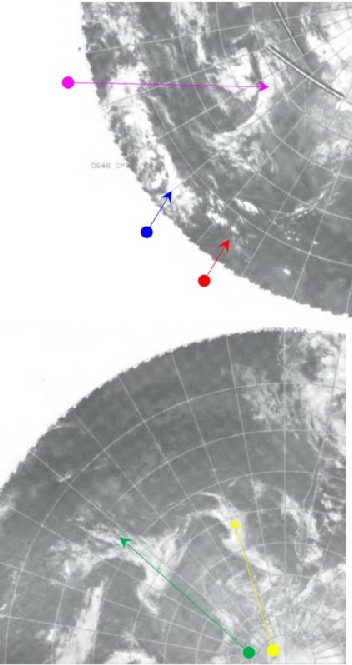
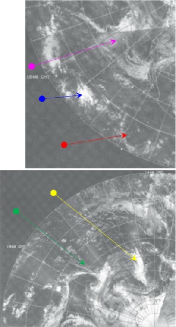
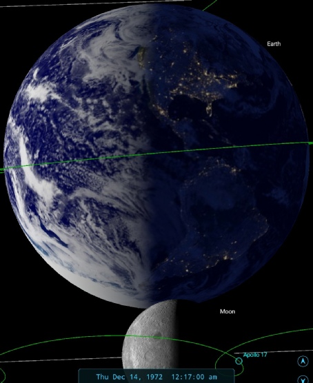
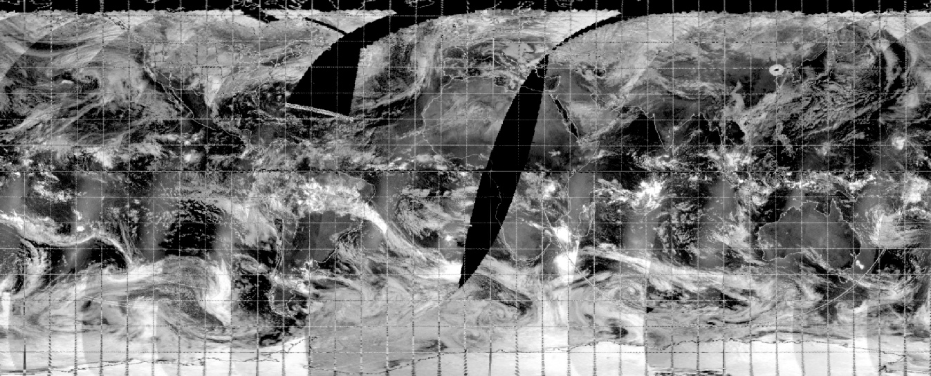
Figure 4.9.8.1: Screenshot of EVA broadcast (top right and close up above). SkySafari time depiction is above right. Top left are IR images from the early hours of the 14th. Bottom left are visible spectrum satellite images from the 13th (northern hemisphere) and the 14th (southern hemisphere). See text for explanation.
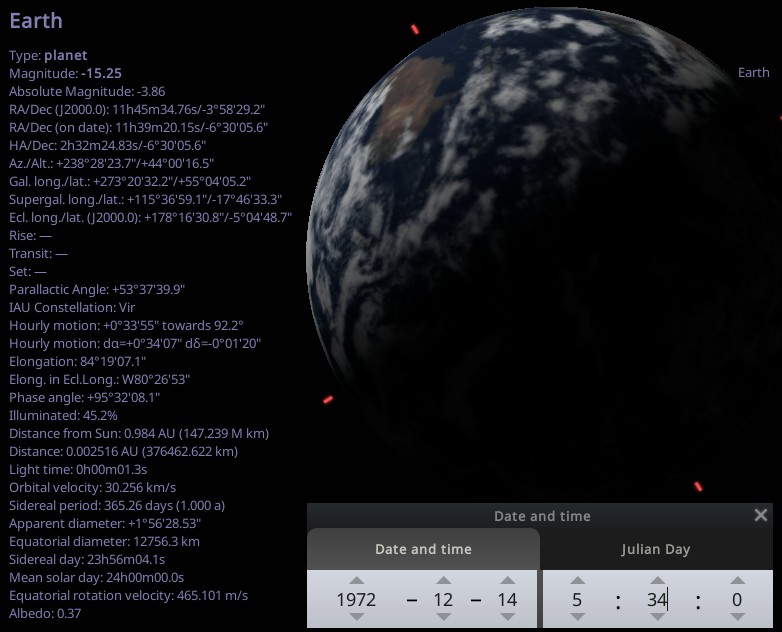
Figure 4.9.8.2: Stellarium and Fourmilab depictions of Earth at the time of broadcast
The orientation of Earth in the sky matches the Apollo TV view, as does the centre point of it
Returning now to magazine 134, from image AS17-
It is shown below in figure 4.9.8.3, and analysed in figure 4.9.8.4.
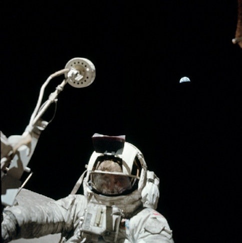
Figure 4.9.8.3: AS17-
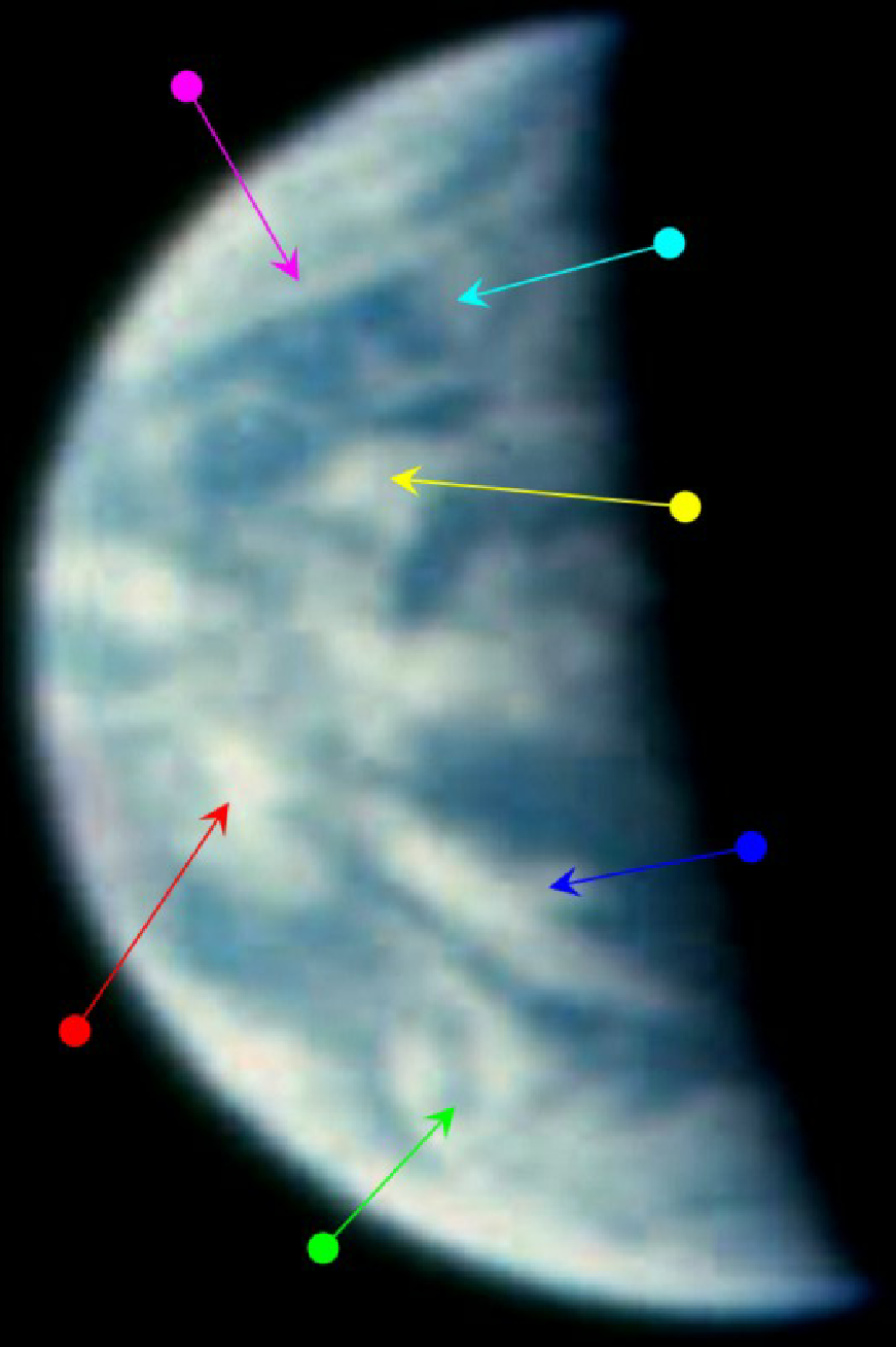
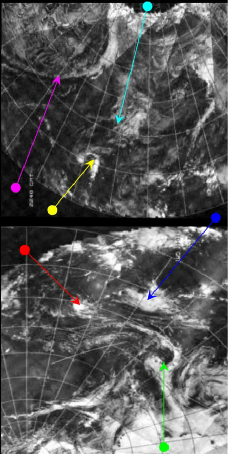
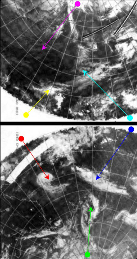
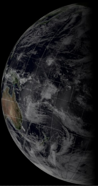
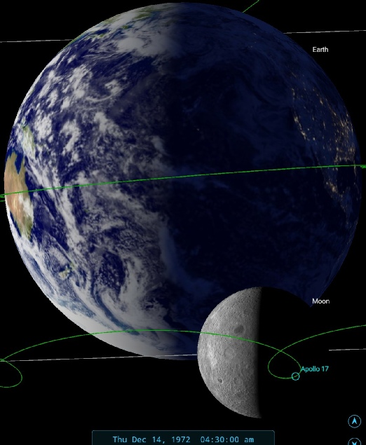
Figure 4.9.8.4: AS17-
The Apollo image is recorded as being from the end of EVA 3. The EVA itself ended at 168:07 MET, or 05:40 GMT on the 14th. The image is recorded by the ALSJ (after subtracting the extra 160 minutes) as 166:53 MET, or about 04:25 GMT on the 14th – just over an hour short of the mission being a week old. Setting SkySafariat this time shows that Australia should just be visible on the western limb of the Earth, and that is exactly what we can see. The slightly less than half full Earth also matches what should be visible.
We can again confirm this with ephemeris data:
1972-
1972-
And its depiction in figure 4.9.8.5.
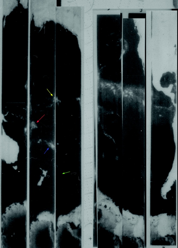
Figure 4.9.8.6: ESMR NIMBUS-
There are other images of Earth taken around the end of this EVA, but they’re to be found in the visors of Schmitt and Cernan (figure 4.9.8.7)
For a more detailed analysis of these visor shots, see here.
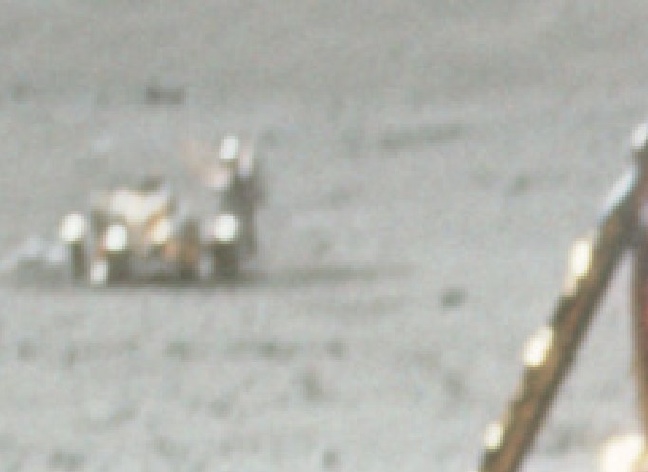
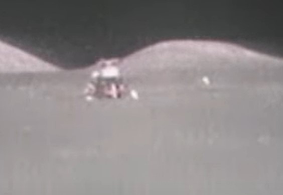
Only one image remains from the surface, and it was not taken by anyone on the surface. While Cernan and Schmitt were in the LM awaiting the time to lift off and rejoin the CSM for the journey home, the LRV camera, positioned a safe distance away, remotely scanned the horizon and, eventually, the distant Earth. A screenshot of that video, which can be found at the ALSJ is analysed in figure 4.9.8.8.
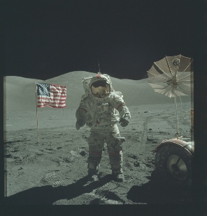
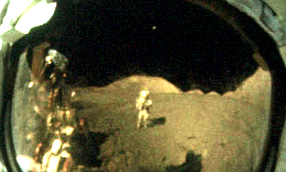
Figure 4.9.8.7: Original shots and visor details from AS17-
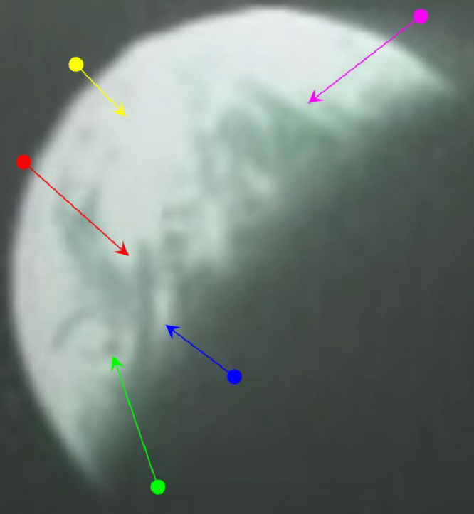
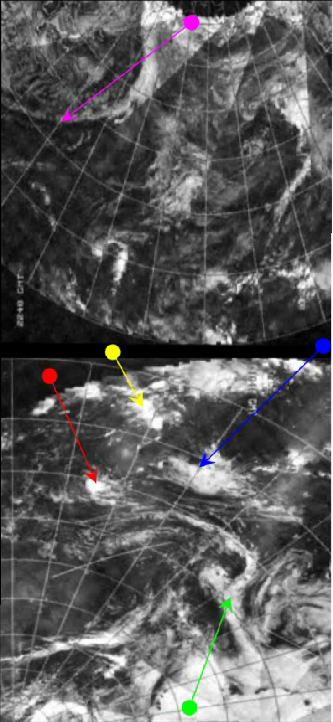
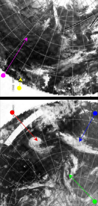

Figure 4.9.8.8: Screenshot of Apollo 17 LRV footage (top right) zoomed and cropped (main image) compared with NOAA 2 IR (left) and visible spectrum (centre) mosaics and Stellarium depiction at time of broadcast. Right is a 3D reconstruction using digitally restored NOAA data.
This video clip is recorded as commencing at 170:40 or 05:34 on the 14th. At exactly this time in the transcript (and in the video!), Capcom tell the crew:
170:40:34 Mission Control Okay. And as you guys say farewell to the Moon, we're looking up to the Earth down here where you guys are returning pretty soon.
Shortly after this, Gene Cernan utters the final words as the last man to have his feet on the Moon, stepping back inside the LM for the last time.
As this is only an hour after the previous still image used, the features visible should, image quality permitting, still be broadly visible.
Can we be sure that it is an appropriate match? We are relying here on the words spoken on the video matching those of the transcript, which gives a time, and then using that time to see what clouds should be visible, and drawing arrows to what we assume are the same clouds. The argument here is that this is a reasonable use of the evidence to support the suggestion, but it is somewhat circular.
We do have, however, a large mass of cloud in the northern hemisphere (magenta arrow) next to a large band of clear ocean that ends with a band of equatorial cloud (yellow arrow). In the southern hemisphere at the roughly 4 o'clock position there is a distinct and thinner band of cloud corresponding to the blue arrow, and below that is (if it is examined closely) the multi-
And as one final check, there#s the ephemeris data:
1972-
1972-
Which can be verified with Stellarium & Fourmilab (figure 4.9.8.9)
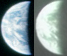
His claim is that the Hasselblad and TV image were taken at the same time, but show different things. If I’ve understood his post correctly, he’s rotated the two Earths to match, not manipulated the terminator.
The obvious reason for the difference, and one that doesn’t seem to have occurred to this particular idiot, is that they weren’t taken at the same time, something confirmed by the movement of the clouds -
“they are very very very obviously different cloud patterns”
so let’s try and help him out by identifying which clouds match (figure 4.9.8.11).
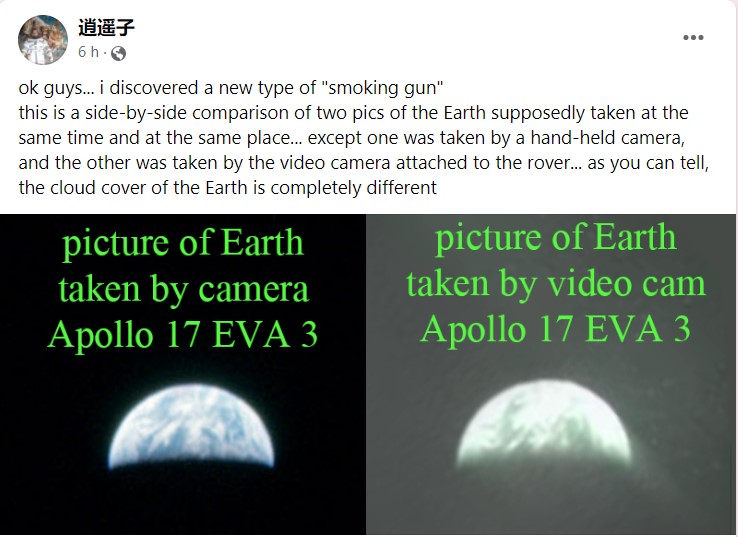
Figure 4.9.8.10: Claims that the Hasselblad and TV images at the end of EVA-

Figure 4.9.8.12: Left -
He also claims in a reply to his facebook post that “as far as i know no one has ever tried to compare surface pics taken by camera and taken by video cam at the same time”. Yeah about that.
As we’ve demonstrated, there isn’t a “many many hour” gap needed for the rotation that’s evident, what we see is perfectly consistent with the hour or so that’s actually elapsed (as demonstrated by the 3D and SkySafari reconstructions), and not the time lapse that he thinks would be needed but doesn’t see fit to actually demonstrate. Still, he does at least say that “the one thing they can’t plot out is the cloud cover” (figure 4.9.8.13), so he seems convinced that Earth in the image is genuine.
He might want to check with Jarrah though, as discussed here. The moon hoaxers need to get their story straight!
Having finally left the surface of the moon, the re-
Figure 4.9.8.13: Facebook post confirming that cloud cover can’t be predicted.
Hopefully that’s made it clearer for him, and pointed out that the differences here are not in the weather features on show, but the different cameras involved and a small amount of rotation.
In terms of timing, the Hasselblad was taken as they finished their EVA, the TV image as Cernan prepares to exit the surface, something that happens after he’s driven from the LM to the final VIP parking spot and walked back.
The hoax proponent here is claiming that the Hasselblad was taken after the rover was parked, but several photographs after this image was taken show first Schmitt and then Cernan at the rover (still parked by the LM), before some final images of the ALSEP taken by Schmitt. The photograph even has parts of the rover included in it, and the TV broadcast also captures the moment it was taken followed by views of the LM.
We also know that the two separated for the final part of the mission, they could not have taken pictures of each other at the VIP spot. The TV taken at the VIP spot shows Schmitt at the ALSEP, and the photographs taken at the ALSEP show Cernan (See figure 4.9.8.12).
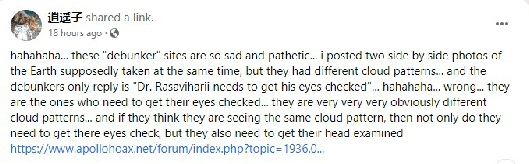
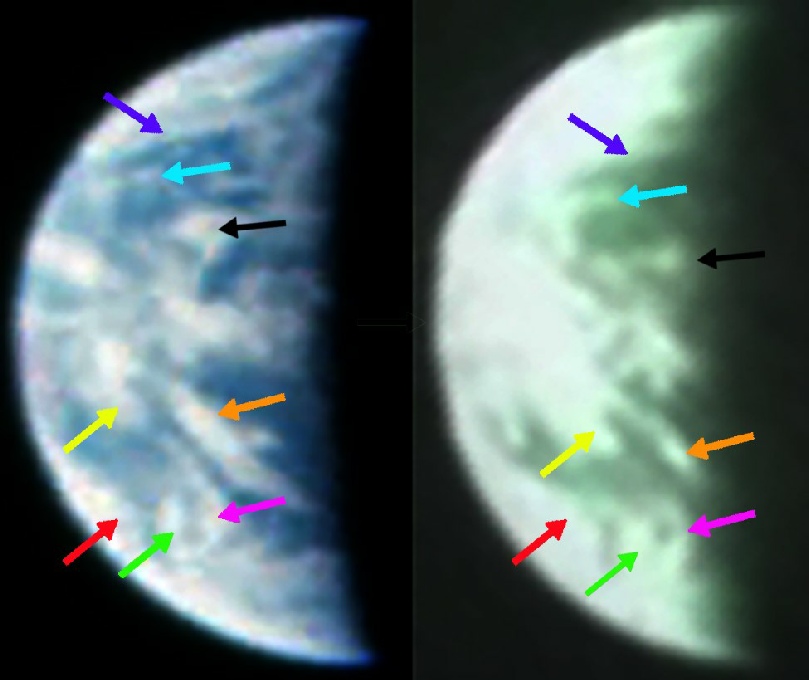
Figure 4.9.8.11: Labelled views of Earth identifying the same cloud features a short time apart, together with the claim made that they aren’t the same cloud features.
The satellite view (timed at a couple of hours before the broadcast) is complicated by the image errors in the southern hemisphere, and the LRV camera does not show a very clear view of Earth. There is also the fact that the Apollo view is quite some time apart from the visible spectrum view, regardless of which one you look at. For this particular example I’ve stuck with the northern hemisphere (10 hours prior to the TV), and southern hemisphere for the 14 (14 hours after), as the southern hemisphere view form the 13th is almost impossible to decipher. The infra red satellite is much closer (only a couple of hours out), but is obviously not exactly what we can see. The 3D reconstruction is all based on data from the 14th.
Despite this, I don’t believe the suggestions I make there as to which weather systems are identifiable are unreasonable. The bank of cloud off California is there, together with a gap between it and the cloud in tropics. There is definitely a clear gap in the clouds in the Equatorial Pacific, before much denser systems off southern America.
We can also add the ephemeris data into the mix, as we have with other Earth images. Here they are for:
1972-
1972-
Which can translated into the Stellarium and Fourmilab views in figure 4.9.8.2
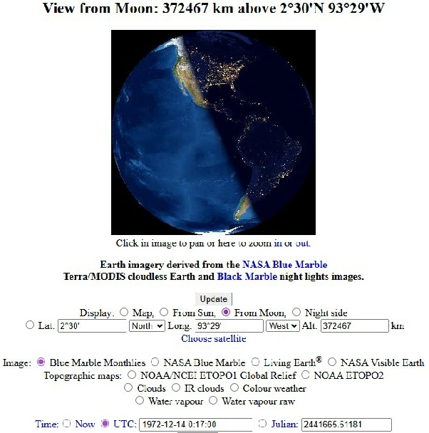
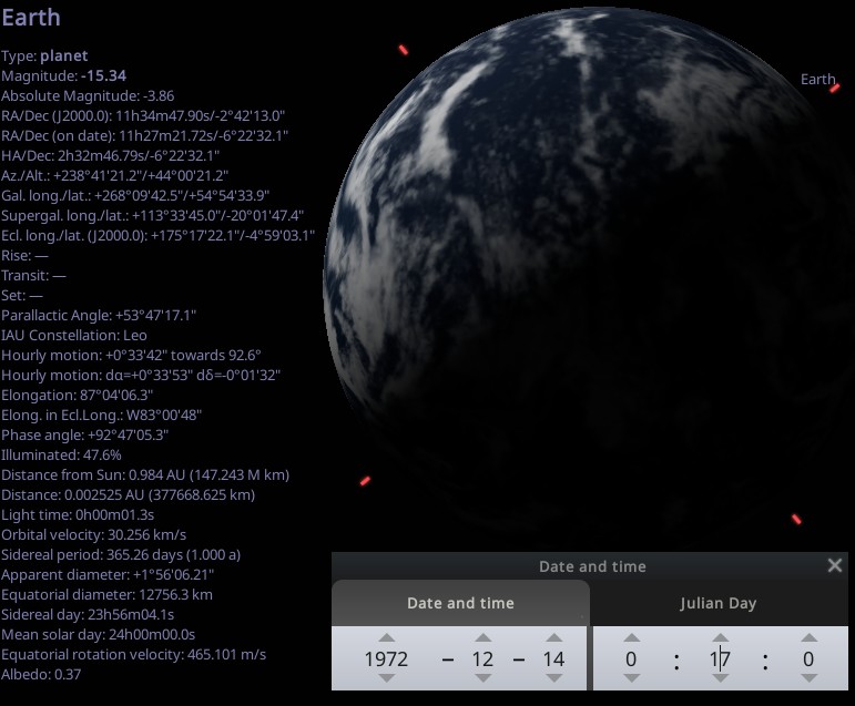
Figure 4.9.8.5: Stellarium & Fourmilab views of Earth at the suggested time of photograph
Again, the analysis includes both the IR and visible spectrum images as well as the 3D model (which in the absence of restored data form the 13th uses an image dated the 14th), and these, again show perfect correspondence with what is visible in the Apollo image, despite issues with the data near the southern hemisphere terminator region with the visible spectrum mosaic (the grid overlay is offset by some distance, and there appear to be errors in the data over to the terminator area (over the cloud mass picked out in blue).
Between them, the IR and visible spectrum mosaics provide an exact match. The times their orbital pass over the terminator area would have been made are roughly 07:00 on the 14th and 19:00 on the 13th respectively. The 3D reconstruction’s terminator time is around 19:00 on the 14th. The storm identified by the blue arrow is a particularly good match, as is the multi-
We also have available ESMR images for the 14th, one daylight set of passes covering Australasia and one night-
As with the previous ESMR image the arrows identifying cloud features should only be seen as tentative, but there are features in the same locations as those on the ESSA and Apollo images.
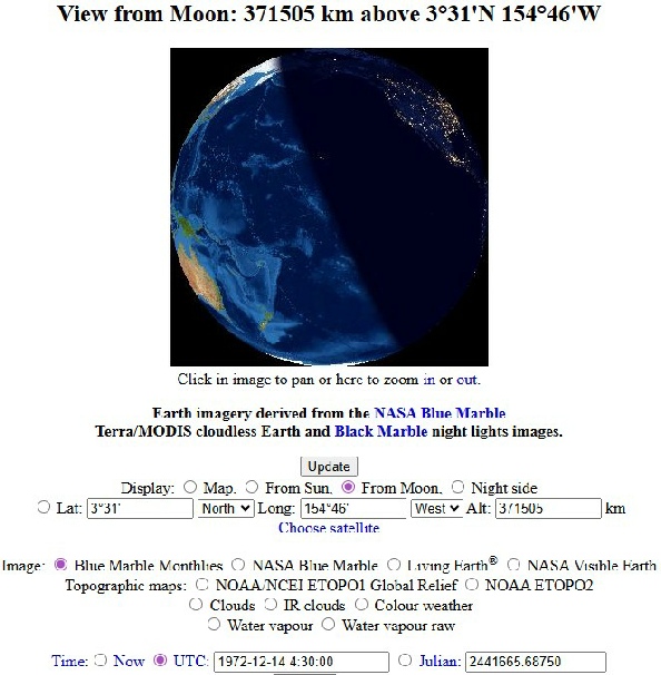
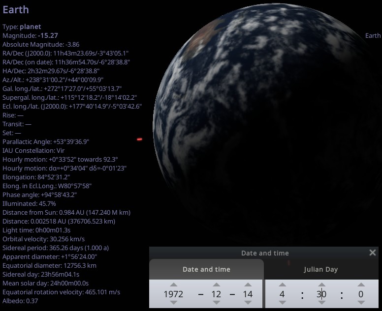
Figure 4.9.8.9: Stellarium & Fourmilab depictions of Earth at the time of broadcast
Again, entirely consistent with what’s on show.
One conspiracy claimant, who claims to work for the Chinese Space Agency and is a self-