


Pretty obvious what the answer is to that one: none. I’ve made a best guess as to where the location is on the LO4 photograph, but it’s pretty much just blobs now. Apollo and LRO, by contrast, are still showing remarkable levels of detail.
The crater next to the eventual landing site has now become visible (yellow arrow). The red arrow in this image identifies a crater just visible to the right of the yellow arrow in the previous image. J
Just so we can keep up the pressure on the hoaxers, Chandrayaan (right) still provides us with an impressive amount of corroborating detail. So much detail that we can, in fact, zoom in and make out the disturbed ground around the lunar module next to the landing crater and by the parked lunar rover:
And finally, we have the view just as the LM descent engine begins to pick up some dust.
In this shot the red and blue arrows identify the same craters as they do in the preceding image, and it should be obvious to all but the most blinkered of retards that craters just a few feet across are easily identifiable in the Apollo 16mm still, craters that would not be imaged again for another 40 years, and were not visible at all in any photographs (including those taken from orbit by other Apollo cameras prior to Apollo 16).
Once on the ground, one of the first jobs was to set up the ALSEP scientific equipment, which was done at a spot south-
Firstly there is the ALSJ panorama, which I have cropped to make more manageable. Secondly there is an LRO view of the site. Thirdly, there is the Newspaper front page.
The crater sections below are all shown with the Apollo image in the centre, the LRO view on the left, and the perspective view on the right. As Chandrayaan’s image was discovered after this page was written it’s much easier to fit it in after these

The viewing angle for the area highlighted in green on the perspective shot means that it is difficult to be certain which rocks are which, so i have omitted the arrows on that one, but it us likely that the largest feature visible are the rocks picked out by the blue and green arrows.
Just out of interest, the view on the right is an excellent shot of North Ray taken by Apollo 14 (AS14-
What is certain is that the Apollo view of North Ray shows details that can only be seen in the LRO view, and again, to hammer home the point, this is only possible because they were there -
A prominent feature on the south-
It is visible more clearly in the overhead LRO view shown above. It is shown in detail in this LRO view, and I have compared it with a crop of a photograph taken of it on the way from Station 11 of EVA3 to North Ray, AS16-
The only difficulty in identifying the rocks in the Apollo image is dealing with the up-
The black arrow on the LRO view (in the bottom right) is on the original image and picks out the path taken by the crew on their way to get samples from House Rock.
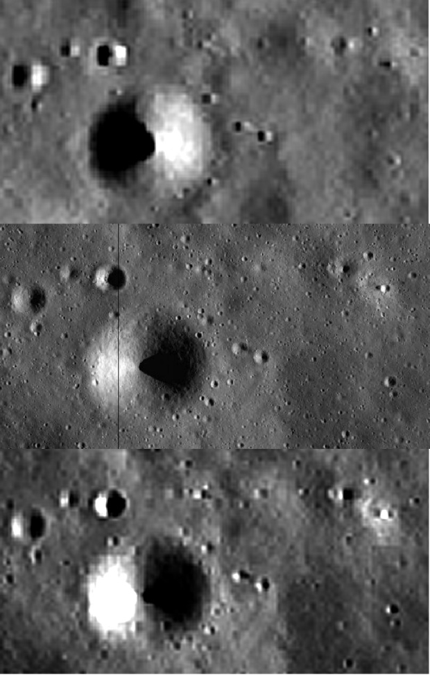
At the opposite end of the Apollo 16 area of operations is South Ray, a smaller but still very bright young crater. A panorama of the crater has been assembled, and is available here. I have cropped that panorama, and adjusted the levels in it to make improve the contrast between light and dark areas, I’ve used this LRO view and taken numerous screenshots to assemble a high resolution version. The original LRO image (like many) was reversed, which i have corrected. I have also rotated it to match the perspective of the photographer, which is from Station 4. Chandrayaan’s version is below left.
By way of a change, I’ve also pointed out areas of darkness covering the brighter areas, as they are quite distinctive and allow other features to be located.
Again, the main difficulty is in compensating for perspective, which is from Cinco crater at station 4. Anyone who cares to can check that the perspective is correct, as shown iby the locations of the stations and craters in this image, see below.

Before venturing out to see these much larger, features, Duke & Young also went westwards to see some smaller craters on EVA1.
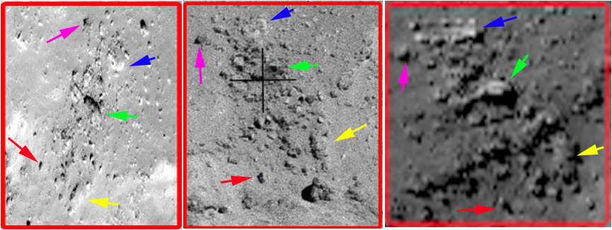
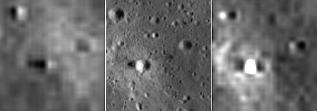
One such stop was at Spook crater, just a short distance from the LM. Again I have multiple screenshots to compose a high resolution image from the LRO data, and have compared it with this panorama.
The Apollo view was taken on the north-
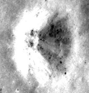
Immediately behind the Apollo photographer is Buster crater, a much smaller one to the north of the stopping point for Spook. A panorama showing Buster is available here, and is compared with the LRO below.
The yellow hexagon marks the position of the photographer (whose shadow can be seen bottom left in the Apollo view). Rover tracks can also be made out in this view, and the location of the arrows shows that the view in the Apollo image is entirely consistent with the LRO -
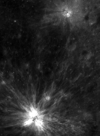
For the final images for Apollo 16 we return to the 16mm footage as the LM ascent module takes off and returns to orbit.
The first still shown below is shortly after take off, and the LRO view has been rotated to match that given in the video. Brightness levels in the still have been adjusted to provide more contrast.
The rover tracks running both across and from top to bottom are a clear match, as are the footpaths taken by the astronauts. Some of the small craters that these tracks skirt round or end at are also visible.
A short while later the LM descent stage becomes visible, and the trails leading from it are obviously the same in the both scenes. What also matches exactly is every single crater in the scene.
There is only one way this can have been achieved -
Another victory for Japanese as far as I’m concerned.
As with other landing sites, we also have the availability of newly releaased higher quality Chinese images, and we have an excellent view of the landing site in them.


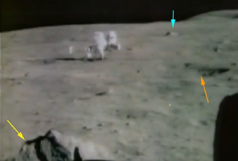
It’s important to remember that the panorama covers almost 360 degrees, so the angles shown may not quite match what would be expected from the LRO overhead shot. For example the light blue arrow very obviously identifies a large rock north of the central station, whereas the yellow arrow is picking out the rock next to the LRV, which is parked south of the central station.
We’ve already shown these features can’t be identified on any images taken before Apollo, and here we have pretty solid proof that we had images from the lunar surface taken during Apollo 16, because it appeared on a newspaper front page the day after the first EVA. Let’s look a little more closely at that newspaper image, and compare it with the TV footage, taken from a screenshot of the EVA broadcast here.
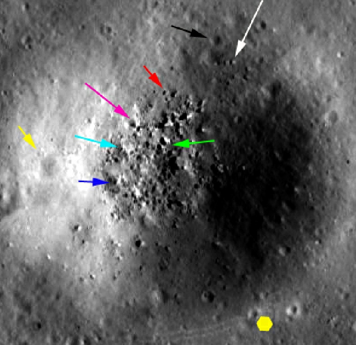
As with Apollo 15, Duke & Young used the LRV to cover large distances. The most northerly point they visited was North Ray, a large and relatively young crater (the bright material has been exposed to space weathering for a shorter period).
The images below show the view of north ray from my own composite (top left), a ‘synthetic perspective’ looking from south to north, constructed using stereo pairs and topographic data (top right), and an assembled panorama taken on the ground. I have cropped this image to focus on the crater itself. An LRO view just of North Ray can be found here. I’ve also added Chandrayaan’s view of the crater.
As the crater is so large, I’ve highlighted three areas (red, blue and green) and looked at the details within them. Feel free to use these locators to identify other rocks and small craters.
Apollo 16
With the introduction of the mapping camera comes a problem for the hoax believer, namely that the best maps available for the mission are now produced with data from Apollo photographs. The Descartes highlands landing area for Apollo 16 was also photographed extensively by Apollos 12 and 14. This does mean that the “well they already had photos didn’t they” argument relies quite heavily on them actually going to the moon.
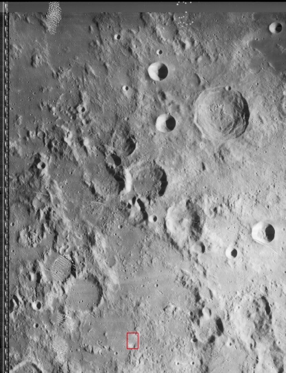
Just for the sake of argument, here are the best examples from Apollo 12 (left) and Apollo 14 (right) images of the same area:
Now let’s have a look at what modern probes have to show of the same area, with the images below showing the LRO overview of the site (left), Chang’e 2 probe’s version (centre), and Chandrayaan’s image on the right.
The LRO view is a screenshot from the LRO website, but others used in this page are from cropped versions of full sized oblique LRO views joined together for this study, eg M175179080L and M175179080R.


We also have this nice oblique view from the LRO, with key mission points annotated. The view is interesting in that it shows what was visible from the approaching LM, but isn’t detailed enough for our purposes.
It should already be obvious that the detail from the LRO, and even from the Chinese view, is much greater than that from the LO, and that’s without zooming in to see the finer details.
We can start to do that now by looking at the approach video taken by the LM’s 16mm DAC camera, as re-
The suggestion made above that the LO4 view does not contain the detail of Apollo or the LRO is confirmed -
Only the biggest features can made discerned in the LO4 shot. It’s also worth casting an eye over the oblique LRO view above and comparing the 16mm still with it -
India’s probe also manages to provide corroborating evidence, matching both LRO and Apollo crater for crater.
What hope is there that we will still be able to make out anything as we get closer the surface?
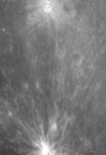
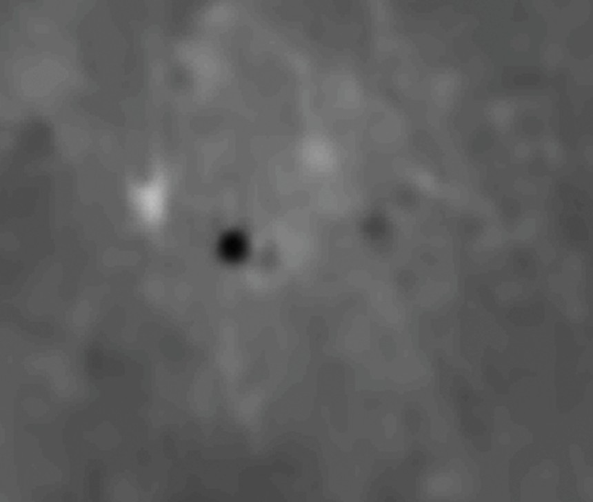
The next view shown below is taken at 2000 feet.
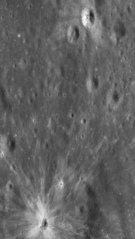


It is by no means a pin sharp crystal clear image, but if anyone would like to prove that that is not the shadow of the lunar module and disturbed ground next to the crater, and the other dark blob not the LRV be my guest.
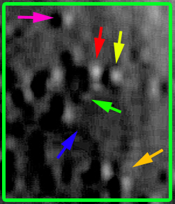
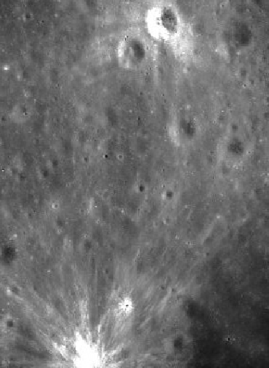
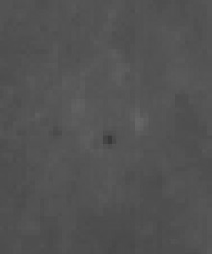
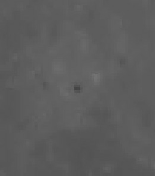
As we get down to 300 feet we get even more detail on the lunar surface, and even less on the LO4. For additional coolness we now have the LM shadow coming into clear focus (visible near the top of the frame above the yellow arrow). The eventual landing site is not visible in the 16mm still, as it is below the lunar module. I’ve not bothered with the LO4 version of the image and replaced it with Chandrayaan’s view. I’ve not added any arrows as the ground resolution has pretty much gone, but the larger crater can still be made out, and a suspicion of the LM shadow.


Having shown earlier that India’s satellite provided a good view of the landing site, we have a late addition to the page in the form of Japanese views. Below we see the LRO shot of the landing site (centre) compared with an evening (bottom) and morning (top) view of the same area.
The LM is top right in each image and you can just about make out the area disturbed by astronaut feet in the two Japanese ones. We get a better idea by zooming in more closely.
Nice one China -
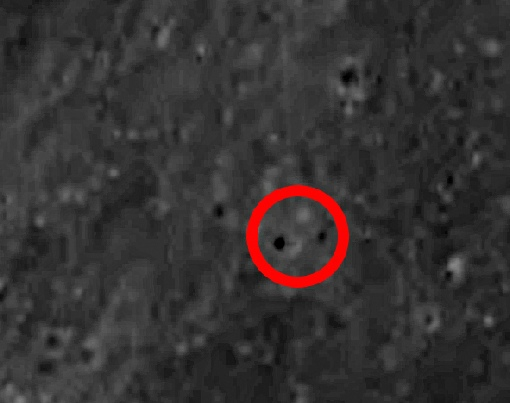
As with other newly released Chinese images the disturbed area around the LM is very well defined, and in this one we can even make out the activity around the location of the lunar rover. Here’s a closer look.
Even the footage taken through the orbiting CSM’s sextant is better than the LO4 image.
You know he’s full of it.
China’s probes do not have the power to resolve the landers themselves. What they are showing is evidence of human activity. “Traces” is just that -
As with other missions. South Korea’s Shadowcam instrument on their Danuri probe has photographed Apollo 16 as well. Here’s how it looks.

So when an internet idiot comes out with garbage like this:


They repeated the observations using the TMC-


Only one mission remained in the Apollo landings, and the analysis of Apollo 17’s video and photographic evidence can be seen in the next part of this series -


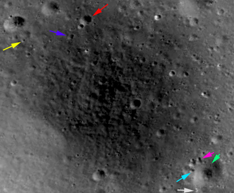
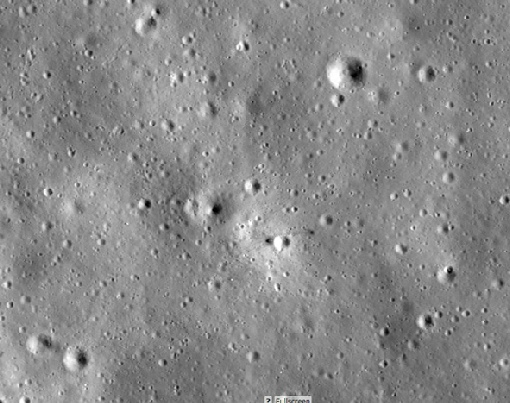
North Ray and Baby Ray craters are easy to make out, which means from there we can pinpoint the landing site (inside the black square) . Once that’s done, it’s easy to zoom in and see the disturbed ground around the LM and the rovers VIP parking spot.
First off, let’s examine what images they would definitely have had available. The best available image is from Lunar Orbiter 4 (image 4089 h3), and is shown far left
The approximate area of operations is outlined in red, and this is given in a crop of the much larger high quality TIFF image.
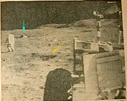
The arrows are the same colours as are used above. The screenshot is taken slightly before the one in the newspaper, because it allows confirmation of the astronaut’s location relative to the central station, and therefore the location of the crater between him and the LRO. It also allows confirmation that the boulder identified by the yellow arrow is the same one shown in the panorama.
So, not only do we have an Apollo image picking out rocks and craters on the lunar surface, it can only have come from the Apollo era, because it was on the front of a newspaper the day after the EVA.
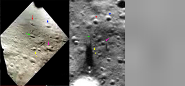
A little further west is Flag crater, adjacent to which is the much smaller Plum crater Both of these can be seen in the large panorama available here, and a cropped version is compared with the LRO’s version below.
The white arrow indicates the rock behind which the astronaut took the photograph. Another interesting feature that isn’t highlighted is that the inner ‘bowl’ of Plum crater, a secondary deepening, is also visible on the LRO screenshot.
As usual, there is an exact agreement between the Apollo view and the LRO.
I’m not the only one to have found Apollo 16 in Chinese photographs. Russian space journalist and space writer Vitaly Egorev found it for his book “People on the Moon”. Here’s the image:
It’s also featured in ‘Universe Today’.
The LUTI instrument on the same probe makes it much clearer, as shown in this image taken 24/09/23:

It was imaged again on 01/12/23:

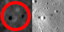
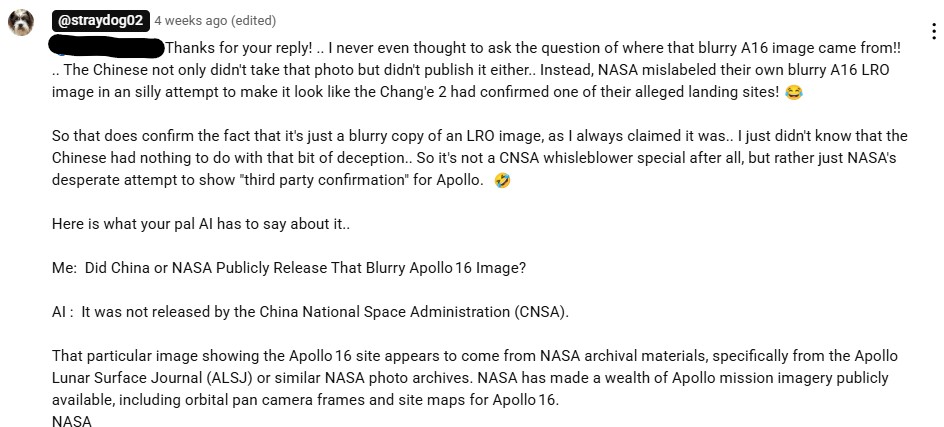
Some hoaxnuts are adamant that China has never published any images of Apollo sites, and have even claimed that this specific one is just an LRO image that has been doctored:
And then demand that people prove China published the images. Well, OK then, we’ve already done that with other Apollo missions, so why not here.

The filenames you need to look for on China’s site are:
CE2_BMYK_CCD-
CE2_BMYK_CCD-
Here they are in full.
It’s worth pointing out that even without any processing at all, the LM and LRV sites are discernible.
Increase the dpi, adjust levels, do some sharpening, and you can make them out even more clearly -